Sky Mountain
December 23, 2017
1671m
Stevens Pass / US-2 Corridor, WA
“Sky Mountain” is the unofficial name of the highest peak along the horseshoe-shaped “Skyline Ridge” or “Heather Ridge” immediately north of Stevens Pass of the Central Cascades. This isn’t a particularly glamorous objective from hiking and scrambling perspective although the south slopes do offer neat steep skiing opportunities. Approaching from the Skyline Lake along the undulating east ridge most hikers would stop at the lower, but rockier sub-summit and it is only the peak-baggers that venture farther than that. Detouring around this aforementioned rockier summit requires traversing some very steep slopes on the south side hence a stable snowpack is a must (if in winter).
For me myself small peaks like this offer only interests in winter conditions. This particular one is best done together with Tye Peak as they share the same approach. I chose to ascend Tye Peak first as that’s the easier of the two, and based on the field observations I would have a better clue whether or not it’s safe to attempt Sky Mountain on this day. The condition was “moderate” but there had come down 42 feet of snow in the last 7 days according to the locals. While on the summit of Tye Peak I joined two professional skiers for a pit test and the result was on our side.

Winter ascent routes for Tye Peak and Sky Mountain. GPX DL
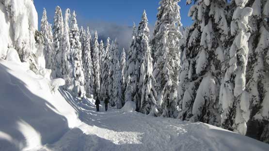
The adventure of this east ridge route began at a “rock garden” feature. Most snowshoeers had stopped there and the only tracks beyond were made by one or two skiers. Negotiating this rock garden was risky in its own for obvious reasons but with careful probing I did make through without incidence (while using the skier’s tracks). I did discover a hole while probing and that costed me a bit of detouring to get around. The rest of the way down, and then up around the south side of that rocky summit was not long, but had some consistent steep grade.

The east ridge starts from somewhere here. I had to bypass the rocky peak ahead

First of all I had to find a way through this large rock garden
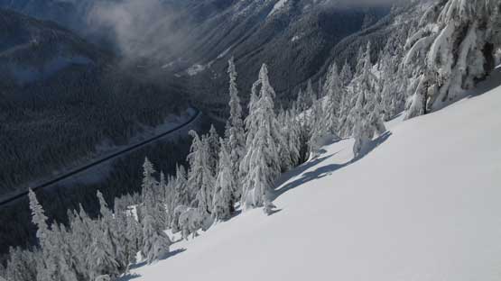
Traversing very steep south slopes. Note the highway below

Traversing… This is the typical terrain around that rocky summit
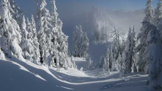
After the contouring the terrain flats out.
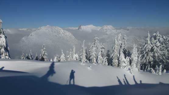
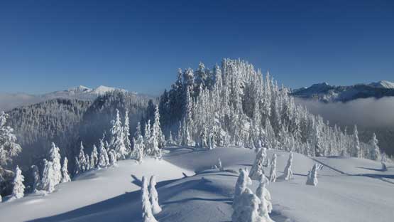
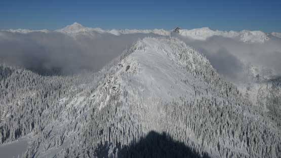
Right before the actual summit block I was facing a steep drop with about 30 meters of elevations loss. The correct attack was on the north side and thank again to the skiers I did not have to make my own route-finding. I then followed this same set of skin tracks grunting up a gully feature to the final (forested) summit ridge. The true summit lies slightly to the north but it seemed like the skiers came here for the steep descent off the south face. There’s a fainter set of skin tracks going for the true summit which I followed to the top. The view was much better than from Tye Peak probably because of the improved weather. I could see most of the peaks in this broad region.
My shadow on the snow thank to the late December sun’s low angle.
Looking back after bypassing that rocky summit. It doesn’t look as rocky from this side..
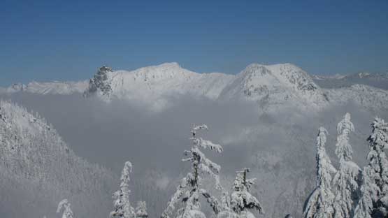
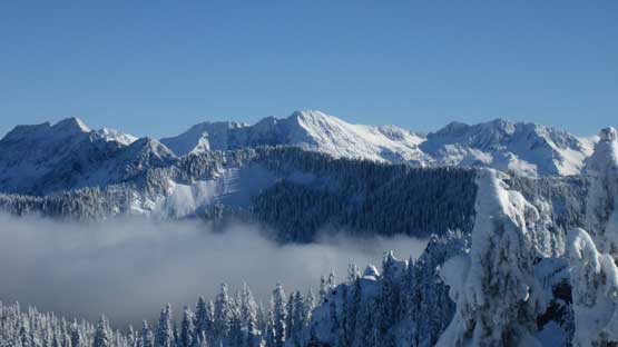
The south face of Lichtenberg Mountain pokes above the fog layer

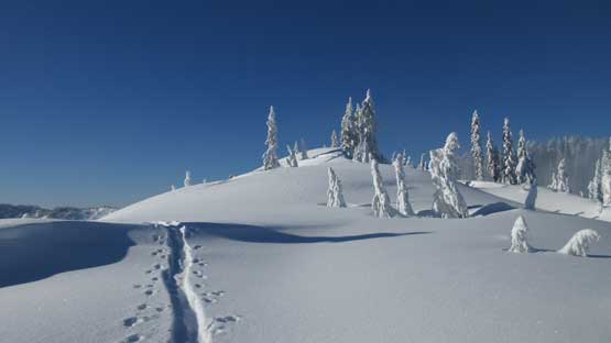
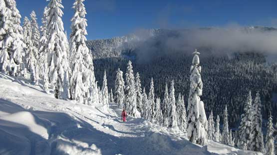
Ahead is the true summit of Sky Mountain.
After a bit of elevation loss I had to grunt up this broad, shallow gully
Following the skin tracks around a corner. The skiers were here for the south face.

This is looking down the Tye River valley where US-2 travels through.

Summit Panorama from Sky Mountain. Click to view large size.
Tye Peak in the foreground is now below me.

That tall peak is Mt. Fernow (not to be confused with another Fernow in Chelan area)

Mt. Howard and Rock Mountain
Snowgrass Mountain et al. in the eastern central Cascades
Gunn Peak looks very striking from this angle
Columbia Peak and Kyes Peak in the Monte Cristo Group

The “Matterhorn of Cascades” – Sloan Peak

Glacier Peak

Me on the summit of Sky Mountain
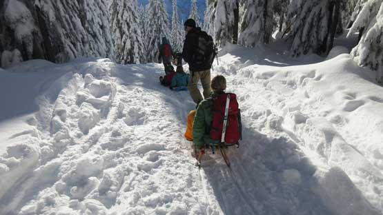
After a while I leisurely retraced my own tracks. The few elevation regain was a bit of annoying but overall this is a short route so in little time I was back at the “rock garden”. Not wasting much of time I joined the hordes descending onto Skyline Lake and then continuing down. Shortly after merging onto the main snowshoe track I removed my snowshoes as boot-packing was much easier on this type of hard packed trails. All forms of traffic and hundreds of people had showed up – boots, snowshoes, skis, snowboards, crazy carpets and even one wood chair…

Time to head down…

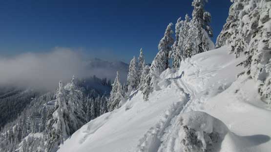
Just about to traverse back across that steep section. Note the resort behind

Back to the rock garden. I didn’t bother to linger this time.

Down to Skyline Lake now
Plodding across the frozen lake.

This looks fun..
Some people really know how to play
Joining the road plod at the end.
Some people were still going up.

One snowboarder passed me on descent.
The parking lot was cold so I did little lingering plus I just wanted to get out of this resort kind of gong show. The drive down the steep grade of Stevens Pass Highway was pretty easy with the road nice and dry, but then I got into a major traffic delay entering the urban areas. The traffic was very much standing still. I had no idea whether it’s an accident or just the volume but it was pretty bad. The border crossing back to Canada was crazy. All lanes were open and even so I got delayed by at least 40 minutes. I guess it’s the Christmas traffic and I guess it’s just normal..
