Bunker Hill (Pasayten, WA)
August 29, 2022
2206m
Pasayten Wilderness, WA
Bunker Hill is a lesser known summit buried deeply in the Pasayten Wilderness. The Boundary Trail traverses pretty much over its summit, but to get to this spot via Boundary Trail’s either direction takes several days. This is not a significant summit by any measure so those who summitted Bunker Hill likely did it as part of the Boundary Trail through-hike. I obviously had some other plans. I noticed this peak while doing Sheep Mountain a couple months ago. The Pasayten River FSR goes to within 1 km from the BC/WA border and from the BC side Bunker Hill seems like a quick ascent albeit with some bushwhacking. I wouldn’t drive this far just to do Bunker Hill but I did keep this objective in mind when I happened to be in the area.
This happened to be the case on this Monday. Matt Lemke drove north to give Castle Peak an attempt and I agreed to join. We decided to follow Eric Gilbertson’s route but taking bikes to shorten the approach. The idea seemed brilliant but the reality was cruel. We arrived at Monument 83 trail-head the night before only to see a trail closure sign saying some bridges were out. We ignored the closure sign as usual and even carried the bikes over two creeks (taking shoes off) but then we encountered hundreds of dead-falls. Lifting the bikes over some dead-falls wouldn’t be problematic, but within a few kilometers we had seen 100 of them. This was starting to become stupid so we made the decision to cut the loss and go back. After wasting 2 hours for nothing we were back to the truck. I threw out a few possible consolation objectives including Three Brothers and Chuwanten but clearly Matt was more keen on peaks in Washington. Matt picked Bunker Hill out of the three suggestions. This would be my last pick out of the three, but it’s on my “list” so I agreed to give it a try. The access road seemed to be in a better shape than last time I was here, such that we cruised down to mainline in no time. The spur roads labelled on my maps seemed rather non-existent so we turned around and parked on the main road. We pushed the bikes for about 100 m into the overgrown spur road and locked them onto a tree. These two fatbikes together worth over 10,000 dollars so we didn’t want to risk losing them.
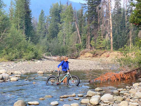
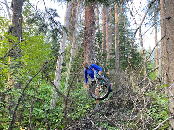
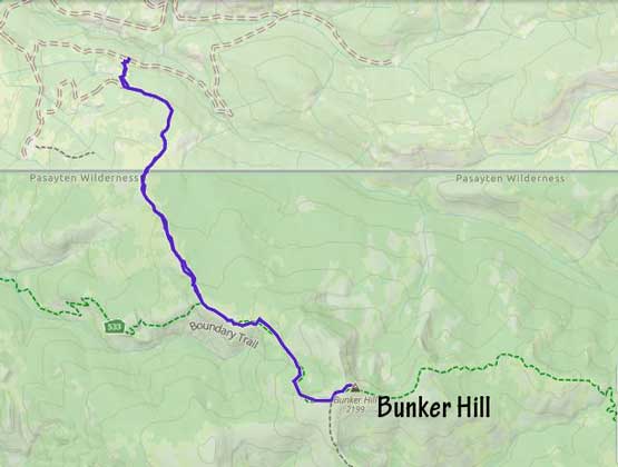
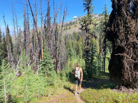
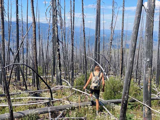
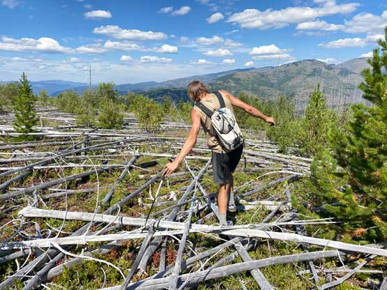
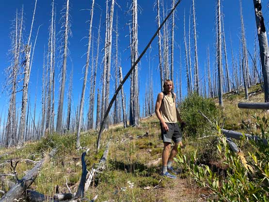
Due to the lack of cell reception we couldn’t download the satellite images so the navigation would have to be done purely on Gaia’s topo map. For complicated logging roads assisted hikes in lesser-known areas the Gaia map can be undertooled and this one was surely the case. The spur “road” shown on the map was basically too overgrown to walk on, so we made the decision to just bail into the bush to go straight up the slopes. The bushwhacking was definitely annoying, but within a tolerable range. After a while we popped onto another road that seemed much more defined and followed that road to the end, within 500 m from BC/WA border. We talked about to take this road back on the descent but we had no idea where this road originated from. The thrash to the border was starting to become worse and the worst was the first kilometer on the Washington side of the border. We were literally traversing ground that every square foot is filled in with pick-up-sticks. Thankfully those sticks weren’t super mangled so we were actually able to maintain a steady pace. This trip started to become stupid again but we were already too far into the pain to cut the loss. This was overall not a long hike so we were committed to get the job done.
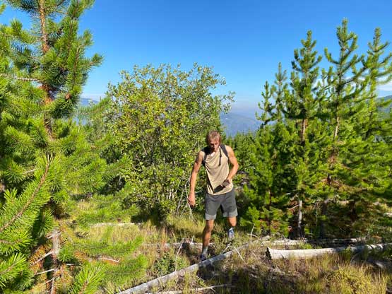

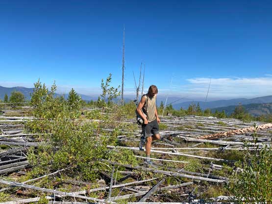
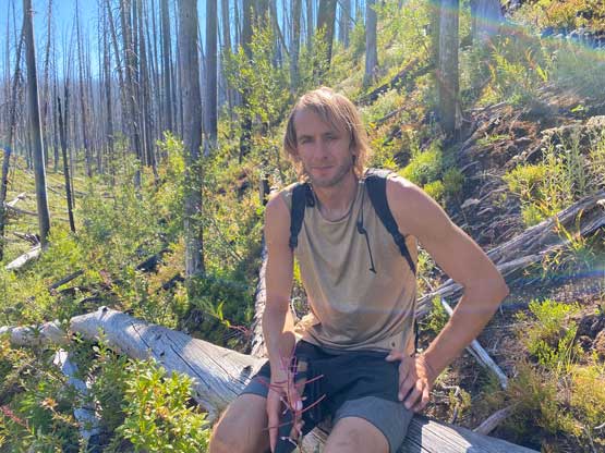
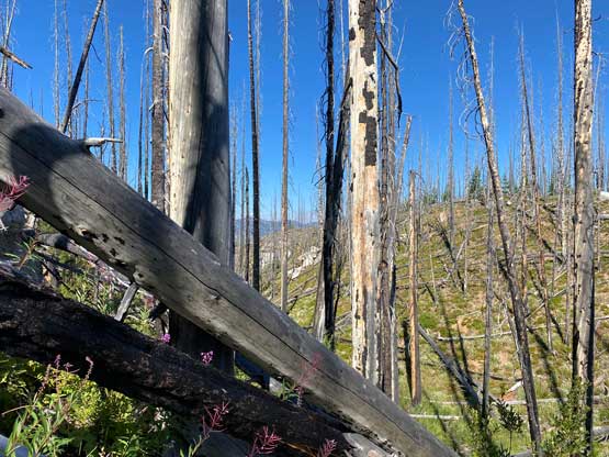
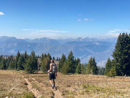
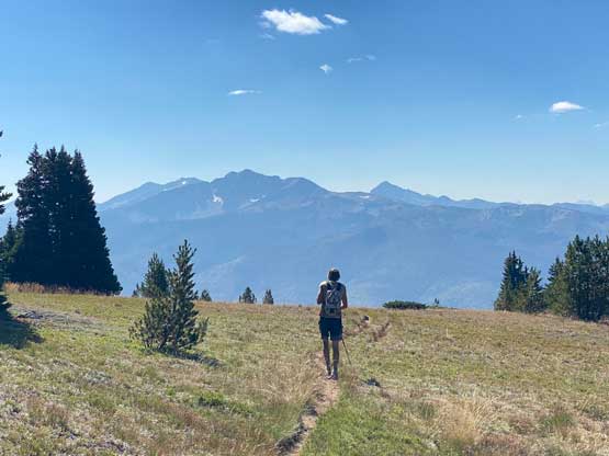
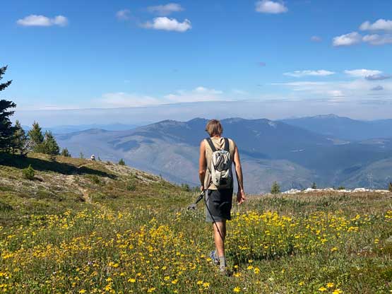
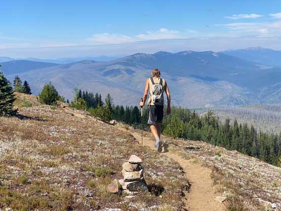
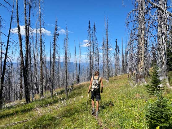
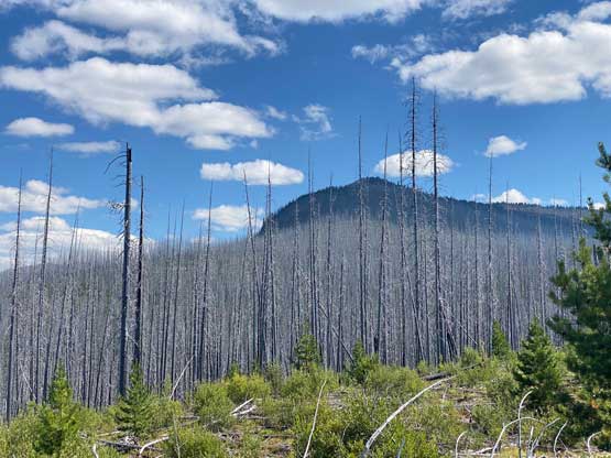
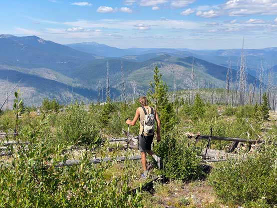
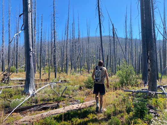
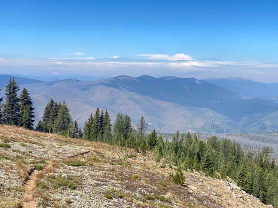
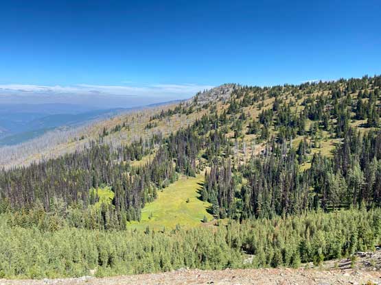
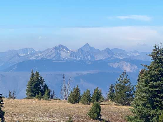
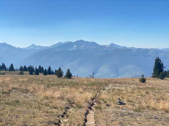
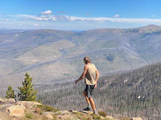
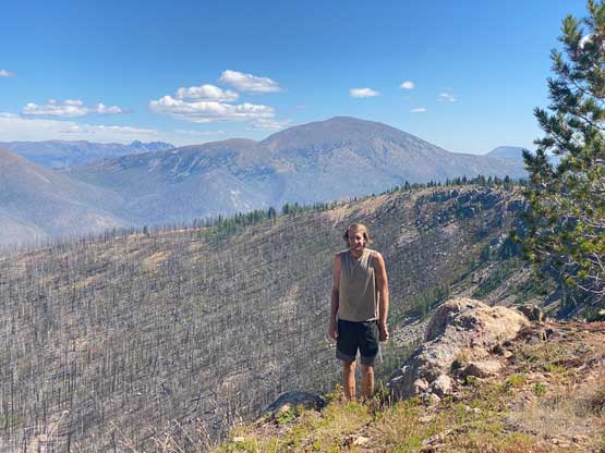
We kept checking the maps to see how far we still had to bushwhack to reach Boundary Trail on the west side of Bunker Hill and the progress took a lot longer than anticipated. It was a few kilometers’ of bushwhacking to get there. This was shaping up to become an “ultimate” definition of dumpster-diving but thankfully the upper mountain wasn’t as bad. Once joining the trail we had a pleasant hike to the summit covering another 3 km distance. The trailed portion was also longer than expected, but with good views into the Pasayten and northwards into Canada. From the summit we could see the bulk mass of Sheep Mountain to the east as well as some familiar Bulgers from unfamiliar angles. We even caught some strong cell receptions so we spent about an hour reconnecting to the society.


Eventually we must face the descent and the bushwhack. I let Matt to lead in front for most of the time while I stayed behind to check GPS and to correct our bearing. The downhill travel over pick-up-sticks was overall not as terrible as on the ascent. After the border I took over the lead to find the end of the road. I was literally bushwhacking while holding the phone on my hand to retrace our GPS tracks. Lower down we decided to more-or-less stick to the known and dived back into the bush to get back to the truck. Overall I cannot say that I enjoyed this ascent, but for a low-expectation summit this was actually not too terrible. The drive home was long and tiring. We eventually drove back to Abbotsford to meet up with Matt Juhasz who lent us the second fatbike. Matt had just finished an ascent of Tulameen Mountain so we exchanged our stories of the day.