Mount Wilson
April 22, 2013
3260m
Icefield Parkway (North), AB
Mt. Wilson is a big ass mountain overlooking Saskatchewan River Crossing, covering more than 60 km^2 ground and towering almost 2000 vertical meters above the river. Everyone would have an eye on it while driving up or down the Parkway. It’s been on my wish-list ever since I read trip reports of the “direct route”, but the day never came close until I get some essential skills. It’s a serious ascent and not a popular one, as you can see from these facts!
- 2000 m cumulative vertical gain
- 15 hours round trip which was basically the longest day I’ve ever done
- 1-hour GPS navigation in dark through tight forest
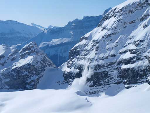
- South facing avalanche gully for 800 vertical meters, 30-35 degrees.
- 40 degree North facing gully for 100-150 vertical meters
- Traverse 40 degree slope with cornices threatening from above.
- Lengthy glacier travel with route-finding through open crevasses
- Giant cornices on the summit ridge that you cannot tell its boundary.
- And to reverse all these stuffs on the way back!
Alright. I honestly underestimated the challenge. I thought it would be like a White Pyramid style approach with a Hector style glacier, and I was so wrong. These two mountains can be used as a warm-up if you’re interested in Wilson. Vern, Eric, Ben and I all met in Rampart Creek Hostel on Saturday evening and we ascended Big Bend Peak and Mt. Saskatchewan Junior on Sunday. Snowshoes were used in this trip as opposed to skis for simple reasons that I lacked the required skiing skills…
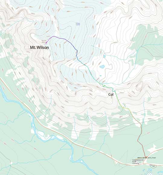
Mt. Wilson ski/snowshoe ascent route via the short-cut col. GPX DL
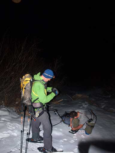
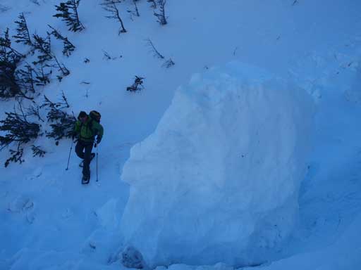
Like how I did on White Pyramid and Mount Hector, we decided to start super early. We woke up at 3AM, and quickly got ready and drove to the “trail-head”. The description from some trip reports was confusing since the pull-out was definitely not 700m from the Junction. It’s about 200-300m away. It has some boulders marking, and after parking there you should be able to see old roads heading in. We wasted some time to find this spot. It should be obvious if we didn’t have the information of “700m”. There was no snow at all at ground level, and we suspected if there would be any snow until the drainage/gully, so we kept carrying snowshoes instead of strapping them on. The correct direction would be heading up the right fork of old road (which we discovered on the way back), but we decided to head left and then into the bushes after 100 meters or so in. Don’t ever expect a trail on this approach. You’ll be bushwhacking carrying your gears for 1 hour for the least. The trees were tight at places, and Vern even got a cut on his nose that nobody realized until we were way up high. He did a great job navigating by GPS. We’d be worrying about if we would ever find that gully, and if we went up the wrong gully we would miserably fail no doubt. After some tediously tedious whacking and hopping we made to the way-point where we could follow a small rocky drainage up. Eventually we did manage to reach the main snow gully where we could then confirm we were on the route. Good luck skiers for the bushwhacking part with big sticks strapping on your pack. We were very happy to be there, and we soon strapped snowshoes on, preparing for the upstair walk in the next short while.
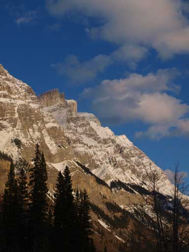
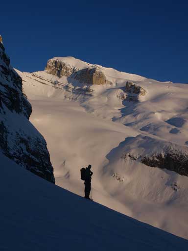
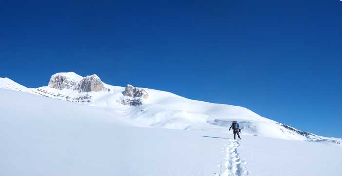
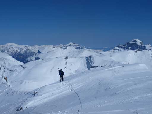
Mount Wilson seen from the highway. We were psyched!!
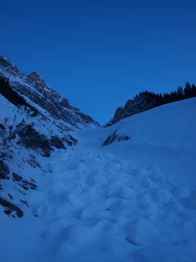
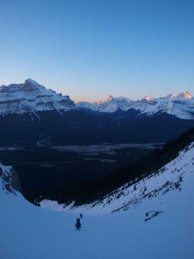
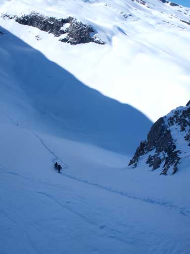
Now we finally got to the gully. Time to snowshoe up!
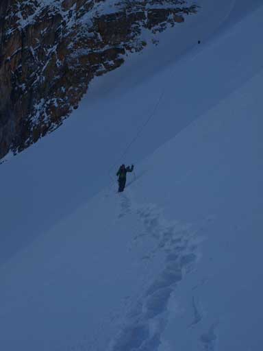
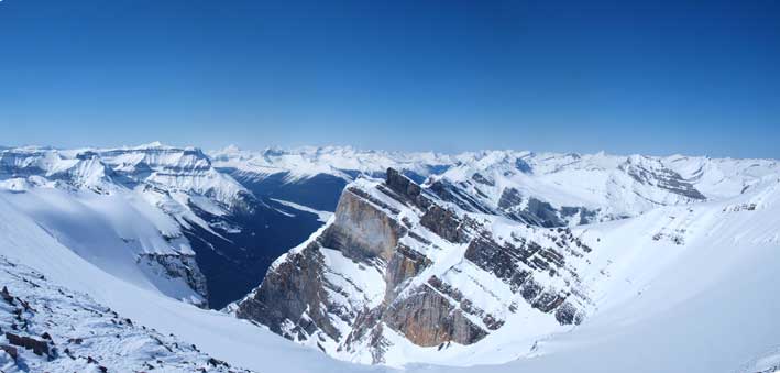
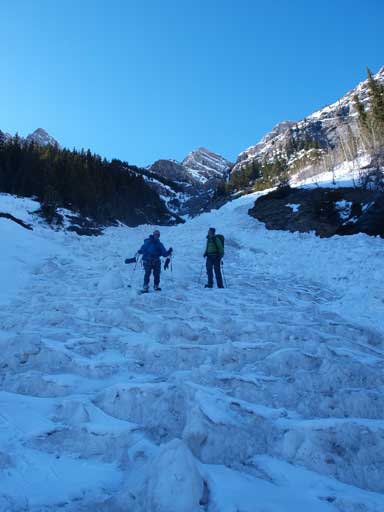
Some brightness started to show up on the horizon and looking back, we could see the impressive Mount Murchison. We were all psyched for the alpenglow that would be 1 hour or so later. Walking up consolidated snow on snowshoes was the best, and higher up we started to encounter avalanche debris that thankfully wasn’t entirely ice. We still could get grips on this snow boulders which helped a big time, because from here on until the top half of second gully, debris would be accompanying us all way. We soon found the supposed left fork, but it appeared to be too early. We made the call of going left after some debating, a good call. You’ll be going left on the first major branch. The right fork is still bigger, but left fork is considerably sizable too. You won’t see the upper gully looking left but that’s okay, and it will turn climber’s right not far up. We were glad to find about 30 centimeters of debris free line on the left side. And once we curved right the debris free line moved to the right hand side. Good luck skiers again. You’ll be walking up and down your skis while wearing boot crampons, kicking step into the hard debris… Once we hit the top half of second gully the debris were gone. We thought it would be only half an hour to the high col, but the view was very foreshortened. We were actually only about halfway up the second gully (starting from the fork). We kept looking back ready to shoot sexy ladies especially Chephren/White Pyramid. We didn’t want to just march up and miss the alpenglow. Once it started to glow, it was just beyond awesome. We entered crappy snow soon and just like on Fortune, we were slipping backwards. I made a call of switch-backing since it’s difficult for snowshoes to slip sideways. Ben and I took turn breaking trail up the last bit of the gully (with one section having slab avalanche concern), and once we made to the high col we got a head-on view of our objective, as well as how far we had to go down on the other side… We took our first energy break here.
This is the second gully, the left branch
Looking down as guys going up. It already started to glow!
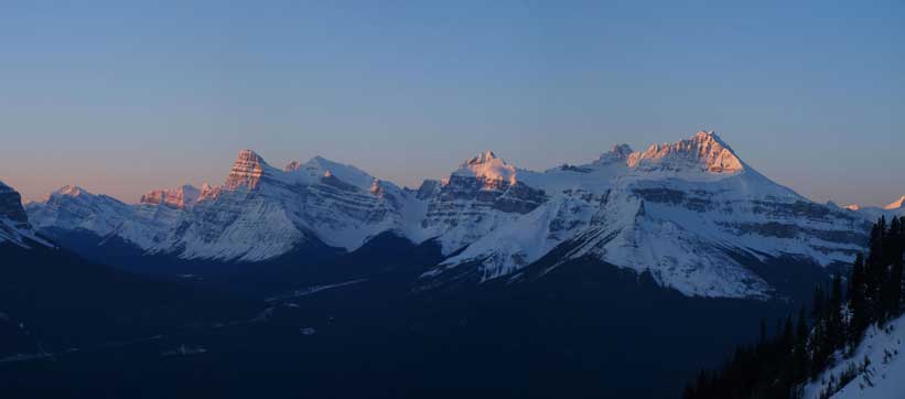
Alpenglow on Chephren, Epaulette, Sarbach!

Ben breaking trail up the upper gully. It was very foreshortened
Morning glow again
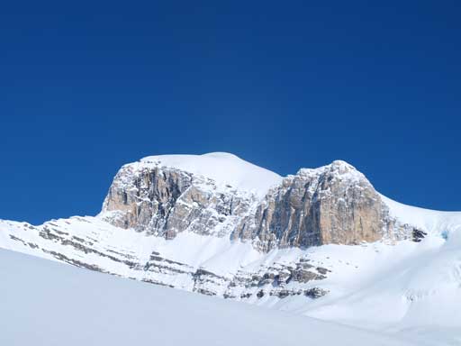
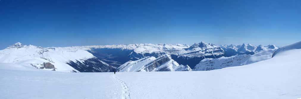
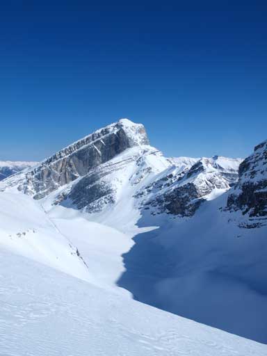
Now here we go. Mount Wilson seen from the high col
Vern on the high col, with our objective in the background.
Leaning towards the north side, oh wow, looking at that slope! Even though we knew it’s a 40 degree slope we were still get surprised about how big the terrain on the other side. We took off snowshoes and walked down for as far as we could without too much post-holing, and then put snowshoes back on. There was no sign of any instability which was very good. We made a call to traverse skier’s left resisting losing elevation. We could save a lot of loss and regain on post-holing terrain. It was a good call because I’m writing the trip report at home, with the peak done, and no one got into trouble. However, I should say it wasn’t a smart call as the next 15 minutes or so would be extremely sketchy. With terrain-trap below any slide would be fatal. A beacon just wouldn’t help on something this big. There was also a couple slabs that were very hard so we had to count on snowshoe crampons. Slipping on those slabs would send us all the way down. Skiing here? Oh well. If I do Wilson again (which I don’t ever think so), I’ll be descending towards skier’s right and contouring around the obvious rock feature on its right side. You will be staying on the big slope for a longer time, but you won’t be doing the traverse part, but you will lose 100m more elevation. Overall there is no easy way here and every possible line is exposed to giant features.

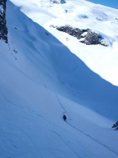
Descending the steep north facing gully from the high col.

The steep traverse
A closer look
After nervously traversing the steep terrain we took another break, breathing deep. I consumed my second gel at this stage (I brought 5 gels and 2.5 bars up and that’s it). We suspected the terrain ahead was on a glacier, but we decided to leave ropes in our pack until we were on the main glacier. The view from here on was just beyond “foreshortening”. You still have 800 vertical meters on somehow flat terrain, so don’t even expect the peak is gettin’ closer. There were 2 steep south facing rolls that caused us some concerns. Oh by the way, the terrain on Wilson Icefield is rolling. If a white-out comes, you will need very accurate GPS track. Otherwise you will confuse yourself not far up. We roped up once we passed the last bit of rock, and we were directly facing towards the 2 open crevasses. I switched the lead to Ben, and he led a way through the middle of the two, which was a good idea since that part should be on a compression zone. We switched the lead back to me again, and since I was high on energy, I broke trail entirely up after the open crevasses. I traversed horizontally and then left, gently working up the glacier. The gentle slope would never come to an end. We did try to look back soaking in the views. The views of East side was better on the way down though.
Now we finally got some sunshine!
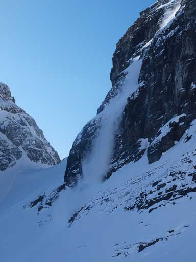
Small sluffs coming down to where we just traversed through…
Ben breaking trail up the massive field. Not sure it’s ice below or not.
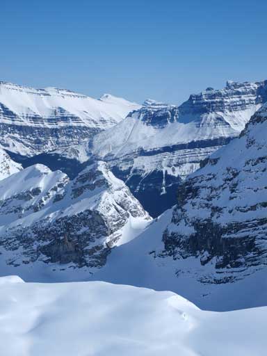
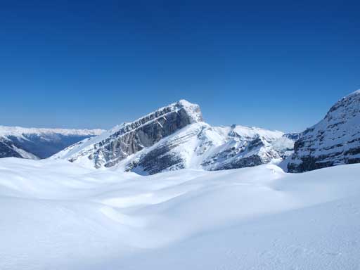
A closer look at Wilson. This isn’t the summit though
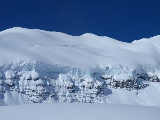
Impressive seracs!
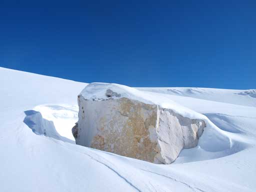
An interesting boulder
Another small avalanche coming down to where we just traversed.

Looking back at Eric following up. You can see the high col on left
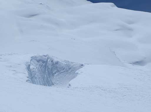
Open crevasses
Higher up
Ben with the seracs behind. Giant views!
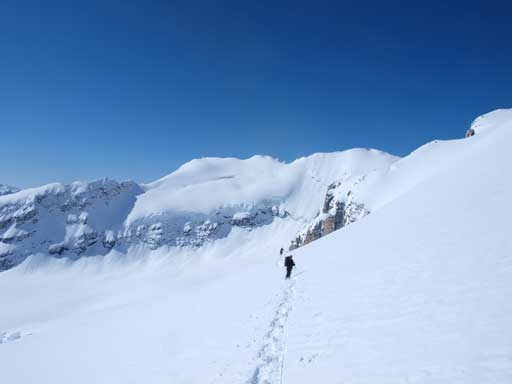
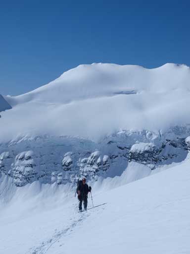
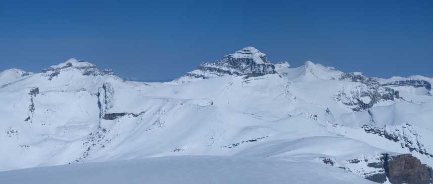
Eventually after eternity we joined the ridge coming from further north, and we could recognize the features ahead of us from Chic’s book. Oh note, Chic Scot’s route description is correct, but his route map is WRONG! You’re following the NE ridge, not SE ridge. the SE ridge wouldn’t work I can tell you! Vern suggested to go further climber’s right to avoid the possible bergschrund or hidden crevasses on the ridge. I agreed but still took out my probe. The snowpack was thick, but I need to be careful with the ‘schrund though. I never discovered one and we hit the summit ridge very soon, where the wind suddenly picked up to >50kph. It was cold wind and it was brutal to stand there without moving.

You should recognize this feature from Chic’s book. Note the cornices
Right before the start of the infamous cornices (that I’d heard some horrible and scary stories), the terrain suddenly steepened up. This was where Golden Scramblers fell into the hidden hole. I fully knew it but still decided to take off snowshoes for two reasons. The snow right in front of me was rock hard so I though with ice axe probing I should be fine; it would be sketchy on snowshoes on icy exposed snow. Other three said it was pretty soft near the crevasse but what I could remember was the hard snow where I took off the ‘shoes. I couldn’t remember how hard the snow once I started going up since I didn’t encounter any issue. The other guys were shouting to me to go climber’s right. They would have a better perspective than I did since I was right on the slope. I thought I’d traversed right enough, and I didn’t find anything surprising except for the icy snow that I started to front-pointing on top. Ben, Vern and Eric decided to use snowshoes and I’m pretty sure they couldn’t traverse too far right since the ‘shoes won’t work on this icy exposed steep terrain. That might contribute to Ben’s discovery of that crevasse. Me on the lead, being 30 meters away from the rest, and with that wind smashing into my face, I couldn’t hear anything details and communication was near impossible. What I could feel was the constant drag from behind. I heard Ben shouting “anchor”, and I thought he just didn’t feel comfortable about the steep snow, so I traversed to a softer spot and axed in. I didn’t expect him from stepping into a hole. I didn’t step into one on boots, but he stepped into one on snowshoes. The cornices were massive and I couldn’t tell where they start, especially once I was on the ridge, so traversing on the steep snow was the only option. Despite being slow, they somehow managed to goin’ up all these things on snowshoes. Amazing! Once off the most exposed part, the summit was a short walk away. I hate the weather repeater on the top which ruined my panorama and the views. I didn’t enjoy the time soaking in the views since it was freakin’ cold. The other guys showed up shortly with worrying faces. Then they told me what actually happened…
Ben walking up the summit ridge after finishing the most difficult parts

Summit Panorama. Click to view large size
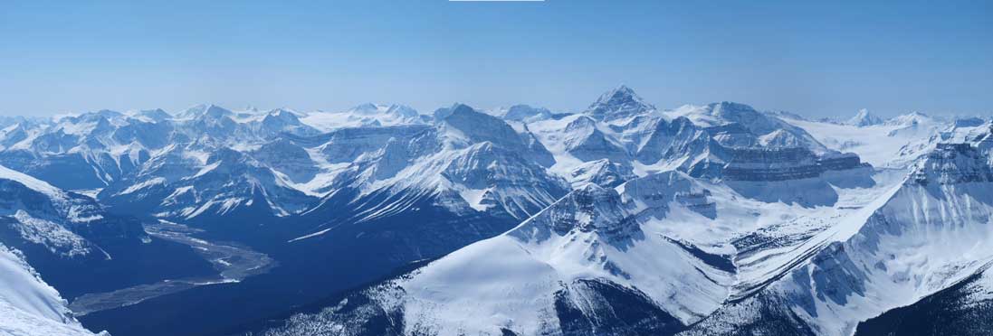
Looking towards Freshfields on left, and Mount Forbes on right
Erasmus, Lyells, and Amery
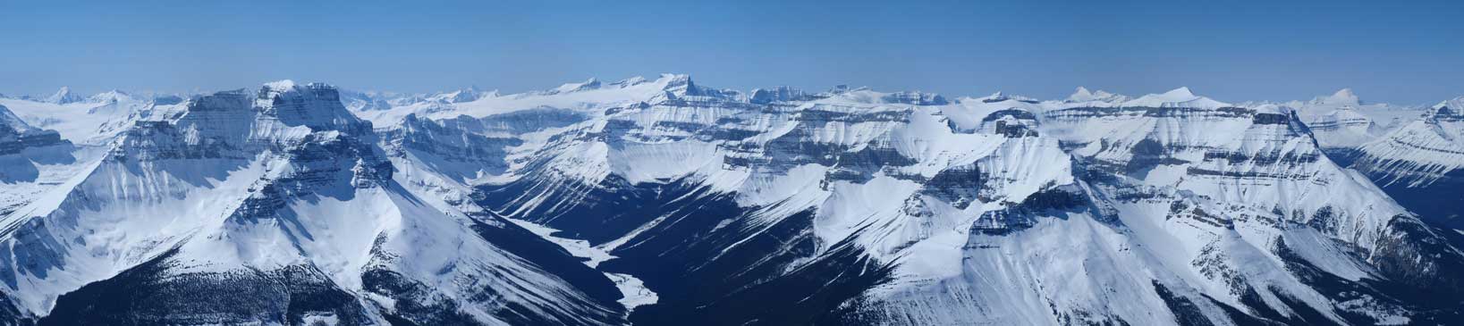
Mount Saskatchewan on left. You can see Nigel peak down the highway.

Peaks NE of Wilson. They’re in David Thompson Country
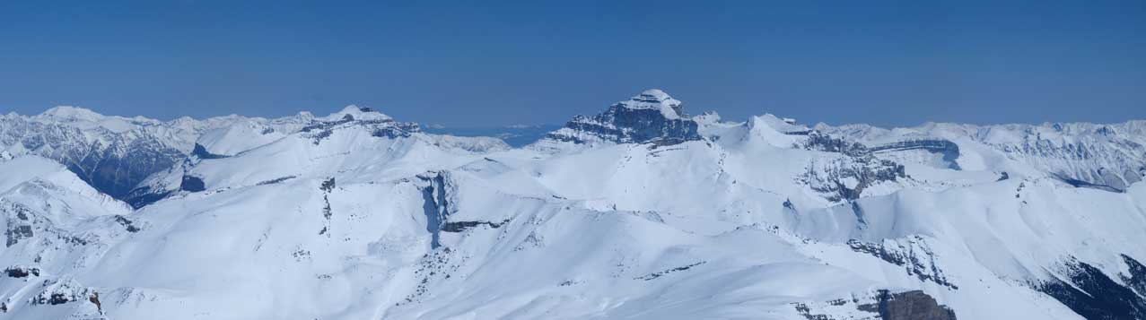
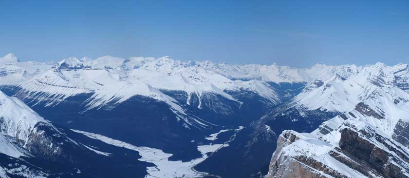
The impressive Mount Cline. It’s high on my list as a summer ascent
Peaks in David Thompson again

Murchison on left, Chephren/White Pyramid at center. Sarbach right of center
Due to the communication problem we would be short roping on two teams to descend the summit ridge. We decided to go towards the cornices trying to avoid the hole, since the snow was icy hard and it was impossible to punch through a cornice. However, it was still possible to punch down the entire cornice… Well, while approaching the edge, a sudden whump scared all of us, and we ran back suddenly. We wasn’t that close and it already showed extreme instability. Geez.. Now we had to descend the steep icy slope with snowshoes on. I tried my best to give Ben an ice axe belay on every sketchy part. I was wearing crampons so I could just walk down pretty much except for one step requiring awkward moves. Eric and Vern followed us shortly behind. After what seemed like a long time we finally got down the ridge.
Vern down-climbing icy snow
Vern and Eric
Back down the ridge, the last look at the other side before dropping down to the glacier
Since we were on snowshoes we could descend the exact same line as going up. We unroped for the descend so everyone could have more freedom taking photos and soaking in the views. Going down the glacier was nice and soft until we were facing at the big traverse right before the steep climb to high col. It was in the shade pretty much all day. We decided to just retrace our steps rather than losing more elevation. I wasn’t that nervous coming back this area though, but I did find myself speeding up. I only stopped a couple times taking a couple photos. We managed to snowshoe up exactly on our down-tracks back towards the high col.
Mount Cline again. The peak left of Cline is one of the Whitegoats
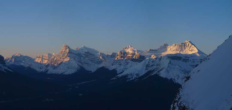
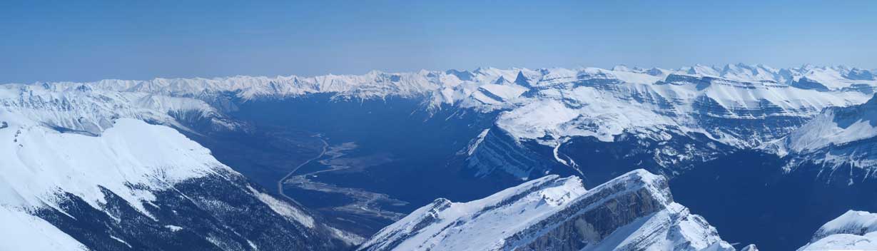
Panorama from the descent

A zoomed-in panorama towards Murchison and Chephren/White Pyramid

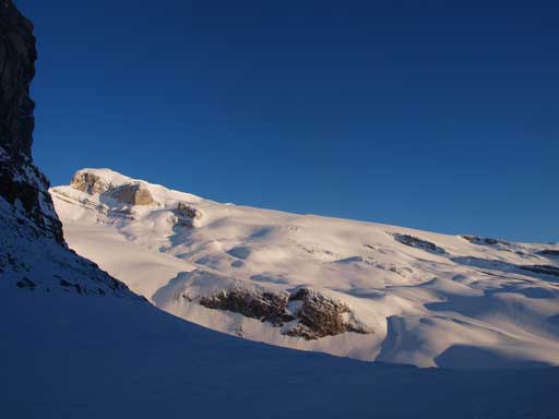
Impressive snow feature
Looking down towards the high col
Vern snowshoeing down a steeper section
One of the many sub-peaks of Wilson
The same sub-peak again

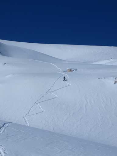
Wow the big traverse!
Same as above
Looking down the big north gully from the top

Looking back towards Wilson. If the resolution is higher you should be able to see our tracks.

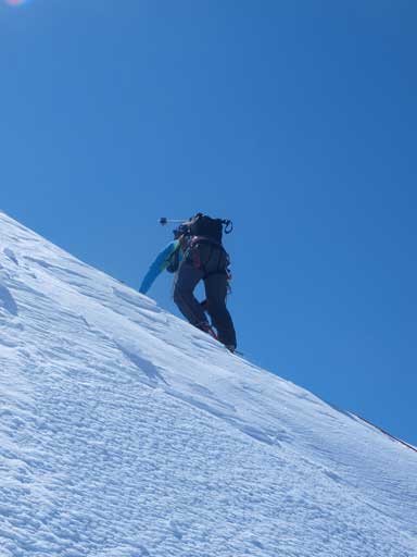
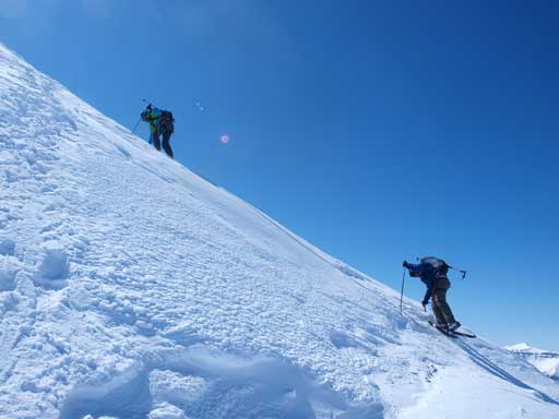
Vern and Ben slogging up the steep slope
Plunging-step down the upper south facing gully would be the last challenge for our day. By now the sun had already went down and the gully was in the shade for a while. I had some fun snowshoeing down the soft snow until down to the bottom half where the debris filled the path. Going down those things was not that fun since we had to go down step by step. We got a better perspective of this giant avalanche path. There was one snow boulder that’s car sized oh wow. The first gully was fully filled with debris too. I got amazed by the giant terrains on this mountain. Eventually we got back down to the bottom where we took off snowshoes. The day hadn’t done yet since we still had 1 hour of bushwhacking to negotiate. We believed there has to be a better way off but couldn’t find one. The bush was far from fun but we all glad it wasn’t isothermal snow which would be even worse. It was (almost) snow free. We’re amazed by the fact there’re people hauling skis all the way this approach route just for doing some turns on the glacier. This is a mountain that’s more efficient on snowshoes.

Going down the avalanche gully. Time to enter the field of debris

Looking back

Beautiful afternoon view
Look at this car sized snow boulder

Back to the first gully. Looking up…
Oh wow the debris!

Time to snowshoe off, back into the trees

And ready for the bush. This is the best one can expect. It’s mostly worse than this.

Back to parking lot, looking towards Murchison
Finally after 15 hours on the mountain we made back to where we started. The big two-peak day on Sunday surely consumed our energy and slowed us down today, but I was very glad the weekend worked out this way. We got the best we could get! Since I was running out of all food I had to starve until Nordegg where we could get some food. We ate dinner in Rocky Mountain House. Ben and I took turn driving home, and it was 1Am when we got back to Edmonton. I still had English final exam the next morning at 9AM. I’m used to intense days back to back and I did okay on the exam. I’m looking forward to the next big peak like this. Mount Wilson will stay on top of my list for a long time until I get something giant maybe Mt. Columbia.

I’m pretty certain that the ski approach for Wilson is via Rampart Creek to the north, which would be a much longer and more gradual route. At least that’s what the Jasper section of the ACC planned on doing.
I see. We were looking at a day trip only and there was no online trip report for that route. I mean, no detailed trip report on the several popular sites. For direct route we had Golden Scramblers’ and Ferenc & Andrew’s ascents as reference. They made things sounded “easy”.
By the way, nice site Mike! It looks quite different from before. Nice work!