Sasquatch Peak
May 20, 2021
894m
Harrison Hot Springs, BC
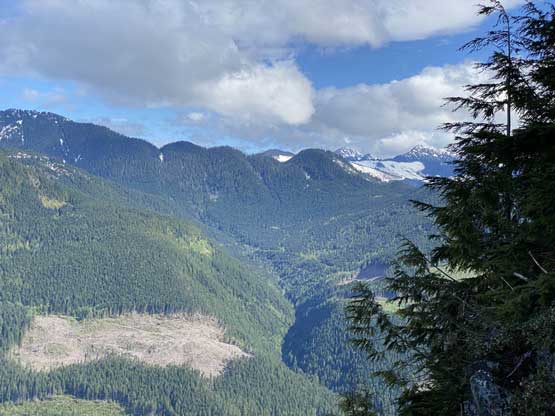
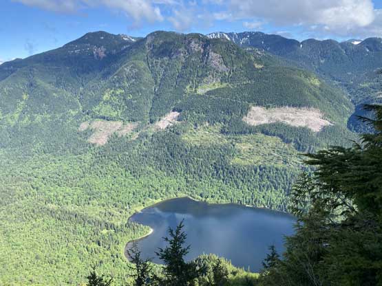
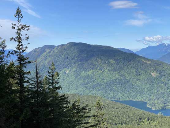
“Sasquatch Peak” is the unofficial name of the highest point of a small piece of woods immediately to the south of Sasquatch Provincial Park a short ways from Harrison Hot Springs. Despite the low elevation and the forested profile this peak surprisingly boasts over 600 m prominence as it’s surrounded by deep valleys. There are at least two small bluffs near the summit that offer some views on a clear day. Mt. Hicks to the south of “Sasquatch Peak” also in this same section of the woods is officially named but is lower and 100% forested with no view.
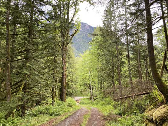
This peak also boasts a somewhat distinct boob-shaped profile when driving westwards down Highway 1 from Hope towards Chilliwack and in fact, I probably would have called it “Green Boob” had it not been named yet. Earlier in this year “Sasquatch Peak” along with Mt. Hicks had suddenly caught the “SWBC Peak Baggers” attention due to its prominence that at least half a dozen groups had gone in and bagged it within a period of a month. I waited a little longer to let those Facebook stories settle a bit in my memory. Ideally these peaks should be done in winter when avalanche danger is too high to attempt bigger objectives but there’s a problem. The gate at the entrance of Sasquatch Provincial Park is closed in winter meaning an extra 5 km of biking/walking is required. I was not too keen on that. The solution was then to bag it in spring as a before-work exercise and I pulled the spontaneous last-minute trigger on this Thursday as I couldn’t come up with a better objective. As always I preferred to car-camp so that I could get a few extra hours of sleep. I drove out of White Rock on Wednesday night after work at 10:30 pm and made to the “trail-head” past midnight and simply slept on the passenger seat of my truck.
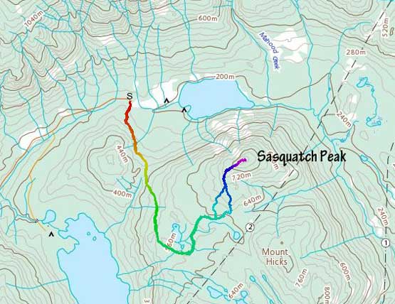
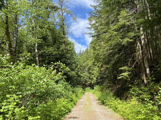
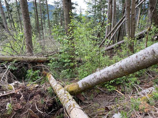
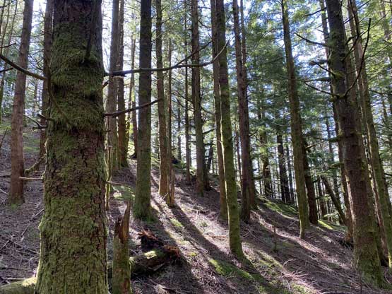
The spur road that goes up onto the west flanks of Mt. Hicks / “Sasquatch Peak” was in an excellent shape but unfortunately it’s gated meaning that those kilometers must be earned on foot. The road brought me to the south-west side of “Sasquatch Peak” near Sasquatch/Hicks saddle. I did not do my homework for this hike and ended up picking a rough route on the ascent. I naturally aimed for the highest possible spot on the spur roads before bailing into the forest. The last spur road was overgrown with wet bushes, and the forest was a true nightmare with “BW4” pick-up sticks and brambles. I should have just turned around to search for a better route because nobody mentioned such a bad bushwhack in their trip reports but I was too stubborn to turn around. After half an hour of hell I exited the worst of it onto the upper SW Ridge.


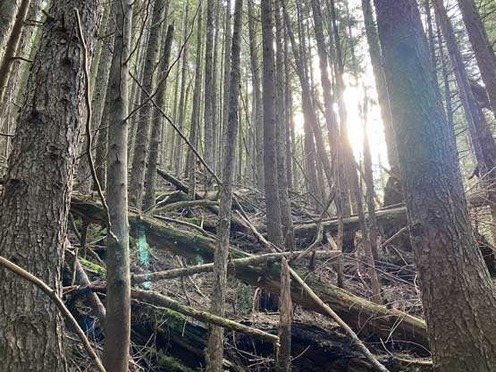
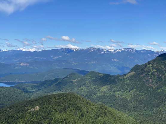
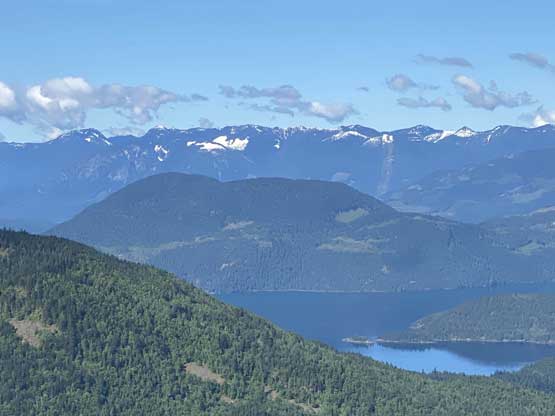
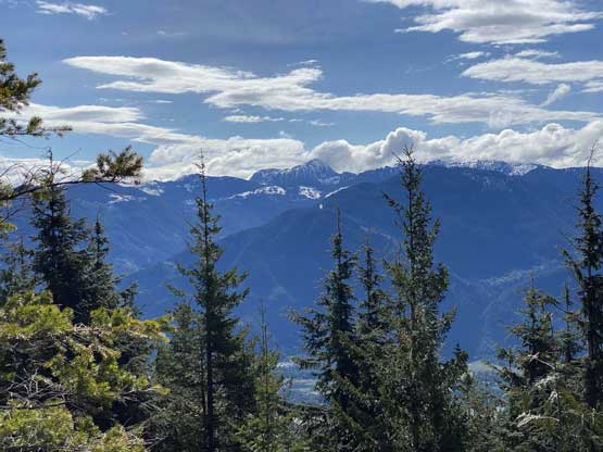
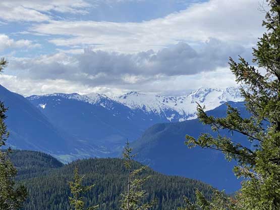
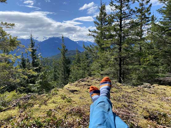
The upper SW Ridge had an easy section but soon narrowed down into another mess of pick-up sticks field. The difference was that the bushwhacking here was at worst “grade 3” and the sticks were much smaller and easier to step across. The bluff immediately to the west of the true summit offered surprisingly expansive views and the bluff right on the summit had some views looking south. At this point I decided against bagging Mt. Hicks because I needed a break from the bushwhacking so lingered on the summit for over half an hour soaking in the sunshine.


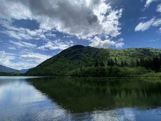
I noticed some dark clouds building up (thunderstorms in the forecast) so quickly packed up the gears and started the descent. I retraced my route down the upper ridge then veered down-climber’s right in hope to avoid the worst of the bushwhack. Indeed, I picked a much better line on the descent so that the bushwhacking never got worse than “BW3”. There were some devil’s clubs on the lower parts but those were easily avoidable. I almost decided to just fuck it and go for Mt. Hicks since I was already there, but then I checked the time and decided to head down. I had work in the afternoon and I didn’t want to risk being late. It was already past noon at this point and I knew the traffic could not be too easy in the rush hour. I drove to the shore of Deer Lake after the hike but it wasn’t very worthy.