Blanshard Needle
August 7, 2017
1550m
Golden Ears Provincial Park, BC
Golden Ears north of Maple Ridge is one area in SW BC well constructed and maintained for hikers at all levels but for some reasons I actually hadn’t paid a visit yet. The namesake objective, Golden Ears itself is by no doubt the most popular one but its standard route is just a “hike” which makes it less appealing to me. Blanshard Needle is an impressive horn south of the main peak and there’s no “tourists route” up. The easiest route up the south face goes at low 5th class. Vlad and I had been discussing this one for at least a year already and things eventually lined up on the Monday of this past August long weekend. The air quality was as poor as in Beijing thank to the forest fire smoke so we picked something not outrageously scenic, but yet interesting enough to motivate getting out.
There are two commonly used approaches to access the south face – the Fly’s Gully which is a snow ascent usually done in early season, and the trail up and over Alouette Mountain. I had absolutely no idea what to expect given the very limited research time but Vlad had been that way more than a few times and he suggested we should make a loop by going up the Fly’s Gully and down Alouette trail. This sounded perfect to me. Having to carry ice axe and crampons added extra weight but then the water sources in Fly’s Gully also shaved off some weight so I think it all balanced out. I was not particularly keen to drive considering it’s the last day of a long weekend but thankfully everything is paved so Vlad could get us there in his Honda Fit. There’s nothing to see on the drive thank to the dense smoke.
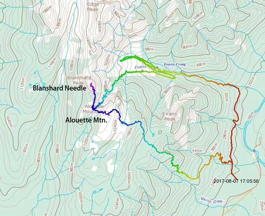
Blanshard Needle loop up Fly’s Gully down Alouette. GPX DL
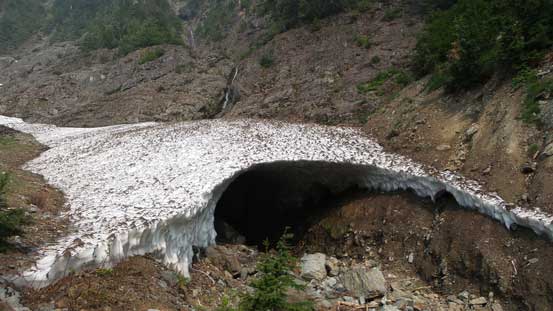
Right off the bat we could feel the heating beating down. It was stupidly humid too. After a few trips back in the Rockies I think I need to readjust to the humid coastal climate. Needless to say I was not in my element on this particular trip but good thing the approach isn’t a long one and we made to the end of Evans Creek trail in a mere hour after leaving the car. Not doing much thinking we took the wrong branch of the creeks and ended up checking out a few large snow caves. This costed us at least an hour and tons of backtracking (more than 200 vertical meters) but on the hindsight this was my only chance on giving those snow caves a visit as I never repeat a peak, so there’s still something good about it. Now at home with both Blanshard Needle and the next trip, Whitehorn Mountain successfully bagged I was happy about this bit of detour, but on that particularly day I was not happy about our careless route-finding.
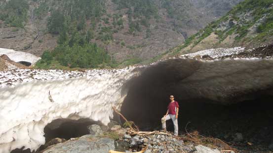
Vlad showing the scale of this snow cave..
Very freaky crevasses on the snow slope… It’s all hollow underneath
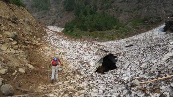
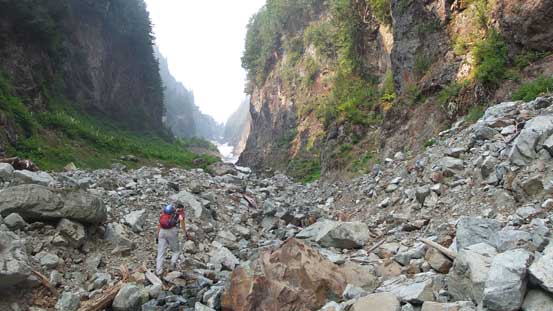
Going up the wrong gully…
Another snow cave
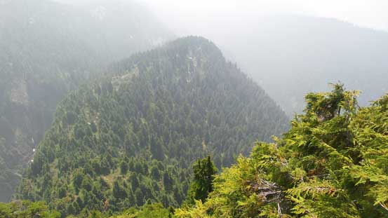
We were still going up the wrong gully.. Blanshard Needle behind
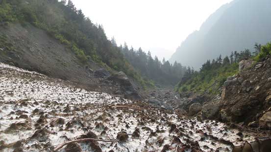
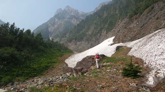
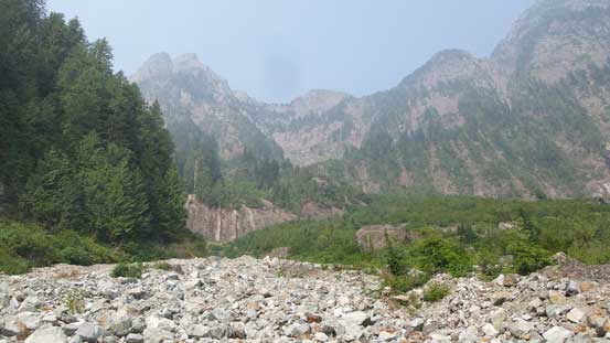
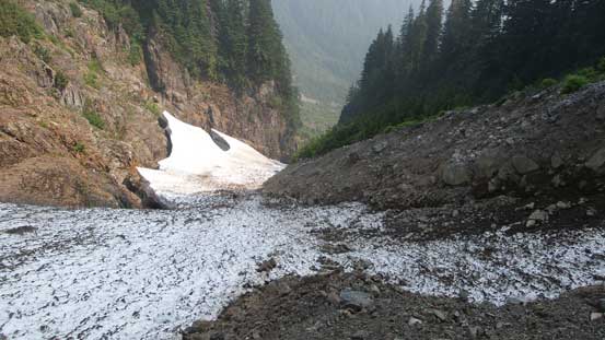
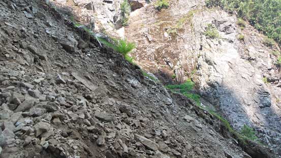
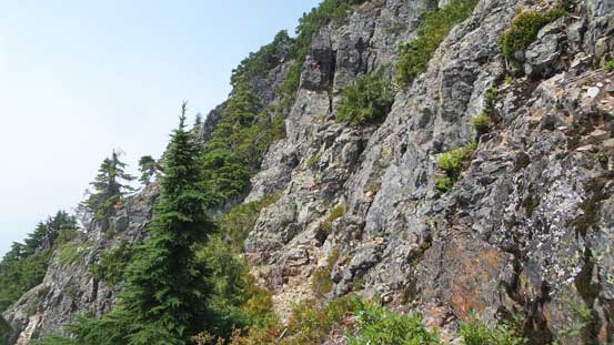
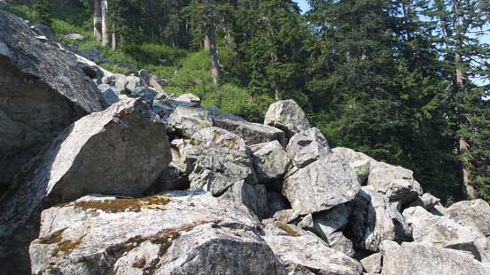
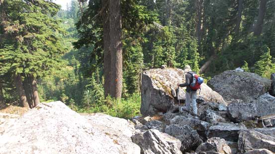
After fair a few 4-letter words flying around we descended to where the LEFT branch of the Evans Creek starts. It honestly wasn’t obvious to locate but with a GPS unit we didn’t screw it up this time. After about 20 meters of bushwhacking on a short-cut we joined the proper drainage, and then another long stretch of hopping on boulders later we arrived at the base of Fly’s Gully. The gully looked like at least 70% snow covered and the snow was not the most optimal conditions to warrant fast travel. It was almost too hard but the slope angle was fairly mellow. I trusted the edging on my new Trango Ice Cubes so didn’t bother with ice axe nor crampons although a slip anywhere in that gully would not be pleasant. It felt fairly exposed higher up but at that point I just kicked hard and sucked it up. The last step getting out of snow was super shitty loose moraine type of choss. We had to use grass and dirt as “handholds” to stem ourselves up and by any chance we were definitely not going down the same way… The rest of the ascent to Alouette/Blanshard col was “choss fest” at its finest speaking the west coast standard.
Finally traversed into the correct drainage…
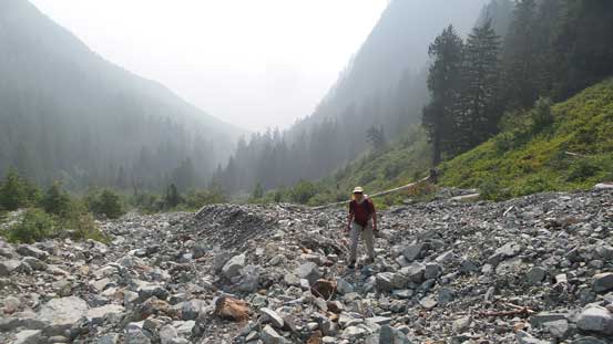
Vlad and the typical boulder hopping in this dry creek bed
Merging into Fly’s Gully now
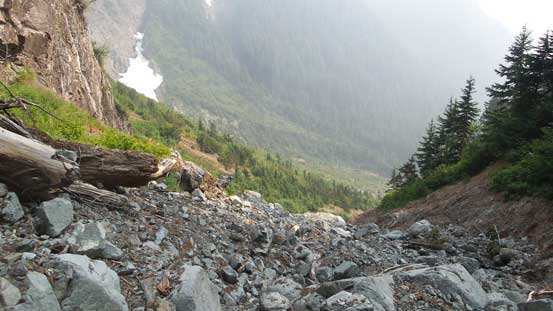
This is the start of Fly’s Gully. More rubble hopping…

Finally onto snow and then the snow was rock hard…
I refused to don crampons and kicked hundred of meters up

Near the top of the snow
Transitioning out of the snow path was super loose even by Rockies standard…
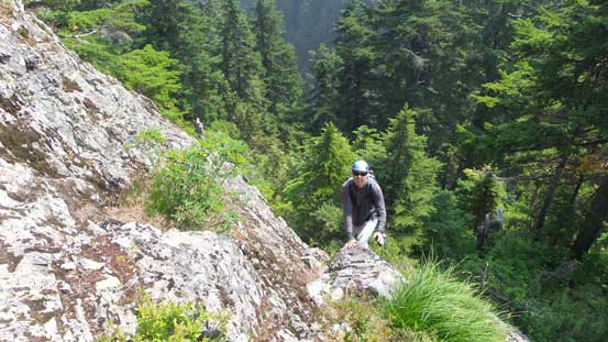
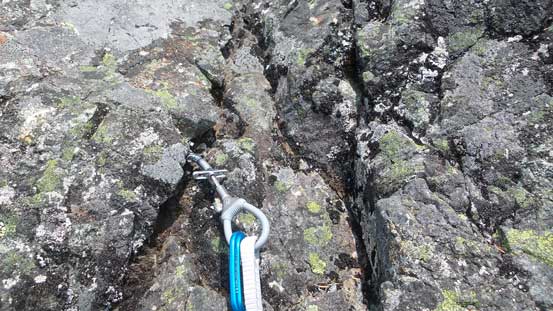
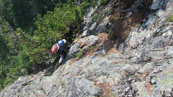
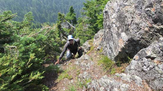
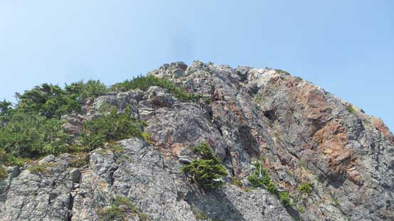
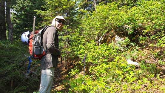
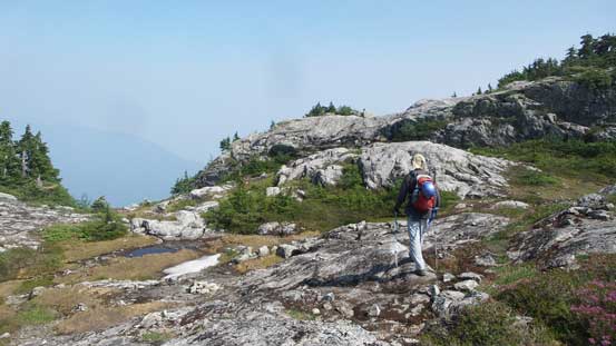
At the col we finally could shave off some weight leaving the ice axes and crampons behind. Then up the north side we scrambled up ledges and bushes towards the base of Blanshard Needle. The quality of the trail/path was much better than expected with actually a foot path as well as a ton of flagging so there’s no way to get lost. The temperature was really taking its toll on us though but with less than 300 vertical meters to the summit it couldn’t get much worse anyway. The crux pitch looked intimidating from the base so that we were glad to have brought a full rack of rock gears up. I also swapped my boots for rock shoes and meanwhile we built an anchor by slinging around a tree.
Vlad coming up a short step on the lower south ridge
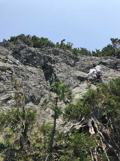
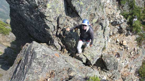
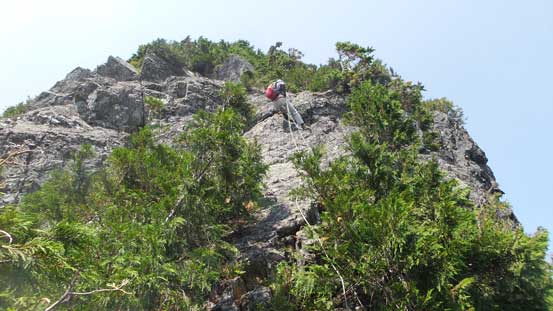
Near the base of the crux, the terrain is near vertical
The crux looks very difficult…
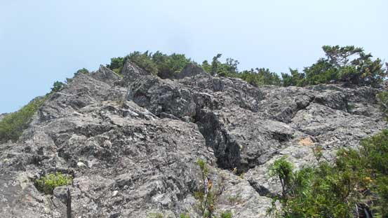
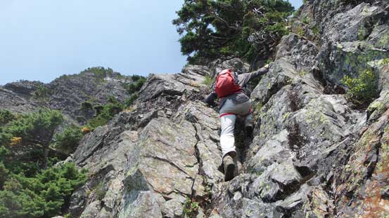
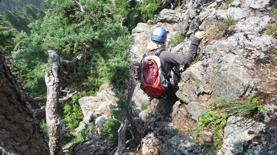
As I led up I trended a bit towards climber’s right side. Below the overhanging crux I managed to get two pieces of cams in which greatly built the confidence. The crux wasn’t too bad with rock shoes as I traversed a bit left and then back right using some tiny foot holds. It wasn’t easy for Vlad though on mountaineering boots and I felt it definitely deserves the 5th class grade. I was happy about my climbing performance I did not have to pull on gears.. The pitch was surprisingly short-lived and before realizing the fun was over. After that we packed the rope and continued upwards on some 3rd to maybe low 4th class terrain with fairly simple route-finding. This long stage topped out near the false summit where we traversed leftwards on an obvious ledge to the notch between false and true summits.
Me leading up the crux pitch.
Putting gears in..

Looking back down the pitch. You can’t see the overhang from this angle
Continuing up 3rd class scrambling
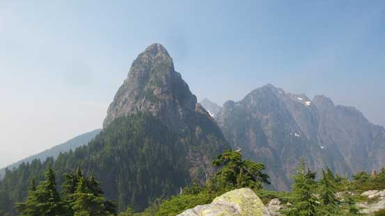
Very typical and reminded us the Lions
Vlad leading up the next step. This part felt quite vertical
Coming up a grassy gully
Somewhere around here we had to traverse across the face
Merging into the notch
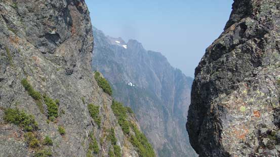
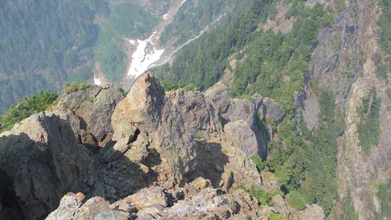
Cool views from the notch.
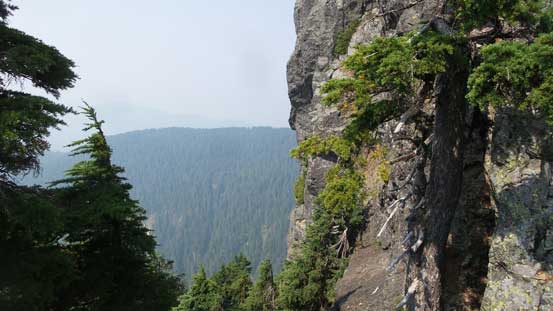
The scramble up the true summit was 3rd class at the most but the terrain became a little bit chossy here with loose pebbles thrown in covering some ledges. It was easily managed though so nothing really worth nothing. The view from the summit was non-existent except for towards Edge Peak and Golden Ears…
The last bits of scramble towards the true summit

Looking down into the Evans Creek valley where we came up from
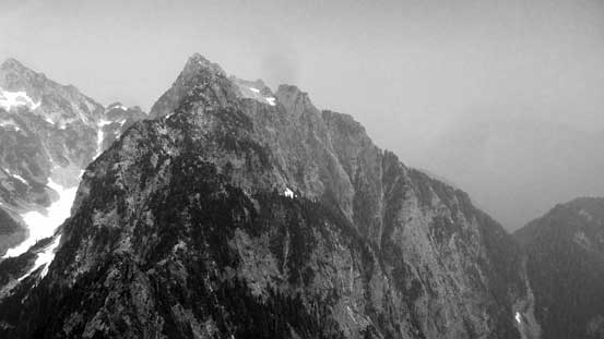
The south ridge of Edge Peak. There is no easy way up that peak neither
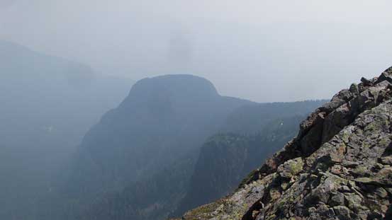
This lowly bump is Evans Peak
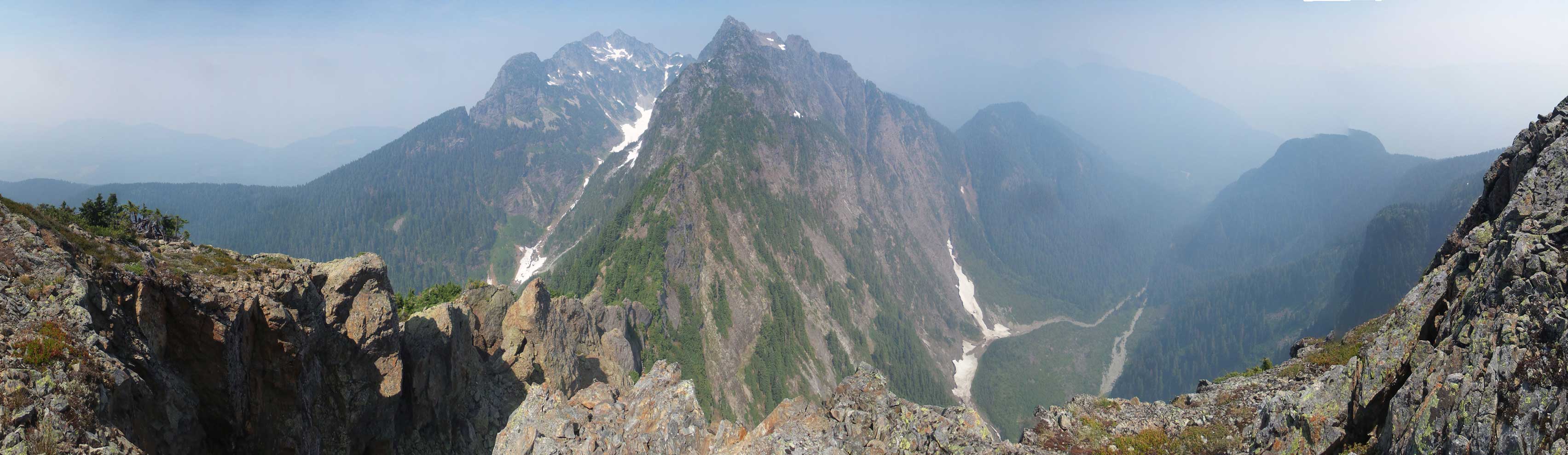
Summit Panorama from Blanshard Needle. Click to view large size.
The north ridge of Blanshard Needle heading down to Blanshard/Edge col
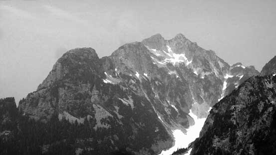
Golden Ears
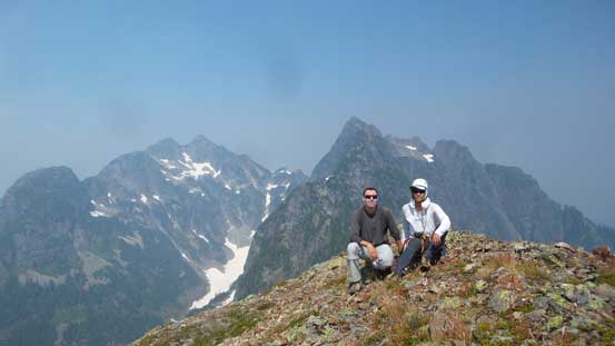
Vlad and I on the summit of Blanshard Needle
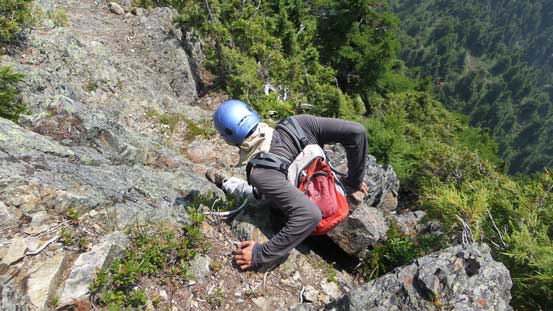
We were both running low on water and the heat was really exhausting to say the least, so there’s no time to linger on the summit and we had to get down fast. The rocks were toasted hot just to say how brutal the heat was… The down-scramble was surprisingly easy and fun and we had no trouble making back to the crux pitch. The only thing that we had to pay attention was route-finding in micro-terrain as getting off-route was not an option on this climb. At the crux pitch we decided not to fuck around and just do a short rappel straight down into the notch. A 30 meter rope was just long enough to reach the bottom. And then we packed up efficiently and descended to Blanshard/Alouette col where we ate some snow for water… It’s not the most effective way to hydrate but worked nonetheless.
Descending the upper face
Looking down the smoky lower ridge
The typical down-climbing
Rappelling off the crux
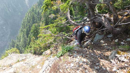
Given how good the trail up Blanshard Needle was I was really expecting the similar type of trail going up the north side of Alouette Mountain. Unfortunately that did not come true as we got ourselves disoriented in the bush. Quite a few 4-letter words were flying around again but at least this section was not long. About 50 vertical meters of pulling up on “west coast 3rd class bush scramble” we arrived at the broad summit of Alouette Mountain. The view looking back at Blanshard Needle was crazy and I’m glad we made this loop option.
Into the thick bush Vlad was still smiling
After bashing our way up we finally reached the summit of Alouette Mountain
Looking back towards Blanshard Needle was inspiring and satisfying
We paid close attention to the GPS getting down from Alouette Mountain. Getting lost here would not be an option and would put us into an epic so we must find the trail. After a few backtracks we rationalized that the trail must descend into a rocky gully feature somewhere on the NE side. We checked it out and after about 20 meters down we found the path an flagging so it’s all good. There’s one boulder field to negotiate lower down which was pain in the ass but otherwise it’s a cruise sailing down to Alouette/Evans saddle. Vlad has done Evans Peak and I had no particular interest in wasting more energy for that small bump so we resumed the descent down the trail. About 700 m must be lost on the steep, knee-crushing Evans Peak trail and wearing the stiff mountaineering boots was particularly not pleasant. By the time we finally hopped back to the parking lot I felt completely beat.
We had to search around to find the trail down…
A painful boulder field…
Finishing the boulder field
The trailed descent… For more than 1000 vertical meters…
Finally back to the west canyon trail… Almost done…
I had no idea how I was going to pull off a serious 11,000er immediately after but at this point I just had to go home, sleep and hope for the best. It’s a great remind that even a small peak in BC west coast can turn into a fairly sizeable day and adventure. Unlike the Rockies or the Cascades there’s very limited condition updates in SW BC which means you just have to show up, pay your blood and let the adventure unfold itself.
