Mount Weart
October 23, 2015
2835m
Garibaldi Provincial Park / Whistler, BC
The gem of Wedgemount Lake area at roughly 20 km north-east of Whistler boasts two of the highest peaks in Garibaldi Provincial Park – Wedge and Weart. While the aesthetic route (NE Arete) up the highest peak is a classic snow climb often done in late spring, the standard route up the second highest peak does require dry conditions at least for the final summit ridge. The approach is via the popular Wedgemount Lake trail – not a terribly long one (2-3 hours) but fairly steep and does require 1000+ meters of elevation gain. This October has been warmer and drier than normal for most of the province and with some fair weather for this past Friday and Saturday I figured I had to go high. The plan was to ascend Mt. Weart on Day 1, traverse Mt. Cook to Mt. Moe on Day 2 and possibly bag Parkhurst and Rethel on Day 3 before heading out assuming the weather could hold that long.

Mt. Weart, Mt. Cook and Mt. Moe from Wedgemount Lake. GPX DL
Up by 4:30 am at home I was soon driving northwards along the winding Sea-to-Sky Highway towards Whistler. The final 2 km along the Wedge Creek FSR was in a good 2WD shape and I had no issue making to the trail-head. Due to some construction work the lower portion of Wedgemount Lake trail (and the parking lot) has been relocated further to the north. The new trail was in a good shape and brought me up the steep coastal rainforest at a steady pace. There wasn’t much to describe about this 7-km approach except for a slippery boulder field followed by a boggy section at roughly 2/3 of the way up, and the final 200 vertical meters being quite steep by hiker’s standard. Two park rangers were working on cleaning the shelter and the outhouse and I continued further along the trail down to the lake shore. There were quite a few nice pads and I picked a scenic one to set up my tent.
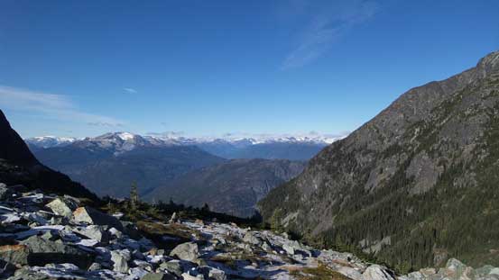
Almost made to Wedgemount Lake, looking back
A closer look at Rainbow Mountain across the valley
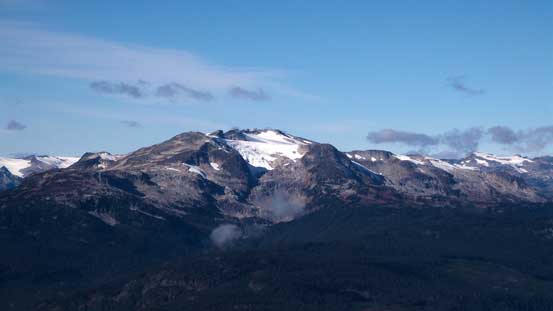
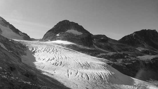
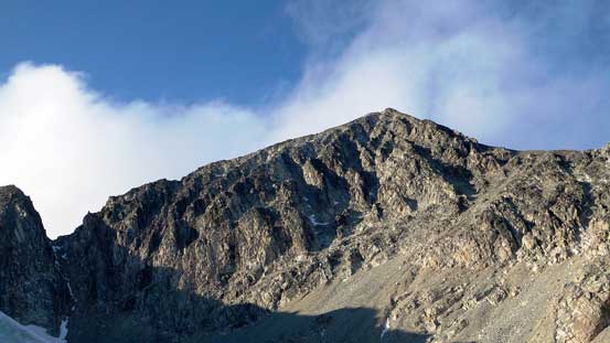
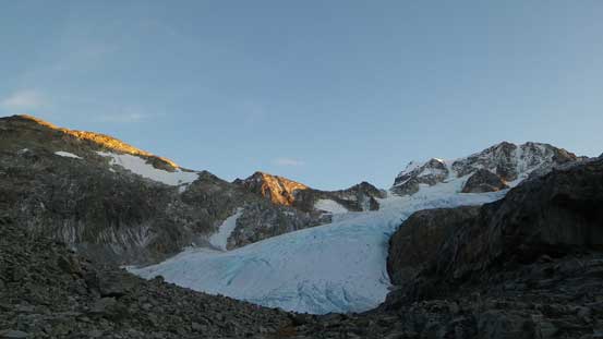
Mt. Weart with Armchair Glacier – my first objective

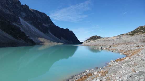
The classic shot of Wedgemount Lake
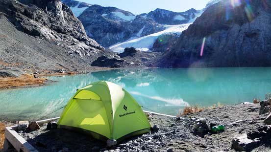
My tent and Wedgemount Lake
After dumping all of the unnecessary loads I resumed the ascent. The first section was following a good path contouring around the lake to the toe of Wedgemount Glacier where ice chucks were calving into a small tarn. I didn’t have much time to investigate this glacier and instead I followed more-or-less the fall line veering climber’s left all the way into the “lower basin”, staying left of the stream. There’s one cliff band towards the top that I scrambled through some rock steps (marked by cairns). The portion between “lower basin” and “upper basin” had some of the worst scrambling on this mountain. I went up initially to the left then did a rising traverse back to the right on very loose rubble and boulders, and with good perseverance I made to the “upper basin” and a frozen tarn.
Circumventing Wedgemount Lake

At the end of Wedgemount Lake, looking back
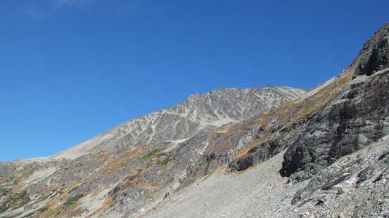
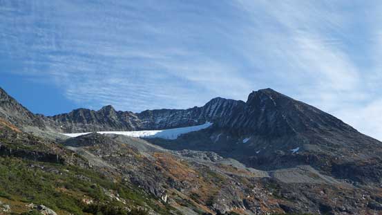
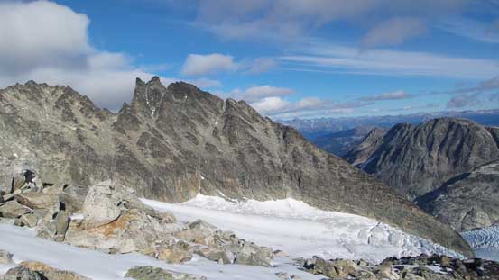
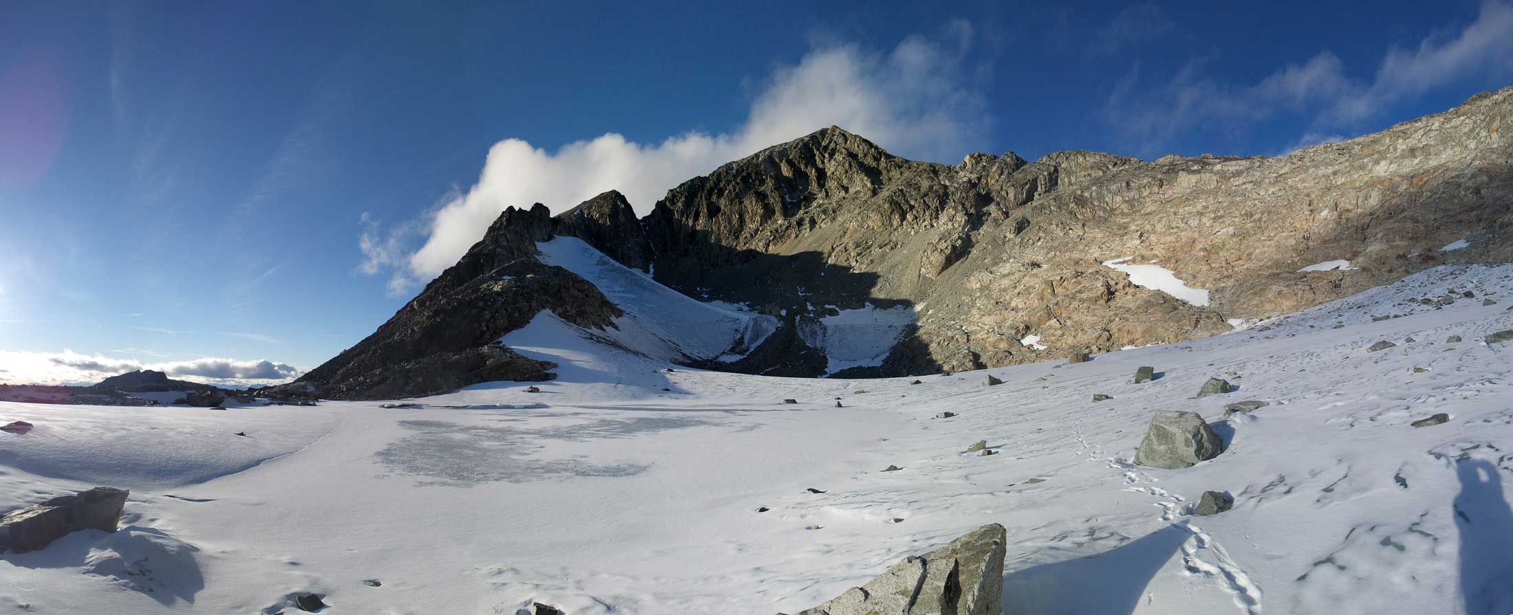
The uninteresting Mt. Cook will be my second objective in this trip
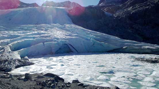
The toe of Wedgemount Glacier

My route ascends this valley beside the glacier

Another look back towards Wedgemount Lake
Wedgemount Glacier flowing into the Lake
Parkhurst Mountain looms behind the Glacier
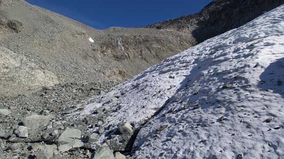
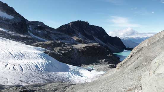
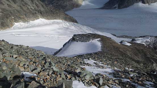
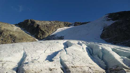
There’s another glacier by this lower basin

Ugly terrain between the two basins
The “double-glacier” shot

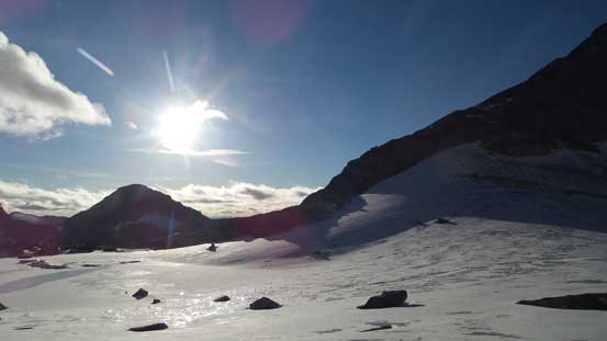
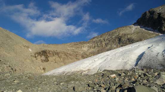
A frozen tarn by the upper basin. Note the ice arete behind
There’s a glacier leading down from climber’s right side into this frozen tarn and I had to step on the ice no matter what route I took. Thankfully there’s a layer of soft snow giving me a tiny bit of friction so that I didn’t have to take the crampons out. Up the final head-wall I followed Matt Gunn’s route in this scramble book – up left then traverse back right along a ledge. The rock was slightly better than the section I just ascended, but not by much. Good thing was that the views kept improving so my mood was still high especially upon seeing the entire stretch of Weart Glacier. The final slog up the SE Ridge was a grunt on again, boulders and rubble, but at least not nearly as loose.
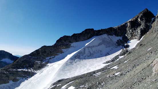
The sexy Ice Arete on one of Mt. Weart’s sub-peaks

Oh the ugly slog up the final headwall…
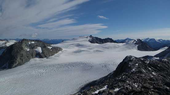
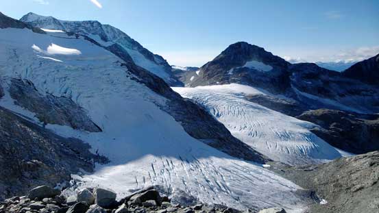
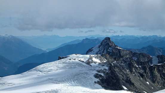
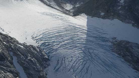
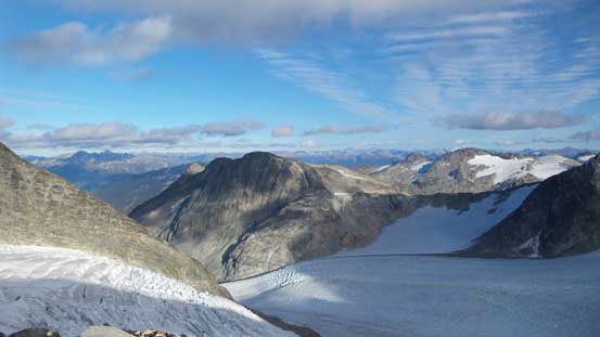
Cresting the SE Ridge, I got to see this expansive view of Weart Glacier

Icefalls!!
Probably my favourite panorama from this trip. Weart Glacier. Click to view large size.
I got to see The Owls for the first time

The SE Ridge. Not very exciting. Just slog…

The NE side of Mt. Weart

The bulky Wedge Mountain is one of the highest peaks in SW BC
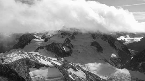
Unfortunately about halfway up the SE Ridge some low clouds moved in obscuring my views. The summit of Wedge Mountain got soaked in and so did the view towards Pemberton Valley. I took a lengthy break on the summit but there’s no sign of improvement and eventually it was the coldness that forced me to start heading down…
Looking down at the SE Ridge
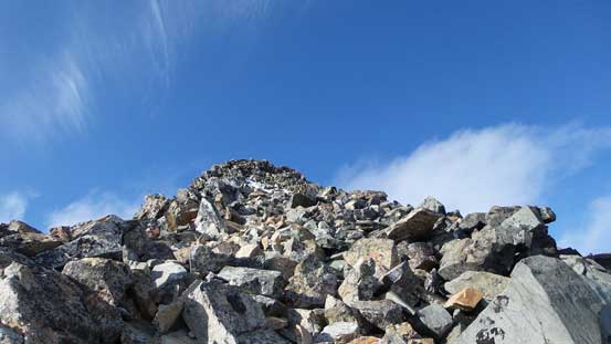
Almost there!
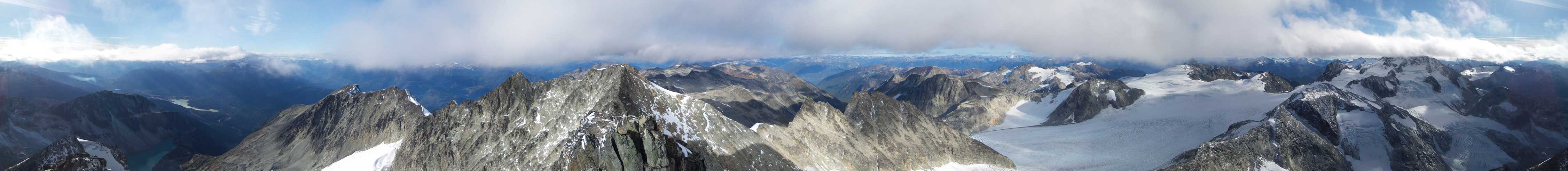
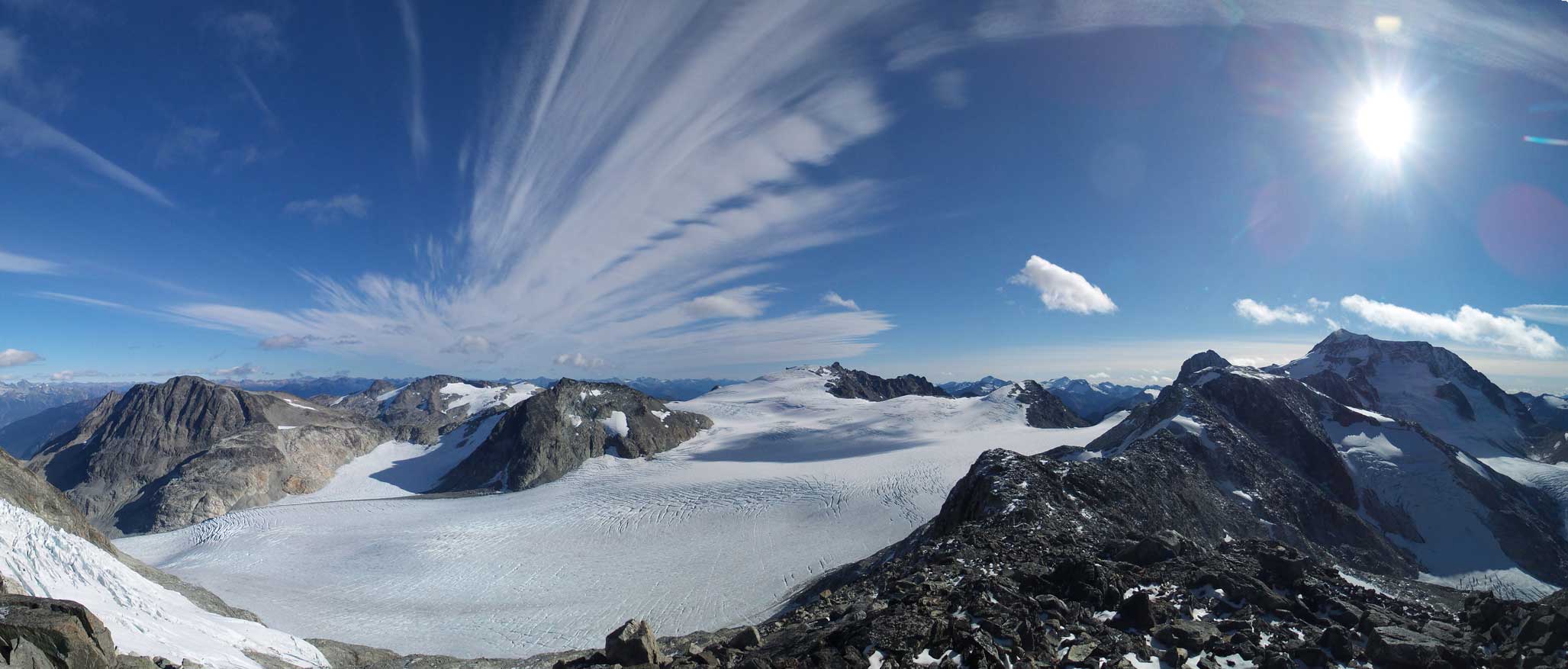
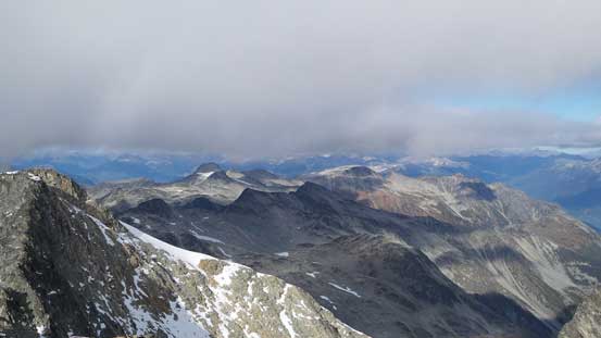
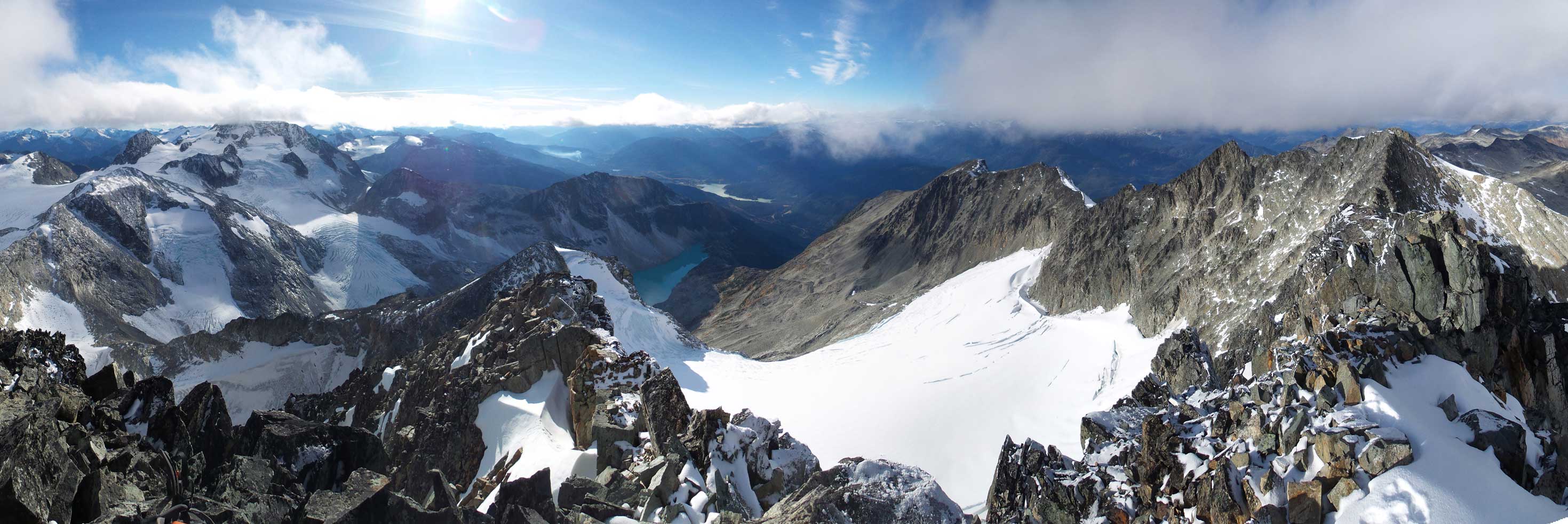
Summit Panorama from Mt. Weart. Click to view large size.

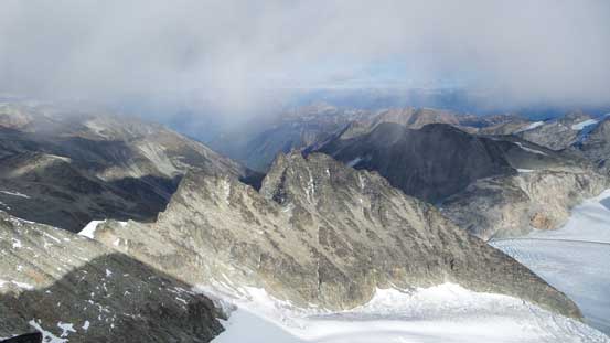
The jagged ridge traversing towards the lower North summit

Looking down towards Mt. Neal (foreground) by Needles Glacier
Wedge Mountain

Rethel Mountain and Wedgemount Lake

Mt. Cook
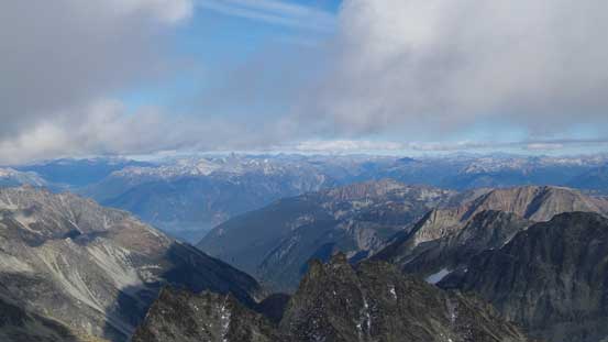
Looking North down Ure Creek towards Pemberton area
The Joffre Group – Slalok (L) and Matier (R)

Green Lake by Whistler
Mt. James Turner is one of the more rewarding summits by this area
Peaks to the north. Hibachi Ridge left of center

Nivalis Mountain by McBride Range. Behind way in the distance is Mt. Baker

Mt. Sir Richard on the left skyline. Lesser Wedge Mountain in foreground (R)
Looking down at The Owls

Another look at Wedge Mountain. Its NE Arete at center
The very crevassed Wedgemount Glacier
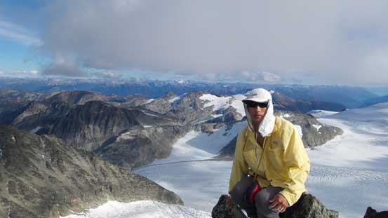
Me on the summit of Mt. Weart
Another panorama from the summit. Click to view large size.

One more panorama. Click to view large size.
I retraced my way down the SE Ridge and then into the upper basin. And just as other trips, weather started to improve as soon as you started going down.. Oh well… The section between upper and lower basins was as shitty as I remembered from the ascent, but going downwards was still easier and much faster. The rest of the return back to camp was uneventful and as the sun getting low I got to enjoy some nice evening views.

Time to head down

One last look at The Owls

Lesser Wedge Mountain isn’t a small peak itself…

Looking down the steep S. Face into the bowls
One last look at Weart Glacier. Mt. James Turner behind
Oasis Mountain is this broad rocky summit

Peaks by Duffey area – the Interior side of Coast Mountains
Another shot of Wedge Mountain
The day is short…
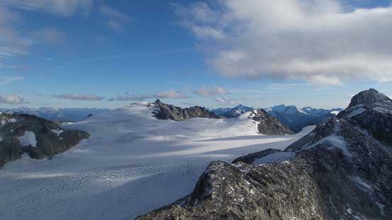
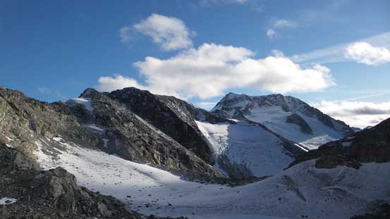
Panorama of the frozen tarn in this upper basin. Click to view large size.
Looking back towards the summit

The upper glacier
Down to the toe of this glacier
The same glacier, in this lower basin
Started to see Wedgemount Lake again
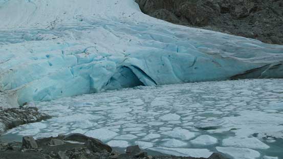
This glacial tone and the tarn with icebergs
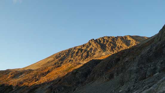
Evening glow on Mt. Cook
Evening glow on the tip of Wedge Mountain
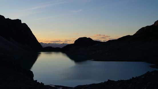
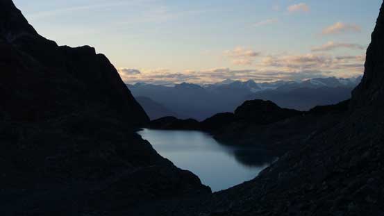
Dusk over the horizon
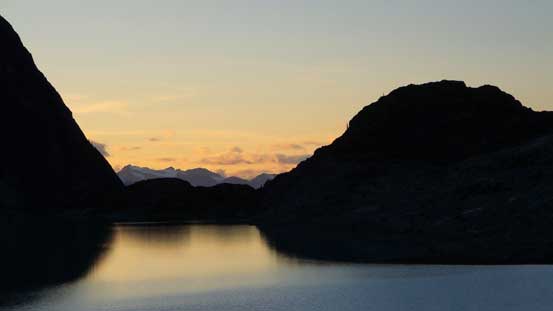
Another shot of the dusk
The evening was peaceful but quite cold. I got about 12 hours sleep and rested pretty well. The next morning I was up by about 8:30 am and it’s time to head up Mt. Cook and then Mt. Moe.
