Crowsnest Mountain
July 1, 2012
2785m
Crowsnest Pass, AB
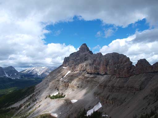
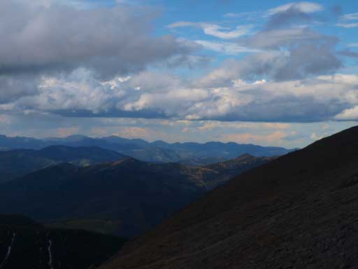
On the second day of this past Canada Day long weekend Eric and I woke up under some questionable weather. Well, it was only “partly cloudy” towards east, but looking west it was already soaked in. We had car-camped at Turtle Mountain’s trail-head near the Frank Slide and we were looking for a reasonable day-trip objective nearby. Thankfully the weather cleared up by noon. Given the fact this was our first time visiting Crowsnest Pass the biggest prize was obviously Crowsnest Mountain itself. This Crowsnest’s icon is easily the most photographed peak in its vicinity and the normal route is a mere “moderate scramble” when dry.
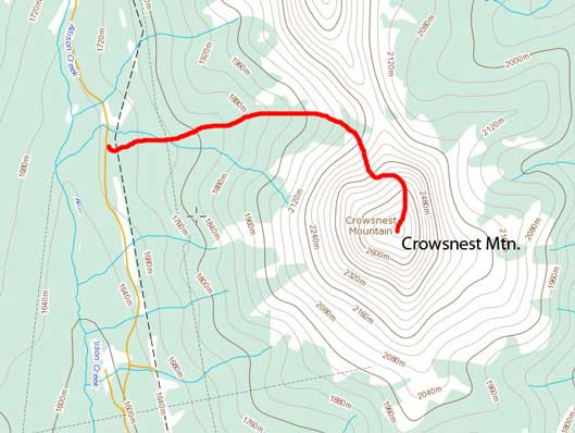
Crowsnest Mountain scramble route
We found Allison Creek Road following the direction given in Alan Kane’s Scrambles in the Canadian Rockies. To our surprise it was actually paved (for the first few kilometers anyway). After turning gravel the road had become heavily potholed… Further up, there was a water bar that required quite a bit of clearance. I didn’t want to risk it with my low clearance 2WD so added about 2 km of walking (one way) to the trip. Thinking positively, we didn’t need to walk up the entire road, so it wasn’t the end of the game…
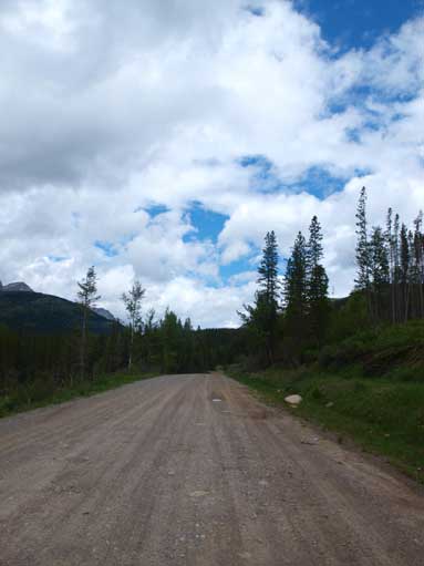
Walking up Allison Creek Road
The crux was to find the correct trail-head. Without all the fancy GPS devices this wasn’t an easy task. We managed to find a clear cut about 25 min into the trip, but according to So’s trip report there’s supposed to be an official hikers’ sign. We rationalized that this wasn’t going anywhere so backtracked to the Allison Creek Road. At about 200 m down the road we found another clear cut which looked more or less like a trail. Good thing this was the correct trail, as we found a hiker’s sign about 200 m up the trail. This trail eventually joined the cut line that we just passed by… Well, sometimes it’s better just ignore other people’s direction and trust your own sense, maybe..
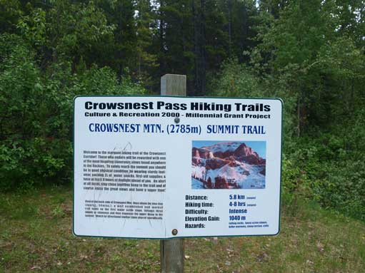
The Trail-head
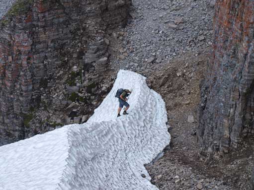
This trail/cut line led us to the treeline with several stream crossings on the way. Upon reaching treeline, we managed to follow a beaten path to a snowfield. The snow was not too hard so we could kick step fairly easily and the ice axes weren’t required on this day. There was a group of hikers going up a wrong gully. While watching them struggling up, we followed the correct route without problem. These three hikers turned around soon after realizing their mistake, and we managed to catch them up at the entrance of the correct gully. Two of them were apparently under-equipped and I guess Crowsnest Mountain is a popular scramble for inexperienced scramblers just like Temple or Cascade.
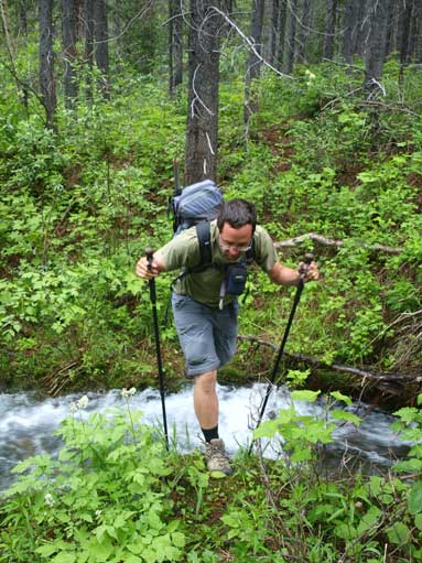
Eric crossing a stream

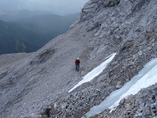
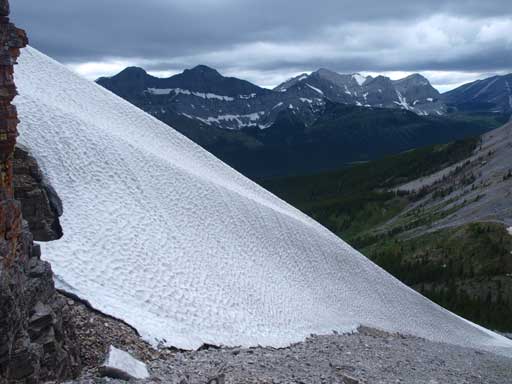
Sometimes it’s easier to walk on snow instead of scree
The impressive Seven Sisters Mountain
Eric just finished his snow line. I was faster on my scree line.
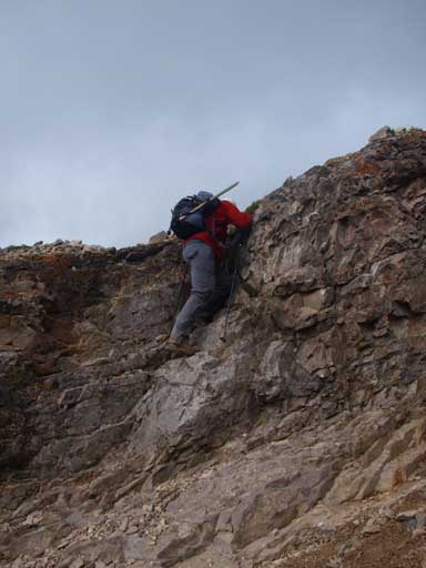
The gully was pretty long. Near the top, a chain led us up a downsloping slabby section. Without the extra bit of aiding I would rate this part a “difficult scramble”. Topping out of the gully, the rest of the route was obvious. Just pick up one of the beaten paths and you will stand on the summit half an hour later.
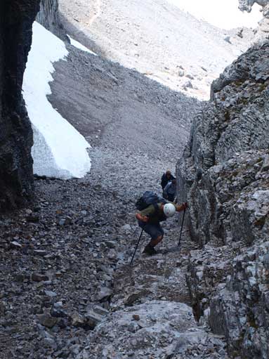
The start of this gully. Note the two guys behind us

Another look at this big gully
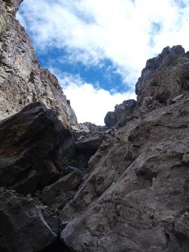
This is looking upwards

There is a fixed chain at the crux.
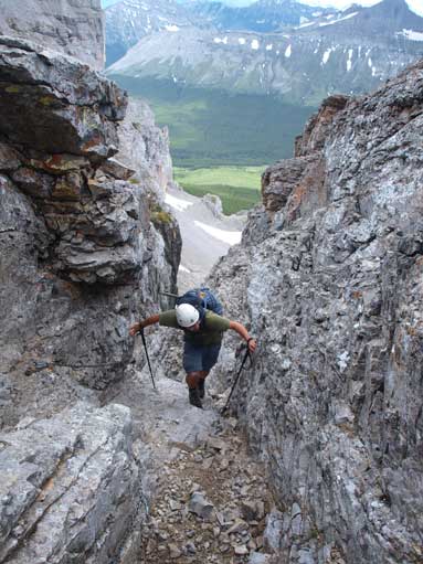
Still a bit of hands-on scrambling after the crux
Weather moved in and we had to add layers.
We arrived at the summit under an overcast sky. Those three scramblers joined us on the summit about 20 minutes later and a storm soon moved in. We were treated with blizzard conditions for a while. They got cold very soon and started the descent, but we decided to wait for views. Luckily, some blue skies arrived after the storm. We stayed on the summit for at least 2 hours soaking in the views. The clouds added up to the scenery. I thought it was even better than just a bluebird sky (more dramatic). Eric was particularly interested to see the summit of Mt. Ptolemy sticking out, which was the main reason why we stayed that long.
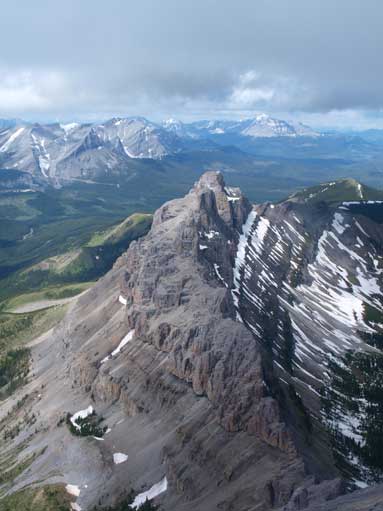
Seven Sisters Mountain
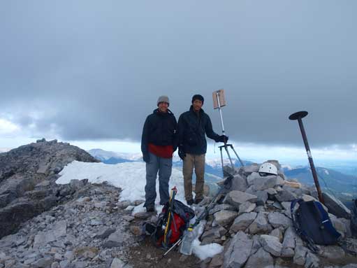
Eric and I on the summit
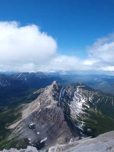
Another look at Seven Sisters Mountain
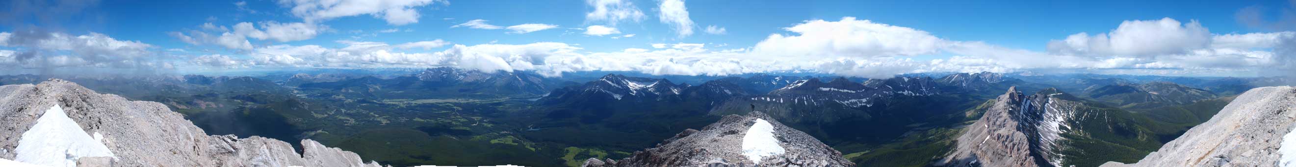
Summit Panorama. Click to view large size
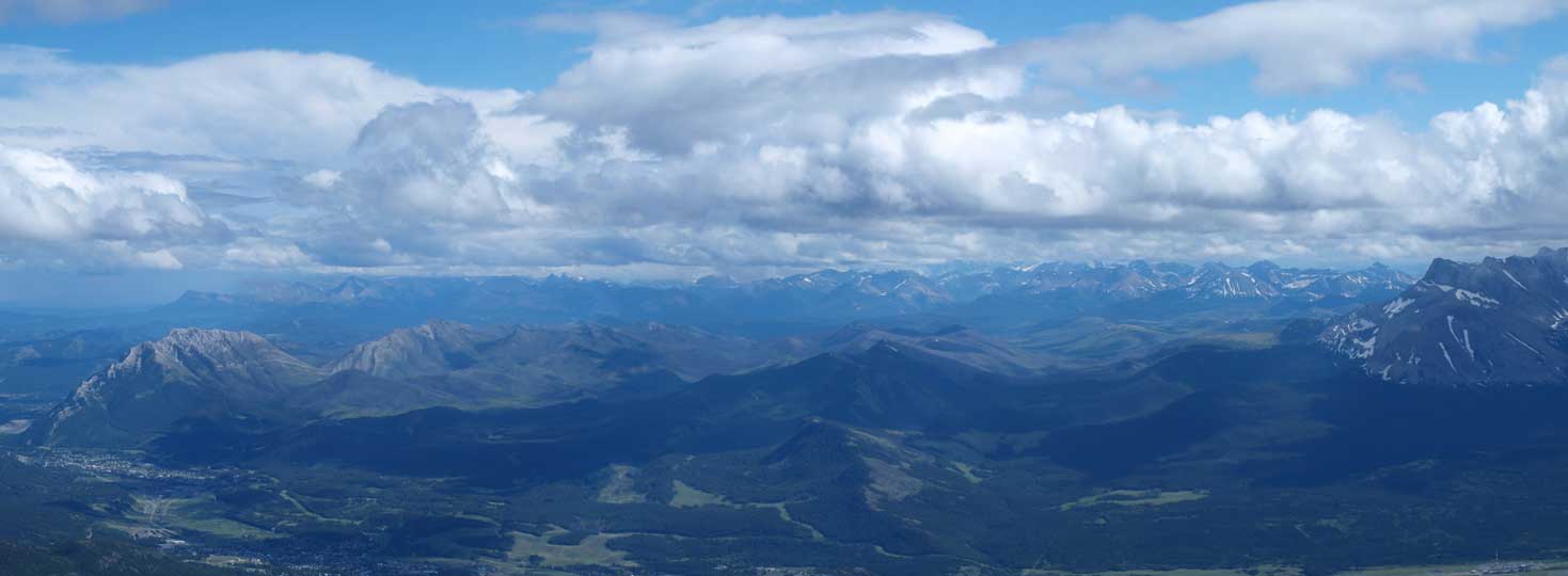
Looking down towards Turtle Mountain and Hillcrest Mountain on left
Looking over High Rock Range. It’s BC on the other side
Looking towards the foothills. We could constantly hear the quad noises from that direction.

Tornado Mountain in the distance

Clouds still building on top of the peaks in BC
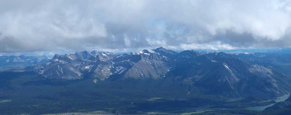
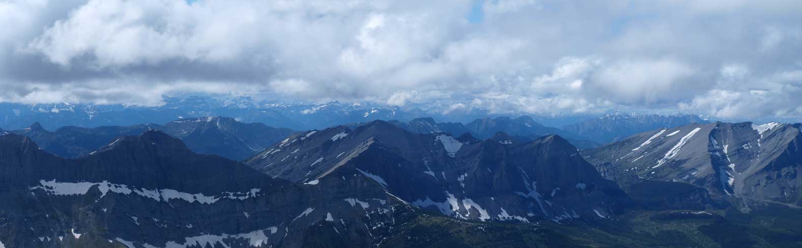
Flathead Range Panorama with Mt. Ptolemy being the highest (right of center)
Descending was fast. Getting down that gully was easier than going up. Eric had a fun boot skiing down that snowfield. I also managed to boot ski that snow field, but in an awkward way. Just like the actual skiing I felt extremely tiring on my upper leg muscle groups. Once into the woods we followed the cut line all the way down instead of just retreating our ascent route.
Eric down-climbing some fun stuffs near the crux
We would soon merge into the snow line

Looking back at Crowsnest Mountain
Overall I have to say that we surely got lucky with weather to knock off Crowsnest Mountain on our first trip in this region. Given the questionable forecast I wasn’t expecting this to happen. While it’s certainly one of the biggest mountains out there the trip wasn’t nearly a “long day”, thank to Allison Creek Road that brings one hundreds of meters above the Crowsnest Pass’ elevation. With some sunshine in the forecast for the next day Eric and I figured it’s time to head down to Waterton to see what we could get…

Hi there,
Good morning ! we plan to hike Crowsnest Mountain on 9 June, can I ask you one question ? are there still lots of snow on the mountain at that time ? I know the trail is pretty steep, is it ok to climb the mountain on 9 June ?
Thanks.
Ming
There’ll definitely have snow in the gullies. I’d carry ice axe and crampons and start very early when snow is solid. Basically expect it to be a mountaineering ascent in early June.