Mount Forddred
April 15, 2020
2169m
Hope / Sunshine Valley, BC
Mt. Forddred is one of the taller summits in the immediate vicinity of Sunshine Valley not far from Hope, but itself is also a rather insignificant summit overshadowed by Mt. Payne, Mt. Rideout and Silvertip Mountain to the south. However, unlike the taller neighbours to the south, Mt. Forddred is a winter/spring objective and in fact, due to the deactivated and overgrown nature of the logging road in Potter Creek drainage this access is only doable with a thick snowpack covering the mangled alders. I’ve heard parties were forced to bail even in February as the alders were really, really bad. This means the only time in a year to do Mt. Forddred, and the nearby Mt. Green is from late March to around late April, the height of spring season when the snowpack is the thickest. My friends Al, Mel, Katie and Winnie made an ascent of this peak on the Monday of this past Easter long weekend and reported fabulous conditions. I talked to Alex immediately after hearing their success and we agreed to do the same two days later, on Wednesday. The weather would be warmer than Monday but looked like the consistent melt-freeze cycle we’ve been seeing recently would resume.
I had the commitment to get back home before 7 pm in the evening and our plan was to do both Mt. Forddred and Mt. Green. Based on Al’s report we estimated the round trip to be around 10 hours moving at a fast pace, and after some backward math we determined it’s essential to leave Vancouver no later than 4:30 am in the morning. We made to the start of Sumallo River Road in Sunshine Valley in under 2 hours. The road was still fully snow covered so we had to park at the small pull-out before the main bridge.

Mt. Forddred and Mt. Green via Potter Creek. GPX DL
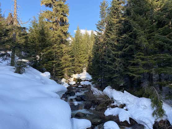
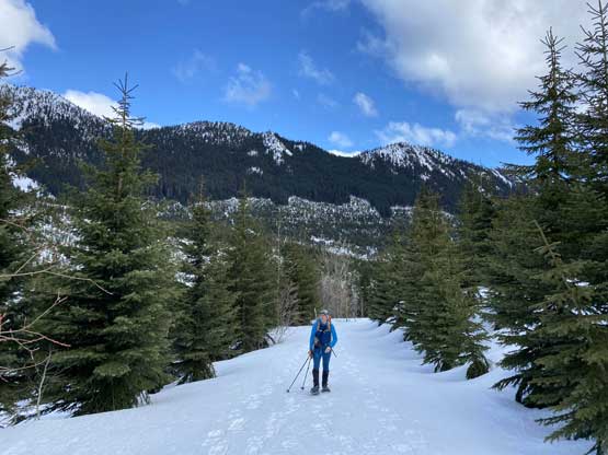
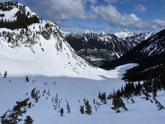
The first kilometer or so up the main Sumallo River Road was a blast and the next thing we arrived at the creek crossing. Because it’s so close to the parking lot I brought my neoprene socks and shoes for packrafting and the result was that my feet weren’t cold at all. The water was knee deep but not moving fast. Beyond the river crossing we followed Al’s group’s tracks onto the deactivated Potter Creek Road and in no time we had to don snowshoes. The overnight freeze was not too good down at this elevation, that we experienced some occasional punching through. However, the condition on open areas (without tree coverage) was bomber. The road climbed on the north side of Potter Creek steeply that we actually had to use the heel-lifts of the snowshoes to facilitate the uphill travel. The next 1.5 hours or so was rather monotonous and boring. There were alders at a few places but nothing I would classify as “bushwhacking”. We maintained a steady pace and made to the very end of the logging road in 2.5 hours after leaving the truck.
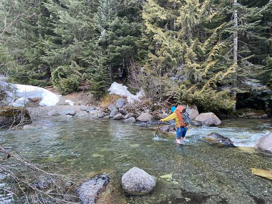
Alex crossing the frigid Sumallo River in the morning
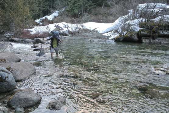
Me crossing Sumallo River. Photo by Alex R.
The second crossing of Sumallo Ridge had a nice bridge on it

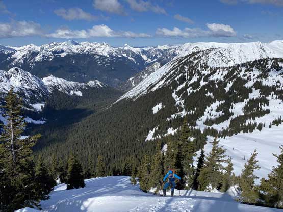
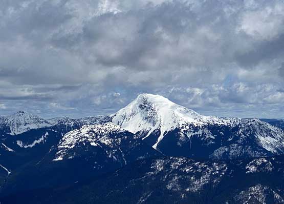
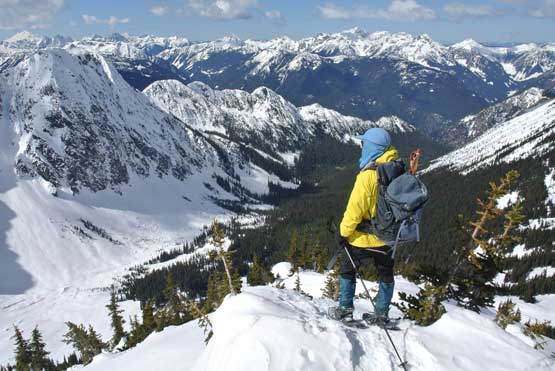
Our first sight of Mt. Green – our second objective
There were alders on the road but with a thick snowpack it wasn’t painful

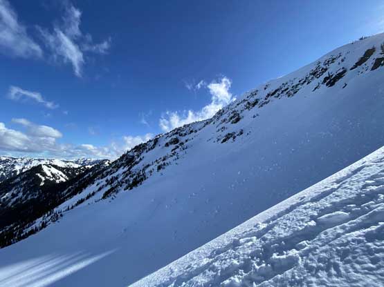
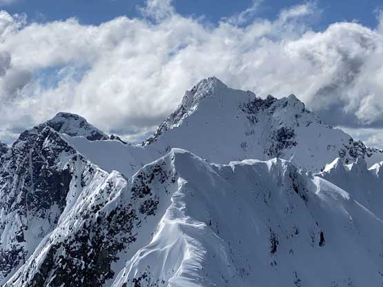
North Buttress of a sub-summit of Mt. Forddred…
Alex arriving at the end of the road
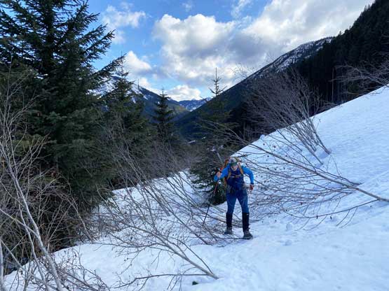
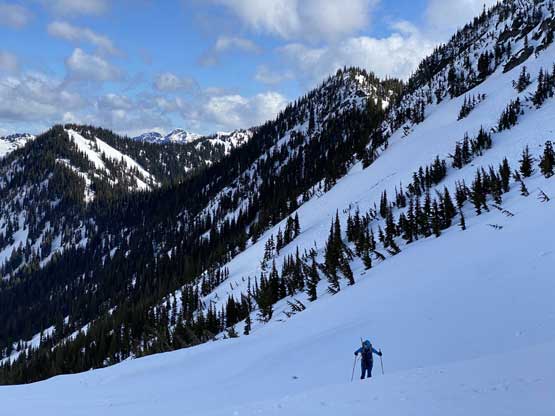
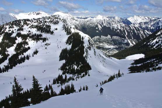
Without doing any lingering we resumed the ascent following the tracks and made the only stop about 200 vertical meters above the end of road, where we donned some sunscreen and layers. It had been a chilly and windy morning and the clouds were moving fast above the peaks. There was a section of steep switchbacks following and then I correctly picked Al’s descent tracks cutting into the hanging valley immediately to the NW of Mt. Forddred, from which we then easily ascended onto the NW Ridge of our objective.

Alex ascending the first of the two hanging valleys above road’s end
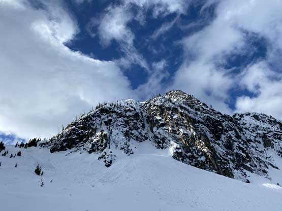
Another photo of that aforementioned north buttress.
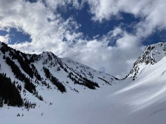
Merging into the second hanging valley now. Our objective ahead
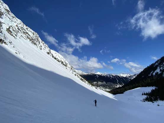
Alex snowshoeing up the second hanging valley NW of Mt. Forddred
Gaining the NW Ridge. Looking back
Alex gaining the NW Ridge of Mt. Forddred
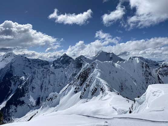
Looking ahead from the point where we gained the ridge
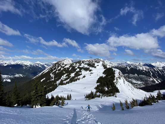
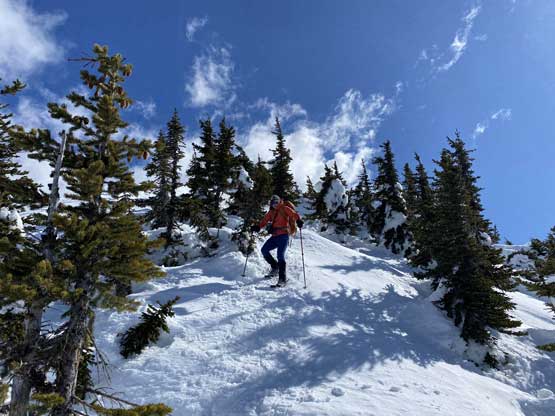
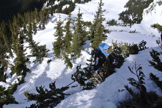
The NW Ridge of Mt. Forddred wasn’t just a plod and rather involves several steep and bushy steps. One particular step required climbing over a horizontal tree using vege belays. We did however, keep the snowshoes on and never felt the need to use an ice axe. A while later we made to the summit with fabulous views as expected. The north faces of Mt. Payne and Mt. Rideout are much more impressive in winter.
Ascending the lower NW ridge. Looking back
Looking sideways across the NW Face
Alex marching up
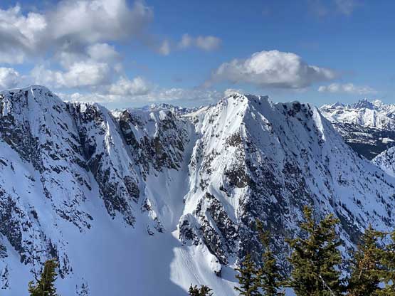
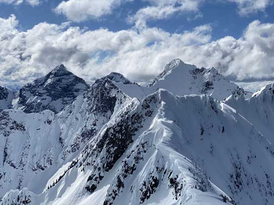
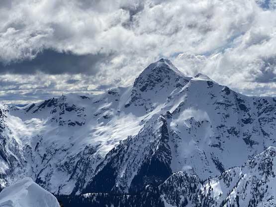
This sub-summit to the south has another impressive north buttress

Alex climbing up the crux step

Alex higher up on the ridge.
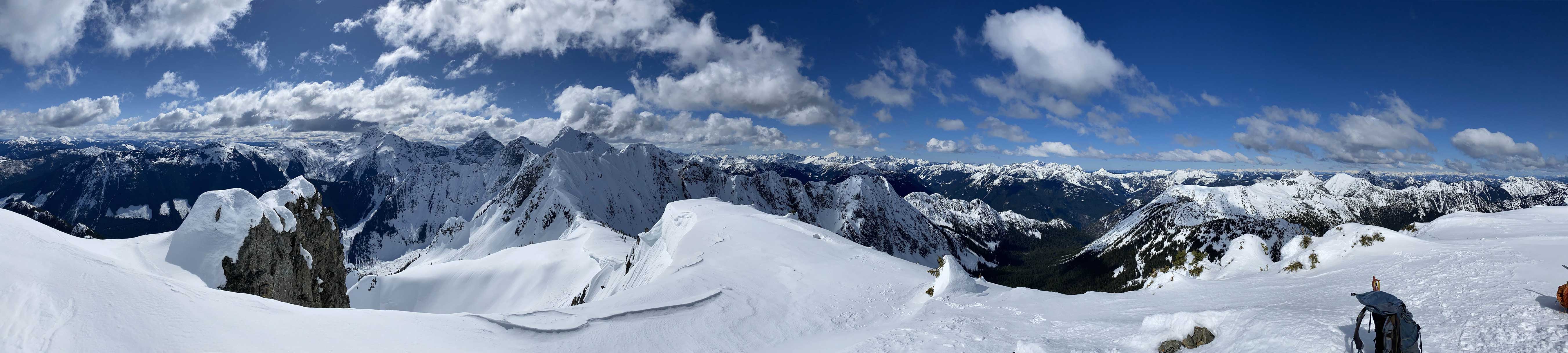
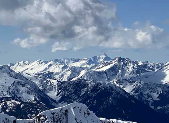
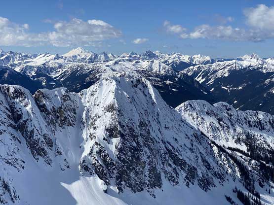
Partial Summit Panorama from Mt. Forddred. Click to view large size.
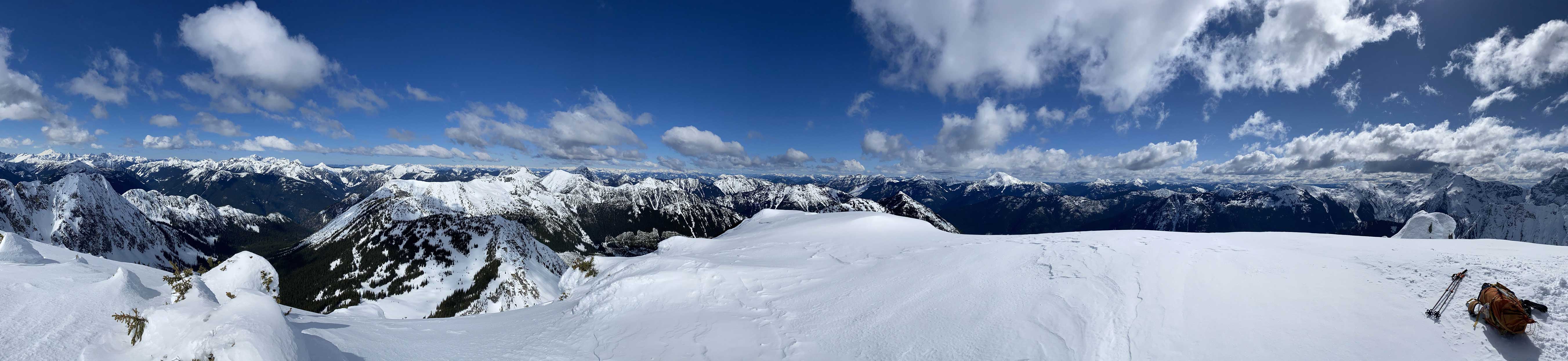
Partial Summit Panorama from Mt. Forddred. Click to view large size.
Mt. Outram baked under the sun
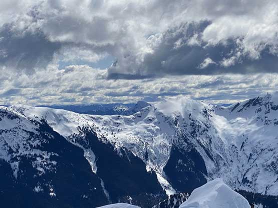
A wider view looking south

A closer look at the north face of Mt. Rideout
Mt. Rideout and Mt. Payne with “Cassino Peak” in front
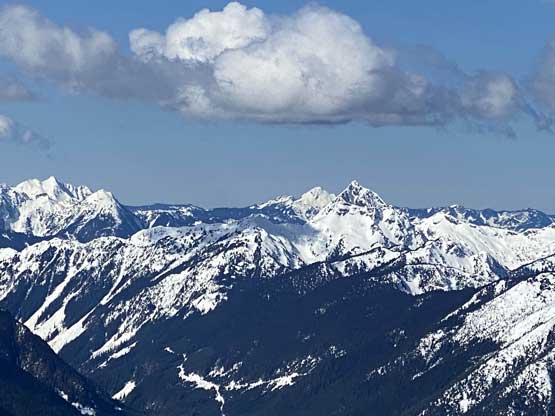
Silvertip Mountain – the northernmost “ultra” in the Cascades
A closer look at Mt. Payne

This is looking over Mt. Coulter towards Hope area
“Rocktip Peak” catching some sunshine
Mt. Dewdney and Snass Moutnain in the distance

This big peak in foreground is Mt. Grant

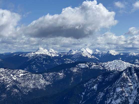
Welch Peak is the highest in Cheam Range
Mt. Williams right of center

Slesse Mountain is such an imposing spire
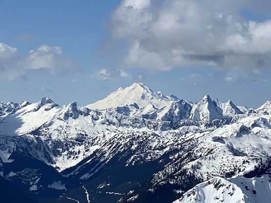
Mt. Baker is the volcano. Mt. Rexford to its right in front
Mt. Shuksan looms behind Mt. Lindeman

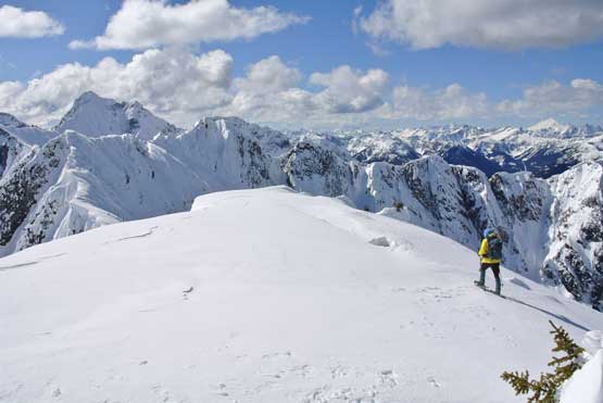
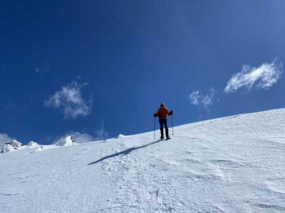
Me on the summit of Mt. Forddred
The ascent had taken us 4 hours 20 minutes so we didn’t linger too long up there. We confirmed the plan to traverse to Mt. Green so after snapping enough photos we soon descended the NW ridge following our tracks. Again, we did not feel the need to use an axe nor to bootpack for those vege belay sections. The down-climbing on snowshoes actually felt easier than on the way up.
Time to head down. Photo by Alex R.
Alex starting the descent
Another look at this impressive unnamed peak
Me taking in the views. Photo by Alex R.
Alex snowshoeing down the steep vegetated zone

Alex down-climbing the crux
Me down-climbing the crux. Photo by Alex R.
Me continuing down the NW Ridge. Photo by Alex R.
In no time we were down to the saddle and looking ahead, we had two major bumps to negotiate before the long south ridge of Mt. Green. It’s going to be a long haul and it sure was. The ascent of Mt. Green turned out to be trickier than anticipated.
