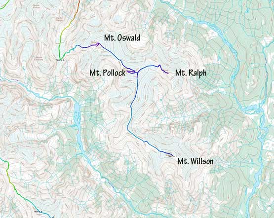
Mount Ralph
July 18, 2020
2527m
Elaho River / Clendinning Area, BC
Mt. Ralph is on the boundary of Clendinning Provincial Park on the divide between Sims Creek and Clendinning Creek. The north side of this peak is heavily glaciated and caught my attention when I did the group of peaks near Overseer Mountain three years ago in the Harrison Hut area. The access of Mt. Ralph is much more difficult than Harrison Hut though with no established trail whatsoever. The fastest way would be to take a helicopter ride, but even so the ascent routes of this peak are undocumented on the internet making some full-on exploratory mission. Alex, Vlad and I did it as the second objective of our 10-day, 18-peak traverse across the headwaters of Sims Creek into the heart of Clendinning area. Earlier in the day we had flown to the summit of Mt. Willson, plodded a long ways due north-west and dropped our ridiculously heavy packs on the south slopes of Mt. Pollock. We were closer to Mt. Pollock than to Mt. Ralph but it actually made more sense to do Mt. Ralph first.
The first day – Mt. Willson to Mt. Oswald.
Alex and Vlad had brought smaller day-packs for the sake of a few side-trip missions but I did not. Vlad’s small pack only weighted 150 grams but Alex’s was an actual mountaineering pack capable to store two axes, so I shared the small pack with Alex and took turns to carry it. From the south-east corner of Mt. Pollock we had to drop 200 meters of hard won elevation to Pollock/Ralph col, and this stretch involved a bit of navigation around a few large sags on the glacier. From the low point we then easily plodded to the col on the lower NW Ridge of Mt. Ralph. This ridge was definitely more difficult than the SE slopes but was the most direct option for our planned traverse route. The summit looked to be 3rd class and we just hoped our sense was correct.
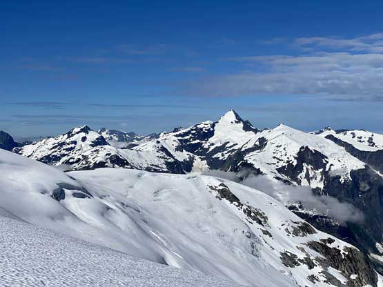
Mt. Tinniswood from the plod towards Mt. Pollock
Plodding towards Mt. Ralph
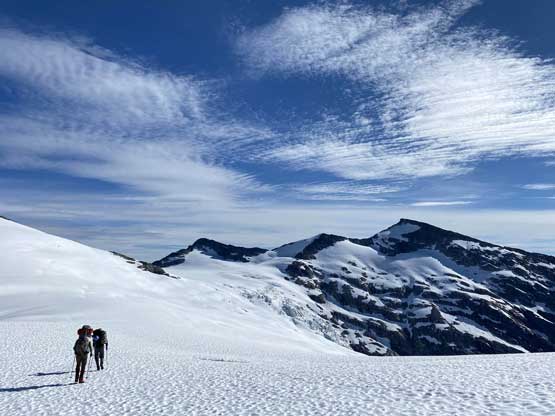
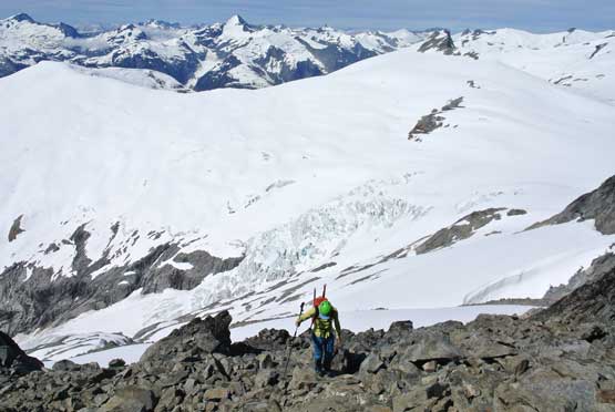
Alex plodding up onto Mt. Pollock’s south shoulder
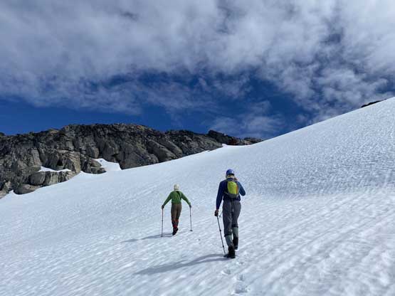
Now plodding towards the starting point of Mt. Ralph’s NW Ridge

Popping out on the ridge, looking at the north side of Mt. Ralph
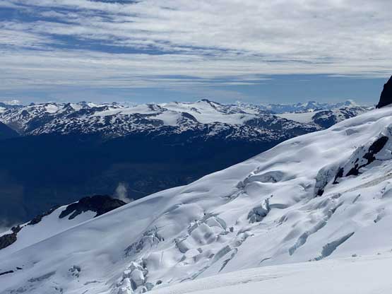
The north side glacier with Torah Peak on Pemby Icecap behind
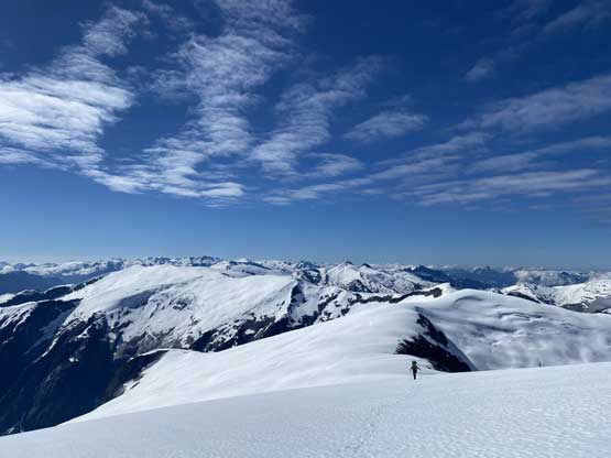
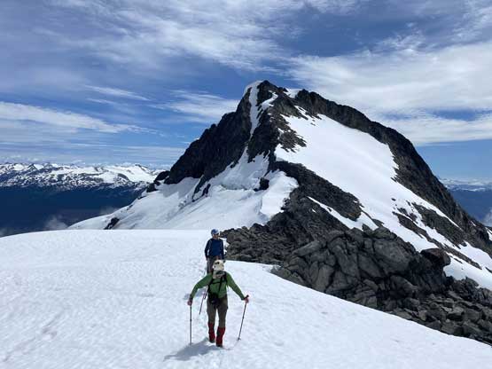
The ridge started off nicely and we could easily stay on either rocks or snow making some fast progress up to a flat stretch. The flat section required some caution with cornices and was followed by a slight dip in elevation on mostly class 2 terrain. Then there came the scramble pitch to the summit, which consisted of some large boulders (sometimes loose), but nothing harder than “easy class 3” that in short time we were on top soaking in the views.

Alex and Vlad ascending that flat stretch on Mt. Ralph’s NW Ridge

Vlad and I on the same section. Photo by Alex R.

At the base of the steep scramble towards the summit

Alex on the typical terrain here
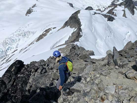
Me approaching the summit of Mt. Ralph. Photo by Alex R.
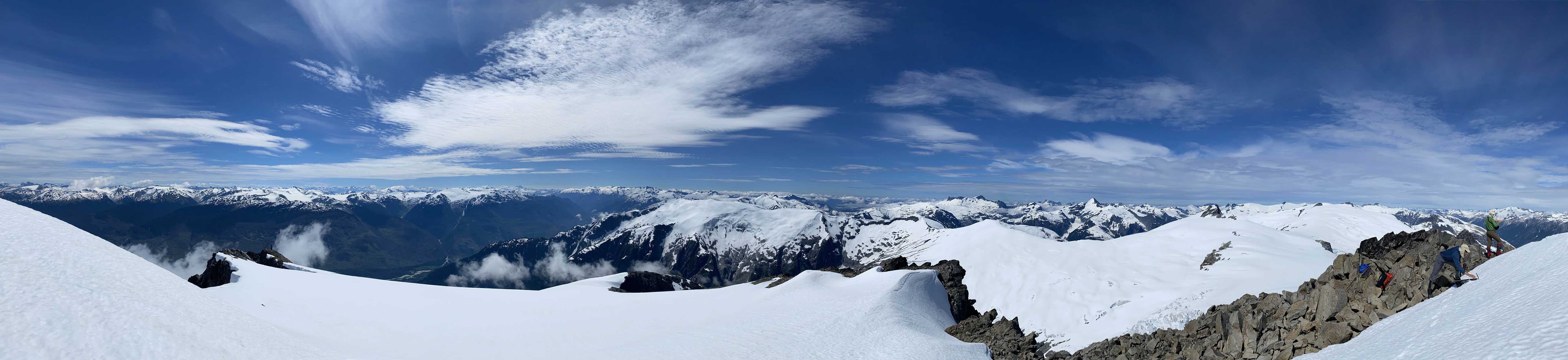
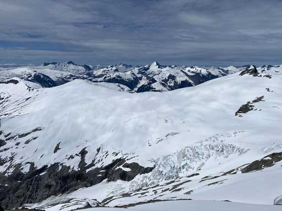
Summit Panorama from Mt. Ralph. Click to view large size.

The north glacier of Mt. Albert
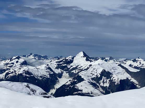
The east face of Mt. Tinniswood draining into Sims Creek valley
The north glacier of Mt. Willson in the foreground

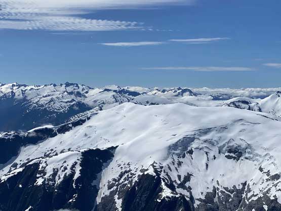
The deep Elaho River valley draining into Squamish
Elaho Mountain at the head of Clendinning Creek

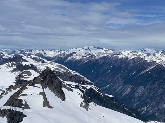
All peaks in foreground are sub-summits of Elaho Mountain, across Clendinning Creek
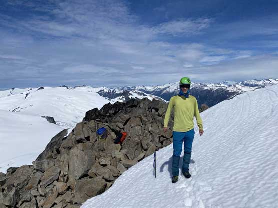
Me on the summit of Mt. Ralph

Our group shot on the summit of Mt. Ralph
We did not linger too long on the summit for obvious reasons that we still had a long way to plod on this day, so quickly retraced our route back down the ridge. We could have taken some short-cuts here and there but just opted for the known. The 200 m elevation regain back to our packs wasn’t as bad as I thought, mostly because at the time I was not carrying anything. And then there came Mt. Pollock being our next objective.
Vlad descending the summit block
Some fractured glaciers in the foreground. Mt. Tinniswood behind
Looking back at the NW Ridge of Mt. Ralph

Me and Vlad now plodding down the never-ending snow and glacier.
