Volcán Imbabura
December 28, 2022
4621m
Otavalo, Ecuador
The volcano of Imbabura is visible from anywhere in the vicinity of Ibarra and Otavalo and boats over 1500 m prominence making it one of the ultra-prominent peaks in Ecuador. The elevation of this peak isn’t tall by this area’s standard so it can be served as an acclimatization objective. Adam and I decided to climb Imbabura after Chimborazo etc. so by this time we were already well acclimatized. This was done on the 2nd day of a 3-day outing to Otavalo area with our private 4×4 driver, Marquito. On the first day we explored a “new route” on Cusín and drove from Quito to Otavalo.
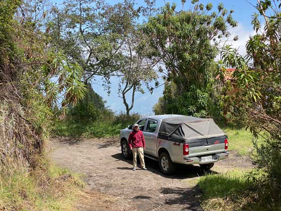
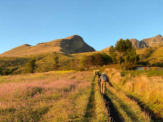
The standard route on Imbabura is a full-day outing with substantial amount of elevation gain and class 3+ scrambling, so we wanted to start as early as possible to take advantage of the stable morning weather. We informed Marquito to wake up at 4 am to be ready to drive by 5 am. The drive from Otavalo to the trail-head on the east side of the peak took over an hour, with the last few kilometers on some increasingly rough roads (4×4 definitely required). We somehow took a wrong road but this proved to be an alternative starting point. We actually drove 100 m higher than the standard trail-head but our route involved walking through someone’s farmlands. Adam and I were worrying about dogs and cows but they weren’t acting aggressively on us. We parked the truck minutes before sunrise and this was shaping up to be one of the prettiest days we had in Ecuador.
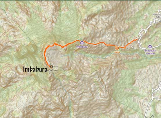
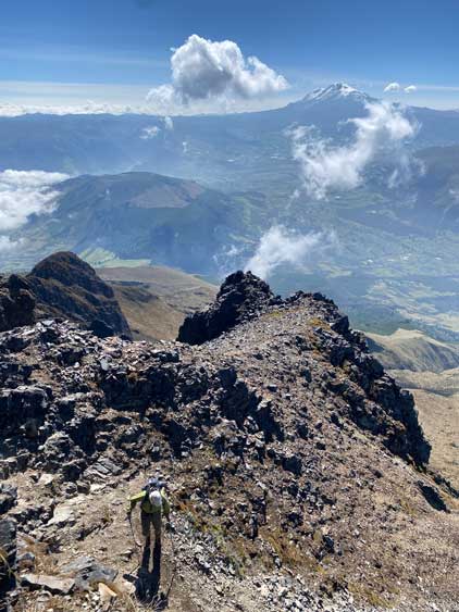
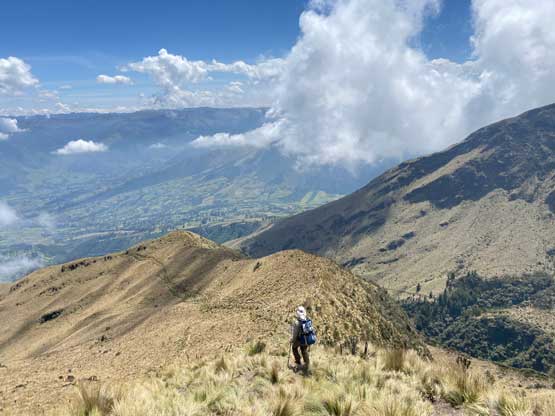
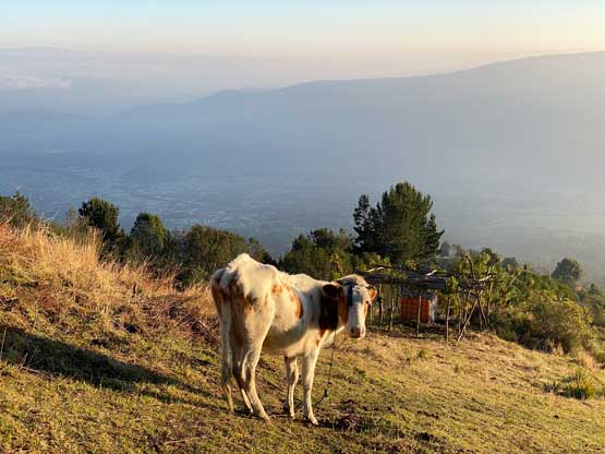
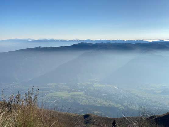
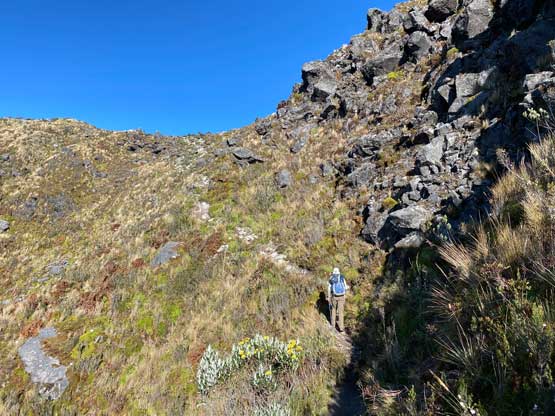
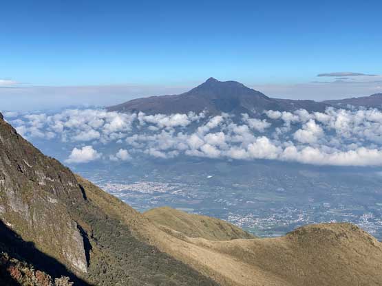
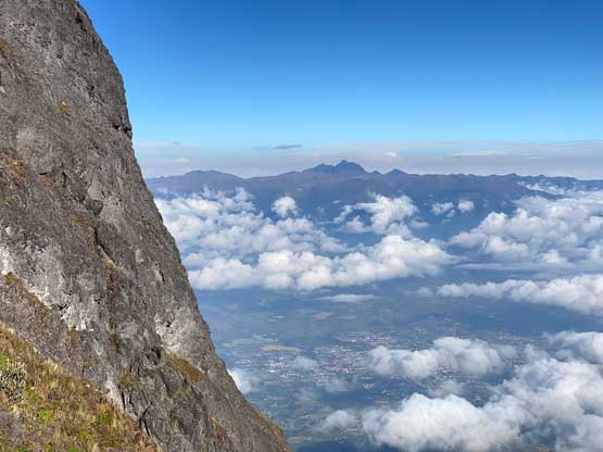
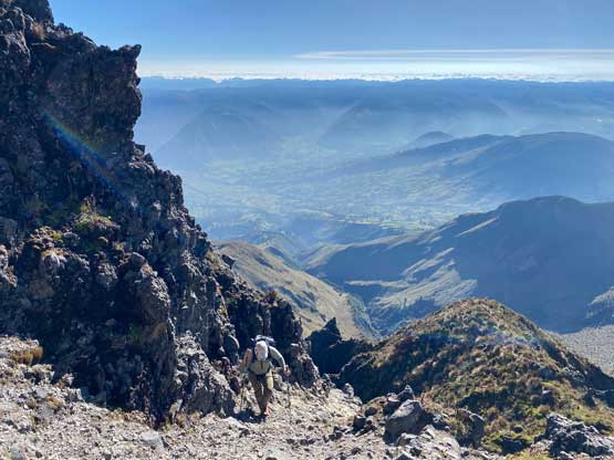
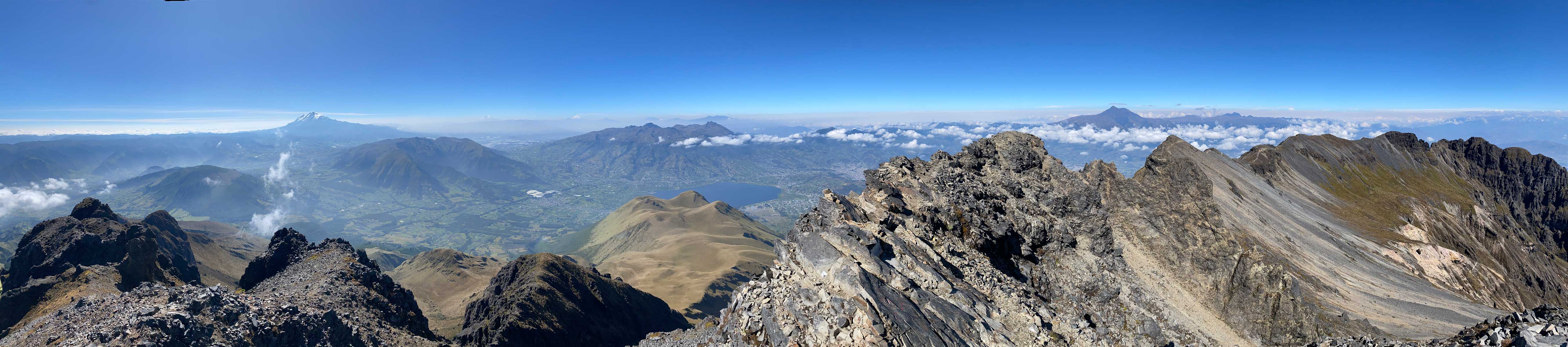
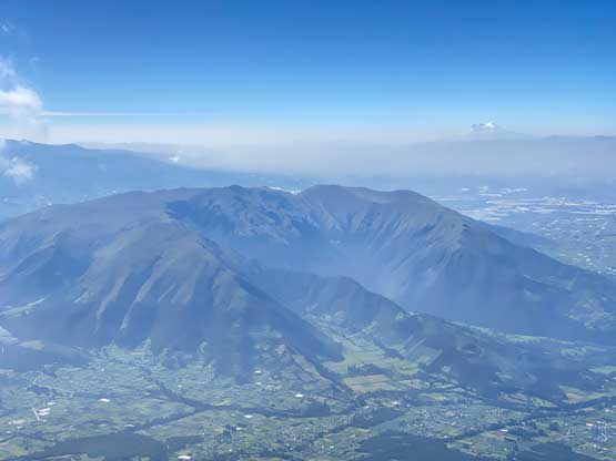
There’s actually a connecting trail from behind the farm house to the main trail so we took that. We had to walk to within a few meters from a cow but the cow didn’t even want to move and just plainly stared at us. This is a rather popular hike and the trail, though very steep at places, is well defined. We gained elevation rapidly. The views behind us was stunning with Volcán Cayambe stealing the show. Above 4000 m we came to the first obvious buttress feature and followed the steep trail to bypass it on climber’s left side and after that we were officially onto the NW/W Ridge system. There were a few more steep rises in addition to some minor scrambling to content with before reaching the so-called “tourist summit”. Where exactly is the “tourist summit” is rather undefined as there isn’t a substantial false summit on this mountain. I assume it refers to the dome-shaped high point (with hardly even 10 meters of prominence) as much more serious scrambling is required beyond that high point.


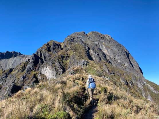


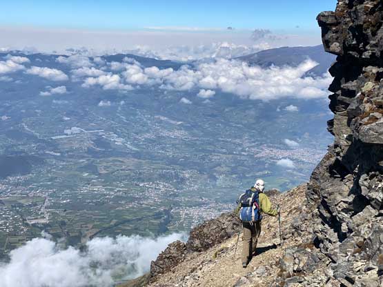
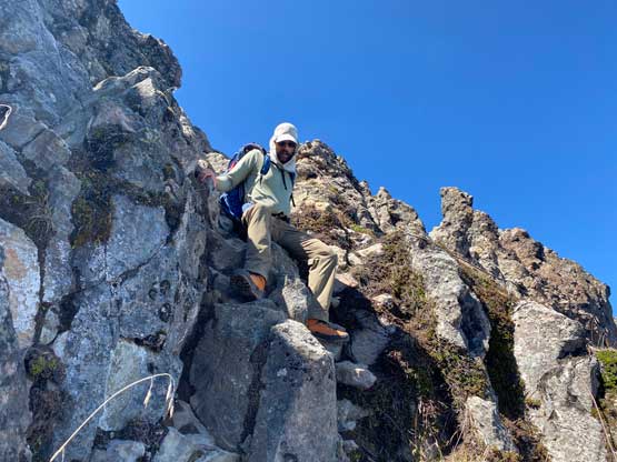
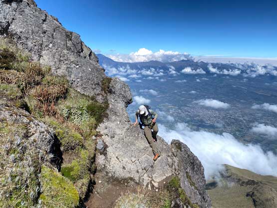
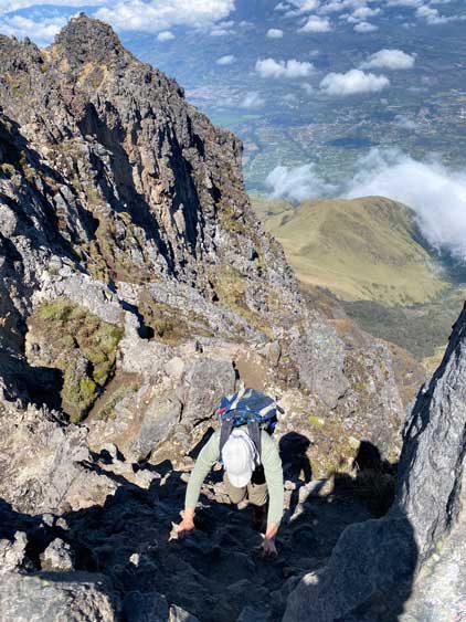
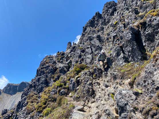
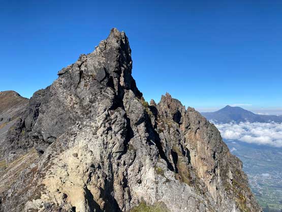
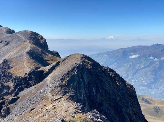
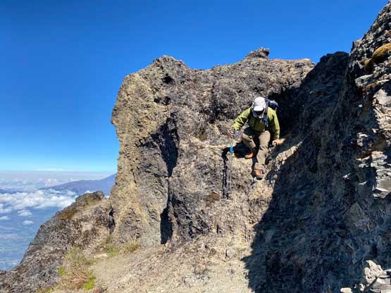
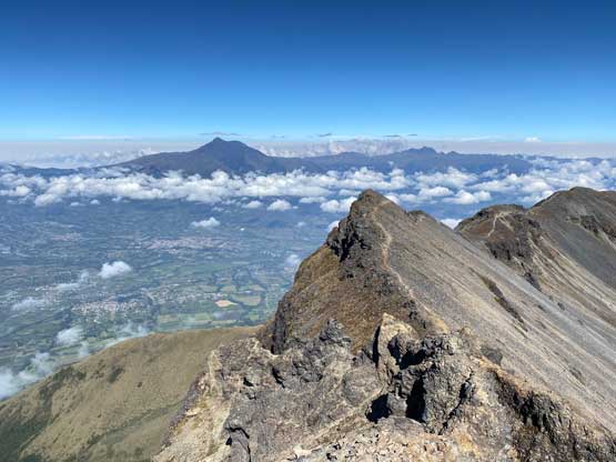
The journey to the true summit involves class 3+ scrambling with some exposure hence most trekkers opt to not go there. For Adam and I it’s either the true summit or “nothing” so we must keep going. There were a series of notches to descend into and scramble out of. The route-finding wasn’t tricky as there’s enough traffic to create some kind of paths here and there, but the exposure and the hands-on moves were definitely not for the averaged hikers. After those notches the trail actually drops and traverses around another bump on the ridge before ascending back onto the crater rim. The rest of the traverse southwards along the rim to the true summit was mostly straightforward except for the final bits. A few more class 3 moves were encountered and the final summit block was attacked from the opposite direction by traversing under some cliffs. Again, there’s a path leading the way so we just followed. This scramble turned out to be a really enjoyable one and the position is also very aesthetic.


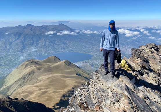
After spending half an hour on the summit we decided to retreat. All we needed was to follow the exact route that we took on the way in. We crossed path with two local scramblers on the crater rim and everyone else we encountered seemed to only aim for the tourist’s summit. The scrambling felt easier on the return mostly because we already knew what exactly to expect. Once picking up the main trail we picked up the speed, but stopped a few times to rest our knees. This was overall a lengthy and steep descent that shouldn’t be rushed in one go. While walking back through the farmland we met a couple on a dirt bike with a dog barking behind. The dog ended up barking at us but didn’t act too aggressively. We let them to go ahead and leisurely walked behind and our round trip time turned out to be 5.5 hours including everything. This was definitely not bad considering the 1300 m elevation gain and the complicated terrain on the upper route. Marquito then immediately drove us back to Otavalo and we chose to have lunch in that same restaurant. The rest of the day was spent mostly resting and some torrential rain came in the evening.