Dreadnought Peak
March 31, 2016
1994m
Watersprite Lake / Mamquam Main FSR, BC
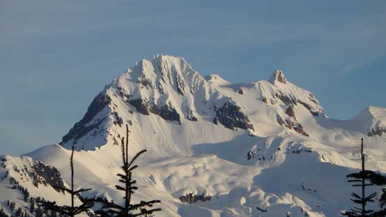
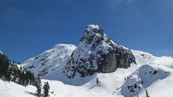
Dreadnought Peak is a somewhat interesting and prominent peak in a group of (unofficially named) peaks by Watersprite Lake. This is one area south-west of Mamquam Mountain and the access has been dramatically improved over the past year thank to the Skookum IPP project. The logging roads were re-graded and a trail has been developed by BCMC. In September last year I did my first trip in this general area and bagged the biggest prize – Mamquam Mountain and ever since that I’ve been looking forward to return to this beautiful area.
Vlad and I had been trying to schedule a trip together for quite a while already, but our calendars never seemed to line up. This time with work commitments I was restricted to just a day-trip on Thursday. We abandoned the idea of making an ascent of Mt. St. Helens (too long for the drive) and with Vlad suggesting Dreadnought Peak I was instantly game. The downside was the toasty temperature so with freezing level approaching 4000 m we had to start super early. There’s some aggressive south-facing terrain involved and we wanted to be off the peak before noon, if possible. By 5:00 am we’d met at the Church in West Vancouver and up the Sea-to-Sky Highway we went.
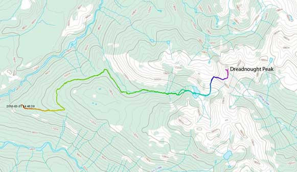
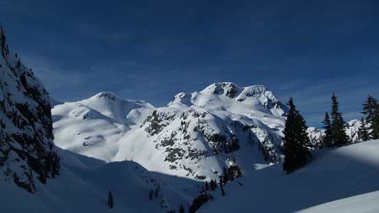
Dreadnought Peak ascent route from Watersprite Lake. GPX DL
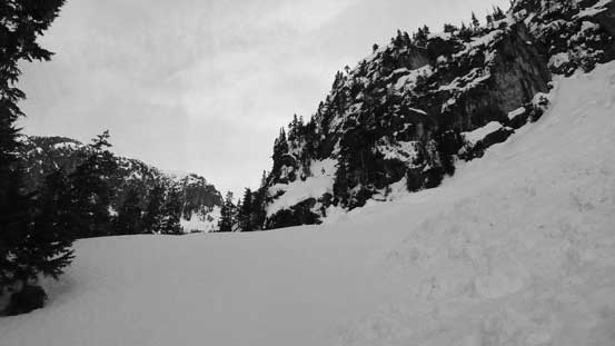
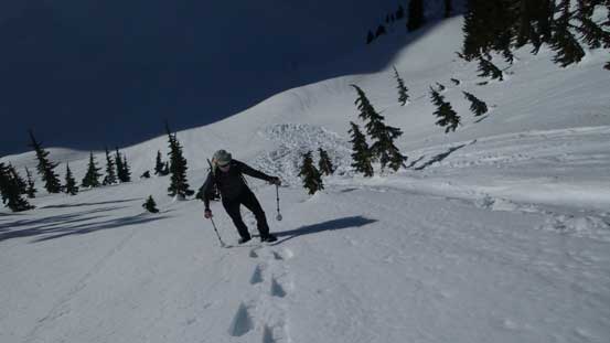
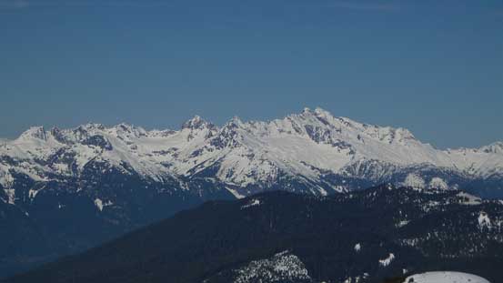
The road was in a “good” shape by SW BC standard by in my opinion I still wanted to call it “rough”. I wouldn’t want to drive my small car up there for sure but had no problem making to the trail-head with my Jeep. It was already bright enough by the time we’d geared up. The first 5 km or so was a mundane plod up a deactivated logging road spur and after few hundred meters in we strapped the snowshoes on. There’s no freeze at all but by staying on the previous parties’ tracks we didn’t have to sink in for too much. Vlad set up a blistering pace so in about 1 hour we’d done this road section. The view of Mt. Garibaldi massif was great from a couple vantage points.
The very satisfactory view of Atwell/Garibaldi – both bagged in this month!
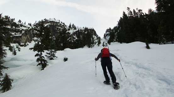
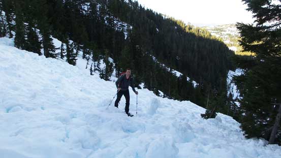
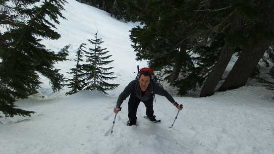
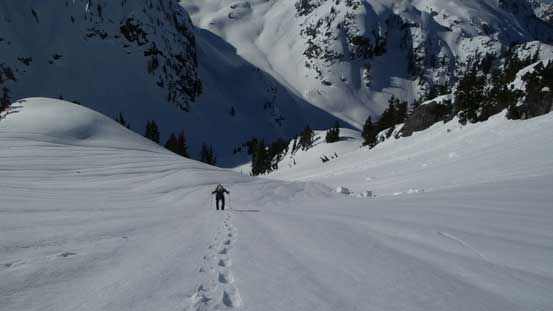
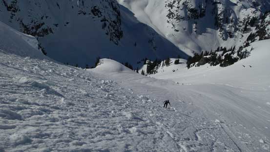
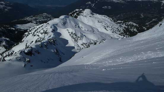
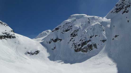
Near the end of that spur road we picked up some flaggings and a set of snowshoe tracks. We crossed the creek three times with the first one by a small jump across a water channel, the second one by a partially submerged log (thank to the crampons on my snowshoes for traction), and the third one on a questionable snow bridge. Except for these crossings we had no further issue following that set of tracks, and in short time we arrived at the bottom of an impressive avalanche path. The path had already slid as we worked our way up (still following the tracks), and then did a long diagonal side-hill traverse overcoming more debris before a steep ascent to Watersprite Lake.
Ascending up an avalanche path. This is where the grade steepens considerably
Crossing some debris!
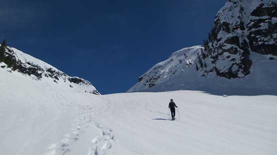
Now, take a rising traverse line
Vlad ascending the last few meters towards Watersprite Lake
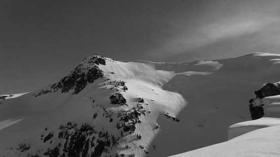
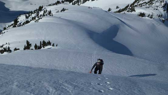
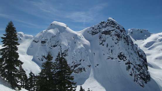
A necessary break at Watersprite Lake was in the order and I have to say that “Watersprite Tower” looked super impressive. Without the forest cover the overnight freeze was much better around here with the crust able to support our weight. We continued ascending the drainage keeping a beeline to the left, and after a roll we could see the big south-facing slope to our left. It didn’t look as bad as I was expecting, but the sun was already there beating down the snow, so we had to hurry up. The crust was still, mostly able to support our weight, and near the top the grade had become fairly steep especially for Vlad who didn’t have the heal-lifts on his ‘shoes.
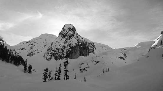
Watersprite Tower looming behind
This is the slope that we’d ascend
Looking back at Martin Peak et al.
Vlad starting the long south-facing slope
Watersprite Tower still looks very impressive
Midway up the slope

Another look at Martin Peak
The upper slope
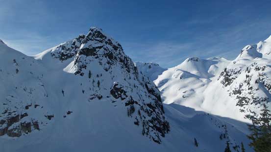
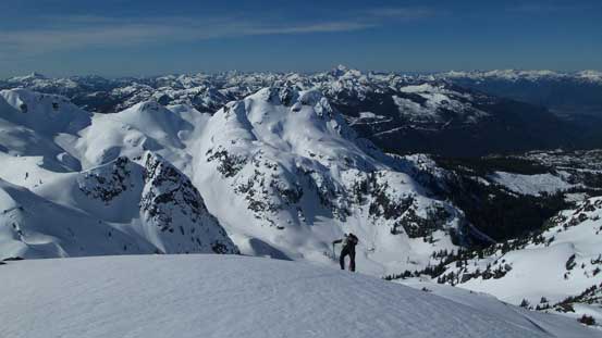
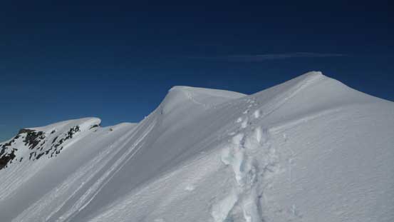
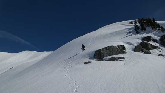
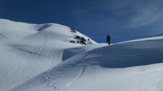
There’s some massive cornices on Dreadnought Peak’s west ridge but those were all fairly easily avoided. There’s also some micro-terrains with a few steep rolls so at one point Vlad took a break switching snowshoes for crampons. I had some more aggressive snowshoes so kept ’em on until the big slope just before intersecting the south ridge. That slope was quite steep and long and required lots of step-kicking, and once the angle eased I strapped my snowshoes on again as I started to sink.
Our objective finally in sight – still fair a bit of ways to go
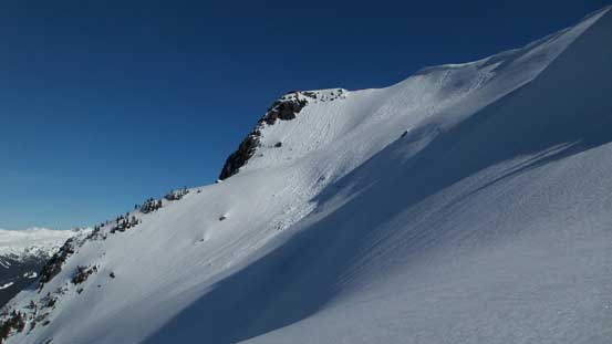
Impressive face!
Looking back along the undulating west ridge
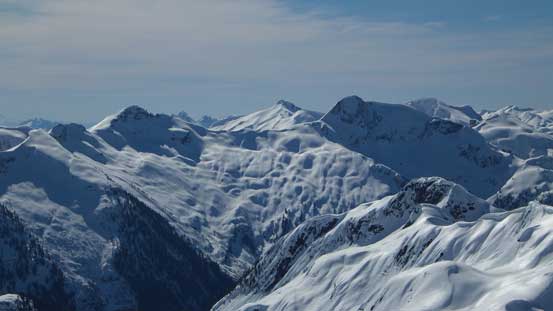
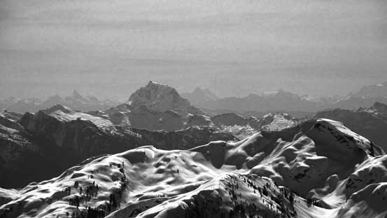
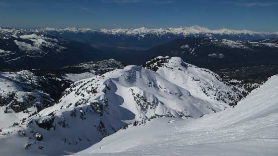
The rugged Tantalus Range

The Mt. Garibaldi massif
Vlad climbing up a steeper roll

Now the route joins the south ridge
Vlad coming up.
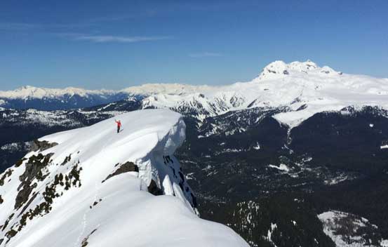
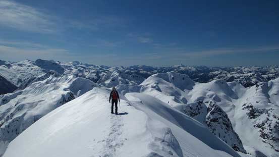
The final traverse along Dreadnought Peak’s south ridge was also more involved than expected with some cornices to avoid and exposure to each side. I ditched the snowshoes once the ridge narrowed down and carefully made my way to the summit. It was very nice up there so we did a long break. I also went further along the ridge to check out a lower sub-summit which had a cool cornice on top.
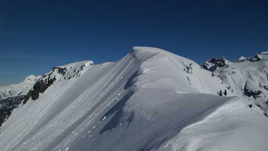
The final summit ridge traverse. Note the cornices
Looking down the west face

The last few meters
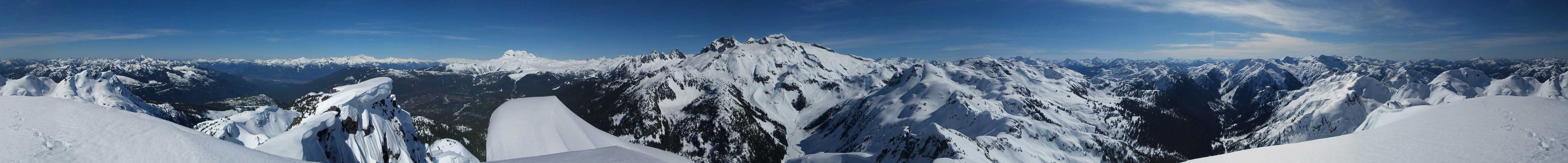
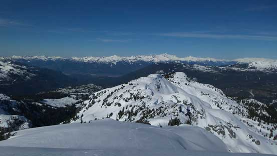
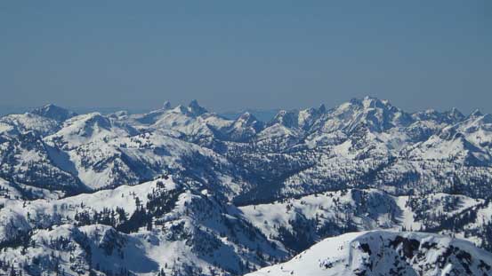
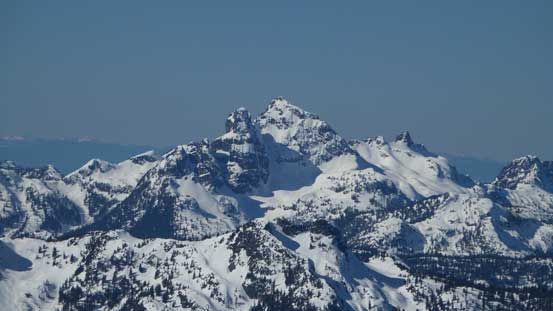
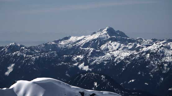
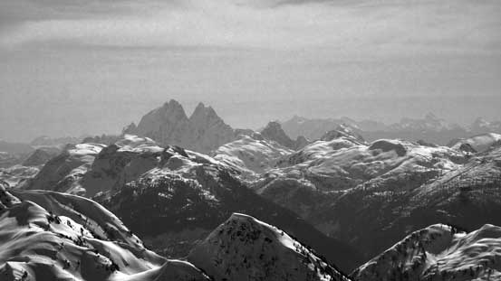
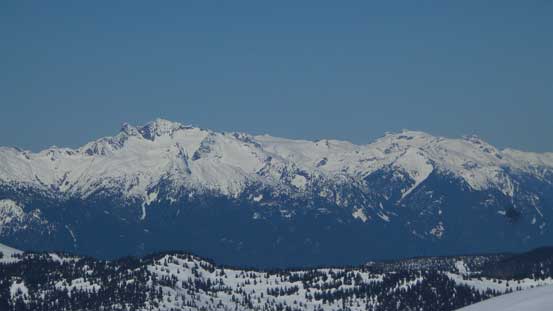
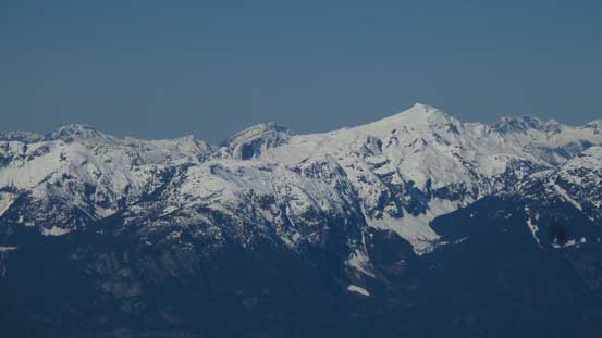
Summit Panorama from Dreadnought Peak. Click to view large size.

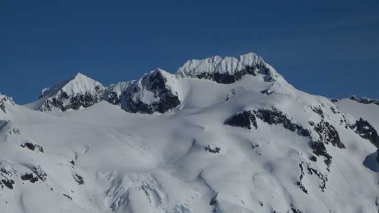
Darling Peak and its sub-towers
Looking north towards Garibaldi Neve, with The Sphinx behind
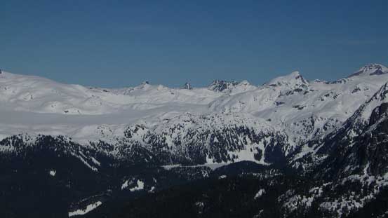
Mamquam Mountain

Crawford et al. in the same general area

Vlad approaching the summit
Pinecone Peak et al. looking south
The Lions and Brunswick Mountain along HSCT

Mt. Habrich rises in front of Goat Ridge

A zoomed-in view of the summit of Mamquam Mountain
Sky Pilot Mountain
Cathedral Mountain
Mt. Robie Reid
Mt. Judge Howay
Pelion Mountain and Mt. Jimmy Jimmy – both on my to-do list
Mt. Sedgwick is apparently tough to access now.

A full shot of Mamquam Mountain massif
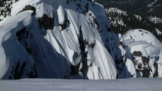
Impressive snow formation on the north side
Me on the lower summit. Photo by Vlad

Looking back at Vlad on the true summit

Watersprite Tower doesn’t look as impressive from this angle
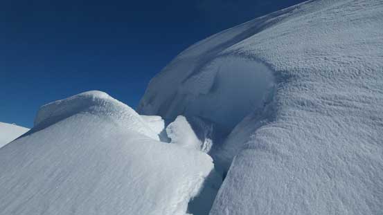
Cornices are ready to break off!
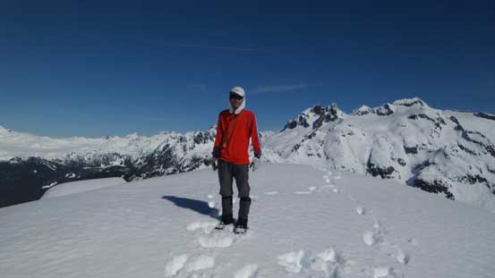
Me on the summit of Dreadnought Peak
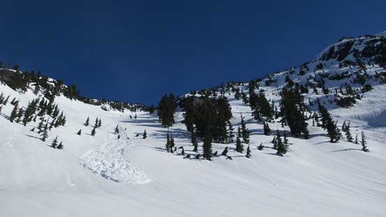
Now with the sun really beating down on full force we couldn’t linger much longer. We pretty much retraced our steps and for that big slope we had to down-climb facing inwards. And now came that south facing slope. The surface had already gone slushy but the upper snowpack stayed reasonable strong. With the soft surface we managed to easily plunge down in literally no time with “1 step down, 2 steps sliding forward”. It was tempting to bag Watersprite Tower since it’s “right there” but given the conditions we decided against it.
Time to go down
The long west ridge in the foreground. That’s another return option
Vlad traversing back along the summit ridge

Down-climbing the big slope
Continuing down
Typical, typical on the ridge

Onto the slope.
Watersprite Tower
Into the bowl
Plunging down from the bowl
A short uphill plod after Watersprite Lake we got to enjoy another run of plunging down the slopes below. The avalanche debris had also softened up providing some better “down-hill texture” on our snowshoes. Re-crossing those creeks was interesting especially for the final one as we couldn’t trust the snow anymore. We did manage to cross without wetting our feet though, and then there came the final, uninspiring 5-km road plod. We took a long break rehydrating (it was VERY hot) and rushed back in one single push.
Watersprite Tower from Watersprite Lake

Plunging down from the lake
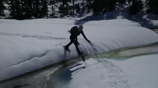
Jumping across the creek

Looking back at the valley

Onto the road plod..

Bushy at places

Almost done!
The driving back home was uneventful and I have to say that this is indeed a great place. I’m sure I’ll be back for more exploration but now, with the high pressure system still in I needed to focus on my next objective…
