Mount Huber
July 4, 2015
3368m
Yoho – Lake O’Hara, BC
Mt. Huber is one of the 7 11,000ers in Lake Louise/O’Hara group. It’s the lowest among those by elevation but looks equally impressive when viewing from Lake O’Hara. It appears like a giant towering rock buttress in front of the jagged ridge of Mt. Victoria. The standard route up this mountain involves Class 4 scrambling on Huber Ledges, a short glacier crossing and then steep snow climbing on the upper mountain. Ferenc, Ben and I climbed it together with the nearby main summit of Mt. Victoria in 1 day, car to car without the scheduled bus shuffle.

Ascent route for Mt. Victoria and Mt. Huber. GPX DL
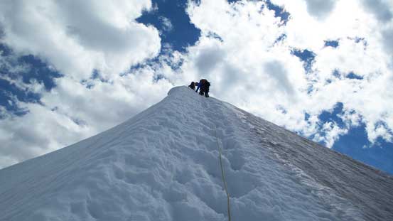
After coming down the W. Face of Victoria we immediately focused on our next objective. The snow was getting slushy in the afternoon and the slope on Mt. Huber appeared to be steep and thin. We had two sets of tracks to follow with one leading straight up the glacial ice. It’s apparent we’d take the other set of tracks but that involved crossing a very sagged bergschrund on questionable snow. I actually took out the probe and the snow depth appeared to be fairly thick, so despite the slushy condition we all crossed that bridge with no incidence. After that things started to get a little bit interesting as the snow depth dramatically decreased. There’s at least one section we actually had to front-point on the ice (covered by a thin layer of slush), but thankfully condition improved higher up.

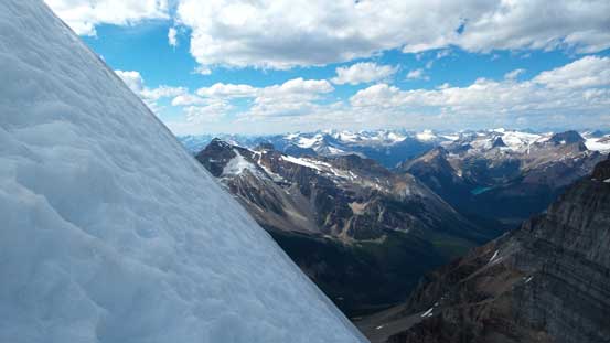
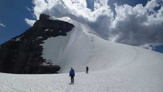
Mt. Huber seen from near Victoria/Huber col
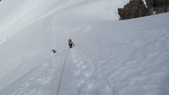
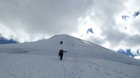
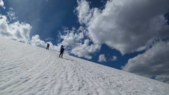
Ferenc and Ben coming up Huber’s snow slopes
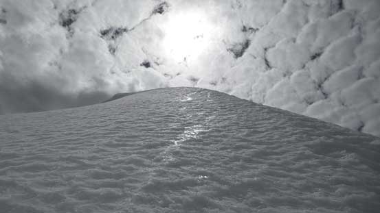
Looking up from midway up
The terrain never got overly steep and soon we stood on the top. Some weather was starting to move in at this point but the views were still great. This is a great vantage point for the W. Face route on Mt. Victoria but it’s nearly impossible to pick out the exact like we took… Due to the concern with weather and conditions we didn’t linger any longer than necessary and immediately started the down-climb.
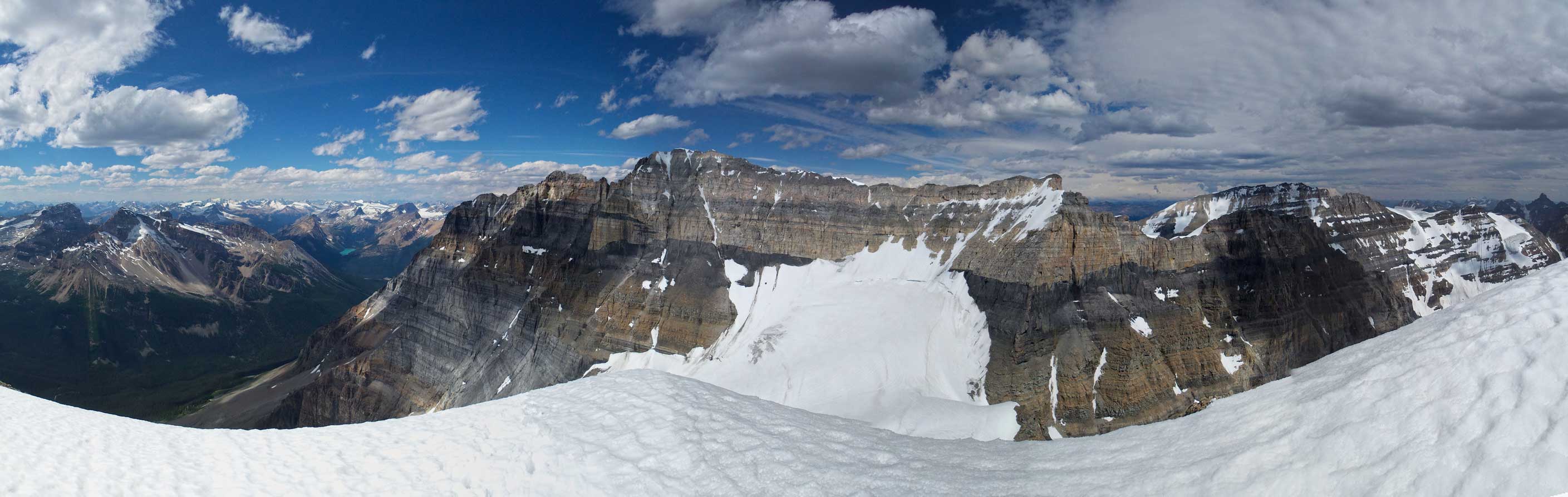
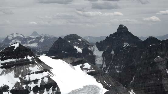
Partial summit panorama. Click to view large size.
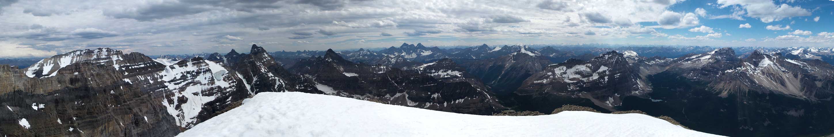
Partial summit panorama. Click to view large size.

Mt. Balfour and the Wapta Icefields
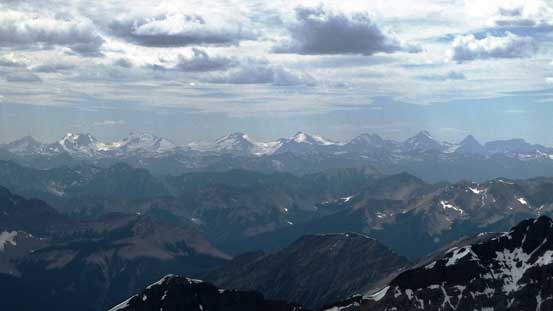
The glaciated giants in the Southern Selkirks

Mt. Vaux rises behind Mt. Owen
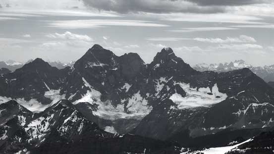
The majestic Goodsirs
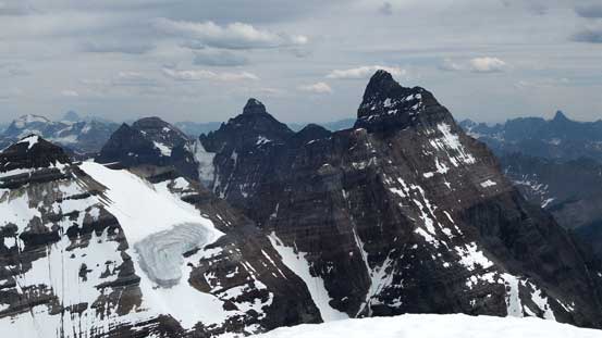
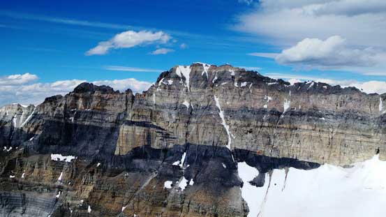
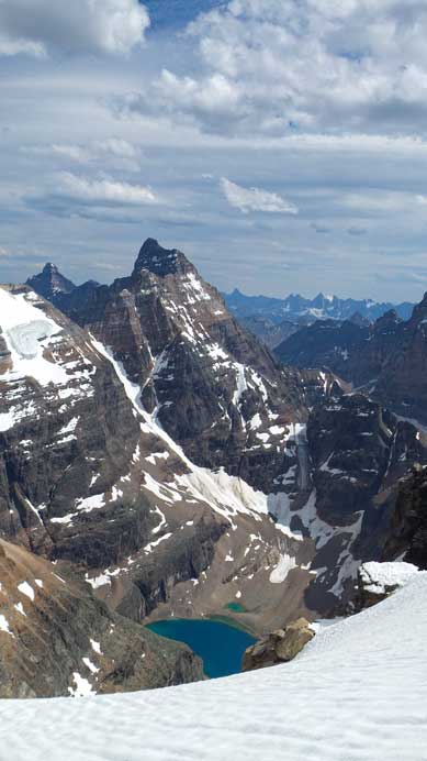
Hungabee Mountain
Deltaform Mountain
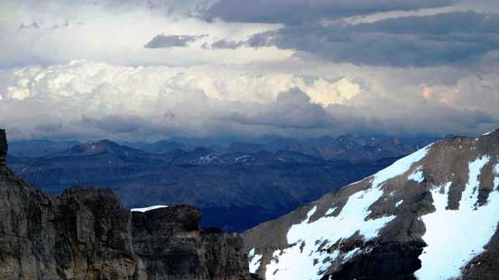
Thunderstorms in the front ranges, and weather’s moving in our way…
The west face of Mt. Lefroy looks awfully dry

The lowly Glacier Peak is still 3200+ meters high
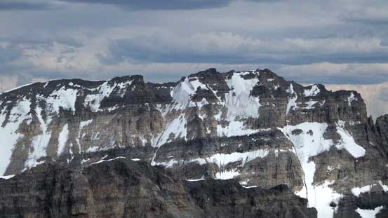
Mt. Victoria

The west face of Mt. Victoria
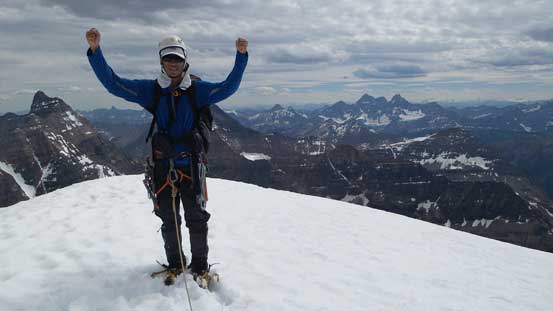
Me on the summit of Mt. Huber, my 34th 11,000er!!
Normally for this slope we would have just plunged down since it’s not very steep (40 degree ish at Max), but given the thin slushy snow we opted to down-climb facing inwards so less chance of making a mistake. Re-crossing the ‘schrund was a bit interesting. I think we all had a few knee+ deep post-holing on the schrund but nobody broke it through. Shortly after we were back to the glacier. Thank to the condition again we lost our tracks and I led the group descending too far down and had to backtrack after putting one foot into a hidden crevasse. We reversed the line and Ben excellent led us back on track using his GPS and soon we were off the upper glacier. Down-climbing the rock step (with crampons and ropes still on), and then crossing the lower glacier we were back to the dry ground.
Down-climbing the snow. Note the bare glacial ice just to the right
The slope was quite steep
Back across the sagging bergschrund…
Hungabee Mountain looms behind Lake Oesa
Descending the glacier
Looking back at Mt. Huber
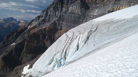
Here’s the toe of the first Huber glacier
Looking back towards Mt. Victoria from just exiting the glaciated terrain
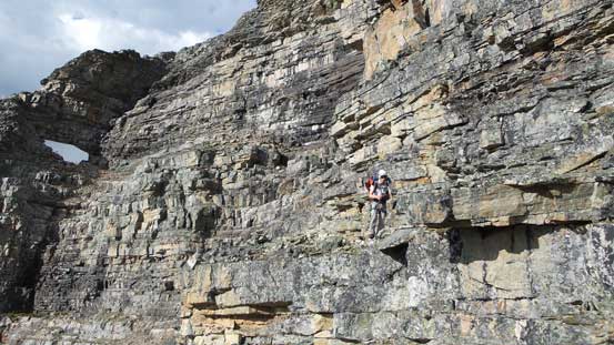
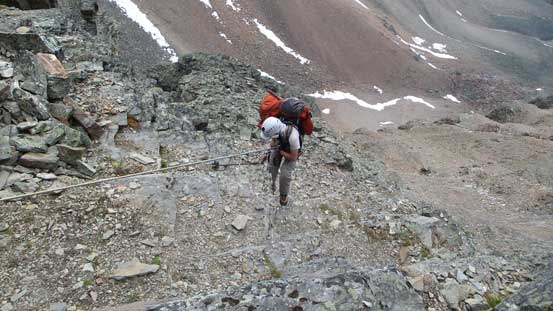
Coming down the Huber Ledges we paid close attention to route-finding. We managed to stay on the path for most of the way so it went by pretty fast. At the crux Ben and I figured might as well just use that 2-bolt anchor for a 20-meter rappel. We brought two 30-meter ropes so that’s long enough. Ferenc forgot his belay device but on the upside he searched around and managed to find a less troublesome route than the one we took with some zig-zagging on narrow ledges. In fact he got down much faster than Ben and I did. The rest of the descent back to Lake O’Hara went uneventful. After a well-deserved dinner break at the campground (lots of mosquitoes) we started the long trudge back to the parking lot. My feet was giving me some blister troubles. Normally I would have just sucked it up and deal with that later but considering I have another 4-day trip coming up with virtually no break in between I had to figure out a way so that the blisters wouldn’t get worse. We tried a few methods and eventually found the correct one. I put on Ferenc’s running shoes on my right foot and problem (sort of) solved.

Descending the Huber Ledges
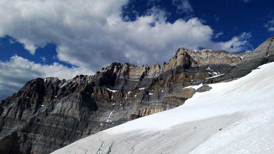
A view from the Ledges
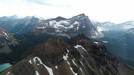
In the foreground are Wiwaxy Peaks. Behind is Odaray Mountain
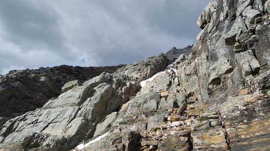
More of the Huber Ledges
Steep terrain…
Ben rappelling the crux

Almost back to the Wiwaxy Gap (Huber/Wiwaxy col)

Looking back towards the Huber Ledges

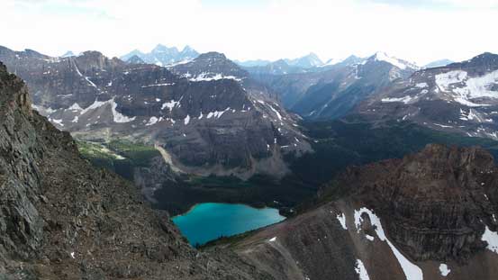
Lake O’Hara
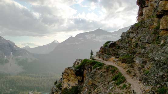
The trail. Note the weather…
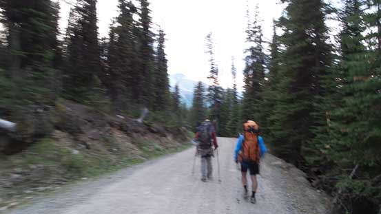
Oh the road slog…. Painful…
Back to the parking lot our round trip time was 19 hours. That was a wee bit slower than expected but we did take a lot of longish breaks on various parts of the trip. We took our time on the descent too as there’s no point to rush. We wouldn’t have caught up the 4:30 pm bus regardless. Now I’ve successfully bagged North Victoria, Mt. Lefroy, Mt. Victoria and Mt. Huber, the 4 big snow-and-ice Lake Louise classics all on my first try. Great climbs indeed and now I’m looking forward to the two rock 11,000ers nearby.. And then the next trip…

One of the best trip reports Ive read. Thanks!
Did you find it necessary to put in anchors on the steep glacier sections?
It’s about 35-40 degrees so if it’s still snow without showing bare ice then I’m fairly confident to climb without pros. If it turns ice (like later in the season) then maybe do a running belay using a couple screws.
So is Huber an 11thousander?
I’ve read that it’s 3348metres on most sites but vary from site to site. Wondering why that is. Thanks,
Your blog’s have been incredibly useful and informative, thanks!
As far as I know, only about 15 ish 11,000ers had been surveyed accurately. The elevation sources could not be fully trusted. Huber is close, could be above or below, hard to tell. Someone needs to climb all of them and survey the accurate elevation.
hey steven, looks like the GPS link is broken. any chance of getting that fixed?
Yes. I’ll fix the 2015 and prior years track once I get back home. Not in Canada right now.