Marmot Mountain (BC)
March 20, 2020
2103m
Manning Park / Skagit Valley Provincial Park, BC
Marmot Mountain is a very obscured summit despite the lack of technical difficulties, and its close proximity to Highway 3 and Manning Park. The peak is at the end of the complex ridge system NE of the much-bigger Silvertip Mtn. but despite that, Marmot Mountain itself is truly a massive with numerous sub-summits, as well as more than 2000 feet of topographic prominence, making it the single most obscured “P2K” objective in the whole Cascade Mountains. This peak has only two or maybe three documented ascents in the last two decades, with the first one by the Washingtonian peak-bagger Grant Myers, who needed this peak to finish his prominence lista and the second one a BCMC trip led by the legendary Alastair Ferries. Both of these ascents were done via the west side by going over “Goldtip Pass”. As the mountaineering history and culture in BC goes, I’m sure this peak had seen more ascents especially back in the old days when the Brown Peak ski area was operating, but records were too old to be found.
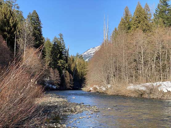
This peak had eluded me for years. It’s very visible from the highway and yet nobody talks about it. The north and east sides of the massif are guarded by some impenetrable cliffs and bluffs as well as Sumallo and Skagit Rivers. By glancing at the maps I did also agree that the west side approach might be the only option, but the 500-m elevation loss from Tearse-Goldtip Ridge was far from appealing. I estimated that with the decommission of the logging roads the west side approach almost certainly needs to be done as an overnight trip. A couple weeks ago Alan Blair reached out to me with a theoretical attack via the south slopes and ridges by wading Skagit River. I had thought about this approach but I never convinced myself that fording a major river like the Skagit on foot would be possible, but after some detailed mapping and digging I did agree that the route above the river would likely go, although not without some steep and uncertain sections. The river would be the biggest uncertainty, but on the way back home from Full Moon Rising a week ago I paid special attention of the water levels and determined that a ford would likely be possible at this time of a year (late winter or early spring). The weather had been good for at leave five days, and the avalanche conditions had dropped to L/L/L across all forecast regions. The last uncertainty was the trail condition as we had to hike 8 km down Skagit River trail from Sumallo Grove, but Al managed to dig out a recent report, from a week ago that the trail was packed to at least 4 km to Delacy Campground.
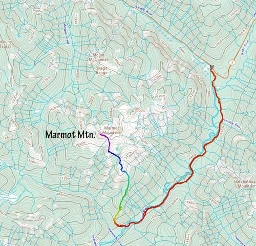
Marmot Mountain via South Slopes. GPX DL
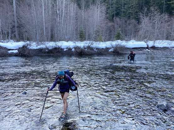
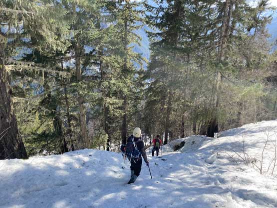
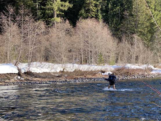
After settling on our objective we sent multiple invites and to our surprise, a total of seven of us signed up – Al, myself, Vlad, Mel, Winnie, Iliya and “the Pink Panther” who didn’t want to be publicised because she called in sick at the last minute in order to join us. I set the starting time of 7 am from the trail-head which meant we all had to get up early. We grouped in Abbotsford and piled into two vehicles. I drove Mel, Vlad and Winnie out east and the other three was a couple minutes behind. The gearing up took very little time because we all knew the importance of being efficient on gear transitions for a long outing like this one. Mel set up the blistering pace as usual, down the packed Skagit River trail in over 5 km/h pace. An hour or so later past Delacy Campground the trail became faint at places. We lost the trail for a couple hundred meters in a dead-fall field and I strapped the snowshoes on. The others still opted to boot-pack and either way worked. We made to the river crossing in exactly 1 hour 40 minutes, more than 8 km down the trail with at least 100 m net elevation loss and numerous annoying up-and-downs. The river was wide but looked tame from a fording perspective, but was very cold as soon as we stepped in.
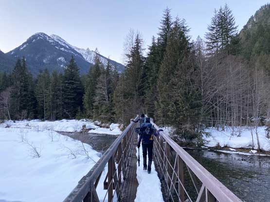
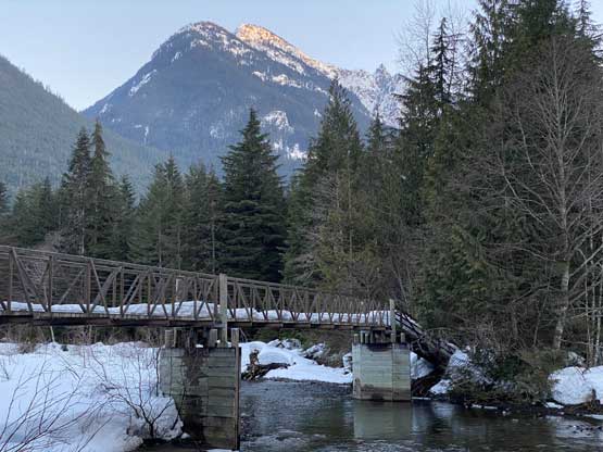
The bridge crossing Skagit River at the start

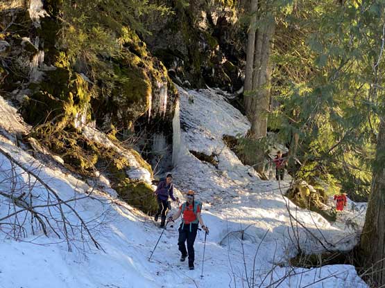
One of the more interesting spots on this 8-km approach trail

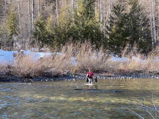
Al leading across the frigid Skagit River
Winnie crossing Skagit River.
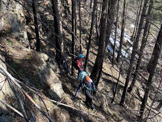
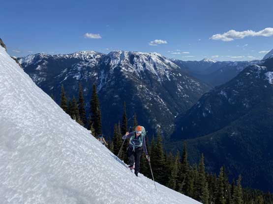
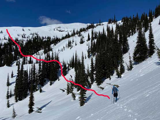
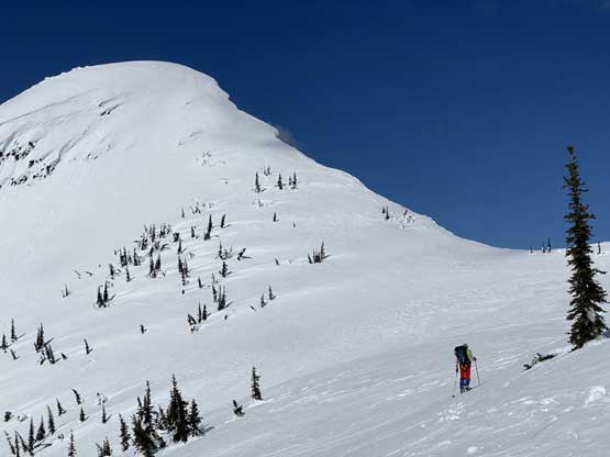
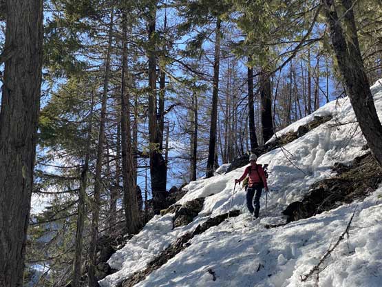
We all took a long break on the opposite side of the river drying out and regaining strength. The next section was to gain the south ridge proper but to get there we had to endure some bushwhacking and hop over some massive dead-falls. While traversing southwards I got tired of the side-hilling and made the call to ascend straight up a large opening area, which started off with snow but the snow soon gave way to loose talus and scree. The grade became increasingly steep to over 40 degrees and we had to start scrambling. To gain the actual ridge wasn’t difficult but involved an awkward leftward traverse with a lot of rockfall hazard. Then up the lower south ridge we had no snow whatsoever for a couple hundred vertical meters. The trade-off for no post-holing was to manage loose rocks. I felt like I was going back to the Rockies as the rocks here were nothing but choss. Once the snow appeared to become continuous we took a food break and strapped the snowshoes on, but the snowshoes came off not long after as we faced another long stretch of dry scrambling. The crux section came unexpected as we faced a vertical cliff band that’s about 1 pitch long with no obvious bypass. I went around to climber’s right side to evaluate different options but in the end we decided to attack the nose, that involved some class 3-4 bush scrambling with moderate exposure. Half an hour later we all cleared this mess and the terrain finally tapered off and we finally could officially start the snowshoeing.
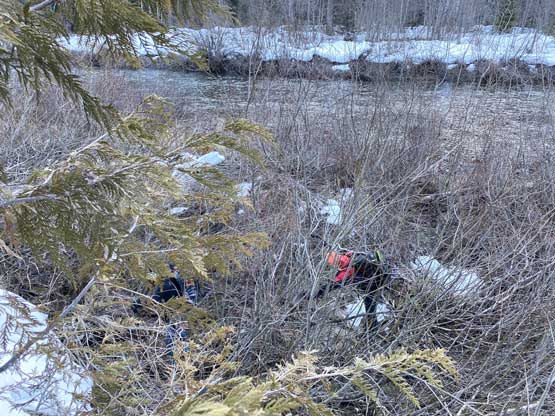
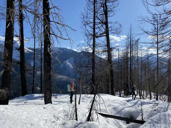
Iliya bushwhacking immediately after the river crossing…

The gang ascending an open slope of snow before the hell began
This is that sketchy loose traverse to gain the ridge proper

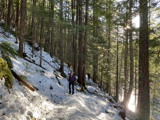
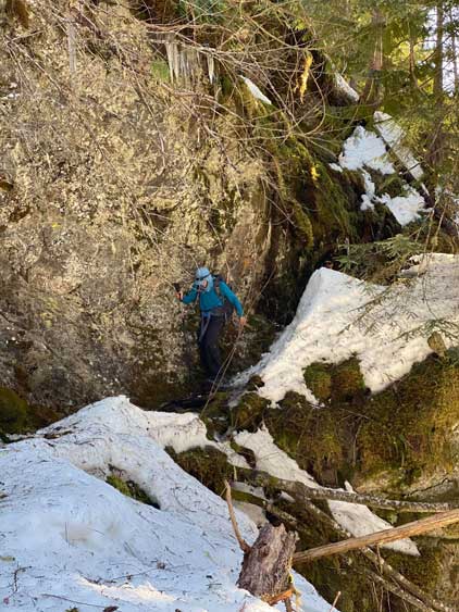
Me picking the route in the bluffy forest. Photo by Mel O.
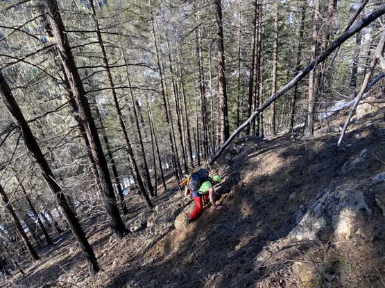
Al scrambling on steep dirt.

“The Pink Panther” hopping over one of the many dead-falls
The terrain gave us a brief break here

The south slopes of Silverdaisy Mountain

Looking down to where we just crossed the Skagit River

Upwards and onward

Vlad opted to bootpack while I went for snowshoeing here
Vlad leading us towards the crux rock band

Halfway through the crux zone. This is looking down
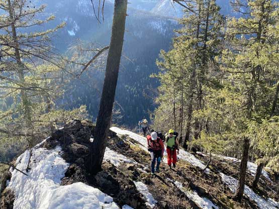
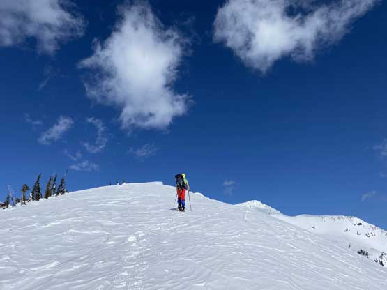
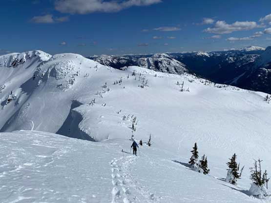
Part of me regretted for not hauling a short rope because such would greatly ease the descent difficulties of this sketchy zone, but for now we wouldn’t need to worry about that yet. The next couple hundred meters of gain was nice and easy but as the grade kicked up again the post-holing soon became challenging. The crust had fully broken down and I sank to knee deep on the wet snow. After a while of post-holing I called for another food break, because I figured the steep stretch from 1400-1600 m needed to be done with fresh mindset as I expected difficult route-finding through bluffs. It turned out that this stretch was easier than I thought, but still not without route-finding challenges. I think we had a higher snow year and that helped, and the low avalanche hazard meant that we could charge the steep open slopes straight up instead of finding a roundabout route. I led at least 3 or 4 stretches with 35 degrees or more, and Mel led the last roll to gain the next section of the south ridge, which was certainly steeper than 40 degrees. The snow was soft though meaning we didn’t have to remove the snowshoes. This middle section of the south ridge offered some unobstructed view of Silvertip Mountain massif but for now we had to focus on the next section, which was easy as all we needed was to go straight up for 100 more vertical meters to the base of the next steep bluffs. Based on my research and the field observation I made the decision to bail into the adjacent bowl, cross the entire bowl and to gain the next ridge west of us as soon as possible. The side-hill descent into the bowl involved some elevation loss but the ascent to the next ridge was less steep than appeared.

Mel leading us on this mellow stretch through burnt forest

Looking across the Skagit River Valley towards the remote Mt. Brice

Mel continuing leading and the terrain soon became steep again

I took over the lead as we marched towards 1400 m zone.

One of the few steep open slopes that opted to snowshoe straight up

Another steep roll.

The photo isn’t tilted and yes this was the slope we had to ascend

Mel leading the final steep roll to get us back onto the south ridge proper
The Pink Panther topping above that uber steep roll

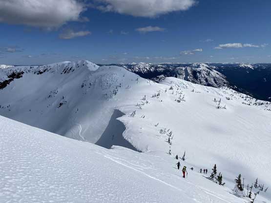
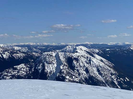
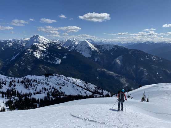
An unobstructed view of Silvertip Mountain

Silvertip Mountain is the northernmost “ultra” in the Cascades
Me side-hilling into the bowl. Photo by Mel O.

Me ascending steep slopes to gain the next ridge. Photo by Mel O.

The terrain in the alpine was very gorgeous

The group grunting up this steep slope to gain the ridge
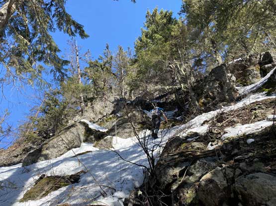
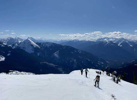
We took the last food break on this ridge studying the route ahead. The “Marmot Mountain” labelled on our topographic maps were wrong as I knew the west peak was actually higher in elevation. The west peak appeared steep though but again, the avalanche condition was low so we should be fine. The snowshoeing up to the base of the uppermost east ridge of the true summit was easy. My plan was to “snow-climb” the upper east ridge but from the base the grade appeared to ease off so I kept charging up on snowshoes. The conditions were also prime for steep snowshoeing too. The upper section was 40 degrees or slightly more, with massive cornices dangling on the right side and steep, exposed run-out on the left; that no mistake was allowed. Still, I was pretty experienced in climbing snow like this on snowshoes so didn’t even bother to take the ice axe out, and soon enough I was on the summit. The others joined soon one by one and we lingered up there for more than half an hour to soak in the success.
Al leading the next ridge section
Winnie et al. following up with Skagit Valley behind
Al heading for the upper east ridge of Marmot Mountain
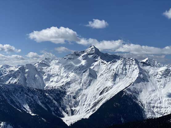
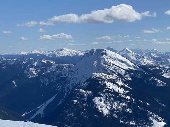
Another look at Silvertip Mountain
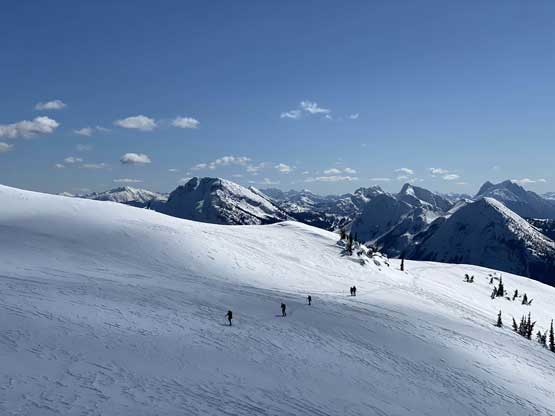
The gang snowshoeing across the sub-summit

The gang almost at the base of Marmot’s East Ridge
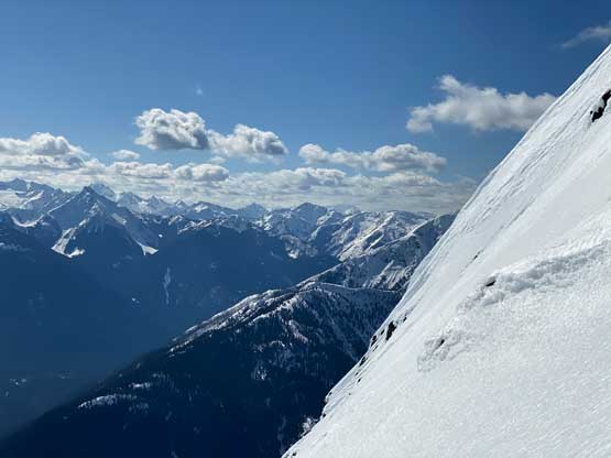
Partway up the east ridge, looking sideways
The photo doesn’t justify the steepness. It’s definitely a no-fall zone
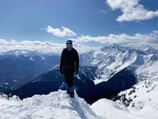
Al celebrating the summit of Marmot Mountain

“Goldtip Peak” in the foreground
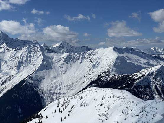
This is looking at “Rocktip Peak” and “Merge Peak”

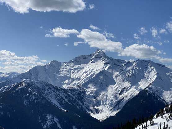
A closer look at the summit block of Silvertip Mountain
Mt. Custer et al. the group of Chilliwack Bulgers in Cascades

Mt. Dewdney north of Highway 3

The massif of Snass Mountain

This is looking deeply down towards Hope. Mt. Urquhart on the skyline

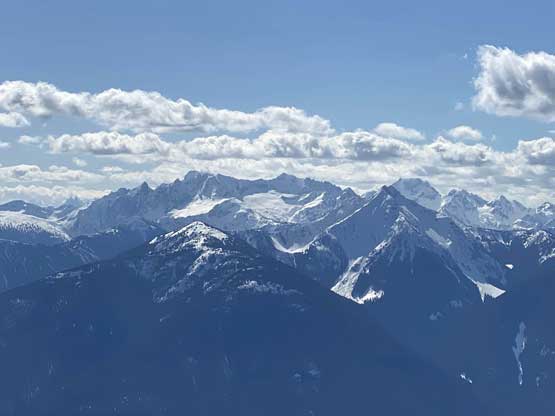
Hozomeen Mtn. and Jack Mtn. are very visible in the North Cascades

Mt. Outram dominates the northern skyline
Hatchethead Mountain in foreground with an obvious couloir
Mt. Brice and its west ridge

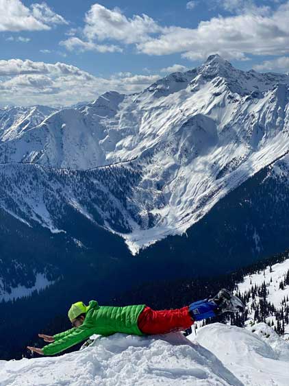
Mel and I on the summit of Marmot Mountain
Me on the summit of Marmot Mountain
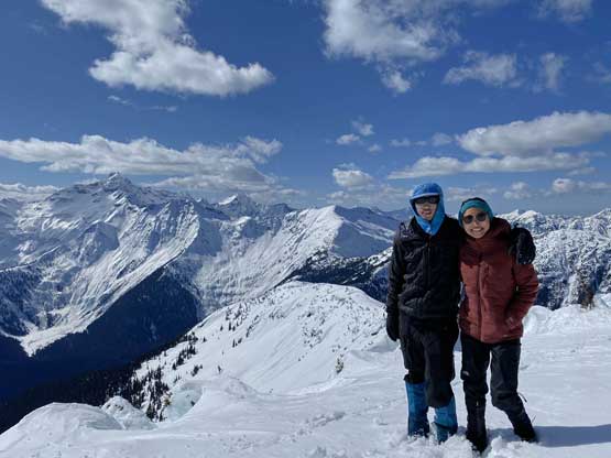
Winnie and I on the summit of Marmot Mountain
For the descent we all removed the snowshoes and take out the ice axes. The descent only required plunging while facing outwards so it was probably only 40 degrees at the steepest. About halfway down the upper east ridge I discovered a few waist deep holes so made the gear transition back to snowshoes. The others all swapped gears at the roughly same spot, and we regrouped on the upper south ridge. The plunging and glissading down into the bowl and then up onto the middle section of south ridge went by easily. The descent of that steep zone from 1600 m down to 1400 m was also fun as we could glissade most of the steep stretches other than the initial roll. The rest of the snowshoeing on the lower south ridge was not fun at all thank to the shitty, wet snow conditions, but we were expecting it so we just had to suck up the pain and push through the misery. Once the snow ran out the descent on rocks was even worse especially in such a large group. Managing rock-fall was nearly impossible and quite a few of us were nearly hit. We discovered a slightly easier line to get off that crux rock band, and then reversed the exact line we took descending to the Skagit River.

Vlad’s ready for the descent

Partway down the upper east ridge

Mel falling into a deep hole
Me back to snowshoeing. Photo by Mel O.

Looking back at the tracks we made on Marmot Mtn.
Mel heading down the easy sections of the ridge
Silvertip Mountain

Steep and awkward descent

Me snowshoeing down the next steep slope

Three cars piled up on highway 1!!
Into that burnt forest section

Gorgeous country around here
But hell’s gonna begin soon

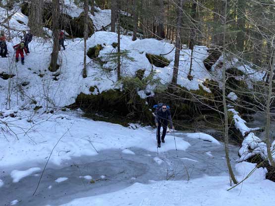
Al picking his way down the crux section

This section was very slippery and awkward
Vlad post-holing down the soft snow

Al carefully descending the steep dirt and scree

Me almost back to the river bank.
A few of us didn’t give a fuck about the river crossing and did it without even taking the boots off. I did the more civilized way as I brought my river crossing footwear. It was flowing slightly higher than in the morning and was still very cold. Mel and I decided to do the 8 km return hike while keeping snowshoes on as we figured the added traction would contribute to the efficiency. The others decided to just hike while carrying snowshoes. I think we knocked down the depproach in about the same time as our hike-in, so not bad. By the time I got back to the parking lot there was still sun beams depositing on the vehicles.
Back down to Skagit River
Vlad crossing Skagit River
The poor Illya had to cross it both ways bare feet.
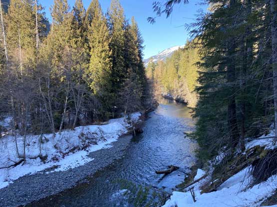
More about Skagit River from the hiking back
Winnie back on the trail, still smiling
One of the stretches that we lost the trail

Gorgeous afternoon lightning
Me squeezing the narrow stretch.
It was like this forever. The hike out was never-ending
Back across the bridge at the start. Almost done.
Our round trip time was just over 12 hours including all breaks and that’s considering we had 7 people in the team (everybody summitted), and had zero beta about the route we took. There was no documented ascent of anyone climbing Marmot Mountain via this route although I probably wouldn’t claim the first ascent because of the BC mountaineering history and culture. Most peaks and routes had been done back in the days, 50 or 60 years ago when internet didn’t even exist, but too bad those early explorers’ stories were not survived to this modern era.
Be sure to watch Al’s video on Youtube.
