Mount Temple
September 24, 2011
3543m
Lake Louise, AB
Standing on the summit of Mt. Temple had been my dream ever since I started the game of “scrambling” and with the experience of successful ascents of classics such as Cascade Mountain and Mt. Rundle earlier in this year I figured it’s time to give it a real try. Fortunately some guaranteed sunshine was in the forecast for this past Saturday and at the same time, the alpine seemed very dry (all new snow had melted). Mt. Temple is the highest peak near Lake Louise, the 11th highest in Canadian Rockies and easily the “grand daddy” of all scrambles. The standard route is a mere “class 2/moderate scramble” and attracts hundreds of tourists every year.

Mt. Temple standard scramble route. GPX DL
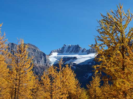
My parents and I woke up at 2:30 am in the morning and drove all the way down to Lake Louise. It was late September and we really started to feel the shortened daylight time. We had an awesome view of alpenglow near Canmore. By the time we made to Moraine Lake, I ran up the big boulder for photos. But too bad, the lake was in shade… Oh well, at least it gave me some sort of warm-up. By late September, there was no more group size restriction, so we quickly started the Larch Valley trail. There were already groups of people ahead of us. Not a good sign though as they would kick down rocks to us, and we didn’t have helmet by that time… Switchbacks brought us to the upper valley, and we soon got an WOW moment. This was my first time seeing the yellow larch trees. Oh gosh, we got blown by the views. The Ten Peaks are majestic as well.
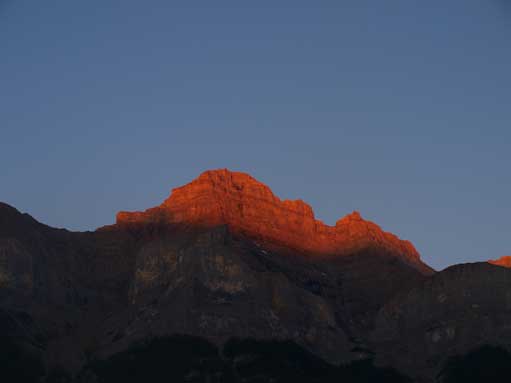
Alpenglow on Mount Rundle
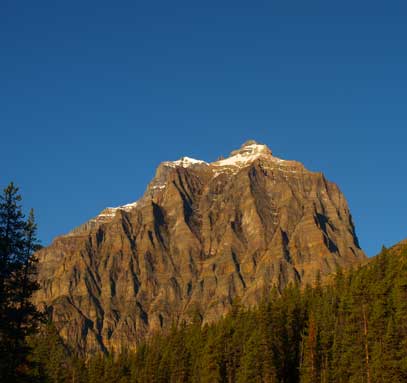
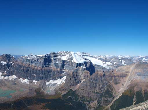
Morning view of our objective, Mount Temple

The classic shot of Moraine Lake

Temple seen from Moraine Lake viewpoint
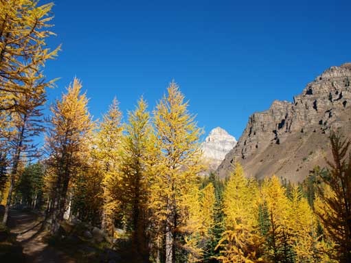
Scenic hike through Larch Valley
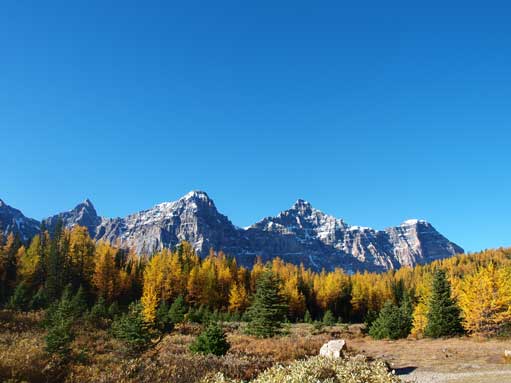
Deltaform Mountain looms behind

Pinnacle Mountain, a technical climb
Mom and dad on the Larch Valley trail
Me with Deltaform Mountain behind

Eiffel Peak, a moderate scramble
At the trail junction, we took the Sentinel Pass Trail which quickly led us to the small tarn called Minnestimma. It provided some cool photos as well, but with Mt. Temple in my mind, we quickly passed the lake and started the switchbacks up Sentinel Pass. The terrain gets a bit exposed and rockier but didn’t impose any problem to us. We quickly made to the pass, and were treated with the view of the other side: Paradise Valley and Mount Lefroy. Grant Sentinel is visible as well, a very intimidating rock pinnacle.
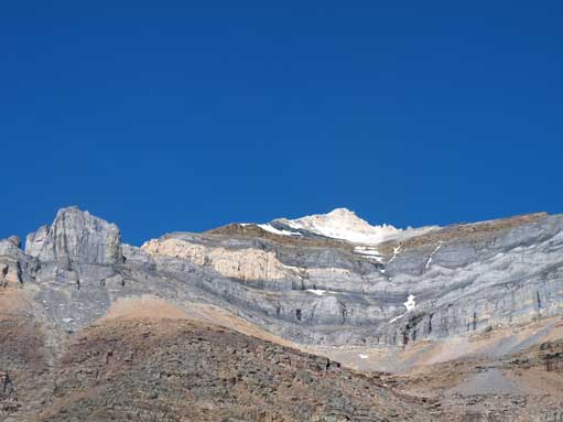
The scramble route up Temple stays right of the obvious ridge below the yellow band, and left of the ridge above the yellow band.
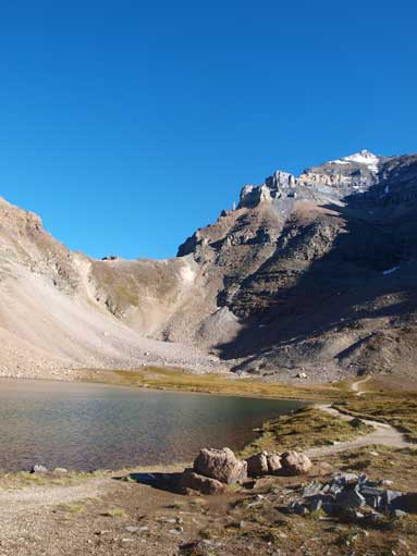
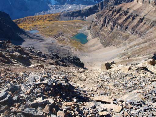
A small lake/tarn called Minnestimma

Hiking pass Minnestimma
Hiking towards Sentinel Pass

View opened up towards the other side from Sentinel Pass
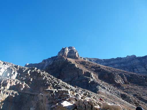
Normally, this is the place you want to get your helmet on. If I do repeat this mountain in the future (I doubt if I will, as repeating a mountain doesn’t sound appealing to me), I will definitely bring my helmet! Strongly recommended! The scrambling section started by trudging up a broad gully on the climber’s right side of the ridge crest. Looking back, Pinnacle Mountain looks impressive. The gully itself was easy going, but due to the people above, we had to dodge the rocks… This section went on and on and we finally got closer to the rock pinnacle (halfway point). An impenetrable rock wall appears ahead and we had to traverse horizontally towards climber’s right. There’s a well beaten path so you don’t need to worry about getting lost. However, natural rock fall from the cliffs above is a real hazard.
By the time we could spot the two big scree paths on our right, we had to look carefully on climber’s left for the 1st gray rock band. It’s easily missed so you’d better do some research before going. I was caked in between several scramblers so we went up the correct rock band. My parents were fallen behind and I didn’t notice until I was way above… The terrain between 1st and 2nd rock bands are very loose and we couldn’t help but to kick down a tens of rocks.. I followed a guy going further towards climber’s left to aim for more solid rocks. We soon arrived at the crux, the 2nd gray rock band. We quickly spotted the ascending mark, but we could spot less steep line on climber’s left side of the crux. I made through a short chimney which was much less exposed. After the crux, the terrain was still very loose until I got to the yellow/brown band shoulder.
Looking up the broad gully (climber’s right of ridge crest) from Sentinel Pass
Hiking up the gully. Typical terrain on the lower slope

Looking back at the impressive Pinnacle Mountain
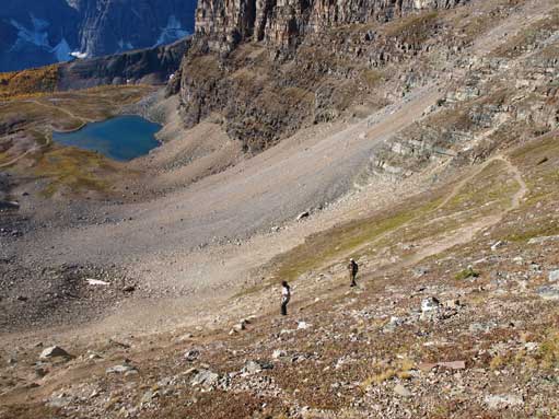
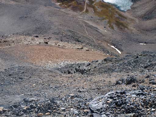
Looking down the loose terrain. You can see Minnestimma below
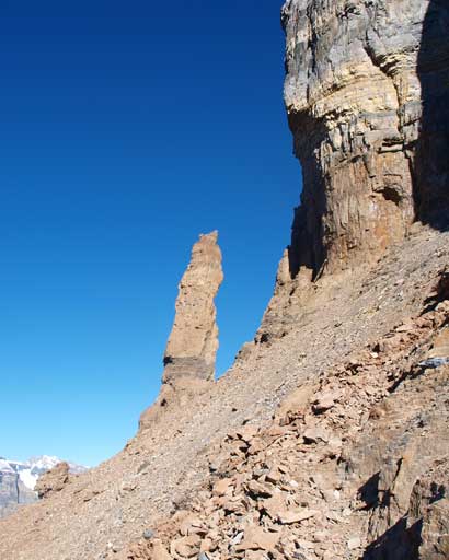
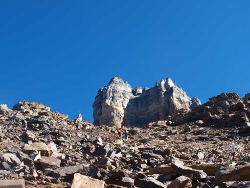
A rock pinnacle marks “halfway point”
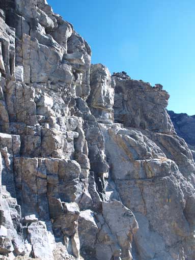
The 2nd grey band, crux of this route
At yellow/brown band shoulder, looking towards the next obstacle
Now, I realized that my parents weren’t following… I thought they would stop and turn back if they’re encountering terrain that’s beyond their ability, so I proceeded up with the other scramblers. By this time, Hungabee Mountain and the glacial lake below fully showed up. We quickly made towards the light brown rock band. This one is longer than the crux, but less steep and much easier to negotiate. After this band, we were staring at the broad summit ridge. Further up, we came to the last obstacle, a black rock step. Now, it was getting very windy and cold, and I was wearing shorts… I wanted to put my long pants on but couldn’t find them.. Oh gosh, they were in my dad’s pack… Well, since I already made to this high, there’s no way I could turn around, so I pushed on in an extreme cold. There was still a fairly long section to get there but I kept pushing on. I finally made to the very corniced summit ridge, and the wind was too crazy that I could barely stand alone. After more struggling, I made to the summit. There was a big icy cornice hanging on the east side. Due to the extreme wind, no scrambler actually went up the cornice (I know there’ll be lots of people doing it on non-windy days). My fingers were frozen and I could barely take summit photos. I let a girl taking a photo for myself and I quickly started the survival run, down the mountain.
Hungabee Mountain from yellow/light-brown band

The light-brown/yellow rock band
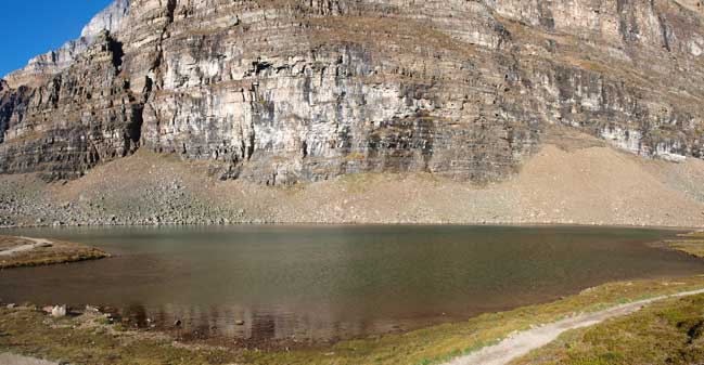
Mount Lefroy and its glacier

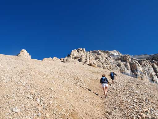
The upper slope. What a slog that was…
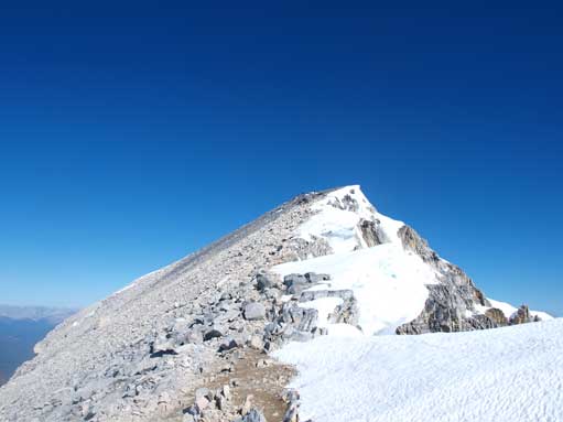
Now at the summit ridge. Note the cornices
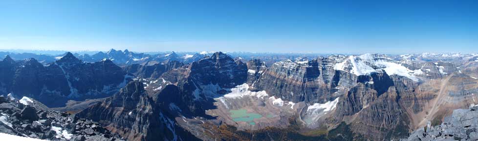
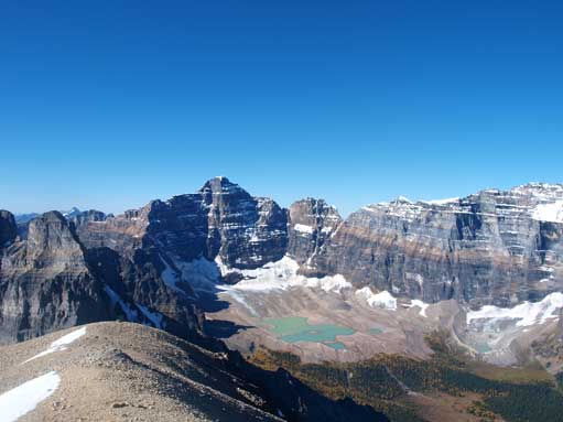
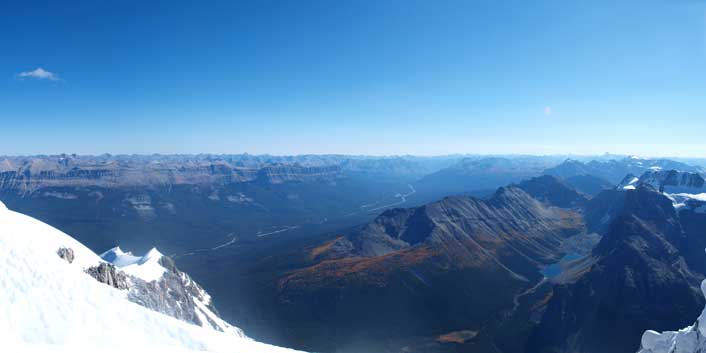
Summit panorama looking towards Deltaform, Hungabee, Lefroy, and Victoria. Click to view large size.
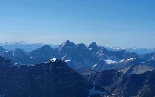
The three peaks of Mount Goodsir
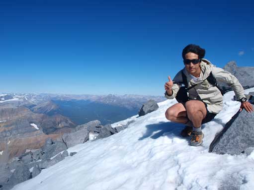
Me on the summit. I was very, very cold despite my smiling face…

Even Mount Hector looks small from here
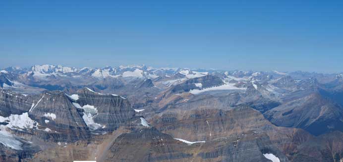
The entire Freshfield and Wapta was below me now!
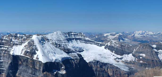
Looking down at the infamous 11,000ers – Lefroy and Victoria S&N
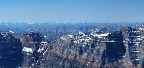
Looking over Glacier Peak towards the distant Selkirks including Mount Sir Donald
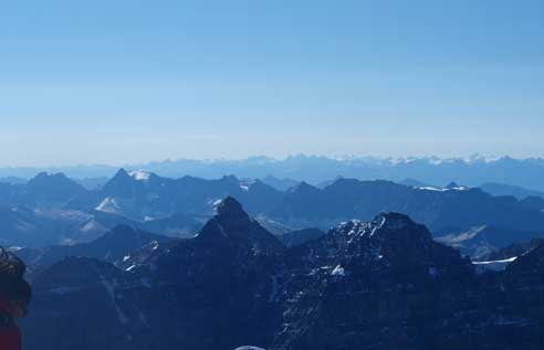
A sea of peaks towards South
A long shot of Bow Valley. Panorama Ridge looks tiny from here.
Going down the summit ridge still required extreme caution due to the wind. I had to try not to twist my ankle while descending the boulder terrain. As soon as I made to the broad summit ridge, I soon started the run. I lost elevation quickly and by the time I made down to the light brown rock band, the coldness had gone, thank god. At the crux, I descended the same way I came up. Descending the loose terrain between the two gray bands provided some challenge to me as I constantly slipped. Further down, I finally could spot my parents waiting for me at the first rock band… Thank god again, as I was really worrying about them. I re-joined them at the 1st band and we slowly made back to Sentinel Pass. They told me that they missed the 1st rock band and ended up far to climber’s right. They did try to go up but their path got less and less travelled. As they realized their route was wrong, they decided to turn back, and by the time they made back to the 1st band, they saw me coming down…

Looking at the massive SW face from descent
Descending steep and loose terrain from 2nd grey band, towards the 1st grey band which is at center of this photo.
We took a lunch break at Sentinel Pass. On the way back, we took time to enjoy the beautiful Larch Valley. With afternoon sun lighting the mountains, we got a much better view of Mount Fay, Panorama Ridge and Tower of Babel. There were hundreds of tourists and we’d passed, mostly on jeans with no backpack. We also went up the giant rock at Moraine Lake for photos, but due to sun direction, those photos look bad..
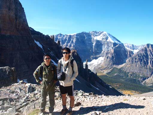
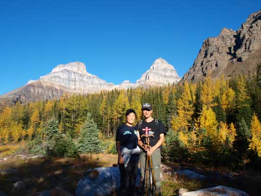
Dan and I at Sentinel Pass
Looking back at Mount Temple
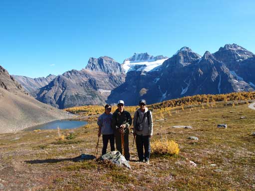
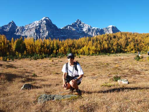
Group shot on the meadows above treeline

Beautiful fall colours!

Tower of Babel and Panorama Ridge
Mount Fay

Mount Fay again

Tower of Babel from near the parking lot.
In the evening, we drove up to Lake Louise for photos and then back to camp. It was too dark so my photos didn’t work that well. And the next day.
