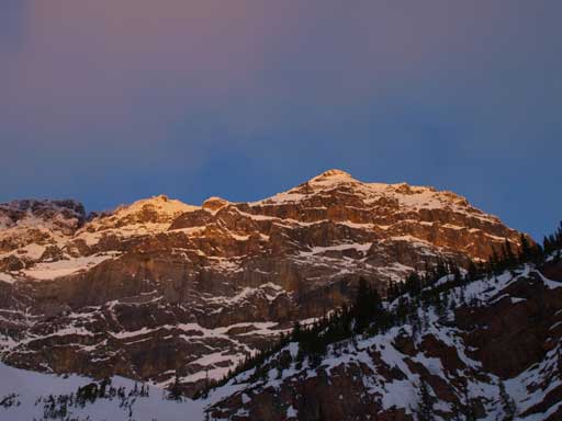
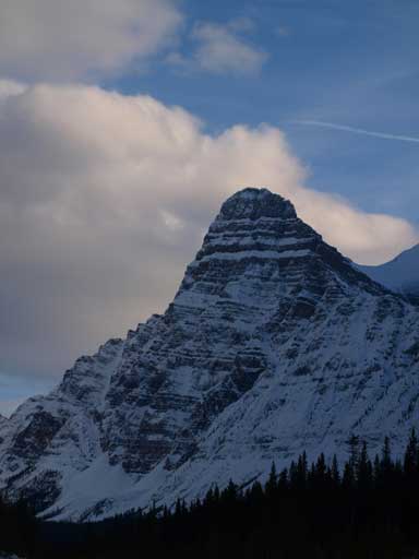
White Pyramid
March 30, 2013
3275m
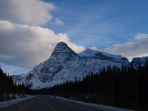
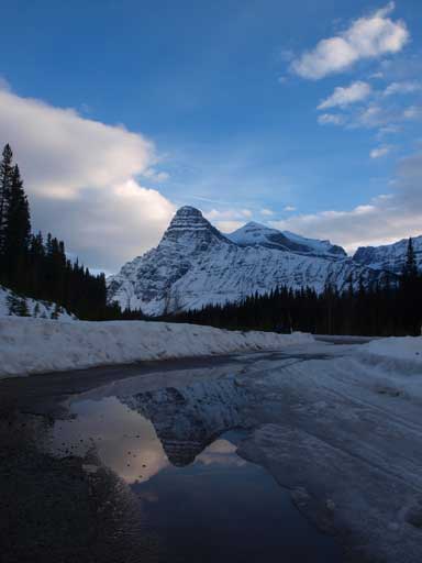
Icefield Parkway (South), AB
Given the great condition and weather in this Easter Weekend, we wouldn’t be satisfied by just Mt. Hector.. Mike and I would be accompanied by Wil Tabak on this day. The avalanche condition would drop to “Moderate/Low/Low”, and weather would be partly cloudy instead of variable cloudiness. White Pyramid, although still a very big mountain, would be easier than Mt. Hector since it doesn’t have the rock step challenge. Its standard route is a mere snow plod in the ‘right’ conditions. We figured that the crux would be locating trail-head in dark, the potential of river fording, and negotiating the creek bed if not being broken.
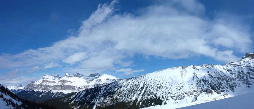
White Pyramid ski/snowshoe ascent route. GPX DL
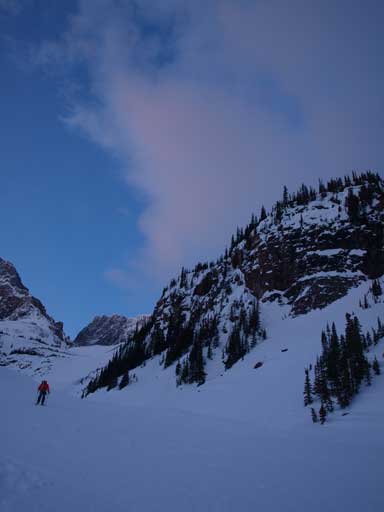
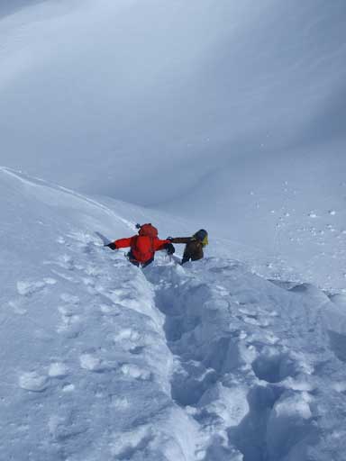
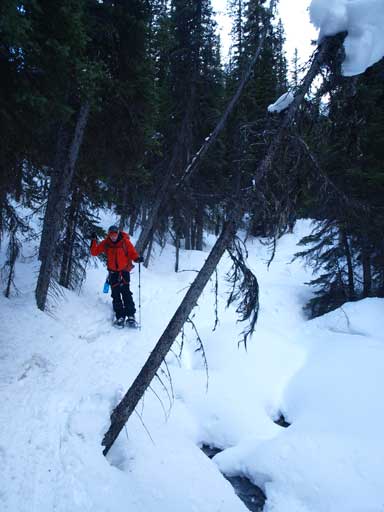
With Mt. Hector knocked off already, I could sleep well on Friday night not thinking/worrying too much about White Pyramid. We woke up at 3:30 am, had some breakfast, drove north, parked at a small pull-out slight further than the supposed trail-head, geared up and started at about 5:30 am. This is a longer drive than Mt. Hector. We drove separately since Mike and I would go home from Highway 11 instead of Highway 1. We kept our eyes closely on any visible ski tracks, and we soon found one on Bison Creek. That wasn’t the way to go, so we kept walking south. Mike found another set of tracks about 10 min into the walk, and we decided to follow that. Well, I have to say, there would be multiple routes to Epaulette Creek in that general area. It really doesn’t matter especially on snowshoes. The tracks we followed crossed the Mistaya River three times, so you might want to choose another one if river fording is required. For us, the river was well frozen and we could walk across the solid ice/snow.
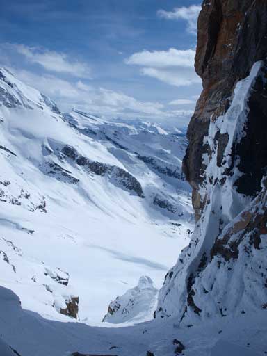
The ski tracks traversed more towards climber’s right and were very easy to follow. They looked to be fresh. However, we didn’t get enough freeze overnight, and we punched down quite a few weak areas and snow bridges. We had to stay on track, otherwise it would be an exhausting game of post-holing. The creek bed, just like Hector Creek, was not steep enough for heal-lift, but steep enough to make my legs sore. It didn’t take us long to reach Epaulette Lake, which was larger than I thought. There was some open water near the creek side. The valley on the other side of Epaulette Lake was also much longer than expected. It took us a while to the base of the steep ascent gully. By this time the sky was getting brighter. It was apparently gonna be a windy day, and I had to take out my jacket.

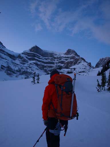
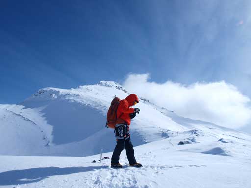
Wil Tabak gearing up in dark
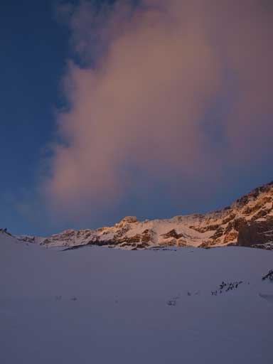
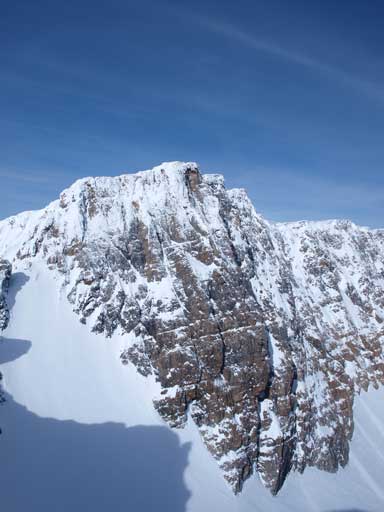
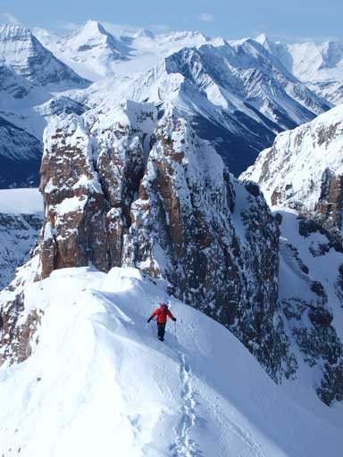
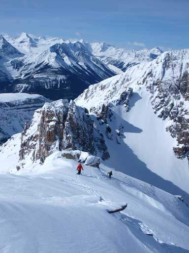
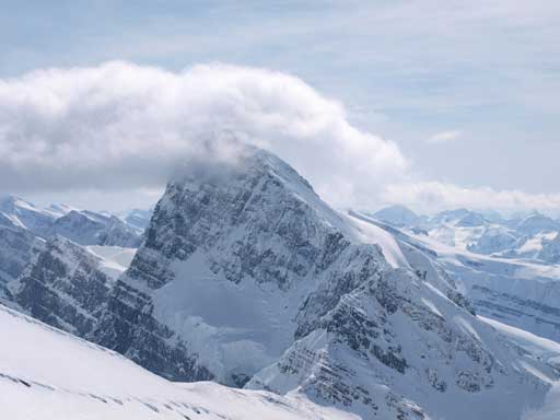
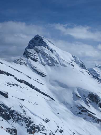
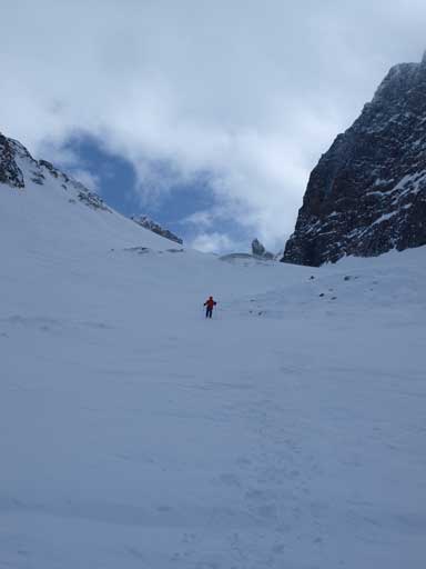
Like the day before, there were some clouds obscuring the summit. They kept rolling in and out. We soon started going up the first part of the gully. Well, I should say, we were going up a steep head-wall to access the main gully. In any case, this part was steep, and long. It reminded us about the slog up Smuts Pass. Looking back, we got awesome photos of Mount Murchison, and the distant Mount Cline. The sun was never shone on us until the summit ridge (west ridge), so we didn’t see the sunrise. However, the orange colours on the East face of Epaulette Mountain was exactly what we were looking for.
Mike just about to ascend the 1st head-wall
Mike on left, with the headwall just above him
This is the prize of doing an alpine start
Look at this face

Cline in the far distance, Mount Murchison dominates the view
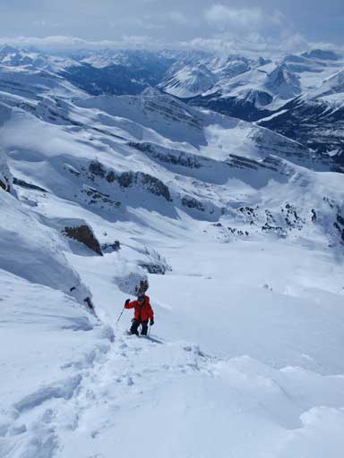
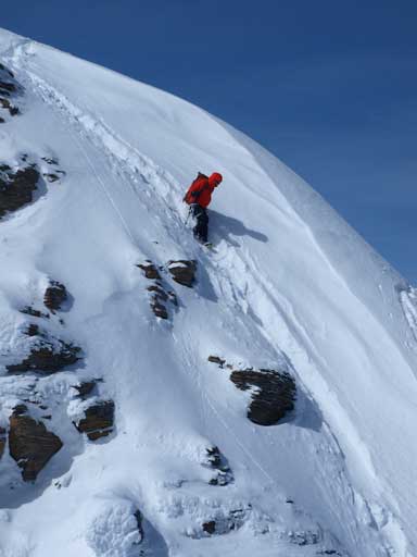
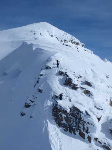
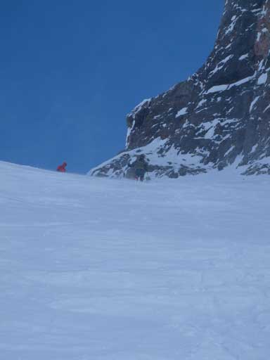
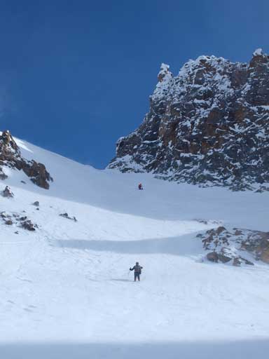
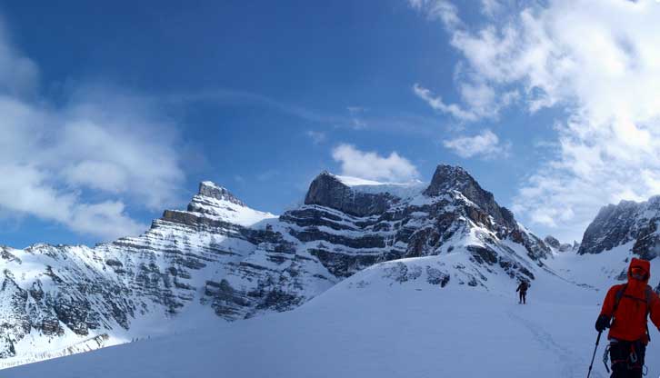
The grade eased after topping above this head-wall. This was an excellent place to take a break. The gully was actually flatter than expected. It steeps a bit, and then flats out, and repeats the cycle, until we were near the end, where we should turn left towards the summit ridge. We resisted the urge of going up too early according to Vern’s trip report, and kept following the gully to its end. Here the terrain was too steep even for snowshoeing. I didn’t see boot tracks and I certainly didn’t want to take off snowshoes and post-holed knee deep. Instead, I awkwardly made some switch-backs and eventually made to the ridge. This is a big slope, one of the biggest I’ve ever been on. Mike took out his ice axe for some security which was a smarter idea.
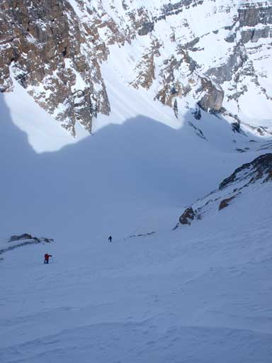
Mike and Wil approaching the steepest slope
Mike ascending the steep slope.
A closer look
We kept our snowshoes on following previous parties’ tracks. Not far up I ditched them, and changed to crampons and ice axe, due to a couple icier spots. Our progress was slow, and by the time we made to the giant slope below false summit, I could already feel the heat of the sun. I was worrying about the snow condition, and I was right. The previous tracks couldn’t support our weight anymore, and I almost post-holed down to the bottom all the way until false summit. Seeing the true summit from the false peak wasn’t encouraging at all. There was apparently still lots of distance and elevation.
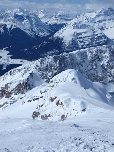
Now the sun is high enough. This is another unnamed peak between Epaulette and White P
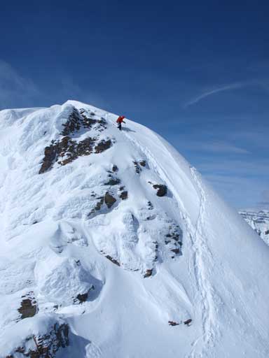
Mike ascending the west ridge of White Pyramid
Mike and Wil approaching the flat bench before the push up false summit
Mike, with the false summit behind

Aiming for an obvious break through a cliff band
Mike approaching the false summit, with big terrain behind

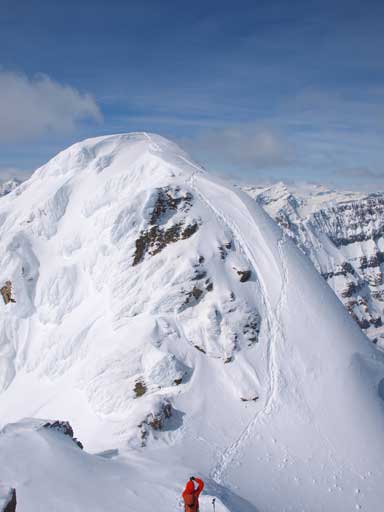
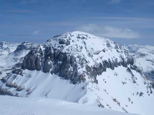
The true Pyramid came into view. It’s within our touching distance now
I like Howse Peak so much that someday I will go bag it.
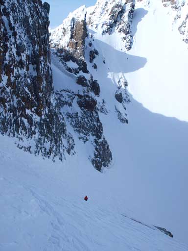
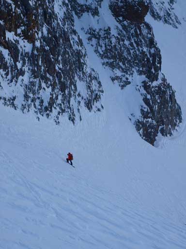
By this time I was starting to question if there is any glacier on this route. The entire route looked to be quite rocky thank to the low snowpack this year. Mike and I decided to proceed on by ourselves, and if the terrain looks suspicious we would wait for Wil to catch up. Immediately we had to descend a steep part. It looked way steeper, but actually not that bad. We could face outwards entirely, and I never sensed exposure. Once down to the col, we had to ascent a short rock step which was also easier than it looked. I took out my probe not far up as soon as my ice axe couldn’t reach the bottom of the snowpack. Still, I didn’t think there’s any glacier on this route. Near the summit, I couldn’t tell so I probed carefully making sure. The suspicious part was too short and we were too lazy to take out the rope… Soon we made it, and there were also rocks on the summit, so really, if anyone knows where the glacier is, please tell me.
Interesting snow on false summit
Mike, just about to descend the steep snow towards false/true col
Mike on the steepest part
Looking back at the false summit
Traversing this snow scoop.
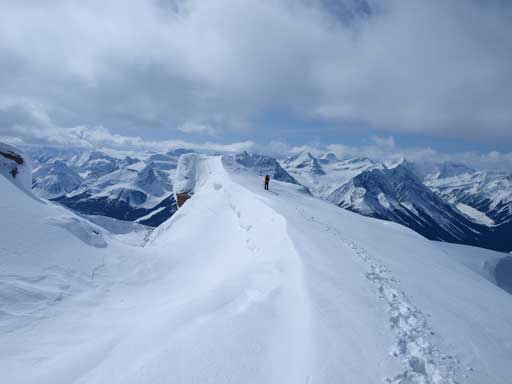
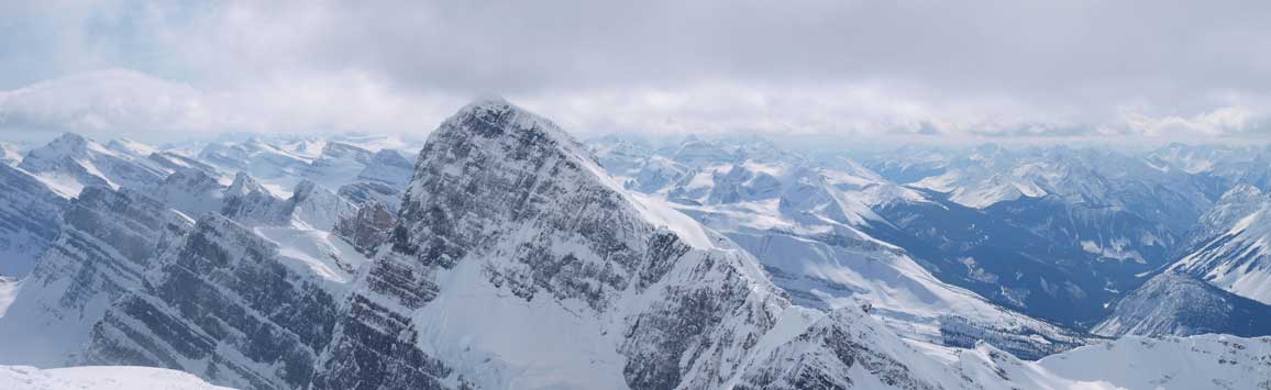
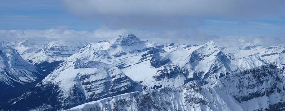
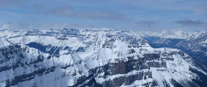
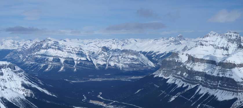
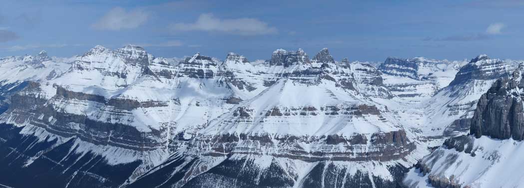
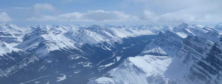
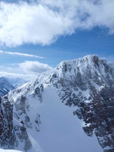
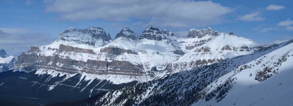
The view was fantastic towards each direction. Mount Chephren looked to be really close, but too bad I had to wait for another day.. Howse Peak didn’t look to be that far neither, but again, it wasn’t on the schedule. This peak is probably the best viewpoint for Freshfield Icefield, and towards Northwest we could see the Lyells and Forbes, and then Erasmus and Amery. Mount Wilson looks attractive, and so does Mount Cline and Mount Murchison. We also got a clear look at Totem Creek, which is the approach route for Corona Ridge. We waited for Wil to show up and cheered on the summit.
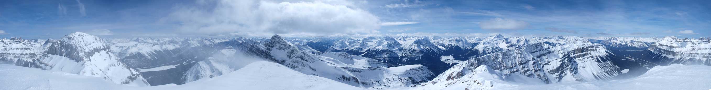
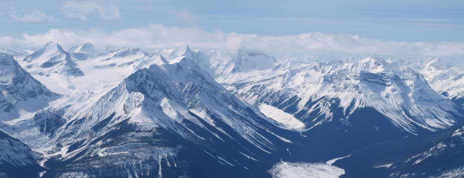
Summit Panorama. Click to view large size
Hawse Peak and the distant Blaeberry River Valley on right.
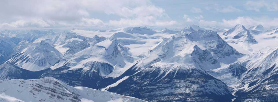
The south section of Freshfield Icefield
The north section of Freshfield Icefield
Mount Forbes is the big one. Outram looks more like “Little Forbes”, with The Lyells in the background.
Erasmus, Amery, with Sarbach in front of them.
Mount Wilson, another big spring objective.
Mount Murchison. I’m really interested in try this, but I want more route beta.
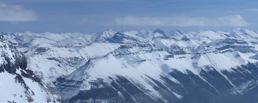
The distant peaks towards East. I don’t know much about their names.
The upper Mistaya Valley, looking towards Bow Summit
Mount Chephren
This is the way up – West Ridge
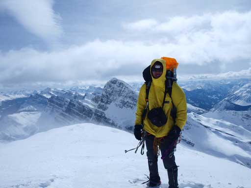
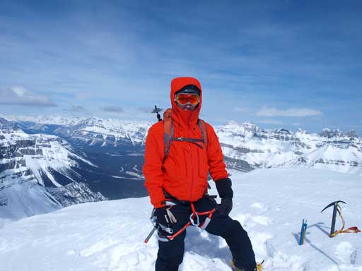
Me on the summit of 3275m White Pyramid
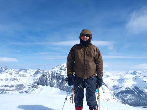
Mike on the summit
Wil on the summit.
It was very cold and windy so we didn’t stay long. Actually the wind picked up considerably in the afternoon, and our entire descent was hammered by the cold wind, especially on the ridge. We met two groups of skiers on their way up. Well, I guess there’re people being more confident on the snow condition than us. The place where we ditched our shoes was one of the few wind sheltered area, and we had a quick lunch break. We kept our ice axe and crampons on, while carrying snowshoes, down that steep slope. Like I said before, it’s a real slope. It’s steep enough that I would never consider skiing it with my current ski skill.
Time to go down
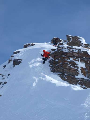
Mike coming down an interesting step. It’s not as hard as it looks.
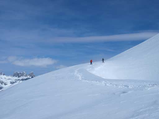
Mike and Wil going up back to false summit
Another group of 3 were on their way up the true peak
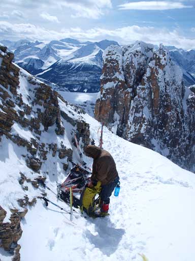
Here is where everybody ditched gears. Some guys ditched their backpacks too.
Impressive mountains (unnamed)
Looking down the south side of the col
Afternoon view of Howse Peak
Wil and Mike just about to descend the big slope
The big slope
Once down this part, we changed to snowshoes again, having a break, and leisurely walked down the big gully. Again, this gully itself wasn’t that steep, and there were a couple flat areas. However, the danger in this part comes from above, the potential of cornice fail. We did see avalanche debris which obviously came from high on Epaulette Mountain. Due to our slow progress, it was getting late, and we got passed by the two groups of skiers in no time. However, the clouds and the low angled sun added to the variability of the views. We took our time soaking in the views, and slowly walked down the head-wall, and then it was a pure slog back to the car following our up tracks. The snow got isothermal and we must stay exactly on the tracks, otherwise, oh well… Once down to the road, we kept looking back and wondering were we really way up there a couple hours ago. It looked BIG…
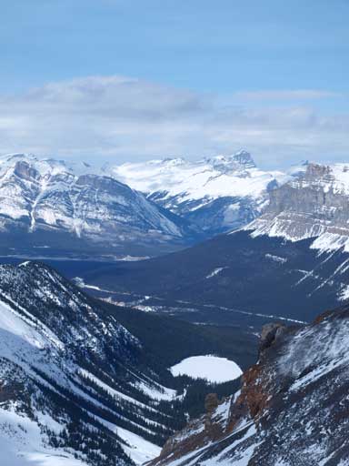
Now I got a clear view of Epaulette Lake. Cline in the far distance
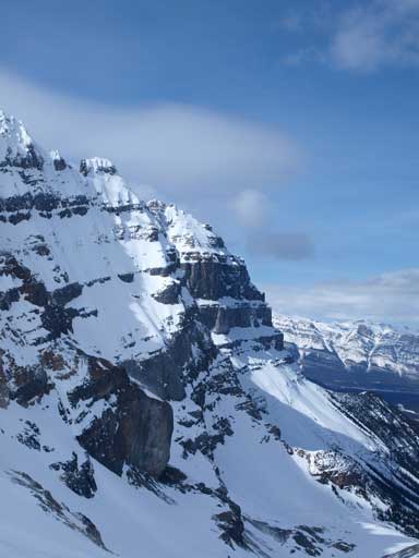
Impressive East face of Epaulette Mountain
Walking down the gully
Mount Murchison

The skiers passed us in no time. They made me jealous
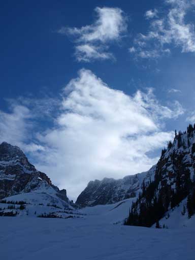
The clouds were constantly changing, making the views more variable.
Chephren on left, White Pyramid on center. The gully on right.

Interesting snow formation, near the top of 1st head-wall

Look at those seracs. No crazy ice climbers?

Mount Chephren
Looking back up the gully again.
Typical walk on the de-proach
Were we really up there? Looking back at Chephren and White Pyramid
Mount Chephren from Highway 93
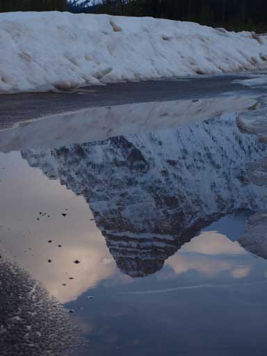
This pool of water gave some interesting photographing oppourtunities
Looking Down at Chephren!
Overall, another awesome weekend in the mountains. I have to say these two peaks are less physically demanding than another 2-peak back-to-back weekend (Carnarvon + Coleman), mainly because of the winter condition. It was like walking upstairs when going up, and plunging-step down was easy on the knees than descending the solid ground in summer. However, it was a great sense of accomplishment to finish two big winter mountaineering objectives back to back. I also got an awesome climbing log in this March: Rhondda, Thompson, Habel, Hector, White Pyramid.
