Tigger Peak (Peak 2650)
November 5-6, 2017
2650m
Channel Creek / Duffey Lake Road, BC
This is a fairly sizeable peak that boasts a few aesthetic ski lines on the eastern reach of Duffey Lake Road although the name “Tigger Peak” is a completely randomly-assigned one by bivouac.com without historical importance. This is a worthwhile objective even if it’s completely unnamed so in this case I don’t care that much. “Bivouac” names beat “no name”. A few trip reports had showed up on ClubTread over the past years with Simon’s standing out as the best. After reading that report I was completely sold to make Tigger Peak happen as a winter ascent.
The first weekend of November wasn’t quite “winter” yet but the snowline had already dropped down to valley floor. The temperature would drop to below -15 degrees thank to an Arctic outflow plus the unknown amount of snow accumulation meant I definitely had to bring snowshoes. It also seems like at this time of a year it’s unlikely to be just a day-trip so I had to haul an entire set of overnight gears. Adding all of the above it sure would be an adventure. This was exactly what I was looking for as this particular peak would be my 700th summit. The objective of Day 1 was simply making to the base camp beside the “upper lake” so there’s no need to rush. I drove out of Vancouver at around 6 am and that put me at the trail-head about 1 hour after sunrise. There’s no designed parking pull-out just so you know.
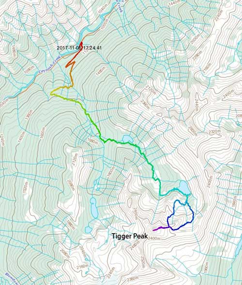
Tigger Peak via Channel Creek. GPX DL
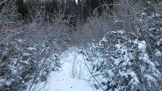
The approach is via Channel Creek and the first 4 km was bashing up the deactivated Channel Creek FSR. The level of degradation was worse than expected. The first 2 km was still in a decent shape at least for walking but after a major path of landslide things went down in no time. The alders grew in really badly that I had to constantly swim through the brushes. To make it worse there’s some recent dusting of snow making some very wet and unpleasant bushwhacking. Thankfully it was cold enough that the snow stayed reasonably dry but having so much white stuffs dumping on top of myself is never a pleasant start of a trip.. Slow-ass going as it was. There are also quite a few unsigned intersections that the only way to make sure you stay on route is to have a pre-drawn GPS track.

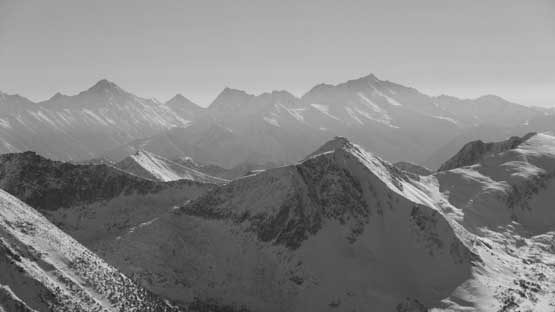
Some typical Duffey views from the lower Channel FSR

The first 2 km up Channel Creek FSR was easy going on foot

Beyond 2 km this road will remind you it is overall the wild west coast..

There are a few really bad spots that I really had to power through.
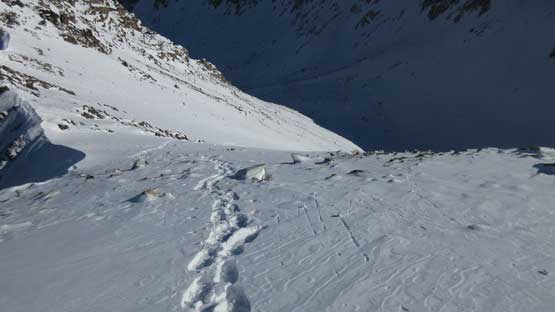
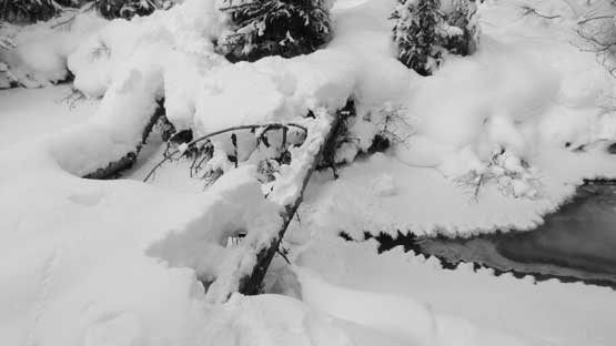
At the end of this Channel Creek FSR I thought I could take a break from the sustained bushwhacking but I was wrong. The “flagged trail” mentioned in various sources wasn’t that easy to find. Firstly a couple flags directed me straight into a clear-cut and as peak-baggers we all know how painful to travel inside a clear-cut. And to make it worse I then had to cross Channel Creek to its east side bank. This wouldn’t be much of a deal in summer but right now the logs were all coated with snow and verglass. Au-cheval or putting on crampons? I opted for neither, went upstream for about 20 meters and found a patch of ice to just walk across. The ice could break at any time but as freaky as it seemed I had my fate on the H2O’s hydrogen bond.. Once picking up the flagged trail I had about half-an-hour’s break from bushwhacking as this trail was pretty easy to follow. The problem arose as I slowly working my way towards the “first lake” that the trail actually went into the South Channel Creek drainage.

At the end of this deactivated road I picked up a flagged trail
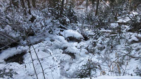
But first of all I had to cross Channel Creek which was a pure mess
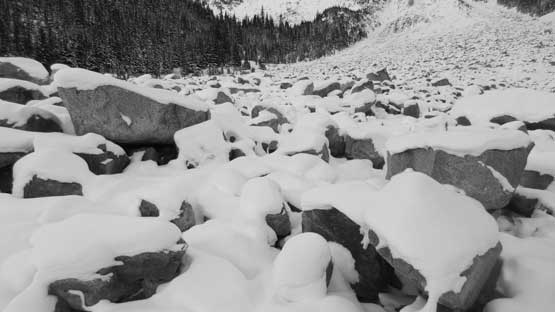
I realized this mistake through constant checking of my GPS screen. It’s obviously not going the right way so I bailed that trail and cut into the correct valley. There’s some increasing amount of bushwhacking due to underbrush but without a significant increase in resistance. There’s also one boulder field that I had to bypass. A thinly covered boulder field is the worst type of terrain especially with a heavy pack but on this trip that seemed pretty inevitable. Nonetheless I reached the shore of “first lake”, skirted around on the south side but the real adventure was just about to begin. I would not want to document the next stage in details as it’s pointless and not fun at all. The degree of bushwhacking was fairly sustained mostly due to tight timbers and dead-falls. The snow depth was never deep enough to keep the snowshoes on, but yet deep enough to create arduous post-holing. The solution? Just strap your snowshoes on and off for at least 10 times. And there came a few sketchy boulder fields. In other words, this was terrible.
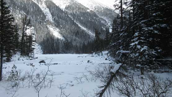
Arriving at the first lake. The “fun” hasn’t really begun yet

This is the theme of this trip. If you cannot handle this then go home now…
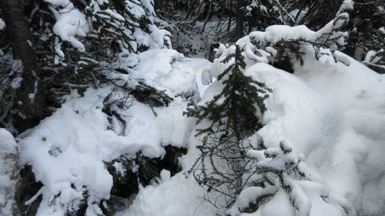
The bush wasn’t terribly by the west coast standard, but fairly sustained
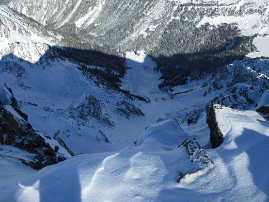
The bushwhacking ended at the bottom of a gigantic path of boulder fields. It seemed like I’d have no choice but to cross or ascend this tedious terrain. Most, if not all of the boulders were covered by a thin layer of snow making ultra sketchy travel with, or without snowshoes. I opted to cross the path and ascend beside it on climber’s left side and this worked as much as I was hoping for. After ascending for a long while I cut left and traversed another long stretch of boulders (this time, side-hilling) to the entrance of “second lake”. It’s about the time to call a day but I ventured down to the lake shore anyway to check things out. The terrain did not look very inviting so I backtracked a bit and set up camp in the forest. And then there went the winter camping routine (kinda fun) and then the long long night.
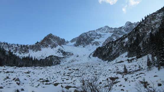
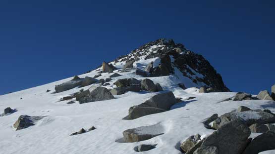
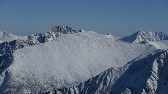
Arriving at the bottom of a gigantic boulder slide path. Tigger Peak looms in front

Let’s face it… Be a man…

After a long grunt up the field I arrived at a traversing bench.

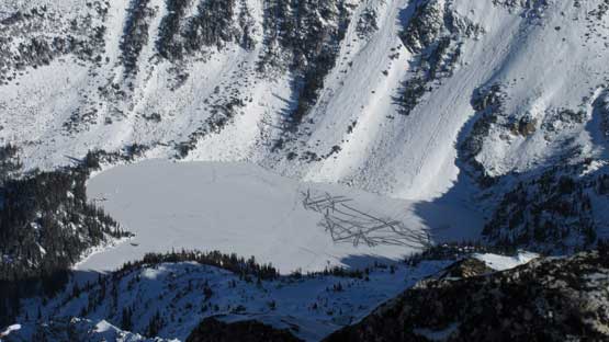
Checking out the upper lake.

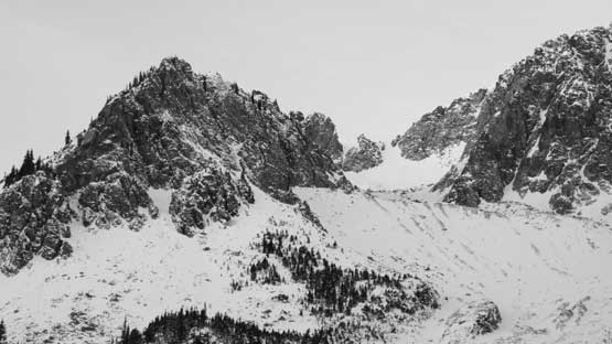
Evening colours on the west slopes of Channel Peak. The end of Day 1
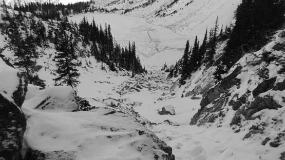
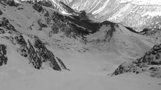
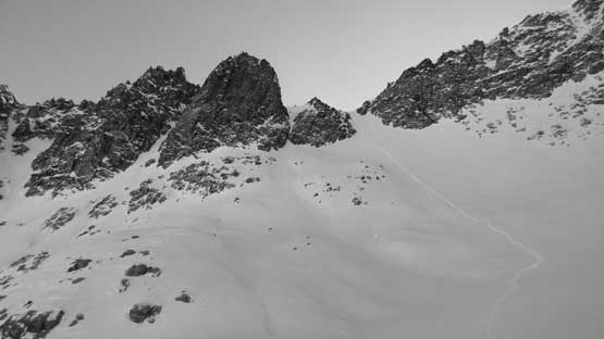
One reason why I like winter camping is that I can catch up as many hours of sleep as possible. Pretty sure I slept for at least a solid 13 hours but I won’t complain about that. I didn’t set up an alarm or any sort like that so woke up leisurely after sunrise, and soon enough I was on my way towards my objective. Firstly I followed my own tracks down to the lake and not wanting to fuck things around I just walked across the ice with snowshoes on. Traversing the lake shore looked terrible or next to impossible so I didn’t really have much of a choice other than taking chances with the early-November ice. At least the whole lake was totally frozen over.. I traversed at least halfway around and there were only two possibilities to access that upper basin. Neither looked inviting so I just randomly picked one and the punishment was again, thin-snow covered boulder fields with some chucks being sketchily loose… One big block wobbled upon touching. The snow coverage improved a little bit higher up as I slowly ascending into the “hidden valley”.
Looking down after finishing this boulder-gully-of-pain…
Working my way around to the NE side of Tigger Peak

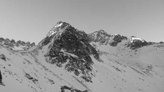
Looking back towards Channel Peak

Slowly, but steadily working my way into the “hidden valley”
It’s now that the “fun” part finally began. For the least I could finally keep the snowshoes on without having to worry a hidden boulder’s gonna snap my Lightning Ascents into pieces. Post-holing was reasonable. There’s a bit of undulating terrain to cover but with some gradual elevation gain throughout, and then there came the headwall to get out of this “hidden valley”. This headwall looked pretty fearsome from afar but there exists a not-so-steep way on climber’s right side. It’s about 35-40 degrees for a while but I managed to keep the snowshoes on throughout. The condition was a light dust on top of a icy firm base layer (just as expected) and the crampon system bit really well. Above this headwall the views opened up and then the terrain transitioned into the windswept alpine.

Into the “hidden valley” now. It’s finally getting better

This is the headwall at the end of “hidden valley”.
Ascending a steep slope to get out of the valley. Grade was sustained 35 degrees.

Near the end of this steep grunt I finally started to see things around.

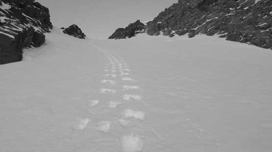
Looking down at my snowshoe tracks out of the valley

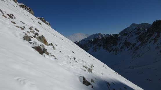
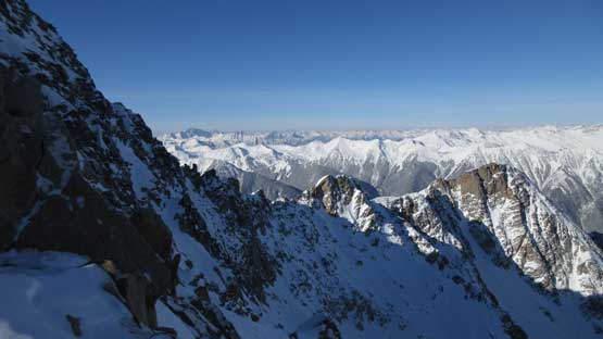
Topping out on the upper east slopes now. Elusive Peak behind on skyline

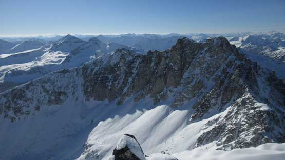
This is looking across the upper east slopes into the Gott Creek valley

A zoomed-in view of the west slopes of Channel Peak
The snowshoes were ditched in no time and there came the final 200 meters of gain to the summit. Much of the last stage was plodding up frozen scree with occasional snow patches with either post-holing or step-kicking. The crampons weren’t required and the final summit block required a few moves of scrambling. The views were totally awesome and there’s surprisingly some cellphone reception…
The summit is not far away now.
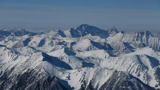
Looking across the north face into a sea of peaks and ridges
This is looking down the upper east slopes into the “hidden valley”
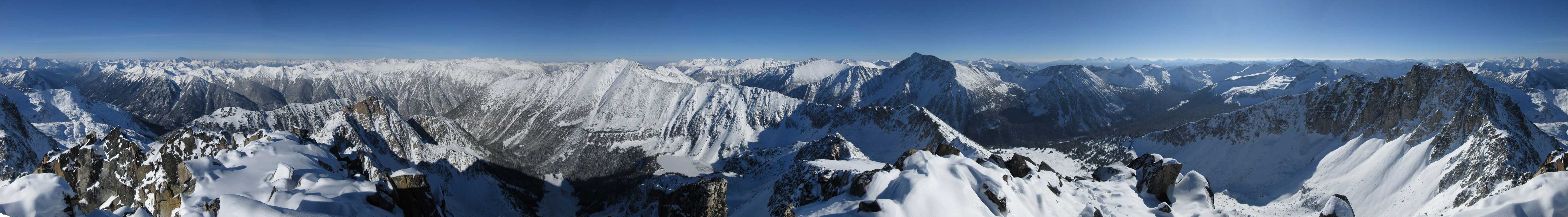
Summit Panorama from Tigger Peak. Click to view large size.

Elusive Peak

North-east horizon with Mt. Brew being the tallest

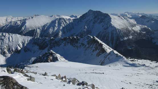
This is looking back towards the “west Duffey” area with lots of familiar peaks.

A closer look at Mt. Brew the 5th highest in SW BC
Wonder Mountain pokes behind a sub-peak of Elusive Peak
Mt. Marriott looks like a giant from this angle.
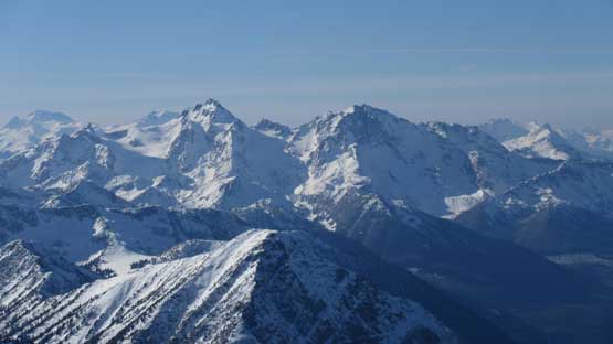
Mt. Matier and Joffre Peak catch one’s eyes from anywhere
Moomin Peak is more impressive than I thought
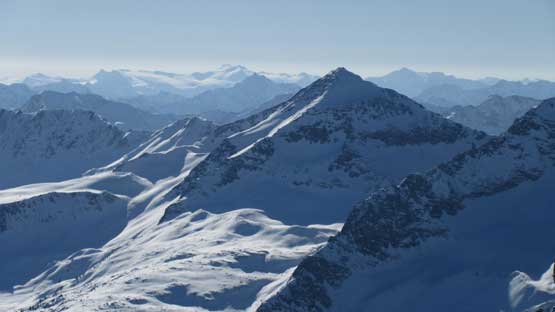
Skihist and Petlushkwohap on the horizon, the 1st and 2nd highest in SW BC

Looking up the upper Gott Creek valley towards Siwhe Mountain on the horizon
This is looking down at the upper lake where I camped near
“Tigger SW1” in the foreground.
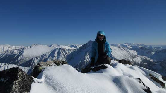
Me on the summit of Tigger Peak, my 700th summit
The north face is surely an impressive one…
After updating my various accounts I had to move on. There’s not a lot of extra time to kill at this time of a year plus I would rather finish the bushwhacking before dark, if possible. After retracing my steps down the upper slopes I noticed a couloir on the NE side. I had previously spotted that line from lower down but wasn’t sure if it connects to the regular route. This looked much more aesthetic than the “hidden valley” so I spent a couple minutes donning crampons and ice axe. I brought them up so better actually use them.. The snow condition was needless to say, next to perfect with each step down feeling like kicking into styrofoam. In no time the couloir was over and then I did another gear transition back to snowshoes and poles. Plunging down back to the lake was also much better on this side of the peak but I did have to make a few guesses near the bottom. The last gully-of-boulders was inevitable and that sucked.

Time to head down…

This is roughly where I found the entrance into that “NE couloir”
My snowshoe tracks farther down. That’s the “hidden valley route”.
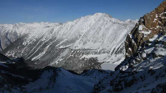
Another look at Channel Peak
This couloir on the NE Face is far more attractive
Kick, kick, kick and kick.

Impressive terrain on the north face

Massive terrain around and would be nice ski area too.
A review shot of the couloir that I down-climbed

This is looking towards the entrance of “hidden valley” where I came up from

Another shot looking back at the NE Face

Having enough fun with this snow-covered-boulders??

Down to the upper lake now. I just walked on ice.

Back to camp, but have to immediately break camp..
Once back to camp I wasted no time but packed things up as quickly as possible and then down I went. The descent was surprisingly easy because I could just follow my own tracks without too much brain power required. There are a few places that I thought I didn’t pick the best line on ascent but better stick with the known. Eventually the shit show came to a brief stop and then I rushed down that flagged trail and then used the same ice bridges to cross Channel Creek back onto the deactivated logging road. Hiking down the road still required lots of alder swimming but at least the gravity was on my side so things were a little bit easier, so overall the descent was much faster than expected. I didn’t even need to use head-lamp until the final 1 km down the road but that’s OK.

Leaving camp, this is the first boulder field that I had to cross…
The second field of boulders that I had to cross. Fun time..
Just another shot to show the NE Couloir that I down-climbed.

The bushwhacking was pretty bad at places.
Only if there’s more snow… This was really interesting.

Down to the first lake now…
And now, back to the road. And there’s still a ton of alder thrash left..
As cold as it was I immediately started the engine. Five minutes later the truck’s back on the road and the next destination was Pemberton. The rest of the way back home was uneventful and without traffic. Overall this was surely an adventure with hardly anything worth recommendation. The summit view is great but the work required to get that far is simply too much. In short words you want to have either no snow or a lot of snow, otherwise don’t bother.
