Nicomen Mountain
February 3, 2021
1221m
Mission, BC
Nicomen Mountain is just another forested summit in the immediate vicinity of Mission that boasts a dull-looking profile. This peak is highly visible from a lot of places in the Fraser Valley but offers very little mountaineering interest. This peak was however, somewhat attractive to me for a few years because of the lack of information, especially considering its proximity to Mission. It seemed to me that all routes involve fair amount of bushwhacking and/or trespassing private properties. The status of this peak had suddenly changed in the past year thank to the exploration and dedicated work done by Craig Bresett. Craig came up with a creative solution by linking up the Raven Bluffs trail, the (new) logging road systems on the south side of Nicomen Mountain and the steep forest on Nicomen’s south slopes and had spent countless days and hours building, flagging and maintaining a trail that goes all the way from sea level to the summit. The very top of this peak is completely covered in trees but an open bluff about 200 m down east past the summit offers some nice views so the trail actually extends to this viewpoint.
2020 seemed like the busy year for Nicomen Mountain with many ascents reported right after Craig published his work, including some big names in the local peak-bagging community such as Simon Chesterton, Alan Blair, Chris Hood and Ben Shewan, along with numerous “new” peak-baggers with names that I was not very familiar with. It’s fascinating that such a local summit had been untouched by guys with 10+ years of peak-bagging in SW BC and that also explained why I was keen on Nicomen Mountain even well before Craig’s trail showed up. Now with the beta already out all I needed was to preload two sets of GPS tracks sent by Al and Craig into my Gaia map. I also determined that this peak could be done as a before-work exercise and I even found a partner – Ashkan R. to join at the last minute.
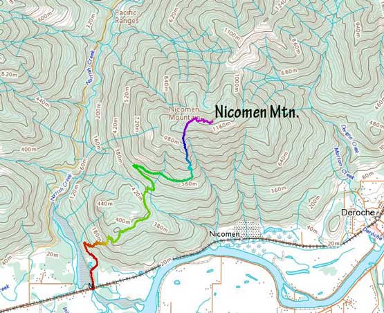
Nicomen Mountain via “Bresett Trail”. GPX DL
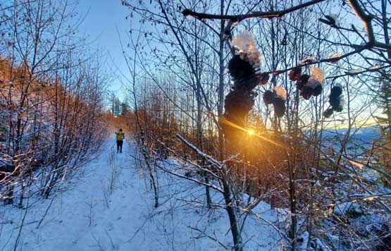
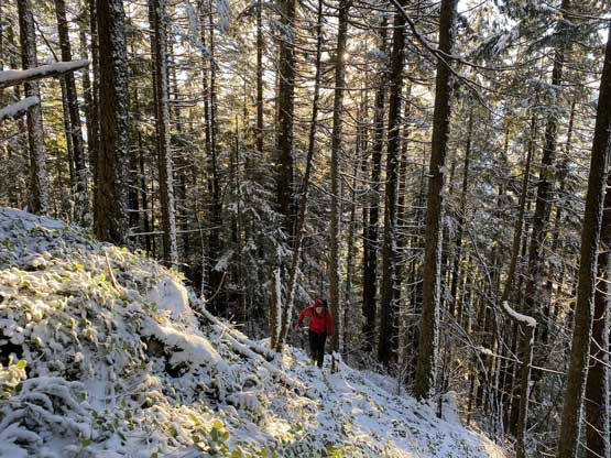
Both Ashkan and I started work at 3:30 pm in the afternoon and I estimated the trip would take around 6 hours. To give us enough contingency we agreed to meet at the trail-head at 6 am and started the first hour in the dark. The first hour was spent hiking up “Raven Bluffs” trail to a few viewpoints. The trail was quite steep but gained elevation quickly. We made to the last major viewpoint still with head-lamps on, so carried onward. We correctly found the trail that Craig built to link onto the aforementioned logging road system. The roads were in walkable shape but very muddy with lots of puddles of water. After another kilometer or two we merged onto what seemed like a new, wide-open logging road. In fact, this road could be driven up but a gate in Norrish Creek valley required a special key to open. I thought about to pay for the code but I also hated the permit bullshits. We followed this road to the very end where the steep trail started in a cut-block. At this point we had encountered a few inches of fresh snow on the ground.
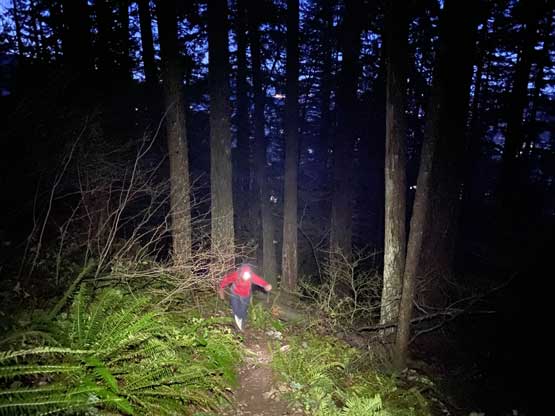
Ashkan hiking up Raven Bluffs trail in pitch dark
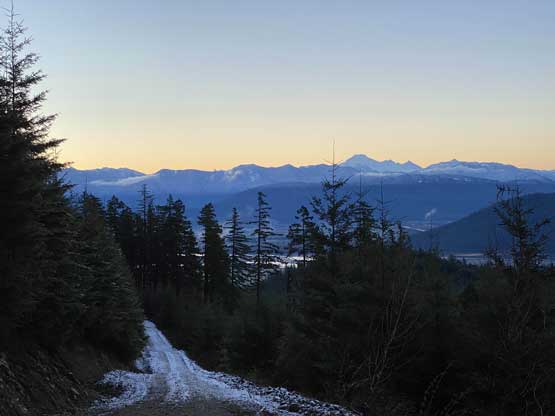
A long while later on the logging road section we saw the dawn skyline
Me on the highest logging road spur with sunrise. Photo by Ashkan R.

Ashkan walking on the highest spur road
Another photo of me with sunrise. Photo by Ashkan R.
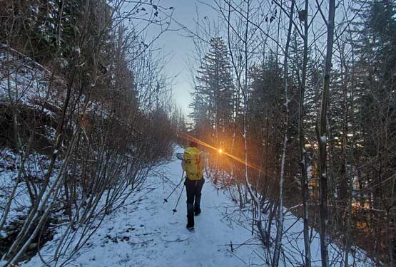
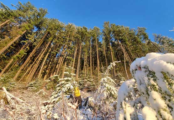
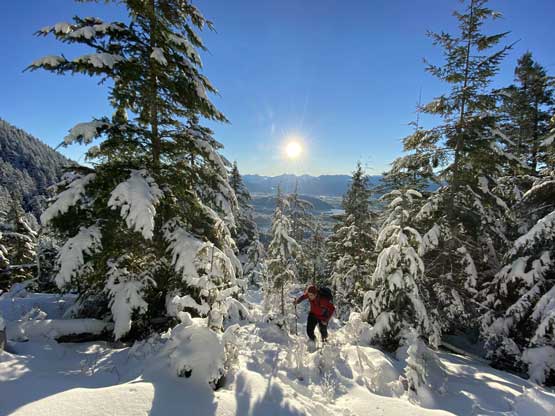
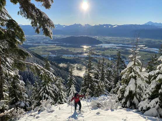
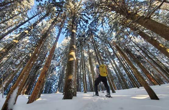
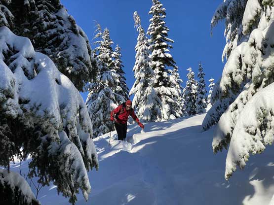
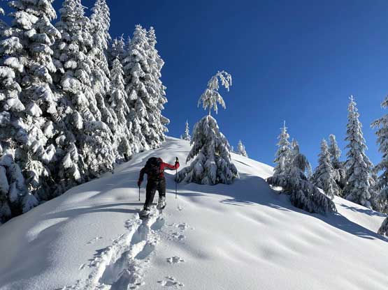
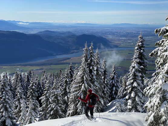
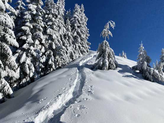
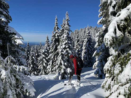
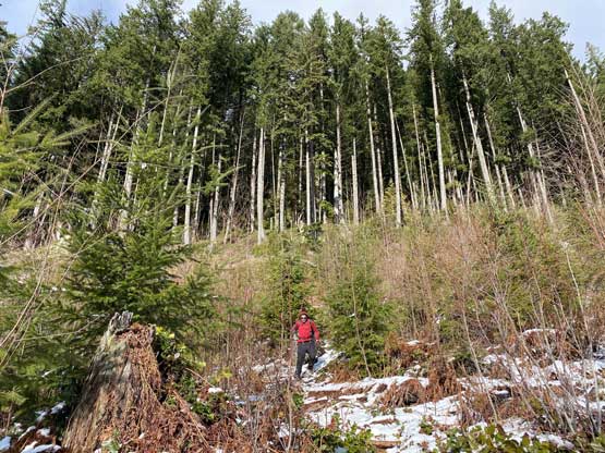
The ascent in the cut-block was surprisingly scenic in the morning hours and we took our time taking pictures. The cut-block soon gave way to mature forest that we had to deal with a few hundred meter’s of elevation gain on steep and slippery ground. The trail was not very obvious in the fresh snow but there were enough flags to help us orient. A while later we merged into another semi-opening area where the wallowing was deep enough to warrant the use of snowshoes. Once this opening area gave way to mature forest the snow depth drastically decreases back to a couple inches but we were too lazy to take the snowshoes off again. A few more hundred meters of gain later the snow depth was finally enough for proper snowshoeing.

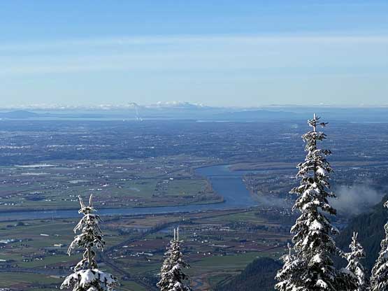
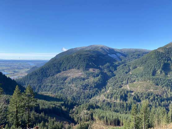
The cut-block offers some unobstructed views looking south

Ashkan ascending through the cut-block
Me trying my best to stay on trail despite the fresh snow

The morning Sun behind the Chilliwack horizon
Ashkan on the edge of the cut-block soaking in the views
Ascending into the mature forest now
The typical steep grunt in the mature forest
We were surprised to come into this patch of opening
We strapped snowshoes on at this stage
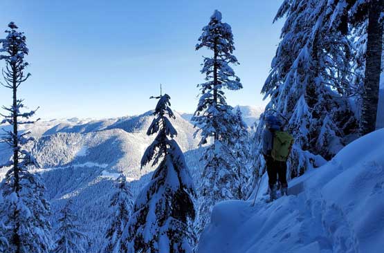
The snow depth increased in no time and the snow condition was wet and heavy. We sank past our knees wherever there wasn’t substantial tree coverage. The ascent onto the true summit was relatively easy but the traverse to the viewpoint involved fair amount of post-holing. The view from this viewpoint was worth the extra effort though.
Me snowshoeing up the upper forest. Photo by Ashkan R.
We found a northern viewpoint. Photo by Ashkan R.
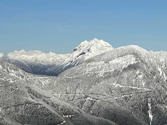
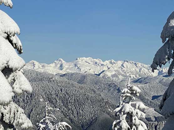
The massif of Mt. Breakenridge from this viewpoint
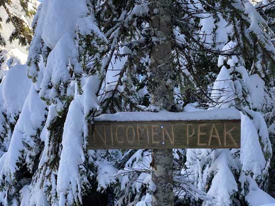
The sign suggested we made the summit. No view from the very top…

Me checking out the very fancy register. Photo by Ashkan R.
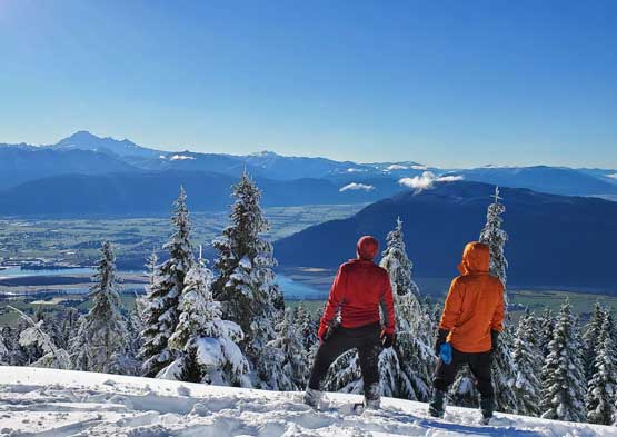
Despite the deep snow we were determined to check out the eastern viewpoint
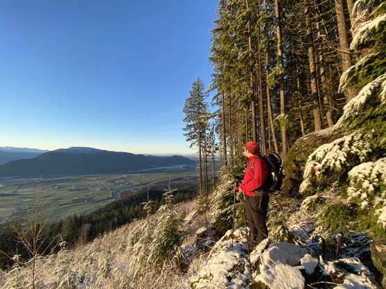
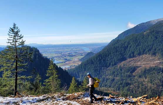
Looking back down into the Fraser Valley
Ashkan breaking trail up towards the east viewpoint
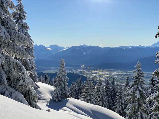
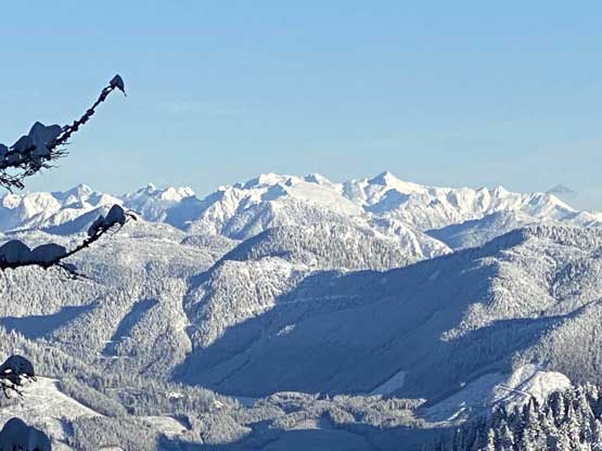
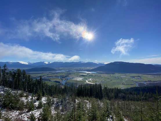
The Fraser Valley and peaks in Chilliwack Valley
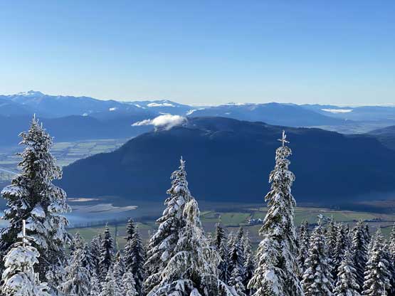
Sumas Mountain in the foreground
Slesse Mountain pokes behind
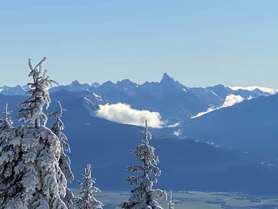
Mt. Judge Howay with The Defendant on the far left
Mt. Robie Reid close-up shot

Golden Ears blends with Edge Peak; Blanshard Needle sticks out on left
Looking back at the true summit from this east side viewpoint
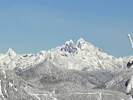
Mt. Clarke et al. in the core Chehalis Group
Ashkan and I near the summit of Nicomen Mountain.
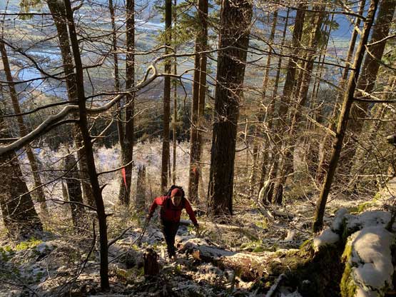
Traversing back onto the true summit was easier than I thought and so was the plunge on the upper treed slopes. We kept the snowshoes on all the way past where we strapped them on earlier in the day. While descending the lower forest we got showered by the snow-melt on the trees. The temperature had become fairly warm and the fresh snow was all gone. The rest of the descent was uneventful but boring and long. I did not take a look at the stats before the trip but our trip clocked at around 16 km distance and 6.5 hours.
Ashkan starting the descent
Looking back at the trench we dug out…
Playing around in the deep snow was kinda fun

Another shot looking back at our tracks
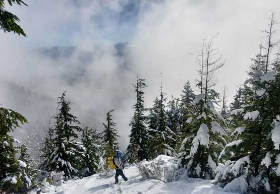
The clouds lifted in while we descended. Photo by Ashkan R.
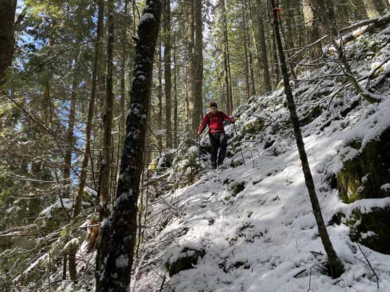
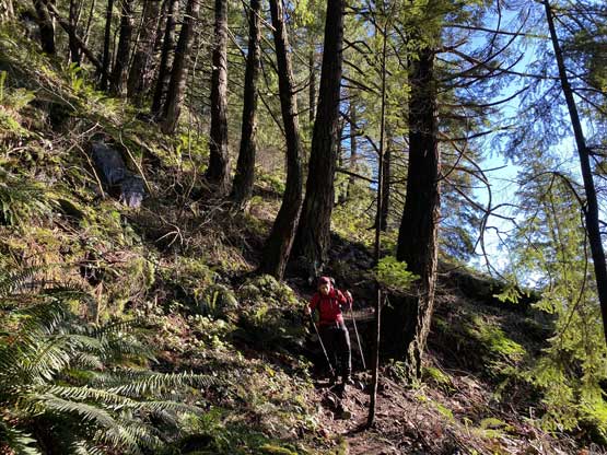
Careful work needed to negotiate the very steep and slippery forest
Back into the cut-block with plenty of views
Ashkan descending the cut-block
A view of Dewdney Peak
Me walking down the logging roads. Photo by Ashkan R.
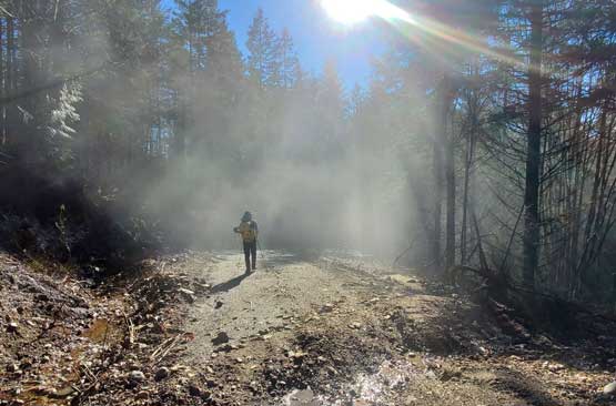
A misty scene in the forest. Photo by Ashkan R.
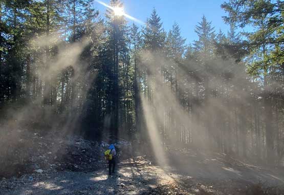
Another shot of me walking into the mist. Photo by Ashkan R.
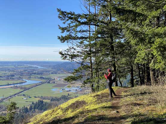
Ashkan checking out the Raven Bluffs viewpoint
Descending the unforgivingly steep Raven Bluffs trail
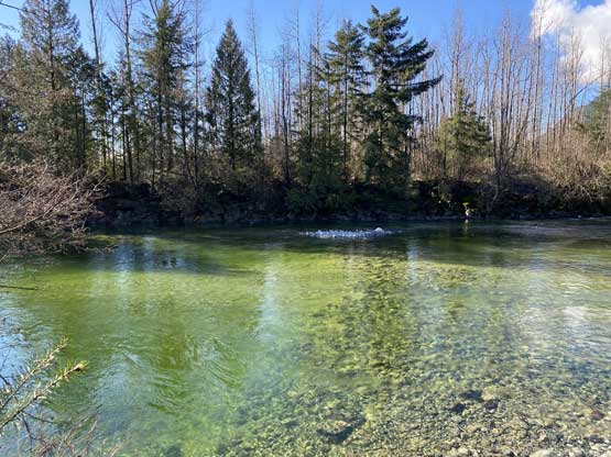
Down to Norrish Creek now, 200 m from the trail-head
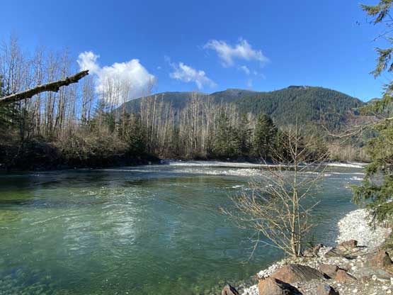
Looking up Norrish Creek with Dewdney Peak as a backdrop
The trip was a little longer than anticipated so I rushed a bit on the drive home, after having lunch in ABC Donair in Mission. I did get back home in time for work but didn’t quite earn myself that extra time to sleep.
