Mount Douglas
August 25, 2017
229m
Victoria / Vancouver Island, BC
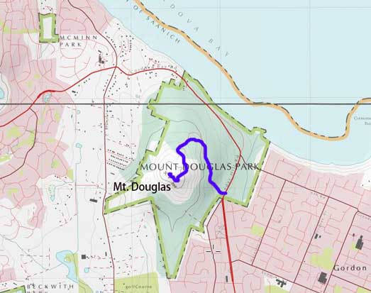
Mt. Douglas is rather just a lowly, but obvious hilltop in the Greater Victoria of southern Vancouver Island but on a clear day it offers some fine views of the Saanich Peninsula, the San Juan Islands and even the high peaks on the Olympic Peninsula of Washington state. The hike is however, very much just a causal walk in an urban setting. There’s no wilderness feeling whatsoever so I personally wouldn’t even want to call this a “hike”. There are a whole bunch of trails on all sides of the peak along with a paved road so one can imagine the popularity it boasts.
Adam (Gimplator) and I wouldn’t take the expensive ferry rides to Vancouver Island just for this lowly bump. Our primary plan was Golden Hinde but some weird scheduling gave us a half-day time frame to kill. In that specific scenario I suggested Mt. Douglas as a suitable objective as it would give us a decent introductory of the Victoria area. I had been to this city twice in the past – first time in a field trip of Socials 10, and second time for a badminton competition. I never got a chance to really take in the scenery of this city so I was actually quite excited to come back.
We got to the Tsawwassen terminal roughly an hour before the first scheduled ride just to be sure we could actually get onto the ferry. This worked out pretty nicely but on the downside I was super tired. I ended up pretty much just sleeping in the car during the ride. The weather was overcast anyway so there’s little point in taking pictures. Once onto the island I directed my iPhone navigation app to the “summit of Mt. Douglas” and meanwhile the ceiling was slowly lifting just as forecasted. The app led us through some pretty curvy and secondary roads in such way that I got completely disoriented. Other than simply following the instructions I had little clue where we were actually going. The road to the summit was gated in the morning but that just meant we could get a chance to stretch our legs.
Mt. Douglas in the city of Victoria
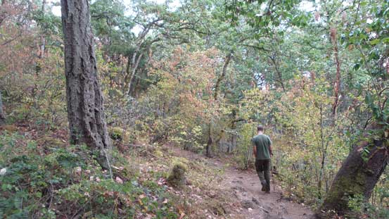
This gate was not part of my plan as what I wanted was a simple drive to the summit, but thankfully there’s a pretty big map with all of the trails shown. The easiest tactic was simply following the road to the top but we decided to make things just a little bit more interesting. There’s a trail of Irvine rated “black” which caught our interest. The first stretch was still following the road but then at a signed junction we left the road. This trail was a little bit steep and rocky at places but we had no problem even with just a pair of Nike runners. In no time we got to the southern sub-summit and then it’s a casual walk on a paved path to the highest point.

The first stage was walking up the access road
And then we branched off using the trail “Irvine”
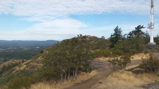
Looking towards the true summit from the south summit
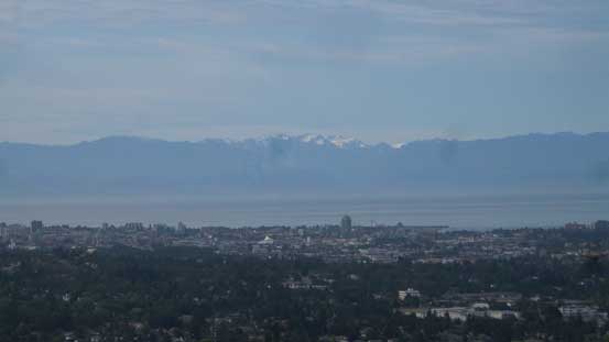
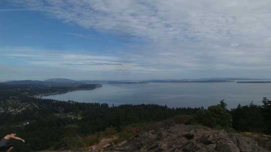
The glaciated massif of Mt. Olympus behind the downtown Victoria
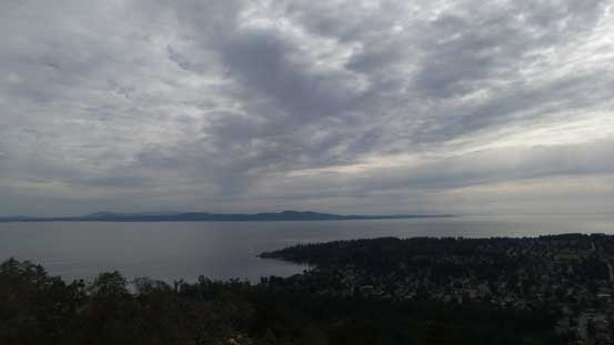
As you can see the sky was still mostly overcast
This is looking north into Haro Straight
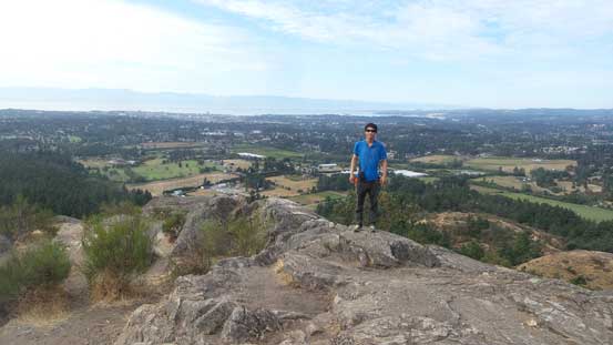
Me on the summit of Mt. Douglas…
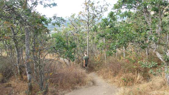
The sky was still overcast but the clouds were really clearing so there’s no point in rushing. Eventually we got some sunshine and figured it’s good enough so started the descent. To make the trip more memorable we opted for another “black” trail called Glendenning on the south slopes. This was again, a bit steep at places but the most interesting thing was a stretch of sandy path. It was pretty much like walking on a desert floor or a beach but apparently none is the case here. Lower down we picked up the Whittaker trail which got us back to the parking lot.
Going down
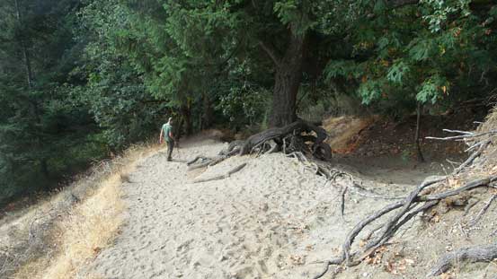
I’m curious where did those sand come from…
Down to the trail “Whittaker” now
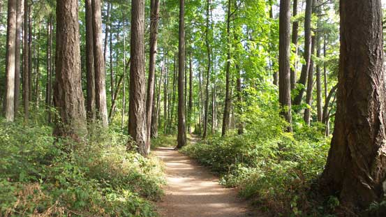
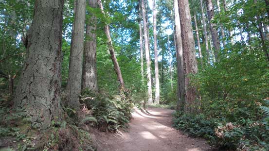
Good hiking in Vancouver Island rainforest nonetheless
Another unexpected delay that Adam’s car key was low on battery. That could cause some serious problems but luckily we managed to find a local Subaru store in the city of Victoria. The downside was again, some extra time spent so that eventually we gave up the plan of doing Mt. Finlayson. There’s not enough time to squeeze that one in so we just turned north and the next stop would be the Arnica Lake trail-head in the heart of Strathcona Provincial Park.
