Storm Mountain
August 12, 2012
3161m
Banff – Castle Junction, AB/BC
I was quite tired after the long ascent up Fisher Peak in the previous day, so I was looking for a shorter objective. Kevin Papke and I were originally planning on Wapta Mountain, but after realizing how “difficult” that peak is Kevin figured we should do something less (technically) demanding. We re-scheduled it to the following Wednesday (with rope and gears, etc.) and Kevin pointed out the nearby Storm Mountain as we drove up the Bow Valley corridor. Did we pick an easy objective? No!!! It turned out to be the least enjoyable scramble I’ve done in Alan Kane’s Scrambles in the Canadian Rockies so far.. And not to be confused with another officially named Storm Mountain in the Highwood Pass area, this one is on the boundary between Banff and Kootenay National Parks on the continental divide.
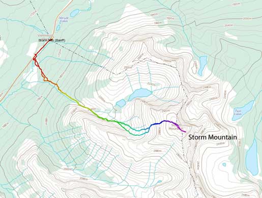
Storm Mountain standard scramble route
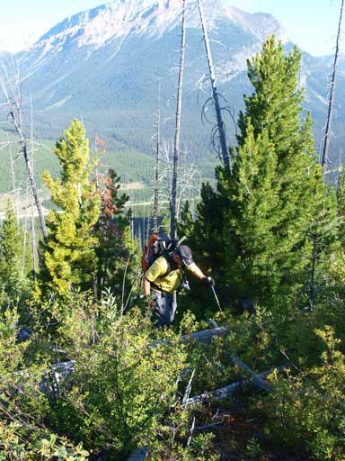
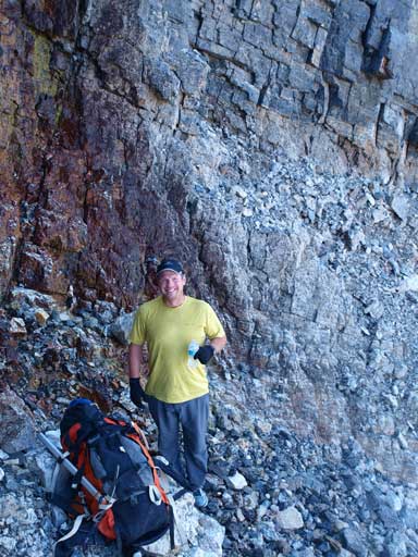
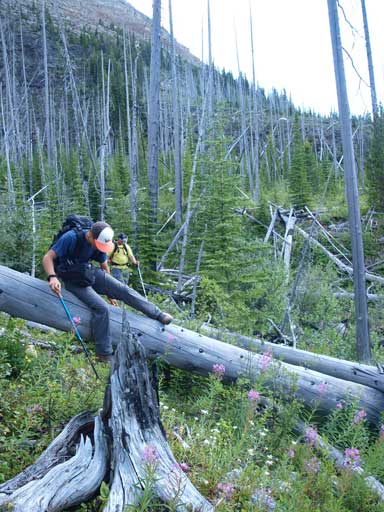
Because of the last-minute change of plan, I didn’t do any preparation on Storm Mountain. I didn’t know there’s even a trail on the left hand side of the main drainage… We met 4 scramblers from Edmonton at the parking lot, but we decided to go separately. They went ahead of us so they could help us scare away the bears. Kevin and I started the bushwhacking soon after the start. We traversed diagonally up until crossing a small drainage. We crossed it according to Kane’s book, and then ascended straight up on its right side. The next half hour was to negotiate a thousand of deadfalls… This isn’t the worst bushwhacking I’ve done, but definitely the worst bushwhacking I’ve done in Kane List. Higher up, the bush got less dense and we started traversing more towards climber’s right. Eventually we reached the main drainage and we re-grouped with the other 4 scramblers.

Bushwhacking through hundreds of deadfalls
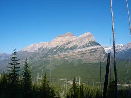
Looking back, we got Mt. Whymper behind
Typically typical
Finally out of the trees.
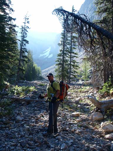
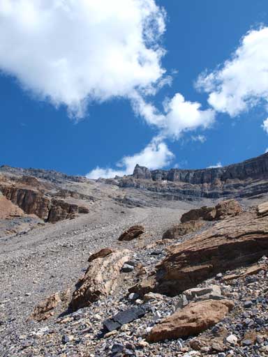
We took a short energy break and soon started the trudge up the gully. It’s very foreshortened… It took us a while to get to the upper part where we should leave the gully and traverse more towards climber’s right. We went too far up and as a result, we had to negotiate a giant boulder field. Good thing was, the rocks were generally stable at this point, as we quickly made ourselves to the upper bowl, the official start of scree bashing…

At the start of this drainage. There were quite a lot of boulders to deal with.

Now we officially started the scree bashing…
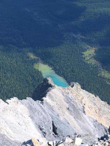
The initial part of the scree wasn’t too bad for going up. It was mainly a rubble slog, but as we went higher and higher, the terrain got steeper and steeper, and the rubble slope became more and more unstable… Three of us (we grouped together, so 6 of us total) didn’t bring poles.. Oh man, they really had a hard time slogging up this stuffs without a pair of poles. As we went up, we started to see an alpine tarn near treeline. If not because of the deadfalls, we should have give it a visit on the way down..
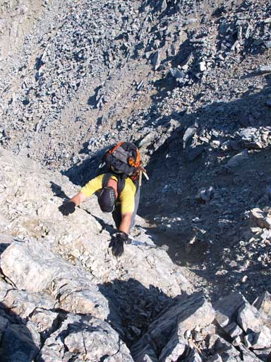
We could see storm was building up in Lake Louise area, and Kevin and I decided to go on ourselves as we didn’t want to be turned back due to thunderstorm… We cut climber’s left to gain the broad scree gully in Kane’s book. It was okay at the beginning, but higher up, the terrain got looser and looser… Anything could move, no matter how large the boulder was… We managed to get to the base of the rock cliff where we could get better grip. Higher up, in order to avoid more scree, we did an optional moderate to difficult scramble section to get up a step. The view was very foreshortened and after that, we still had lots of elevation to go before topping out on the ridge. At least the views were good. One thing I didn’t realize was, Storm Mountain is even higher than Stanley Peak. Eventually we topped out on the ridge, and surprisingly we still had a good amount of work to do… Again, the view was foreshortened and the final push on the summit plateau wasn’t pleasant especially just after doing all of those miserable stuffs.

Typical scree slog

But the view was pretty good.
Kevin taking a short break, refilling water
We tried to use not-so-solid rocks to avoid more scree
Eventually we made to the summit ridge.
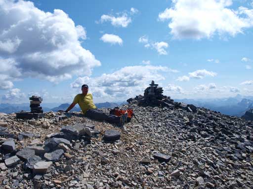
Kevin was waiting for me on the summit.

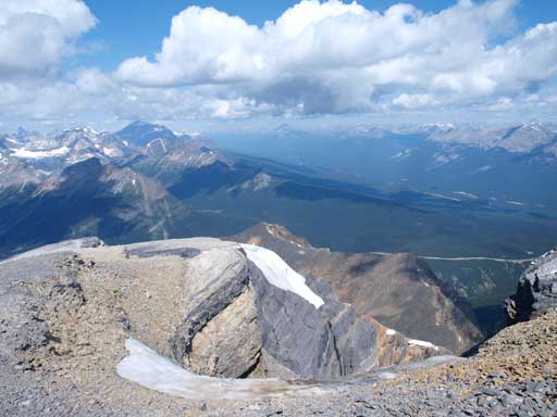
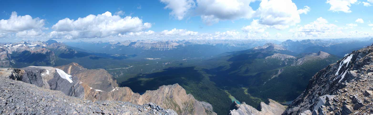
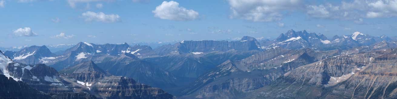
Summit Panorama looking SW (into Kootenay N. Park)
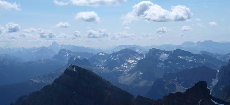
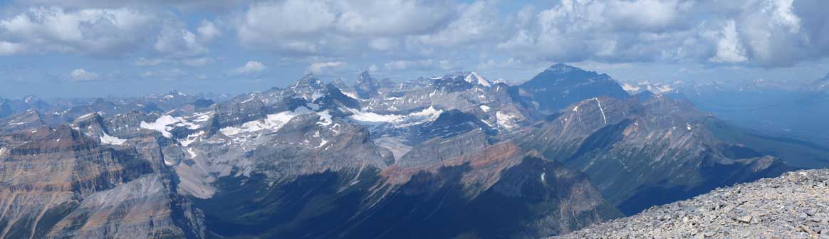
Summit Panorama looking NE (into Banff N. Park)
Despite the smoke, Mt. Assiniboine was still visible.
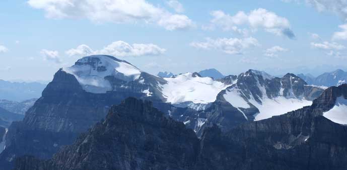
Mount Ball
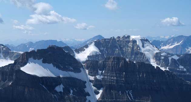
Stanley Peak
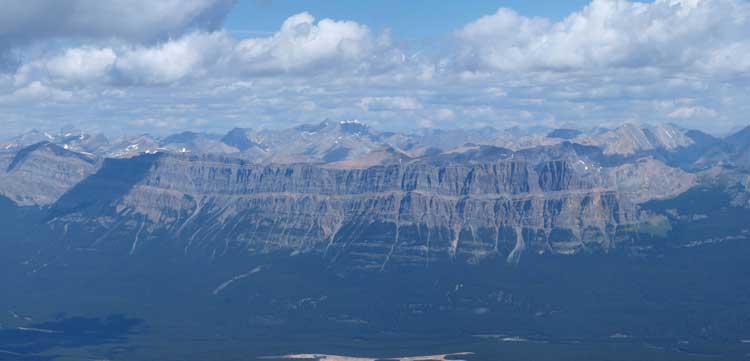
The Rockwall at center; Goodsirs on right.
The south side of “The Ten Peaks”. Mount Temple is the big one in shades.
Looking down to Castle Mountain
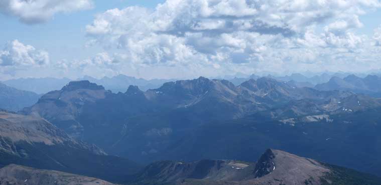
Massive Range. Pilot Mountain on left; Mount Brett at center.
An alpine rock route goes up this ridge

Me on the summit.
We didn’t stay long as soon started the descent. Usually the looseness helps on the way down, but this mountain is an exception. The loose ground is too shallow. It was mainly a loose layer on down-sloping slabs and the slabs are not stable as well. Nothing is stable. We took our time and descent parallel to each other. Apart from the thousands of rocks we knocked down, a microwave sized rock was dislodged and we watched it bouncing down for hundreds of meters… At the end of the gully/ramp, we managed to catch up the other 4 scramblers. They turned around due to the looseness. Turning around on this mountain really sucks, but I have to say they actually made a good call. Not to say the lack of experience and poles, having 4 in one group you really have to bring a helmet… The ground got better as we got down. We regrouped together again and slowly moved back through the boulder field. Now we were down to the main drainage.

Descending
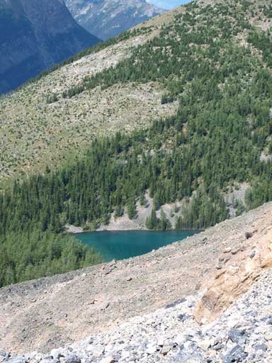
There’s an alpine tarn
Looking back at this nasty scree slope…
We decided to follow the drainage down for as much as we could, and that turned out to be a really good call.. Initially we had to negotiate more deadfalls but soon we managed to find a trail!! We could follow the trail almost all the way down…. Oh okay, looks like we did lots of extra work on the way up.. Before reaching the highway, we had to cross a river. Kevin didn’t mind to wet his boots so he just plunged through, while I bushwhacked on my side for a while to find a good spot to cross. Fortunately I did spot on deadfall which prevented me from wetting my boots. Once on the other side of the river / stream, I was only about 15 m from the highway. However, this 15 m proved to be the densest bushwhacking of the day. Eight-feet tall high alders + deadfalls, I had to really push through a way to cross. We walked back the final hundreds of meters on Highway back to car.
Deadfalls, deadfalls, deadfalls…

Finally got down all of the elevation.
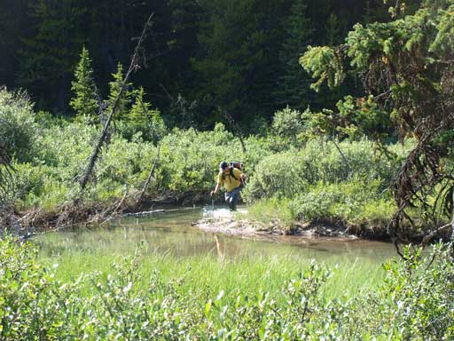
Kevin decided to walk in Vermillion River…
I found a shallower spot to cross it.
Overall, except for summitting this major mountain and the views, nothing was enjoyable. On the other hand, if you don’t like exposure and hands-on but you like good views, you might actually enjoy this peak though. Oh by the way, on the way up, you should try to find the trail…

Thanks again for detailed report !
Always very helpful!
Stay safe.!