Lassen Peak
May 20, 2017
3187m
Redding / Lassen National Park, CA
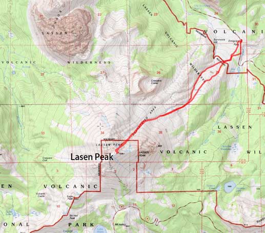
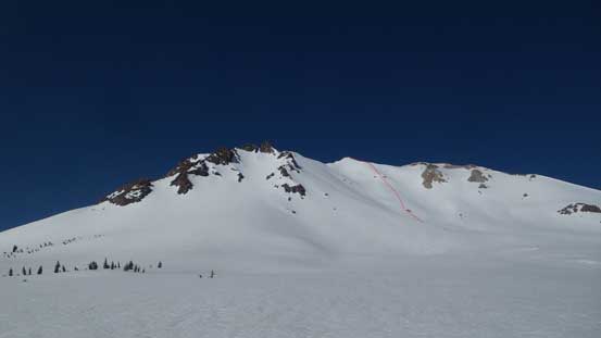
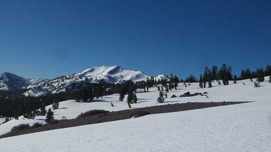
Despite being much smaller than the nearby Mt. Shasta, this famed Lassen Peak is the southernmost volcano, and the 9th highest peak of the Cascade Volcanic Belt which extends from Pemberton, British Columbia all the way down to the northern California. It is also very visible from the urban areas of Sacramento Valley and is very much the second most sought-after objective in the Californian Cascades. The ascent is however, tamely easy as a well-constructed trail brings thousands of tourists to the summit each year in summer months. In winter and spring the road isn’t plowed to the upper lot but the NE Face from Devastated Area is considered as one of the finest ski mountaineering classics and goes at 35-45 degree snow for a couple hundred meters long.
I’m not interested in skiing steeps but the same route appears just as good as a snowshoe mountaineering ascent, so why not. After a successful ascent of Mt. Shasta and Shastina the previous day I woke up at around 6:30 am at the Devastated Area parking lot. Tired and low on motivation but having the face proper displaced right in front it didn’t take me long to get going. The boots were still wet which sucked, but still beats wearing the double-plastic ice climbing boots which I brought down as a back-up.
Lassen Peak via NE Face. GPX DL
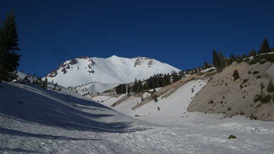
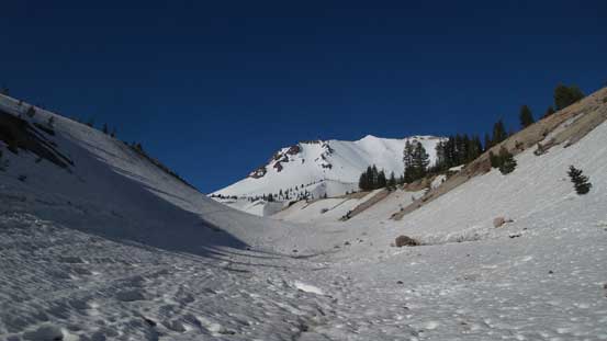
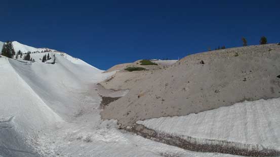
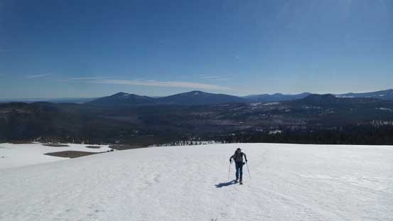
The most confusing section was right at the start where I must travel through some undulating forested terrain to access the drainage coming down from NE Face. The general bearing is due SW and a GPS unit is a great asset. The route I took follows the unplowed road for about 5-10 minutes before venturing into the forest. A couple sections of light bushwhacking was then required but nothing troublesome, and soon enough I reached an opening and then dropped into the drainage. Here I met a local skier and we teamed up for the next couple hours. The route then followed this gulch/drainage upwards curving to the left before swinging back to the right, and once making sense we ascended out of the gulch and took a gentle traverse to the base of NE Face.
Merging into the drainage/gulch now. My objective ahead
Just another picture from this approach gulch.
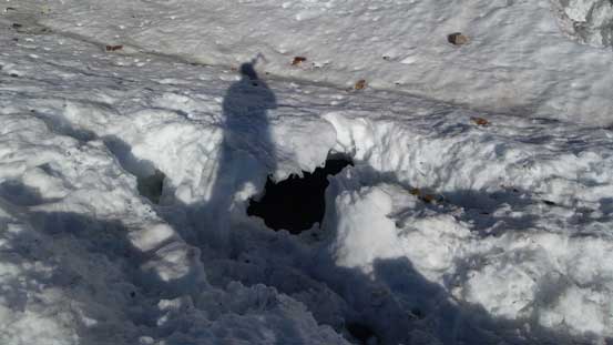
River crevasses…

Looking back.
This depression zone is another option to ascend.
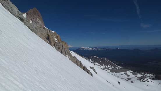
Route I took went climber’s left here.
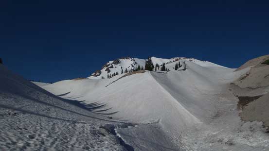
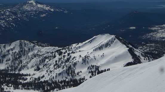
Approaching the face. It’s starting to look big..
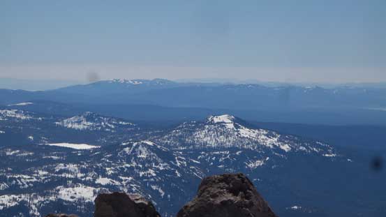
Reading Peak to the south
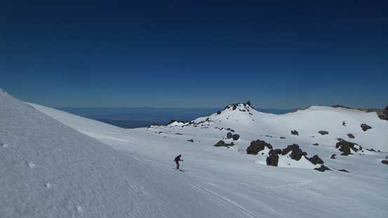
Skinning up..

Looking at part of Crescent Crater to the NE
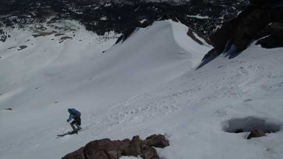
The start of this face was nice and gentle (25 degrees) which worked really well for my Lightning Ascents but the skiers had to spend a couple minutes putting ski crampons on. There’s one rock outcrop marking the official start of snow climbing ahead. Most skiers went to boot-packing at this point and since it’s dry it made perfect sense for me to ditch snowshoes along with some other unnecessary gears that I had brought this far up. With a lighter pack I knew I’d be much faster on the next stage so I set out on my own pace. At first I was using the pre-set boot tracks but soon enough I bailed and went for my own route as the steps were too small for my like. What normally takes 2 steps for me would be 3 for the previous parties and following really messed up my own rhythm. About halfway up the slope there came the steepest pitch (40+ degrees for a short while) and it was here that I rejoined their tracks.
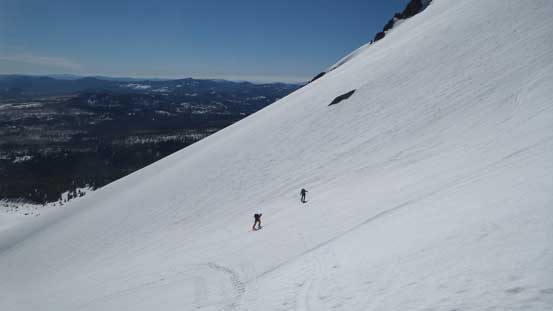
The skiers show the scale of this mountain. The face hasn’t started yet.

A view from where I ditched the snowshoes.
Higher up on the face, looking sideways across
Above the steepest pitch now, looking down.
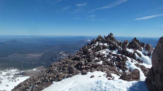
The steepest part was right in between two rocks and once above the “gate” the terrain levelled back to 35 degrees ish. For the upper reach of the face I just followed the tracks and soon enough I topped out on the crater rim. The party in front was pretty fit and I didn’t manage to catch them up. Now turning left the summit was only 5 minutes away and the views were pretty awesome, hundreds of miles down each direction.

A view looking towards SE

Almost at the crater rim now.
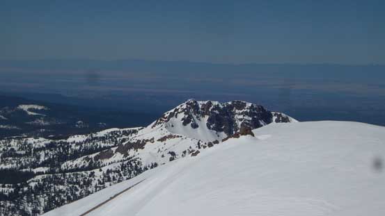
Reading Peak

The final push to the summit
The skiers were already on their way down now. This is looking into the crater
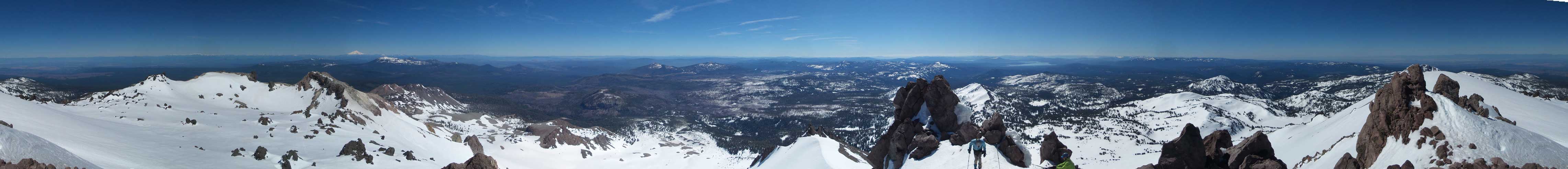
Summit Panorama from Lassen Peak. Click to view large size.
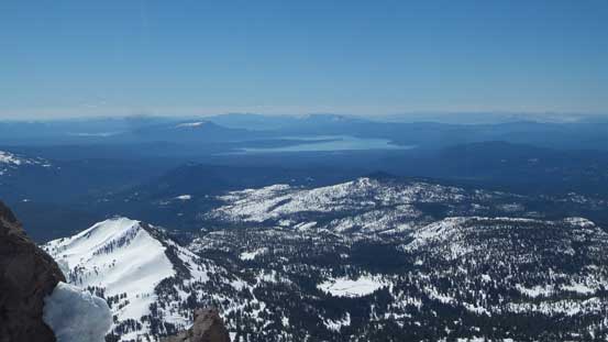
Looking towards Lake Alamanor to the south-east

The Sacramento Valley to the west

Looking north, the mighty Mt. Shasta on the horizon
Smaller peaks to the south-east that I’m not going to find out the names

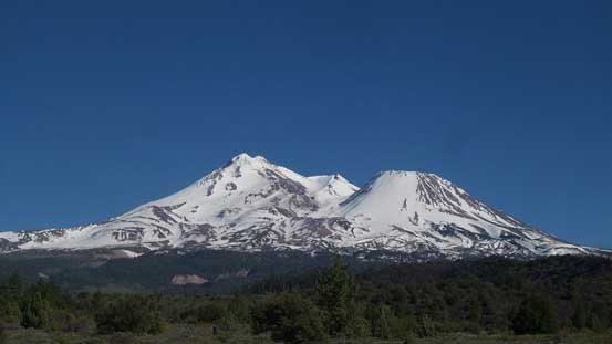
A closer look at Mt. Shasta
Brokeoff Mountain
A skier dropping down the NE Face
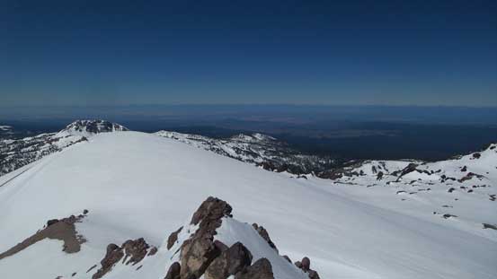
Another view from the summit
Playing around.
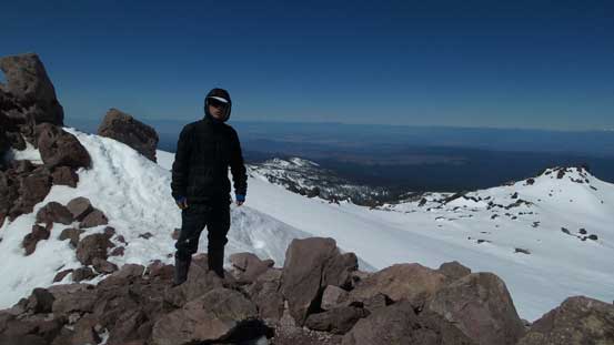
Me on the summit of Lassen Peak
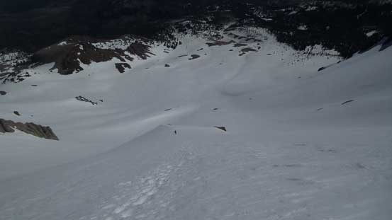
I took a very long summit stay as it was so nice up there but eventually it’s time to get going. The goal for this day was to push all the way to Crater Lake so there really wasn’t much time to waste. The face was a little bit too steep to plunge down and the snow wasn’t in the greatest condition of plunging, so I just sucked it up and down-climbed the whole thing. I didn’t turn my face outwards until about 100 m above the rock outcrop where I finally could pick up the speed again. I carried the snowshoes down until the grade eased off where I took the crampons off and strapped the ‘shoes on. The flotation was really needed for the lower route as the snow was already slushy and could no longer support my weight. The last 20 minutes in the forest was boring and undulating which made me feel slightly better for not using skis on this otherwise, classic descent…

Down-climbing the face while many were still going up.

Just one picture from the rest of the descent.
Just like the previous day I spent about 1 hour in the parking lot relaxing and drying off the wet boots but soon I realized it might be much hotter in the city of Redding and it sure was. The 35 degree reading on my car’s thermometer meant the boots should get dried off fairly quickly and for that purpose I went for lunch in the restaurant of Olive Garden. About an hour and half later I came out, and the boots were still wet. Oh well, I had to get going anyway and soon I was following my iPhone app off towards Klamath Falls, OR. I got really tired and had to take at least 3 stops along the way and once I got there it was right in time for dinner.
A gorgeous view of Mt. Shasta and Shastina
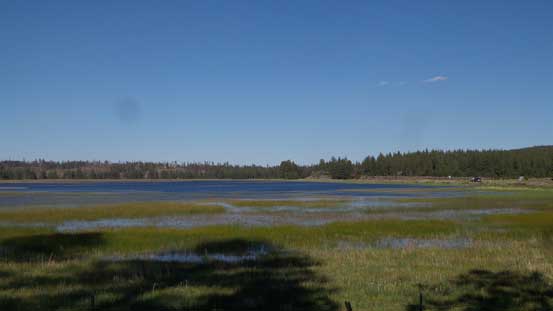
Grass Lake along US-97

Lake Ewauna at Klamath Falls
This section of the drive was very scenic and is much better than I-5 in my opinion. Now with the darkness falling in no time I knocked off the last 2 hours of driving and eventually by about 11 pm I made to the west rim of Crater Lake. I drove to as far as they plowed the road and went for a much-deserved sleep.
