Mount Orrock
April 29, 2021
1563m
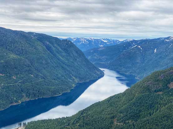
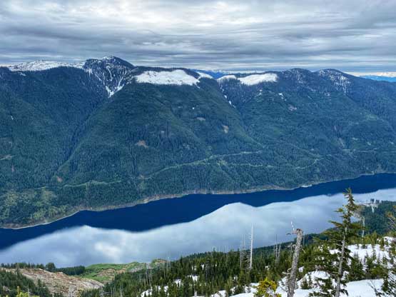
Chehalis Lake / Harrison West, BC
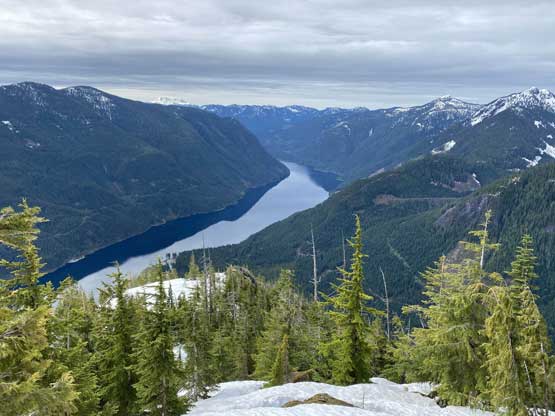
Mt. Orrock occupies a large area at the north end of Chehalis Lake in a remote corner of SW BC that requires lengthy access of logging roads no matter what. This peak barely sticks above treeline, but is steep, bushy and bluffy on all sides. The summit itself is rather dull and dome-shaped but supposedly offers some fine views on a clear day. A major landslide on the south-eastern flank of Mt. Orrock had permanently destructed a section of the logging road blocking the access from Mystery Creek and Harrison West. Nowadays the only access into this area is from the south, 31 km up Chehalis Main to Skwellepil Creek. There’s only one route that had been published, the south ridge from the bottom of Skwellepil Creek FSR. The route had been flagged by multiple parties but a “path” had not developed yet such that it’s still mostly a bushwhack with some scrambling around bluffs.
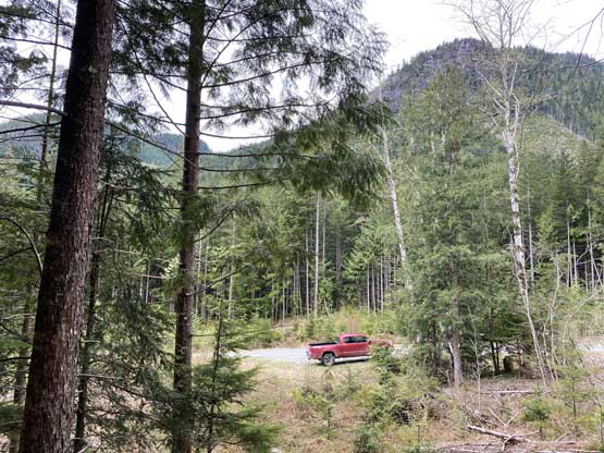
I figured that for a SW BC bushwhack the better time would be winter or spring with abundant snow coverage. I eventually decided on “mid spring” as I did want the scrambling sections to be dry, if possible. The downside was that I had to carry snowshoes for a few hours in the lower, dry forest. I pulled the spontaneous trigger on Wednesday night after seeing a so-so window on Thursday. I had to be back home in the afternoon for work but in the height of the spring conditions I did not want to miss out a single day of oppourtunity. As usual I preferred to drive out at night and car-camp. The Chehalis Main was as smooth as one could ever expect all the way to around 20 km marker but the remaining 10 km was a total crap show. It appeared that the road had been deactivated but there was plenty of evidence of user-maintenance suggesting this road did get some decent volume of traffic. I was able to slowly crawl to a designated pull-out a few hundred meters up Skwellepil FSR. It was almost 2 am and I quickly fell asleep in my truck.

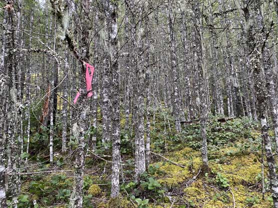
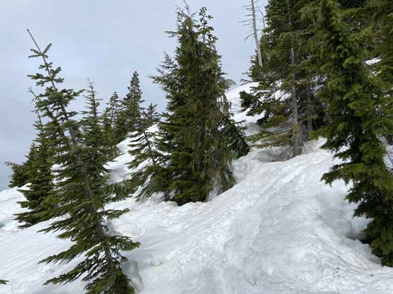
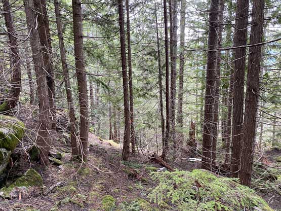
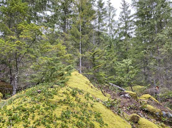
I was not keen to bushwhack in the dark so decided to wake up at 5 am. After forcing in some cold but surprisingly tasty sushi bought in Save on Food I started the ascent at 5:30 am just after it’s bright enough to not require the use of a head-lamp. I saw some flagging right from the parking lot but was not able to link them up. I came here hoping to see an actual “path” and tried pretty hard to look for one, but after a few minutes of wondering I gave up. I did come with a pre-loaded GPS track from Duffy and Roberto’s ascent in May 2020 so I decided to just bushwhack up the forest roughly following their tracks. Of course as usual, after a short while I came across more flags and what seemed like the “path” that I had been looking for. I was disappointed to see the quality of this “path” but at least by this point, I knew that this was rather just a “flagged route” and the flags were only to serve as a guidance of macroscopic decision-making. The forest was also different than anticipated with more openings, smaller but tighter trees and a shit ton load of small bluffs. I was hoping to find some fun scrambling on the bluffs but gave up upon reaching the first, as the rocks were completely covered in moss and the recent rain did not help that neither.


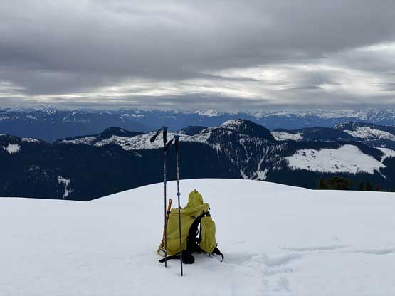
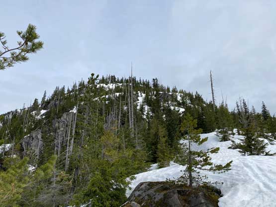
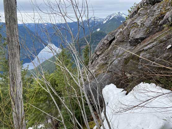
The section in the forest that’s worth noting was between 900 m and 1050 m where I must find a way to scramble up some rock steps or bushy gullies. The snowline on the south slopes was much higher than I thought, that I did not manage to touch snow until 1000 m elevation. This stretch of scrambling was overall more difficult than I thought with some moves of “class 3”, although I have to admit that I did not try too hard to stick to the easiest possible line. Generally speaking I used more gulley features than ribs as the rocks were loose, down-sloping and covered in moss. Higher up I stayed on climber’s right side of the ridge and finally found snow to kick into, but the intermittent (thin) coverage and the numerous snow-to-bush transitions with mini features of moats meant I had to be fully concentrated. The snow became continuous at around 1050 m just when I finished the steep scrambling stretch. The grade of the route would east afterwards and I took my first break of the day, donning snowshoes.


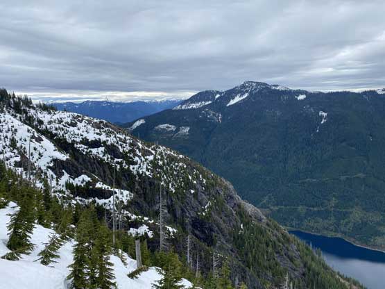
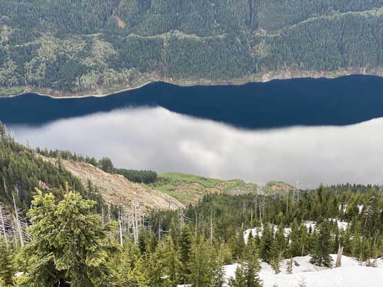
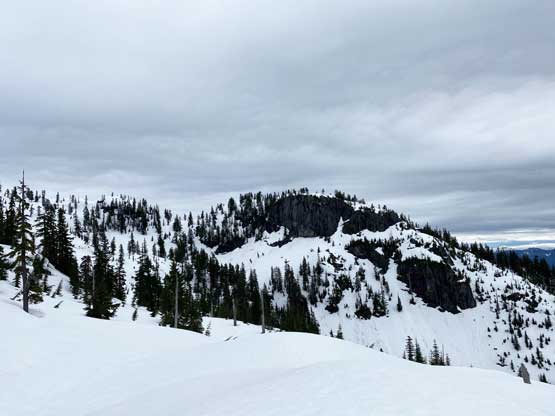
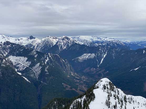
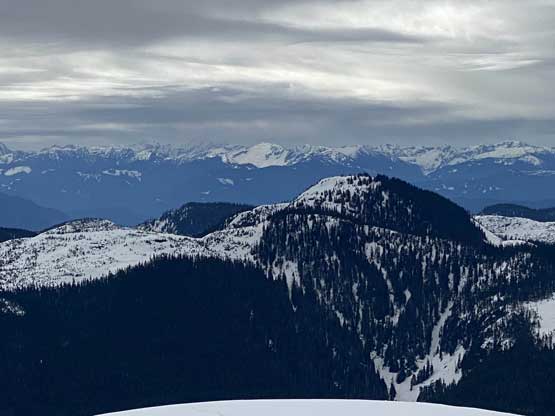
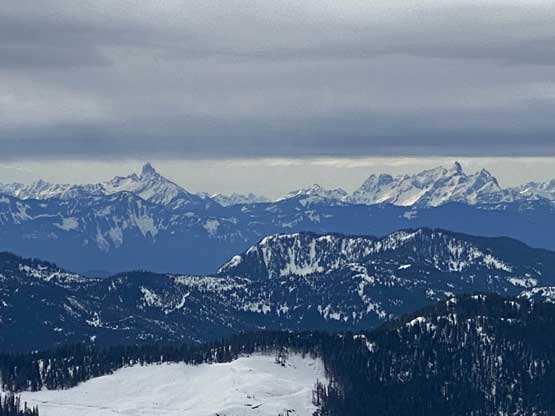
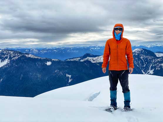
The next 100 m of elevation gain (now on snowshoes) was still decently challenging that the grade combined with the lack of snow had resulted in the necessity of “technical snowshoeing” techniques. It was not that bad to ascend but coming down felt much sketchier. The grade finally eased as I approached the 1250 m contour line on the map. There’s even one small dip coming up. Another section of steep-ish forest later I was on the final series of rises and ramps leading towards the true summit. The light was unfortunately flat that it’s pretty difficult to gauge the angle of the slopes but eventually improved a little bit after I got onto the summit. The weather had been as expected, overcast but with good visibility. I regretted a bit for coming up here on a cloudy day because the views were rather far-reaching, but I also knew that it’s impossible to win everything.


Descending the upper slopes on snowshoes was fast and fun. I made a few glissades (with snowshoes still on) and tried hard to boot-ski and again, with snowshoes on. Some of the boot-ski attempts did not end too well but some were fun. Once the snowshoes were taken off the rest of the descent was nowhere near the word of “fun”. The stretch from that intermittent snow coverage to the end of the scrambling zone required some full concentration thank to the uber-slippery footings. My snowshoes and the snow baskets on the poles kept getting caught on things making a very frustrating descent. The going became easier lower down, but I still had to pay attention to the footings as well as route-finding. I checked GPS whenever I could not see the next flag to make sure I did not end up descending another rib into trouble. Overall I managed to mostly retrace the exact line that I took on the ascent.


Needless to say, this was definitely a “type 2 fun” trip but on the other hand, I never came to expect Mt. Orrock to be “fun” anyway. It’s overall still a “Chehalis bushwhack” despite the rumours of a “flagged route/trail”. My round trip time was exactly 6 hours. I took my time driving out of the Chehalis and eventually got back to White Rock at 3 pm. I cancelled one hour of work because I was exhausted and desperately needed at least an hour of nap.
