Jorgenson Peak
April 16, 2017
1831m
Hope / Fraser Canyon, BC
Sandwiched between the Fraser Canyon and the busy busy Coquihalla Highway about a dozen clicks north-east of the municipality of Hope, Jorgenson Peak is not far from civilization. However, over many years the status of this peak remains obscured and mysterious to most but the die-hard peak-baggers. The reason is simple as the peak is surrounded by steep, bluffy and densely vegetated west coast rainforest on all sides with the only exception of the south-west aspect where some seriously overgrown logging roads exist. The summit barely pokes above the treeline and the elevation of this objective is far from “tall” although it is locally prominent. Among the selected few who actually bothered to try Jorgenson Peak or the nearby Ogilvie Peak, most ended up having to wait for several attempts and a report of a successful bid on any objective in this obscured group was a very rare thing.
While the introductory seems anything but “glorious” to most, it was the main driving force for me to make an attempt and to resolve the misery myself. The available information was very limited although from a few old trip reports on ClubTread I could clearly picture out where they went. The rough idea is by ascending to Jorgenson/Ogilvie col from the SW side followed by an undulating plod up the south ridge. The “standard” time is winter for the sake of reason to avoid bushwhacking for as much as possible and being a snowshoeing enthusiast of course I had no complaint on that. The thick snowpack we have received this year only suggested a less-bushier approach so much-faster travel. And then there came this past Easter Sunday when weather finally cleared up after about two weeks of crap. At the last minute I checked with a few friends who might be interested in joining but with no luck, so set out solo again, but being solo meant I could push as hard as I humanly could and the aggressive plan was to tag both Jorgenson Peak and Ogilvie Peak in one shot. To make that happen I would sleep in my truck at the “trail-head”, start in dark, turn my “snowshoeing machine” mode on and plod all the way till sunset. Mentally I was ready for as much as a 16-18 hours day but if things went more smoothly I should be able to finish much faster than that.
The approach would start at about 5.5 km up Squeah FSR from Kawkawa Lake. There’s no recent update on the status of this road and except for “all groups used trucks” I had no idea what to expect whatsoever. I was even mentally prepared to walk a few extra clicks on this main road and (for one time) I did not forget to bring a bow saw just in case, but once I got there at around 11 pm on Saturday night this Squeah FSR turned out to be very well travelled. I even caught up with a group of locals heading for Squeah Lake (yes, at around midnight) and it’s just that nobody reports out on the internet. After talking to them briefly we each resumed our own paths. With GPS technology I had no problem to find the correct turn-off and heading in that direction I even saw some fresh tire tracks going up the single-lane road. Not knowing the status beyond I opted to play conservatively and park at the bottom.
Ascent routes for Jorgenson Peak and Ogilvie Peak. GPX DL
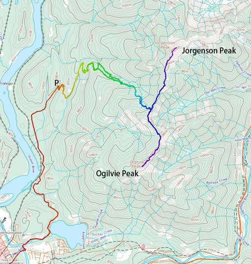
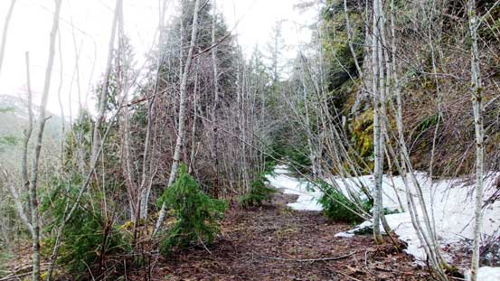
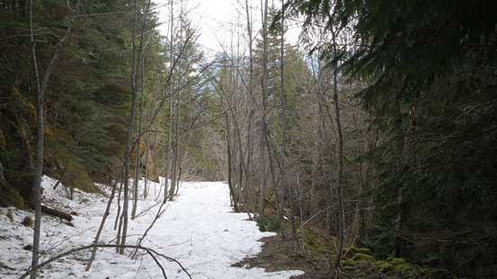
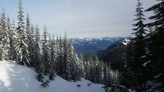
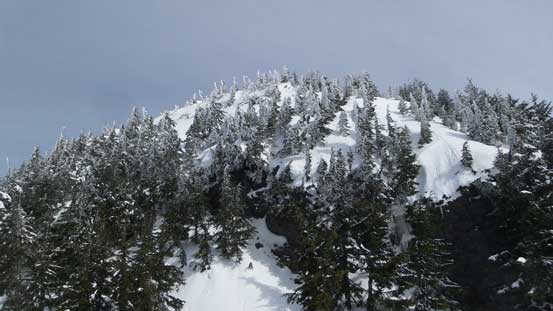
The next morning I failed to wake up at the planned 4 am and slept in for an extra hour. The head-lamp was no longer required as I eventually started the plod at 6 am. A lots of evidence indicated recent maintenance from ATV tracks to the freshly cut fallen trees and I made quick work up the initial few kilometers. At elevation of 650 m I started to encounter snow which was a bit earlier than expected. I spent a few minutes swapping sneakers for mountaineering boots, ditched the sneakers and continued on foot. In another 10 minutes or so it soon became stupid as the post-holing took over so the snowshoes were strapped on in no time. The next stop was at a major switchback where the right hand branch goes towards the “standard” Ogilvie Peak approach. The report I relied on did not elaborate this part and the correct, but easily-missed “Jorgenson spur” actually starts about 50 m up from this switchback that I discovered on the return. Consulting with the GPS multiple times I went into the bush right from the “bend” and after a short while the road revealed itself out of nowhere. Further up this spur road the travel was still fast and efficient thank to the suddenly-increased snowpack thickness and it didn’t take me long to arrive at its end.
The lower reach of this logging road.
Hitting snow now.

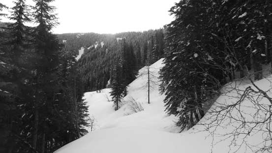
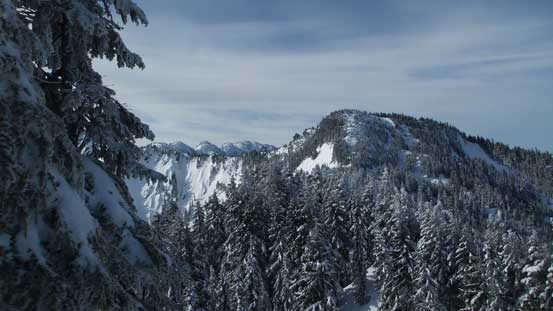
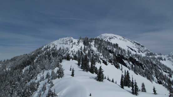
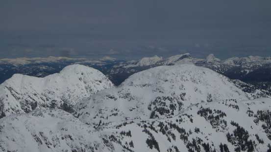
Jorgenson Peak from near the end of the spur road.
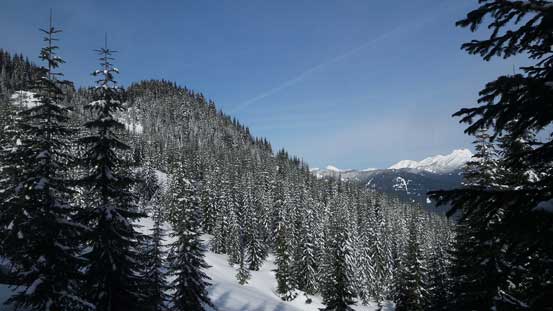
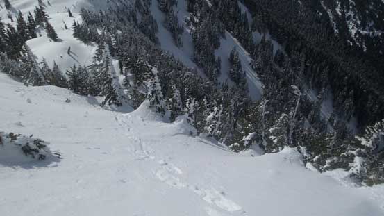
From the end of “Jorgenson spur” the route took a sharp turn due climber’s right (south) into the woods. This would lead further away from Jorgenson Peak but the reason is simple as otherwise you’d have to deal with very steep side-hilling travel which is pain in the ass on snowshoes. The easiest way was going more-or-less straight up the slope but eventually I would have to trend climber’s left to hit the col so wherever made sense I would cut left. In less than 200 meters of gain another stretch of logging road showed up out of nowhere and I followed it leftwards. This stretch was short-lived and then I entered the forest again. There were some young trees in the next stage but generally speaking I could stay away from any “real” bushwhacking and again, whenever made sense I would cut left. Keeping this theme it’s a straightforward plod to Jorgenson/Ogilvie col albeit the trail-breaking was a little tiring.
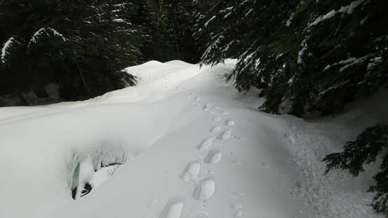
The typical post-holing.
This stretch of logging road showed up out of nowhere.
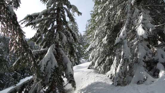
Easy going through secondary growth forest thank to the thick snowpack
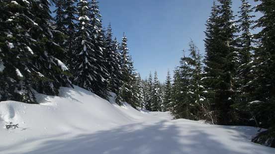
Arriving at another stretch of logging road.
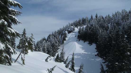
Trending left and aiming at Jorgenson/Ogilvie col
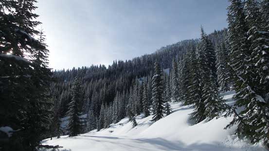
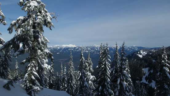
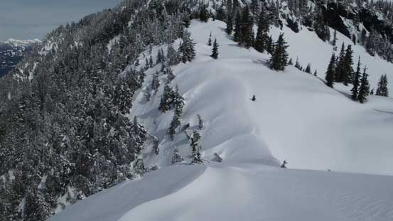
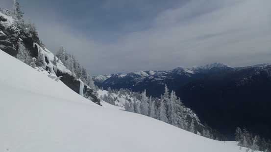
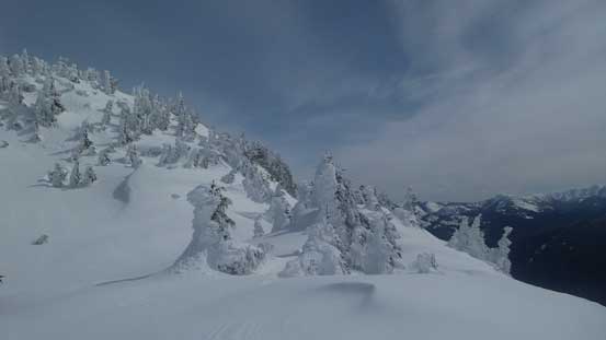
The views started to open up.
Easy going as it seems.
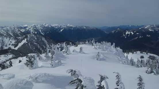
Near the col, looking at my first objective. A long ways to go still.
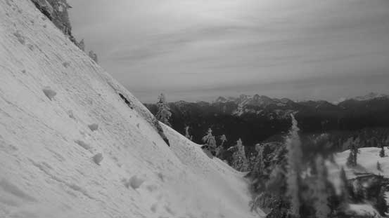
It had taken me just over 3 hours to get here and having the entire day ahead I knew I definitely would be going for both objectives so then I’d never have to come back here again, but as usual I’d think one at a time. Turning left I aimed at Jorgenson Peak first and right off the bat I realized this ridge wasn’t as simple as it seemed on the map. There were lots of micro up-and-downs to slow things down and then there were a few steep spots. The major obstacle came at about 1/3 of the way up which was a very steep band of forest. The climber’s right side was some shear cliff faces so I’d have to traverse to the left, upon which I hit some icy spots and given the increasing steepness I opted to take the ‘shoes off and don crampons. The crampons were kept until I got sick of the post-holing. Snowshoes on the “middle 1/3” along the ridge was easy-going but soon enough another band of steepness presented itself ahead.
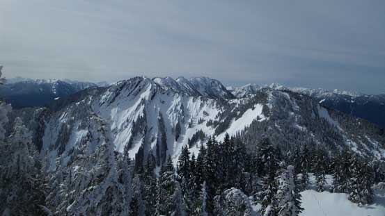
A view from Jorgenson/Ogilvie col. It’s largely forested.

One of the many small rises.
After a while, this is looking back showing the initial climb out of the col towards Ogilvie Peak.
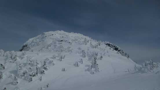
Ahead is the first major steep section on Jorgenson Peak. Attack is on climber’s left side.
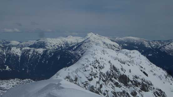
Looking back towards Ogilvie Peak in the foreground.
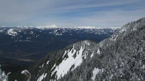
Looking sideways into the Fraser Canyon
Upwards and onwards along Jorgenson Peak’s south ridge.
One of the many dips.
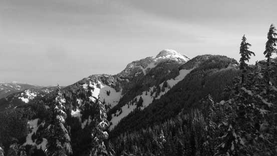
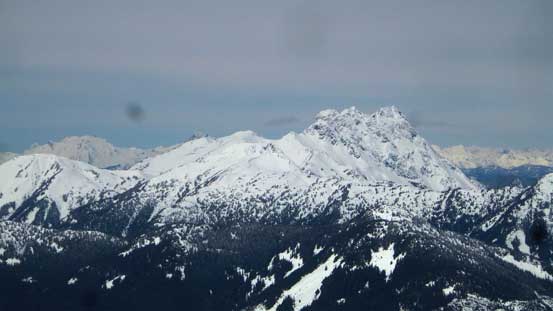
The Old Settler catches one’s eyes constantly.

Looking back at one of the many short descents.
Ahead was the crux – a very steep band attacked on climber’s left.
This time I had to go climber’s left again and judging by the steepness the ‘shoes were stored in my pack in no time. I didn’t bother with crampons nor ice axe for that matter as the snow was already softening up. The grade was very steep though and I frequently had to haul myself up using the vegetation, but pretty fun to be honest. Near the top of this section I put the ‘shoes back on and cut a steep diagonal traverse due climber’s left across an open slope and then the grade eased again. Above this step there were another few steep spots but nothing tricky overall until the final step before the summit. The highest point was reached by a short, but exposed boot-pack up and given the amount of snow this was trivial for someone like me. I didn’t even bother with crampons nor ice axe and shortly after I was standing on the top. It had taken me longer than anticipated but the views were incredible.
This sideways view shows the steepness just above the crux.
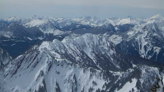
Big country up there!
The terrain mellows out now.
Looking back, I was already higher than Ogilvie Peak.
Resuming the ascent.
Another view looking back.
The next rise. Almost there!
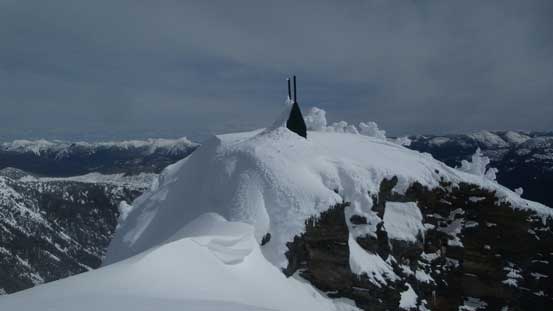
This is the summit block.

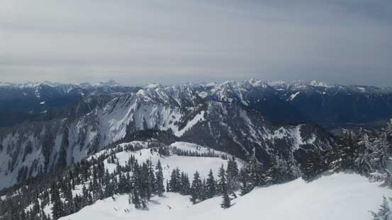
Partial Summit Panorama from Jorgenson Peak. Click to view large size.
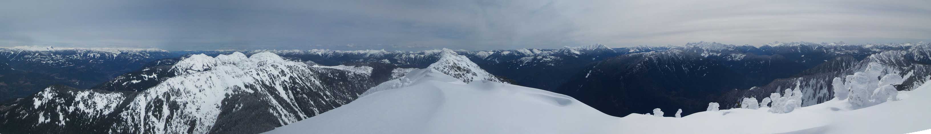
Partial Summit Panorama from Jorgenson Peak. Click to view large size.
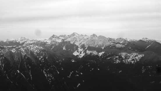
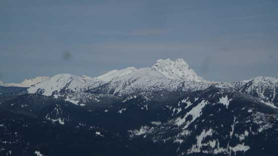
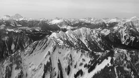
Mt. Outram is the tallest peak out there in this group.
A view toawrds Tulameen Mountain with Mt. Snider to its left.
Looking over the lower east peak towards the distant Coquihalla Mountain massif
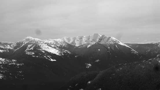
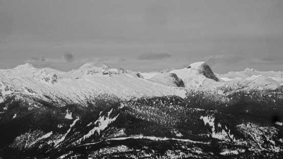
In the foreground is the broad summit of Squeah Mountain

Looking over an unnamed peak towards the upper Fraser Canyon
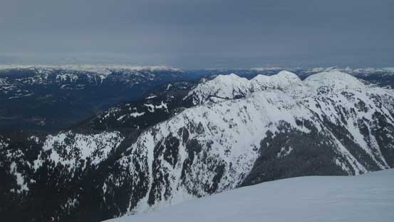
The Old Settler
Mt. Urquhart right of center.

This is Needle Peak from an unusual perspective
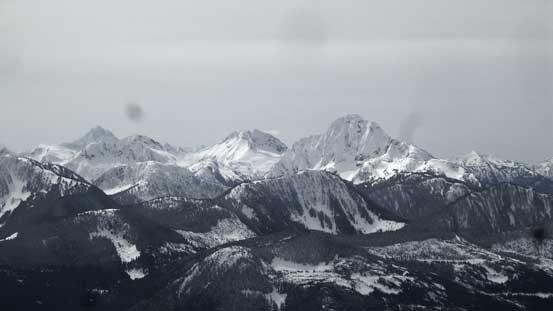
Mt. Grant by Skagit Valley, right of center

In the distance I could see Mt. Baker and to its right are the jagged peaks in Cheam Range
Ogilvie Peak is looking very small now, in foreground.
A wider shot looking north. Squeah Mountain on right.
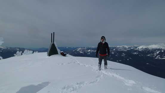
Me on the summit of Jorgenson Peak.
After some obligatory photos I quickly retreated back down the ridge. The most scenic section was about 50 m below the summit where I had some unobstructed view looking down towards Hope and Fraser Valley. Plunging down the upper ridge took no time and then I carefully reversed that steepest spot (with the ‘shoes taken off again). It’s been a pain in the ass to switch gears so I didn’t bother to take the snowshoes off for the lower step. Instead I just carefully kicked steps while facing inwards and the crampon system on my Lightning Ascents provided enough traction.
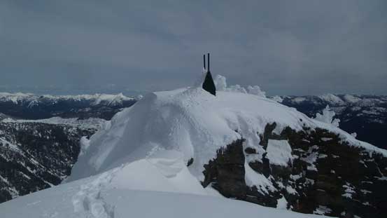
A review shot of the summit block.
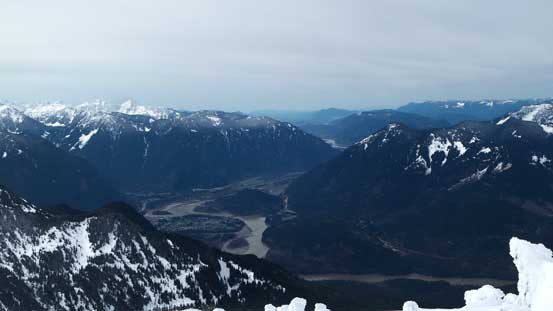
A wider view at Fraser Valley and Hope.
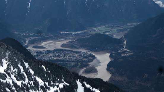
A zoomed-in view towards the municipality of Hope
Ogilvie Peak will be my next objective.

Down-climbing near the crux.

Looking back towards the summit. Yes, Jorgenson Peak in the bag..

This picture shows that you want some good route-finding sense in this terrain.
The rest of the reverse down to Jorgenson/Ogilvie col was easy peasy and not doing any lingering I immediately started up the other side towards Ogilvie Peak. The ridge looked undulating but no worse than what I just did.
Jorgenson Peak turned out to be a very enjoyable outing and 5.5-hour truck-to-summit also suggested it’s not nearly as “remote” as what it seemed like. The lower logging road was nicely maintained (probably by the locals) and the “Jorgenson Spur” was a cruise-sailing on foot. The ascent to J/O col was no worse than any other steep grunt you would do in the south coast and the stretch along the south ridge provided lots of fun snow climbing in various types of terrain. The same route can also be done in summer (bushwhack) or on skis although the ridge section wouldn’t be classic ski terrain. I would actually highly recommend it at this time of a year so go out and do it.
