Cerro del Cuatlapanga
December 26, 2018
2913m
Apizaco, Tlaxcala State, Mexico
There are many reasons why I hadn’t really climbed in mountain ranges elsewhere on Earth that require long distance flying. I had peak-bagged in the last half decade primarily as a dirtbag student and needless to say, for a long period of time money was my limiting factor. This is no longer the case in 2018. I could easily afford an Alaskan expedition to Mt. Fairweather, hire expensive helicopter rides (Mt. Tantalus and Tsar Mountain), and make half-a-dozen Coast-to-Rockies back-and-forth drives without putting too much financial pressure on myself. Towards the end of 2018 Lily Q. proposed a climbing trip in Mexico aiming at the 3rd highest in North America – Pico de Orizaba.
At over 5600 m altitude this peak is considered by many as a “stepping stone” into high altitude climbing. It’s far from technical, expensive, or logistically complicated, but from all three aspects it’s also not a walk-in-the-park neither. I thought this would be a test piece of my performance at over 5000 m altitude, something I had never tried before. The travelling logistics wouldn’t be smooth sailing for Lily and myself neither because none of us had any knowledge in Spanish, and I had next-to-zero oversea travelling experience. I was only used to the type of climbs that involve solely “man vs. mountains” and any complication with “man vs. people” would drive me crazy. Our plan was to not use any guiding company’s service sans the 4×4 ride from OMG in Zoapan to Pico de Orizaba’s basecamp. This meant we would figure out all of the logistics on our own, albeit at a much lower cost. On the evening of Dec. 25th we departed from Vancouver and arrived in Mexico City at 2:30am, Dec. 26th. The first unplanned complication arose immediately as the rental vehicles were completely out of service in Mexico City airport, despite a solid booking conformation that Lily got from Firefly… We were forced to take a 2-hour bus ride to the city of Puebla and then a taxi ride to the Holiday Inn of Puebla to get our rental car (from Avis). This whole process involved lots of frustration with our immobile and heavy luggage, as well as our poor language.. The Google translation on our phones did their job.
Meanwhile we had a luxurious breakfast in the dinning room of Holiday Inn. By around 10am we finally had all of the paperwork done and although not the Jeep we were initially hoping for, a car still beat nothing. I’m not someone who will drive my small 2WD vehicle onto unpaved roads let along the steep and rough backcountry access roads but this is the rental car and not mine, so with some careful driving I wouldn’t care. I had concerns about the driving in Mexico and I was right, as the driving was pretty damn crazy. Right off the bat I got to taste the Puebla traffic by driving to Walmart for food/water, and then a sports gear shop for propane fuel canisters. Getting to the gear shop involved driving down narrow, single-lane grids in the downtown area. I somehow managed to clean the drive without a single scrap but I would prefer climbing risky shits than handling the downtown traffic on any day. It was brutal. I did not feel comfortable at all considering I learnt driving in British Columbia and had never drove outside Canada and US…

Driving out of Puebla towards Volcan La Malinche. Photo by Lily Q.
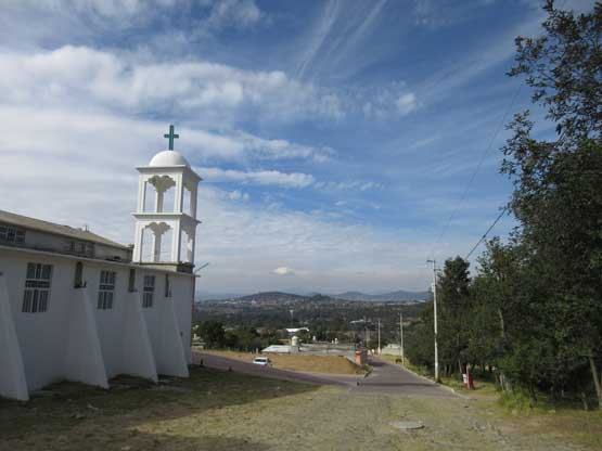
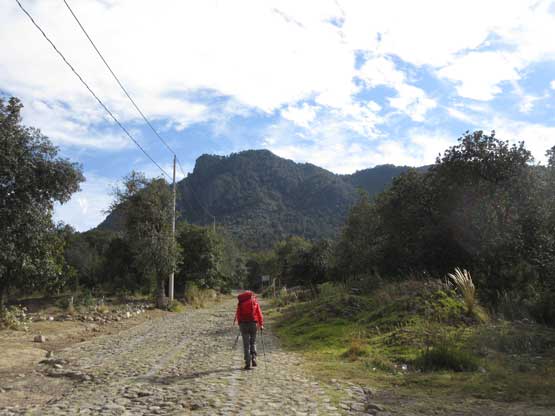
Once getting all of the preparation shits done I cautiously drove us out of the town of Puebla towards the first major acclimation objective – Volcan La Malinche. The plan was to sleep at La Malinche’s trail-head (3000 m) on the evening of Day 1 and climb it (4420 m) on Day 2. This would be considered as “aggressive” for many but I knew from past trips that I needed zero acclimation climbing to 4400+ m of elevation. An ascent of Cerro del Cuatlapanga was not brought to the table until this point when I realized we still had almost half a day to kill. Despite our tiredness I said we must put those hours into use, and a quick check on the electronic maps and Peakbagger app revealed a small hill nearby with an impressive profile. We figured an ascent of this peak would cost less than 3 hours round trip from La Malinche’s trail-head so why not… The crux was navigating the countryside roads to get to the trail-head. We had to travel though some super rural area that I did not feel very comfortable with, but at this point what else could we do other than trusting the Mexican locals. We parked at a small church where the road turned into some really bad shape.

Hiking route up Cerro del Cuatlapanga. GPX DL
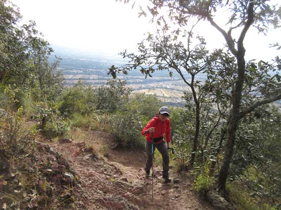
Despite the rural surroundings there’s a very well maintained trail switch-back up the north flanks of this peak. The quality of this trail exceeded my expectation. It started from a deactivated Jeep road and after gaining ~100 m elevation it entered the woods and the grade picked up. We had no issue following the main branch up without having to consult with our phones’ GPS apps. The total elevation gain was around 400 m and the last 100 m involved some degree of views into the nearby desert landscape. The trail terminated at an iconic structure on the false summit that has some apparent association with the local religious activities.
This is near the trail-head.
Lily starting the 400-m gain on our first objective
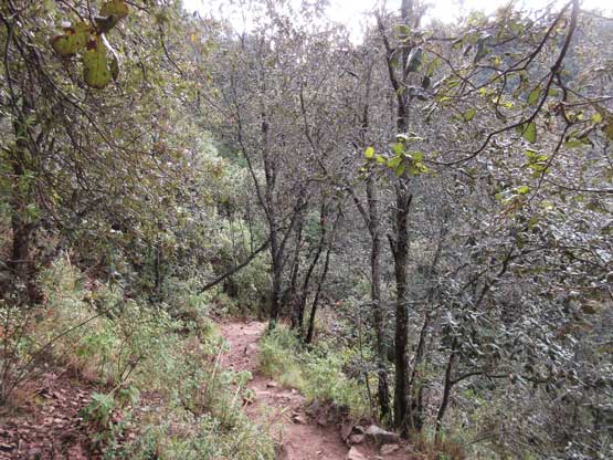
As typical as the trail goes
Lily hiking up the trail
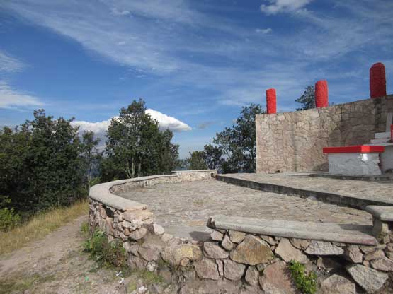
This is that religious structure on the false summit
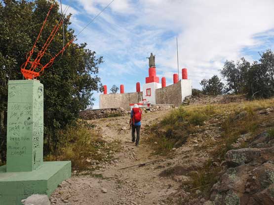
Me approaching the false summit. Photo by Lily Q.
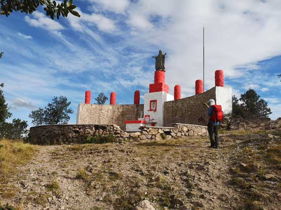
Me on the religious structure. Photo by Lily Q.
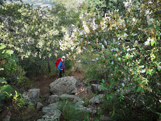
I had zero interest in religion so we moved on, traversing the last bits towards the (slightly higher) true summit. This involved a bit of scrambling and some degree of elevation loss, but to my surprise the trail resumed all the way to the true summit where we got an even-better panoramic vista with the cone of La Malinche dominating.
Me traversing towards the true summit trying to stay on trail. Photo by Lily Q.
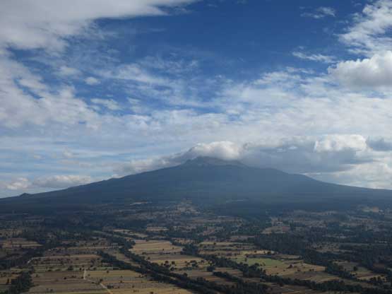
Volcan La Malinche dominating the skyline looking south
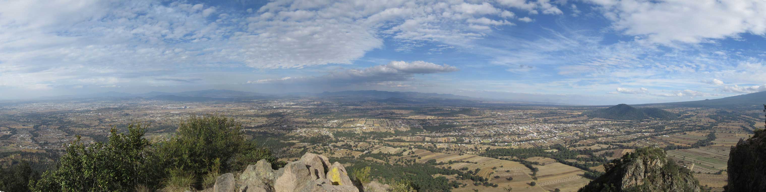
This is the northern partial summit panorama into Tlaxcala. Click to view large size.

Looking back at the false summit
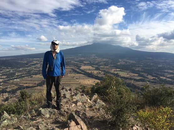
Me on the summit of Cerro del Cuatlapanga
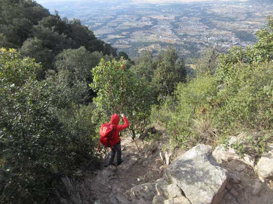
We didn’t linger too long on the summit before leisurely descending back towards our car. The descent went uneventfully and we were back in about half an hour. The drive back to La Malinche’s trail-head resort was tiring but I had to pay 100% attention on the speed bumps – the icons of Mexican roads… Apparently the resort cabins were completely full in the high season and we were forced to pay staying in tent.. We had wanted to pay $$ for some luxuries but a tent camp-site still beat sleeping in car, so we settled in. The evening routine took quite a while but by around 8 pm we did manage to get all things done. Not to our surprise, none of us had any reaction with the 3000 m altitude.
Time to head down..
The alarm was set at 6:00 am and the plan for the next day – Volcan La Malinche and Cerro Tlachichihuatzi.
