Sonyok Mountain
August 30, 2019
1719m
Plains / Highway 100 Corridor, MT
Sonyok Mountain is the last peak in NW Montana that Adam and I bagged in this past 2019 peak-bagging road trip. This is not a tall summit but is definitely an interesting one that boasts some desert-like landscape on the lower flanks. This summit can be attained by driving mostly to the top but a sturdy 4×4 vehicle is required. The driving cuts through an Indian reserve and any recreational use in the reserve requires some legal permits that I don’t actually know much myself. We drove up quite a few summits (Blacktail, Irvine and then Deemer) earlier in the day that by the time we got to Sonyok Mtn. it was already in the evening.
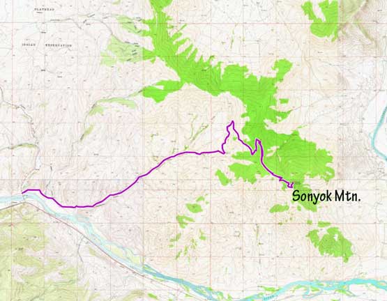
Sonyok Mountain drive-up. GPX DL
The road ascends through Racehorse Gulch on the south-west side of the peak with some farms and lots of black cows blocking the road. After a few twists and turns the road became narrow, steep and increasingly rough, but imposed no issue to Adam’s Subaru until cresting the high ridge and dropping to the east side. It was apparently that some recent logging had taken in place and the roads were not exactly matched on Google Map nor Gaia GPS app. We were confused by some unmarked branches and actually ended up taking some wrong turns. We corrected the mistakes not far into the wrong directions and proceeded to within 15 min of walking to the summit, where a locked gate prevented any further motorized access. This was done by some trial-and-error so to reduce the work of future parties I’m uploading GPX track of the entire trip, including the entire driving portion from highway.

The start of the gravel road into Racehorse Gulch

The scenery in the lower Racehorse Gulch
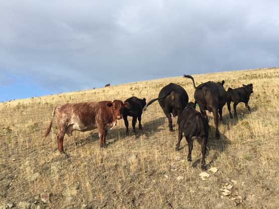
Lots and lots of cows in Montana…
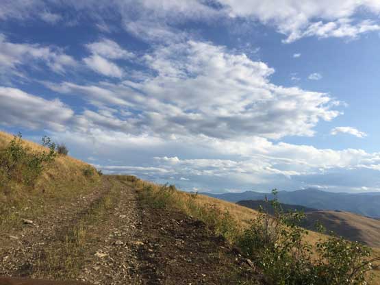
Driving into the sky… The road’s getting narrower and narrower

Eventually after negotiating some rough spots we made to the highest we could
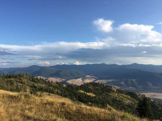
None of us expected much from this peak but the summit actually offered the nicest view on this day. There’s actually a lookout tower with wooden staircases leading to it. We had some unobstructed view of the Mission Mountains with McDonald Peak stealing the show, but didn’t linger long up there due to the lateness of the day.
A southern view into the hills south of Flathead River
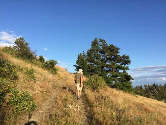
Adam hiking up the short stretch of the road above the gate

The summit’s ahead
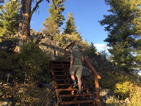
Walking up freshly built wooden staircases

The summit lookout and the wooden staircases
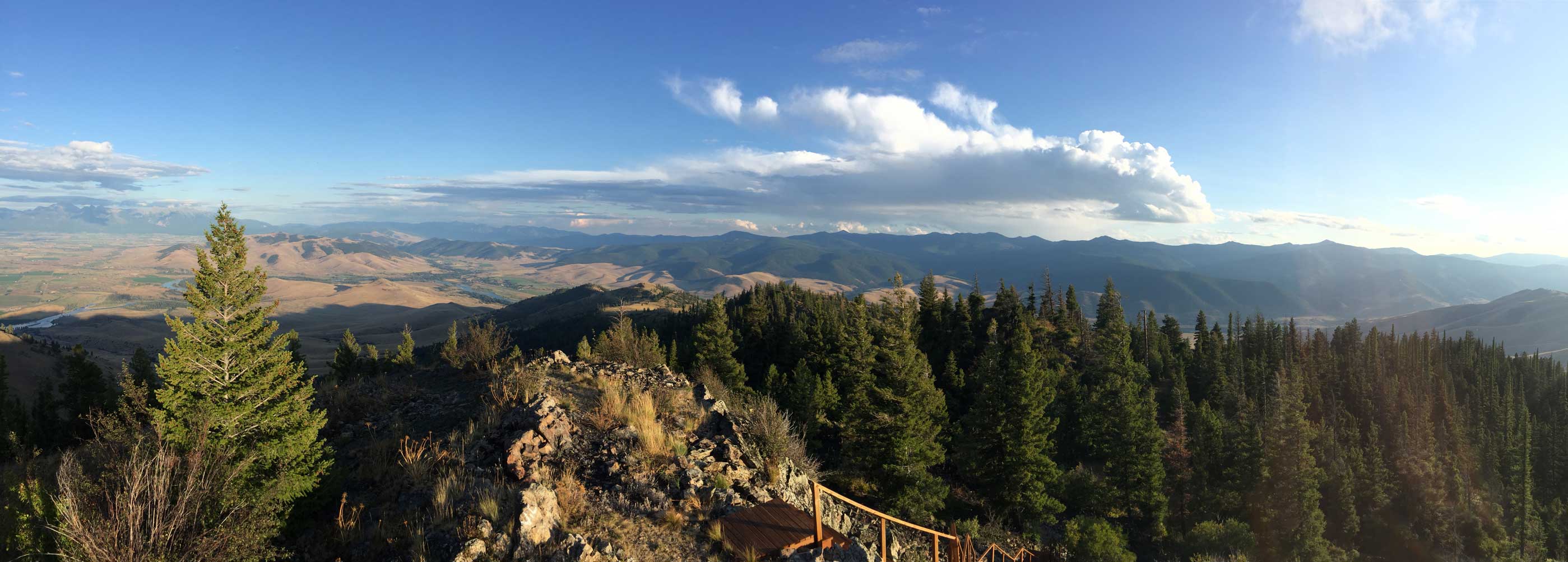
Partial Summit Panorama from Sonyok Mountain. Click to view large size.

The Mission Mountains to the east across Flathead River

Mt. Calowahcan

McDonald Peak is the highest in Mission Mountains

Moises Hills in the foreground with some desert-like landscape

Me on the summit of Sonyok Mountain

This is a broader, northern view from the summit

Adam in the lookout tower

Adam hiking down the wooden staircases from the lookout tower

Waking a short ways down the road
Adam carefully drove down the windy and rough roads and we cooked a late dinner at the junction with pavement, right after exiting the Indian reserve on the “good side” of that big “permit required” sign. The final destination of this day was more than 4 hours away in the far northern tip of Idaho and it was already getting dark. Adam for some reason, seemed to have infinite energy and drove all the way there while I slept most of the way. We got to the trail-head of “South Selkirk Crest” by around 1:30 am and quickly set up the car-camping stuffs. Connor was already there sleeping in his own vehicle. On the next morning I opted to skip “South Selkirk Crest” due to my feet injury a few days earlier, and our next objective was Molybdenite Mountain in NE Washington.

Evening horizon and the Racehorse Gulch scenery
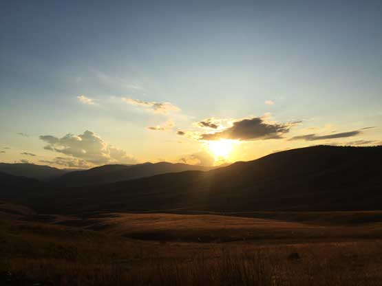
It’s sunset time while we drove down the rough road

One last photo of the grass land in Racehorse Gulch

We cooked dinner on the shore of Flathead River
