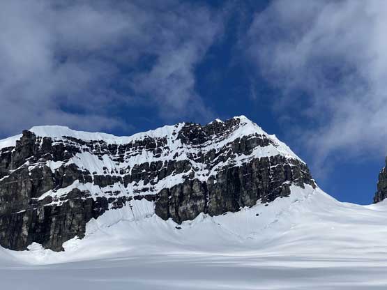
Walter Peak (Lyell IV)
August 25-28, 2020
3448m
Lyell Icefield / Icefield Parkway, AB/BC
The five peaks on Mt. Lyell massif sit pretty much in the center of Canadian Rockies and take a major section of the 11,000ers list. The five peaks had earned their separate official names – Rudolph, Edward, Ernest, Walter and Christian from Lyell 1 to 5. Among these peaks, Ernest Peak (Lyell 3) is the highest, but Walter Peak (Lyell 4) is by no doubt the most difficult. While the other ones are generally not harder than “simple glacier travel and steep snow”, the 4th peak in this massif requires extensive steep and exposed snow climbing and mixed climbing, making it one of the harder objectives in the entire 11,000ers list.
The approach to the Lyells take at least one full day from either Icefield Parkway on the Alberta side or the Bush Arm / Valenciennes River on the BC side. There are only 3 ways to reach the summit of Lyell 4. The easiest from technical perspective is the south ridge by traversing up and over Lyell 5 and this requires the condition to be as dry as possible. The south ridge can also be accessed directly by climbing a steep and broken glacier on the west side of Lyell 4/5 col, which is fairly uncertain and unknown especially in the recent years. The third option, more technical but easier logistically is via the north ridge from Lyell 3/4 col. The north ridge of Lyell 4 is the single most aesthetic alpine climbing route on the Lyells massif and for those capable of a bit of mixed climbing, this should be the route of choice. Regardless the route, the timing aspect for a successful ascent of Lyell 4 is extremely tricky that most parties ended up visiting Lyell Icefield several times before eventually reaching this elusive summit, if they ever gonna make this summit. The “ideal” window might open only once or twice a year and is very short-lived. It took me two visits to the area to get Lyell 4 and everyone knows how rare that is for me.
In the spring of 2015 I made my first visit to Lyell Icefield with Ben N. and Vern D. from the BC side. We managed to grab Lyells 1, 2, 3, 5 along with Arctomys Peak and the rarely-ascended Farbus Mountain. We did hope to ascend Lyell 4 on that trip but realistically speaking we didn’t count on that because we literally came here during a record-breaking heat wave. We had to use snowshoes to facilitate the plod across the icefield and with no freeze there was practically zero chance to get Lyell 4. I was not particularly looking forward to a return visit given the difficulty of the approach and the high degree of uncertainty in Lyell 4’s timing window, but I also knew I would eventually face the problem if I wanted to finish the list. The strategy was to not worry about Lyell 4 until I’ve already climbed the major technical cruxes on this list, in particular Mt. Robson, Mt. Alberta and the Goodsirs. That happened during 2017-18 but unfortunately missed the oppourtunity to bag this peak with the most ideal partner – Ben Nearingburg. Ben managed to grab Lyell 4 while I was climbing Tsar Mountain. Between those two I would have to prioritize Tsar due to the logistical challenges of helicopters. Towards the end of my quest to finish the 11,000ers list it started to become obvious that I might have to finish the list on this peak. I needed a very strong group of climbers to cover my weaknesses in ice/mixed climbing and that needed to be aligned perfectly with a rare window and such required all members to be indefinitely flexible. By the time 2020 came I only had three more to climb. Earlier in August I made a long march onto Brazeau Icefield to grab Mt. Warren, and a couple weeks later I returned and scrambled up Lunette Peak. This had put me 57/58 with only Lyell 4 left. My partners on Lunette Peak were all keen to help me finish this list. The long range forecast seemed solid and we had a dream team – Jesse and Yanick from Banff, Austin (ACMG rock guide) from Canmore, Steven Noel and myself… Steven N. and I drove to Canmore to refuel our energy with only one day’s spare between Lunette and Lyells. We spent most of the day in the A&W and didn’t finish repacking until almost midnight.
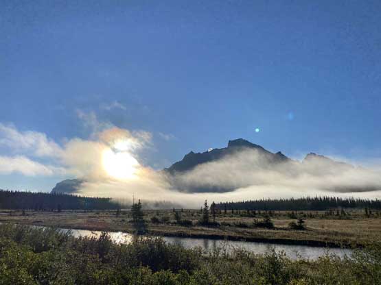
Living in Edmonton far from the mountains Steven Noel had become an expert in dirt-bagging around Canmore. Both him and I hated paying $$ for sleeping but I also knew the rules in Rockies were a bit more strict than in BC. Steven showed me a few secret places to car-camping without getting bothered by rangers. Between the BC and AB approach options it’s clear that the BC side was the easier one, but we didn’t have a choice this time due to a fresh wash-out on Valenciennes FSR at kilometer-5. I also didn’t have a mountain bike nor did I have much experience in biking. To reduce the degree of uncertainties we opted for the option to drive shorter and walker longer. I had previously marched up the Glacier River valley to climb Mt. Forbes in 2015, but I had never done the section from “Lyell Lake” to Arctomys Peak on the edge of Lyell Icefield. I liked this option because that would also give me a little bit more of “new terrain” to explore. The plan for the first day was to slog all the way to the Lyell Meadows camp and we estimated around 12 hours. To make sure we could get there before dark the alarm was set at 4 am. Steven N. and already driven to the trail-head. My job was to pick up Austin from his home and some food from Canmore’s McDonald’s for myself, Jesse and Yanick (which took something like half an hour)… Thankfully even with this unexpected delay we were still not late for the meet-up. I was extremely exhausted and sleepy driving up the Icefield Parkway and asked for a 10-min nap at the trail-head. The temperature was only marginally above freezing and it was very difficult to get going.
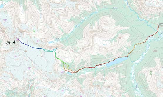
Lyell 4 via Glacier Lake Approach. GPX DL
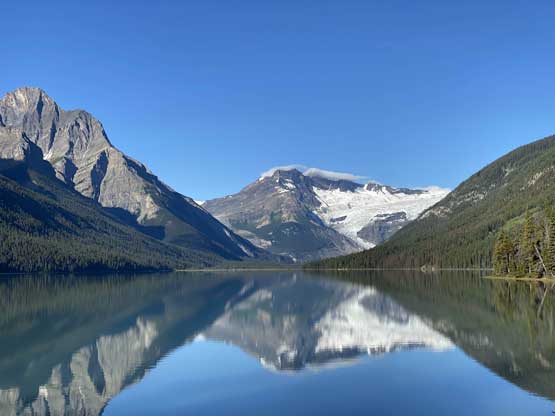
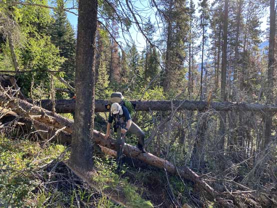
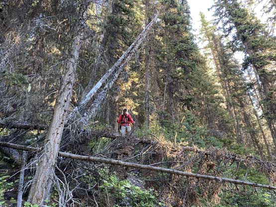
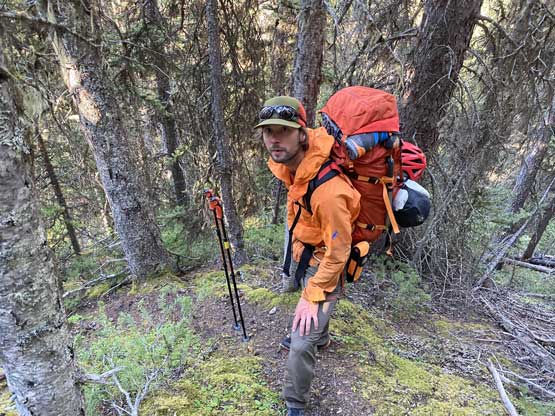
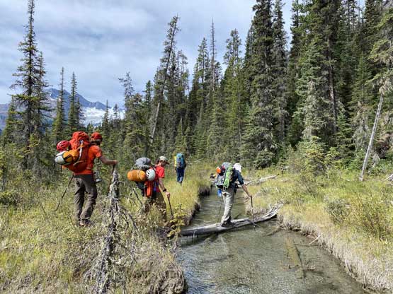
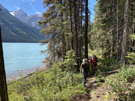
The pack weight for all of us was around 45-50 lb considering that we had to carry two ice tools each, full-shank mountaineering boots, steel crampons, two 60+m ropes, food for 4 days and sleeping gears to survive at least one night at 3000 m on an icefield. The first stage of the death-march was the 9 km plod to Glacier Lake that involved 300 m of ascent and 250 m of elevation loss… We made there in just over 2 hours and without doing much of a stop we continued the death-march around the north side of Glacier Lake. This is a big-ass lake, almost twice as long as Lake Louise so the contouring took another hour. Then into the upper Glacier River valley the slog had finally taken its toll on us. We took a couple food breaks to rest our shoulders. Steven and I had both been here before so that we had multiple sets of GPS tracks to follow. We managed to pick the route with the least resistant without much wondering around. What’s not obvious for us was the exact position to leave the valley heading for the “trail” to Lyell Meadows. We all had put in effort into the research stage. The only beta that’s helpful was Kevin Barton’s trip report and I even sent him an email to further clarify some details. I had spent a couple hours in Canmore’s A&W matching Kevin’s description with my own photos taken from Mt. Forbes but once there, we were still confused. In this modern era I felt pretty hard and frustrating when there’s no GPS track to follow. In the end we just marched across the upper “Lyell Lake” and thrashed up a wooded moraine. The next few hours of course turned into a miserable bushwhacking fest (BC BW3 and sustained) because we completely screwed up the beta. We didn’t discover the trail until we were literally 100 m under the meadows. We marched another 200 m up, climber’s left side away from the green zone until we found a perfect spot to set up camp. The approach took us under 11 hours so despite the bushwhack, it wasn’t too bad.
Mt. Murchison in the frosty morning

Mt. Sarbach from Howse River viewpoint
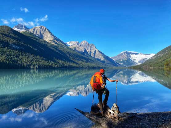
Yanick at Glacier Lake posing for some photos
Division Mountain and the edge of Lyell Icefield way the heck up there
The trail around Glacier Lake had lots of dead-falls

Partway down Glacier Lake

Finally finished the plod around Glacier Lake

Just a sub-summit of Mt. Forbes massif.
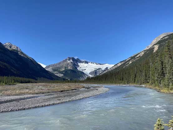
Glacier River and Division Mountain

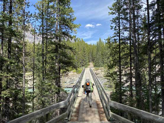
The log bridge is a key spot of this approach
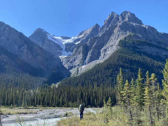
Marching under more impressive sub-summits of Mt. Forbes

A closer look at Division Mountain

Taking a long break…
Marching around “Lyell Lake”. We were already off-route now

Taking another long break. Our packs were too heavy…

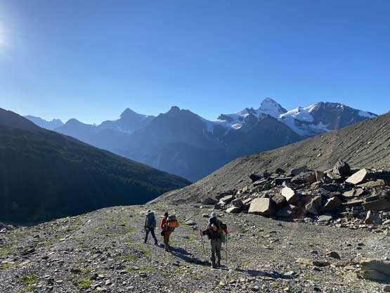
Austin marching towards the end of Glacier River Valley
Looking back at “Lyell Lake”

Ascending a sparsely wooded moraine

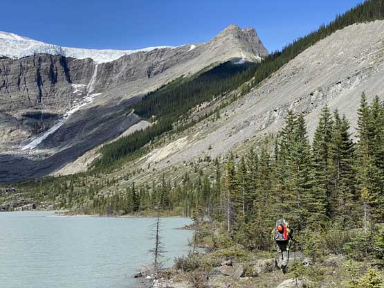
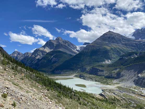
The SE Lyell Glacier
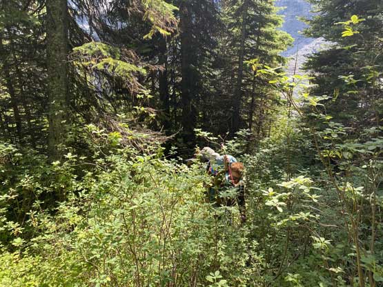
Hundreds of meters of BW3 bushwhack…
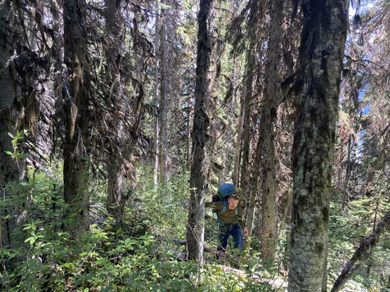
More bushwhacking…
Mt. Forbes and Mt. Rosita finally showed up

Marching into Lyell Meadows

A while later, this was Jesse at our first camp
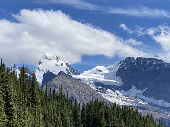
The next morning we woke up with some very red skies. The sunrise was incredible but we also knew what those reddish morning skies meant. By the way we marched to the base of Arctomys Peak the weather had turned into a horizontal snow blizzard. This was not in the forecast but I also knew how fickle the weather was in Canadian Rockies. There are a few ways to traverse under Arctomys Peak. The safest way was to plod pretty much up over the west summit of it, and that was exactly how Yanick and Steven N. did. Jesse, Austin and I were less patient and went for a sketchy ledge traverse that soon turned into down-sloping mud and dirt. I was not feeling particularly comfortable and stopped to put crampons on, and sure enough one crampon broke on the toe strap… The guys were already ahead at this point so all I could do was to use them anyway but to go slowly. By the time we all regrouped at the base of Lyell Icefield I showed the team my problem. It was definitely not repairable but we figured there’s a way to deal with it by using some cords to strap things around. I spent a few minutes to reinforce the strapping using a 5 mm cord given by Jesse. It seemed fine at least for the short period of time, so up onto the icefield we went. The blizzard had passed dumping a good dust of fresh snow onto the high peaks. The weather had turned to a mix of sun and clouds that even the Lyells started to show up, so our spirits were actually quite high.
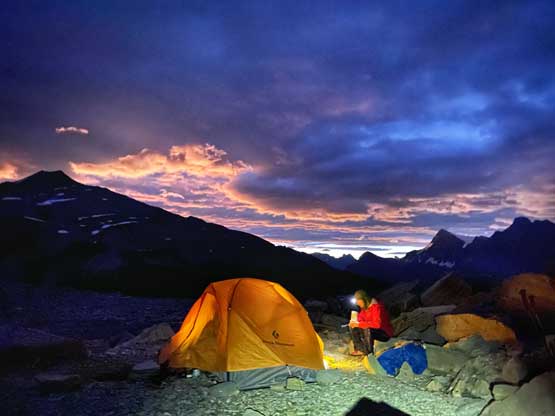
Our Lyell Meadows camp at dawn
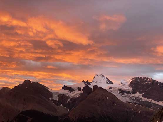
A very red sky was forming in the morning. Not a good thing…
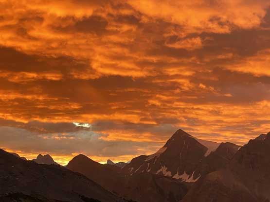
Mt. Outram and the red sky
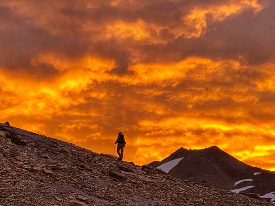
Steven N. plodding up under the red sky
Yanick plodding up utilizing snow
Traversing an exposed and down-sloping muddy ledge under Arctomys Peak

The blizzard passed and we were on the edge of Lyell Icefield
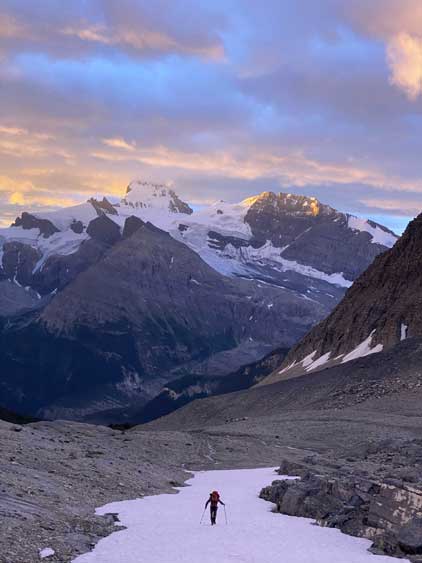
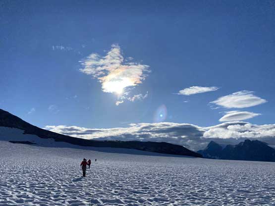
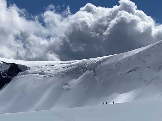
I had previously done the stretch from Arctomys Peak to the base of Lyells so I led the way. The glacier travel was surprisingly easy given the late August time frame. There were a few rolls to go over and only one major sag that we had to avoid. The plod to the base of Lyells was very long and monotonous. We were all experienced enough to know how foreshortened an icefield could be, so nobody complained. We marched all the way to around 3050 m right under Lyells 4 and 5 to finally call it there. The weather was still a mix of sun and clouds but was slowly turning cloudy, although the southern horizon was still clear. The camp set-up took us at least one hour because we needed to dig down. It was pretty much a winter camp there and the two shovels we had brought all came in use. We must do something in the afternoon after setting up the tents and I suggested we should go grab Lyell 4 right away. The weather was not looking too promising but the clouds had kept the snow frozen such as the conditions were definitely on our side.
Marching across the lower icefield on sun cups

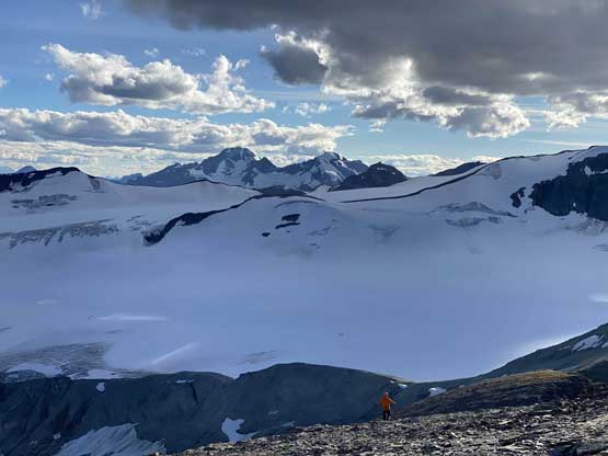
Onto the main icefield now. The Lyells were still soaked in
Our group marching up the main meat of Lyell Icefield
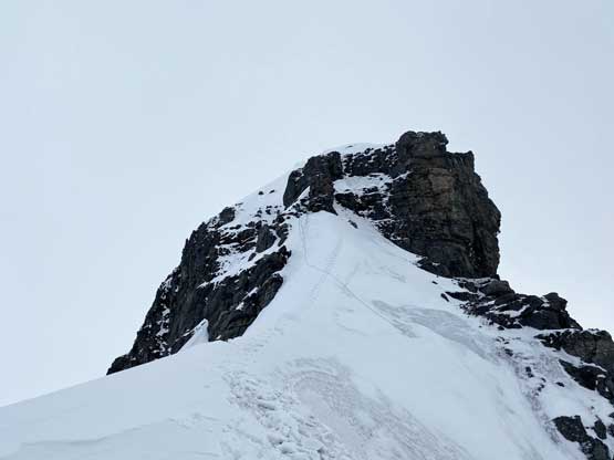
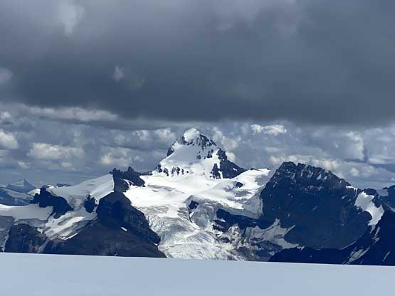
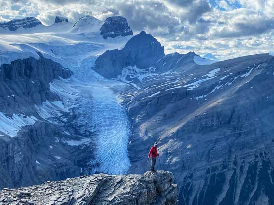
Lyell IV – our objective !

My tent and Austin up high on Lyell Icefield
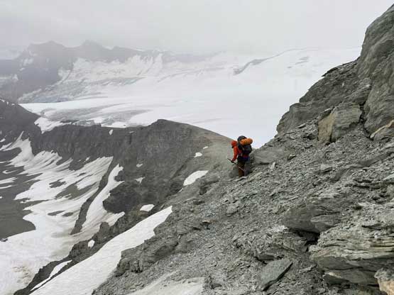
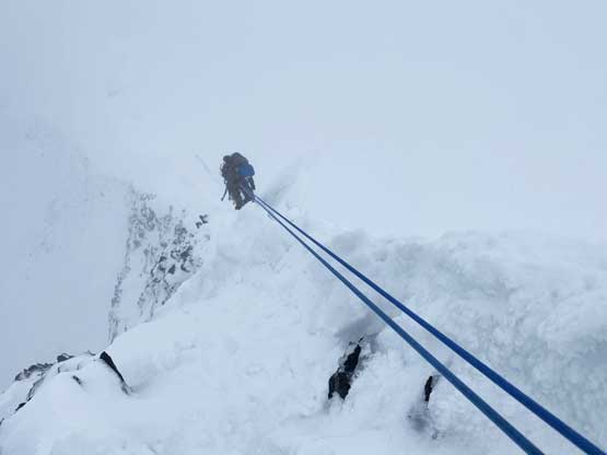
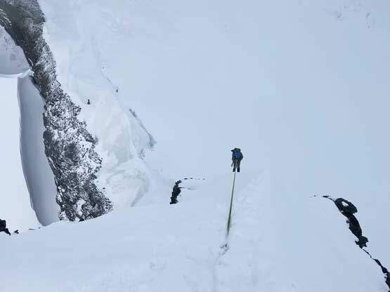
A while later we were going again with again, me leading in front for the glacier travel. The plod to Lyell 3/4 col was short and sweet but we entered the clouds near the col. We crossed the big bergschrund under the col on an obvious piece of snow bridge. The atmosphere at the col was moody with winds and white-outs but without doing much of lingering Austin and Steven N. went ahead charging up the snow arete. I was anticipating ice on this stretch (as per Dan Kim’s trip in August 2012) but the condition was much snowier in this year. We basically brought 8 ice screws for nothing. At the top of the snow arete we had to do a sketchy leftward traverse to a belay station. While Austin leading the technical pitch the rest of us took turn soloing the uber-exposed snow arete to the station. Austin finished the lead and fixed the rope and yelled there’s one awkward step above the upper station that we must scramble through. I was in line for the second to ascend this pitch. The start wasn’t particularly difficult but the rock step was as challenging as I had expected. Climbing it in a mixed-climbing fashion was out of my league. I ended up storing the ice tools, removing the gloves and grabbing the ropes in a batman style to mantle up a few moves. The upper station transition felt extremely sketchy. There were a few more 5th class moves that one mistake would meant game-over. I thought about a few ways to extend the security but practically speaking the only way was to untie myself and solo that step.

Austin heading for the north ridge under moody weather

Austin and Steven high up on the lower snow arete

The awkward belay station
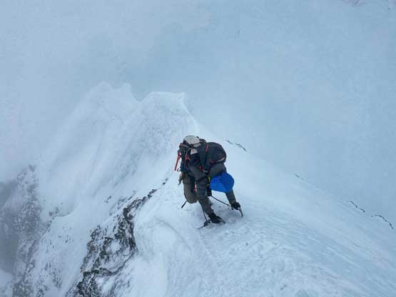
The second rope was in my backpack and meanwhile Austin and I were busy trying to dig a t-trench to belay the others up that sketchy transition step. In the end it wasn’t really needed as would be awkward as well. Once Steven N. came up the three of us started charging up the upper north ridge. It was far from easy. Austin started by leading some easy snow traverses that soon became extremely exposed and corniced. There came a second crux about 3/4 of the way up that looked double-corniced. It looked extremely sketchy and I shouted out to the others that the rope’s in my pack and whoever went first should have the rope. I did not want to lead this pitch and to make the transition easier Steven N. and I just swapped our backpacks. Steven N. did an incredible job soloing this pitch that felt like some full-on alpine climbing. It took him what seemed like a long time to find or set up an upper anchor and the communication was nearly impossible in the winds and white-outs. Jesse and Yanick had all come up to this step. It’s apparent that we could stand in this position forever given the coldness so Austin and I started to solo the pitch using Steven’s tracks. Austin went up pretty fast and by the time I was halfway up the rope’s finally fixed. Beyond that upper crux we had one more steep snow arete to climb and then the final summit ridge traverse. The summit ridge wasn’t easy at all, but felt much more chilled than what we’d just climbed.

Austin traversing the typical exposed snow on the upper ridge

Steven and Austin at the upper crux step

Jesse climbing up the upper crux, now with a fixed rope

Jesse and Yanick traversing the summit ridge

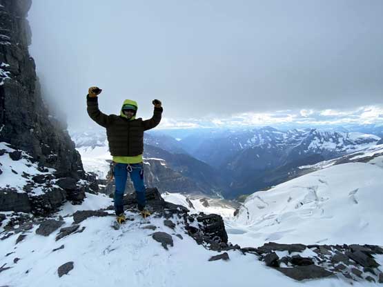
Steven N. and I on the summit of Lyell IV – my 11,000er finisher 58/58
There’s not enough room on the summit for all of us so we took turn summitting, then reversed the down-traverse. Steven donated his 240 cm sling to the upper station so that we all could rappel the upper crux step. Then we stored the rope and gingerly down-climbed and traversed the middle section of steep snow. I donated my picket so that we could rappel into the technical crux not dealing with that sketchy step. We then rappelled off the crux onto the lower snow arete. The game’s not over yet as the rope’s stuck. I was mentally done at this point so Steven offered to climb back up to the belay station to free the rope. He did manage to free the rope but it certainly wasn’t an easy nor stress-free process. For his effort I offered him one of my remaining mooncakes and also to finally celebrate our success. The descent back to camp was uneventful and we didn’t even bother to rope up as we could just follow our own tracks. We both agreed that the intensity of the technical climbing on Lyell 4 combined with the approach and the challenge in timing would make it for sure one of the top 10 hardest in this list.
Steven rappelling the upper crux, leaving his 240 cm cord behind
Down-climbing a long stretch of uber-exposed snow
I left my picket here so that we didn’t have to down-climb into the crux

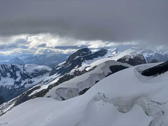
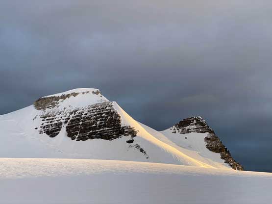
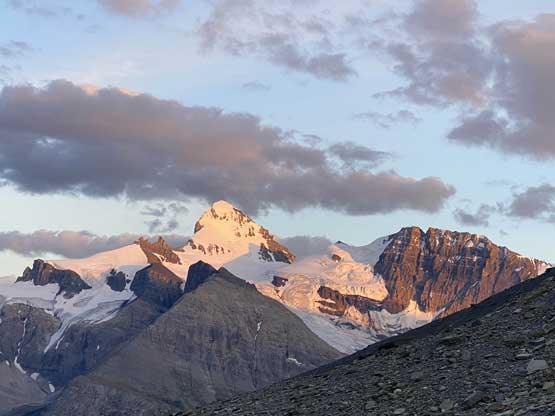
Lyell III finally started to show up a bit

From above the crux step, looking down
Steven had to climb back up to free the stuck rope
Cockscomb Mountain is a remote giant in Bush River valley
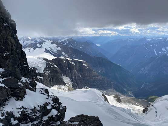
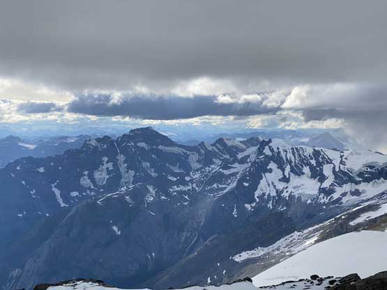
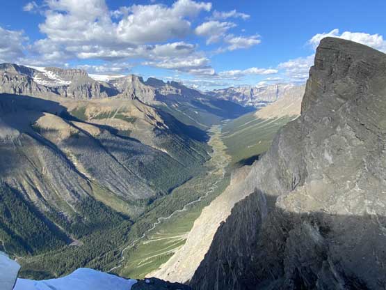
Looking down Lyell Creek valley into Kinbasket Lake in the far distance
Looking over Farbus Mountain towards Mt. Alexandra
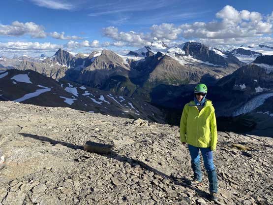
Me at Lyell 3/4 col celebrating the climb

One last look at the north ridge of Lyell 4
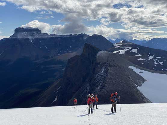
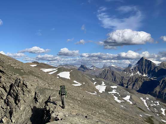
The objectives for Day 3 was to climb all of the other Lyells and move camp back to Lyell Meadows. The weather was pretty good at sunrise time but soon turned shit again. There’s no desire from my side to repeat any of those so I slept in and took a rest day. Austin also skipped Lyell 1, 2 and 3 but the four of them all went up Lyell 5 later in the day. By the time they were all back from Lyell 5 we took no break but immediately breaking the camp. The weather was still unstable and we all wanted to get down the glacier with good visibility. Our own tracks were not obvious and were difficult to follow but I had my Gaia handy for the navigation. I led us down the icefield with a bit of variation in the end and then we all decided to plod up and over Arctomys Peak’s false summit instead of dealing with that muddy traverse. I decided to repeat the summit of Arctomys Peak as it’s such a great vantage point and a good one to reflect my journey throughout the 11,000ers quest.
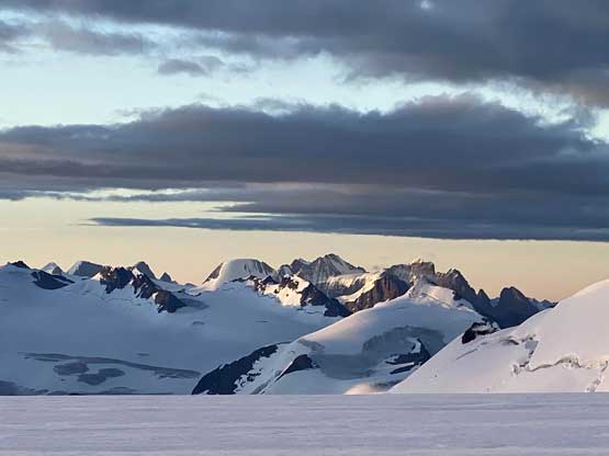
The Mons Icefield peaks with Freshfields behind

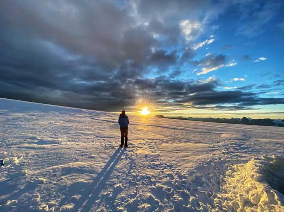
Sunrise on Lyell Icefield on the morning of Day 3

Me and our icefield camp

Lyell 3 and our tracks
Lyell 2 and Lyell 1

Lyell 4
Steven N. and the sunrise

My tent and Mt. Forbes
The guys coming back from Lyell 5
Mt. Forbes showed up again

Leaving the icefield camp behind now. Lyell 4 in the background

Marching back across the upper icefield

This lower stretch of the icefield was very tedious with sun cups

Steven N. marching up the lower slopes of Arctomys Peak

Descending to true/false saddle on Arctomys Peak
Arctomys Creek – Valley of Lakes rarely sees any human visit, if any…

Plodding up towards the true summit of Arctomys Peak
The typical Canadian Rockies scenery
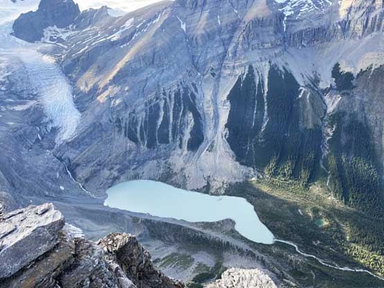
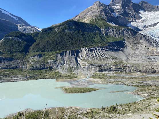
The glacial lake at the head of Arctomys Creek

Steven with Division Mountain and SE Lyell Glacier behind
Steven with Lyells 4, 3, 2, 1 behind
Mt. Erasmus is an elusive giant – probably only been climbed two times
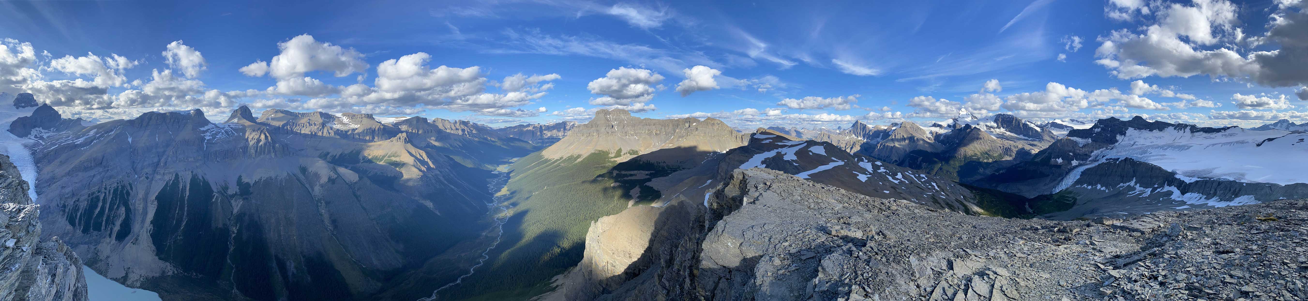
Summit Panorama from Arctomys Peak. Click to view large size.

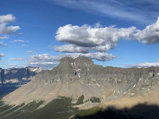
Mt. Outram with Howse Peak behind

Mt. Forbes the white tooth
Yanick descending with Lyell Icefield and Bush Mountain behind

Me on the summit of Arctomys Peak for a second time..
Another photo of me on the summit of Arctomys Peak

Back to our Lyell Meadows camp
Evening glow on Mt. Forbes and Mt. Rosita

Nepal Evos party… My pair in the middle and Steven N.’s on the side…
The weather forecast that we got from our various inReach devices all suggested a beautiful day for our hike-out so we took our time. We were determined to find and follow the trail down from Lyell Meadows. I was honestly fine to just reverse our own route through the bush but we wanted to track the trail to make future parties easier. The trail traversed a long ways skier’s left before going down the forest. There were a shit ton of dead-falls and confusing spots but there were also orange flags. We resisted the temptation to just go down our route and instead, we tried pretty hard to find the actual trail through the jungle mess. The trail ended on the crest of a gigantic moraine and it’s apparent that we had to descend the crest of this moraine. This was the real annoying part as the vegetation was very hard that bushwhacking in those felt like a real pain. There were also many spots that the moraine’s edge had collapsed to force us bushwhacking more on the sides. Eventually a few of us were done with this and went down the moraine as soon as it’s possible. All of us got separated somehow but we all managed to regroup at the downstream side of “Lyell Lake”.
Time to head home I guess…

Yanick descending some ugly terrain down from our camp

Back into the lower Lyell Meadows

This cairn is critical to locate the trail

We tried really hard to stay on trail so that we could track it out…
It was quite a dead-fall nightmare
Yanick on the steep trail…
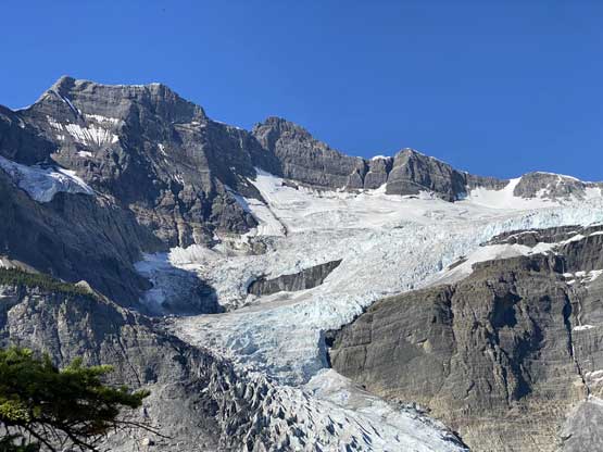
Lower SE Lyell Glacier and Division Mountain

Austin descending the uber-ugly moraine crest
At least the view of Lyell Lake was good. This stretch was literally shit…

Finally down to the river.. Time to take a very long break…
I now finally knew what Kevin Barton meant in his beta but I wouldn’t take too much time writing down the direction here. All you need is to download my GPS track and follow the descent route and that’s it. We took a very long break at the river and I also finally swapped my Nepal Evos for trail-runners. Once we figured it’s time to commit to the death-march we let the game began. We marched back across the upper Glacier River valley at a modest pace but once joining the official trail we each took a racing pace out. Steven N. was the pace setter and I tried my best to keep up. The 250m elevation regain was not inviting at all, but Steven and I had been chatting about peaks for hours so didn’t really realize that much of height gain.

Yanick hopping across one of the many dead-falls
Crossing that critical log bridge

Almost back to Glacier Lake
Austin plodding back around Glacier Lake

Ahead’s over 200 m of elevation gain…
Finally back to the last bridge.

Mistaya River. The End…
After the trip Steven N. had to drive back to Edmonton while the rest of us drove south and the plan was to have a dinner in Banff’s Indian restaurant. We regrouped in Lake Louise. I had promised that if we made the summit of Lyell IV then I would pay us a group dinner, as luxurious as we wanted (100+ dollars). I let Jesse to completely decide our meal menu while I was busy texting a few close friends of mine that I finished the list and were out safely. A couple minutes later I had to resume the drive southwards into Banff. Thank to the COVID we didn’t feel comfortable dinning in, so I took the dinner to Jesse’s home. Needless to say it was an awesome meal. Later that night I drove Austin back to his home in Canmore and he kindly offered me a stay at his home including a much-needed shower. I had thought about spending some $$ for a hotel stay but with Austin’s offer I no longer needed to waste that money.
I did not rush the drive home on the following day. My friend Oakley was supposed to join us on this trip but he was forced to cancel it due to a mandatory attendance of David Xiao’s funeral (who died on Mt. Sir Donald a week earlier). Oakley was going to try Mt. Huber so I texted him to meet in Canmore. After talking to his group I began the slow drive back home through a mixed bag of weather conditions. By the time I drove past Revelstoke the weather had completely cleared up and I made a spontaneous decision to hike up Eagle Pass Mountain. On the next day I made ascents of Morton Peak (an ultra in the interior ranges), and Tuktakamin Mtn., and drove all the way back home through rain.
Below is a timeline and a bit of my reflection in my quest to finish the list. I might write a separate page about the 11,000ers in the near future if I can find the time..
2011 – Temple
2013 – Hector, Athabasca, Brazeau, Cline, Edith Cavell, Assiniboine, Recondite, Willingdon, Crown
2014 – Andromeda, Joffre, North Victoria, Lefroy, King George, Harrison, Woolley, Diadem, Alexandra
2015 – Columbia, Snow Dome, Stutfield, Cromwell, Stutfield NE, South Twin, West Twin, North Twin, Twins Tower, Bryce, Forbes, Lyells 3, 2, 1, 5, Victoria, Huber, Sir Douglas, Murchison, Resplendent
2017 – King Edward, Robson, Deltaform, Hungabee, Whitehorn, Alberta
2018 – Helmet, Bryce Center, Tsar, Goodsirs (North, Center, South), Fryatt
2019 – Kitchener, Clemenceau, Tusk
2020 – Warren, Lunette, Lyell 4
Throughout my peak-bagging career I’ve come across many lists across North America or even in the world but I can safely say that the 11,000ers of the Canadian Rockies is one of the most aesthetic and difficult out there. This list contains only two or three “easy” summits that do not require mountaineering skills and at least a dozen that boast significant objective hazard that can easily kill. What actually make this list extremely hard is the timing aspect. The short climbing window and the fickle weather combined with the continental snowpack means to finish this list in a “timely manner” one must be nearly indefinitely flexible in time, and able to find partner(s) to line up the time. To this date there are only 17-18 people that have finished the list. The fastest time is by my friend Ben Nearingburg (5.5 years) and the longest stretch was by Dean Lister (39 years). For those determined to finish it this eventually turned out to be a lifetime mountaineering goal.
As you can see I progressed gradually in 2013-14 increasing the difficulty of my objectives, and then ate the bulk part of the meat in 2015, but the most important year of my journey was 2017 in which I knocked off Robson and Alberta during the boldest time of my career. In 2018 I resumed the flow and knocked off Helmet and Goodsirs. When the end did come the feeling wasn’t that dramatic because I didn’t leave the hardest ones towards the finishing, but there were a few moments that I nearly shed tears knowing the dream’s indeed coming. Reaching the summit of Mt. Alberta was probably one of the more important moments of my life. In this year I somehow began to cry while driving into the Rockies for Mt. Warren. When it’s getting that close it’s hard to not be emotional.
I yet need to do some statistical analysis of my partners in this journey but for sure I would have to thank Ben Nearingburg the most for sharing 36 out of the 58 summits.
In the end there are some of my own rankings that might interest some of you:
The hardest side:
- Mt. Alberta
- Mt. Robson
- The Helmet
- Mt. Goodsir, South Tower
- Deltaform Mountain
The easiest side (Probably only 4 out of 58 don’t need a rope for most scramblers):
- Mt. Temple
- Crown Peak
- Mt. Harrison
- Mt. Edith Cavell (west side)
- Mt. Willingdon
Hardest alpine rock: 1. Alberta 2. Deltaform
Hardest alpine snow/ice: 1. Robson 2. Bryce
Worst glacier travel: 1. Helmet 2. Clemenceau 3. Twins Tower
Loosest rock/Most Dangerous: 1. Goodsirs (particularly South) 2. Alberta
Logistical Cruxes: 1. Tsar 2. Clemenceau/Tusk (Helicopter assist or weeks-long expeditions)
My least favourate: Sir Douglas
My most favourates: Helmet and Twins Tower
