Mount Barnes-Pauze
June 20, 2019
1470m
Nunavik / Torngat Mountains, NL/QC
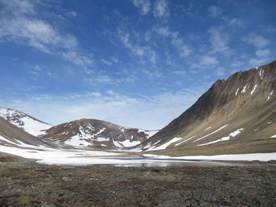
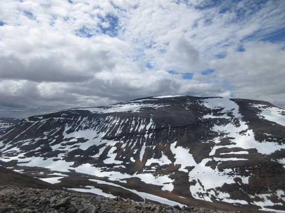
The unofficial name “Mt. Barnes-Pauze” had been given to the second highest summit in Quebec in memory of Susan Barnes and Dan Pauze who perished on Mt. Caubvick/Mt. D’Iberville in 2004. This is a dome-shaped summit composed of mostly talus and scree and in fact, most peaks in Torngat Mountains except of the highest have a similar dome shape. The Torngat Mountains in the Nunavik is very difficult and expensive to access and the only reason we were there was to climb the highest – Mt. Caubvick/Mt. D’Iberville. We finished our primary objective earlier in the trip and now with several more days to kill at the basecamp we had to come up with some other objectives.

Ascent routes for Mt. Caubvick and Mt. Barnes-Pauze. GPX DL
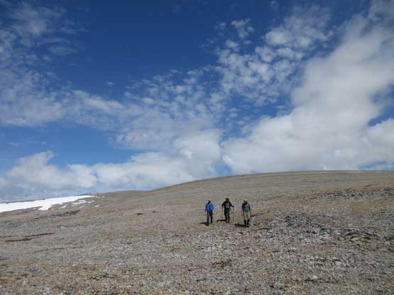
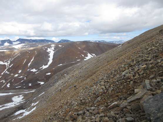
An ascent of Mt. Barnes-Pauze from Mt. Caubvick’s basecamp involves at least 25 km of round trip distance with around 2000 m cumulative elevation gain, on talus, scree and snow. Despite the lack of technical challenge this would be a very physically demanding day with considerable amount of navigation challenge. Our plan was to take the most direct westwards line over several smaller, unnamed summits but such approach involved a dip of over 500 vertical meters before Mt. Barnes-Pauze. Thank to the extremely long daylight time we didn’t start until well past 9 am. Our first objective was plodding several kilometers up the main valley due NW from our basecamp. Once a long strip of snow appeared we took the advantage, gaining over 600 vertical meters to the first (unnamed) summit of the day. This might sound easy on paper, but was a real tedious process, especially when wearing mountaineering boots.
Plodding up the main valley heading NW
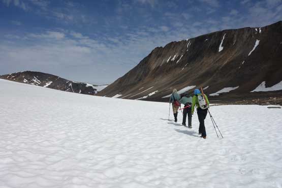
Ascending onto snow. Photo by Yeuhi A.
Fast forward. On the upper slopes of the first unnamed summit now

Eric, Yeuhi and Patrick plodding on the typical terrain
The NE Face of the first unnamed summit

Me on the first unnamed summit with Mt. Caubvick behind
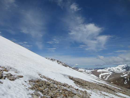
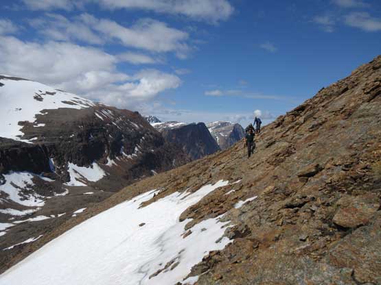
From the first summit we continued along the long, broad ridge/plateau for several more kilometers due SW and then W, to just below the highest of the three unnamed summits. From there I led the way traversing/descending easy talus slopes to a large snow gully. Plodding down this gully involved a lot of post-holing but was still much faster than hopping on talus. Then there came a short ascent onto a small ridge before descending another 200 vertical meters into the broad valley separating Mt. Barnes-Pauze with the group of unnamed summits. This last bits of descent did not look easy at first but I managed to find a scramble route on chossy 3rd class terrain to get us down.
Just as typical as the plod across the plateau. About 4 km long
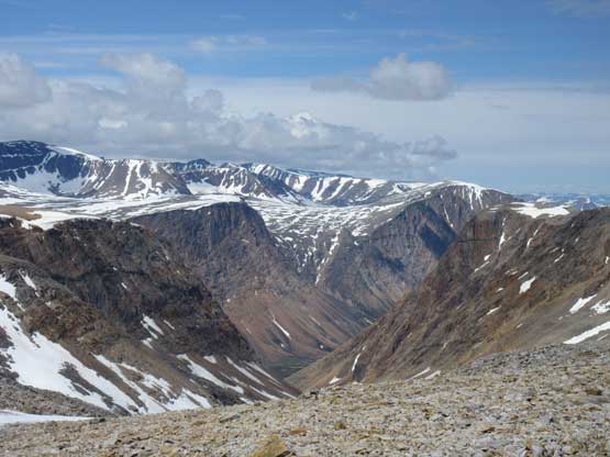
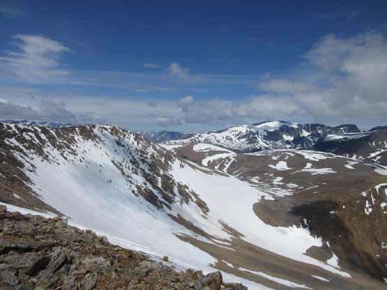
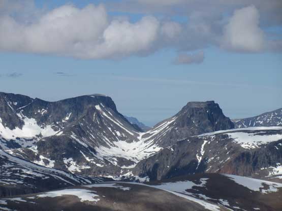
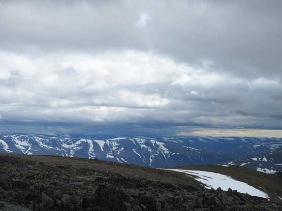
Started to see some impressive views down into Tallek Arm
This is a wider, northern view into Labrador
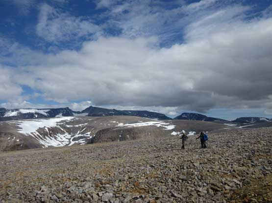
Another shot of the plod across that plateau
Our objective – Mt. Barnes-Pauze ahead

Descending on snow for hunderds of meters
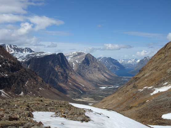
Palmer River into Tallek Arm which is part of Nackvak Fjord
Descending choss
After losing more than 500 m elevation we were down to this deep valley
After a quick break filling up the water bottles we started the last section of this ascent – about 800 m vertical gain to the summit of Mt. Barnes-Pauze on mostly unstable talus and scree. The lower half was straightforward. Eric led us into a broad bowl and then scrambled out of the bowl on some easy 3rd class terrain. The worst came at gaining the summit ridge from the top of this middle bowl. The talus was steep and loose making rockfall a real issue. The four of us picked two slightly different lines and after what seemed like a long while we topped out of the summit ridge. The summit was only 100 vertical meters above us and presented no further challenge. On the summit we found the register booklet placed by Greg Slayden et al. in 2004. There was no other entry so we could have claimed a second recorded ascent at least on the internet. However, later in the trip we found that the park’s ranger, Randel had also made the summit and found the register. I’m sure it’s been climbed by others, probably the inuits as well.
Slogging up the typical talus slopes on Mt. Barnes-Pauze. For hundreds of meters

Eric on the upper slopes

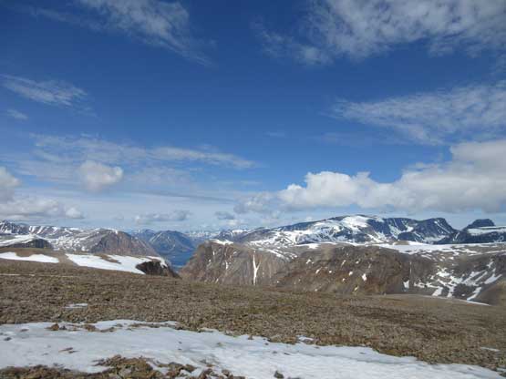
Summit Panorama from Mt. Barnes-Pauze. Click to view large size.
Impressive towers in the Labrador side of the Torngat Mountains
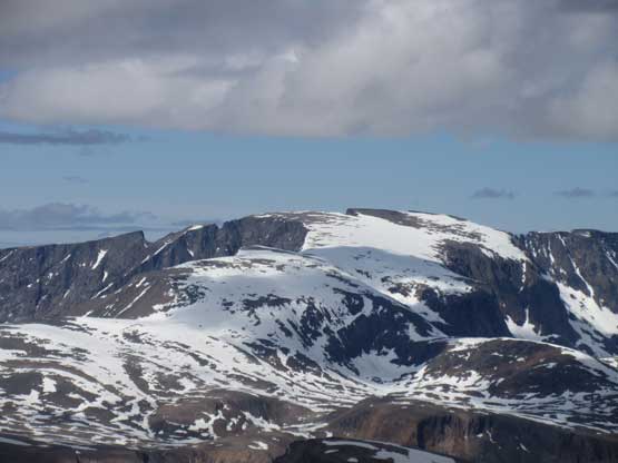
Just another summit in the Labrador side of theTorngats.
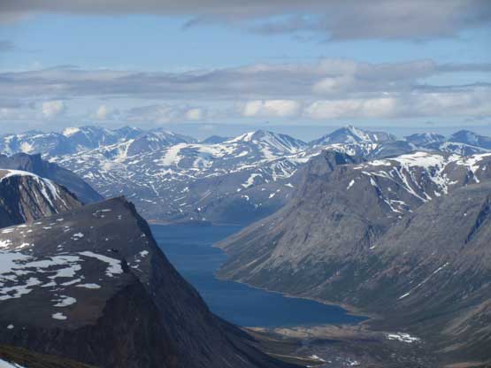
Tallek Arm
Apparently there’s a storm to the south but it never reached us

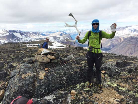
Our group shot on the summit of Mt. Barnes-Pauze. Photo by Yeuhi A.
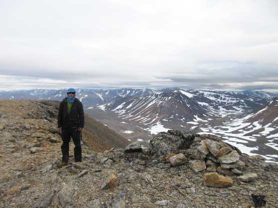
Me on the summit of Mt. Barnes-Pauze
Due the length of this ascent we didn’t linger any longer than necessary on the summit. On the descent I led a previously-scouted route in hope to stay mostly on snow. There came some very tiring post-holing sometimes down to waist deep near the rocks, but overall I still thought the snow was more efficient. The post-holing became better and we even got to boot-ski some sections. The 500 m re-ascent out of the deep valley just to the east of Mt. Barnes-Pauze wasn’t as fun but we all kept our heads positive and eventually it would be over. Near the top of the grunt Eric and I decided to tag that unnamed bump while Patrick and Yeuhi opted to bypass. We eventually caught up to them along the long, tedious traverse across the plateau. Near the end of the traverse we somehow convinced ourselves to ascent up and over a 3rd unnamed bumps instead of retracing our ascent route. The descent off this unnamed summit involved a long stretch of steep snow up to 40-45 degrees and a creek fording near the end. I didn’t even bother to take the boots off because I was already soaked anyway. We eventually stumbled back to camp at 11:30 pm just about the time to need headlamps, and that concluded this long, but productive day.
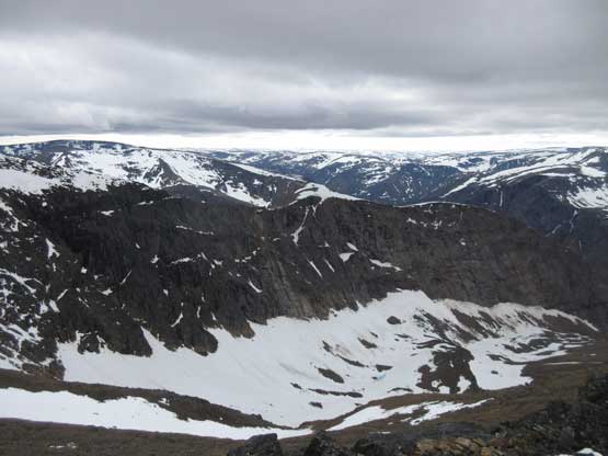
The north side of Mt. Barnes-Pauze is kinda impressive
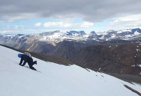
Me descending on snow. Photo by Eric G.
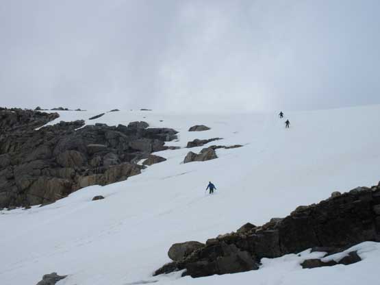
Eric, Patrick and Yeuhi plodding down on snow
After a long grunt here’s me on another unnamed bump
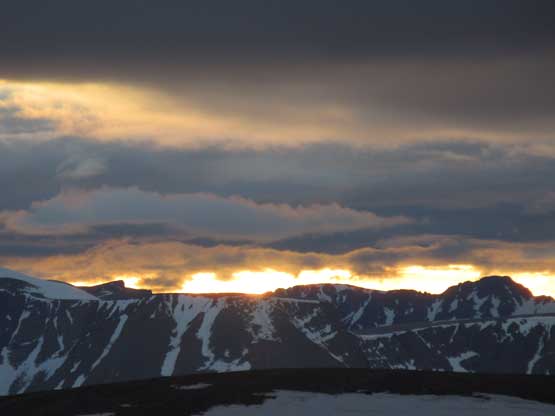
It’s almost sunset time..
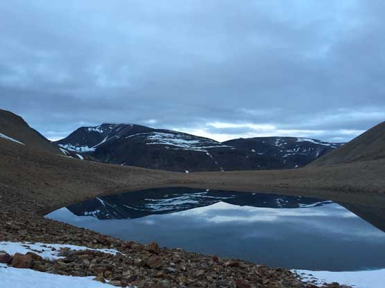
After descending another steep snow slope we came down to this unnamed tarn
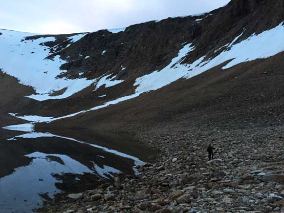
More tedious terrain to traverse around the tarn
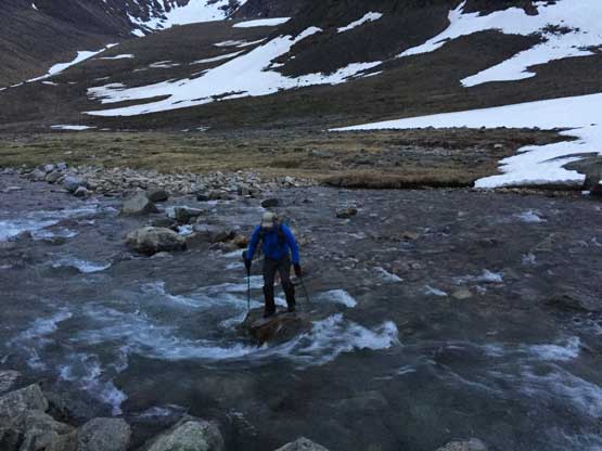
Yeuhi hopping across the major creek at the end of the day.
As much as I wanted to ascend the second highest summit in Quebec I probably wouldn’t recommend this peak unless you are a stubborn peak-bagger like myself looking for punishment. The whole day was on unpleasant terrain despite the awesome views at times. This was a classic Type II fun kind of day..
