Mount Wilson (Red Rocks, NV)
December 30, 2017
2155m
Las Vegas / Red Rock Canyon, NV
As far as I know there are at least half a dozen “Mt. Wilson”s across the western North America so not to be confused with the other ones I have to point out at first, that this “Mt. Wilson” is located just to the west of Las Vegas and is the highest point in Red Rock Canyon NCA. It boasts a shear east face that attracts almost everybody visiting the area but the west side is nothing fancier than a gentle walk-up on forested slopes. This isn’t a “prominence peak”. And thank to the proximity to Las Vegas’ urban development Mt. Wilson offers countless routes but from a scrambler’s perspective only two make sense. The standard route goes up First Creek Canyon (3rd class) from the south while a more interesting and direct option goes up Oak Creek Canyon from the north (4th class).
This was the 5th day of this past holiday season desert trip between Jake and I and also my first time ever visiting Las Vegas. The plan was to ascend Charlston Peak at some point in this trip given how dry the condition was but we also wanted to do something different each day. The “scramble via Oak Creek Canyon” was pretty much exactly what we wanted. Finding a car-camping spot to pitch a tent beside our vehicle was tricky but we did manage to do so without being hassled. This is not something I would like to elaborate in this trip report, however.

Mt. Wilson via Oak Creek Canyon. 4th class
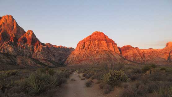
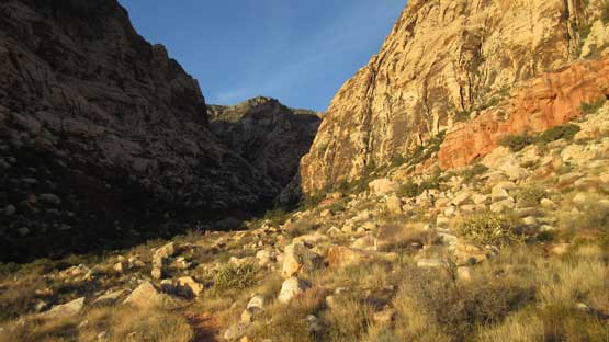
The morning we woke up about an hour before sunrise and eventually got going right before the alpenglow time. This was a perfect timing as we got to watch all of the east faces turning red and orange, including our objective. The plod across the desert plain was surprisingly cold but once we got some sunbeams the air had warmed up significantly. And then we were entering the constraints of Oak Creek Canyon.

The morning was extremely cold but we got this alpenglow on Mt. Wilson

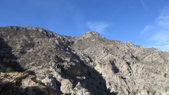
This is Bridge Mountain

Looking farther up north towards La Madre Mountain
Rainbow Peak at glow and the bearing of ours was just to the left of it.

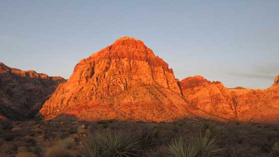
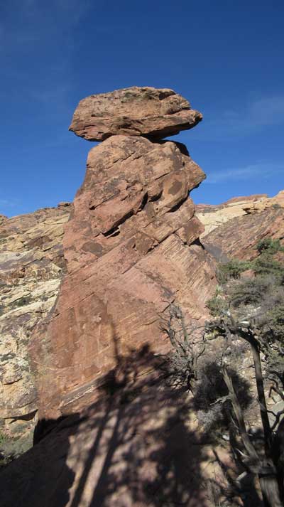
A closer look at the east face of Mt. Wilson with the attached Cactus Flower Tower
Rainbow Peak
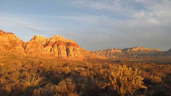
Finally got some sunshine now. This is still looking north towards Bridge Mtn.
One last look at Rainbow Peak before entering Oak Creek Canyon
Entering the canyon now.
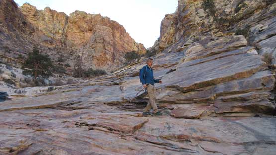
The beginning of this canyon was bushy if you miss the trail. There’s some confusion but we decided to trust the foot paths traversing high on the north bank. This turned out to be actually the correct call as the trail then descends back into the canyon floor and now we got to start the fun parts. The boulders were huge in the canyon and to scramble over, or around some of them required 3rd class moves and sometimes with exposure. At the first major junction we took the left turn and then at the second junction we had to make a choice. The left (south) branch leads into an amphitheatre and then further up the Cleaver Crack (4th class) but neither Jake nor I had done much research. The right fork continues up Oak Creek Canyon and seems to fit with the descriptions we had.
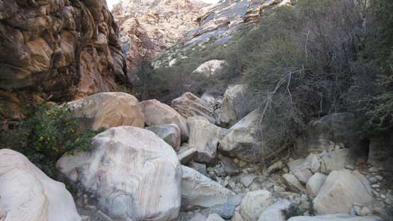
This is the start of Oak Creek Canyon.
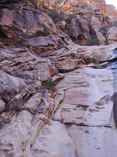
Jake scrambling up.

As typical as the lower boulder hopping and scrambling goes.
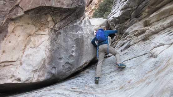
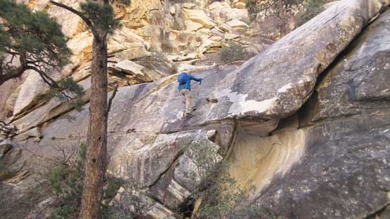
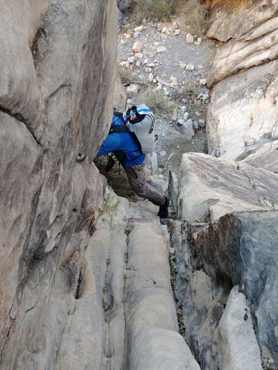
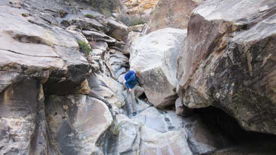
The route essentially goes up the “middle fork of Oak Creek Canyon” and it is this upper stretch that offers the greatest challenge. There’s plenty of 3rd and 4th class steps on the slabby water worn sandstone. We might not have noticed much on the ascent but the descent would be a different story with lots of difficult moves. Generally speaking if encountering 5th class climbing then detour and look for options on the climber’s right side wall. The crux comes towards the end where we had two choices. The 5th class section is now aided by a fixed rope on the left side but we opted to climb the 4th class bypass on climber’s right. There’s one or two exposed and awkward friction moves and because of that we decided to use the rope on descent.
Me leading up one of the typical sections

Jake soloing the 5th class crux #1 while I went for a bypass on climber’s right

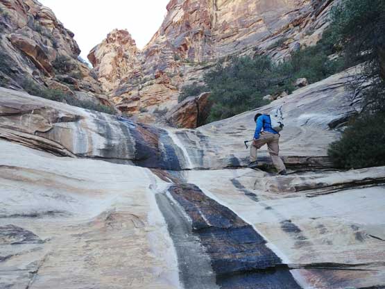
Me continuing up the canyon. This is the start of the Crux #2
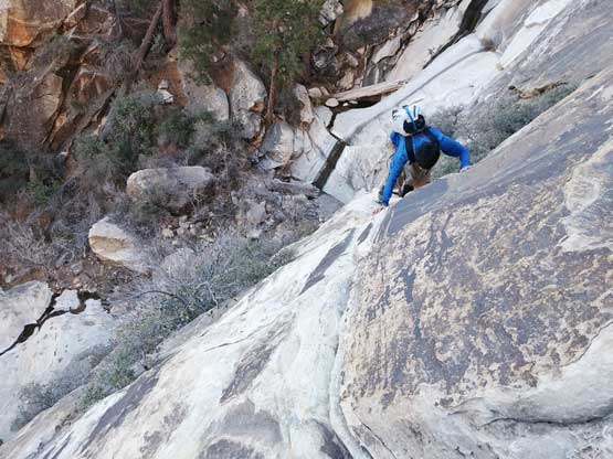
Me just about to tackle the trickiest moves of this 4th class section. Photo by Jake R.

As you can see this pitch is slabby and moderately exposed. Photo by Jake R.
Following the upper canyon trending climber’s left (south) we got to deal with more slippery slabs but now the gradient had eased off. What’s left was mostly a pleasant walk on the slabs with nothing overly challenging, although we still had plenty of route-finding to do. Consulting with the descriptions we aimed our bearing towards the base of an “obvious pinnacle” and then onto a rib feature. This place marks the transition from the red sandstone onto the upper limestone cap. It’s confusing whether or not we should continue up this rib but at this point there wasn’t much we could do other than following the basic instinct.

Aiming at this pinnacle. Photo by Jake R.
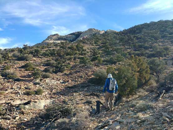
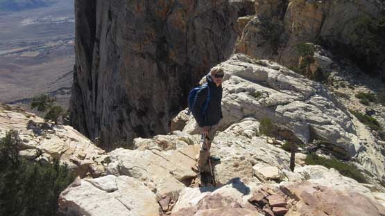
The rib route indeed worked out and the next thing we were traversing the high vegetated plateau towards the summit area. There’s some long side-hilling on off-trail terrain but other than paying attention to the cactus there’s nothing worth noting. The summit “nipple” was longer and farther than it looked and once there we were surprised to see another taller true summit farther behind. Getting to the true summit required some brief elevation loss but the view was just as expected, mind-blowing towards all direction. The only disturbing sight was Blue Diamond Mine just across the valley but I guess there’s not much we could have done to stop that kind of development.
Finally worked our way up to the upper mountain.

Looking back down through Oak Creek Canyon.
Traversing the vegetated plateau. Photo by Jake R.

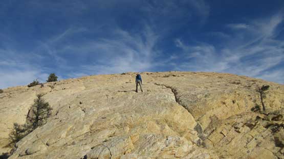
Jake hiking up the open slabs near the false summit

Rainbow Peak is now lower than us.

Looking west the terrain isn’t nearly as inspiring. All these peaks do not have names.
Upwards and onwards…

At this point we thought we were there but not quite…
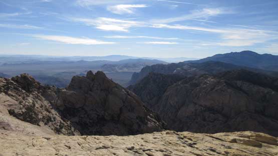
The south side views.

There we go this is the actual true summit.

Summit Panorama from Mt. Wilson. Click to view large size.
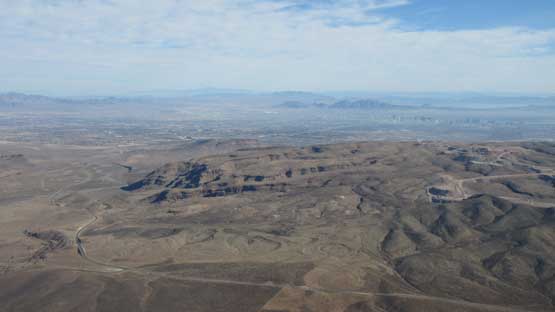
The skyline of Las Vegas behind Blue Diamond Hill
The devastating open mine on top of Blue Diamond Hill

This is the southern view across the shear cliffs
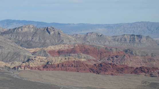
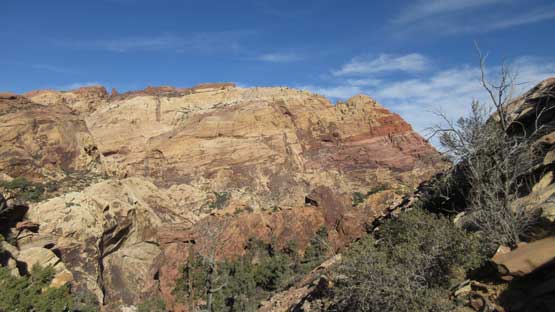
It’s pretty obvious where the world-class Red Rock climbing area is…

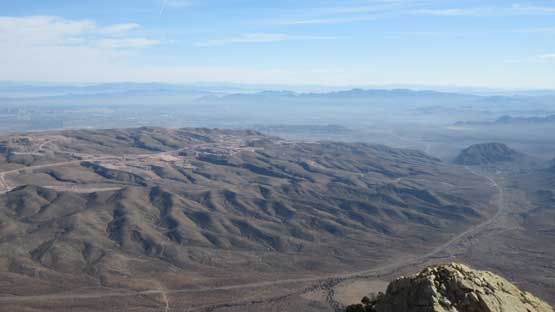
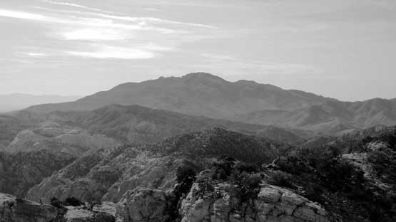
This is probably looking towards the higher peaks near Charlston Peak.
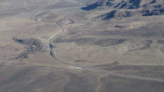
Roads and highways.
Potosi Mountain is a fairly prominent one to the south.

Me on the summit of Mt. Wilson

Another shot of me on the summit of Mt. Wilson
About half an hour was spent there soaking in the views. Eventually we had to face the descent. For the upper mountain we pretty much just reversed our route side-hilling across the vegetated plateau descending into the upper Oak Creek Canyon. At the supposed crux we stayed on down-climber’s right (south) side and found that fat batman rope. The bottom two meters turned vertical and overhanging but this wasn’t our first time using a batman rope to descend so the task wasn’t difficult. The actual crux turned out to be a section of 4th class smooth water worn slabs with virtually nothing to grab onto. I’m pretty sure on the ascent we just motored up using momentum without giving much of a second thought but the down-climb was far more difficult. Jake’s much more confident than me on rock climbing but even him had to spend some time to figure the sequence out. The initial few moves are the worst and I simply could not commit to that. I then spent about half an hour trying around all forms of strategy but eventually committed to a line on the far down-climber’s right (with rock shoes). The exposure was slightly higher but at least there’s some face holds to grab onto. When it comes to friction climbing I really suck and I don’t have much experience at all.
Time to head down.
Cannot get enough of Rainbow Peak
This is that characteristic pinnacle en route.

A bit bushy at places as we didn’t pay enough attention to the route.
This is the uppermost section of the canyon. Lots of slab walking
Down-climbing the main crux using this batman rope

Jake leading down the slabby crux. This is a very slippery stretch.

Jake continuing down the slabby crux.
Below “our crux” I remember there’s another set of 3rd-4th class water worn slabs but slightly more textured. And then there came the “1st crux” described by many other sources, which was actually quite easy if bypassing on down-climber’s left, albeit a bit bushy at places. The lower Oak Creek Canyon isn’t difficult but requires lots of route-finding in micro-terrain as well as boulder hopping which certainly eats time, but we did good on time. The final mile’s plod across Mojave Desert was uneventful other than the sudden increase in the number of tourists.
Me down-climbing one of the trickier sections.
This part is pretty awkward.
Back into the lower canyon we still had lots of boulder hopping to do.

Back onto the floor of Mojave Desert and now looking back at Rainbow Peak
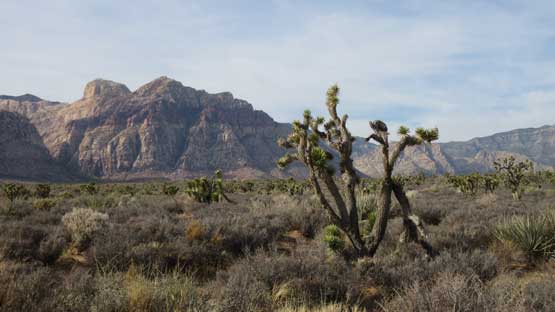
One last picture showing Bridge Mtn. and a lone Joshua Tree
I think our round trip time is under 8 hours which is pretty standard for this route. I probably wouldn’t say it’s a “must do” objective but if you are up for 3rd and 4th class scrambling with lots of route-finding challenge then this is the one, but do not underestimate the challenge. If “tagging the summit” is the only fact that interests you then there’s an easier, albeit more tedious and boring option, via First Creek Canyon (3rd class).
