Cougar Mountain
October 27, 2015
1545m
Whistler, BC
With a “Pineapple Express” approaching towards this weekend Simon and I decided to head out on Tuesday taking advantage of possibly the last day of this warm fall season. A low-elevation, forested summit north of Whistler unofficially named Cougar Mountain was brought to the discussion as we weren’t too keen on anything major. Its proximity to some of the bigger peaks nearby would guarantee some great views.
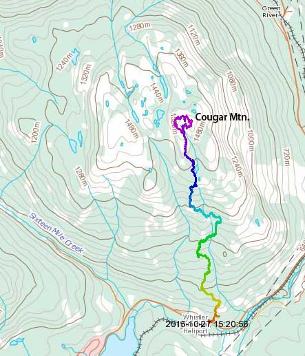
Cougar Mountain hiking route. GPX DL
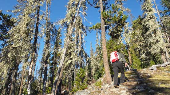
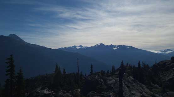
This was rather a lazy day out but to avoid the horrible rush-hour traffic we still decided to head out early by 6:30 am from West Vancouver. In less than 2 hours we made to Whistler and the trail-head was right by the “welcome post” north of the village (1-2 km before Wedgemount Lake turn-off). There’s very minimal information about this trail other than a few posts on ClubTread, but apparently it was in a great shape. Following the flaggings (and tire tracks from dirt bikes) we gained elevation fairly quickly through the forest. The canopy wasn’t nearly as thick as I was expecting and we got a few great viewpoints along the way.
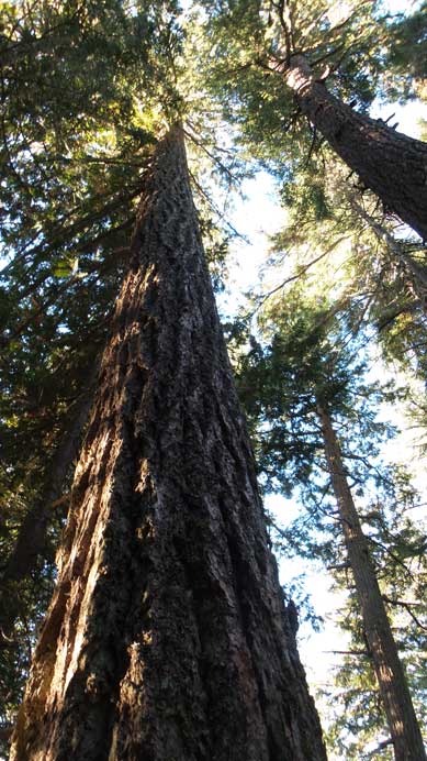
Some giant Douglas Firs

Views through the open forest
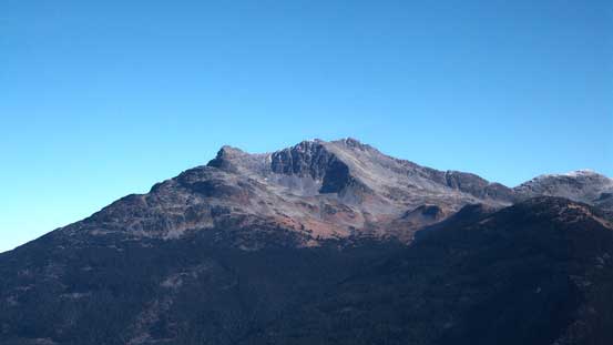
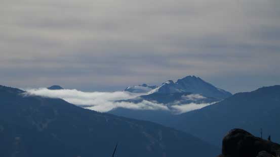
Mt. Tantalus
The trail was a bit vague at some points
Hiking up
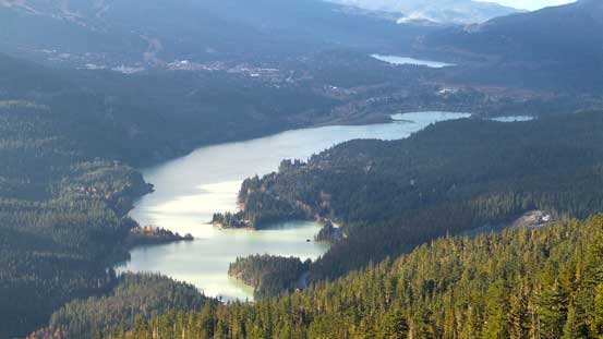
Green Lake by Whistler

Looking upwards through the thinning forest

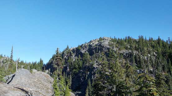
Some of the bluffs

A lot of mushroom on this trail

View finally opened up
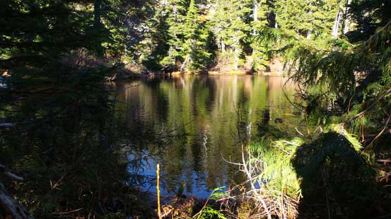
We passed by this tarn
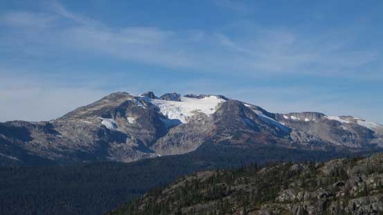
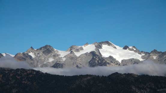
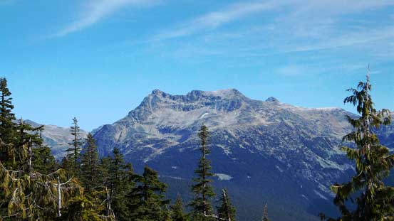
Rainbow Mountain
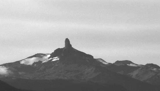
The Black Tusk

Open view down towards Whistler and the valley Sea-to-Sky Highway travels through
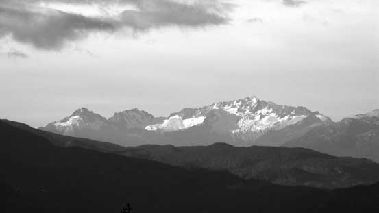
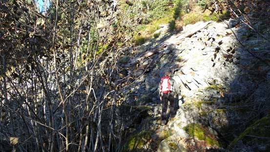
As we approaching the twin summits we slowly lost the trail (and the flaggings). The true summit was on our right (East) but micro-terrain brought us to the left one first (West). Visually it’s difficult to tell which was the higher one so we opted to ascend both (plus we had lots of time to kill). We picked a direct line up a granite bluff with a few tricky moves. The views were awesome especially towards Rainbow Mountain but there’s a bone-chilly breeze blowing from the north. Thankfully there’s enough sheltered place to get out of that wind.

The twin summits ahead. True summit on right

Simon hiking along a rocky rib
The true summit
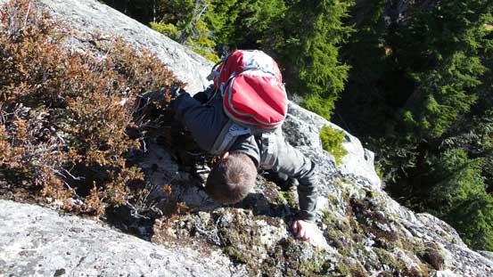
Scrambling up a tricky step

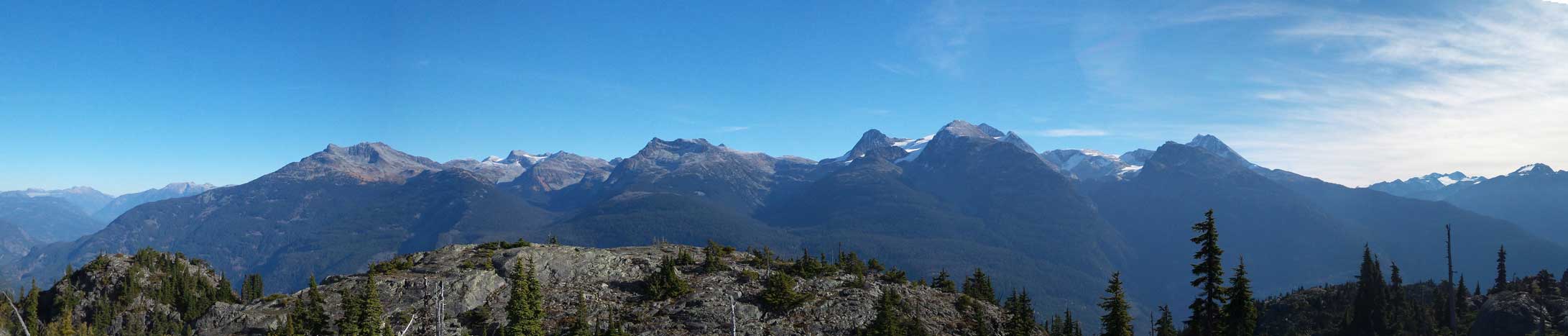
Panorama from the false (west) summit. Click to view large size.

Rainbow Mountain
Some clouds obscuring the view towards Spearhead Range
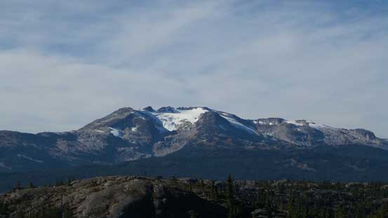
Ipsoot Mountain to the north
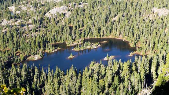
One of the many tarns by this summit plateau area

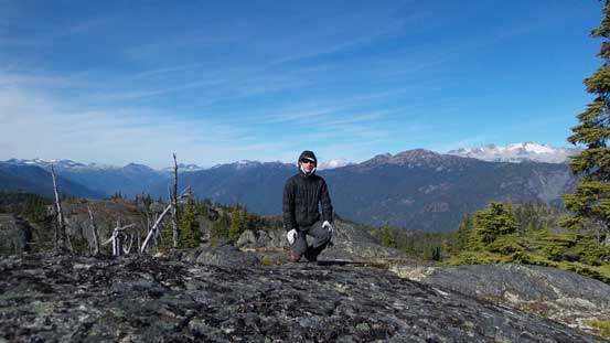
Me on the false summit

One of the many trees up there
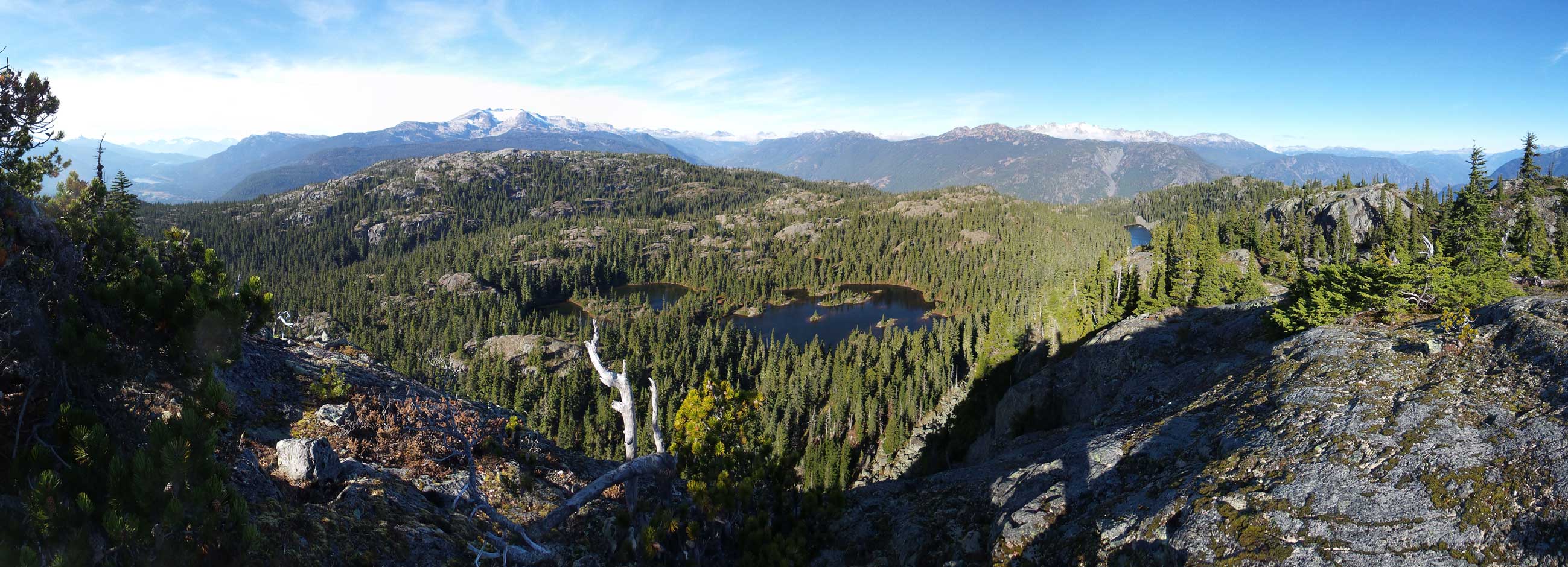
Another panorama from the false summit. Click to view large size.
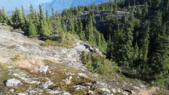
After spending enough time on the west summit we turned our attention to the true one. The terrain between the two summits were bluffy and offered some interesting route-finding and scrambling. Following the terrain we descended the north side of the west summit to the col and then ascended the north side of the east peak. There were a little bit of bushwhacking along the way along with a few moderate scrambling sections. I also ended up having to backtrack a bit to find a reasonable way. There’re a few high points on this summit plateau and we ascended them all just to be sure. We again, spent a long time killing time but the views weren’t as good as the west summit.
Descending the north side of false summit towards the col

The typical terrain going up the true summit

There’s fair a bit of route-finding through this bluffy terrain

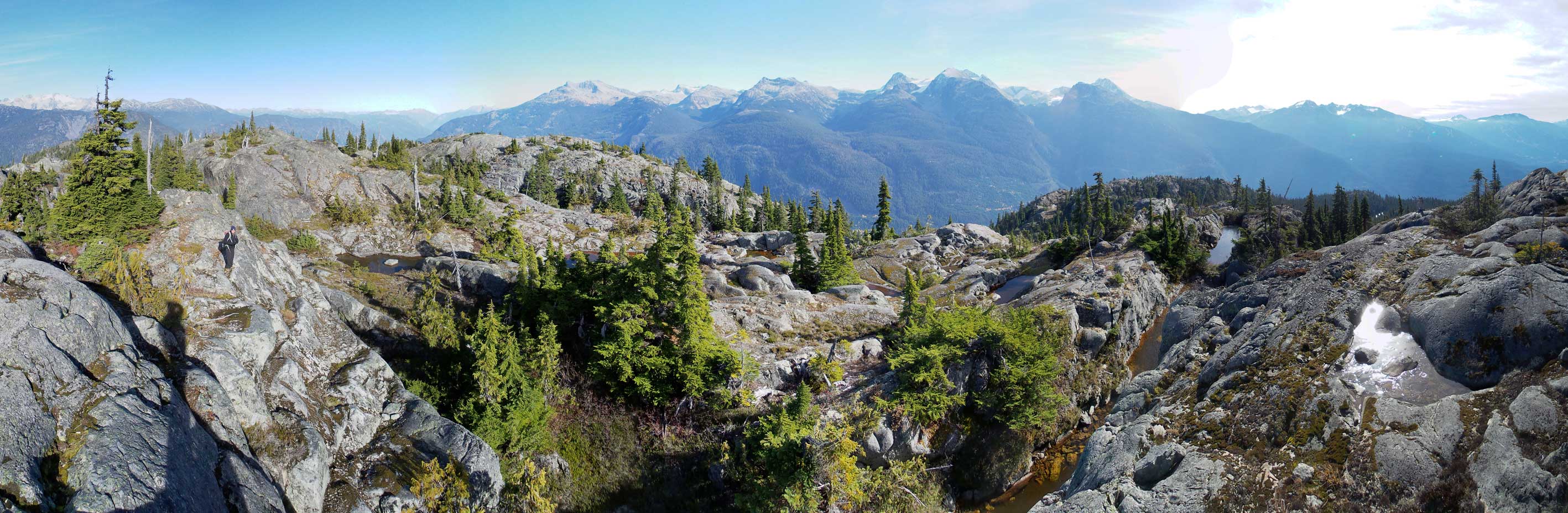
Summit Panorama. Click to view large size.
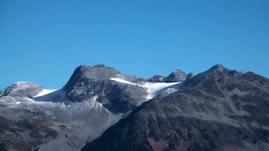
Mt. Currie that I ascended last month
Rainbow Mountain
The Soo River Valley with Mt. Callaghan on left

Ipsoot Mountain with Sootip Peak in front on left
The valley down to Pemberton, with Birkenhead Peak behind on right skyline
Castle Towers looking south
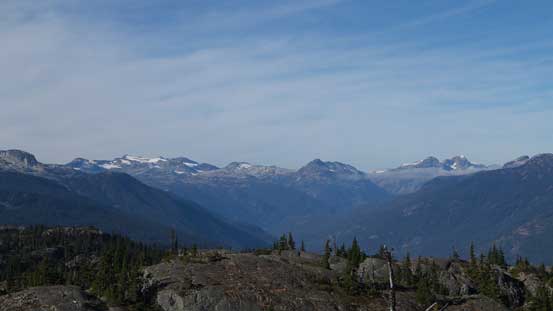
Peaks by Spearhead Range
Me on the summit

Another tarn on the summit plateau. Moe/Cook/Weart behind
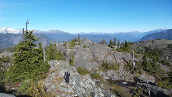
Simon hiking up another highpoint

The false summit in the foreground
Hibachi Ridge

Our group shot. Photo by Simon C
Mt. Currie – Wedge Mountain panorama. Click to view large size.
Another panorama showing the bluffy summit plateau area. Click to view large size.
Eventually it’s the time to head down. Instead of retracing our ascent route which was way too circumventing we opted to explore a direct route off the true peak. In short time our route was blocked by a vertical cliff but thankfully we came prepared with a 30-meter scrambling rope. A dead tree was used as an anchor and after hand-lining/rappelling down this band we resumed the descent. There’s another cliff but we were able to find a scramble route by traversing to down-climber’s right. Into the gully between the two summits we had to deal with some brief, but heavy bushwhacking before we were able to climb out of this gully to join the trail. The rest of this hike-out was uneventful.
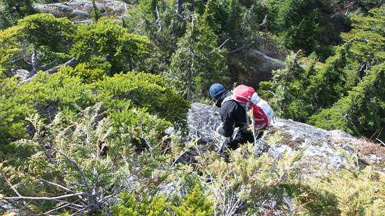
Simon down-climbing the crux using a rope as hand-line

Mt. Moe, Mt. Cook with Mt. Weart behind – three peaks that I ascended last weekend

Wedge Mountain with Rethel Mountain in front
Ure Peak between Currie and Wedgemount

Looking back before entering the forest

A closer look at Mt. Moe
As usual for a weekday trip avoiding Vancouver’s evening rush hour was crucial so we still had to kill some time. We went to Squamish’s MacDonalds for some food before stopping by Porteau Cove for some pictures.
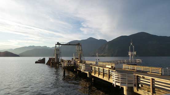
Porteau Cove along the Sea-to-Sky Highway

Sunset over Leading Peak (Anvil Island)
Overall this is one of those trips that turned out to be “more than expected”. Despite its lowly status, the summit offers incredible views. The hike itself was not short (since you start from valley floor) and then near the summit there’s plenty opportunity to pick your own route. A good way to wrap-up this amazing October.
