Mount Spickard
July 10, 2018
2737m
Depot Creek / Chilliwack Lake Road, WA
Mt. Spickard is the highest, but the least interesting among the six Bulgers far north next to U.S./Canada border. For those going after the Bulger list it makes sense to approach this entire group via Chilliwack Lake and Depot Creek from Canada as the nearby Lake Ouzel makes a good basecamp. If the interest is solely Mt. Spickard then the Silver Creek approach from Ross Lake and North Glacier climb provides a more aesthetic option. The standard south side route is no harder than 40-degree snow and 3rd class rock. There are other facts that make Mt. Spickard relatively popular. It’s the 9th most prominent peak in the state of Washington and that positions it well into the Lower-48 Top 100 by prominence. If you are prominence peak-bagger then you have to do Mt. Spickard.
The plan between Eric G. and I was to ascend all peaks in this areas in one single grab while pushing hard on each day. On the first day we had an alpine start from the truck, did the approach and made ascents of Easy Mox and then Mt. Redoubt (18 hours). On the second day we did a “rest day” climbing Hard Mox on a leisure pace (10.5 hour round trip from high camp). That nigh it was pissing rain just as forecasted and the rain stopped in the morning although we were still in clouds. We packed up the camp nonetheless. It seemed like a day to practice GPS navigation and the plan was to move camp to Lake Ouzel followed by ascending Mt. Spickard and Mt. Rahm.
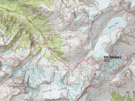
Mt. Spickard standard south side route.
Right off the bat we entered the “ping pong ball” and lost the tracks. It’s apparently the descent off Redoubt Glacier would be done solely by GPS navigation given the less-than-20-meter visibility. Mt. Redoubt and Mt. Spickard are the only peaks in this group that we found GPS tracks to download so we didn’t worry too much about the white-out. My Gaia App on the iPhone needs some exercise anyway. It wasn’t actually too bad but near the bottom we had to pay attention to the thinning snow bridges and crevasses. Finding the correct ledges to get down to Lake Ouzel also involved GPS navigation because we didn’t come up from this way. It’s not that obvious from above but again, with the tracks it was a trivial fair. Fording the lake’s outflow was chilly and then we spent half an hour pitching out the tent and relaxing. There’s a party-of-six camping beside the lake and hoping to move to high camp on this day. This area is more popular than I thought. If these peaks are positioned north of Pemberton then I guarantee they wouldn’t see more than a handful ascent parties per decade. Anything in U.S. is crowded and I have to agree.

As much as descending Redoubt Glacier goes. Photo by Eric G.
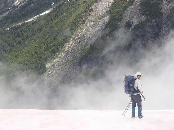
Me during a rare break. in clouds Photo by Eric G.
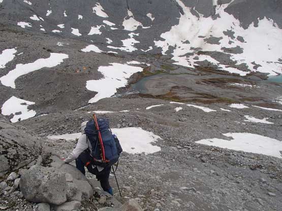
We found the ledges to get down to Lake Ouzel. Photo by Eric G.
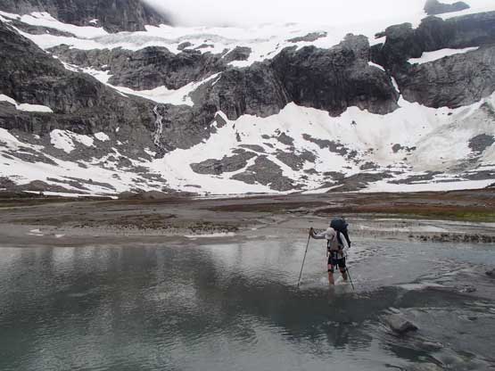
Me crossing the outflow of Lake Ouzel in bare feet. Photo by Eric G.

The huge group camped there the previous night. They were watching us

We quickly set up our camp and then up we went again.
Not wanting to waste any time we immediately started the upwards slog. After rock-hopping for a while we picked up boot tracks on snow and made some fast progress towards Silver Pass. We didn’t have to go all the way to Silver Pass but rather taking a rightward traversing bench to access a steep pocket glacier on the SW side of Mt. Spickard. There were two parties making the summit in the last couple days so route-finding was non-existent but still I often double-checked the GPS just to be sure. Other than some brief glimpses we could see nothing but ourselves. To gain the notch on SW Ridge involved a long stretch of 40-degree snow climbing that required ice axes and crampons. From the notch we lost some elevation on choss and then traversed another flat bench to the base of a steep couloir.
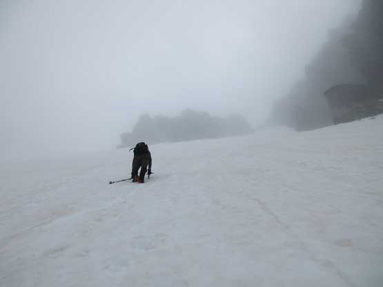
Eric climbing up the 40-degree snow in the lower basin.

Me climbing up. Photo by Eric G.
The set of boot tracks led up the snow couloir to access the SW much earlier than our downloaded GPS track did, but the track was from an ascent in May. The season is different so we put our fate on the actual boot tracks here. The couloir got pretty narrow and steep near the top and involved some dirty transition onto rock but the terrain beyond looked tame and easy – just piles of loose talus. We climbed up the talus field to the crest of SW Ridge and started to follow the ridge crest. There’s some jagged towers including a tricky false summit that we had no choice but climbing up and over because of the white-out. There’s no way to judge what’s beyond the next bump so the best was sticking to the ridge and let the descent to resolve the path with the least resistance. There’s some exposed 3rd class climbing on wet rocks and the summit always seemed farther than appeared on maps. There’s absolutely nothing to see on the summit other than the cairn and register. Disappointed but I’m just glad to not have to redo this approach.

Eric climbing up the couloir/gully to access SW Ridge
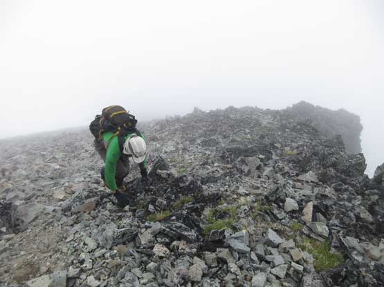
Above the couloir is a long stretch of talus field
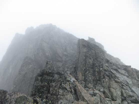
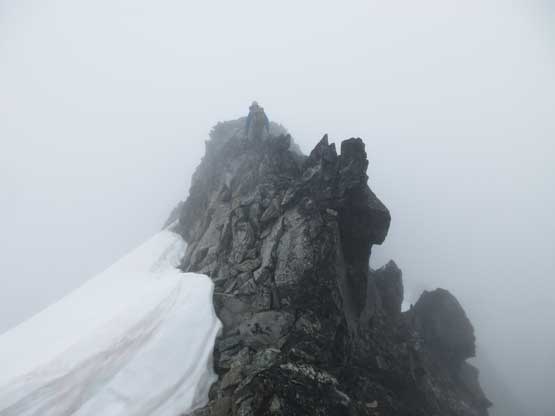
And then we got to the ridge. It was still in a white-out
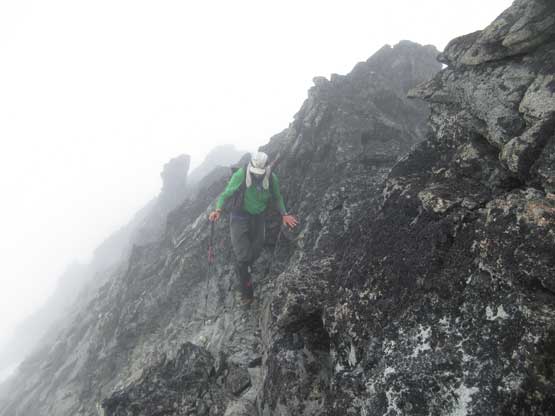
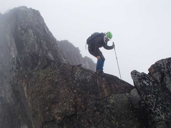
There are 3rd class climbing and exposure at places

Eric scrambling up a steeper section.
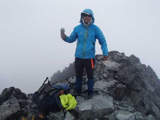
Me on the summit of Mt. Spickard
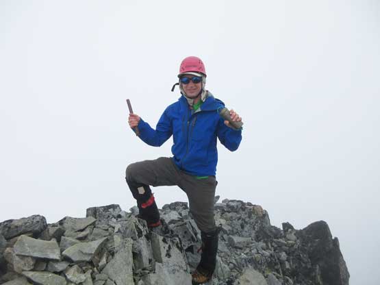
Eric on the summit of Mt. Spickard
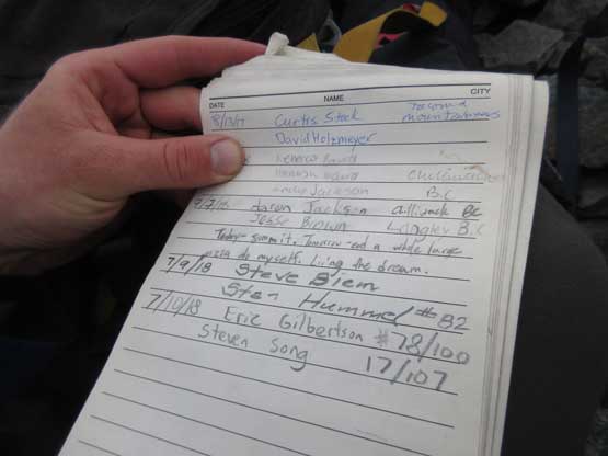
Just have to show a page of the register to prove we did make the summit…
On the descent we explored a couple traversing bypass and actually found some tracks on snow slopes. There’s no need to climb up and over that lichen-covered false summit that’s for sure. Descending that pile of talus field was a pain on the ass and then transitioning back into the snow couloir was also a choss fest. Thankfully the snow was super easy to descend and in no time we were back to the lower basin following our own tracks.
Eric traversing back across the narrow summit ridge
Me balancing with caution. Photo by Eric G.
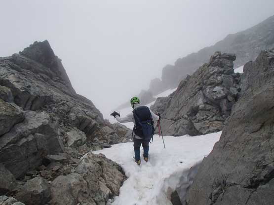
Me entering the constraint of that gully/couloir. Photo by Eric G.

At the narrowest spot we had to turn our faces into the slope

Lower down in that gully the terrain widens up but still steep

This is down-climbing the steep snow in the lower basin.
Instead of returning to camp we turned upwards towards Silver Pass and then Mt. Rahm.
