Ord Mountain
January 8, 2022
1923m
Barstow, CA
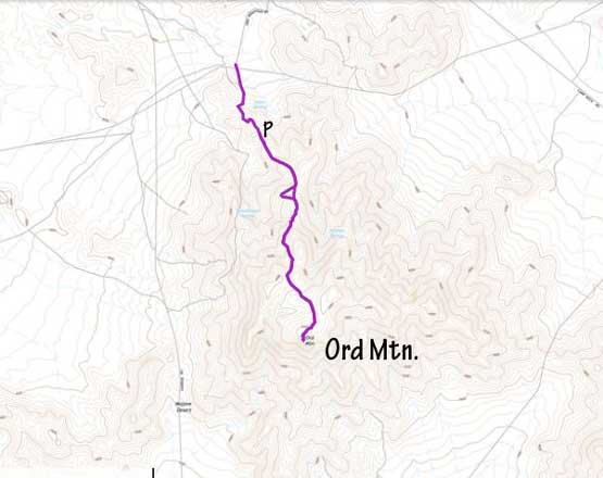
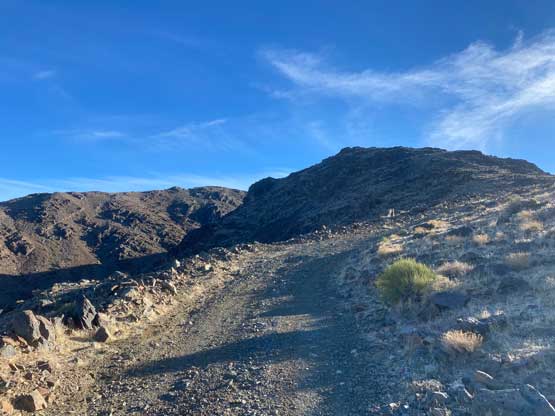
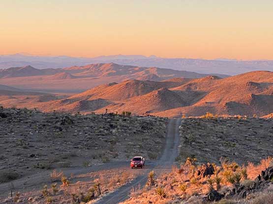
Ord Mountain is a broad and dome-shaped massif in SE California that boasts almost 1000 m prominence. This peak locates to the north of San Gorgonio Mountain in the desert area. A road goes all the way to the summit but the road is gated about 4 km from the top. The access is from the north near Barstow and the driving on dirt roads is long and somewhat complicated. Thankfully the roads are all correctly marked on the Gaia map so the navigation was not a problem. To drive to the gate requires a 4×4, high clearance vehicle with good tires but those without could still park about 1 km short and walk a longer distance.
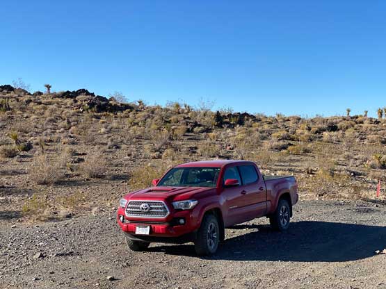
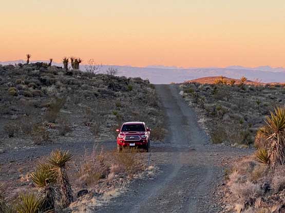
I did this ascent after finishing Clark Mountain earlier in the day. This was already my 20th day in a roll of peak-bagging and the plan was to drive from Las Vegas to as close to San Jose as possible in the Bay Area. En route I planned to tag at least two prominent peaks. Clark Mountain was the first one, and Ord Mountain seemed logical to be the secondary objective. I followed the Google’s direction driving to near Barstow. After diverting onto the dirt roads I followed Gaia’s direction driving to the gate. The last stretch was very rough and steep but did not impose much of a problem to the Tacoma. I thought I might can drive much higher but a gate presented itself, so I was forced to park. There’s another vehicle suggesting at least one more hiker on the peak.
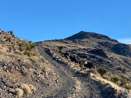
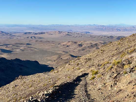
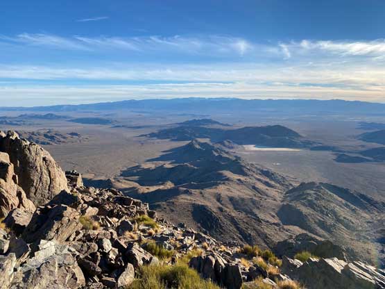
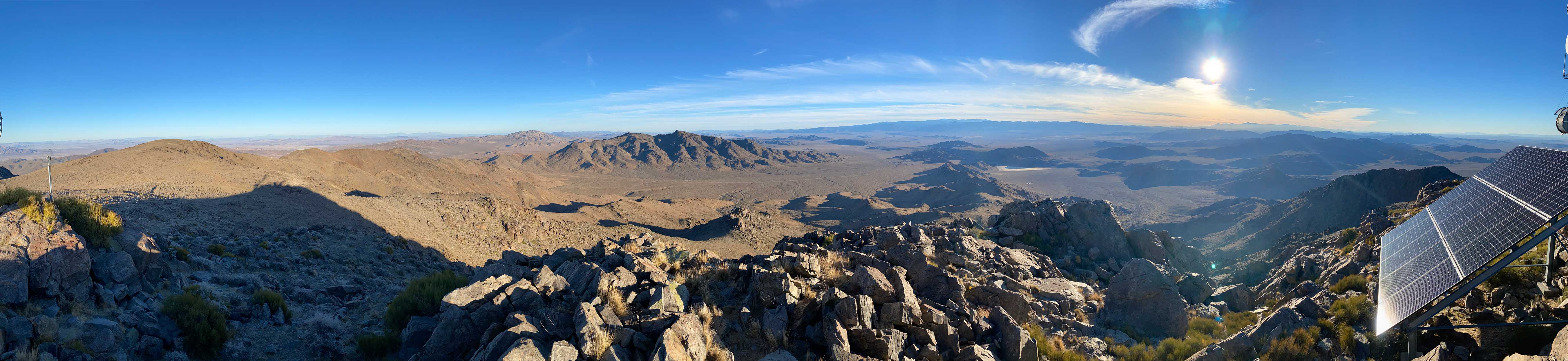
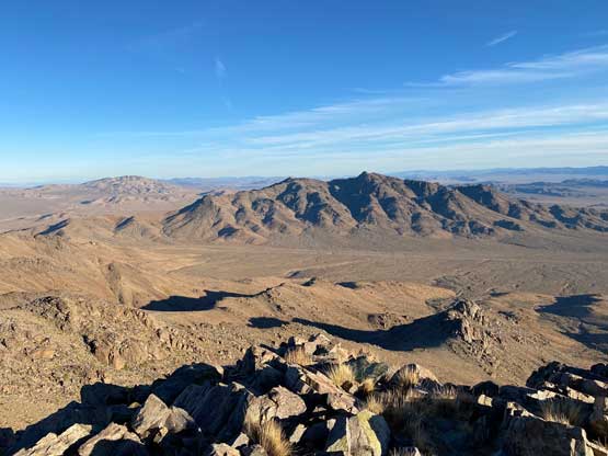
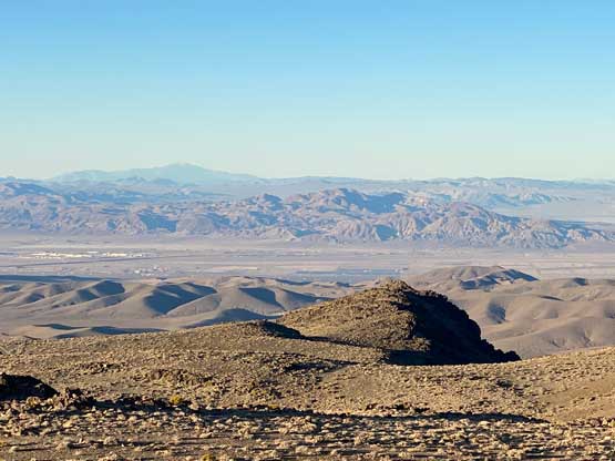
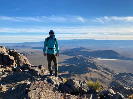
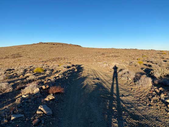
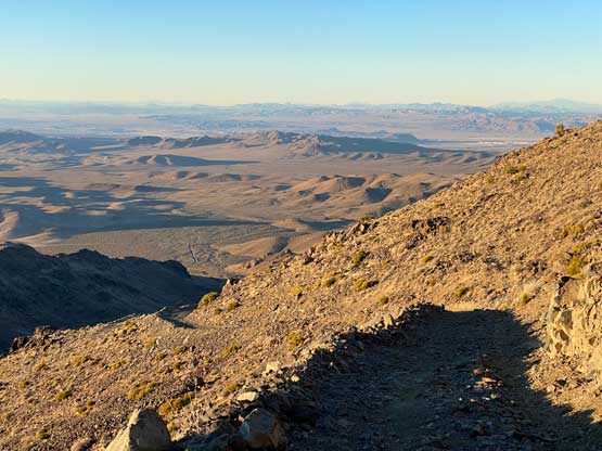
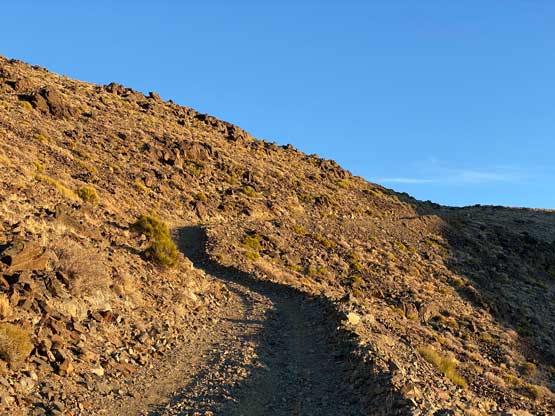
The ascent was nothing fancier than a road plod but turned out much better than expected. The late-afternoon lighting made the views more dramatic, and the desert landscape meant I had views the entire way. This was nothing like plodding up a FSR in BC where the only things to see are the trees. There was no tree in this area to obscure the views. This road was quite steep and rough such that I do not think I could have driven to the top, even if the gate was open. The summit was behind some communication structures so I had to do some brief scrambling to reach the highest point, where I got some more views towards south.

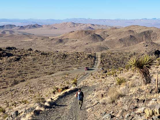


The time was getting on, so I hassled on the descent. As much as I liked to watch sunset from the summit I needed to get moving to not run behind schedule. On the descent I just plodded down the road but took one short-cut to eliminate one unnecessary switchback. I made back to the truck around sunset and subsequently drove down the rough roads. The downhill driving was always easier than on the way up and in short time I was back onto the freeway.


I drove west to Kramer Junction before taking the much-needed gas/dinner break, and then pushed across Tehachapi Mountains to Bakersfield. I drove this part in the dark so I had no idea how much elevation I had gained and lost near the mountain pass. The descent to Bakersfield felt literally never-ending but later at home I checked the elevation of this road and it wasn’t as high as I thought. I then pushed north for as far as I humanly could on I-5. The plan was to get to the trail-head on Loma Prieta near San Jose at around sunrise. I thought I could push the entire drive in one go, but eventually ran completely out of energy. I pulled over and slept a few hours in the truck. By 4:30 am I dragged my tired self out of the sleeping bag and resumed the drive towards San Jose. I followed a state road climbing up and over the Diablo Range and then skirted around the urban area towards Loma Prieta.
