Mount Ballard
October 14, 2018
2542m
Harts Pass / North Cascades Highway, WA
For those familiar with Washington’s Bulger list it’s not a secret that the true “WA Top 100 by P400” has seven extra summits that aren’t included in the original Bulger list. Among them four of those were killed because they are “volcanic sub-summits” including the infamous Lincoln Peak that I had climbed earlier in this year. The disinclusion of Mt. Ballard is due to surveying errors. The elevation of the lower, north summit was surveyed in the old days but in fact, the true (south) summit is tall enough to qualify. Aside from the “Bulger traffics” this peak is rarely ascended even though the standard route is a mere non-technical day-trip. This is a remote summit buried deeply behind the North Cascades Highway on the edge of Pasayten Wilderness and the access involves some lengthy, contrived and complicated driving on logging roads. One needs to drive up and over Harts Pass the highest driveable road in Washington state, before descending ~9 miles losing close to 1000 m elevation. This last stretch of Slate Creek Road had very little information online and for a few years the status remained unknown. It’s still an adventure…
An ascent of Mt. Ballard had not been on my radar for some obvious reasons but when I was invited to join a uber strong team of Jake Robinson, Eric Gilbertson and Trace Gough I could not resist. Eric had just become the fastest person to finish Bulger list shaving the original record from 4+ years down to a little bit over 1 year and all three of them had climbed close to, or over 50 Bulgers in the year 2018. This is a dream team when it comes to anything associated with Bulgers. I’m pretty much a Bulger newbie but I did have climbed Lincoln and the Chilliwacks which are well-agreed to be the cruxes on those lists. Regarding the ascent of Mt. Ballard we were facing two major unknowns – the amount of snow on the standard, East Face route and the condition of Slate Creek Road. There’s only one way to know…
With the long drive in the way we really had to apply that car-camping routine. I finished work at 7 pm Saturday evening and drove straight down south across the border. The border wasn’t fluent but wasn’t terribly bad neither and by 9:30 pm we grouped together in Marblemount and piled in Eric’s Subaru. Eric did an excellent job driving across the divide to Mazama, up the winding Harts Pass road and then down Slate Creek Road to the gate at where Chancellor Road branches off from Slate Road’s south fork. There’s about an inch of snow on the north side of Harts Pass (~1800 m elevation) but didn’t impose any problem. The final 9 miles were narrow and rough but if using BC’s standard I’d say it’s as smooth as a “highway”. The first crux was down. We made to the trail-head so no need to walk extra miles. About half an hour later the tent and bivy sack were erected and the alarm was set at 6 am.
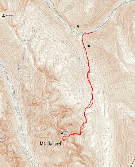
Mt. Ballard standard route. GPX DL
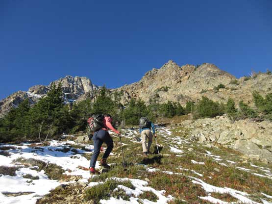
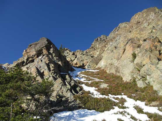
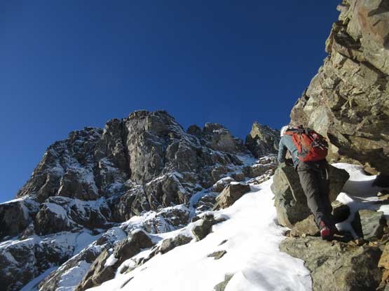
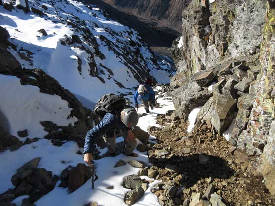
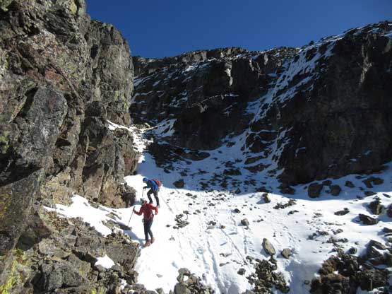
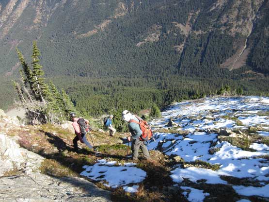
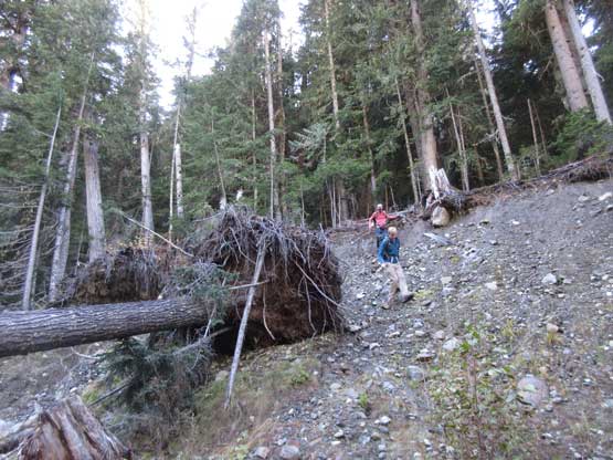
The next morning we all woke up on schedule and managed to get going when it’s still pitch dark. The first stage was following the deactivated Slate Creek Road’s south fork for about 1.5 miles to a bridge crossing the creek. This section went by without event and it’s also here that we no longer needed headlamps. The second stage was bushwhacking in mostly open forest on a slightly uphill traversing line. This section was mostly done by GPS navigation and the aim was at a boulder field at elevation of 1500 m. Crossing the boulder field at this elevation avoided unnecessary alder thrashing and then we continued the southwards orientation overcoming a short, but steep forested roll. The treeline zone had the most sustained bushwhacking in this trip but it’s nothing by BC standard and the next thing we were right under the massive E. Face of Mt. Ballard staring at our objective. It looked pretty complicated.
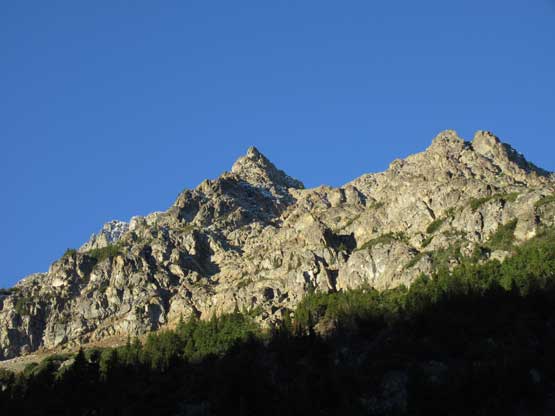
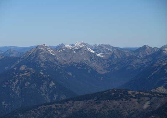
First complete sight of our objective.
Jake existing a patch of tight timbers
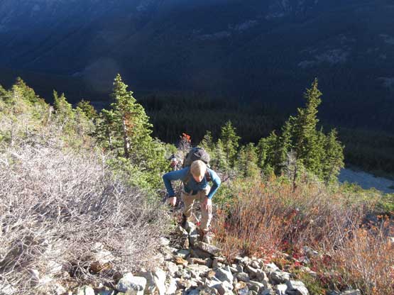
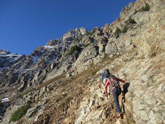
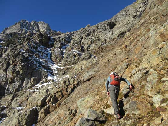
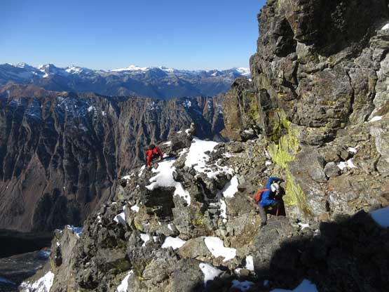
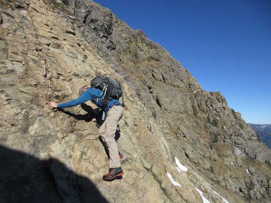
From where we existed the worst of bushwhacking the next stage was to gain the rib farther to the south. That would be the official start of Ballard’s east face route. This part involved a long ass side-hill traverse on frozen choss aiming at a break in the steep bluffs, but as complicated as it seemed we had excellent beta on NWHikers. The route description was pretty much bang on. Once making sure we were on route we took the first lengthy break of this day. Then upwards the lower route started off with mostly class 1 or 2 on increasingly steep terrain.
Eric finishing that side-hilling on frozen choss
Now officially out of the woods. Looking up
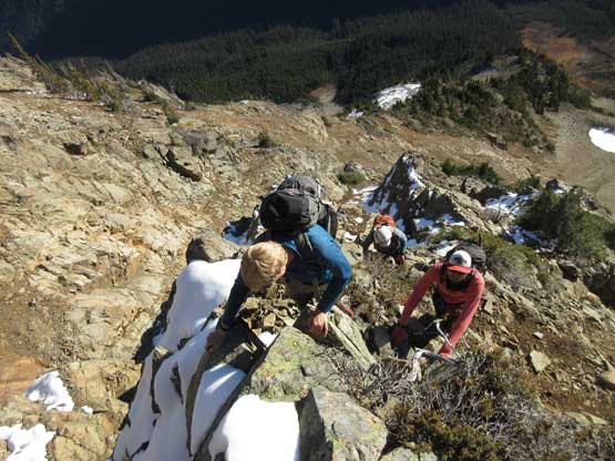
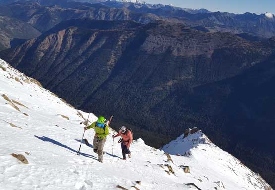
Jake and Trace leading the way on the lower route
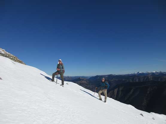
The terrain’s getting steeper and more involved
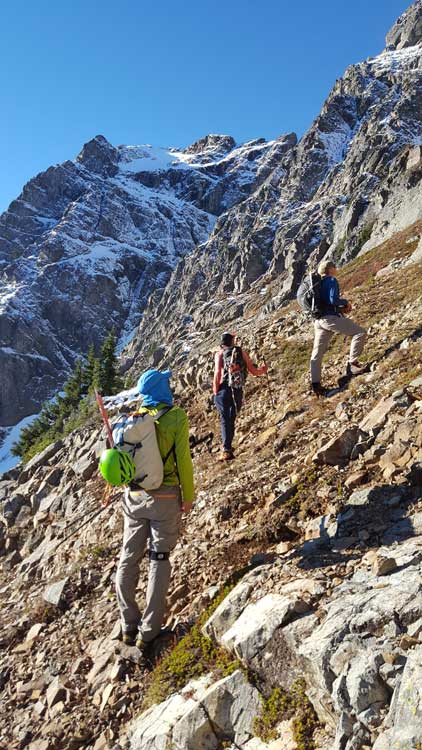
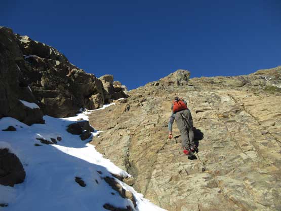
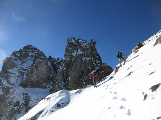
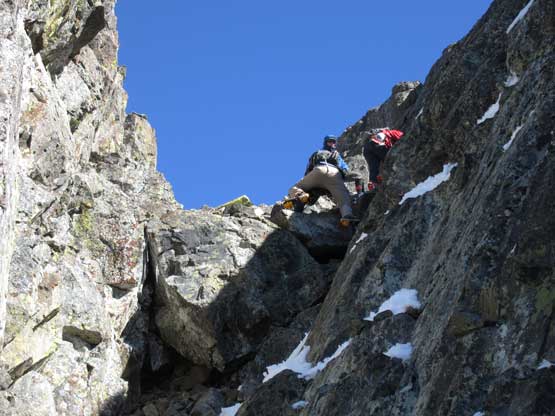
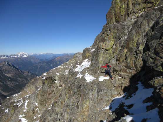
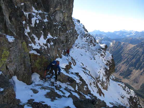
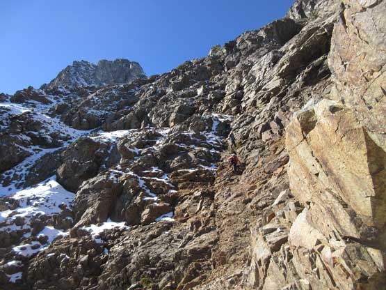
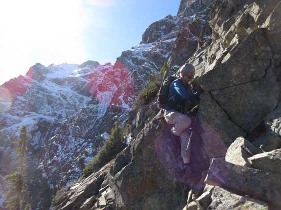
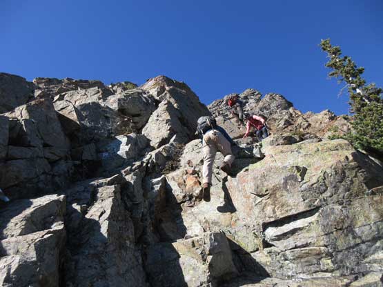
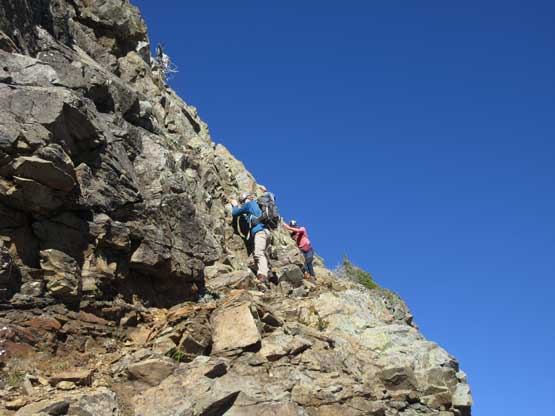
The “green slot” marked where the real scrambling started although the slot itself wasn’t very obvious. On the ascent we climbed a slippery 3rd-4th class vege chimney that might actually be the “green slot” but such complication was entirely bypassed on descent, on climber’s right side. Above the vegetation gully we gained a rib feature and stuck more-or-less on the ridge crest. The scrambling was sustained and somewhat exposed, but never exceeded the realm of “3rd class” with careful route-finding. We did encounter a few 4th class steps but I believe all of those could be bypassed, if we had to. Fresh snow did make scrambling spicier but was far from show-stopping. Before long we were at the base of that horizontal ledge traverse out climber’s left (south). The ledge was completely covered in snow but despite that, it was easy peasy and then we were on the upper half of Ballard’ E. Face.
Wondering about the route. Photo by Eric G.
This is that “green slot” we ascended.
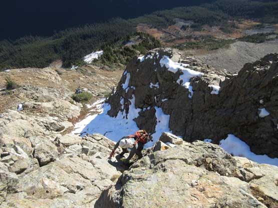
Eric existing the “green slot” on some exposed terrain
Jake and Trace farther up along the ridge/rib. This is the typical terrain
Trace scrambling up
Eric took over the lead here dealing with the choss
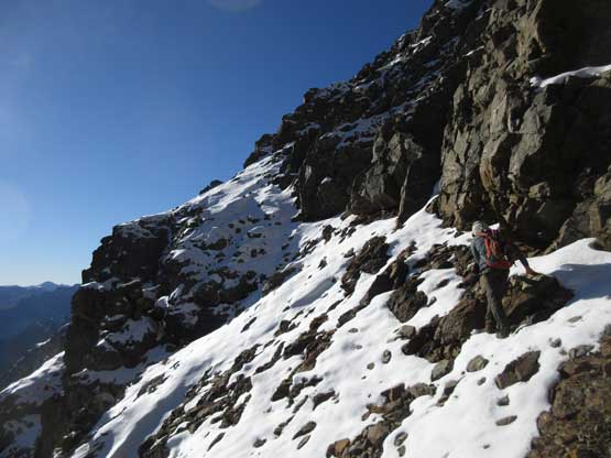
This is that snowy traverse out to the left (south).
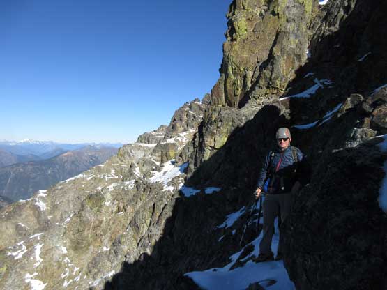
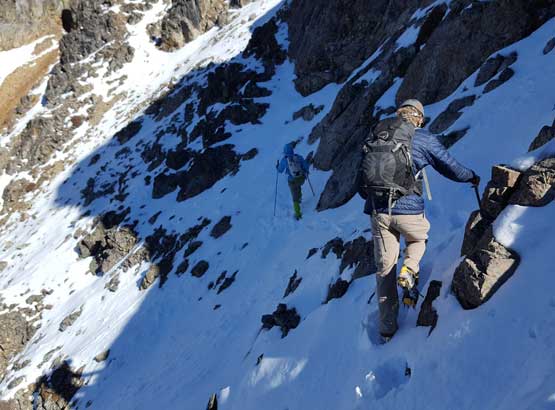
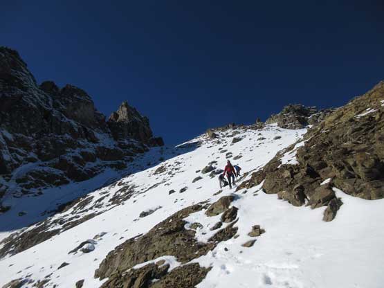
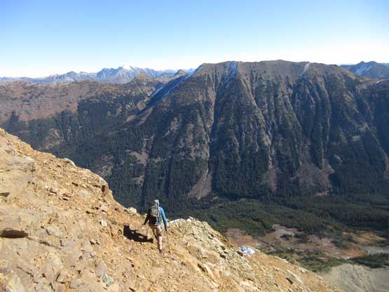
The upper face was considerably mellower than the lower face as the slope angle eased off. The downside was more fresh snow but honestly speaking I thought the snow made things easier especially on the last stretch slogging to Ballard’s high col. Without snow I’m sure that part would be treadmill scree but all we needed was some step-kicking. At the high col we donned crampons and took the axes out. I led the way staring the narrow ledge traverse on the west face. This ledge looked awfully scary but actually not at all. It was wide enough to walk across and the exposure was pretty mild for the whole stretch.

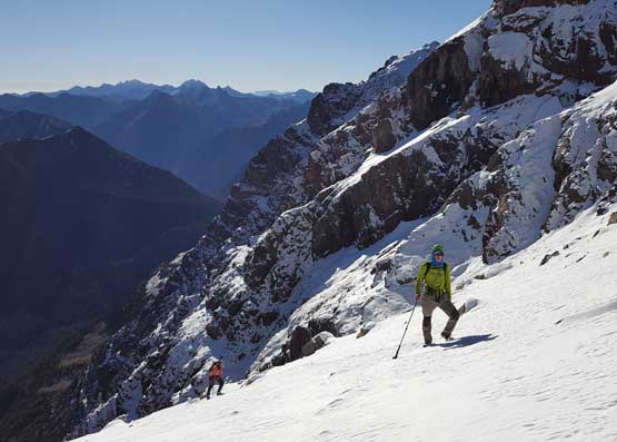
Eric scrambling the typical terrain after that horizontal traverse
Picking a slabby line or thin snow. It’s your choice
Getting higher and higher. The peak’s getting more and more impressive
Eric and Jake on the upper face
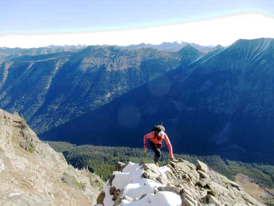
Me and Trace slogging up the upper face. Photo by Eric G.
Another photo of me and Trace slogging on snow. Photo by Eric G.
Jake taking his turn breaking trail
Jake and Eric almost at the high col.
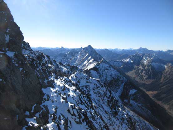
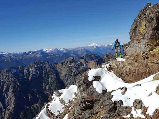
Over to the west side of the peak the terrain’s feeling more alpine
Jake finishing his west face’s ledge traverses.
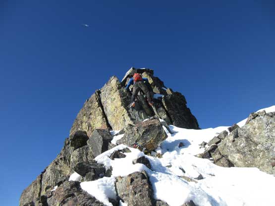
To gain the summit we had to ascend an obvious gully chocked with snow. This gully was also easier than expected although the crux step was sort of awkward on crampons. It involved a solid 4th class move but the exposure was nothing. The summit block had some big steps on solid holds and soon enough we were all on top. There weren’t a lot of room to fit a group of four. We took a lot of effort trying to dig the register out but nope…
Negotiating a tricky spot to get into that summit gully
Ascending that gully on crampons.
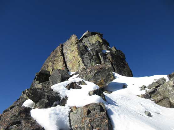
This is the summit block – 3rd class with big steps

Jake climbing on
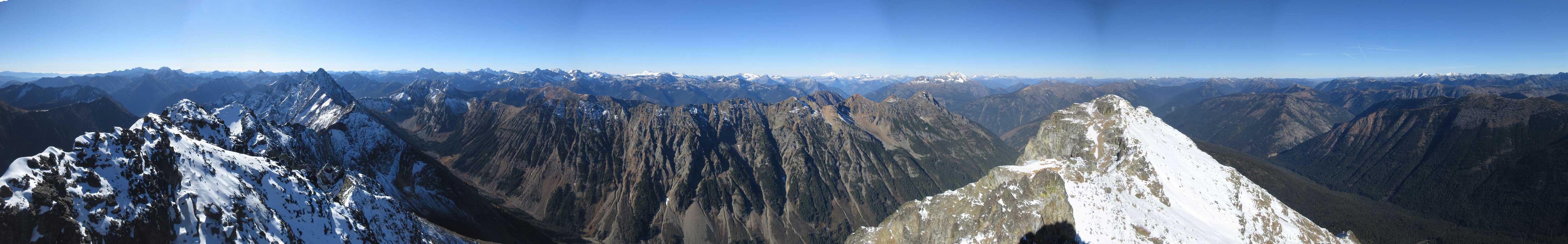
Summit Panorama from Mt. Ballard. Click to view large size.

My favourate view from this summit is looking south at Azurite and Tower/Golden Horn
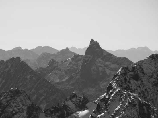
This is the striking Tower Mountain
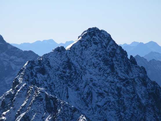
Black Peak with Bonanza Peak behind its left shoulder.
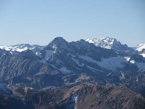
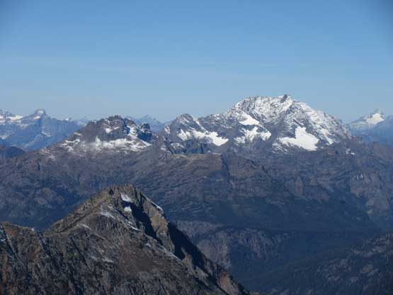
Behind Mesahchie/Katsuk on Ragged Ridge is the massif of Mt. Logan
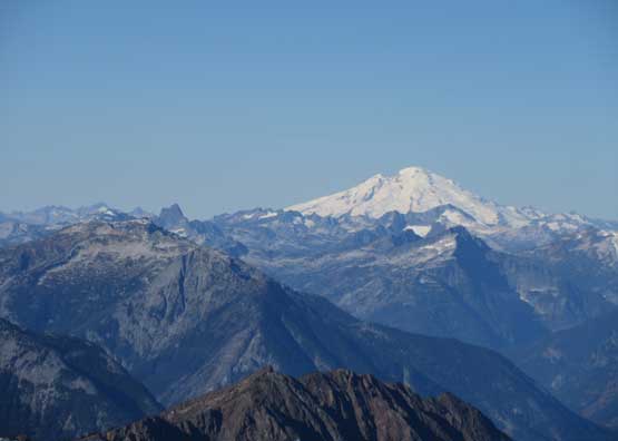
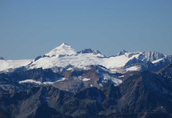
Mt. Baker with the fang of Mt. Triumph to its left
Behind the double-summit of Hozomeen Mtn. on the skyline is Silvertip Mountain
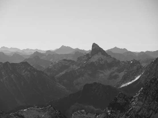
This is looking at Three Fools Peak along the northernmost Pacific Divide
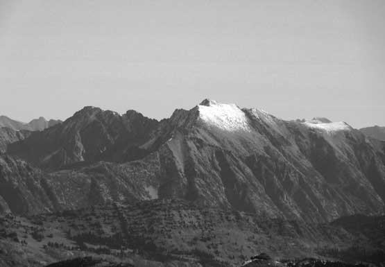
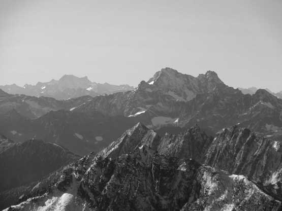
Robinson Mountain in black-and-white
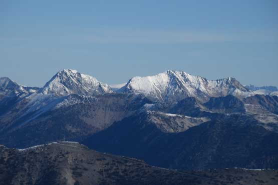
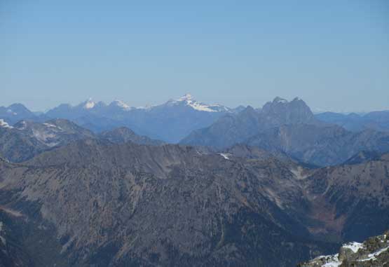
Mt. Carru and Mt. Lago two of the eight Bulgers in Pasayten core zone
Snowfield Peak
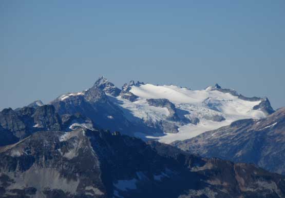
Eldorado Peak and Inspiration Icecap
The NE Buttress of Goode Mountain displaced majestically in front
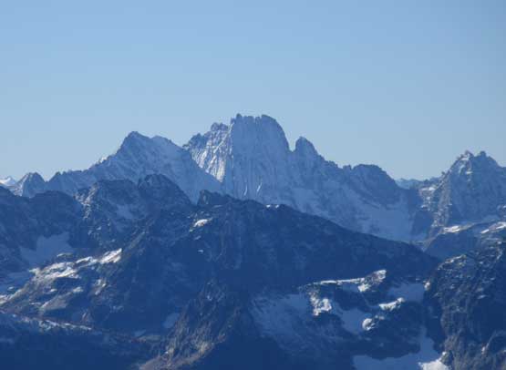
A zoomed-in view of Golden Horn.
This is a zoomed-in view of our neighbour – Azurite Peak
The massif of Jack Mountain with Crater Mountain attached
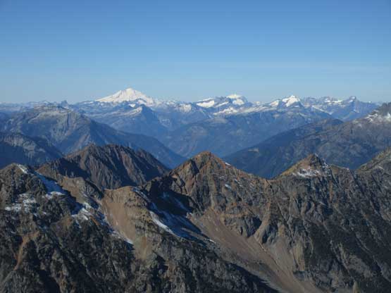
On the skyline are Mt. Baker – Mt. Shuksan and the Picket Range
Looking steeply down the west face into Mill Creek valley
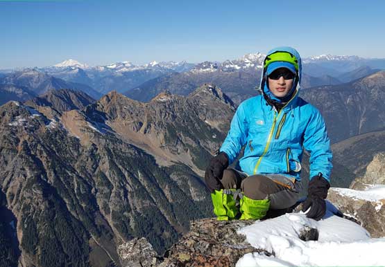
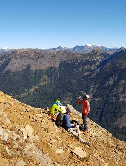
Me on the summit of Mt. Ballard
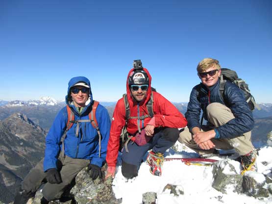
Eric, Trace and Jake on the summit of Mt. Ballard
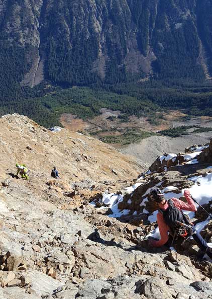
The summit was a cold spot to linger so instead of digging the whole cairn out we decided to descend. Down-climbing the summit block was interesting on crampons and so was the crux step in that gully. Traversing back across the west face’s ledge was fast and fun and plunging down the upper east face on snow was even more fun. In no time we were down to the scrambling sections and thank to the warming-up the rocks weren’t nearly as slippery as in the morning anymore. We still had to pay extra caution on some moves but the descent was overall easier than expected. Not to mention that we also bypassed the “green slot” at the bottom. Navigation in the brushes wasn’t fun by comparison but at this point I decided to let the GPS technology doing its job, and it sure did not disappoint. The final 1.5 miles walk on the deactivated south fork of Slate Creek Road was boring and I sure wished I brought the trail runners for that.
Eric down-climbing the summit block
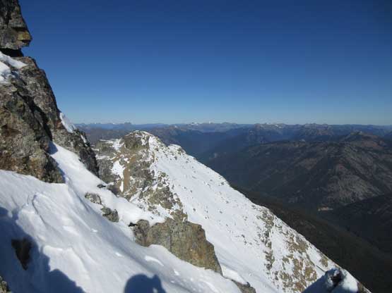
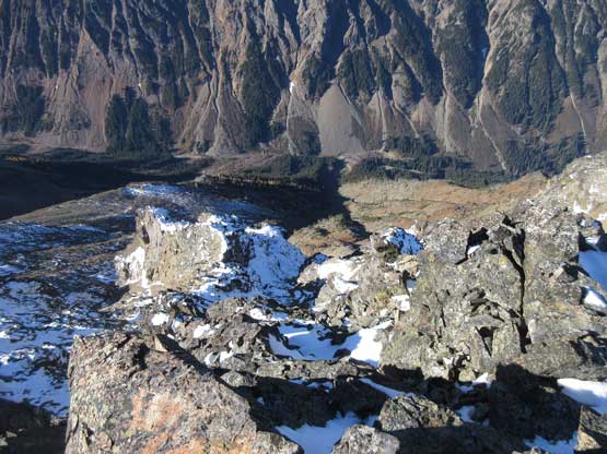
Looking at the lower, north summit
Jake down-climbing the crux step in the gully.
Trace and Eric descending that gully
Trace leading back across the west face ledges
Me and Jake traversing on snow. Photo by Eric G.
Me posing on the west face ledges. Photo by Eric G.
Eric and Trace finishing the west face traverses
Then, plunging down the upper east face
Time to start scrambling. Photo by Eric G.
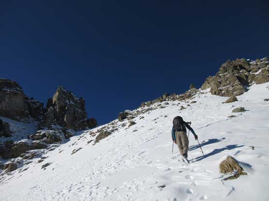
Jake picking a snow-free line
Lots of careful work is needed here
The middle of the E. Face is chossy, but easy
Taking a break. Photo by Eric G.
Jake down-climbing a tricky step on the lower face
This is the typical terrain on the lower 1/3
Throwing in exposure for good measure
Off the scrambling bits now. We still had to pay attention in route-finding
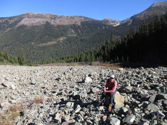
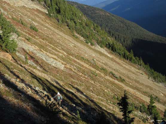
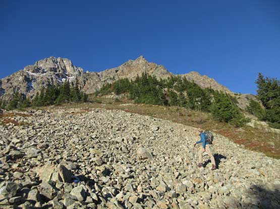
Back down to that boulder field now
Fast forward. Finished the forested descent
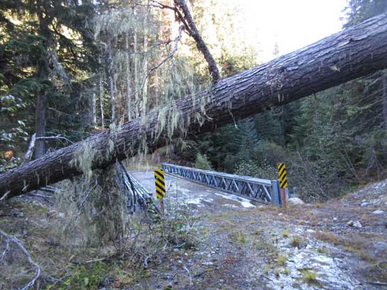
This is that bridge crossing South Fork Slate Creek

The final 1.5 miles of road walk
Our round trip time was 8.5 hours on a steady pace but with lots of long breaks along the way. I’m sure we could have done it faster but who cares. We worked well together and now with plenty of daylight time left we made a spontaneous decision to hike up Slate Peak taking advantage of the weather. The ascent of Slate Peak would only take 20 minutes round trip from the highest parking lot in Washington state. To me everything in the Pasayten Wilderness was new so I’m very glad we did this short sight-seeing detour. The long ass drive down Harts Pass Road into Mazama and then up and over Washington Pass along Highway 20 was a different story though. I was sure glad I didn’t have to drive this part, but the haul from Marblemount back to Vancouver sure felt like a slog. Boring as fuck… I eventually made back before midnight and that concluded another awesome weekend in the mountains.
