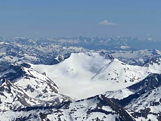
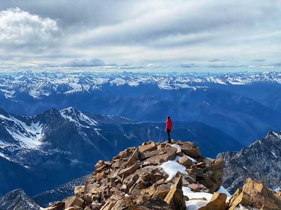
Skihist Mountain
June 16-19, 2021
2968m
Lytton / Kwoiek Creek, BC
Skihist Mountain is the highest of the loosely-defined region of “SW British Columbia” and is also the 7th most prominent peak of the entire province making it one of the most sought-after objectives in our local regions. The ascent is entirely non-technical via the standard south face route but the challenge has been the access since the deactivation of Kwoiek Creek FSR a dozen years ago. This peak had become one of those that boasts more epic stories of failure than the glamorous success. I wouldn’t say it’s a difficult fair to successfully ascend Skihist Mountain especially in a single try but to lay it out that way does require some meticulous planning and executing.
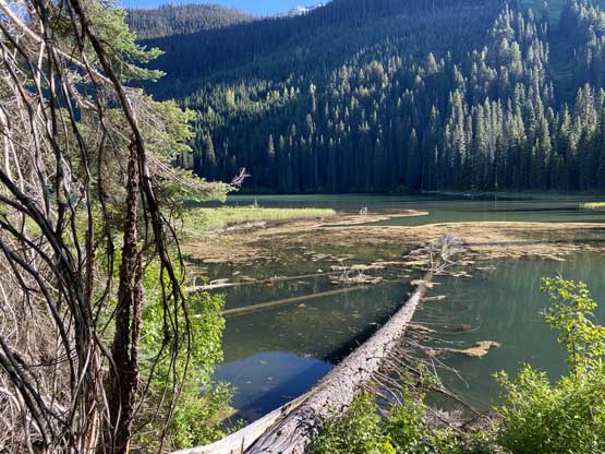
There are basically only three ways to get in. The older “standard access” is by following Kwoiek Creek FSR to Antimony Creek with two extremely challenge, if not impossible crossings of Kwoiek Creek at the outflow of John George Lake and Kah Lake. I had thought about to put my packraft in use for these crossings but I cannot ask my partner(s) to also purchase a packraft (2000+ dollars). The second but more contrived option is via the long and undulating “Eagle Ridge” but there’s very little “beta” available and I did not like the look of it on the maps with all of those up-and-downs. To access the ridge one still needs to bushwhack for a significant amount of distance and elevation. Then there came the summer of 2020 when the “Unnecessary Crew” laid a track bushwhacking around John George and Klept Lakes on the north side to Antimony Creek that completely avoided the issues with creek crossings. The bushwhack did seem brutal from their trip report but I liked this option as despite the unpleasantness it offered the most robust way to get into Skihist Mountain with the least amount of unknowns. I had obtained a GPS track from that crew. As for timing I preferred June when snowshoes weren’t required anymore but there’s still significant amount of snow to cover the soul-crushing boulder fields. This entire mountain is covered in car-to-house sized boulders and I wanted to minimize hopping on those for as much as possible.

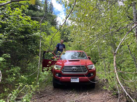
Vlad was keen to be on-call for the mission starting a few weeks earlier and when the window formed I also managed to convince Holly to join the team at the last minute. My plan was to have 4 days of food and ascend at least Antimony Mtn. and Claimpost Peak in addition to the main prize, but I also had a secret plan to possibly extend the trip towards Doss Peak and Mt. Neilsen making a loop traverse. Vlad had work commitment till Wednesday noon but I figured it’s still fine as the objective for the first day was only to reach the base of Antimony Creek. The main uncertainty was whether we could drive to John George Lake or not but I figured for the worst case scenario we would only need to walk 2 extra hours at the start. The three of us grouped in Richmond at 12:10 pm and we were soon on the road cruising down Highway 1. I had decided to use the connector “Keefers Road” from Boston Bar instead of putting a bid on the uncertainties in Lytton Ferry as it’s possibly closed due to COVID. The connector road had numerous “no public access” signs that I simply ignored as always, but also became rough and slow-going once past those BC Hydro private property signs. I had worried about the situation become worse and worse but thankfully it did not. It was just a slow show. The 20+ km up Kwoiek FSR was also rougher than anticipated with lots of careful driving needed and once past Kwoiek Lake the road had become bushy as expected. The other group had given me some “secret beta” that the road’s been cleared by two individuals from Lytton all the way to the lake. The alders on the sides were indeed cut but the tens of thousands of branches were simply just laid on the ground and I think it was also cut mostly for ATV travel that to push through I still ended up putting a shit ton of pinstrips on the Taco. The wheels also snagged a few branches that required me to get out. There were also a couple deep ditches in addition to a few virtually invisible deep holes on very random spots. In the end I was happy to have pushed to the farthest driveable spot but I’m also sure that this would be my one-and-only time driving here. To get here one needs to pick the most reliable vehicle that can handle hours and hours of slow-crawling on rough roads, and at the same time, the driver must not care about the painting job.

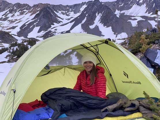
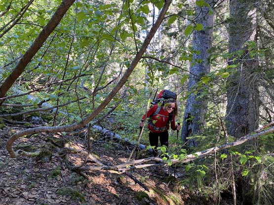
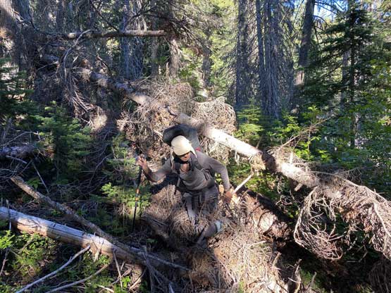
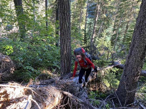
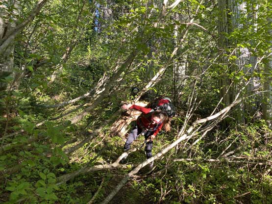
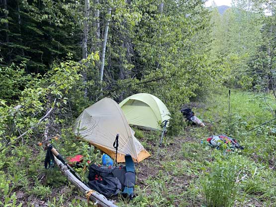
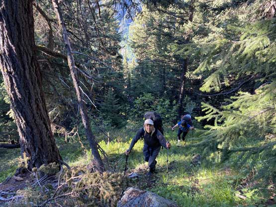
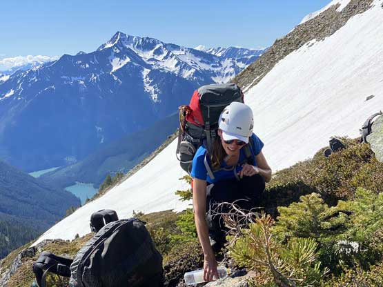
It had taken us 5 hours to get here from Richmond and it was almost 6 pm when we finally started the plod. We picked up a good trail to the east end of John George Lake but soon lost it. We had a short but intense section of bushwhacking around the lake to access a boulder field mentioned by the other crew. This boulder field provided a reasonably fast travel across the north side of the lake for half of the lake’s length. The second half required lots of bushwhacking at “BW3” grade but we also found a game trail towards the west end. This game trail got us through the worst of it (otherwise BW4+) but disappeared in between John George and Klept Lakes. This section between the two lakes wasn’t too terrible by sticking close to Kwoiek Creek. There was one zone of cruise-sailing in open forest but in other spots this was still a thrash across underbrush and pick-up-sticks. Going around Klept Lake we were able to pick up that game trail again but even so, the bushwhacking was sustained with at least one of the combination of alders, underbrush, pick-up-sticks and devil’s clubs. The trail disappeared into nowhere once the contouring of Klept Lake was finished and the thrash from there to the old road at Antimony Creek was the worst, at a sustained grade of “BW3+/4-“. The mosquitoes were brutal for the entire period and I actually thought this was the worst mosquito experience I have had in the Coast Mountains to date. It took us two hours marching at a fast pace to cover the shit zones. Once reaching the road we were pleased to find out that the walking on this road was decently reasonable. There was still alder thrashing but for SW BC standard the on-road bushwhacking was tame. We marched all the way to the base of a new route that Vlad and I had planned and set up camp beside a creek. This camp site was not very pleasant with again, loads of mosquitoes in addition to bear shits but at least we were able to find flat spots and running water.


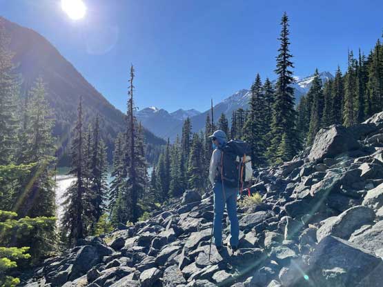

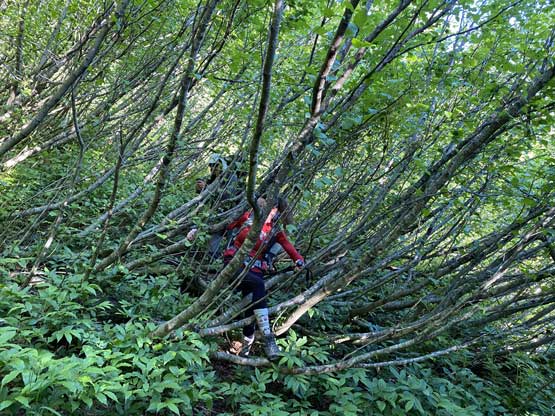
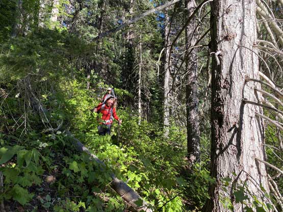
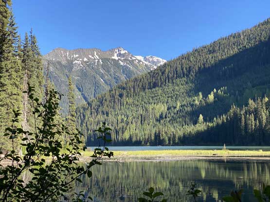


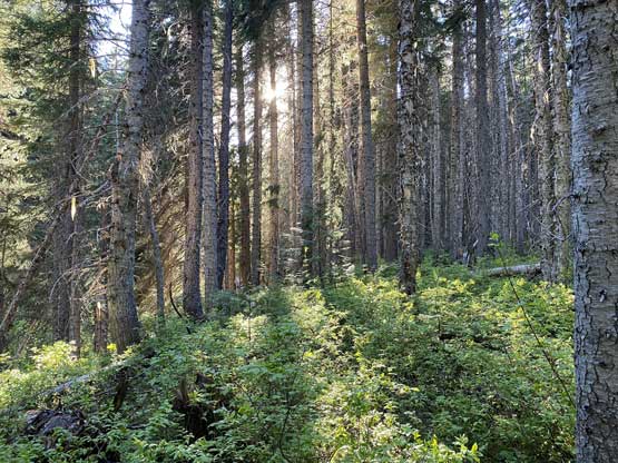

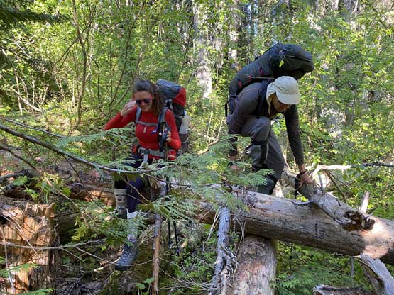


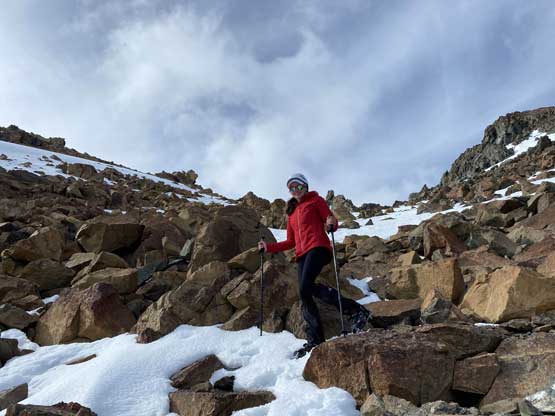
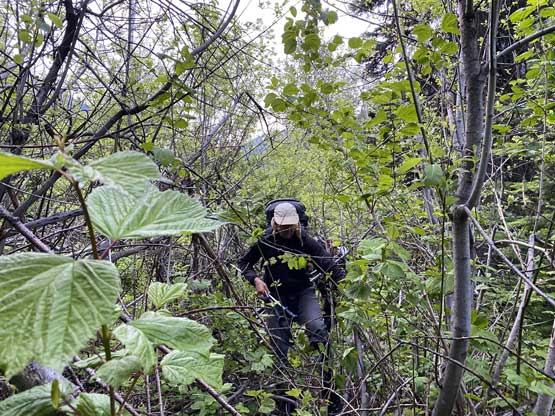
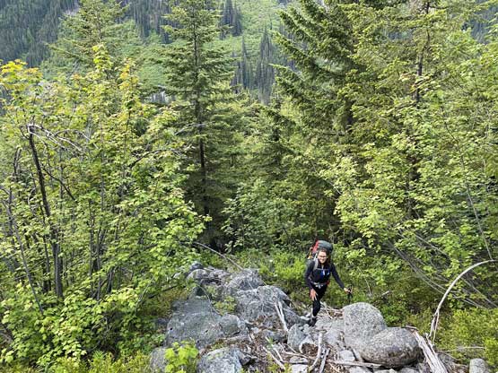
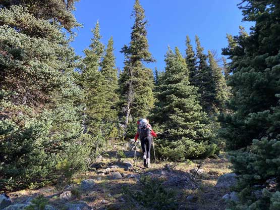
The plan for the Day 2 was to push to the base of Skihist Mountain and to ascend the peak in addition to both Antimony Mtn. and Claimpost Peak so we counted for a long day. To beat the heat we agreed to wake up at 4 am in the dark and get going by 5:30 am. The day started with an intense stretch of BW4 bushwhack through alders and pick-up-sticks for 100 vertical meters but once entering the mature forest the going had become significantly easier. The bushwhacking from there onward 1000 vertical meters to treeline was either non-existing or very tame, but the grade was steep the whole way and the footings weren’t that secure sometimes. It was still a long and slow haul especially with the 30-35 lb of backpacks. We popped out onto the southern one of the two Antimony Mtn.’s SE Ridge at around 2100 m elevation and the views from this zone was already incredible.


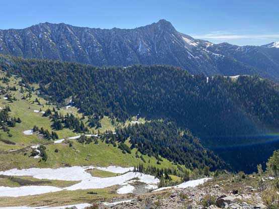


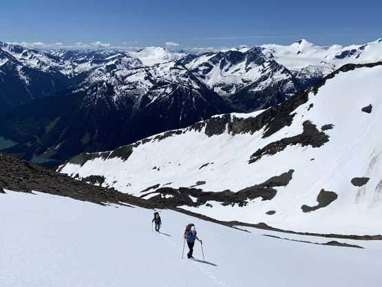
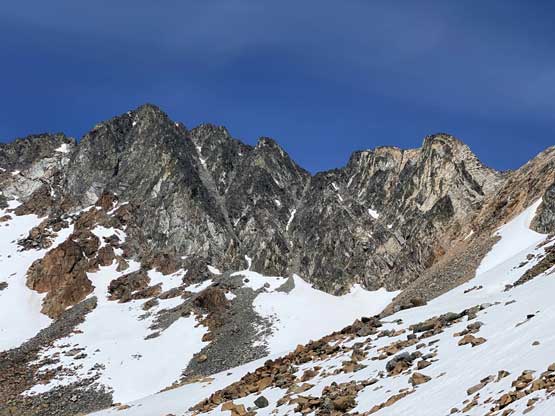
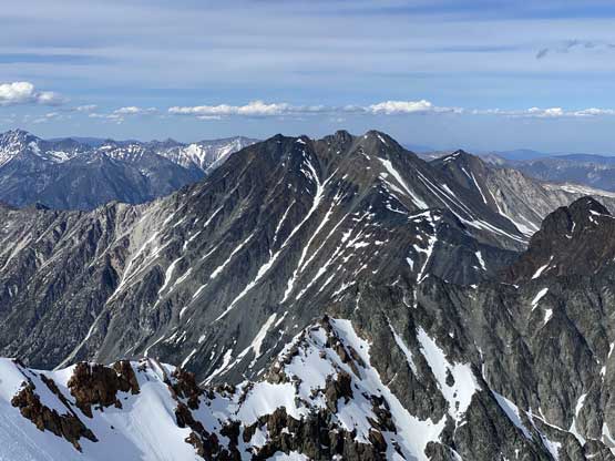
After re-evaluating the terrain and the maps we decided to cut into the “SE Valley” at this elevation by some side-hilling with minimal elevation loss. Once into the valley we were on continuous snow so the crampons were strapped on. We ascended this valley to access a rocky section under Antimony’s south slopes. I wasn’t quite sure how we were going to scramble through this rocky zone but once sticking my nose into it I found a key ledge traversing back towards climber’s right that provided a perfect passage. Above this ledge we had a few hundred vertical meters of cruise-sailing on 35+ degree snow up the south face of Antimony Mountain. The last section to gain the east ridge still required some scrambling on choss. I could not have imagined to come up this route without snow as the slog up this face would have been a chossmare even for a veteran C. Rockies mountaineer.


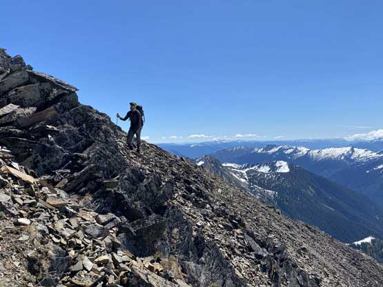

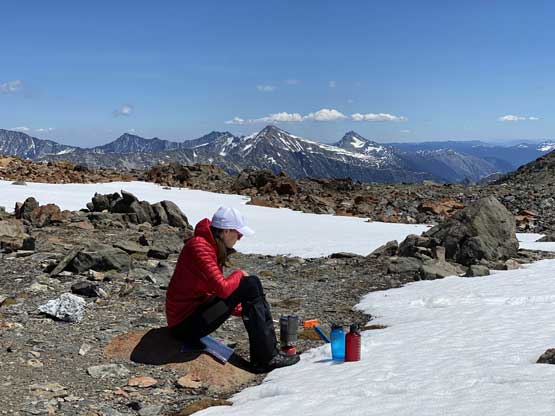
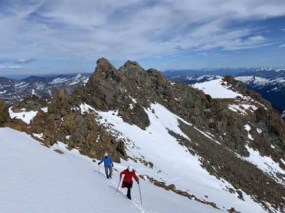
After taking a long break we ditched backpacks and went for a side-detour to ascend Antimony Mountain, then easily plodded down the north glacier for 100+ meters to Antimony/Claimpost col. At this point we were basically on-schedule for the best case scenario so after some group discussion we decided to carry on the loop traverse towards Mt. Neilsen, and to do that we would have to camp in the upper basin of Nesbitt Creek instead of at Antimony/Claimpost col. This further meant the only chance to ascend Claimpost Peak was right now and via the jagged SW Ridge. Holly opted to stay back and melt water while Vlad and I carried on to bag Claimpost Peak. An hour later Vlad and I were back at the col after some fun scrambling. We then shouldered the heave packs and I led us down a chossy gully onto some steep snow to short-cut the descent into Nesbitt Creek valley. For this section we were following the GPS track and beta given by the “Unnecessary Crew” so that we only needed to lose under 200 m elevation. We ditched two of the three backpacks on a gigantic boulder and decided to carry only 1 pack with some food and water up Skihist Mountain.


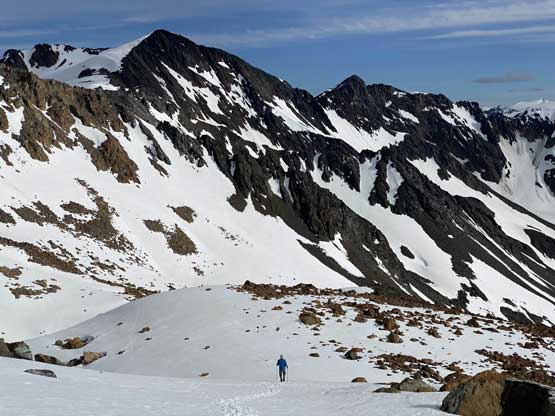
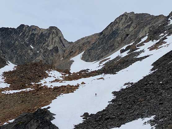
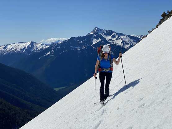
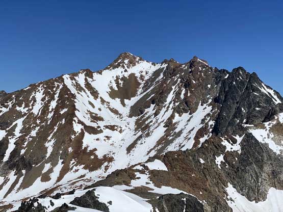
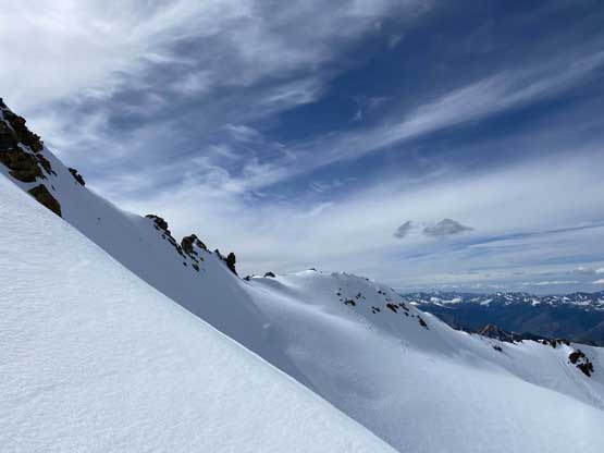
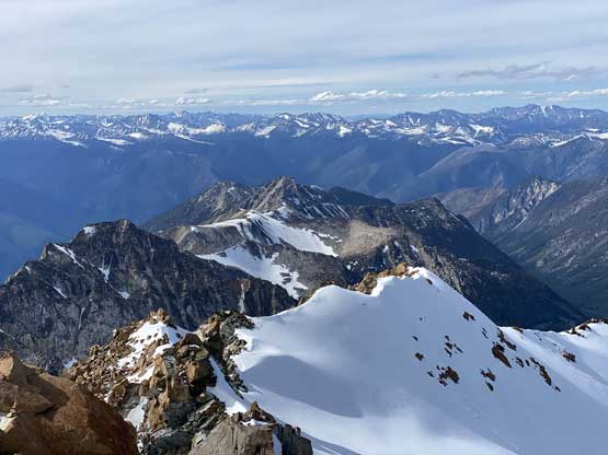
I knew from facts that the basin under Claimpost Peak and Skihist Mountain had the worst boulder-hopping (bus sized) but for us, this section was a cruise sailing on snow. We did break through the snow a few times sinking waist deep but comparing to what the other groups had experienced in August and September we had such an easier time. The ascent of Skihist Mountain was mostly done via the “central south face gulch”. There’s one zone that seemed to have melted out but once there, we were still able to weave around the boulders on snow. We did have to scramble on some boulders but the snow was surprisingly strong and firm even on thin spots, so it was still an easy fair. The 500+ meters of grunt was never-ending though but at least cruising up snow wasn’t that bad.


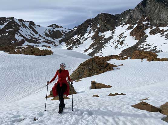
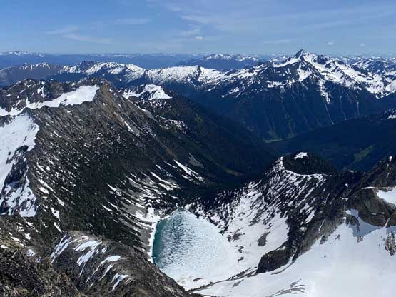
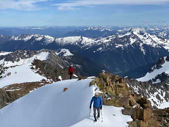
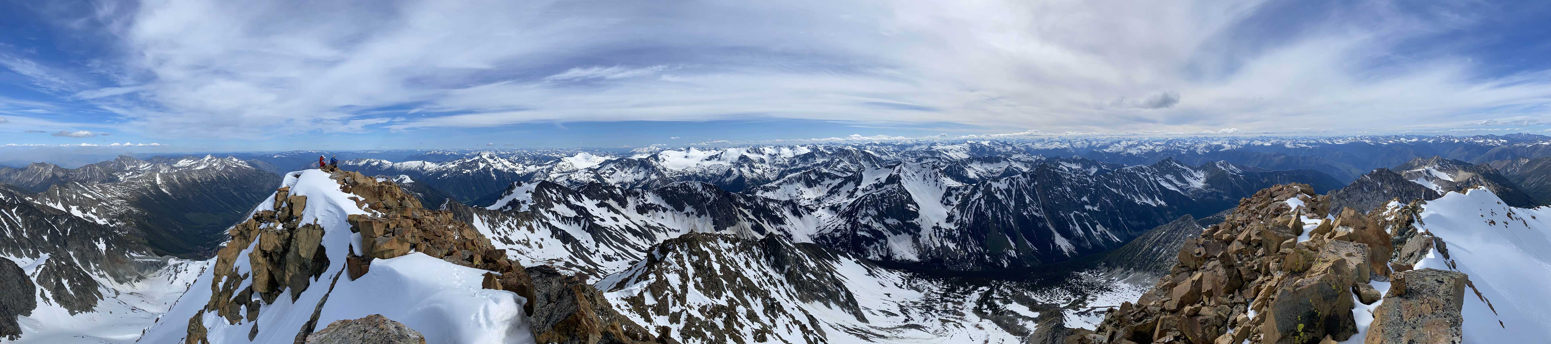
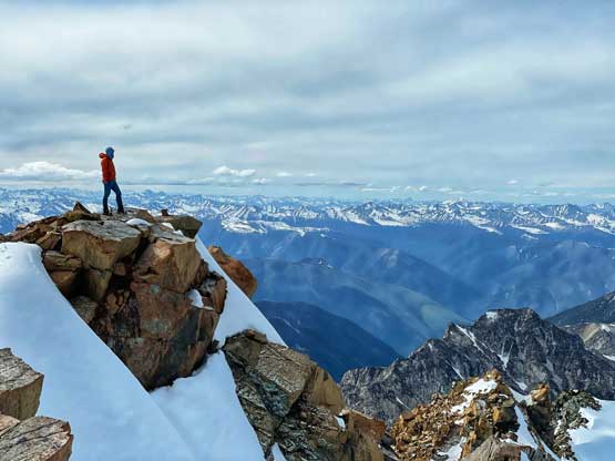
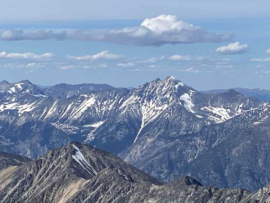
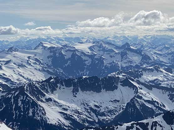
Once hitting the east ridge I opted to explore the north face side instead of dealing with thinly covered boulders on the ridge proper. Once sticking my head over the north side I was pleased to find a passage that’s entirely on snow, so shouted out to Vlad and Holly to follow. The upper finish on the north side of the east ridge was extremely scenic and aesthetic as we were climbing up a steep snow arete. The true summit was a few bumps further but traversing there wasn’t difficult. We got here early enough to earn ourselves almost an hour on the summit. It’s not an easy fair to reach the roof of SW BC and once there, we wanted to enjoy the views and to also soak in the experience.


The descent was a very fast plunge and boot-ski on snow all the way to where we ditched the packs. Another long break was taken to repack and once done, we carried down Nesbitt Creek valley. Form up high I had spotted some perfect camping spots on heather with running water and those were a few hundred vertical meters down in the valley. Plodding towards there we did have to deal with a great deal of post-holing on isothermal and thin snow and a few troublesome boulder fields covered by thin snow, but once there the campsite was not disappointing. The trip then continued with rare ascents of Doss Peak and Mt. Neilsen.