Mount Landale
November 27, 2022
1534m
Vancouver Island, BC
Mt. Landale dominates the area immediate to the north of Lake Cowichan and subsequently boasts over 700 m prominence, but like most peaks on the southern Vancouver Island the access is harder than the ascent itself. This peak can be accessed from three FSR systems – Chemainus River from the north, Widow Main from the south or Cottonwood Main also from the north. All three roads are gated at the bottom. The Chemainus Main does get opened from time to time whereas the two southern options are “short” enough that biking can still be a viable option. I always thought the Lomas Lake trail from Cottonwood Creek is the standard route, but Matt J. went to explore the Widow Main access roughly a week ago and reported a GPX track on peakbagger.com. The round trip distance seemed to be around 24 km with over one third doable on a bike. With the fresh “beta” I immediately made the plan for the oncoming Sunday. Nikita and Phil ended up joining me despite the expensive ferry rides. I also required them to be ready to leave on Saturday night (car camping) and they had no problem with that. The only downside was that neither of them owned a reliable bike so the plan was for them to walk while I rode.
I made some slight adjustments in the work schedule to be able to leave White Rock at 8 pm sharp. I picked Phil and Nikita up from Ladner and Richmond, respectively, and then drove over the Second Narrows bridge to Horseshoe Bay ferry terminal. There usually is a 10:45 pm ride from Tsawwassen but that ride doesn’t seem to run on Saturday so the 10:10 pm ride from Horseshoe Bay was our only option. We arrived with about 20 minutes of spare and were happy to learn that the ferry wouldn’t be cancelled due to the high winds. For the whole day I kept checking the weather maps and the ferry status as I seriously anticipated the ride would get cancelled as the wind gusts were approaching 90 km/h.. The ride did turn out to be the choppiest I’ve ever experienced but we did get to Nanaimo on time. I also brought a chainsaw as I expected blow downs. This proved to be overkill but the roads were indeed covered in leaves and smaller branches. By the time we arrived at the bottom of Widow Main the rain and the wind had stopped, but there wasn’t enough of a space to park the truck and to pitch the tent. We ended up driving to the bottom of Cottonwood Main and car-camped there. Phil went out to pitch his tent while Nikita and I slept on the passenger seats for simplicity. I had brought my tent as well, but was too lazy to even think about pitching it.

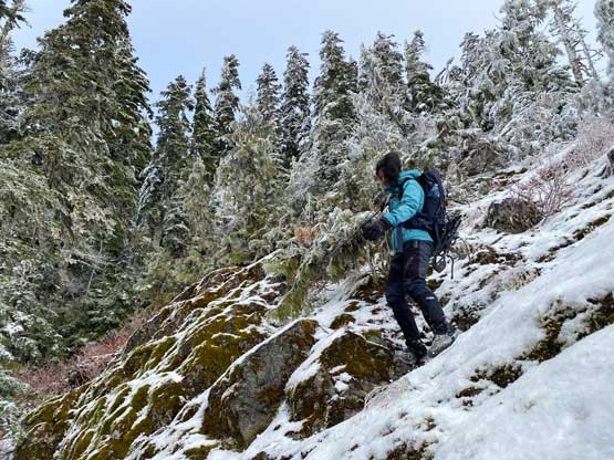
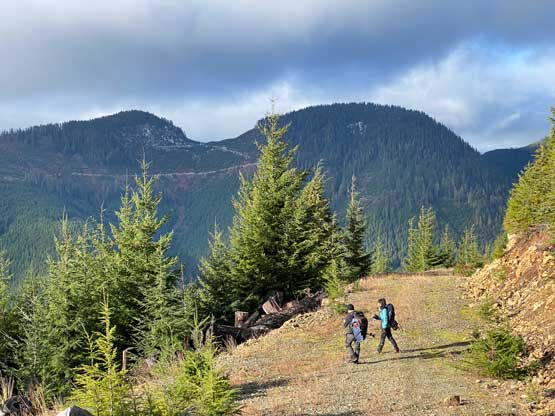
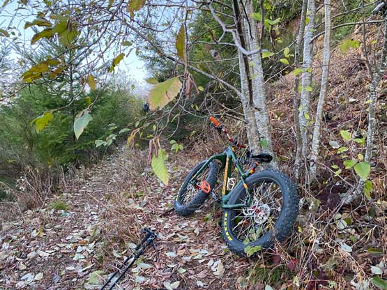
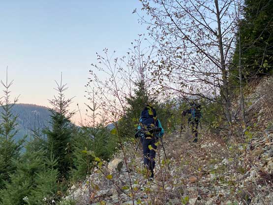
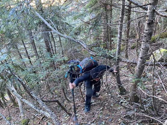
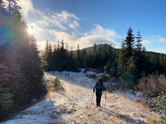
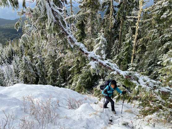
The weather forecast was predicting the clearest conditions in the morning so I wanted to get up early to not miss the views. I made the call to wake up at 5:30 am and we managed to get going in about an hour. The first portion of the ride was rather flat but as soon as we left the mainline the road had become insanely steep such that riding would no longer be practical. I ended up pushing the bike for the next stage while gaining a few hundred meters of elevation over about 2 km distance. The road was also very rough and even started to become overgrown. Eventually at around 700 m elevation I decided to ditch the bike and walk together with Nikita and Phil. They had gone far ahead and I made them to wait for about 20 minutes, but I still think to push the bike as high as possible was the correct decision, even just for the fun factors on the descent. The next few kilometers involved a long horizontal traverse due north and as warned, this stretch was definitely overgrown. Once the road began to gain elevation again the condition improved and we easily followed the GPX track to the end of this road at 1000 m elevation. The next 50 m elevation gain was a straight-up bushwhack to connect the two FSR systems. The bushwhacking was annoying but not terrible and in short time we made to the upper roads on the south ridge of Mt. Landale and it was here that we finally encountered snow.

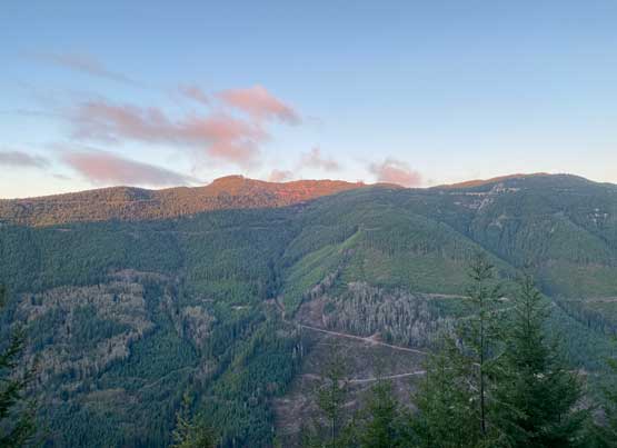


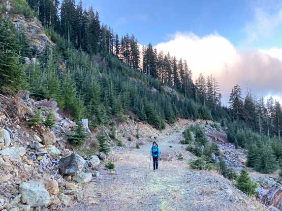
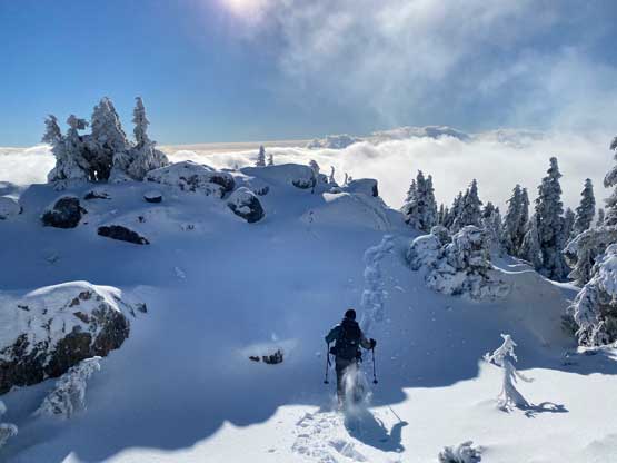
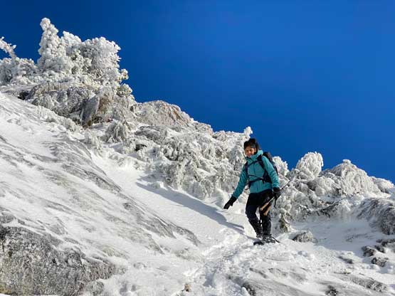
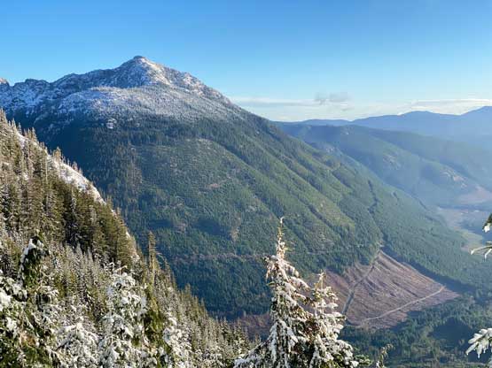
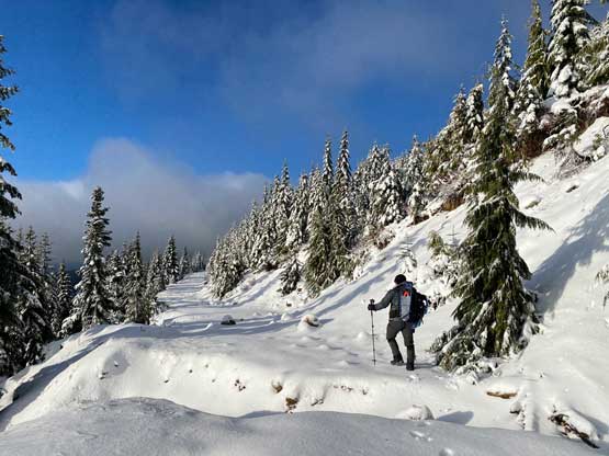
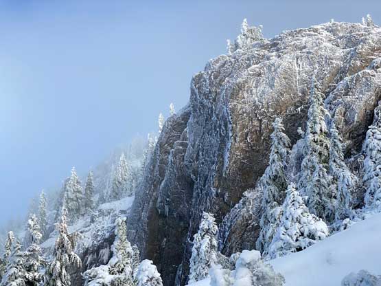
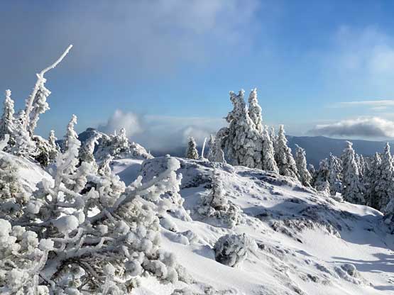
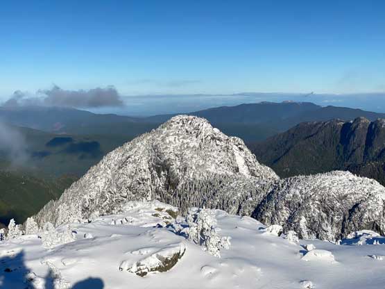
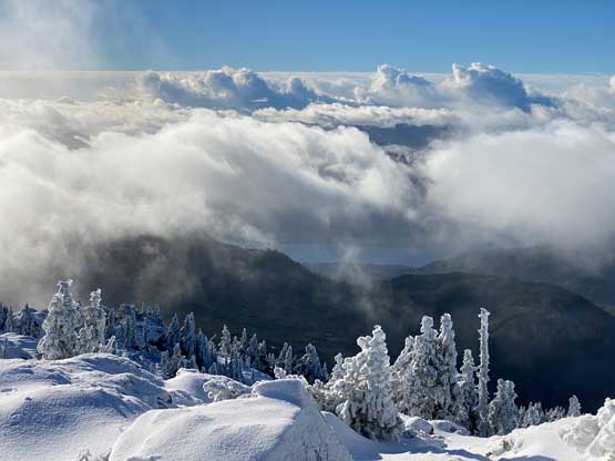
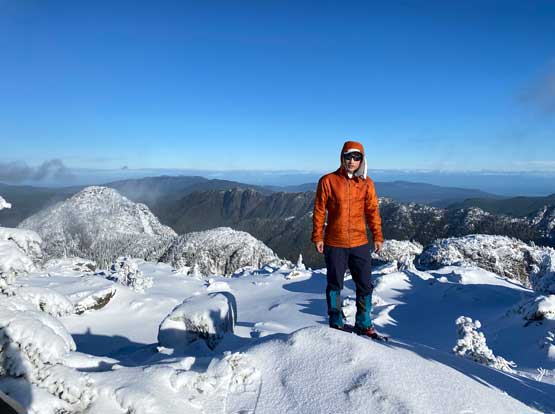
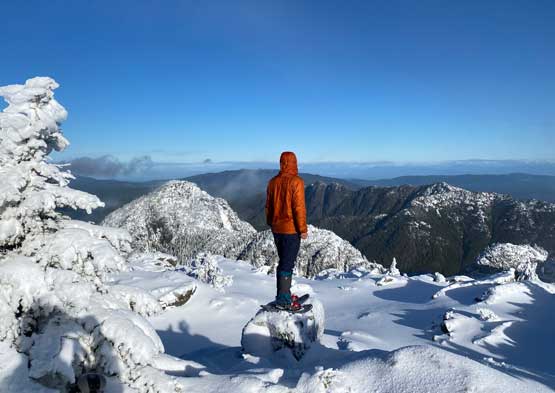
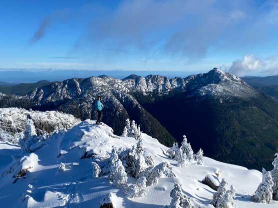
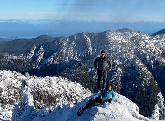
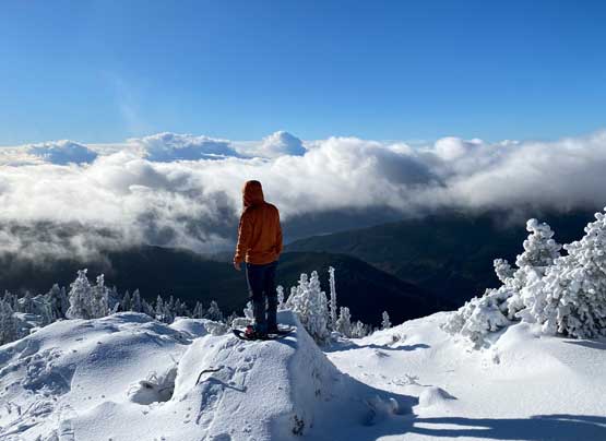
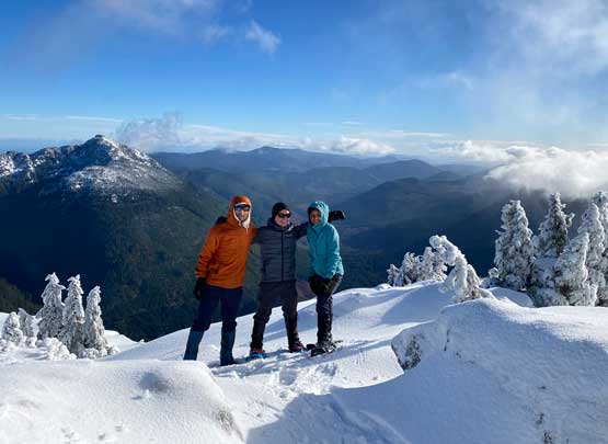
The snow condition changed from a sheet of ice at 1100 m to compact snow with a hard icy crust at 1250 m. The road plodding on the south slopes of Mt. Landale finally yielded some nice views but the clouds were also rolling in. We wanted to hurry up to get to the summit before it got completely engulfed in. We picked up the snow-covered trail from the road’s end and had no problem following it to as high as 1400 m where the snow depth finally increased drastically to warrant the use of snowshoes. For the few days leading to this trip I kept debating about snowshoes but in the end I made the group decision to mandatorily carry them as I did not want to downgrade our success chance by even one percent, even though this meant slower and heavier. I was very happy that the final 100 m elevation gain had enough snow for the use of them. I actually think we would be swimming crotch deep without the snowshoes as the previous day’s dump was likely all in the solid form. There’s rather some route-finding on micro-terrain to content with and the summit was open enough to offer unobstructed 360-degree view of the southern Island. This was overall a better objective than anticipated and we all thought the monotonous slog finally paid off.


We debated about going for El Capital Mountain but decided to save that for a drier summer day when snow and ice isn’t precent on the route. On the descent we simply retraced our snowshoe tracks and foot prints down to the logging roads. While plodding down the upper level roads we almost took a wrong branch but thankfully I realized the mistake soon. The bushwhacking connector was much easier to deal with on the descent than on the ascent that in no time we were down to those lower level roads. The next stage of plodding was rather boring but I had a much shorter slog than Nikita and Phil. The biking ride started from being quite technical (no idea why the islanders built their roads with such steep grades) but a few switchbacks later I released the breaks and cruised down to the truck. I made a change of cloths, had a delayed lunch and “napped” about half an hour before the others showed up. My round trip time was 6.5 hours and theirs was just over 7 hours and that meant we had enough time to squeeze in a secondary objective. None of us was high on motivation so I suggested Mt. Jeffrey by Malahat Summit as I wanted more biking and less walking.