Mount Pollinger
August 4, 2012
2816m
Yoho National Park, BC
The officially named Mt. Pollinger is merely a scree bump on the shoulder of the much-bigger Mt. McArthur. Getting there from Kiwetinok/Pollinger col was just a walk but Kiwetinok/Pollinger col itself is fairly remote and requires some degree of scrambling and scree bashing to reach. I don’t think anyone would come here for Mt. Pollinger itself and folks who bagged this peak often did it as part of a traverse.
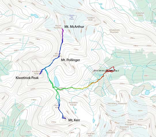
Ascent routes for Kiwetinok, Pollinger, McArthur and Kerr
Mike, Andrea, Aga, myself and two other Andrea’s friends managed to put down this little “peak” on the 2nd day of our Little Yoho August long weekend peak-bagging mission. Mike, Andrea and myself had just ascended the much-harder Kiwetinok Peak and we all regrouped near the col for the rest of this day. Like I mentioned earlier, the ascent of Mt. Pollinger from Kiwetinok/Pollinger col was nothing more than a mere walk, but the views were quite good.

Looking back to Kiwetinok Peak

Mount Pollinger is just this scree bump

Summit view towards The Presidents

Summit view towards Kiwetinok Peak

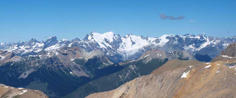
Mount Balfour on left; Daly and Niles on right

Mount McArthur
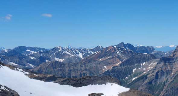
Mount Mummery and Freshfield Icefields
Peaks west of Amiskiwi Valley

Mount Laussedat at center

Mount Carnarvon at center
After taking some obligatory summit photos, we immediately started to focus on the next objective, Mount McArthur.
