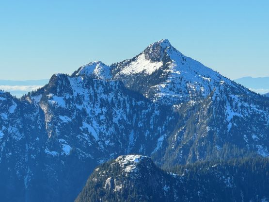
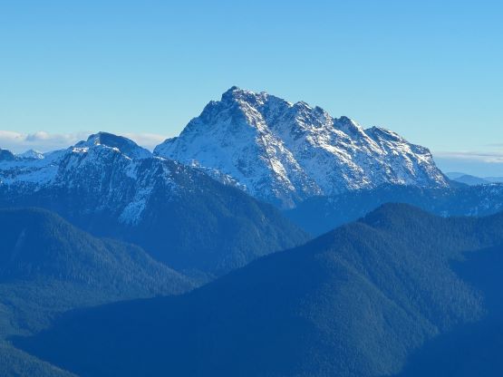
Gloomy Peak
November 24, 2023
1431m
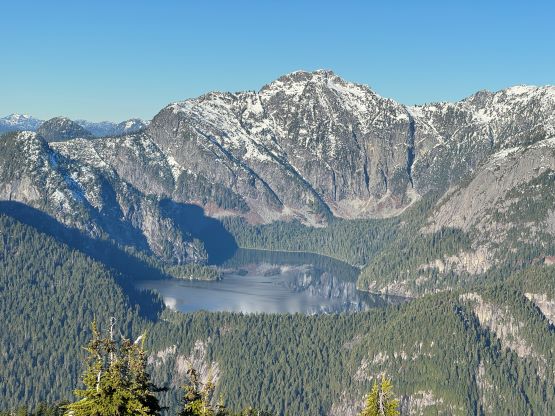
Pitt Meadows, BC
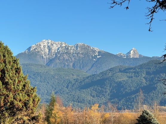
“Gloomy Peak” is the unofficial name of the highest point in the large area east of Widgeon Creek and west of Pitt Lake. The name was originally assigned by bivouac.com and thereafter adopted by other sites. This peak is elusive, with hardly any “beta” on the internet, and had been eluding me for years. This peak is also extremely visible from Pitt Meadows and Maple Ridge, and boasts over 600 m prominence. The area is remote due to the access difficulty. The Quarry Road from the SW is gated with private property issues, that even if one dares to trespass one still needs to bike or walk more than 10 km just to reach the “trail-head”. The other way of getting in requires about an hour or paddling up Widgeon Slough upstream on flat water, and thereafter requires a canoe/kayak or a packraft, and not to mention that the parking at the boat launch is subjected to gate hours. There’s no trail whatsoever anywhere on this mountain, but the “Fools Gold Route” does go to the base of the west flanks making the objective not as deep as I thought.
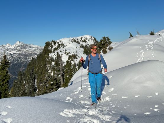
About two years ago Matt J. and I had started a conversation regarding “Gloomy Peak” and we each had our own ideas, with mine being paddling 7 km up Pitt Lake to access the E/NE aspect. But then Thomas M. suddenly logged an ascent on peakbagger.com, albeit without a trip report. Matt talked to Thomas directly and found out a third possible way, same as his from the west but using the key log bridge of “Fools Gold Route” to access the SW flanks and South Ridge. With this way being discovered I was then confident that “Gloomy Peak” could indeed be done in one day, but our ultimate ambition was to tag it as a “before work trip” for me. Fast forward to two years later it was actually me who made the suggestion after seeing a bomber weather forecast for Friday. I did have to be back home for work no later than 5 pm, but we were confident to accomplish that despite the 30+ km distance. Thomas did this objective in the summer (without snow) and never reported anything in depth, so we still had a whole bunch of unknowns waiting to be discovered. The bushwhacking turned out to be much more heinous than we thought, and the south ridge was also complicated with at least one major crux that required some snow climbing. The snowshoes turned out to be training weight thank to the bomber melt-freeze crust, but the ice axe and crampons were essential for the mission. We did eventually accomplish the goal, but the day was much more involved than anticipated that this trip felt like a solid mission.

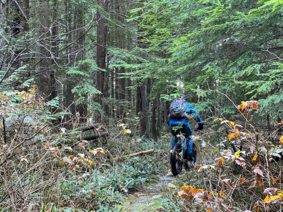
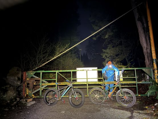
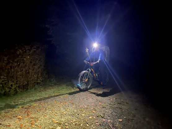
Due to the private property problems I insisted for us to start in the dark (to not get caught on the way in) even if I didn’t have the work commitment in the afternoon, so this wasn’t a difficult sell after all. Matt agreed to meet in front of Quarry Road’s gate at 4:40 am and we would have more than 2 hours of head-lamp time. This meant the entire biking section would be done in the pitch dark, and I knew from past experience that the regular hiker’s head-lamps weren’t likely to be bright enough for the speedy ride. I decided at the last minute to bring my Mt. Everest summit head-lamp that has 700 lumen, but then two days later I found out that I did not take my regular one (with spare batteries) out of the backpack. I seldom made careless mistakes like that, but guess I really made sure to have enough illumination to survive two nights up in the death zone. There were two gates to hop over and the first one was sort of difficult with the cumbersome bikes. The ride was mostly as expected, a smooth sail but with countless up-and-downs. I have already developed enough uphill muscles to not suffer on rides like this, but this was not the averaged 10-km ride in the city, and was certainly more difficult than the ride up Seymour Valley in the North Shore. We rode past the canoer’s campsite onto Widgeon Lake trail and the trail was still very ridable. Matt was promising to ride all the way to the Fools Gold’s junction and he was surely not kidding. The final 2 km had some rough sections and steep uphills that necessitated pushing the bikes, but the pushing was worthwhile. There were more flats coming, and the downhills were entirely rideable towards the end of the day. We parked the bikes right in front of two ditches that were only 100 m away from the Fools Gold’s junction. I took my time donning mountaineering boots, and then off we went into the unknowns.


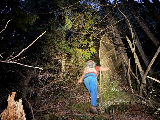
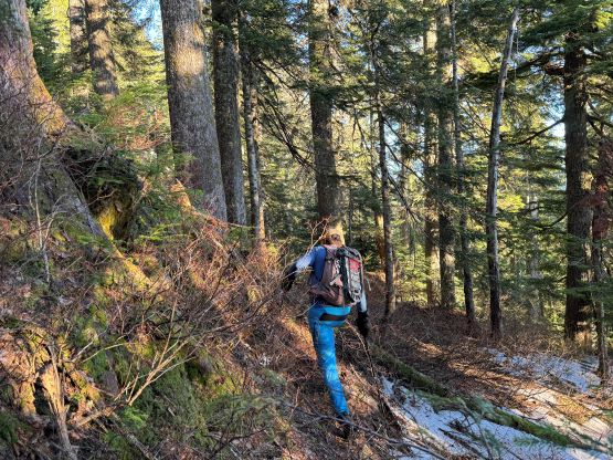
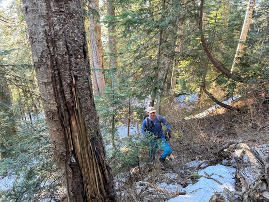
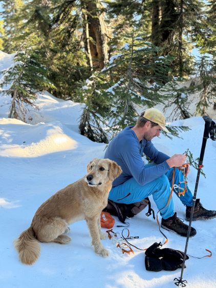
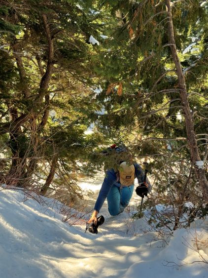
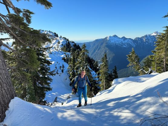
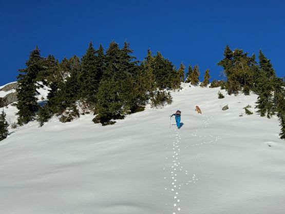
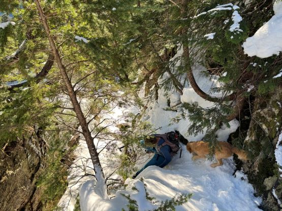
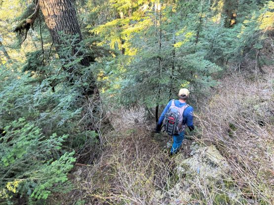
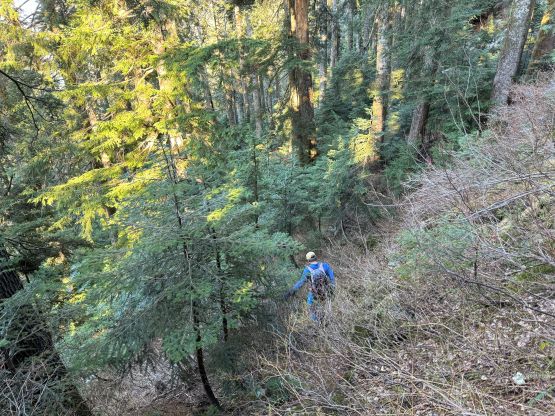
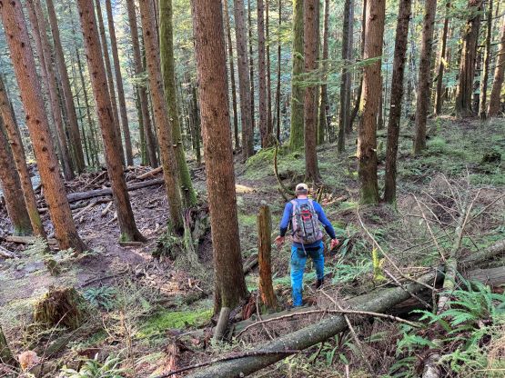
The start of the Fool’s Gold trail follows a deactivated spur down to a foot bridge crossing Widgeon Creek. This section was quite overgrown making me worry about the status of the trail further up the valley (for the access to some other peaks). Unfortunately we only used the Fool’s Gold route for this brief section so I cannot comment on the trail quality beyond the bridge. We were thankful for this log bridge as the creek would otherwise be impossible to cross without going for a swim. I then led us turning climber’s right diving into the bushes, and right off the bat we encountered jungle-like terrain. The sea-level bushwhacking reminded Matt the start of Judge Howay’s approach but we knew from Thomas’ words the bushwhacking should not be that bad at all. Thankfully the situation improved after crossing a few dry creeks and the going was mostly free of obstacles after gaining 50 m elevation. Unfortunately the open-ish forest did not last long. Once the terrain became steep we had to content with some sustained bushwhacking over all kinds of obstacles. It was possible that we didn’t pick the best route due to the limited visibility in the dark, but we could not find a significantly better line a few hours later on the descent. At around 850 m elevation we merged into a landslide path and got some brief break from the bushwhacking, but the worst was to gain the south ridge from the top of this landslide. I somehow got sucked into a band of brambles and needed a break to don gloves. I gave no shit about ruining the gloves as I could not find a better way without significant backtracking. The uncontractible 135 cm trekking poles were a major liability on this day, and so were the snowshoes that were entirely not needed. Matt and I regrouped after encountering some patchy snow on the ridge. I then immediately donned crampons as the snow was bullet proof.


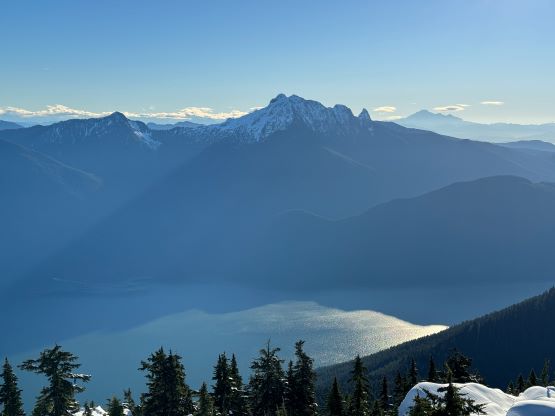
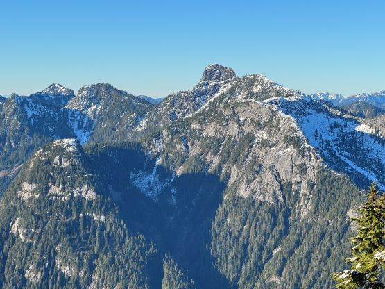
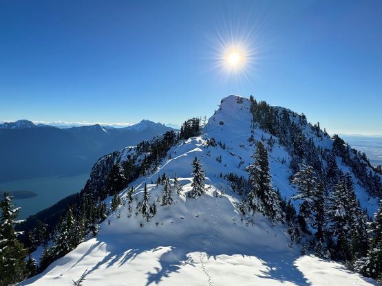
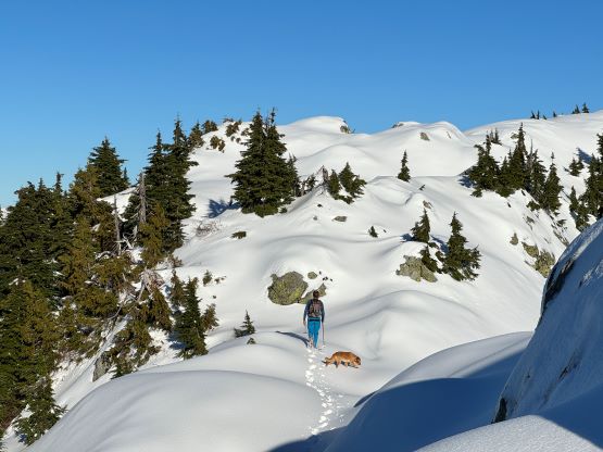
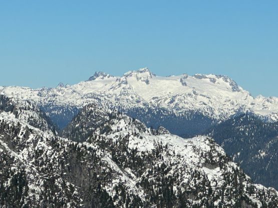
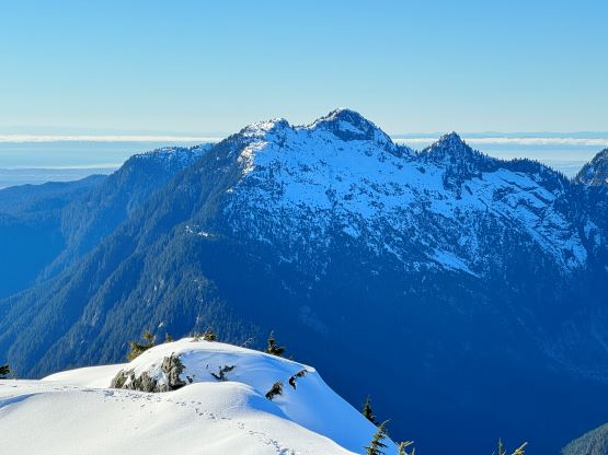
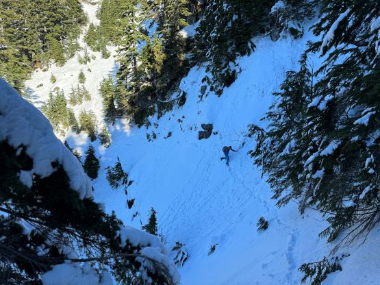
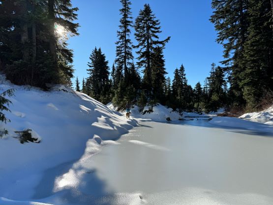
The patchy snow became continuous at 1100 m and Matt also needed to don crampons after trying really hard to go without them for about half an hour. There were two ways to tackle the first of the three summits on the south ridge and we picked the up-and-over option. We were treated with some incredible views into some seldom-seen country, but Matt found a better way around this first summit a couple hours later. The crux was to ascend or bypass the second peak. There’s a cliff band and I went for the direct attack. The scrambling felt like 4th class and required a down-sloping traverse followed by some vege-belay over death exposure. I thought the difficulty would ease after this initial step, but then I encountered a secondary (more difficult) step that really made me struggle. I ended up hauling myself up using one ice tool’s pick and one not-so-great branch. Matt was already seeking some alternative solutions on the west side so he did not see this secondary step, but nevertheless we grouped a while later below the second summit. Matt’s route was not easy, but easier than mine so we would take his route on the way out.


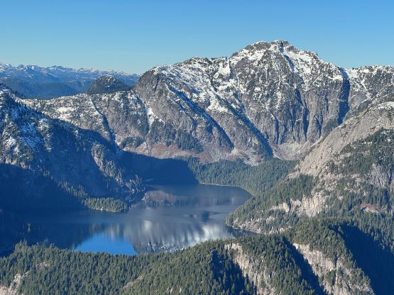
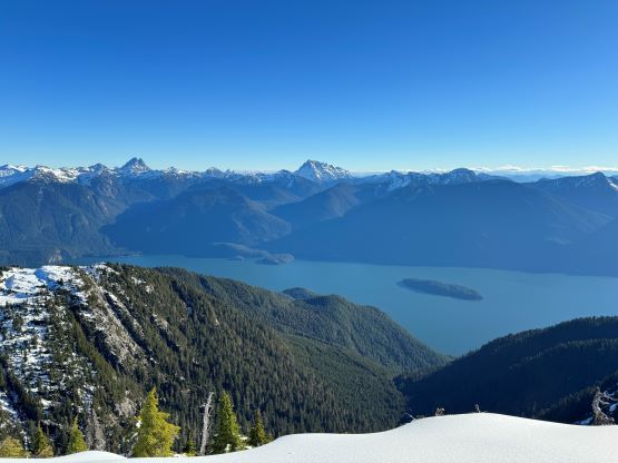
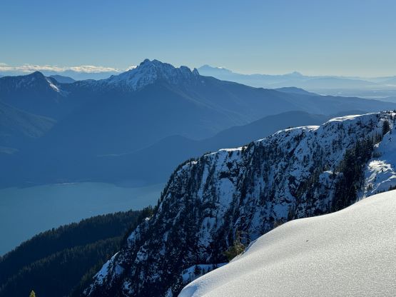
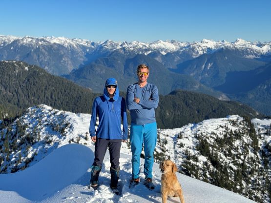
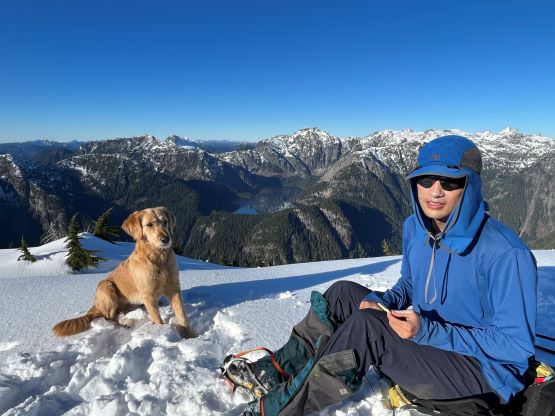
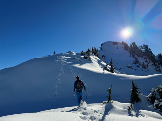
Ascending the second summit was without trouble but then we had more than 50 m to drop into the final col in front of the true summit. The descent was steep, but not difficult. The plod onto the true summit was again, rather tame but involved more up-and-downs and micro-terrain that had now become tedious. We had been moving for over 5.5 hours on full force and we were starting to get tired. Thankfully the summit was attained shortly after and we were able to linger on the summit for over half an hour. There’s even some cell reception so I made some updates on the socials. It also seemed to me that I could indeed get back home in time for work, but we needed to hurry up.


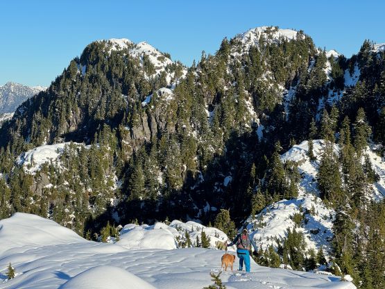
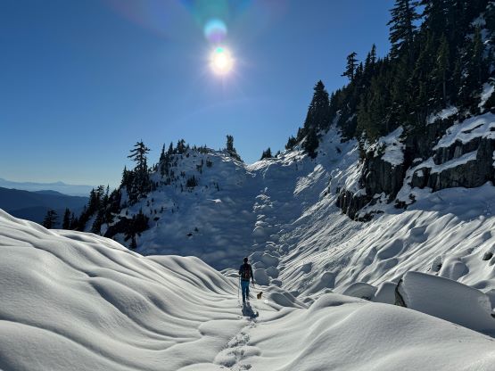
There’s no magic in going back to the central (second) summit as we had to retrace the exact steps that we just made, but then I led us down into Matt’s bypass route. There were a few steep bowls to traverse across that made me stop to take the ice axe out. The slope was on the west side and still hadn’t seen the sun rays yet so the snow was still very icy. I was tempted to be lazy as I was fairly confident on terrain like this, but a slip without an ice axe would be disastrous. Doing transitions was surely frustrating but I preferred to be safe these days. I then followed Matt’s lead bypassing the south (first) summit entirely on a bench on the east side, and Matt’s excellent sense of direction led us rejoining the route at 1150 m elevation without needing to make any unnecessary detour or backtrack. For once or twice I questioned the feasibility of this route but it all worked out despite the few interesting steps. Matt promised the 1-hour descent from the top of the south ridge down to Widgeon Creek but I thought he was kidding. Well, he was not kidding for himself, but Matt’s probably the fastest downhill bushwhacker that I had ever hiked with. This trip reminded me that I hadn’t really bushwhacked in the North Shore (I prefer and did most peaks there in winter), and secondly I hadn’t really bushwhacked with Matt yet. I normally had to wait for my partners in this kind of terrain (hence I always took hundreds of photos in the bushes), but I really struggled to keep up on the descent on this day. The bright side of having a fast partner was that I no longer needed to pull the phone out for navigation, which was also uncommon in my trips.


Nevertheless we made to the bikes and immediately started the bike ride after spending at most 10 minutes doing gear transitions. I knew this return ride would not be easy as there’s only 100 m net elevation loss. I was mentally prepared for a struggle but the infinitely many uphills still kicked my ass. I eventually opted to push the bike for two occasions, and upon seeing the second (inner) gate I saw one open gate with a truck. I could not see Matt so I knew we were likely not in trouble, but the grumpy lady who worked for Metro Van. surely gave me some lectures for how dare could I simply ignore the “no trespassing” sign and “not following the rules”. I replied that the gates were there to block my access to the mountain that I was going to climb, so what, and I had been practicing this all the time over all of the world. The lady replied that she did not have the tickets with her, but she was already starting to ticket people like us, so oh well. I had some reflection after this encounter. Over the years I had probably broken hundreds of rules in my peak-bagging career and I surely had been caught for many times but I yet hadn’t paid a fine. I’m sure that day will come eventually but I just consider that to be a “fee” rather than a “fine”. In any case we finished the round trip in 10 hours and I indeed got back to White Rock in time for work even after a burrito stop. The work was extremely exhausting that I still cancelled the final hour in favour of a much-needed rest.