Mount Moe
May 9, 2020
2664m
Garibaldi Provincial Park / Whistler, BC
Among the peaks by Wedgemount Lake, Mt. Moe seems to be the one that doesn’t often get climbed. One probable reason is that you have to ascend up and over Mt. Cook to access it but to be fair, that’s not a long way over (certainly shorter than the scramble route, W. Ridge of Wedge Mountain). In fact, most beta I got was from ski mountaineering parties doing one of the bigger traverses in this region such as the classic Mt. Currie to Blackcomb traverse. Mt. Moe is also by odd chance, one of the only few peaks that I’ve done two times. The first time was in October by traversing a fractured glacier from Mt. Cook, and the second time as part of the Mt. Neal to Ure Peak traverse in spring time on snowshoes. Because both ascents were memorable I would show both trip reports here.
Spring ascent from Weart Glacier:

Mt. Neal to Ure Peak peak-bagging slam.
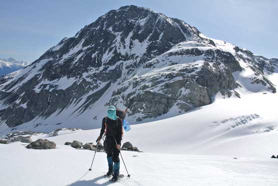
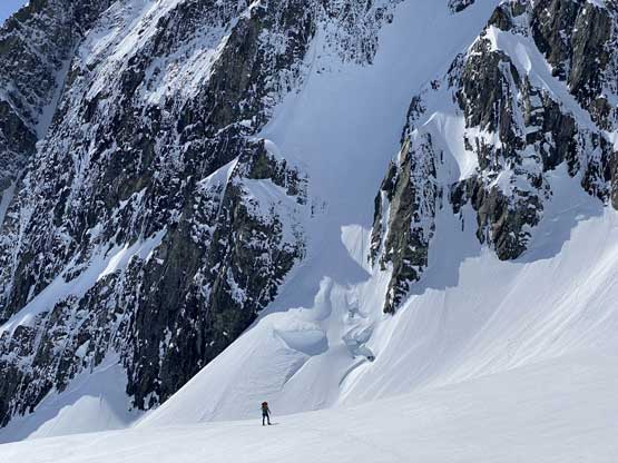
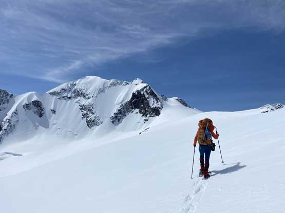
Earlier in this trip Alex and I had ascended Mt. Neal, Eureka Mountain, Peggy Peak and Oasis Mountain. We weren’t very sure how to gain the glacier underneath the north face of Mt. Moe from Weart Glacier. The plan was to lose elevation all the way to the toe of the glacier but earlier observations from Oasis Mtn. changed our plan. We could see a ramp system traversing right underneath the north-east corner of The Owls on rock that could save at least 50 m elevation loss and regain. We aimed for that rock ramp traversing horizontally across Weart Glacier without losing much of elevation. The ramp was wide and despite the lack of snow we managed to plod across without taking the snowshoes off. Traversing onto the glacier involved a few steep stretches with some overhead hazard. One size 1 avalanche came off a steep couloir literally within a stone’s throw in front of me forcing us to go farther out onto the glacier closer to some open crevasses. Thankfully the middle of this glacier seemed to be nicely filled in. A few hundred vertical meters up the glacier we bailed right (north) aiming for the east shoulder of Mt. Moe. This whole section was slow going with a heavy pack.

Me on Weart Glacier aiming for that ramp. Photo by Alex R.

Alex traversing around the NE Corner of The Owls on that ramp
Me posing with Oasis Mountain behind. Photo by Alex R.
Looking back at Eureka Mountain and its NW Couloir
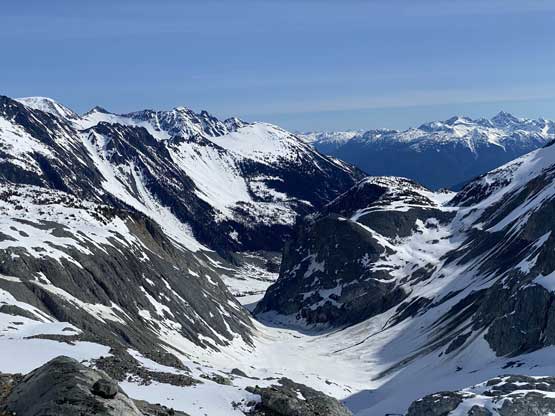
The toe of Weart Glacier drains into a canyon into Ure Creek

Alex traversing onto the glacier north of The Owls

This section was steep and loaded..
Sure enough, an avalanche came off that gully right in front of us..
The top part of the gully that slid.
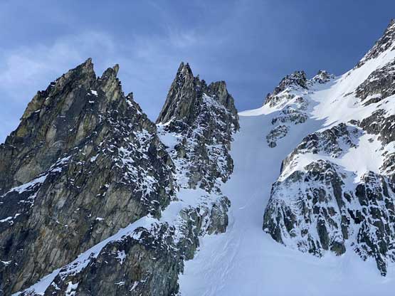
Alex looking small comparing to the schrund on The Owls’ north couloir

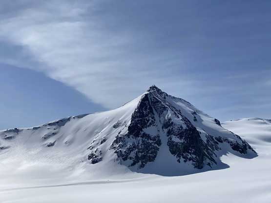
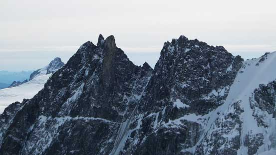
Alex and The Owls
Another photo of Alex with The Owls behind
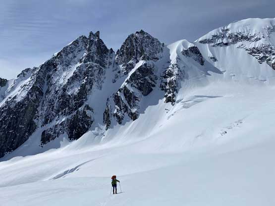
The plan was to camp on the east shoulder but the wind was howling on the ridge. We evaluated a few options and opted to explore towards the SW Ridge despite the added distance to our traverse. Indeed, the wind wasn’t as strong on this side of the peak but still was annoying. We spent the next hour or so digging in and building a snow wall. It was about 2 pm when everything’s done and I opted to take a 3-hour nap. We cooked dinner at around 6 pm and decided to go for the summit watching sunset.
Alex with the north face of Mt. Weart ahead
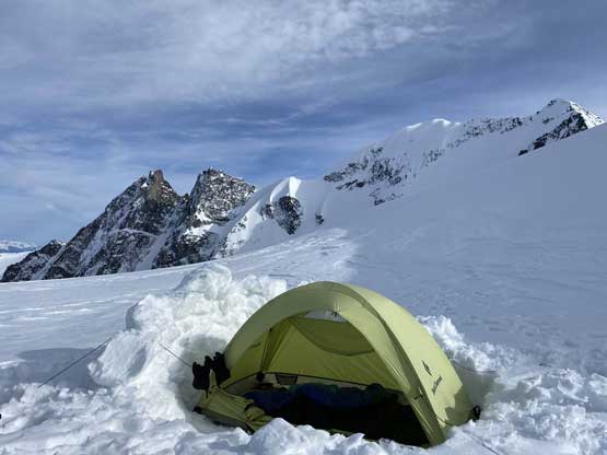
Our camp site at Weart/Moe col
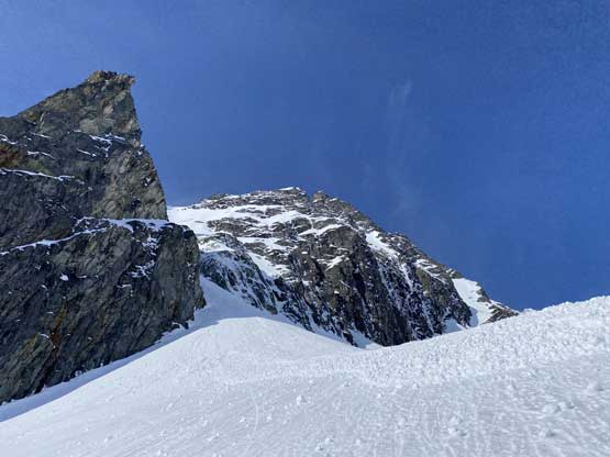
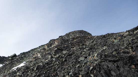
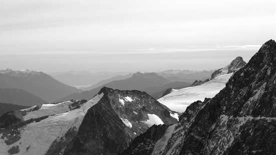
The ascent via east ridge was something I had done before but felt totally different with snow. There wasn’t anything challenging though. The summit was pretty wide but the wind was howling as expected. It took us quite a while to find a sheltered spot a ways down the SW Ridge. There’s one tiny ledge dangling over the west face that we spent time to clean up and hang around for at least one hour. The waiting for sunrise was totally worth it.
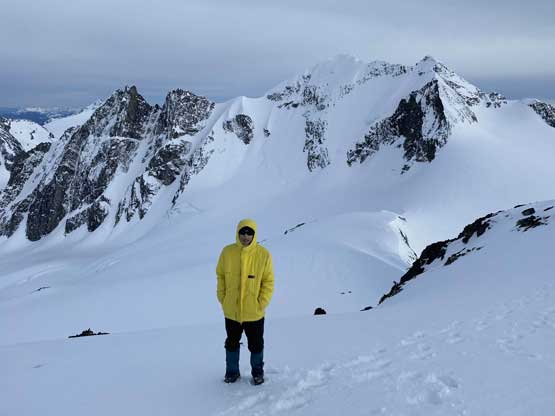
Me on the summit of Mt. Moe, for the second time…
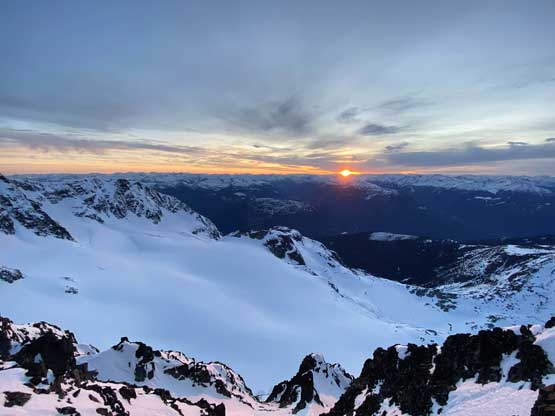
After more than 1 hour on the summit we finally got that sunset view

Evening alpenglow on The Owls
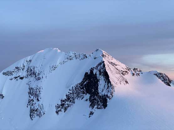
Evening glow on Mt. Weart

This is Mt. Cook

Sunset over the Clendinning skyline
The big peak at center is Overseer Mountain
The sunset was in between Elaho Mtn. and Manatee Peak/Wahoo Tower

The Ashlu-Elaho Divide at dusk.
Once the show was over we leisurely descended back to camp. I dressed up all layers and still felt cold in my -7 degree sleeping bag. The forecasted freezing level was above 3000 m and apparently that was not true… The next day we would descend the north side glacier and then traverse north to ascend Ure Peak.
Early fall ascent via Mt. Cook:
October 24, 2015
In the height of summer a strong party should have no problem traversing Cook – Moe – Weart in one long day, but as of late October I had to break them down into 2 days. Earlier in the trip I’d already ascended Mt. Weart by its standard SE Ridge, and then Mt. Cook by the west slopes.

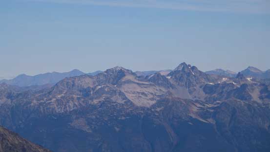
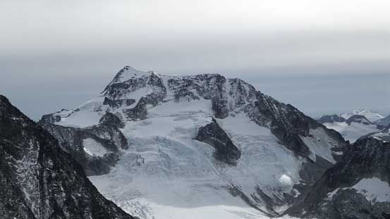
Mt. Weart, Mt. Cook and Mt. Moe from Wedgemount Lake. GPX DL
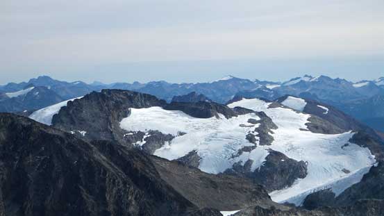
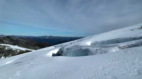
From the summit of Mt. Cook my first business was to drop down to Cook/Weart col. To my surprise that’s such a short way over (only 66 m elevation loss according to bivouac.com). And then I had to work my over to Weart/Moe col and to get there I had to traverse about 1 km on a glacier. From satellite images this glacier appears to be fairly tame but that’s not the case. I could see a few sizable crevasses already from earlier observations and on top of that, the thin fresh snow coverage had made glacier travel specially tricky. Crampons on and down I went. Lots of careful probing were required as I slowly slowly worked my way through some crevasse field.
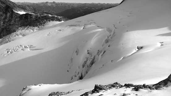
This is the glacier that I had to cross
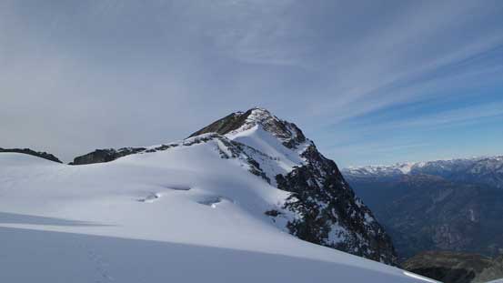
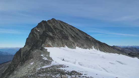
Mt. Moe ahead
Looking back towards Mt. Cook
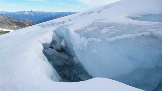
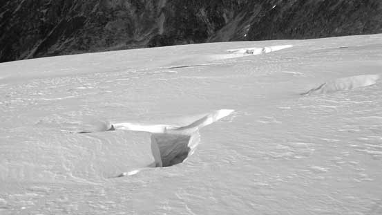
One of the monster sized crevasse…
Lots of crevasses around…

My objective is slowly getting closer
Another monster…
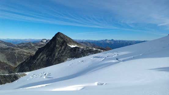
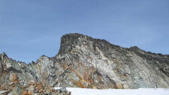
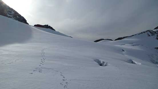
From Weart/Moe col I had to find a way to gain the rocky ridge immediately in front of me. I went climber’s left side to ascend a steep (frozen) scree slope on crampons and it was not fun. (On the way back I just went straight down the nose and discovered a hidden ledge that worked perfectly). Traversing the rocky ridge I soon had to realize that there’s no easy way to gain the summit from the SW Ridge nor S. Face thank to the crazy melt-out in this summer. In winter/spring time I’m sure the S. Face would work but on this particular day I had to traverse way over to the climber’s right onto the E. Ridge. That meant another section of glacier travel and I could see even this flat glacier had quite a few crevasses on it (and partially covered by snow). I opted a line side-hilling above the small ‘schrund and eventually managed to work my way over. Ditching crampons I soon started the scrambling.
On the south ridge extension, looking ahead
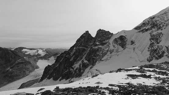
The North Face of The Owls

Looking back at Mt. Cook and the glacier I just crossed

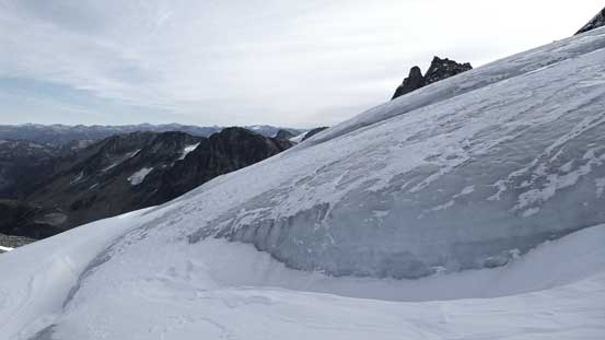
The lower portion of that glacier.
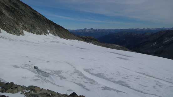
This is the flat glacier I had to cross soon…
It’s obvious why I had to cross that glacier instead of going straight up…
The scrambling along East Ridge
To gain the E. Ridge proper there’s a section of very loose terrain on nothing but boulders and rubble, but once through this crap the E. Ridge was fairly solid and fun. There’s minimal hands-on from now and it’s a simple plod to the summit. The views were great with the N. Face of Mt. Weart stealing the show.

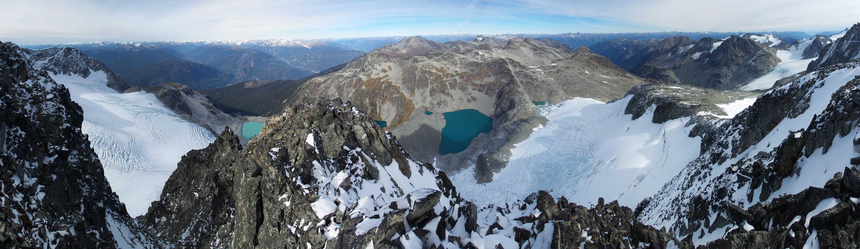
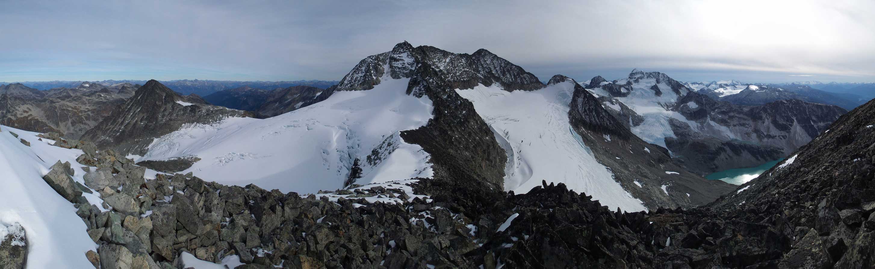
Summit Panorama from Mt. Moe. Click to view large size.

Ipsoot Mountain
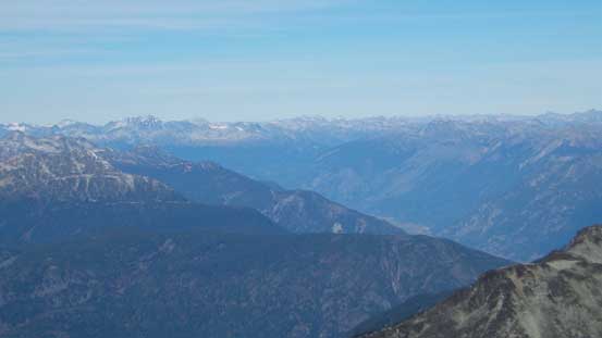
Pemberton Valley
Mt. Currie
Mt. Marriott by the Duffey Lake Road
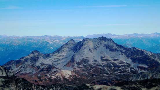
The Joffre Group – Slalok and Matier
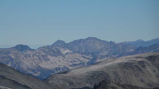
Mt. Neal and Needles Glacier
Way in the distance I could see the tip of Harrison Lake
The Owls looks super imposing

This is the piece of glacier leading down to The Owls…

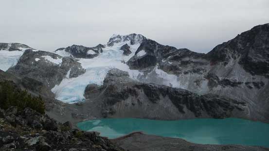
One of the few glacial lakes

The N. Face of Mt. Weart
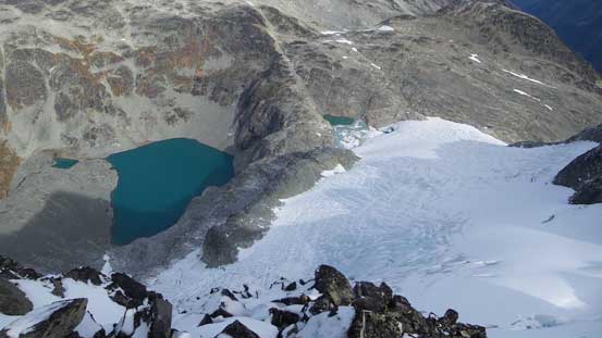
Another glacial lake north of Mt. Moe

The steep NW Face
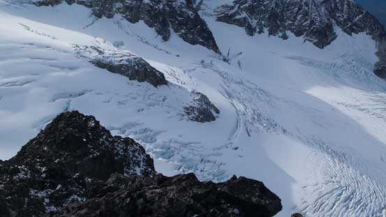
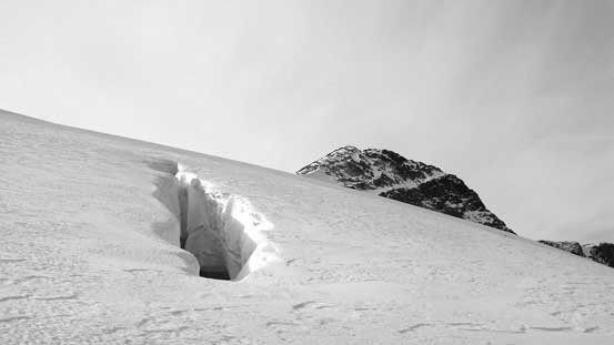
The theme of these glaciers around is “heavily crevassed”…

Crevasses….
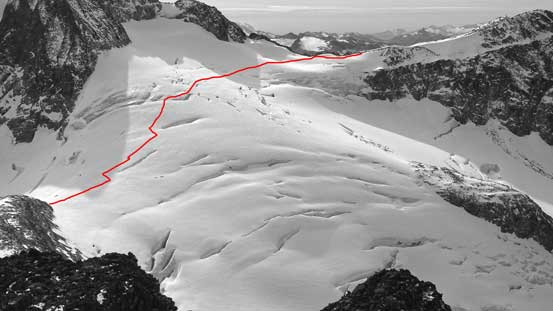
My rough route through the glacier is shown
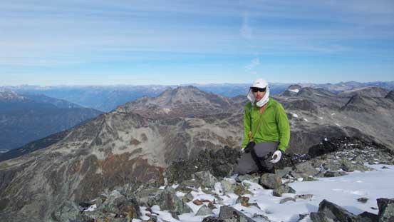
Me on the summit of Mt. Moe
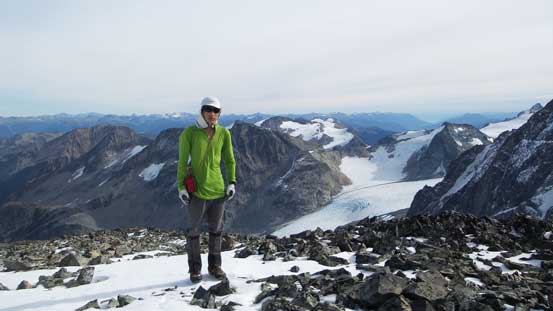
Another picture of me on the summit
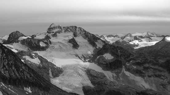
Another panorama from the summit. Click to view large size.

One more panorama. Click to view large size.
On the descent I simply retraced my route down the E. Ridge, across that small glacier onto the S. Ridge extension and then onto the bigger glacier. I followed my exact tracks back across that crevasse field and over to Weart/Cook col. From here I had two choices. I could have descended beside Armchair Glacier following more-or-less a straight line back to camp without having to re-ascend Mt. Cook, but that route especially the upper section looked fairly loose. The summit of Mt. Cook didn’t look that far so I opted to go back the same way. And once down to within 100 vertical meters of the lake I finally deviated from my ascent route and picked a direct line back to camp.

Descending the broad East Ridge
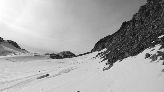
Onto the smaller and flatter glacier. Note the holes even close to rock

My tracks on this smaller glacier
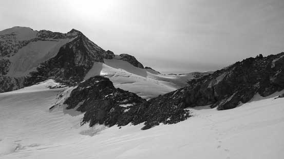
Onto the south ridge extension, crampons off

Moat by the larger glacier

I had to re-ascend all the way back to Mt. Cook

Into the maze of crevasses…

One of the monsters
The same monster from a different angle
Very, very suspicious area… Couldn’t trust any footing without probing a few times…
My tracks and more crevasses…

Finally done this glacier

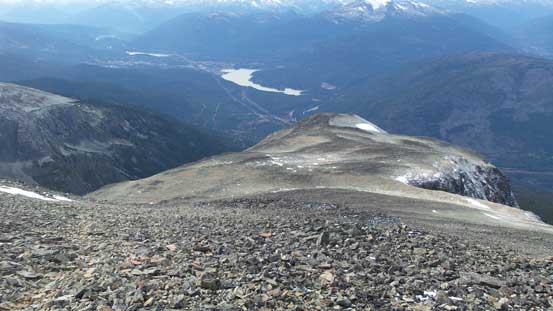
A view looking down towards Wedgemount Lake
The massive Wedge Mountain
Panorama from the shoulder on Mt. Cook. Click to view large size.
Another look at Wedge Mountain
Descending the standard route on Mt. Cook
Wedgemount Lake and Wedge Mountain

Another group on their way up Mt. Cook
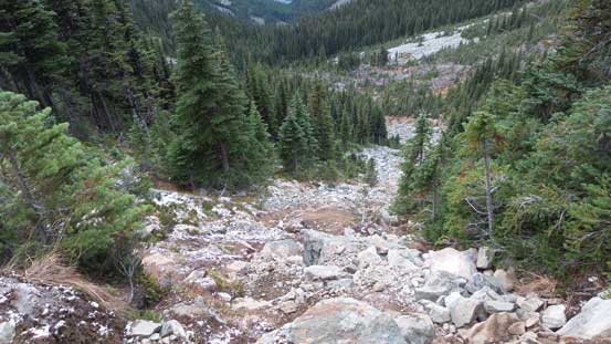
Now I had to make another decision. It’s apparent that some weather was moving in from the south judging by the increasing cloudiness throughout this day and combing with the weather forecast I estimated the following day to be miserable. I wasn’t particularly interested in ascending anything (Parkhurst/Rethel) in bad weather plus the standard route over to Parkhurst/Rethel col was looking ugly in late season conditions. It’s late afternoon and that meant I had about 2+ hours of daylight time. Instead of staying at camp for another night and packing up in the cold morning with possible rain/snow I decided to just head down immediately. The 7-km hike-out was uneventful except for hordes of people that I met (some at the lake, some on their way down and even a few on their way up).

The shelter was full by Saturday evening
Time to head home..
Overall this was a great trip bagging 3 peaks by this beautiful area in the late fall. Not sure if I’ll go back here in the same season though as those boulders and rubble was quite miserable to ascend. It appears that most peaks by this area are better done in early summer or late spring on snow and I’m already looking forward to climb the classic NE Arete of Wedge Mountain and the remote Mt. James Turner at some point.
