Mount Abruzzi
September 13-15, 2014
3268m
Height of the Rockies Provincial Park, BC
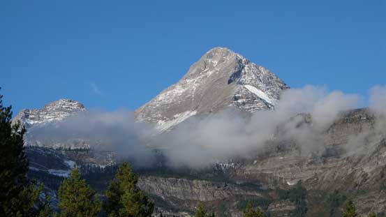
As many of you may or may not know, there’s a group of high and rugged peaks just to the south of Mt. Joffre. That’s the Italian Group, with Mt. Abruzzi being the highest. Earlier in this year I’ve climbed Joffre, King George, Harrison and a bunch of other peaks in the southern Kananaskis and the East Kootenay region, and getting a photo of Abruzzi seemed like an obligatory. The reason was simple – it’s too big to not catch attention. Indeed, at elevation of 3268 m it’s a very prominent peak in its vicinity. After doing some necessary research I found it’s not a difficult peak to climb at all. Most sources including Raff’s trip many years ago proved Mt. Abruzzi being simply a walk-up with some easy glacier travel. The approach, though long, does not involve much of bushwhacking and the scenery in the alpine is simply breathe-taking. Needless to say I’d wish to stand on its summit, sooner than later.
All factors lined up nicely in this past weekend when Eric, Mike and I were gaming for a 3-day mountaineering trip. Weather was too good to not skip Monday and we all had the flexibility to move around the trip time a little bit. Due to the massive dump of snow a couple days earlier our choices were limited to long but easy objectives. I initially forgot about Mt. Abruzzi but once Eric brought it up I was fully convinced, so that’s it. There’re a few reasons why it rarely draws attention to climbers. The most obvious one is the long drive. Buried deeply in the BC Rockies one will need to drive all the way around with lengthy travel on logging roads. There’re two commonly accepted approach routes – both via Connor Lakes. The shorter of the two goes up Maiyuk Creek but due to the bridge out on White River FSR this option is out. The second option, though longer, does involve less driving on logging roads. We’d drive all the way down south to Crowsnest Pass, into Sparwood, up northwards to Elkford, and then up Elk Valley Road for another 28 km or so before taking a left turn for 2 more additional kilometers to a parking lot by Forsyth Creek. It’s about 8 hours from Edmonton and Eric did a great job getting us to the trail-head by midnight.
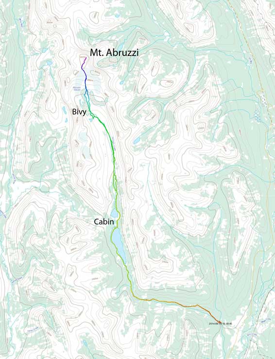
Mt. Abruzzi approach and ascent route from Connor Lakes. GPX DL
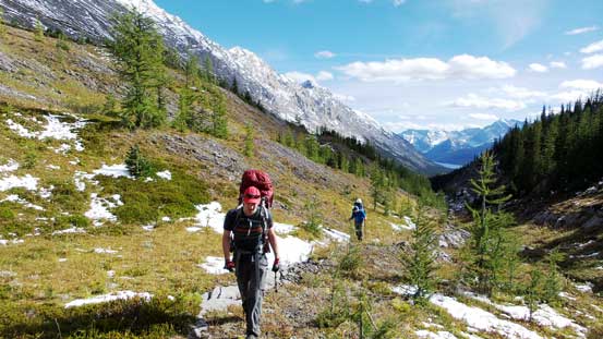
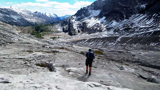
The next morning we woke up around 7 am. Looking around it’s apparent the BC Rockies got a lot less dump than Kananaskis so we wouldn’t need to haul snowshoes up. That’s very good… Now came the second obvious reason why Abruzzi is not a popular summit – the long approach on foot… Well, it didn’t look to be that long on the topo map, but my GPS did record a round trip distance of 62.6 km… That’s quite a trek while carrying full load of mountaineering and camping gears. Good thing that most of this trek would be on a well-defined trail, especially the first 13 km or so to the Connor Lakes Cabin. The first half was hiking on an abandoned logging road and the second half would be on a trail. There wasn’t much of net elevation gain (roughly 300 m) but a theme of this approach was the up-and-downs… I guess the trail was originally designed for horse traffic. Two creek crossings on interesting logs in addition to the beautiful sky-blue first Connor Lake added some fun factor to this mundane approach, and after about 4 hours’ trudge we arrived at the Cabin. There were 4 fishermen giving us a nice welcome along with some route beta. Apparently one of them had been visiting this area for more than 30 years!
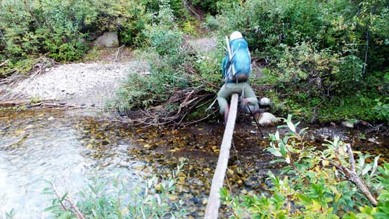
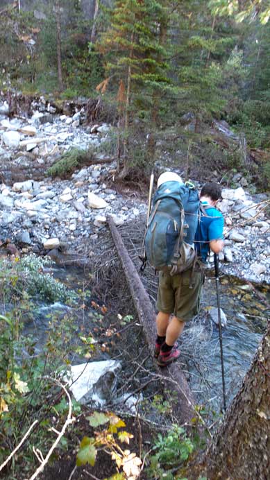
Eric au-chevalling across the first log. At about 100 m upstream there’s a much safer log that Mike discovered. We’d use that one on the return.
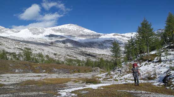
The initial 6 km or so.
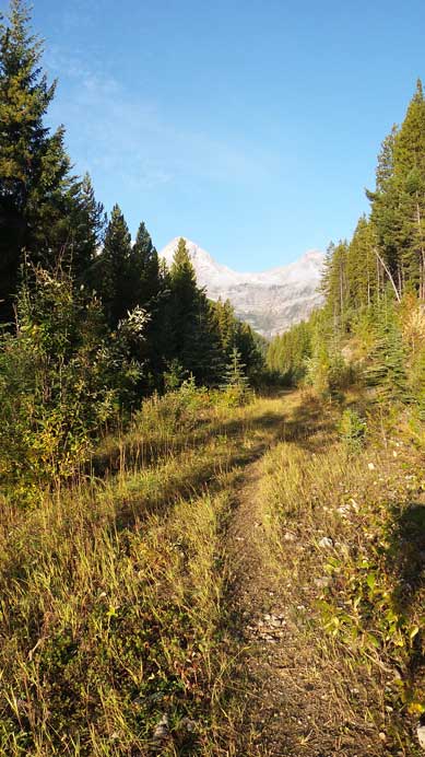
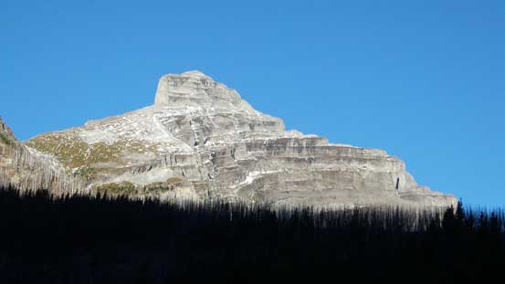
I think it’s Forsyth Peak, but not 100% sure. It’s one of the few prominent peaks you can see from this initial logging road approach.
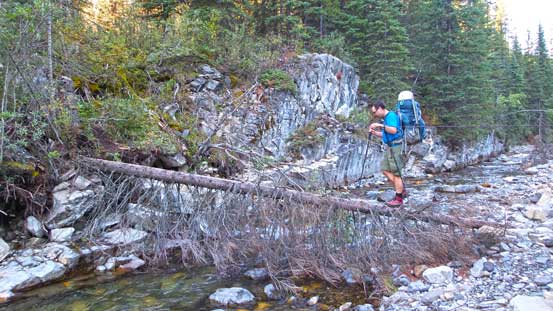
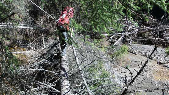
This log was kind of the crux. I ended up au-chevalling across on the way in, and cramponing it on the way back…

A mini-waterfall in a deep canyon.
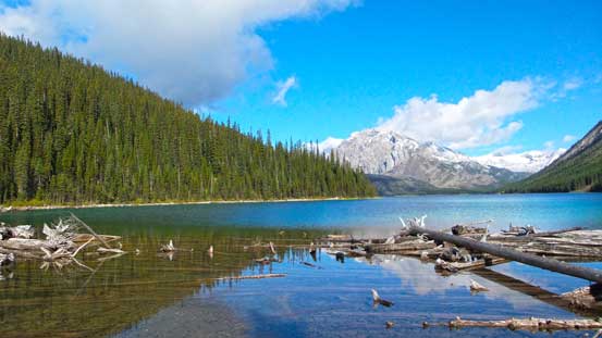
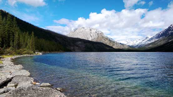
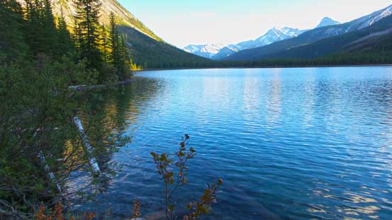
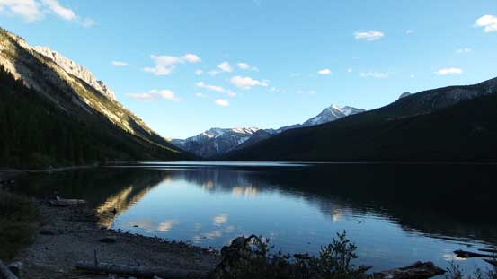
Arrived at the first Connor Lake. It’s a huge one – bigger than Lake Louise and takes about 1 hour to contour around on the left side, even with an excellent trail.
The colour was pretty. At this side there’s also a prime camping site.

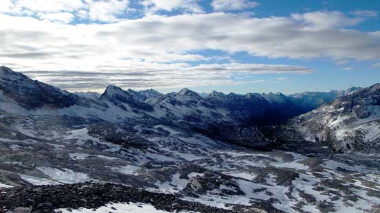
Looking deeply up the valley towards our objective – at about 20 km away…
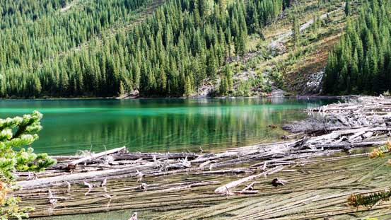
Deep green colour in the first Connor Lake
About halfway across, the other side just didn’t seem to get any closer.

Eventually we made to the Cabin. These guys were surprised we made here in 4 hours.
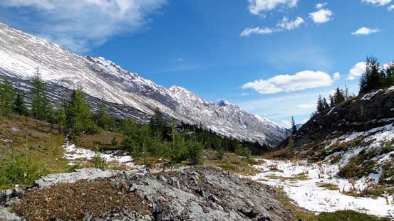
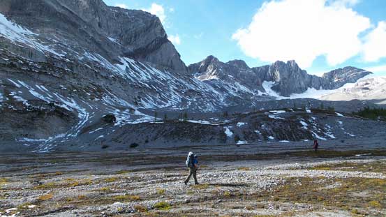
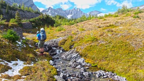
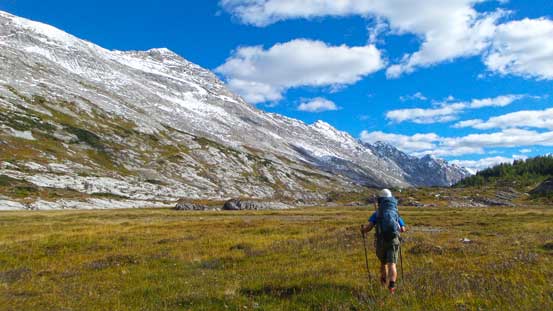
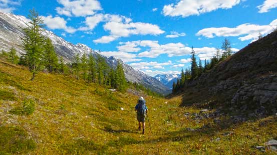
After saying Goodbye to them we pressed on since we still had a long way to go. The trail leading to and around the second Connor Lake was still well defined, but soon it started to degrade. After passing a large meadow area on its right side edge we started to lose the path.. The bush didn’t seem to be awful so we started to pick our own line. Speaking the route-finding in the macro-terrain it’s as simple as following the valley all the way up, but the micro-terrain was confusing the disorienting. Eric initially led us up and along some of the minor ribs but soon we realized that’s not the best solution as all ribs eventually ended with elevation loss. Then we followed the creek but it’s more bushy and had some narrow canyon-like sections. We eventually started bashing up the slope on climber’s right, side-hilling on either open slopes or lightly bushy forest before entering the treeline/alpine. There’s still a ton of up-and-downs but at least we had some nice views in sight.
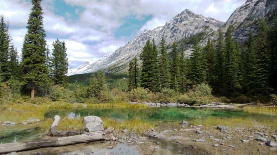
There’s a mini pond in between first and second Connor Lake

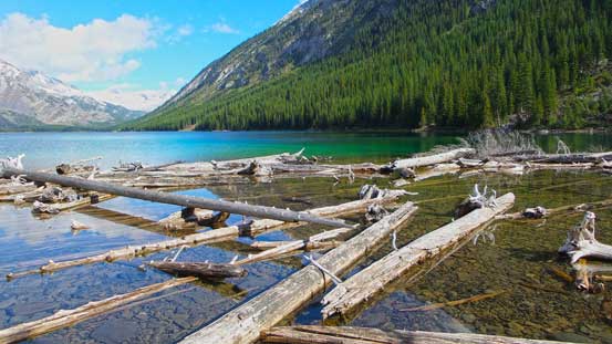
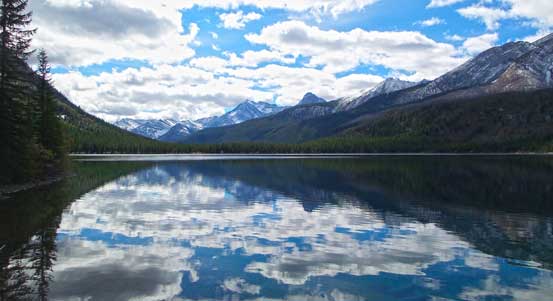
Panorama of the second Lake. I like the colour and the reflection.
Partway across, this is looking back.
Clouds reflecting in the second Connor Lake
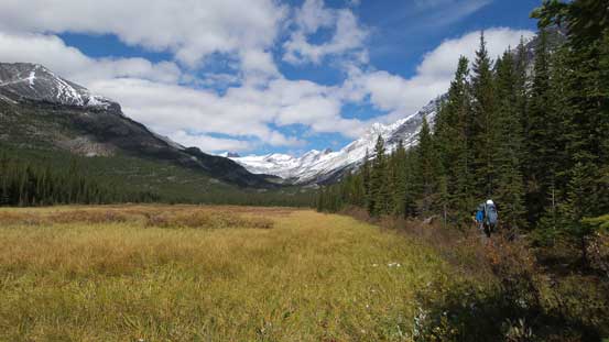
Soon we arrived at a large meadow area.

There were many wetlands like this in this valley.
Kind of the theme of this part.
Another theme of this part. It’s either one or the other.
At least the icefield is getting closer, well, sort of…

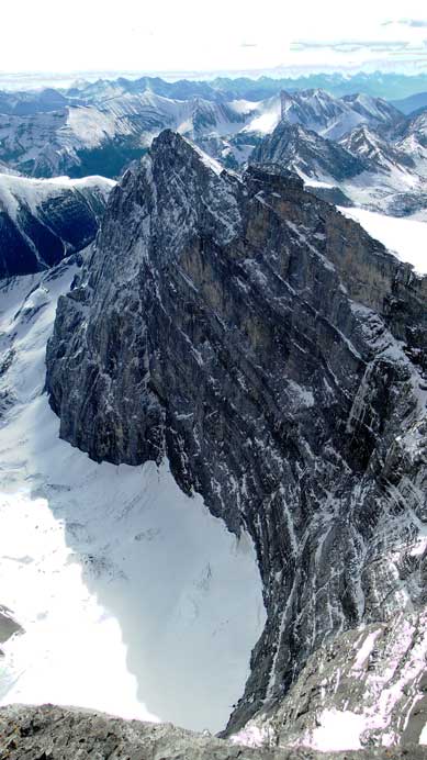
Mt. Lancaster is a technical summit. The shape of these peaks reminded me Opal Range or Colin Range.
Marching up.
Looking back from a small plateau.
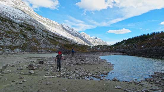
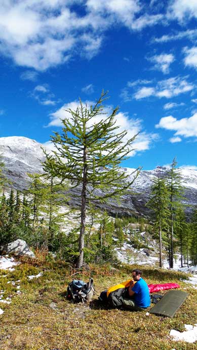
Our destination for Day 1 was a high alpine tarn. We aimed towards it for another 2 km or so but eventually realized it’s bone dry. There were a few really shallow ponds but the water looked very stagnant. We searched around but didn’t find any running stream neither – very strange since there’s an icefield further up the valley… Eventually we gave up finding a stream and set up camp at the last trees. Thank to the big dump a couple days earlier we could get drinking water by melting snow. So that’s about the first day. Another thing to take note was the grizzly. Apparently we were chasing a bear up the valley and we saw many very fresh bear scats and footprints, and it was moving towards the same direction as we did… That was a little bit freaky but thankfully we didn’t have an encounter with the creature. We didn’t even see it during the entire trip.

Eric arriving at the treeline/alpine
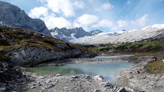
This tarn was beautiful, but the water was stagnant.

The same tarn.
Mike and Eric hiking past this tarn.
We spent some time searching the “bigger lake”.
And, only found bone dry land…

Sun was getting pretty low at this point.
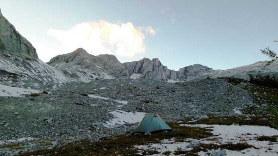
Eventually we decided to bivy at the last tree, and melt snow for water.
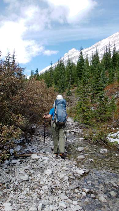
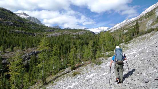
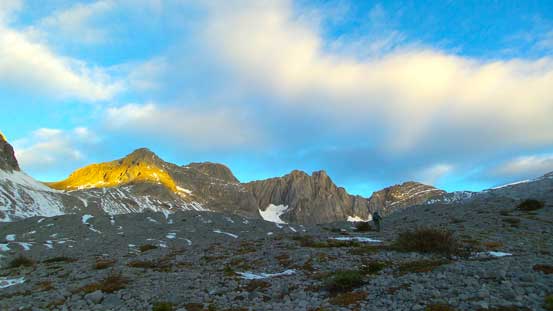
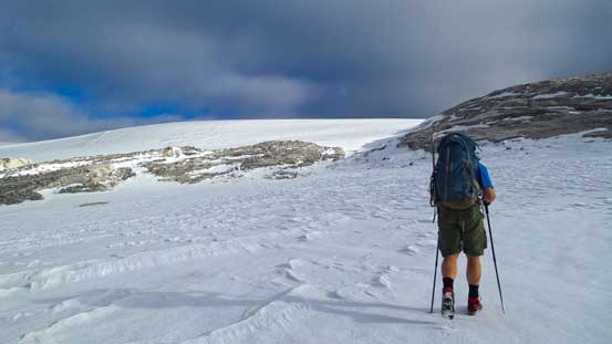
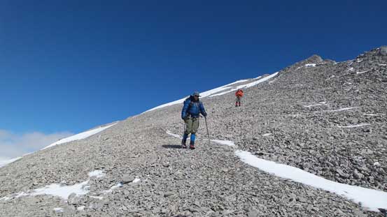
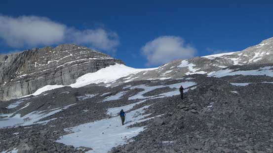
We still had a couple hours daylight time left after setting up camp. I felt very tired during this trip for various reasons so I definitely appreciated the extra resting time. The night was cold but not intolerable. The next morning we woke up at the first light. The sky wasn’t as clear as forecasted but at least the clouds were sparse and high. So after a somehow longish breakfast time we started the trudge. The summit was still almost 6 km horizontally from our campsite so we knew there’s a long way to go, despite the foreshortened view. On the way towards Abruzzi’s glacier we passed some really cool karst landscape including a few deep holes/caves. That explained why we couldn’t see running stream on the surface..

Cool morning colour shown on the impressive rock wall.
Morning light, clouds, and Mt. Lancaster

Hiking up the karst type of terrain. Typical, typical.

Mike with Mt. Lancaster in the background.

Eric hiking up a mix of snow drifts and the dry rock.
Looking back. As you can see there’s a layer of high clouds, so not perfectly sunny.

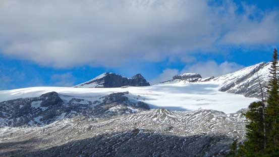
There were a few holes on the glacier, on climber’s left.
Getting closer. We ascended the rock on the right side to the highest we could before venturing onto the glacier.
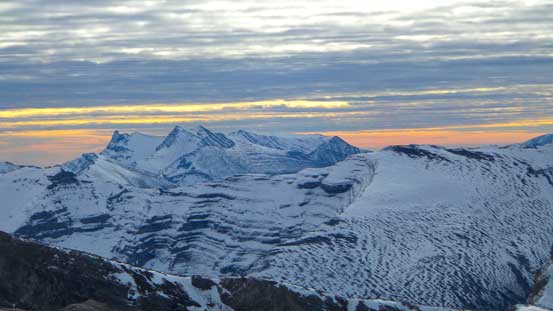
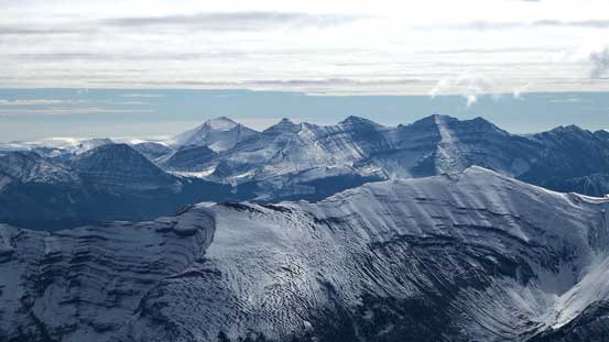
A group of peaks in High Rock Range on the Continental Divide. It looks like winter!
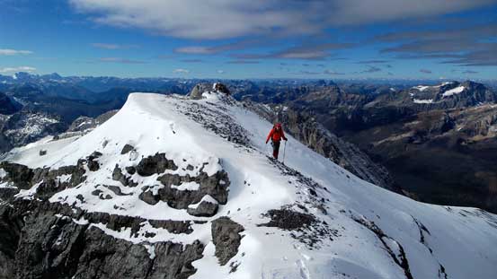
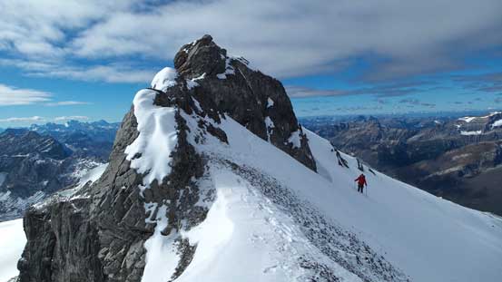
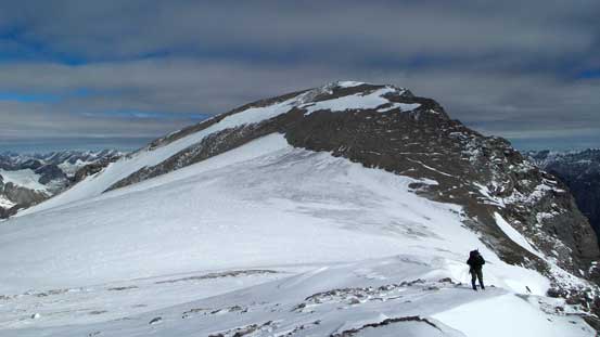
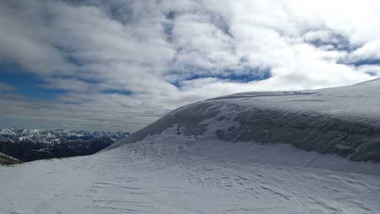
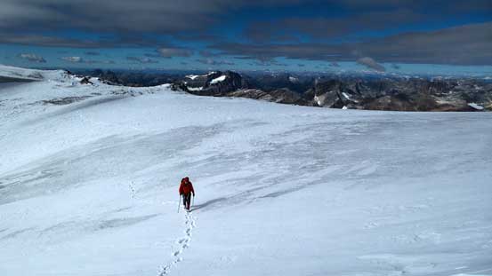
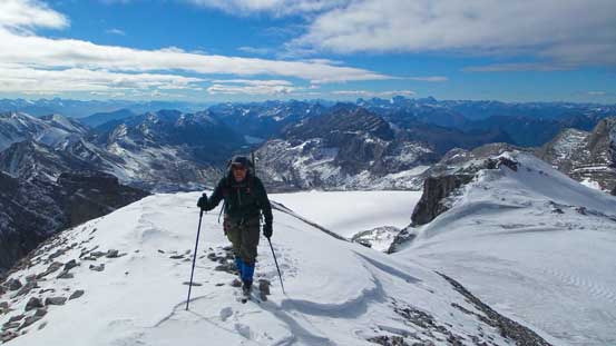
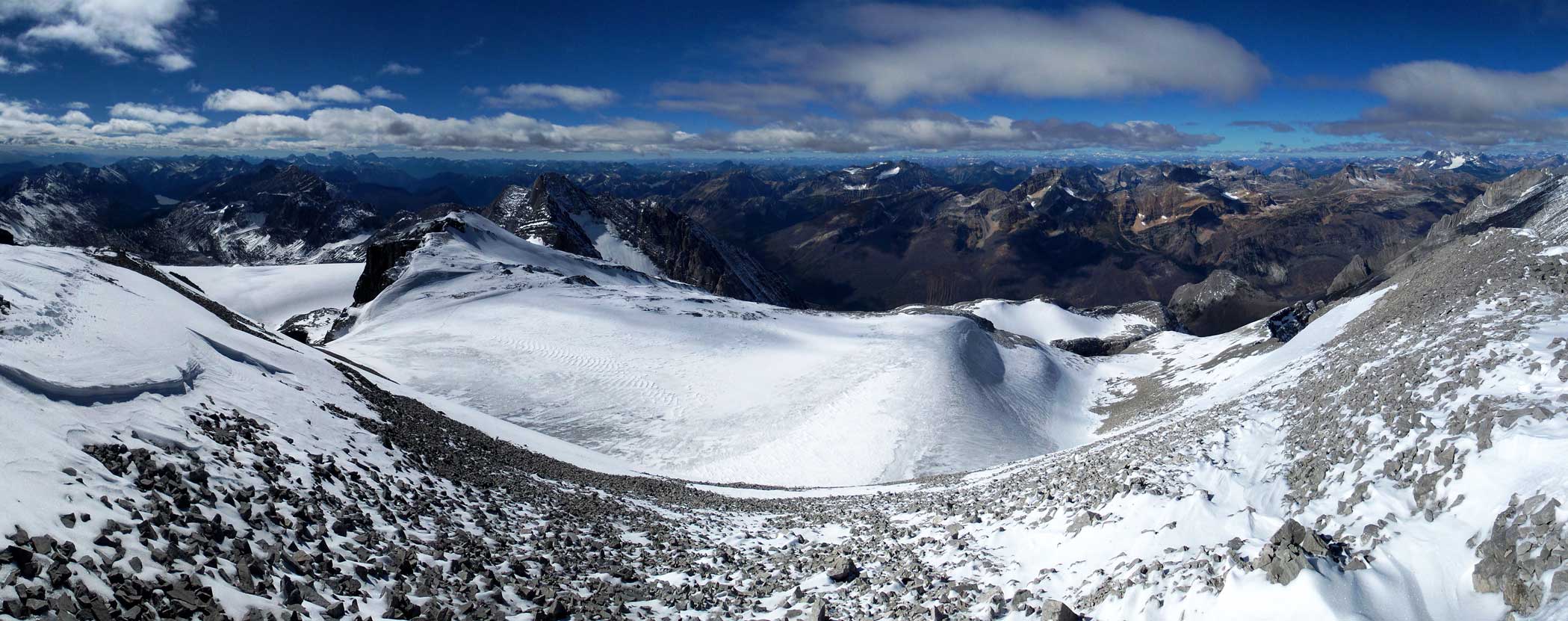
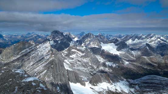
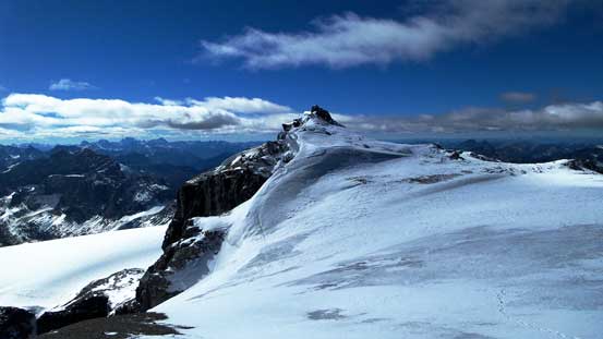
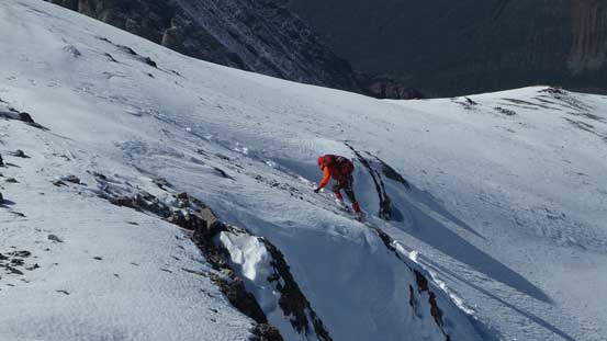
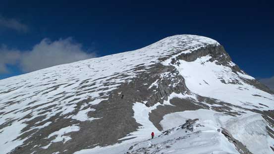
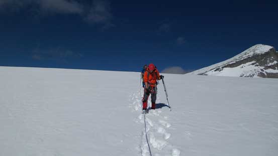
Speaking Abruzzi’s south glacier, it’s quite tame for an icefield at this size. There were still crevasses though and we could see on climber’s left. We brought and decided to use rope because of the fresh snow. There’s about 30 cm of fresh snow covering the ice and I led the way up, probing carefully. I didn’t discover any hole and soon we made to the other side. In another 5 min we would be treated with a gorgeous panorama view towards the purcells. Ahead would be the scree/snow slog up the false summit. There’s nothing technical here and it’s all about perseverance. Near the false summit we could look straight down the east face. That was a huge rock face! It dropped hundreds of meters straight down to the next valley. On the traverse to true summit Eric and I took a direct route which involved one very exposed move. This was probably the only hands-on scrambling on this mountain so I really enjoyed it. Mike took a bypassing line post-holing and side-hilling across a snow slope.
Mike ascending the south glacier.
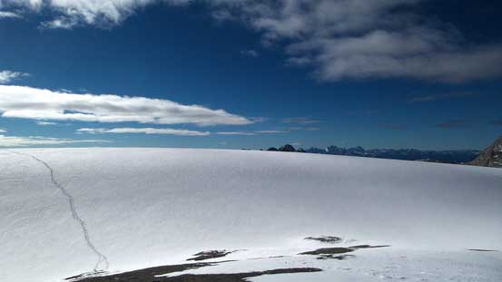
Exiting the glacier, looking back at our tracks.
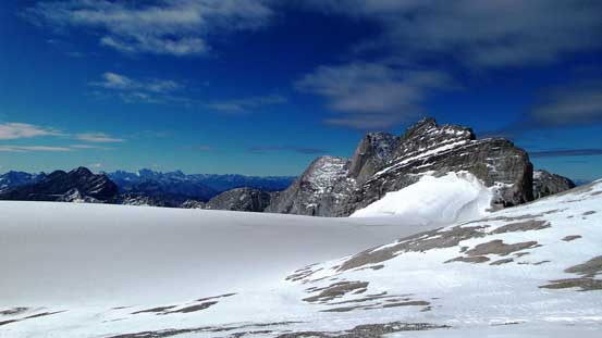
The glacier and Mt. Lancaster.
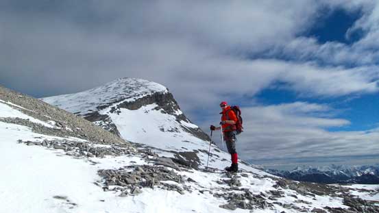
Mike with the false summit behind.
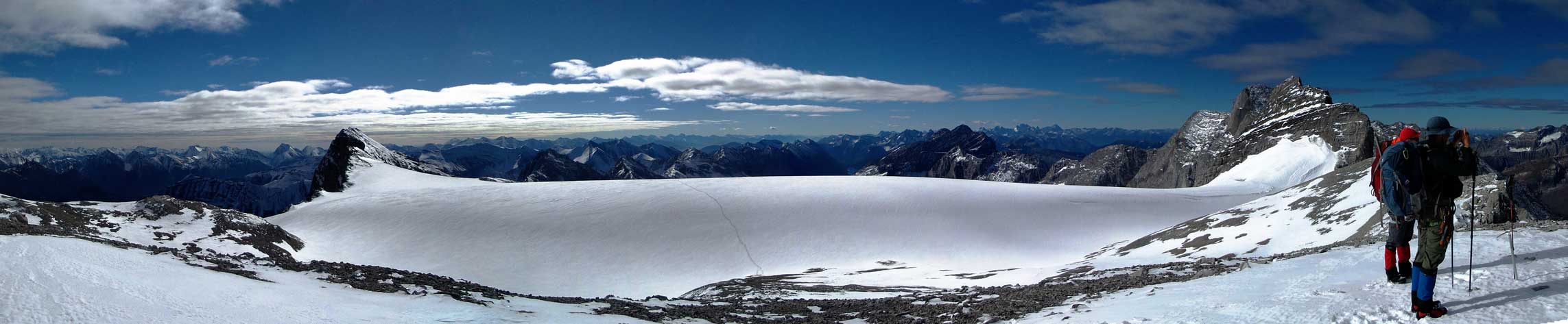
A panorama view of the glacier. Click to view large size.

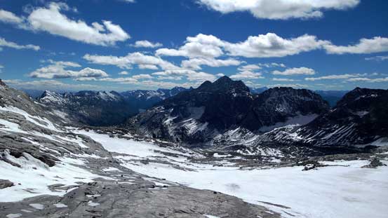
To the west is Deep Lake. This valley can, and had been scrambled.
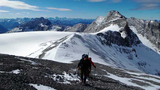
Slogging up scree towards the false summit. The view was amazing so we didn’t complain about the scree.

Mike traversing a small snow slope.
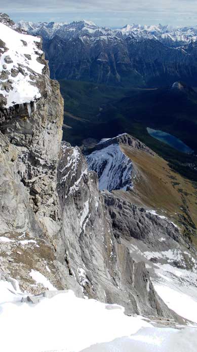
The other (east) side was a shear drop off
The impressive East face!
Mike ascending towards the false summit
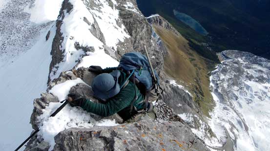
Eric down-climbing an awkward and exposed step off from false summit.

Then, balancing over a narrow section of the ridge
Mike decided to post-hole and side-hill across its base.
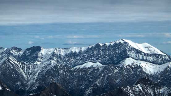
On the saddle between false and true summits we encountered small ice patches. We managed to walk around them on thin snow without the need to strap crampons on, and soon we were on the final push towards the true summit. The view was mind-blowing towards each direction, with Joffre, King George and Harrison stealing the snow. Towards the east was a full panorama of High Rock Range, with Highwood Range poking behind. We spent at least an hour on the summit taking hundreds of pictures before starting the descent. The sun was strong so we were all worrying about the post-holing on the way down.
The final push towards true summit
An icy roll coming down from false summit. We managed to bypass it without the need of crampons
Mike at the saddle
Eric approaching the summit of Mt. Abruzzi
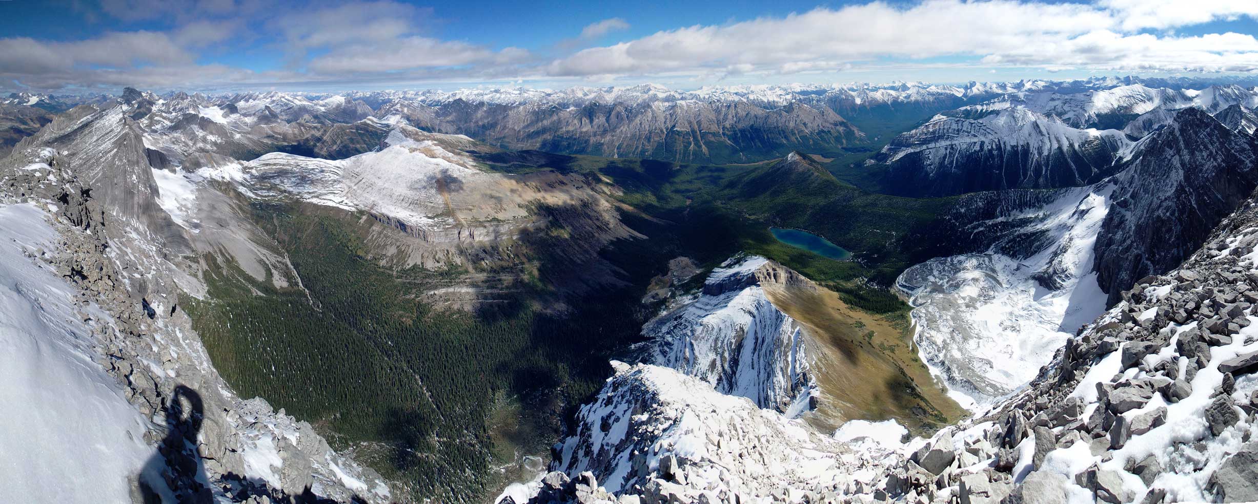
Summit Panorama looking east. Click to view large size.
Summit Panorama looking west. Click to view large size.

Mt. Rae at Highwood Pass. It’s winter up there! I did it two years ago.
Mist Mountain is another big one at Highwood Pass that I ascended earlier in this year.

Highwood Peak is rarely ascended. It’s not technical though, just unofficial.

The impressive south face of Mt. Joffre
Looking south are the giants- Mt. Harrison and Mt. Mike. Apparently Mike wanted to ascend Mt. Mike…

Way in the distance is Tornado Mountain. Eric kept talking about how great that peak was.

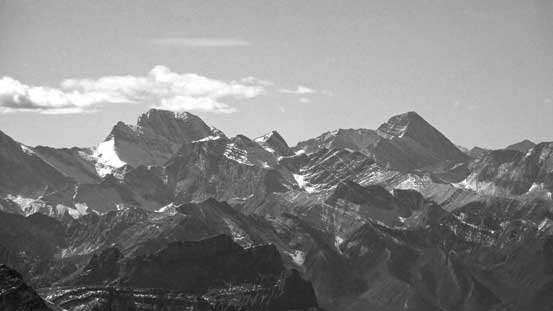
Mt. King George which we climbed last month.
Even the Bugaboos showed up!
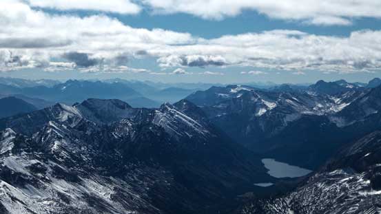
One of the bumps in foreground left of center is Mt. Ingram. On the bottom right are the Connor Lakes
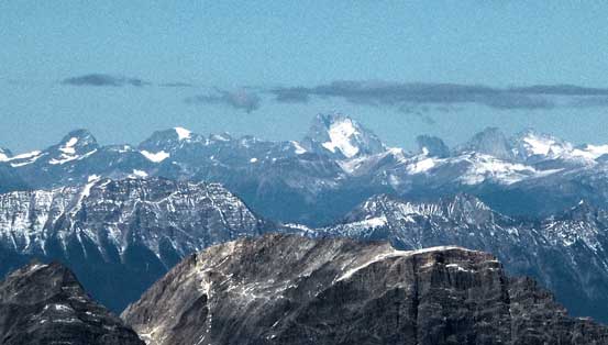
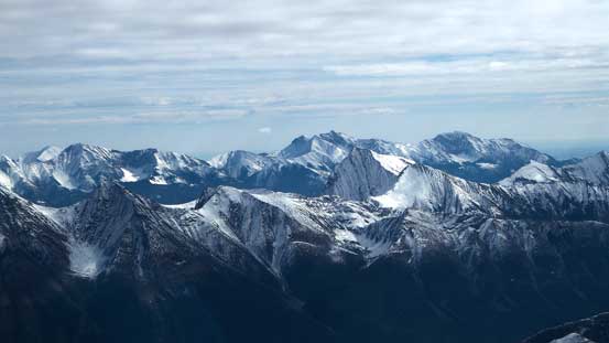
A group of peaks in High Rock Range – Baril, Cornwell, Etherington, Courcelette

Mt. McPhail
In the distance are Mt. Head and Holy Cross Mountain

I like the colour pattern on these mountains.

Mt. Lancaster looks small from here.
The Joffre group as well as peaks on Petain Glacier.
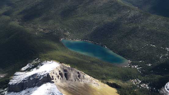
A nice-looking lake to the east
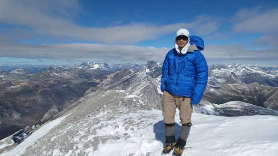
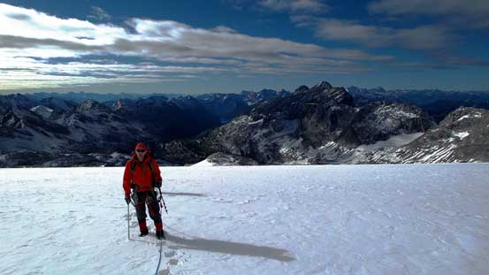
Me on the summit of Abruzzi
There wasn’t that much of post-holing actually as the snow wasn’t very consolidated anyway. After getting back to camp we decided to pack up and return for as much as we wanted on this day. Based on Rick Collier’s trip report and our observation there’s no chance to summit Mt. Lancaster nor Mt. Connor given the current condition and our gears so there’s no need to stay high in this valley. We set the goal to descend all the way down to Connor Lakes Lodge.
The false summit ahead.
Descending from the true summit
Mike ascending onto the false summit

Looking down towards Lancaster
Looking back at the false summit

The south glacier again
Descending the glacier. There’s surprisingly little post-holing on top of our tracks.

Mt. Connor is the slabby peak on left – another technical one.
Looking down our descending valley – Mt. Marcouni in the background

Mike descending the typical terrain
More typical terrain.

These caves/holes explain why there’s no running stream on the surface…
Almost got back to camp
Breaking camp. Note the larches. In another week or so, mmm..
Descending this valley was as tedious as ascending it, and we still got confused many times as whether we should stay low by the creeks, or staying high on skier’s left while side-hilling. Eventually we picked a line that’s the combination of the two. Either way it wouldn’t be very pleasant. We also had to deal with brief bushwhacking as well as up-and-downs. We eventually manage to pick up the trail once almost back to the large meadow area, and after that we followed the trail down and around the second Connor Lake, and then back to the Lodge – a very tedious process.
We finally found running water again. Fill up the water bottle!
Starting the long depproach.
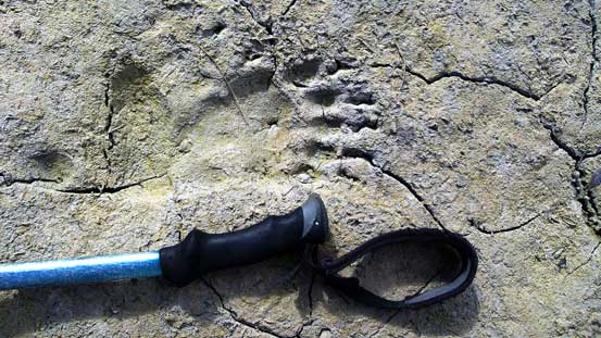
Fresh bear signs everywhere in this valley…

Mike
Eric

Many tarns like this. Looks beautiful on the pictures but imagine coming here in mosquito season..

Wetlands
The second Connor Lake
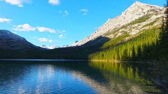
Reflection in the second lake.
Eventually we made back to the first lake.
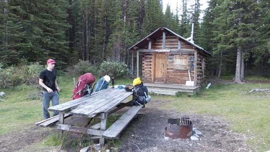
And then, were treated with an empty cabin!
However, we were rewarded with an empty Lodge. What a bonus! This first-come-first-serve Lodge is maintained by Height of the Rockies P. Park and is large enough for a group of 4. At about 10 min walking distance down the trail we managed to find a running stream with water coming out of the ground. There was about 1 hour daylight time left and we all got a very well-deserved dinner. Excellent way to end an awesome day!
The following morning we slept in till alpenglow time. The lake was calm and offered some nice scenery. At this point we still had the thought to scramble Mt. Ingram after finishing the final 13 km deproaching. I guess we were optimistic about that. The first half of the return around the lake and then down the trail was tedious, and the second half along the old logging road was miserable. By the time we got to Ingram’s base none of us had the motivation to bushwhack and scree bash for another 1000 vertical meters given what we just did in this trip. At the creek crossing just before parking lot Mike led us across a log at about 100 m upstream which felt a lot safer, and soon after that we made back to Eric’s car. This wasn’t a long day so we had plenty of time driving back to Edmonton.

Alpenglow in the morning

Just before we left, there’s a layer of mist on the lake surface
A cool looking peak looking west. I don’t think it’s O’Neil Peak, but somewhere in that area.
Back to the sketchy log. I ended up putting crampons on – to justify the purpose of hauling them up anyway…
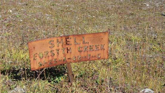
Oil and gas operation here?!
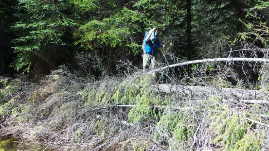
Mike led us across the final log jam
Eric on the log jam. 5 min away from the parking lot!
Overall, there’s no classic mountaineering nor high-quality scrambling involved and the approach, along with the drive, is somehow tedious and mundane. But I’d still recommend Mt. Abruzzi to folks wishing to explore this seldom visited area as well as ascending a high peak. If you’re lucky you can stay in the Cabin – itself is an excellent destination for family camping or fishing. All in all another very satisfactory trip in the Rockies again.

Great trip report and a very enjoyable read. Awesome looking country.
Cheers
Fabulous write-up. Very, very impressive doing this from Edmonton in just 3 days. I’ve been going into the area for over 40 years and have been to the “Donut” (directly above Abruzzi Lake to right side of the glacier) 4 times over the years but have never gone to the peak. I’m too old now so I will do it vicariously through your excellent report.
Take her easy
Sarge
Thanks Sarge!! Very nice to hear some voices from locals like you. It’s a fairly long drive (and long trip) from Edmonton.
We did it in 2012, three of us. Could not remember clearly. There were no registration within the pass 10 years. We might be the group before you guys :). There were more snow than we were there. I love it, hate those mosquitoes so much while we camped at the bottom in the woods.
Great read! I love that area too and camped a few years ago at the base of Mt Queen Mary, scambling around the area and climbing a few other peaks just for the views.
Great photos and text!
Looks like a fine Adventure indeed.
I’ve hike the back side of the Italian group aa well as the Royals into some stunning landscapes and you’ve added to those view!
Thanks for sharing!
Thanks for the detailed report and all the photos.
I hiked the area and summited Mt Abruzzi in 1980 with Outward Bound. I liked the area so much I revisited it in 2004, 2005 and 2008.
My father and I followed the Forsyth Creek route in 2005 and I hope to do it again this summer with my daughter. Interesting to see how the area and vegetation have changed over the years.
Cheers.