Ladner Mountain
January 29, 2022
1800m
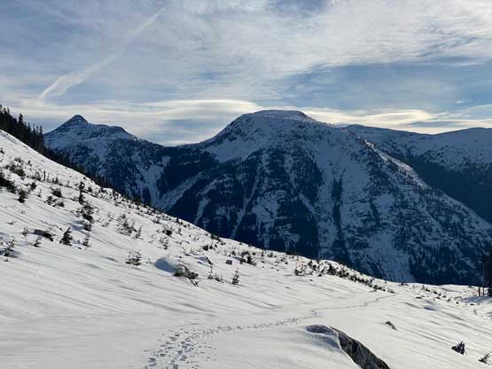
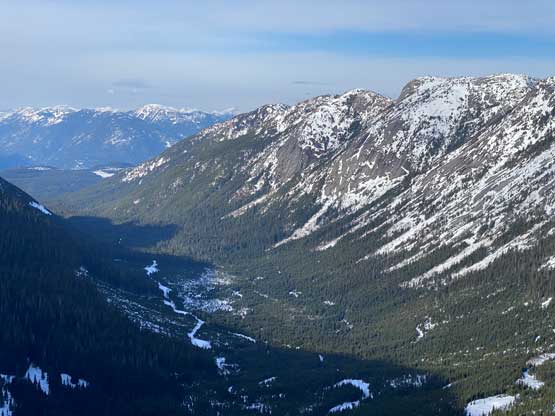
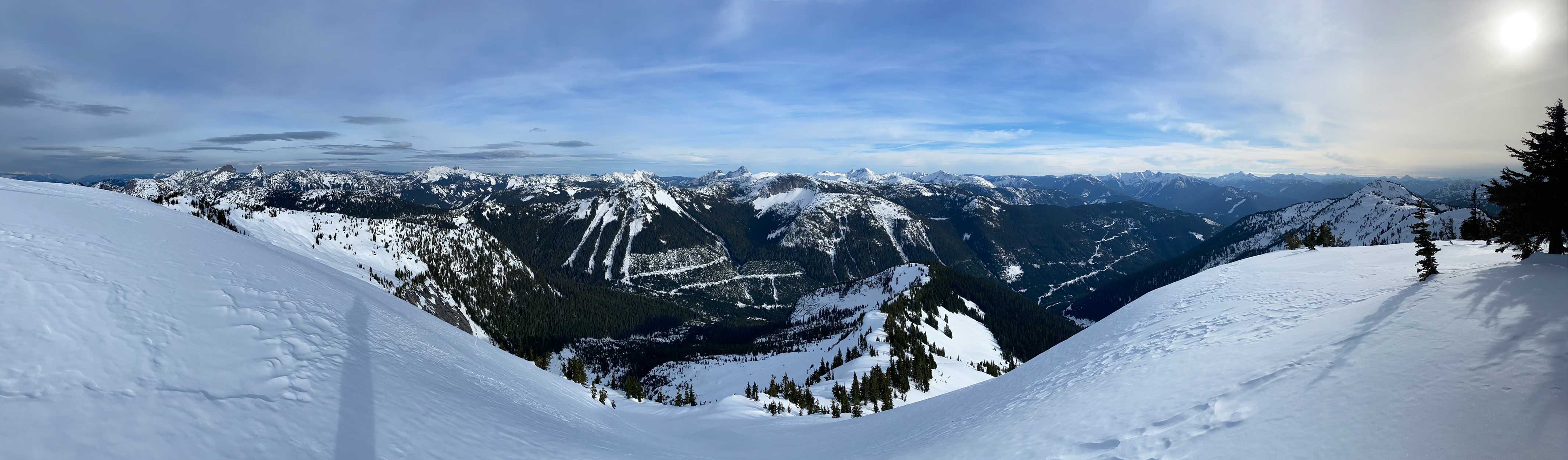
Coquihalla Pass, BC
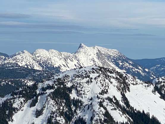
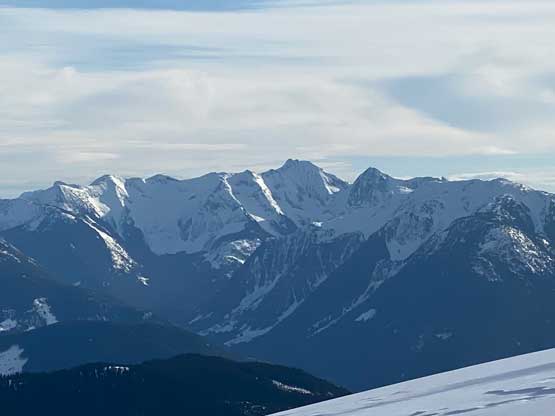
This obscured peak had been known as “Bombtram W4” but bivouac.com later assigned the unofficial name “Ladner Mountain” due to its proximity to Ladner Creek. This peak is rather not a sub-summit of Bombtram Mountain as it’s a stand-alone massif with more than 400 m prominence. There had been virtually no “beta” about the access of this peak but three options exist if one spends enough time browsing topo and satellite maps. Back in the days when Anderson River FSR was in a better shape I’m sure folks had come up from the NW side (in summer when the roads were free of snow), but such isn’t an option anymore due to the deactivation of those spur roads. In the modern era I think only two routes make sense – the longer, but easier option via the FSR system in Ladner Creek to the south, and the more complex but more direct option from Box Canyon via some complicated ridge system. Both routes would have to be done with abundant snow coverage to eliminate bushwhacking.
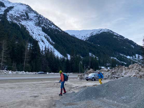
For a few years I had been planning this outing via Ladner Creek but a long road-plod never sounded too exciting. This year when Alex and Vlad were looking to get out in the middle of the old man winter “Ladner Mountain” came across my mind again, as finding “interesting” day-trip objectives in winter that were still on the agenda for all three of us had started to become difficult. I initially threw out this Ladner Creek approach option but changed my mind to explore the Box Canyon side because of the stable and firm conditions that we had seen recently. The conditions had been Low/Low/Low for a few days in a roll and we were confident to traverse/ascend any steep slope we wanted. Alex’s friend Brano joined the team at the last minute. Brano did not have mountaineering boots nor crampons but he was confident to do this trip in the snowboard boots and snowshoes and I was able to lend out a pair of strap-on aluminum crampons. I myself decided to go with Trango Tech mountaineering boots with Petzl Lynx “ice climbing” crampons to give a wide range of terrain selection contingency. Out of complete coincidence I had summitted Bombtram Mountain on the exact same date last year, January 29th. The three of us grouped in Abbotsford at 6:10 am but half an hour later in Alex’s Subaru I realized I had left my phone in the truck. This meant no navigation nor photos from me. I debated about to use other people’s photos but my phone is the 11 Pro with much better photo quality, so I made the call to turn around and get it. That was quite a dumb mistake from my side that wasted about an hour in the morning.

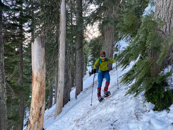
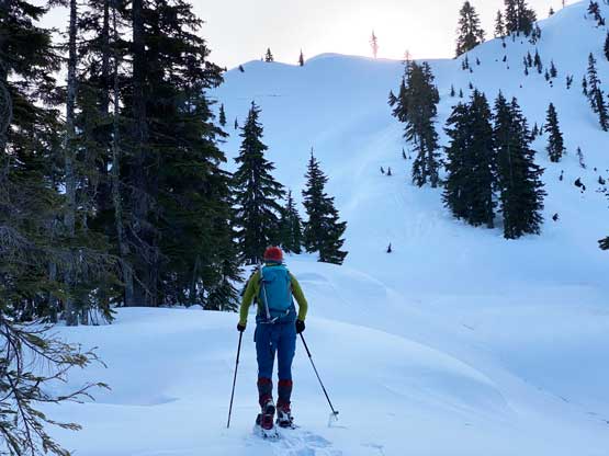
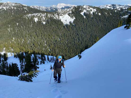
There’s a FSR that parallels Box Canyon on the north side from the highway to almost the first pass at 1320 m. The start of this road was a bit confusing but we soon found it about 100 m to the north of where we parked. About 500 m into the road-walk I made the spontaneous decision to short-cut as many switchbacks as possible as the snow condition was in favour for that. The snow was bullet proof even around thin areas in the cut-block such that we could easily boot-pack straight up the slopes without doing any post-holing. In this condition it’s the fastest to aim for the shortest distance. We did follow the road for a while between 1050 and 1150 m but then took a short-cut again. Eventually at just under 1350 m we left the road into some undulating country around the pass. Unfortunately we started to post-hole so the snowshoes were strapped on.
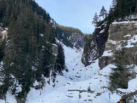


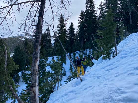
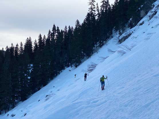
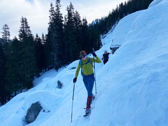
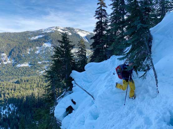
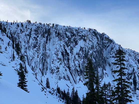
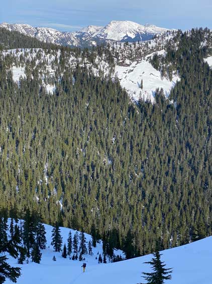
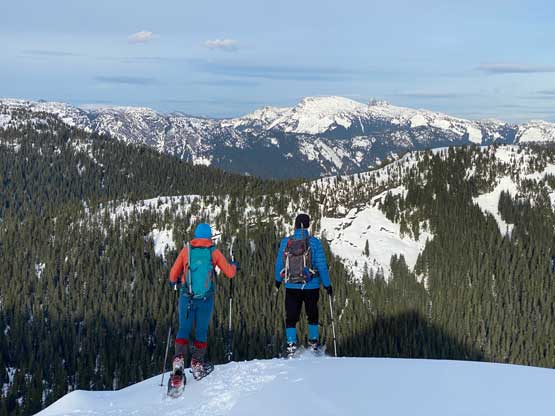
We did not have an exact plan for the next stage which was also the most uncertain of this route. The most efficient would be to maintain the elevation while traversing a long ways across the north slope of some Bombtram’s subsidiary summits but the contour lines suggested some very steep terrain. While planning this route I made the decision to rely purely on our observation in the field. Initially I planned to traverse a broader bench between 1400 and 1450 m but I changed my mind after aiming towards it for a short while. The terrain around 1350 m wasn’t as steep as the contour line suggested so the new plan was to contour this elevation for as best as we could. For the next few kilometers we encountered some steep gullies, (snow covered) boulder fields and open slopes that would be normally be problematic but not in the bomber conditions we had. We did not even end up taking snowshoes off until near the very end of this horizontal traversing section. After swapping snowshoes for crampons we ascended straight up and merged into a steep gully. The steepest terrain (40-45 degrees) only lasted for about 100 vertical meters and then we were back to mellower country again. The post-holing became worse so we made another transition to swap crampons for snowshoes.

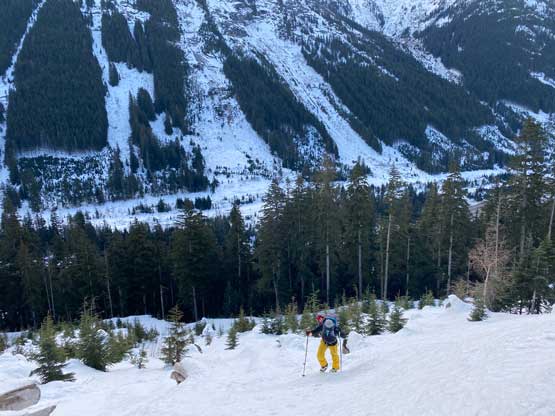
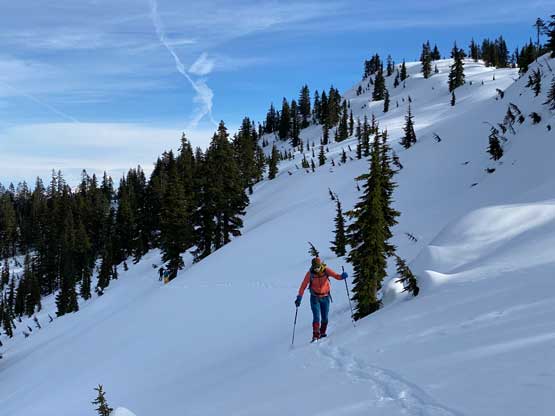
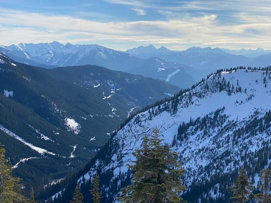
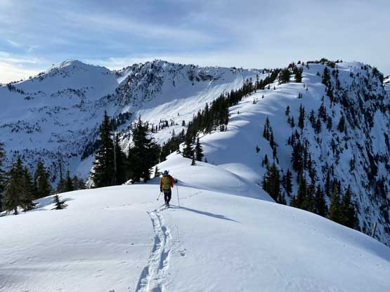
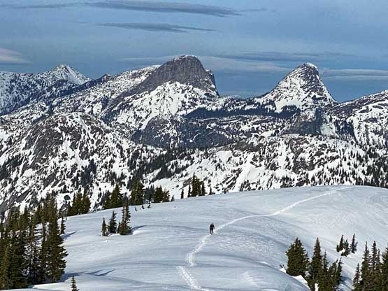
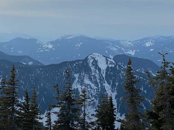
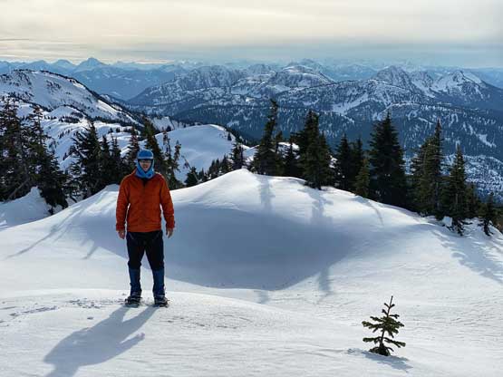
I then led a long and diagonal traversing fashion across the NE slopes of an unnamed 1600-m summit and intersected the north ridge of it. We then continued the traversing mode across the NW face of this summit to the west ridge, before making a steep 150-m drop into the saddle NE of “Ladner Mountain”. This section of the descent was unavoidable for any route that comes up from Box Canyon side but asides this, I think we nailed the route selection by finding a line that involves the least amount of up-and-downs. To ascend out of this deep saddle we had only one zone of steep and open slope to negotiate, around 1500 m and then we topped out onto an aesthetic position on the North/East Ridge system of our objective. Seeing the route ahead being mostly mellow we made the decision to ditch ice axe, crampons and some extra food/water. The rest of the ascent to the summit was just a long plod with some up-and-downs especially near the summit. There’s only one steep roll on the east section of this N/E Ridge system worth noting.

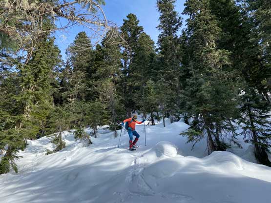

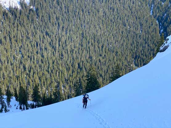


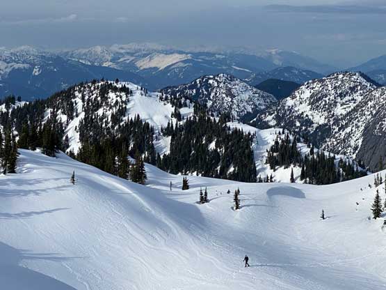


Due to the length of this trip, the complicated route-finding and the late start we weren’t doing particularly good on time, so we had to hurry up on the descent to get off the difficult sections before dark. We talked about a few alternative options but in the end decided to retrace the route by following the exact tracks we just made. In no time we descended back to where we ditched gears and another long break later we made a fast plunge back down into that deep saddle. The 150-m re-climb was surely not inspiring, but didn’t take too long. We snowshoed back across the NW and NE Faces of that 1600-m bump and then donned crampons for the steep traverse around 1300 m level. The strap-on crampons did not work too well for Brano but he eventually managed to just tackle this entire traverse on snowshoes. That was an impressive feat considering he’s not really a snowshoeer and did not own the best snowshoes neither. Near the end of this traverse I led a line slightly lower than the one we took to shave off some unnecessary up-and-downs. The rest of the descent was uneventful and we eventually turned on the head-lamps just before entering the first short-cut. We took the snowshoes off at 1050 m and easily plunged back to the parking lot.


Our round trip time was under 9.5 hours on a reasonably steady pace, which was basically as expected. If I didn’t stupidly leave the phone in the truck in the morning we could have easily finished this ascent without the need of head-lamps. Unfortunately I made another mistake at that carpool location by taking one of Brano’s trekking poles instead of mine, so a day later I had to drive to Vancouver to swap that pole. By now I’ve finished this group of remote and mysterious peaks sandwiched between the lower Coquihalla Highway and Fraser Canyon – Jorgenson, Ogilvie, Squeah, Spider and Ladner. All of them had very little beta on the internet and in fact, four of which were done via exploratory routes with no reference whatsoever.
