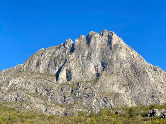
El Toro (Potrero Chico)
January 30, 2023
1480m
Nuevo León, México
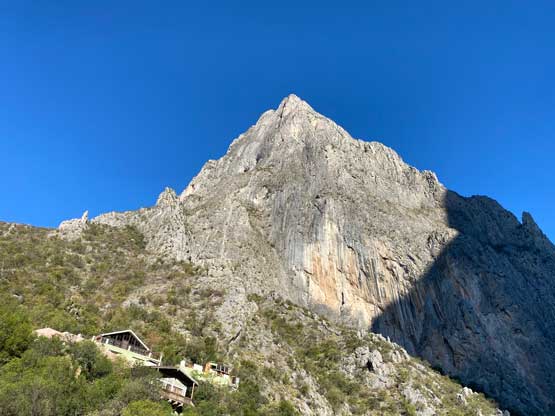
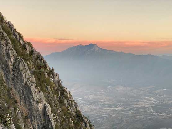
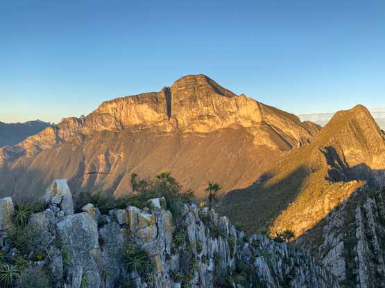
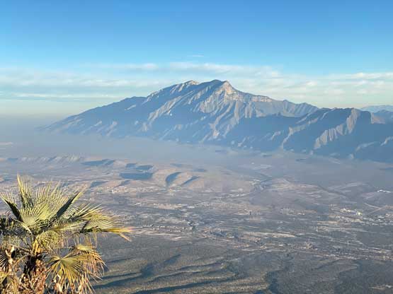
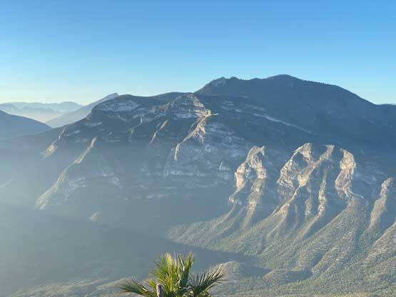
“El Toro” means “the bull” in English but in this case it refers to the iconic limestone peak that rises almost 1000 vertical meters above the climbing area of Potrero Chico in Nuevo León state of México. The rock climbing in this area is world class. A route called El Sendero Luminoso (“the shining path” in English) that runs the entire course of El Toro’s NE Buttress to the summit made the area even more famous through Alex Honnold’s free solo a dozen or so years ago. At the time, prior to Honnold’s solo of El Capitan, that was the hardest ropeless climb made in history. I’m obviously not a rock climber so I shamefully did not learn about this peak’s significance until after summitting. In fact I wouldn’t even notice this peak if not because of Elise’s suggestion.
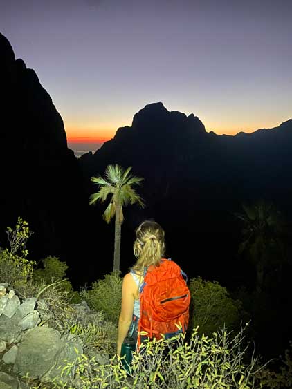
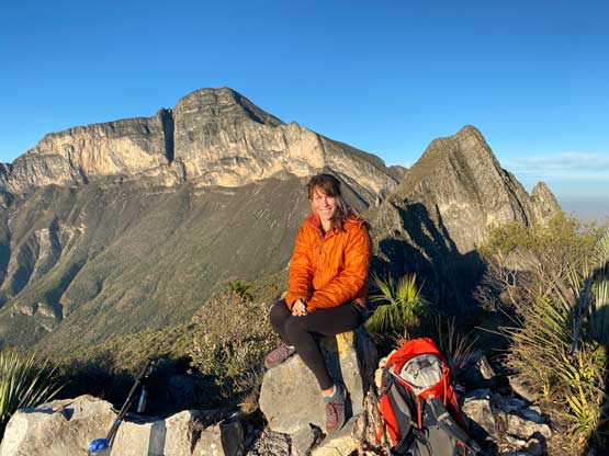
Elise had already done one climbing trip in Potrero Chico and suggested that we should aim to summit El Toro at sunrise in the morning of my departure day. We had climbed Picachos El Fraile and made exploratory ascents of Cerro La Aguja Grande and Cerro La Aguja Chiquita in the previous two days. My flight was at 1:15 pm and I needed to be back in Monterrey airport no later than 11 am. With a bit of rushing I figured it’s definitely feasible. This peak was not on peakbagger.com so I had to manually add it in. Checking the topographical maps while putting in some numerical data I felt depressed as it doesn’t really boast much prominence at all, but I couldn’t come up with a better alternative after all. In the end I was darn glad that I went for El Toro as this ascent proved once again, that the concept of “prominence” isn’t making sense all the time. El Toro is the least prominent peak I did in the 3 days but is the hardest and the most memorable. The profile of the NE Face is also the most iconic and this is also the most internationally famous one thank to the rock climbing routes. This area is just not as well-known for peak-bagging…
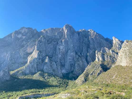
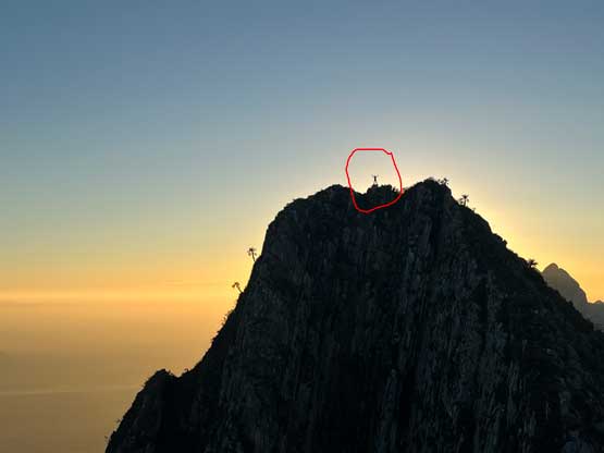
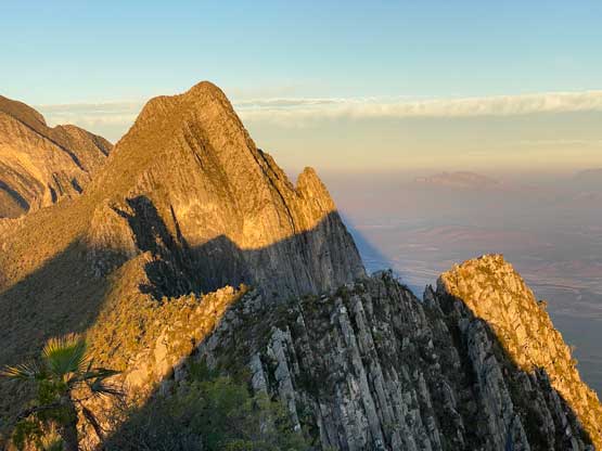
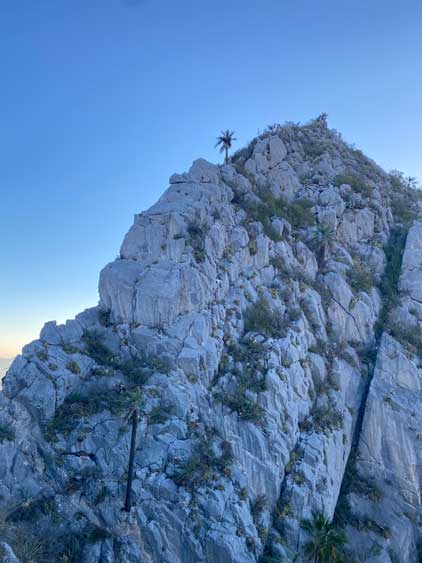
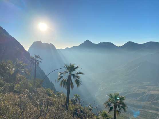
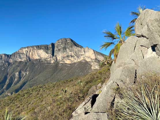
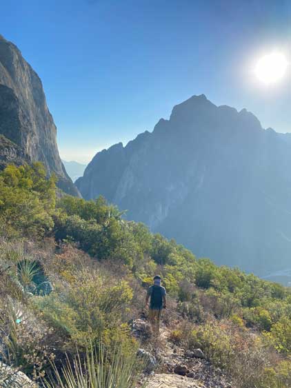
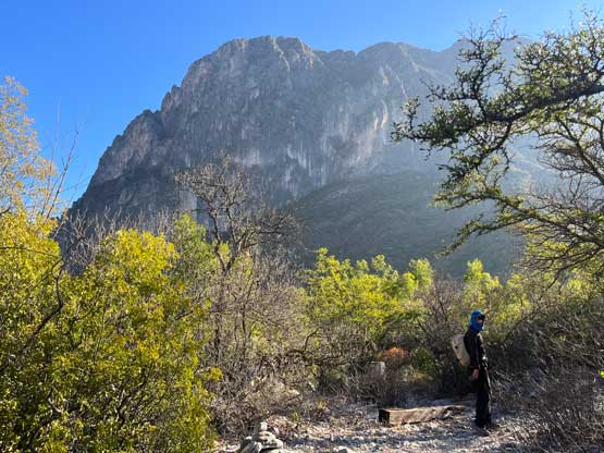
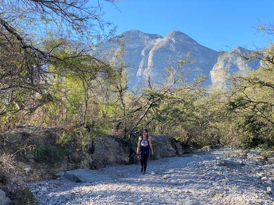
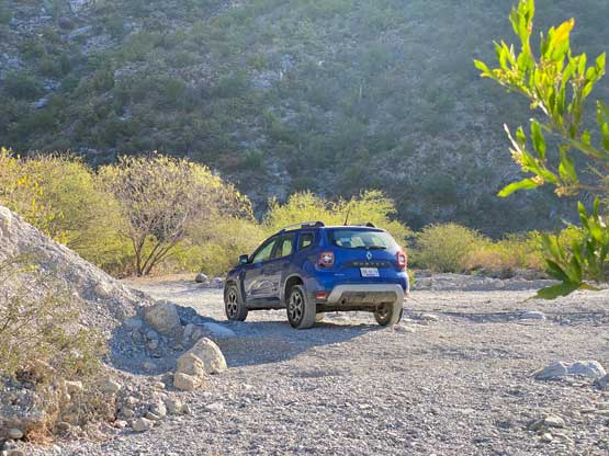
It’s also worth noting that the exact location of El Toro’s summit is loosely defined and arbitrary. The peak technically has only about 80 m prominence so the prominence nerds can argue that it’s a mere bump on the east ridge extension of Cerro La Palmitosa (P600m) regardless where the summit actually is, but to me a peak is a peak and I wanted things to be precise. A trail called “El Toro” goes up onto the ridge crest and one can easily scramble eastwards to a highpoint. I believe that’s the spot where 99% if not 99.9% of the hikers opt to stop and claim where the summit of El Toro is, but there’s clearly a taller peak a few hundred meters further east and that’s the high point where the route El Sendero Luminoso tops out. To get to this higher point requires low 5th class climbing and that’s beyond the pay grade of the averaged hikers. On the internet it seems like the first (ridge) high point is referred as El Toro but as a peak-bagger I needed to climb the higher summit just to be sure. Of course I did not come up there with the said knowledge and only managed to learn the topography after seeing it through my own eyes. We all expected this to be a simple walk-up, so we didn’t bring a rope nor gears. The contour lines on the Gaia topo are also extremely wrong and to further complicate things, the summit is incorrectly labelled to a 3rd high point WEST of the spot where the trail tops out onto the ridge… In any case Elise and I along with Elise’s friend Barak left the comfort of the hostel at 5 am and drove the rental vehicle to the trail-head, about 10 minutes away. The driving was on dirt roads but was straightforward.

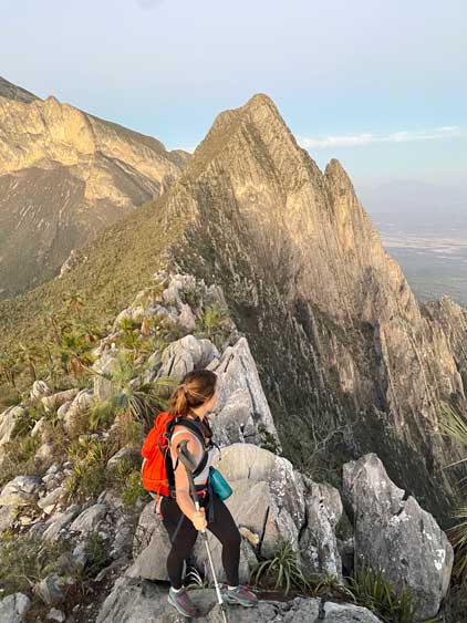
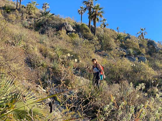
Barak had done this hike numerous times so he naturally became our guide for the initial confusing-ish stretch through a dry wash. There wasn’t any designated spot to park so I just parked at the start of the wash after making sure I wasn’t blocking the road. The actual trail-head was about 200 m into the wash and was well signed. The quality of the trail was quite good, at least for the lower half where the grade wasn’t too steep. The trail was wide enough that we weren’t brushing against the thorny plants. About halfway up the terrain became steep and we started to encounter scrambling steps here and there. The trail also braided out and we sometimes had numerous options to choose from. We on purposely ascended on a slower pace since we started more than 2 hours before sunrise and we didn’t want to make the summit in the dark. About 50 m under the ridge crest we passed the trail junction to “Pico Viatores” which is another bump along the east ridge extension of Cerro La Palmitosa. I would have liked to bag that one too but we didn’t have enough time on this day, so we carried on to the ridge crest and scrambled easily to the “summit” of El Toro. I had already noticed that taller summit further along the ridge and started to question myself if I should make my way there as well. Elise said that she had to wait for Barak so I dropped the backpack and hopefully could make a quick dash to that taller peak and back. The terrain appeared dauntingly difficult but at least I had to try.

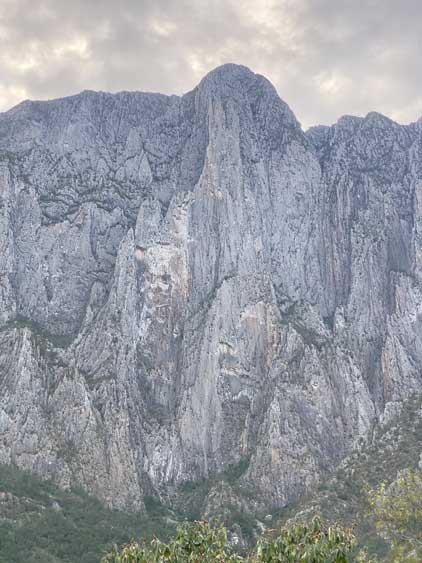
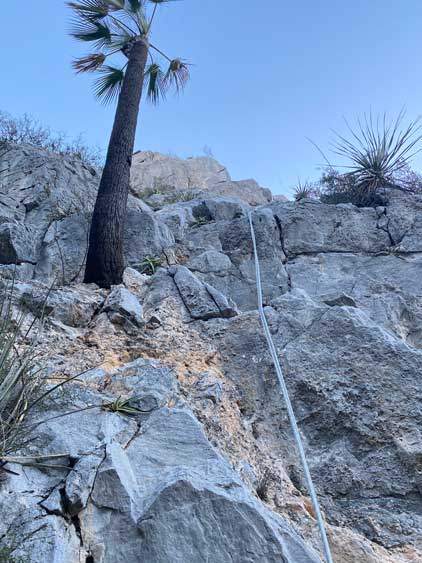
This was still pre-dawn and I gave myself at most 1 hour to traverse there and back. There’s more descending than I thought to reach the saddle but I also found a path here and there which indicated people had definitely come this way. The descent down into the notch was not difficult but the re-ascent out of the notch was the crux. There’s a fixed rope dangling and I could also spot several climbing bolts indicating the terrain was definitely 5th class. The pitch didn’t look too ridiculous so I went directly to give it a try. A few moves later I pulled the plug and down-climbed and determined that was beyond what I would consider to free solo. I then opted to try the ridge but the terrain was even harder and more exposed, so I should either turn around or go back to give that 5th class pitch another try. I opted for the latter. This time I spotted a bushy ledge to “cut into” the pitch while skipping the first few moves so I went for that. The result was some damage to my thins from the cacti but I successfully stepped into the pitch a few meters above the ground. There were only 2 or 3 more technical moves with severe exposure and I spent about 10 minutes to figure out the sequence and to make sure I could definitely down-climb had I committed. I ended up deciding to grab and haul the batman rope for some added assistance and made it work.


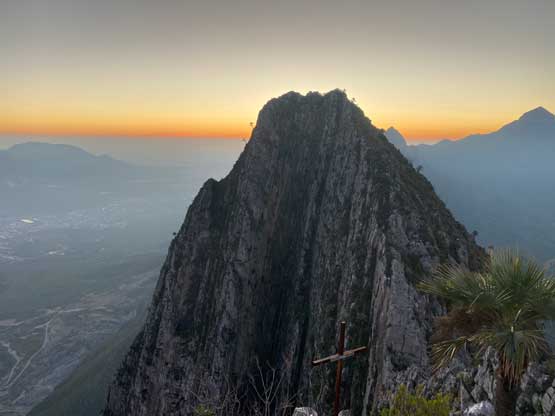
With the crux behind me I was committed to make the ascent even though the terrain above me was nowhere “easy”. I had no idea what else to expect so the solution was to break the entire task down to the immediate steps above me. For a while I mostly dealt with 3rd class terrain with thorny plants but I did encounter a few more 4th to low 5th class moves. Thankfully the limestone was grippy and I pulled myself through without much hesitation. I did look back to make sure I could remember that particular spot on the descent. I did not encounter further difficulty on the upper route and I actually came across paths and cairns which again indicated this higher peak was more popular than I thought. Indeed, those who topped out on El Sendero Luminoso would have to descend this route and that’s probably why they had left a fixed rope there. The only problem was that I had left the poles behind so it’s even more difficult to manage the thorny plants. Instead of just the cacti I started to encounter the cat’s claws which was far worse. My shins were quite destroyed by this ascent and I also accidently touched some cactus balls while grabbing holds.

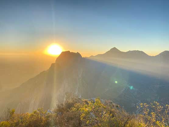
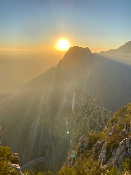

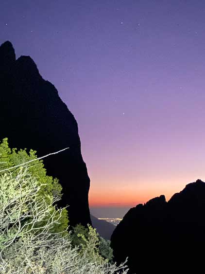
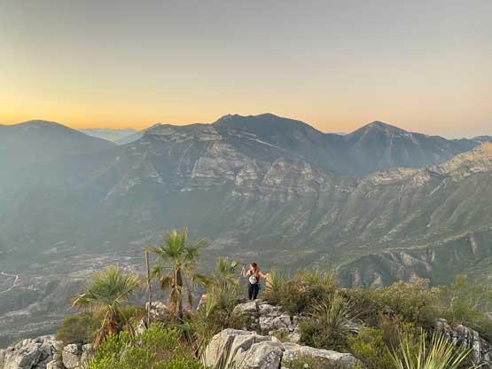
I topped out onto the true summit minutes after the actual sunrise and immediately went down. I wanted to down-climb as fast as I could to take advantage of my fresh memory. Indeed I could remember where exactly to go and where exactly were the technical steps. That upper 4th/low 5th class step felt actually easier on the descent whereas the actual crux pitch with the rope wasn’t too bad neither. At the bottom of the pitch I opted to batman down that rope instead of reversing that bushy ledge to save my shins from further damages. I wasn’t super comfortable to lower myself down on a rope using just arm strength but for made it work nonetheless. I then rushed back to the “ridge summit”. Elise was waiting and Barak had already opted to descend earlier. Elise and I caught up with Barak about halfway down and the rest of the descent was uneventful but scenic.

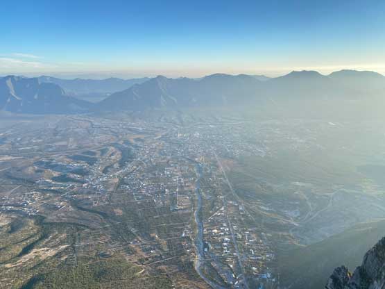
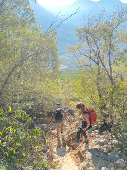


I hastily repacked the duffle and the carry-on bag at the trail-head while waiting for everyone showed up and then drove us back to the hostel in Hidalgo. I earned myself about half an hour’s time to take a shower and to make some updates on the Socials before taking off for the drive to Monterrey airport. In retrospect I should have skipped the Socials updates as now I had to rush a little bit. I forgot the Google’s time estimate does not include the traffic delays and there were certainly some traffics. I also had to remind myself to not take too much risk driving as I did not purchase any insurance. Thankfully my driving skills had definitely improved since my first visit to Mexico in 2018, that even while driving fast I did not feel uncomfortable. I actually drove past most of the other vehicles on the highway and made to the rental car’s return at exactly 11 am as I promised them. The paper work was easy and I took their shuttle to the airport. The American Airline had sent me some emails warning against “severe winter weather” in Dallas so I never knew if I was actually able to go home but the flights turned out to be on-time. I eventually arrived in Vancouver at 9 pm and got back home at 11 pm, and that concluded this Monterrey area smash-and-grab peak-bagging trip.