Bagpipe Peak
February 11, 2021
1657m
Squamish / Stawamus-Indian FSR, BC
“Bagpipe Peak” is the highest summit in Fanning Range that runs from Mt. Seymour all the way to Squamish but the name of this peak is unofficial and was randomly assigned by bivouac.com. I’m not a fan of “bivouac names” but in this particular case the name has been reasonably adopted and used on the internet. This peak also boasts over 600 m prominence. The ascent of this peak is on the other hand, a rare feat, especially since the deactivation of Furry Creek and Mountain Lake Hut access. Just getting to Mountain Lake is not an easy fair these days and let along making a trek over to Bagpipe Peak. To get this peak as a day-trip required some creative thinking. Matt Juhasz proposed a route from Stawamus-Indian FSR that significantly shortened the distance but the forested travel required a thick snowpack to cover the bushes. Winter and spring would be the only feasible time. The only uncertainly was the status of the road but Matt had seen a report staying the road was “plowed”.
The original plan for this trip was actually Hixon Peak to take advantage of the road being “plowed” although I didn’t give a high hope on that. There were more than a few backup plans including Bagpipe Peak down on that road so I also didn’t worry about it neither. Matt and I left North Vancouver at around 6 am and got onto the Stawamus-Indian FSR just after daybreak. The road had a few patches of water ice near Shannon Creek FSR turn-off and then became compact snow after 400 m elevation. The road did seem to get reasonable amount of traffics with a lot of tire tracks. Another few kilometers later we realized this road was definitely not “plowed” but we also didn’t lose hope as the tire tracks continued. The tire tracks eventually stopped shortly after the pass at 850 m elevation so Hixon Peak was out. However, being able to drive to the pass had positioned us well for Bagpipe Peak. Matt had done a great job driving us there in his full sized truck. I don’t think my Tacoma would even have a chance on a few steep hills.
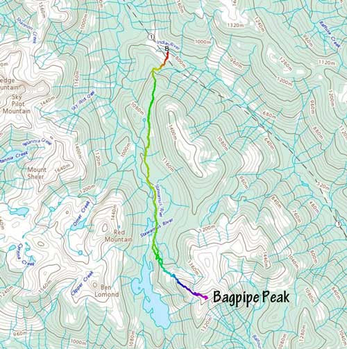
Bagpipe Peak from Stawamus-Indian FSR. GPX DL
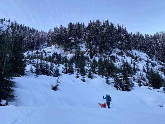
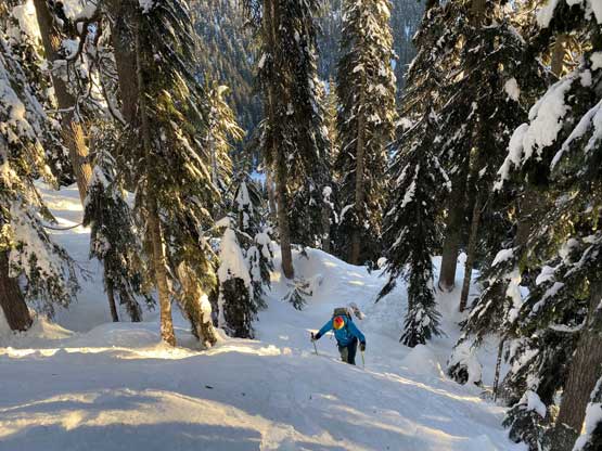
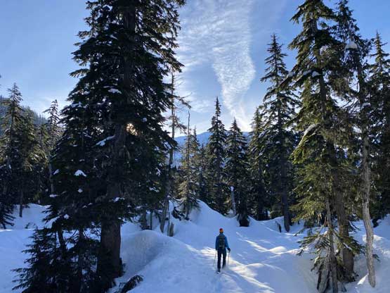
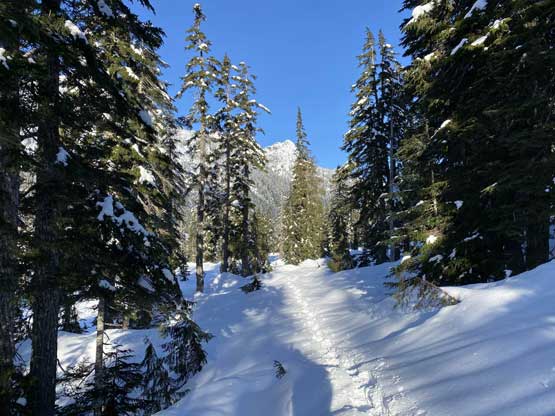
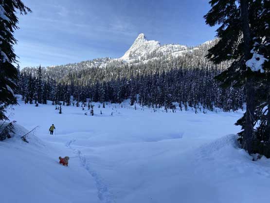
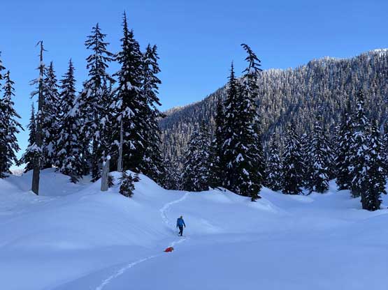
The snowshoes were strapped on right from the truck. We followed a spur road for a short distance then ascended an open cut-block into some steep forest. The first stage of this route was to gain a bench traversing across the west side of a forested summit called “Thistle Peak” or “Maggie’s Bump”. This stretch had a few steep rolls that required some snowshoeing techniques as well as some route-finding. Once onto the bench we easily traversed/descended across the west side of that sub-peak towards some open meadows (covered in 3+ meters of snow) on the east side of Red Mountain. This traversing bench involved a few open slopes as well as close to 200 m of elevation loss. The plod to the base of Bagpipe Peak’s NW Ridge was longer than it looked with unavoidable micro-terrain and up-and-downs. We also discovered a few deep holes in the snow that resembled crevasses on a glacier…
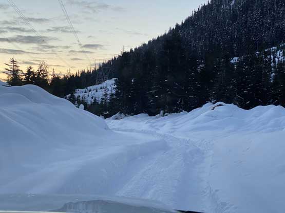
Just an idea of the road condition to the pass. Definitely not plowed…
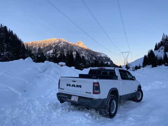
Matt’s Truck parked at the pass… 850 m elevation
Heading into the cut-block

Matt leading us into the steep forest

An obligatory shot of the morning sun beams through trees

From the edge of the old growth, looking back. Mt. Baldwin somewhere there
The typical going in the first few hundred meters of gain
A brief break from the unrelenting grunt
Me ascending a steep roll.
Matt climbing up the same roll

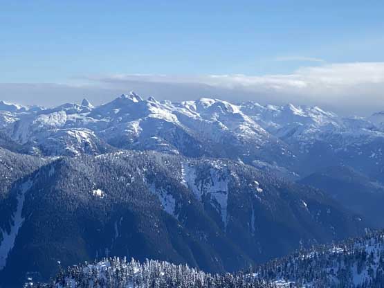
Our first view of Ledge Mountain, with Sky Pilot behind not visible

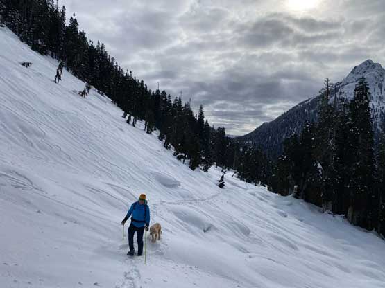
Me snowshoeing across one of the few open slopes on this traversing bench

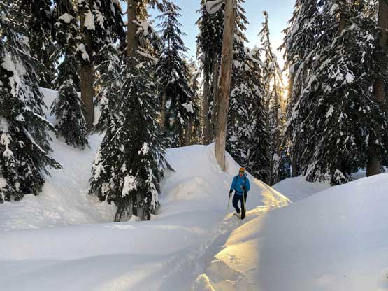
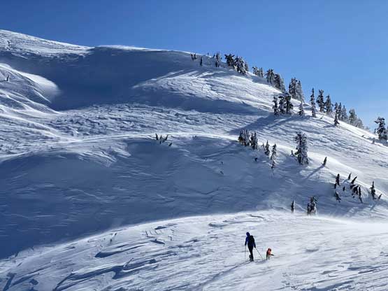
Matt traversing another open slope with Red Mountain ahead
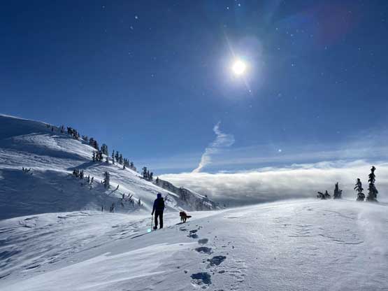
At this point we had descended down into the meadows area

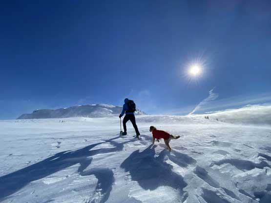
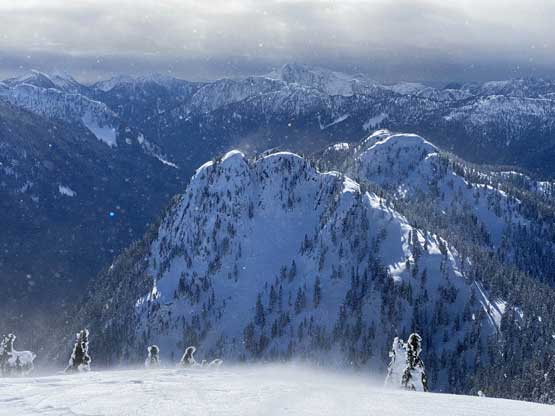
Our objective – Bagpipe Peak ahead
Looking back at our tracks. This was the brief moment we got the sun
Me heading into another meadow with Ben Lomond ahead
Matt descending into this meadows zone
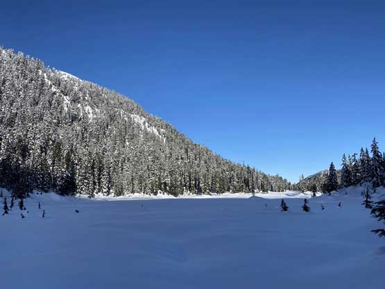
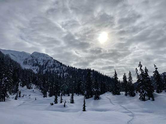
Looking back. There is a tarn here – officially named Stawamus Lake.
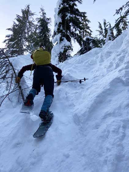
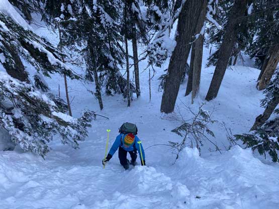
The ascent of the NW Ridge started with some easy terrain but the trail-breaking was tiresome. One minor but vertical cliff band forced us traversing climber’s left to bypass and then we could see the upper ridge and the howling Arctic outflow winds. The upper ridge looked steep and the wind looked brutal. Once the trees thinned out I had to stop to put on my balaclava and sunglasses to protect my face. Matt was able to do this entire ascent without face cover and I don’t know how he did it. The uppermost 300 m had wind chill temperature easily dipping to -30 degrees. We encountered at least half a dozen steep rolls (40+ degrees) but none of them was overly long nor exposed. The summit was a bit farther than anticipated but I also knew we must gain 600 vertical meters on this ridge, so the few false summits didn’t surprise me. Matt and Twig went down immediately after hitting the summit. I stayed a little longer to take some obligatory scenery photos. The views were needless to say, pretty impressive but it’s too cold to linger.

Matt wallowing up the lower portions of the NW Ridge.

Looking north at “Thistle Peak” or “Maggie Bump”

Matt leading up another roll of steep and unconsolidated shit
Matt approaching the steepest roll on this ascent.

Looking back at Ben Lomond

The wind had fully picked up at this stage

It’s going to become quite miserable but let’s embrace it
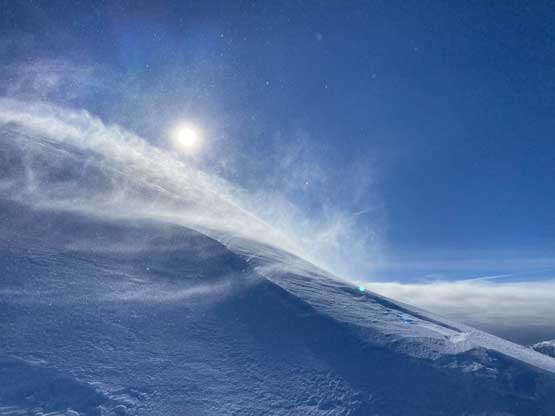
Just a picture to show the Arctic outflow winds.

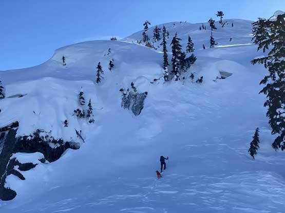
Matt and Twig plodding up with Sky Pilot Mountain behind
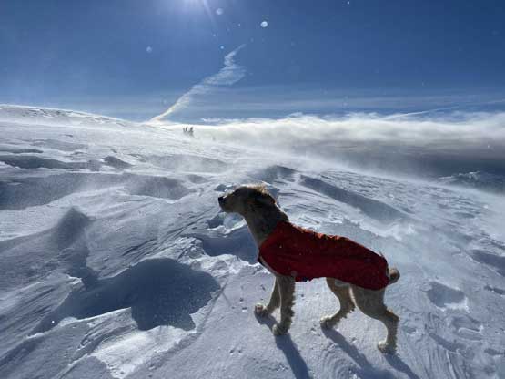
I don’t know whether Twig was having a fun time or not but he’s a tough boy…
Matt and Twig leading the way.
One roll after another.

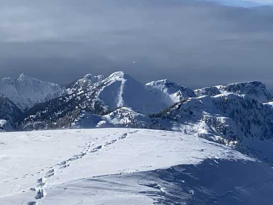
This is looking north. “Haggis Peak” right of center in foreground
Approaching the last dip before the final push
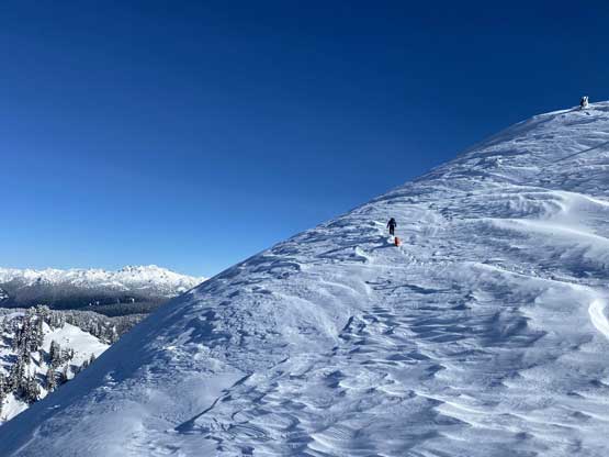
Matt pushing ahead for the last slope before the summit
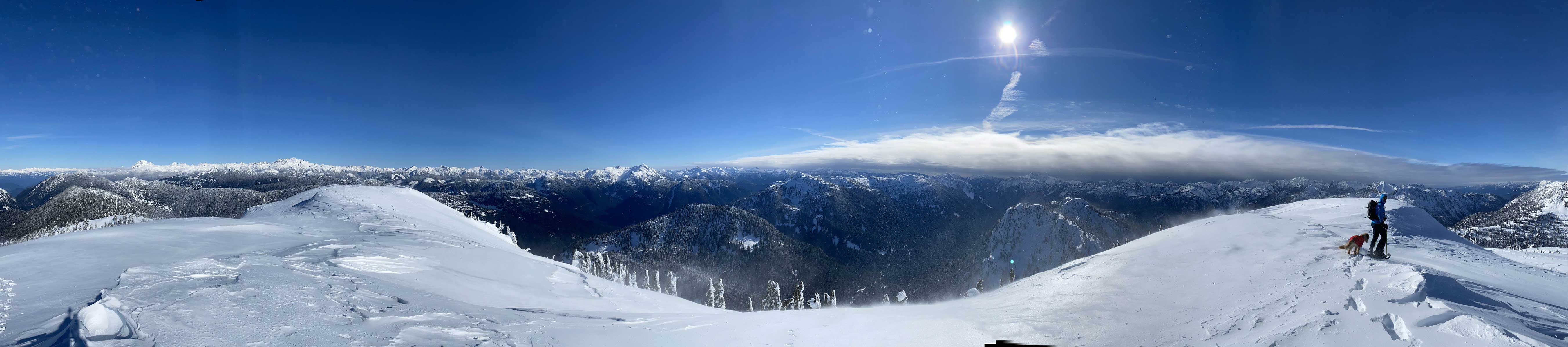
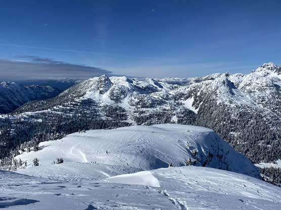
Partial Summit Panorama from Bagpipe Peak. Click to view large size.
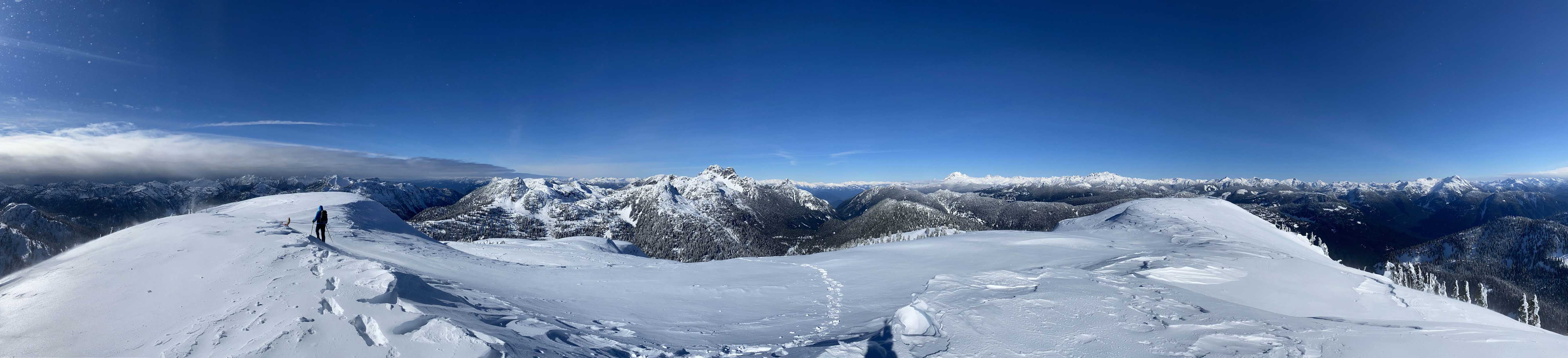
Partial Summit Panorama from Bagpipe Peak. Click to view large size.

Mt. Jukes in the foreground another remote peak in Fanning Range
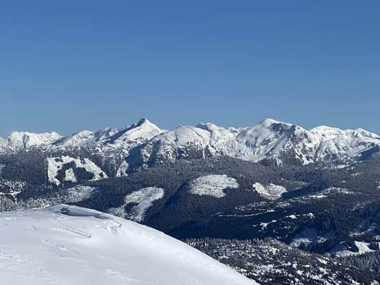
Pinecone Peak, Seed Peak and Mt. Gillespie
A closer look at Meslilloet Mountain the closest glaciated peak to Vancouver
A zoomed-in view towards the Five Fingers on Coquitlam-Pitt Divide
Capilano Mountain from an unusual point of view
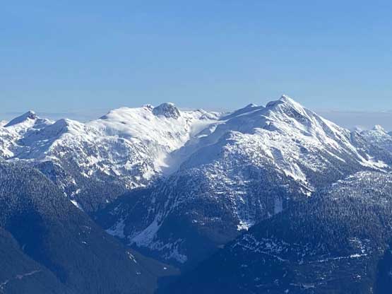
Ben Lomond in front of the Mountain Lake Hut area

Sky Pilot Mountain and Ledge Mountain now can be easily distinguished

Mt. Habrich looms above Stawamus River valley where we came from

“Anif Peak” in foreground with Squamish-Cheakamus Divide on skyline
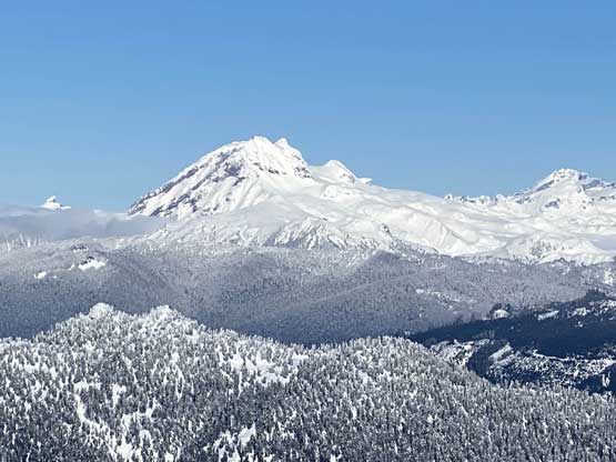
A zoomed-in view of Atwell Peak/Mt. Garibaldi massif

A head-on view of Mamquam Mountain
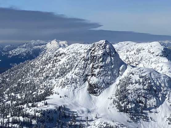
This peak in foreground to the south of Bagpipe Peak is unnamed

The familiar peaks in North Shore Mountains on the skyline
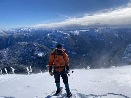
Me on the summit of Bagpipe Peak
On the descent we mostly just retraced out steps down the NW Ridge with a few variations lower down. While plunging down the upper rolls I nearly triggered two windslabs with whumps and shooting cracks all over the places. I adjusted the route selection a little bit and didn’t set off anything. Lower down Matt led us down a more efficient line to reach the meadows. The rest of the plod out was mostly uneventful although the elevation regain felt frustrating.
Time to head down.

Plodding down the upper ridge we were facing against the wind

Matt descending in front of Red Mountain

Me finishing one of the steepest roll

A while later we were down to the valley
Looking back at the NW Ridge of Bagpipe Peak on the skyline

You sure don’t want to fall into these cracks…
Matt and Twig on one of the few steep traverses

A section of mature forest. It was quite icy here

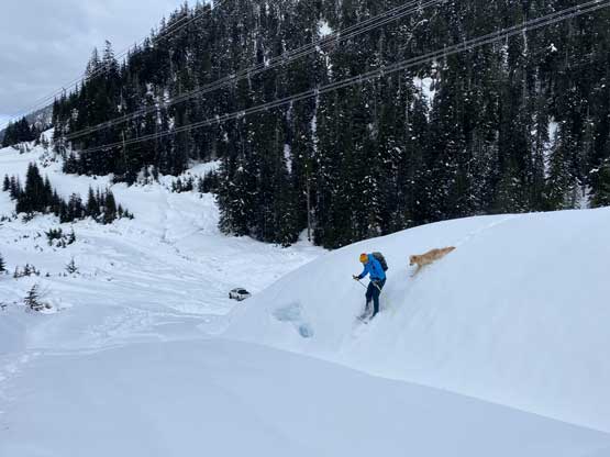
Finishing another stretch of steep traverse across an open slope

The last few hundred vertical meters of descent was very steep
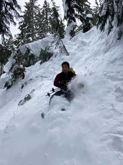
The best way to get down this roll was glissading
Matt went for a snowshoe jump near the end
Our round trip time was 6 hours 20 minutes. This was not bad considering the amount of trail-breaking and the harsh weather we dealt with. Matt again, did a great job driving us down the snowy and icy road back into Squamish. Instead of rushing the way home we decided to have a late lunch in Squamish and eventually I got back home at dinner time. I had taken the full day off since the original objective was Hixon Peak, so no work commitment in the evening.
