Cottonwood Peak
November 10, 2019
2357m
Stein Valley / Duffey Lake Road, BC
“Cottonwood Peak” is an unofficial name to the highest point on the ridge east of Gott Peak and Blowdown Pass in Stein Valley Provincial Park. The name of this peak is likely derived from the proximity to Cottonwood Creek which is one of the zillion tributaries of Stein River but other than bivouac.com I found no other reference. The access of this area is not from the Stein River trail system but rather Duffey Lake Road and Blowdown Creek FSR. With a “normal” 4×4 high-clearance vehicle one can drive 10 km up the forestry road but those with ATVs or modified 4×4 vehicles can probably drive all the way to Blowdown Pass. The access of this area is surprisingly easy for “BC standard” and there are numerous easy summits around the pass to keep peak-baggers busy for at least a couple days. “Cottonwood Peak” is by no doubt the least popular objective and I found virtually zero information online, although the proximity to Blowdown Pass means that this peak likely sees more traffic than what appears on the internet.
If not because of Alex’s suggestion I actually wasn’t even aware of this peak so this trip was once again, a pure spontaneous, last-minute decision. I did know a little bit about Gott Peak, and the unofficially-named “Gotcha Peak” and “Notgott Peak” around Blowdown Pass because I’d seen them from the nearby Steep Creek peaks, but the lowest of them, “Cottonwood Peak” hadn’t caught my attention yet. Alex’s the expert of the Duffey zone, that this would be his last peak to bag in the close vicinity. I did do my own research and agreed that the Blowdown Pass area would indeed be a perfect choice for this past Sunday. For the most important, it hadn’t seen any significant precipitation in the last two weeks and it’s abnormal that one could still drive high on logging roads in November. It made perfect sense to take advantage of the lack of snow while we could still drive there.
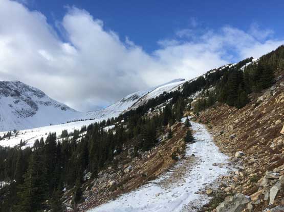
In the morning I picked up Alex from the church in West Vancouver at 5:30 am and made to Pemberton about two hours later. The start of Blowdown Creek FSR is fair a bit of ways down Duffey Lake Road and the forestry road itself was rougher than I thought. There were numerous (shallow) water bars that kept the speed down. None of them presented much trouble to my Tacoma until the last few at around 10 km mark. One particular ditch appeared sketchy but it was the next one that scrapped the bottom of my truck. The last few kilometers were also covered in fresh snow from the previous night but my truck handled it well, even with just stock tires. The tricky ditches were pretty close to the “trail-head” anyway so those without a trusty 4×4 can still park earlier and walk. The weather was overcast with flurries but the forecast was calling for “gradual clearing” throughout the day.
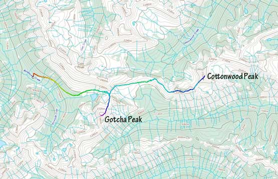
Gottonwood Peak and Gotcha Peak via Blowdown Pass. GPX DL
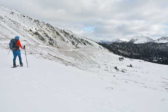
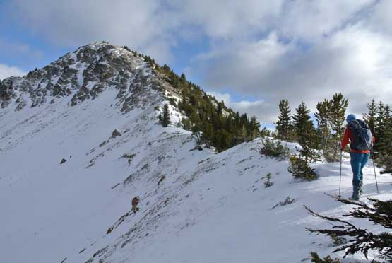
The first couple kilometers on the deactivated road towards Blowdown Pass had lots of slippery rocks and once we hit continuous snow I ditched trail-runners for mountaineering boots. In another kilometer or so we made the call to strap snowshoes on. The snowshoes weren’t needed but we figured that with the extra bits of flotation and traction the plod would be slightly easier than boot-packing. There were of course, many shallow and dry stretches that made snowshoes annoying to say the least, but we did manage to keep the ‘shoes on all the way to Blowdown Pass. The walk to the pass was pretty easy without much worth noting, but expect it to be longer than you think.
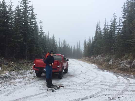
The weather wasn’t great at the start
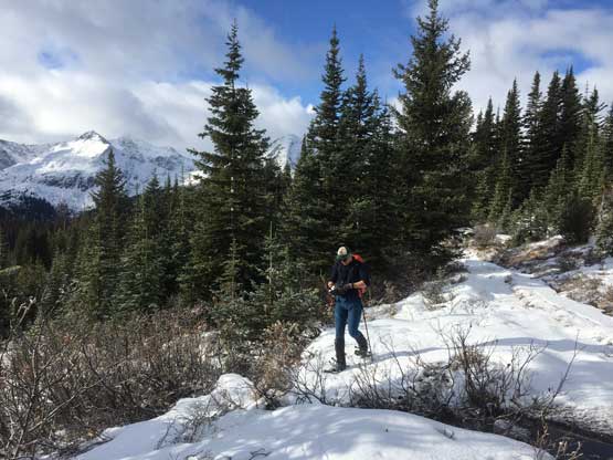
After a few kilometers we strapped snowshoes on
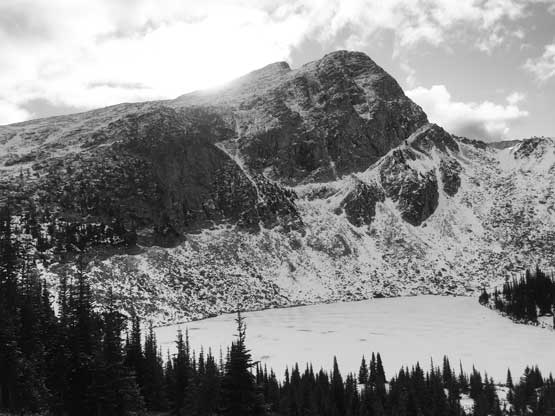
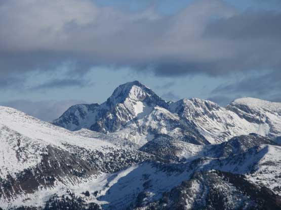
The north face of Gotcha Peak behind an unnamed lake

Alex snowshoeing on the upper spur road

Me snowshoeing towards Blowdown Pass. Photo by Alex R.
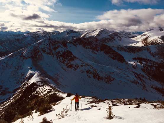
Beyond the pass we continued plodding down the deactivated logging road into the Stein drainage. It really didn’t matter where exactly to leave the road for the bush. The longer we stood on the road the more elevation loss/regain we had to deal with but also the less bushwhacking. It also appeared that hauling snowshoes were no longer needed for the off-trail sections so we ditched the ‘shoes before entering the forest. The bushwhacking was more like a walk in the open forest and in no time we were on the ridge with many bumps to traverse up and over. There was more snow on the ridge than we thought but because of the firm conditions we didn’t regret too much for not hauling snowshoes. There were lots of post-holing but those were much more acceptable than last weekend on Hidden Peak, so no complaint. Once starting gaining elevation towards the first of the two main bumps we could finally stay on mostly wind-scoured terrain with minimal post-holing. The wind also picked up, unfortunately so we had to don some layers.
Me at Blowdown Pass heading into Stein drainage. Photo by Alex R.
We lost quite a bit of elevation on this old road

After a while of bushwhacking we were on the ridge now

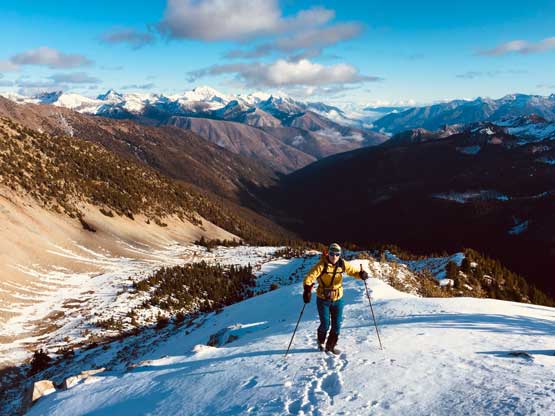
Me heading towards the distant objective. Photo by Alex R.
The first major bump ahead.
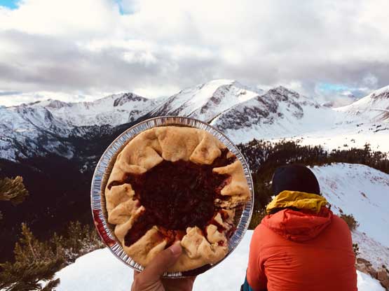
I was lazy to prepare food so just brought a bit pie for the day…
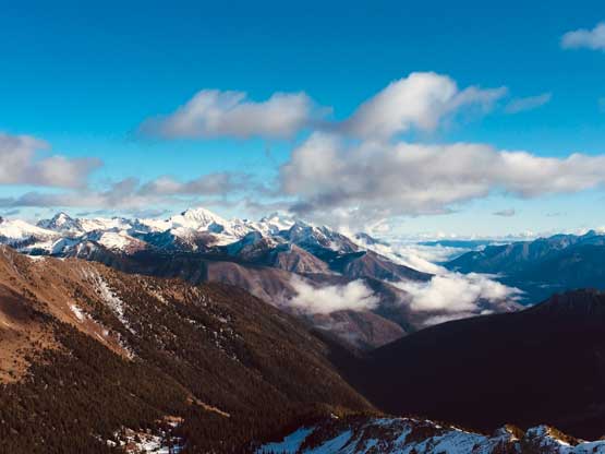
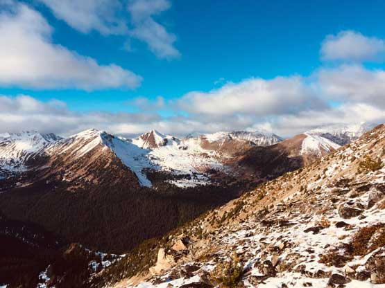
The ascent over the two successive bumps were more scenic than expected. The views were indeed opening up with Skihist Mtn. and Siwhe Mtn. stealing the show looking south and east. There’s about 50 m elevation loss down to the final saddle before Cottonwood Peak along with some brief hands-on scrambling on slick rocks. The rest of the plod up to the summit was trivial and we stayed there for at least half an hour waiting for the clouds to continue lifting.
Me scrambling up the first bump. Photo by Alex R.

Alex scrambling on the wind-scoured dry ground
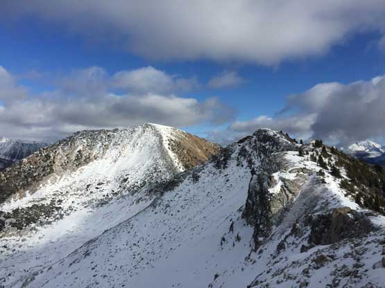
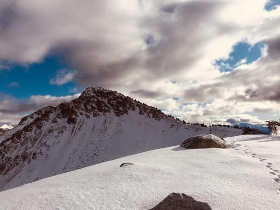
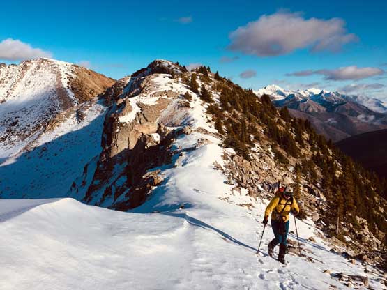
The second bump and the summit of Cottonwood Peak ahead

Alex plodding across the undulating ridge with Stein Valley behind

Looking south towards the massif of Skihist Mountain

The summit of Cottonwood Peak ahead with a major dip
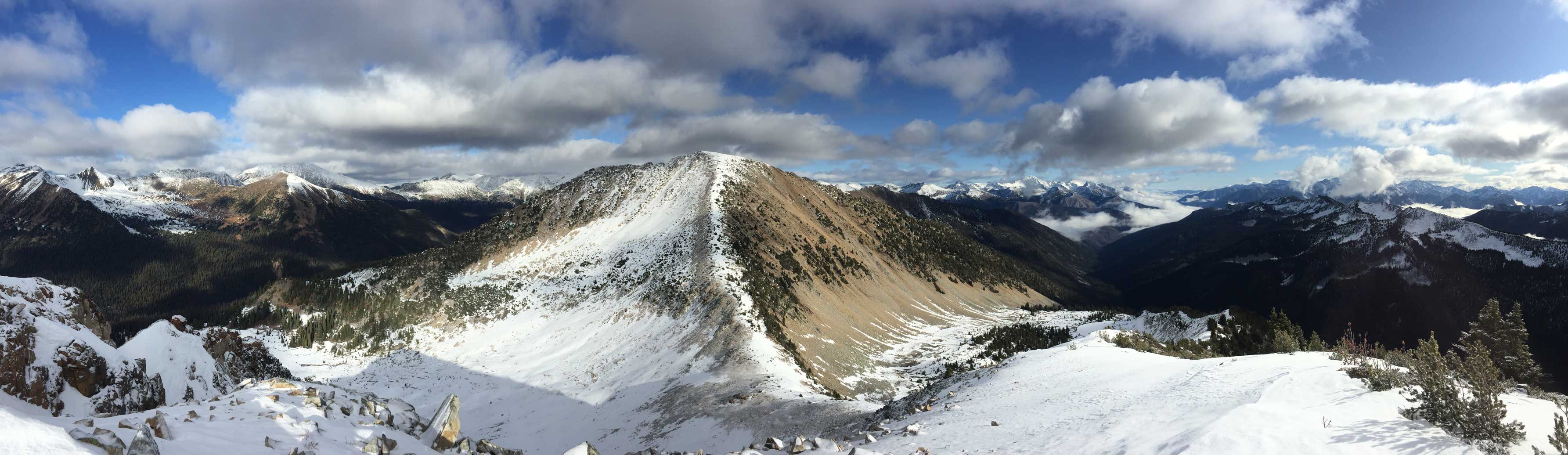
Panorama view from the second-to-last bump. Click to view large size.

Alex plodding up towards the summit.

Partial Summit Panorama from Cottonwood Peak. Click to view large size.
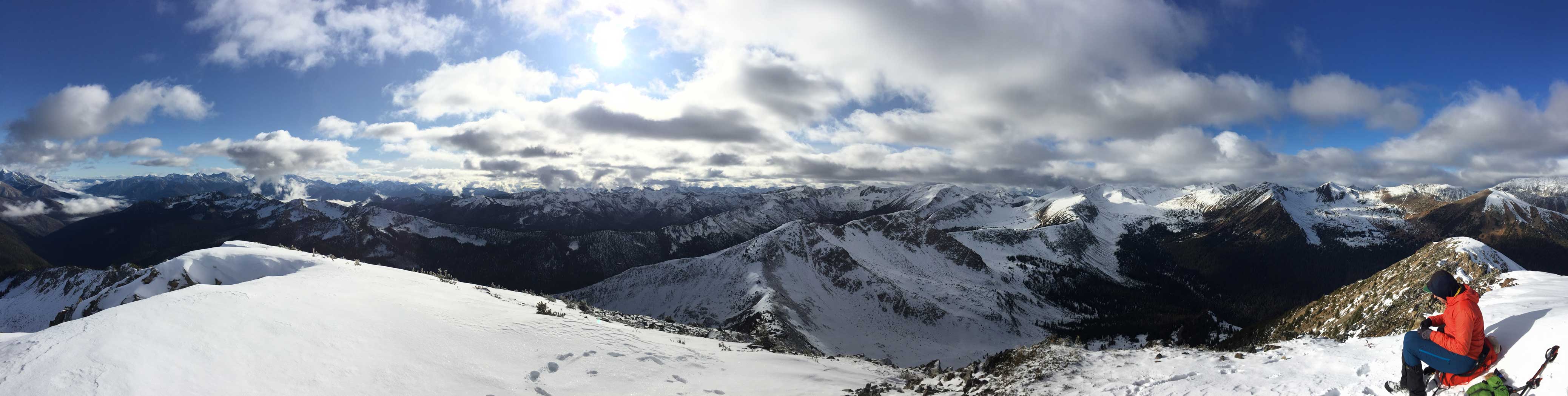
Partial Summit Panorama from Cottonwood Peak. Click to view large size.
“Xavier Peak” to the east on Siwhe massif

A zoomed-in view of Siwhe Mountain

Stein Mountain

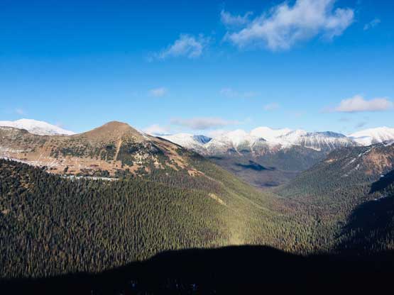
This is a southern view into the meat of Stein Valley

The broad summit in foreground is unnamed
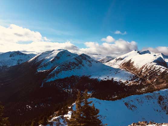
A wider view of Siwhe-Stein Group and Stein Valley
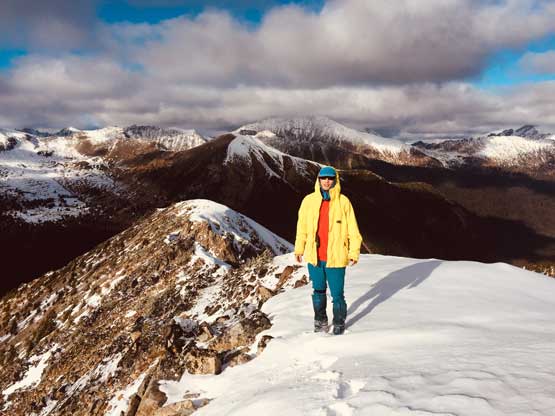
Me on the summit of Cottonwood Peak
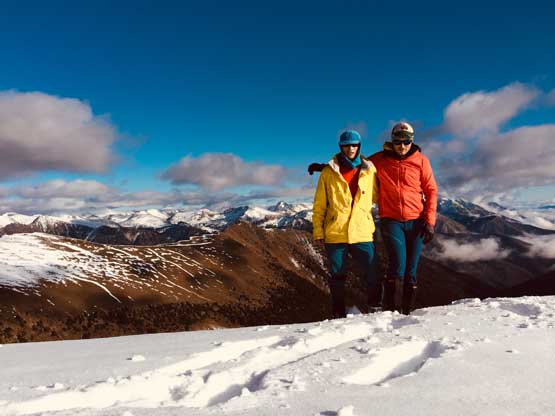
Alex and I on the summit of Cottonwood Peak
The traverse back across the two bumps were actually the highlight for views because the sky was clearing up to become a bluebird late afternoon. We took lots of pictures but also managed to keep a steady pace. The elevation regains were surely annoying, but in such a gorgeous afternoon we did not complain.

Heading down from the summit
There are at least half a dozen summits on the ridge between Gott Peak and Elusive Peak
Alex looks small in the terrain

Down to the saddle between Cottonwood and the subsidiary bump

Regaining elevation back towards the subsidiary bump
The sky’s fully clearing up now
Traversing up and over the bumps

Alex plodding the ridge with Stein Valley as a backdrop

Petlushkwohap Mountain is the second highest in SW BC

These are some uber-remote peaks on the south Stein Divide
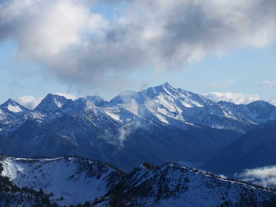
Skihist Mountain finally fully cleared up now – highest in SW BC

Gott Peak and the road we hiked

Me enjoying the scenic ridge traverse. Photo by Alex R.

Me playing with a boulder on the ridge. Photo by Alex R.
Gotcha Peak, Gott Peak and Blowdown Pass

Looking back at the sub-summit we just went over
Taxman Peak left of center and Cottonwood Creek valley

Rita Peak and Strawberry Peak

Looking back towards the summit of Cottonwood Peak (R)

Back down to the road now.

Looking back while plodding back up towards Blowdown Pass
Once back to the road I decided to bag Gotcha Peak since it’s right there. Alex had done it on skis in the past, so opted to wait for me at Blowdown Pass. I agreed with some that the high Stein divide is such an underrated area that offers endless oppourtunity to explore. I previously hadn’t paid much attention to this zone because of the unofficial status of these peaks, but after this trip I think I definitely will come back more often.
