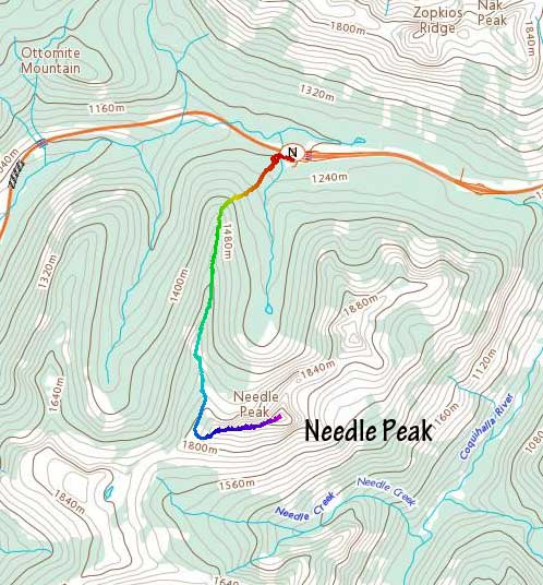
Needle Peak
July 22, 2021
2090m
Coquihalla Pass, BC
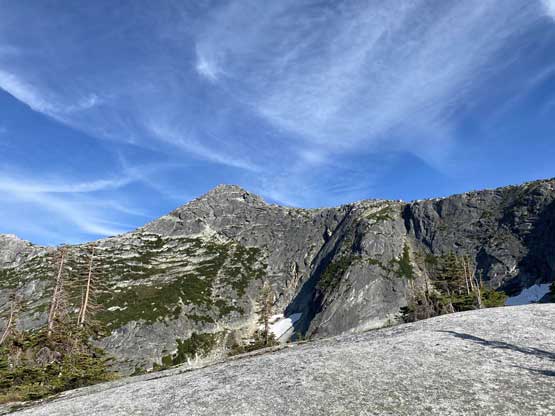
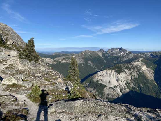
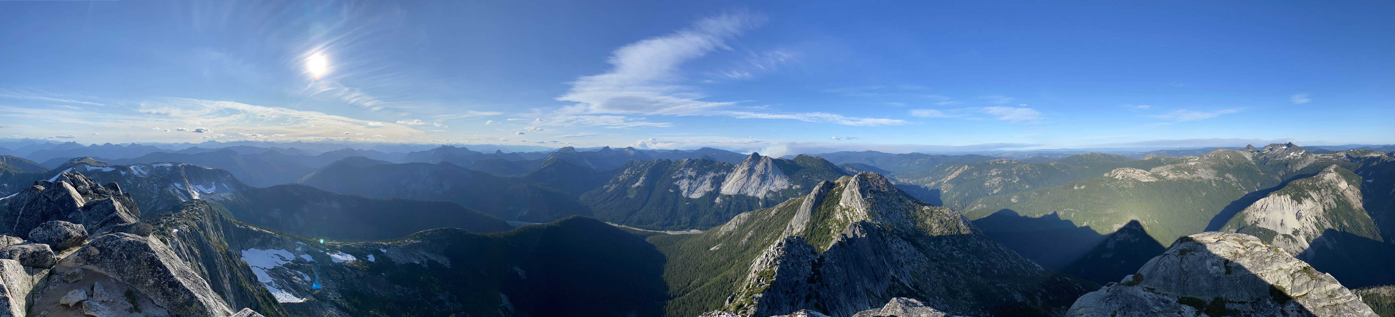
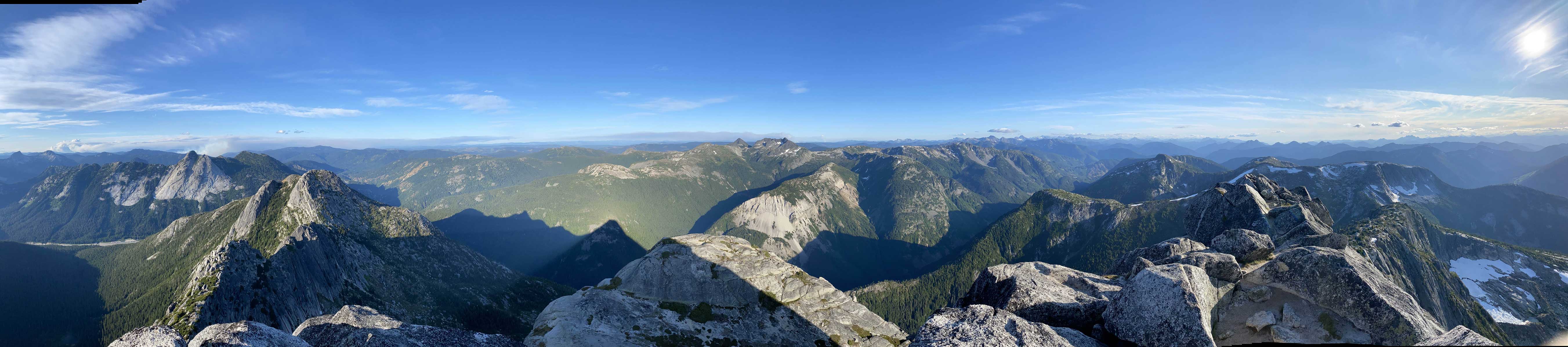
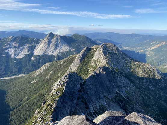
Needle Peak is one of the taller and more prominent summits in the immediate vicinity of Coquihalla Pass and at the same time, with an excellent access trail that goes right up onto the west ridge. This peak also boasts a somewhat iconic profile. The standard route (west ridge) is a pleasant scramble with a few hands-on spots that are nothing difficult, while the north ridge in combine with Markhor-Needle Traverse (class 4) offers a more exciting route to tag this summit. For some reasons I had done almost every peak in this Coquihalla Pass area except for Needle Peak. I even had summitted Markhor Peak in winter and that was 5 years ago. I kept debating about the traverse versus the standard route. To me a “route” doesn’t mean much so in the end I opted for the easy way up. I always thought I’d take some beginners on this hike but at the very end I pulled a spontaneous trigger to hike solo.
It was 2 pm when I made the decision to hike Needle Peak and that would be too late for anyone to join. The plan for the weekend had been pushed back by a day and I definitely didn’t need 3 rest days between trips. I had half a day to make anything worthwhile. Obviously this is not the “right” time of a year to dumpster-dive so I opted to finally finish off Needle Peak even though ideally I wanted a partner for more enjoyments and better photos. The drive out of Lower Mainland was actually not that bad as the traffic was mostly going the opposite direction. I made to Abbotsford in an hour and made to Coquihalla Pass at 5:30 pm. I was prepared to hike with head-lamp on but I figured there’s a decent chance I could finish the hike just before dark.
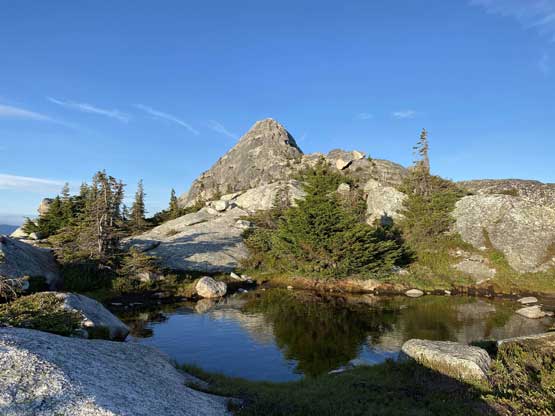
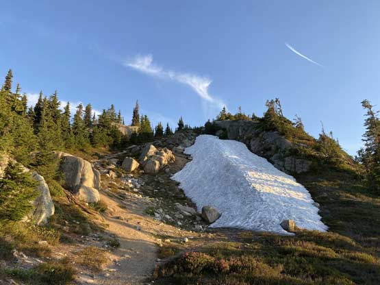
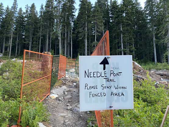
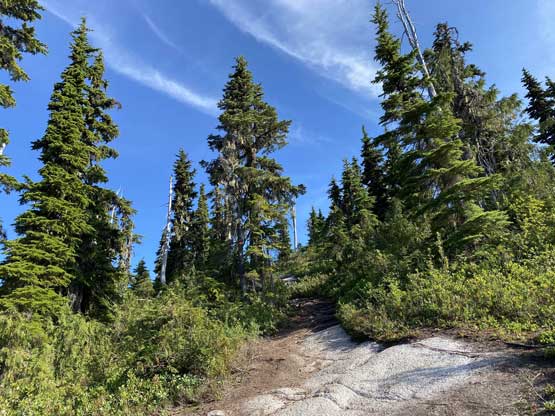
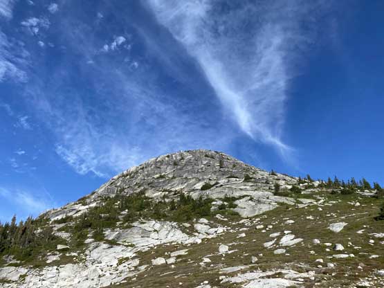
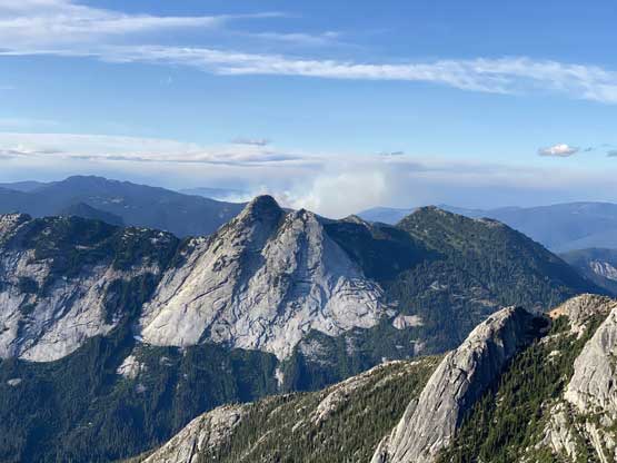
The start of this hike confused me right off the bat as I was not mentally prepared for a construction zone at the trail-head. I somehow wasted 5 minutes searching in the construction site consulting the GPS multiple times and in the end I made a hard dash towards left (east) and intersected the trail at the edge of the work zone. I somehow missed that obvious trail-head turn-off. Once onto the trail there’s nothing magic. I met two separate groups (one large, one small) walking out on various stages of this lower trail. In less than an hour I made onto the lower ridge with some views. I had hiked this trail en route to The Flatiron and Portia Peak a few years ago in late-fall so I knew what exactly to expect. On that trip I was following other people’s tracks on snow. The upper ridge towards Needle Peak’s lower west ridge was prettier at this time of a year as I enjoyed the walking on granite slabs on my trail shoes.


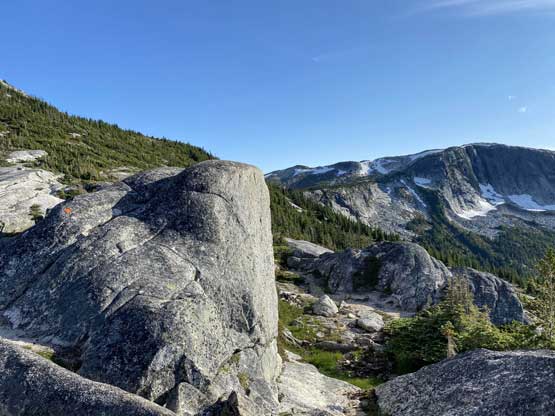
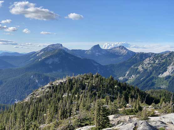


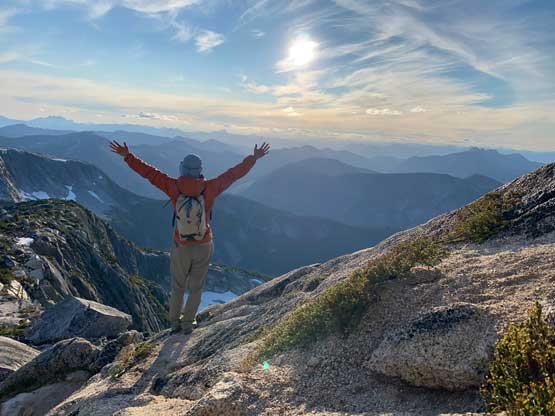
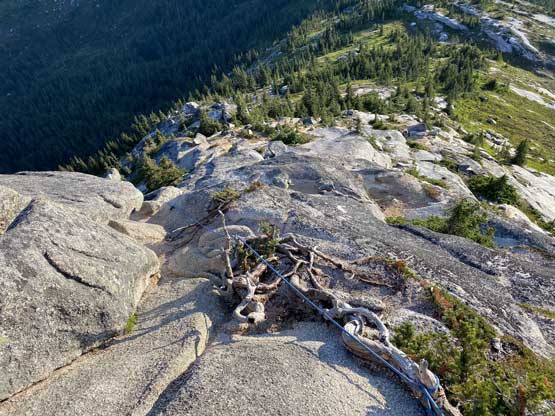
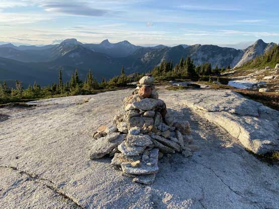
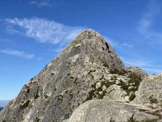
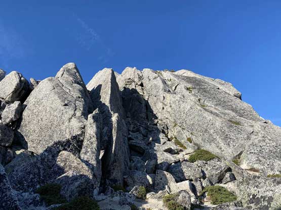
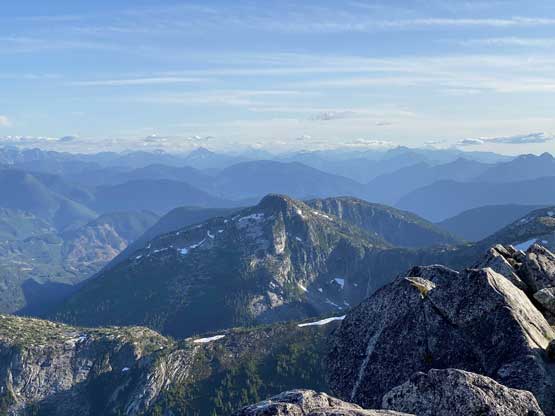
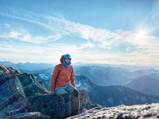
On the lower west ridge I met another group on their way down and that’s it about the traffic on this peak. I’ve heard stories of massive congestion on this route and the key to avoid that is to head up in late afternoon on a weekday. There’s one steep section on the lower ridge that I again, did not pay attention to route-finding. I ended up ascending too far on climber’s right. I knew that was off-route but I was too lazy to back-track so just pulled up a step with a fist jam. I then saw the correct route to my left with a juicy batman rope dangling below. From here it’s a pleasant stroll to the summit block. I paid more attention now and managed to stay on the easiest path up a series of chimneys, climber’s right of the ridge crest. The summit itself was very windy and cold so I didn’t linger too long.


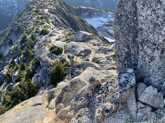
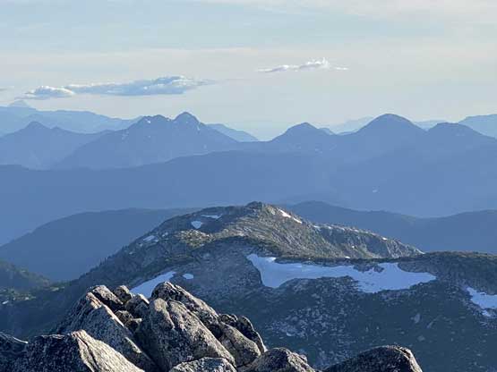

On the descent I took my time playing in the wind trying to take some self-timed photos and it did not turn out as well as I’d hope for. I again, got trapped towards my “wrong route” on the lower section but this time I back-tracked and went down that batman rope area. I did not use that rope because the rope was not dangling down the least steep line I could see. I down-scrambled on skier’s left of the rope. The rest of the hike-out was rather uneventful. I jogged wherever I was on granite slabs because that was pure fun. The steep forested descent at the end was less fun but at least I was still fresh at this point after such a short outing. I made back to the truck with probably 30 minutes of spare before head-lamp time. I had come prepared with pre-bought Tim Hortons so had a late dinner before starting the drive back home. I eventually got back home at midnight and to my surprise, the drive was actually not that tiring.