Isolated Peak
August 3, 2012
2845m
Yoho National Park, BC
About 1 month ago, Andrea asked me to join her group for all 6 scrambles in Little Yoho over 4 days. I was interested in but I had never done an overnight trip yet. Mike Mitchell (Arcturus from ClubTread) also showed his interest and eventually we decided to go as two separate groups. While Andrew had booked the Little Yoho campground for everybody Mike and I would only spend two nights out there, partly due to the lack of camping experience and partly because we figured those peaks could be comfortably bagged in the course of 3 days. All of the proposed ascents except for Whaleback (which was the easiest) are well documented in Alan Kane’s Scrambles in the Canadian Rockies and we’d simply follow the suggested routes.
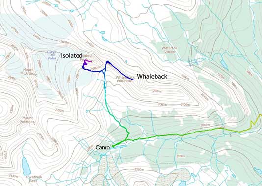
Isolated Peak and Whaleback Mountain standard scramble route
After driving through some rainy weather we arrived at the (busy) parking lot by 9 am and the good news for us was the improving weather. But on the other hand, the approach would be much harder than what I was normally used to in the day-trips… It wasn’t as bad as I thought though (I thought it would be the crux for the entire trip)… But it was still very painful. The Yoho Valley trail was flat and easy to negotiate. In no time we arrived at the Laughing Falls junction. I need to point out here, this approach is very boring and has almost zero view. I’m glad we chose Iceline Trail on the way out. From Laughing Falls, we went up the left branch. A steep 1.6 km switchback section brought us to the upper hanging valley, followed by another 3.5 km nice gradual uphill hike to Stanley Mitchell Hut. The camping ground was 0.3 km past the Hut. A huge relief as we dropped our huge packs and we quickly set up the tents. I was surprised that Andrea’s group hadn’t been here yet. We took a well-deserved lunch break.

After passing this waterfall, we started to gain elevation more aggressively (by hiker’s standard).

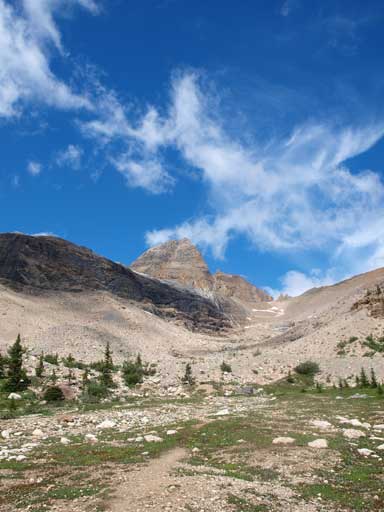
A typical view from the trail.
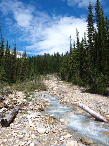
Crossing a stream.
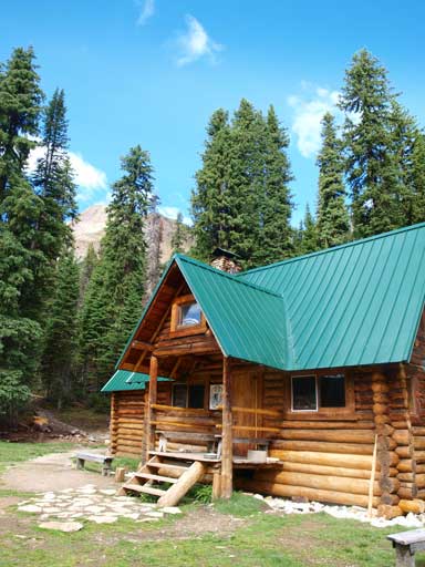
This is Stanley Mitchell Hut

Our campsite and tents
We firstly had to go back to Stanley Mitchell Hut, and we soon found the trail started on the east side of the hut. The trail was well developed and quickly led us to the upper meadows through thinning forest, and we were treated with spectacular views to all directions. As I only brought 1 L of water up from Parking Lot, I was glad to find a mini waterfall where I could re-fill. The trail became faint upon reaching the alpine, but the abundant cairns marked the way correctly. We had to find a way to cross the stream, which could present some problem in early season. Not far up, we arrived at the base of Isolated Peak.
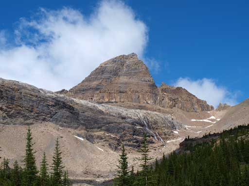
A zoomed-in look towards our fist objective, Isolated Peak

Finally I found fresh water to re-hydrate
Beautiful environment leading towards Isolated Col
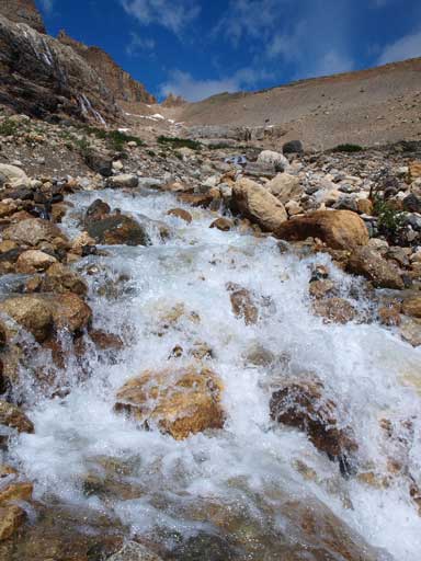
Fresh water!
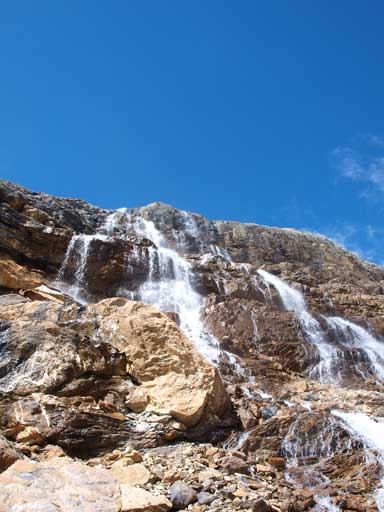
We also passed some waterfalls

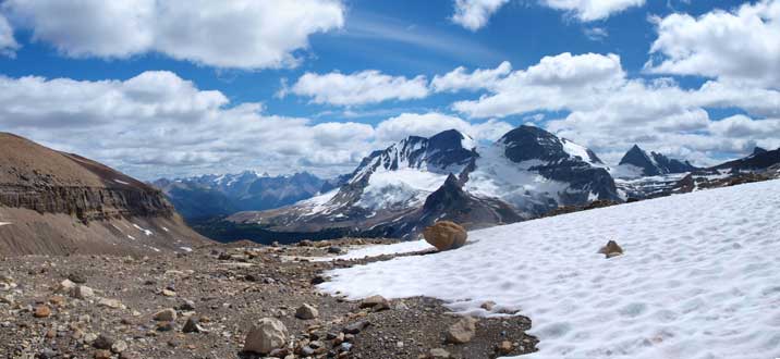
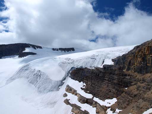
Now we are at the base, contouring around Glacier des Poilus.
From here, we had to skirt around the base of the peak on its south side. The snow was surprisingly supportive at this time of the day. While ascending the snow, we had to make sure we were not on the adjacent glacier therefore don’t venture too far into. We just walked on the edge of the snowfield. A big scree cone coming down from the mountain indicates where we should leave the snow and trudge up the tedious scree.
Looking back at The Presidents
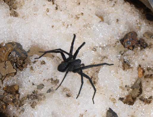
Glacial spider?

Glacier des Poilus offers an easier way up Isolated and McArthur, but we didn’t bring rope.
More of Glacier des Poilus
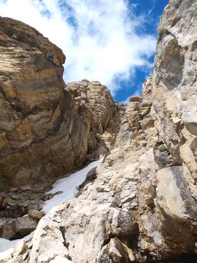
Soon we were facing the ascending gully that Kane mentions. The description has no details from here on, and we had to find our own route up. The gully was snow filled and we made a poor decision of staying on climber’s left of the snow. The gully eventually ended at a 3 m waterfall step. It was too wet to climb up. After some wondering we realized the only possibility was by crossing the gully to the other side. The snow was more like ice and we had to put our crampons on (glad we brought crampons up). The terrain on the other side (climber’s right) was still uncertain and we just hoped it’d go. Not far up we spotted a less steep line to get up the next step, where we found another wider ledge back towards climber’s left. We traversed on that ledge for about 30-40m or so, and we were facing another snow gully. This one looked better than the one before, and I carefully kicked step across it without crampons. Mike followed me but slipped and got wedged in between snow and rock. He was able to pull himself out and crossed the gully safely. A cairn helped confirming we were on correct route now. The next step was going up a narrow gully/chimney. After that, a long loose section brought us to the west ridge. Then it’s merely a hike to get to the summit.
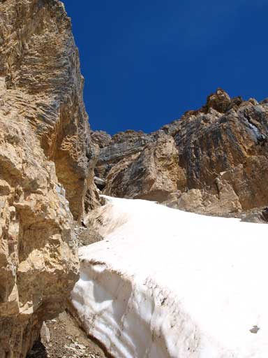
This is the gully we went up. The snow required crampons to cross.
Loose and steep terrain we just traversed
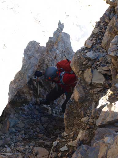
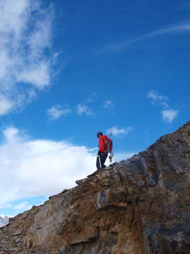
Mike ascending a gully/chimney

Summit Panorama. Click to view large size
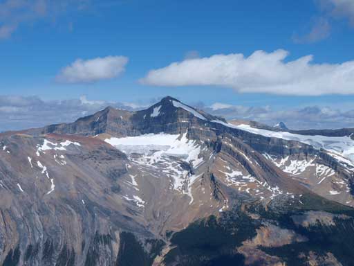
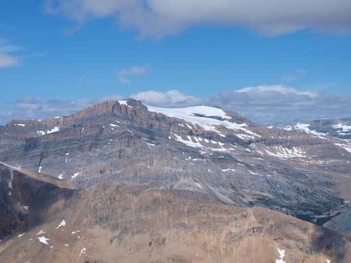
Mt. Balfour – the king of Wapta
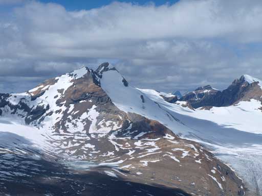
Mt. Des Poilus
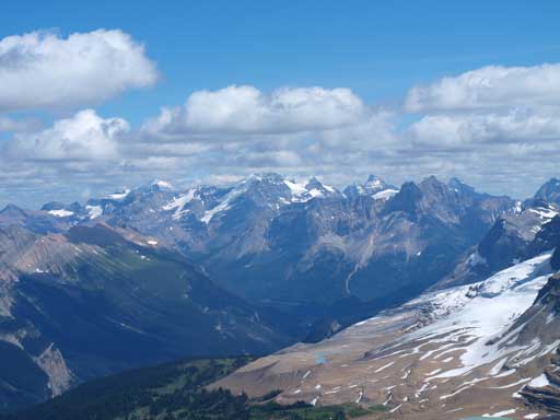
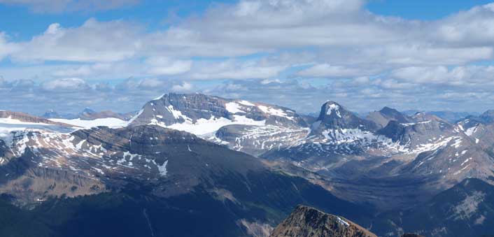
The giants by Lake O’Hara area
Mount Gordon

President Pass is the high col; The Vice President at center
Mount Daly and Mount Niles

Mount Marpole and Carnarvon on left; Mount Kerr right of center.

Yoho Glacier
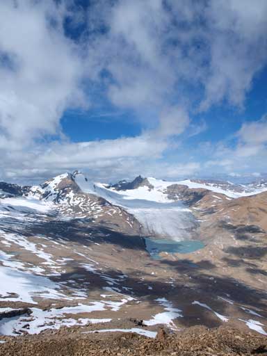
More about Yoho Glacier
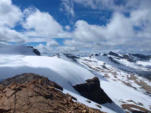
Looking over the shoulder of Mt. McArthur
We retraced out steps on the way down, and it was not faster particularly because of the looseness. We had to be careful not to kick down rocks to each other, but it was almost impossible. For the first snow gully crossing we carefully used my steps made on the way up. For the second snow gully we stayed on skier’s left to completely avoid it. The terrain below is not easy scree run neither, mainly rubbles on solid ground… Getting to the snow below was much of a relieve of our knees, and we quickly made our way down.
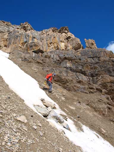
Descending the upper slope
Looking up a gully. We didn’t went up nor down this way.
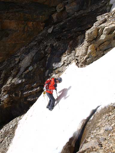
Mike crossing a tricky snow gully without crampons
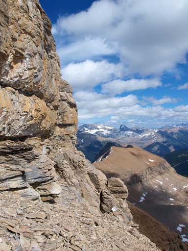
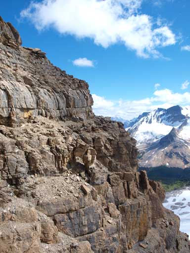
Steep terrain to traverse around.
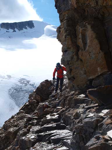
Mike traversing beneath a vertical cliff band. Mt. McArthur behind.
Now back to the tedious scree. It’s not scree skiing, and very hard on our knees.
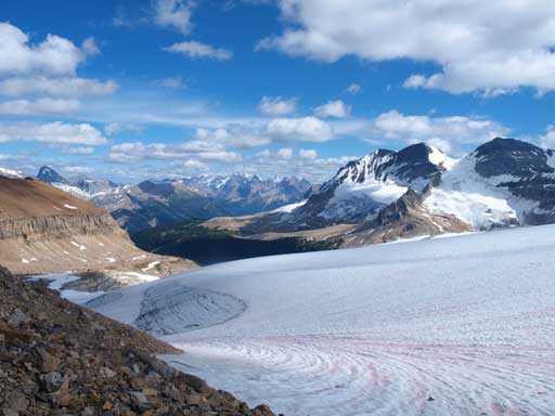
I like this view of Glacier des Poilus. Presidents on right.
Now we’d focus on the second objective of this day, the much-easier Whaleback Mountain.
