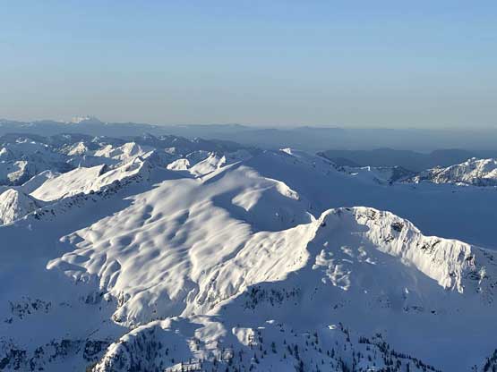
Robertson Peak
April 4-5, 2021
2252m
Chehalis Area / Harrison West, BC
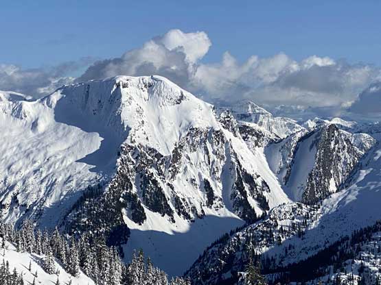
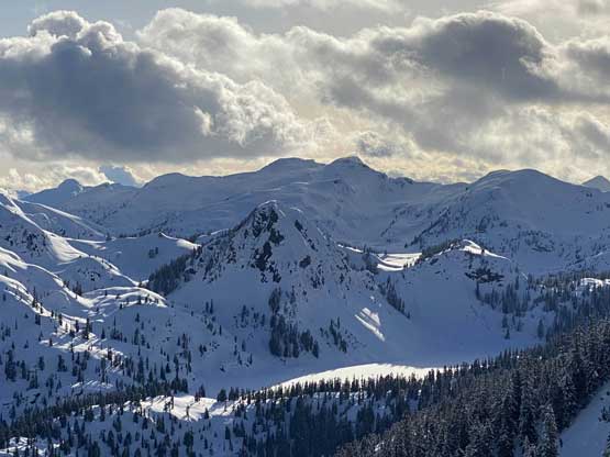
The northern part of the “Chehalis Area” is not known for the oppourtunities in technical rock climbing like the southern parts such as Mt. Clarke or Stonerabbit Peak, but rather for the extreme isolation and remoteness in the way that we are talking about the most inaccessible part of SW BC. Robertson Peak is the highest peak in this area and at the same time, an “ultra prominent peak”. Robertson Peak does not stand out as iconically as Mt. Judge Howay but for the die-hard peak-baggers and explorers based in SW BC this peak is equally elusive, if not more.
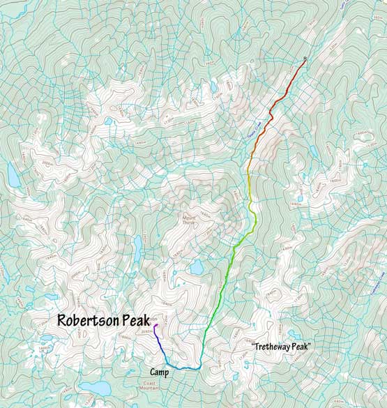
Robertson Peak has only seen 4 recorded ascents in history with all but the first ascent (over 40 years ago in winter) done via the North Glacier route in summer from Tipella Creek drainage. The information given by these parties was rather minimal but records of “bushwhacking 3x worse than Grainger Peak” was heard and to me who had already embraced Grainger Peak, the previous parties’ words earned Robertson Peak a “BW5” status. I did not have to doubt their words as I had spent countless hours hoping to find a better way to access this peak and the conclusion was absolutely none. This was no longer the case Matt Juhasz came up with a vision to climb Robertson Peak in winter as a day-trip. At first I thought he was crazy given the long known history of this peak, but upon closely examining the proposed route I started to believe this might actually be a bright idea. Those who know me know that I’m not usually the “creative” or “thinking-outside-the-box” type or person and my strength is rather to make things happen. In this particular case I had never thought about to make a winter attempt but once I concluded the feasibility of this route I instantly put in on top of the priority list.
Hours and hours of research was then put into this new route, to the point that I was more than 95% confident that it would go rather smoothly. There’s about 10+ km of valley travel from the start of south fork of Tipella FSR at 500 m elevation to the basin under Robertson/Tretheway col with potentially “BW4+” bushwhacking the whole damn way, but I also knew that the snowline also starts at around 500 m in most time of winter or spring and by 800 m elevation one could count on at least 3 meters of snow making bushwhacking a non-existing thing. The key is to have abundance of snow coverage, which is something people did not think about, myself included. The upper route would involve traversing/ascending consequential avalanche terrain on all aspects as well as a potentially technical summit ridge climb but those are mountaineering elements that I’m much more familiar with. The top priority is to have the maximum possible snowpack to eliminate access challenges, that generally happens around late March to early April so once a window formed with bomber weather and stability, I had to drop everything in life and go for it.
Matt had been pushing to make this ascent for a few weeks but I did not foresee that “perfect window” until this past weekend when forecasts gradually converge to pin that window onto Monday. This was a rather single-day window with both Sunday and Tuesday looking questionable (but not terrible) but a clear night and deep freeze right after a warm precipitation event was exactly what I needed for a summit bid on Monday AM. Matt unfortunately couldn’t make Monday happen but Vlad was able to make two days out of the three so the plan was to overnight it with Vlad on Sunday to Monday. I actually liked the overnight idea more because we essentially would pioneer the whole route with no beta to speak of whatsoever. Having overnight gears meant we could have a ton of extra contingency and thus increasing our success chance. Matt changed his mind on Friday after seeing this window becoming really good and said he would drop anything to make something work. I suggested that he should follow our tracks on Robertson Peak with a midnight start on Monday and with his usual style and plan Mel and Ben was instantly on board. Meanwhile Vlad talked to Chris H. but Chris wasn’t able to join us due to work commitment on Monday. However, a few hours later Chris said that he would go in day-trip on Sunday ahead of us and see us out there in the bush. A Robertson party was formed. A total of 6 of us in 3 separate groups gunning for the summit over a 2-day period.
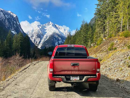
The Tipella FSR locates about halfway between Pemberton and Fraser Valley in the middle of the In-SHUCK-ch / Harrison West logging road connector. We chose the longer drive via Pemberton because the section of West Harrison between Trio Creek and Tipella was reported to be very shitty. I picked up Vlad at 4:30 am from his home in Richmond and made a smooth drive up the Sea to Sky corridor to Pemberton. Thank to the COVID shut-down of Whistler there was virtually zero traffic the whole way. Down the In-SHUCK-ch FSR we decided to take the Lillooet River West option which turned out to be mostly smooth sailing. I was able to cruise at around 60 km/h all the way down to the north end of Harrison Lake, over 80 km from the start. The weather had been better than expected with patches of blue skies. I was not hoping to drive too far up the Tipella FSR but the road had been seeing some logging recently that it was a smooth going 4 km up past the IPP project to snowline. I could have pushed a little bit further but we saw Chris’ Jeep and opted to park at the same place. I’m very much a chicken when it comes to 4×4 risk tolerance.
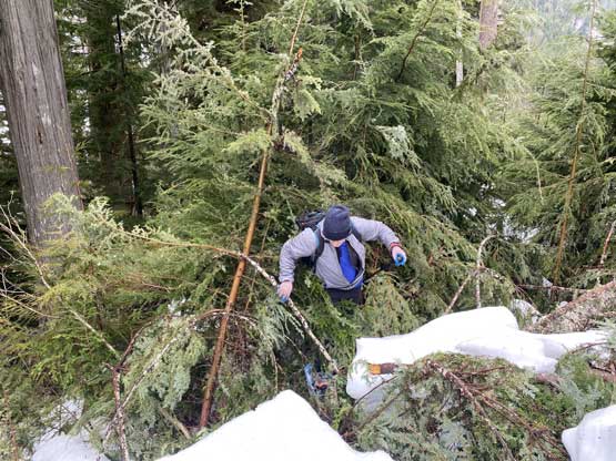
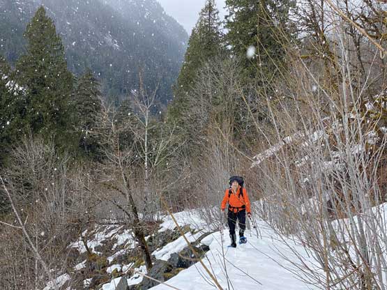
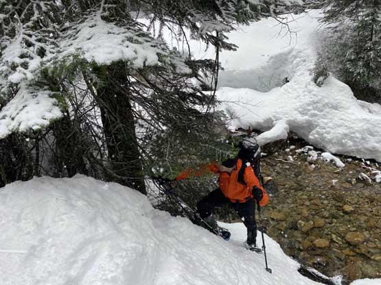
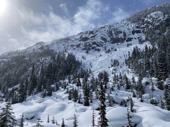
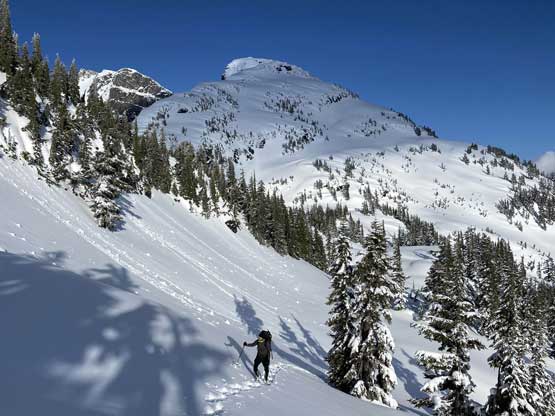
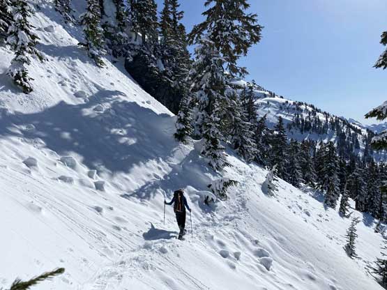
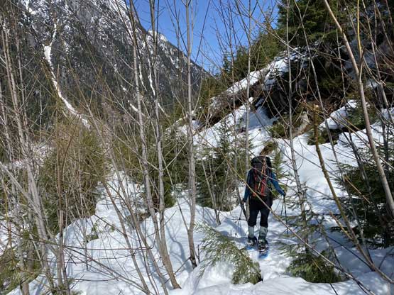
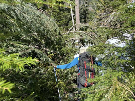
My pack weighed 40 lb at the start and Vlad’s weighed 36 lb. Vlad did not own “high tech” gears so the reason his pack being “light” was because I lent him all of my gears including a WM -7 bag, down pants, XTherm and aluminum ice axe. I, on the other hand, opted to carry my -18 bag along with XLite pad. We were able to follow Chris’ foot tracks for over a km before continuous snow forced us to strap snowshoes on. The overnight freeze at this elevation (450 m) was non-existing that even with snowshoes we were sinking. The main line of Tipella FSR was in a great shape but unfortunately we had to leave it after 2 km into the trip, onto the unknown “Tipella South branch” that soon turned into an alder mess. Chris turned around and was walking down as the bushwhacking was becoming hedious. After some conversation we convinced him to at least try a little bit further with us and we offered to break trail. The bushwhacking between 500 and 700 m was pretty sustained for a few kilometers with a few rough spots but this was what we came here for. The 1+ meter of snowpack at this elevation surely helped smoothing things out as otherwise we would have swam a few hours just to push through this stretch. After the road turning a southward direction the bushwhacked eased. However, the weather deteriorated rapidly thank to convective clouds building. Wet and sticky snow started to fall before we even exited the bushy section and would last for half a day. The post-holing was also terrible that we sank regularly past our knees. It was not looking promisingly but Chris was still with us pushing further into the misery.


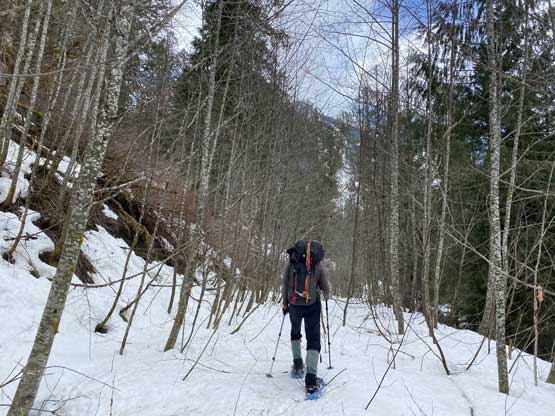

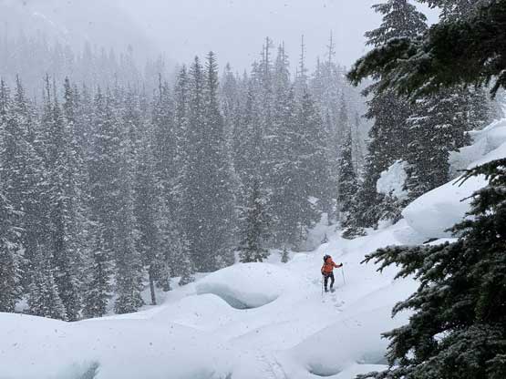
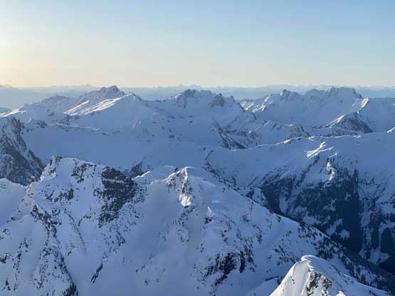
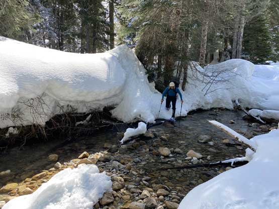
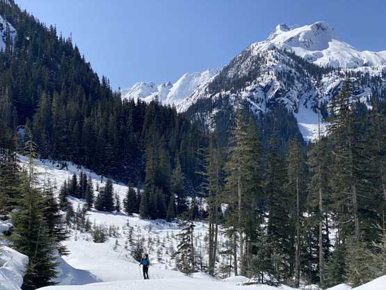
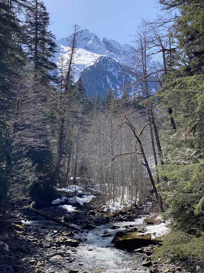
Thankfully the bushwhacking was completely done above 800 m elevation as we now had almost 3 meters of snowpack. The weather did not show any sign of improvement and the post-holing was not getting better. We could hear avalanches across the valleys due to fresh snow and poor overnight freeze but we had to keep going. The end of the road was soon reached and then we plodded across a flat stretch of snowfield (covering what would be a hour’s worth of alder bashing in summer). The next few kilometers up the valley was the most adventurous section as we had no idea what to expect. There were three creek crossings and Chris turned around at the first one. None of the crossings required us to get wet but we did have to wonder around to find a spot. Among these crossings there were sections of short-lived bushwhacking and wallowing in house-sized boulder fields covered in 3+ meters of snow. I had put hours into researching the satellite images although the actual route we took was not exactly the same as I had studied in front of my computer. The forest turned out easier than expected that we didn’t have to aim hard onto those openings that I saw on the satellite images, and those opening areas were actually not as great as they looked with lots of boulders covered in soft snow.
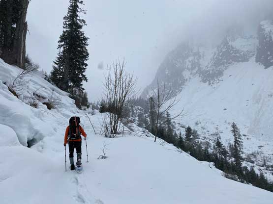

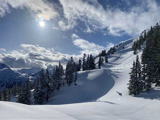
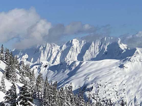
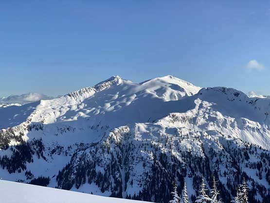
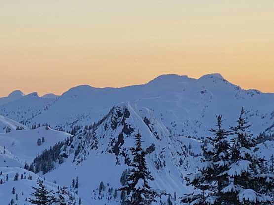
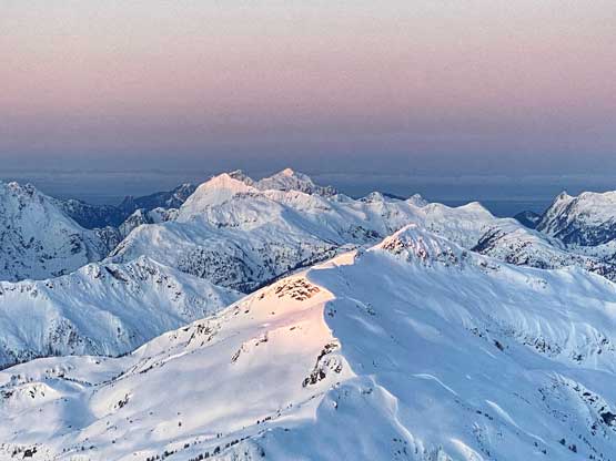
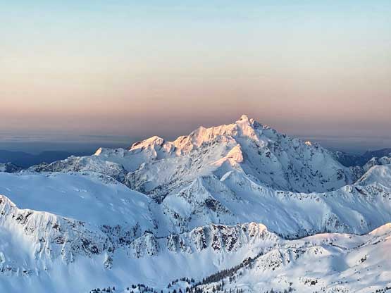
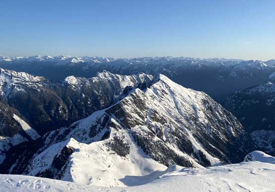
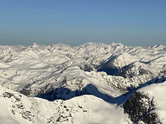
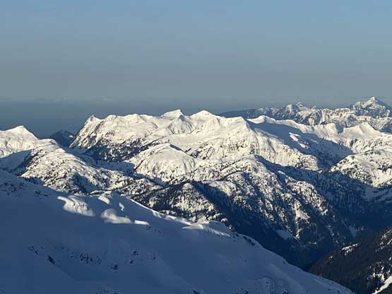
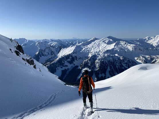
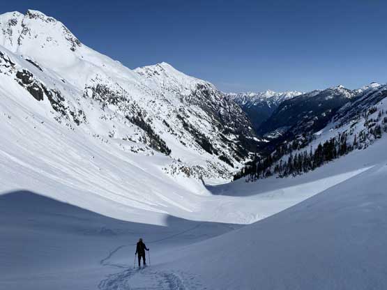
Another couple hour later we saw the first patch of blue sky in a while and another half an hour later the snow had stopped. At this point we had been slowly but steadily approaching the head of this valley towards the distant Robertson/Tretheway col and we timed it well with the weather. The steep ascent towards the cold appeared daunting from afar at the first glance but once getting closer the terrain started to feel not that bad. Traversing 1000 m under the NE Face of Robertson Peak was an unique experience as we knew almost for sure at this point, we were the first human being lying eyesight on Robertson Peak’s NE Face from this angle. The ascent onto the col was a long haul with very foreshortened sight that took us about an hour and half.

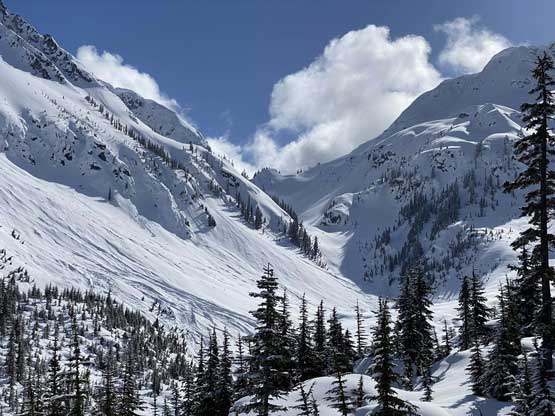


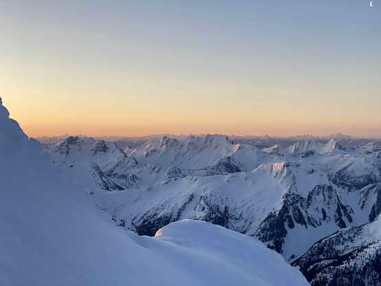
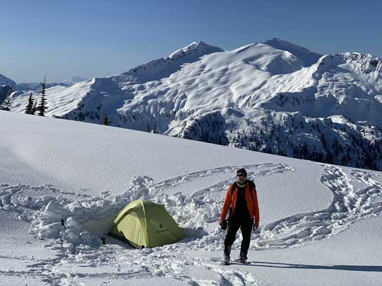
We debated about setting up camp at the col but the view from the col was not as impressive as I was hoping for. We still had a few hours of daylight time and I said we should push further to the 1600m lake basin. This would greatly eliminated our route-finding challenges in the next morning in the dark, and turned out to be a great call. Traversing the 1600 m contour line was far more challenging than the map suggested with numerous steep south-facing slopes and gullies to cross and micro route-finding decisions for every single minute. I think we nailed the line reasonably well but the steep traverses involved a great deal of post-holing making our approach time a total of over 8 hours. We found a windless spot south of the little lake and set up the camp, about an hour before sunset. We managed to finish all of the winter camping routine before dark and set up the alarm to 4:10 am. We had come here with a primary route choice to gain the upper south face of Robertson Peak but that route appeared not feasible. The only alternative was by using what I would call the “SE Face Central Gully” that’s a classic terrain trap that would soak the sun beams first thing in the AM. Watching sunrise from high up on the face was one thing, but for the most important I wanted to be off this gully before mid-morning.


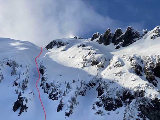


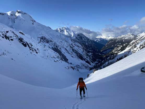
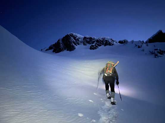
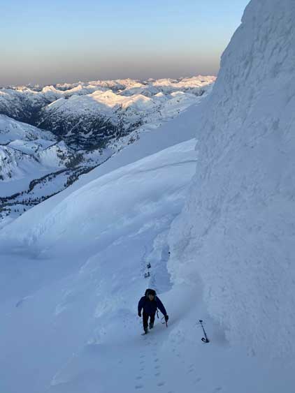
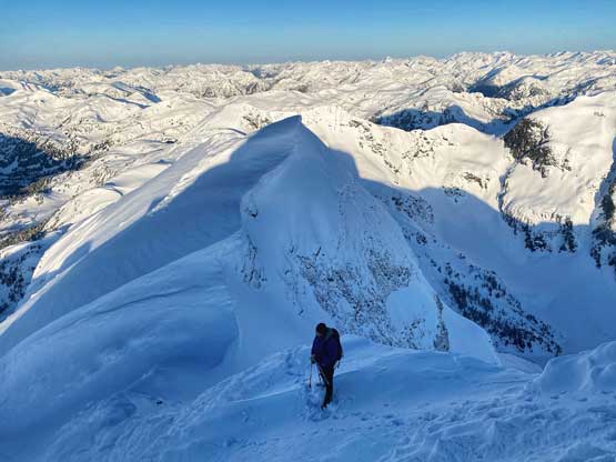
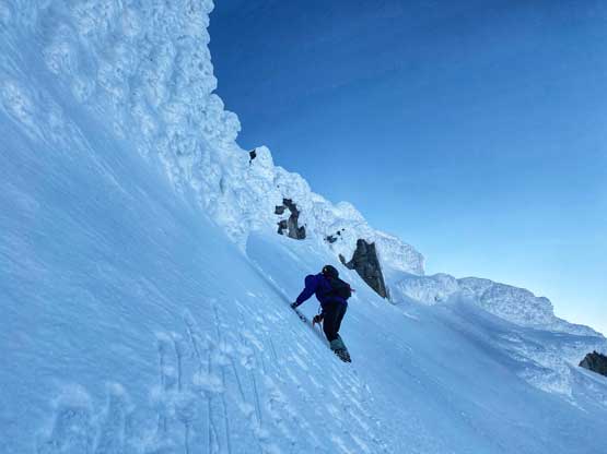
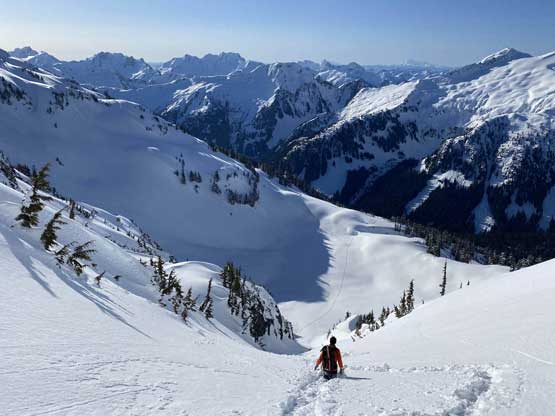
Vlad agreed with this plan although getting going at the dark hour was never a fun thing. Vlad’s boots were completely frozen over that it took him fair a bit of effort to put them on. I had come here on winter hiking boots while carrying my Trango Towers mountaineering boots so I did not have that frozen boots problem. The gully turned out mellower than I thought with the steepest section between 35 and 40 degrees in the lower zone. Given the fresh snow we were able to snowshoe straight the hell up the middle of it. The ascent to the high col involved 550 m elevation gain and took us longer than expected. Two hours after starting the day we watched an incredible alpenglow show from the high col on Robertson Peak. I wished we could watch the sunrise from the very summit but the time beat us by half an hour.


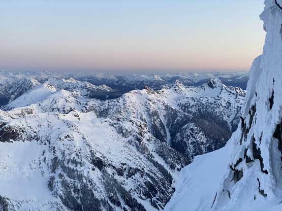
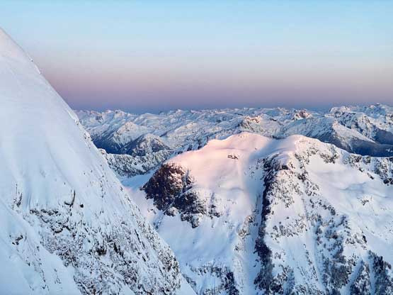


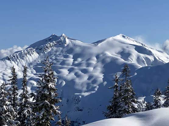
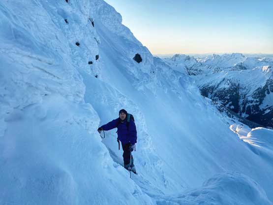
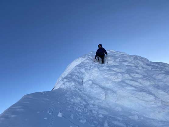
The summit ridge (west ridge) did not appear any easier than I thought with rime iced gargoyles right off the bat. We took our time donning crampons. The first route I tried failed at a 3-meter mixed step. I could have climbed it but down-climbing would be troublesome without rappelling, so backed off. I did not know what would be the secondary choice but the only possibilities existed on the south face side of the west ridge, so I then led a long diagonal traverse (45 degrees and icy at places) around that first steep section and to my great relief this line indeed worked and brought us back onto the ridge crest. The rest of the ascent was still not easy with lots of wallowing on the rime-covered ridge but didn’t give anymore major obstacle. There’s one narrow spot right before the summit that I had to be careful of cornices and the summit itself was also suspected to be on a gigantic cornice.


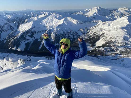

After taking the obligatory photos it’s time to descend. We were both shivering on the summit in the cold wind. The descent of the ridge was much easier as we now knew what exactly to expect and there was no more wallowing required. In no time we were down to the snowshoes and another short while later we were halfway down the face. Matt, Mel and Ben showed up much earlier than we had anticipated. Their pace was impressive but not surprised given how cold the previous night was. I thought for sure they had firm conditions from the truck all the way up and this condition would actually hold well into the PM later in the day (hence proved that the timing for this Monday was indeed the best window in this season so far). Vlad and I glissaded the lower gully and enjoyed a fast run back down to camp. Another hour later we were on our way home. I was still debating about “Tretheway Peak” (no recorded ascent) but I was tired from the previous day’s post-holing and Vlad’s knees were aching.


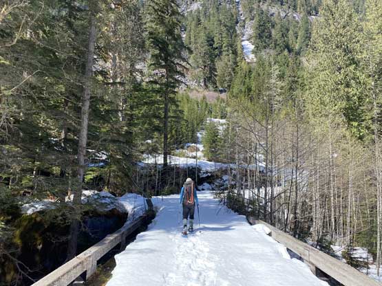
After saying no to the secondary objective we resumed the leisure descent down from Robertson/Tretheway col, enjoying to be in the magnificent terrain surrounding us. We did plod a little bit faster here as we saw some huge cornices dangling at least 500 meters above on either side and feared they could trigger some deep slab avalanches. Once into the woods we slowed down again taking in the scenery that we missed on the approach day. There was no more snowfall event and instead, we were baked in t-shirt temperatures. The snowpack was still strong enough to hold our weight given the previous night’s full-depth freeze. The rest of the descent was rather uneventful following our own tracks and turned out much easier than the previous day. Matt passed us in the bushy section and Mel and Ben passed us while plodding the final 2 km on Tipella FSR. We all finished at Matt’s truck at the same time so Vlad and I even got a free ride down to my truck, saving 1 km of boring road walk. Matt’s round trip was under 10 hours truck to truck and I’m sure that’s the fastest time this peak would ever see in a while.


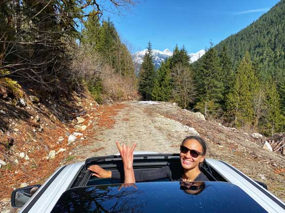
Vlad and I was in no rush going home so we took a few tourist’s stops on the long drive northwards to Pemberton. We decided to explore the mainline of In-SHUCK-ch FSR that ran on the east side of Lillooet River. This road was wider than the Lilloost West but had more pot-holes so not recommended. I had to drive at 40-50 km/h at the fastest. The rest of the drive back home was long and tiring but uneventful. I eventually got back to White Rock at 11 pm and that concluded a very successful mission. A new route on a Ultra-prominent peak smoothly done on the first try. As I said many times, prep work and timing is everything. The actual trip itself was rather just the execution of the plan. Nobody would believe how many hours I had been spending zooming in maps, images, reading trip reports, following on social media and checking weather forecasts and condition reports, for every single day and for 10 years in a roll.

