Ghita Mountain
March 1, 2014
2531m
Mt. Robson Provincial Park, BC
So the question is, where is Ghita Mountain? Before Eric suggesting it as our objective for this past weekend, I hadn’t even heard of this name. Well, it is an officially named peak in Selwyn Range in an obscured part of Mt. Robson Provincial Park. Well, I should say the entire park area that’s south of Highway 16 is obscured. There’s no trail nor whatsoever and for the most part, one needs to cross Fraser River which is not fordable in summer. For Ghita Mountain there’s no need to ford Fraser River but still, one needs to bash through a long distance in untravelled terrain to even just get to its base. Needless to say, there’s no beta at all. There’s no previous recorded ascent neither. (Now after finishing the ascent, I totally understand why)…
An Arctic high pressure system came and granted us blue sky but also extreme coldness. The forecast was calling for -36 degrees on Saturday morning even in Jasper townsite, with 15-20 kph wind and that would put “feel-like” temperature below -50 degrees. But we felt adventurous to push for it.
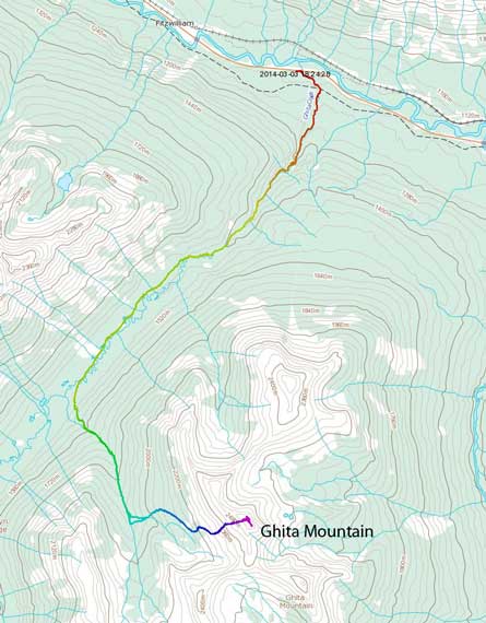
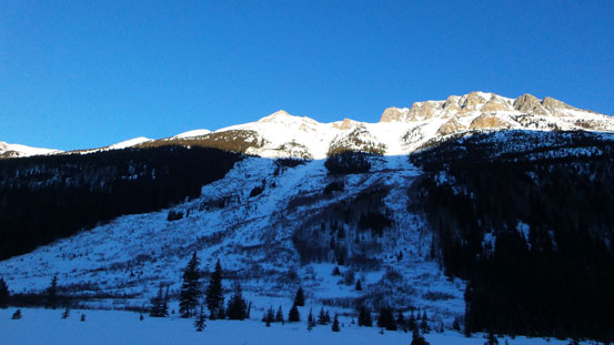
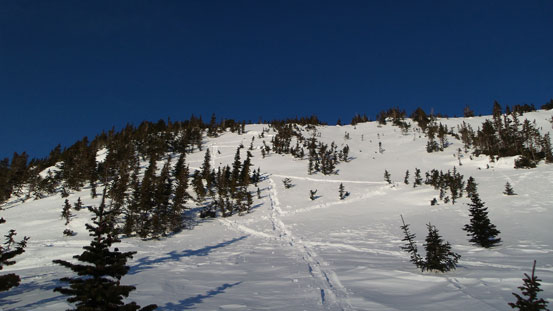
Ghita Mountain winter ascent route. GPX DL
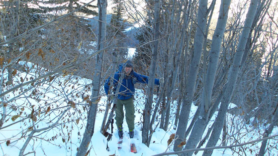
We had to make agreement on a couple things: 1-day versus 2-day and snowshoeing versus skiing. We had 4 choices and like on Mount Milton earlier in this year, it was very difficult to choose. We figured it’s not that ridiculously long by the statistics so by starting and finishing in dark we should be able to finish in 1-day. Well, adding all the layers on and inside our -20 sleeping bags it might be good enough to survive a night in -40 degrees but it’s overall better to avoid bivying if possible. Eric somehow managed to convince himself skiing was the better way, since the route was essentially travelling up a creek/river followed by a side drainage and finally an open alpine slope. I, on the other hand, decided to use snowshoes for a couple simple reasons, the lack of beta, the possibility of returning a long way in dark, the potential thin snow covered boulder fields and one more important thing, the much lower chance to get into trouble (in this harsh condition, even a slight injury could be disastrous).
So at Friday night, we found ourselves parking at the bridge crossing Ghita Creek on Yellowhead Highway. The highway shoulders were surprisingly very wide and we had no problem finding enough room to park without shovelling (we packed a big shovel in case there’s no parking area). It didn’t feel as cold as expected which was good. After catching up a couple hours’ sleep in car, we woke up at 3:30 and started our epic adventure, coldest trip, longest day-trip ever at 4 am on Saturday morning. Skiing/snowshoeing up Ghita Creek for a while, all the sudden we came across a set of cross country ski tracks. The creek was more interesting than expected. There were many gigantic deadfalls and snow mushroom (boulders). Sometimes we had to go into the bush on either side to bypass some of the logs. The snowpack was also much thinner and less supportive than anticipated, and we had to use many questionable (sagging) snow bridges to negotiate the maze of open water. Sometimes we could hear the torrent right underneath us… But, having a set of tracks to follow we felt all good at this point.
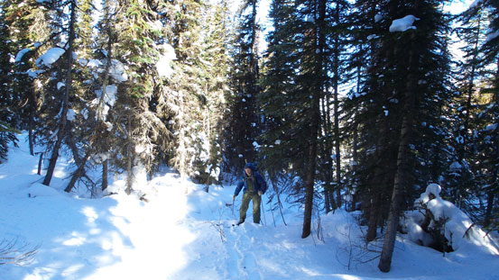
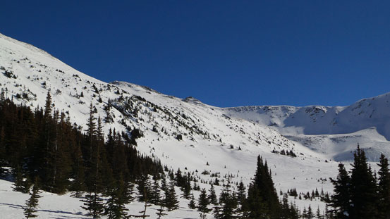
After an hour or so the creek started to get narrower steeper and we entered a canyon section. The cross country ski tracks stopped in front of a big deadfall. We could have squeezed underneath but didn’t like the sound of that raging torrent so we backtracked a bit, into the bush on climber’s right side and bypassed that log. Getting back into the creek wasn’t easy neither. There’s one steep descent followed by a short jump, and Eric had to take off his skis to do that. From here on the massive amount of trail-breaking officially started. The next 2 hours or so was similar in characteristic but only without the ski tracks. Tedious and tricky at places even on the way up. We knew it wouldn’t be as fast on the way back as we thought. There was one big waterfall to negotiate and we found a route up on the left side, and after that we were in a long and flat meadow. Now Ghita Creek had become a lot more meandering and instead of following the creek we’d be aiming more-or-less straight ahead. Sometimes we had to go down into the creek and then up the other bank, and sometimes we had to bash through alders. The bush wasn’t bad at this part. The sky also got brighter now and we could see the distant drainage we were aiming at. This section was very foreshortened and by the time we finally got close to the side drainage, we were already 5 hours into the trip.

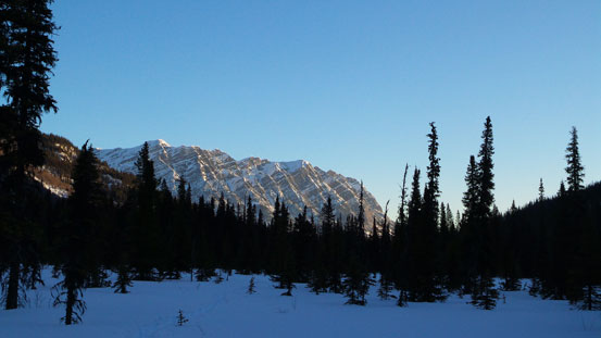
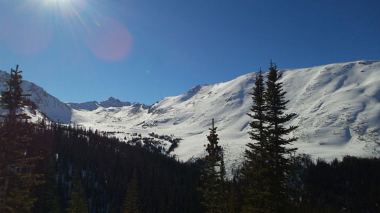
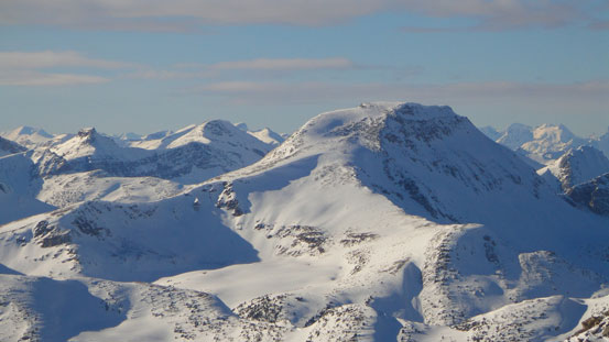
Morning view from Ghita Creek. This is one of the outliers on Sleeper Mountain
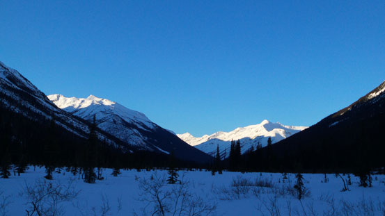
Looking back at Yellowhead Mountain
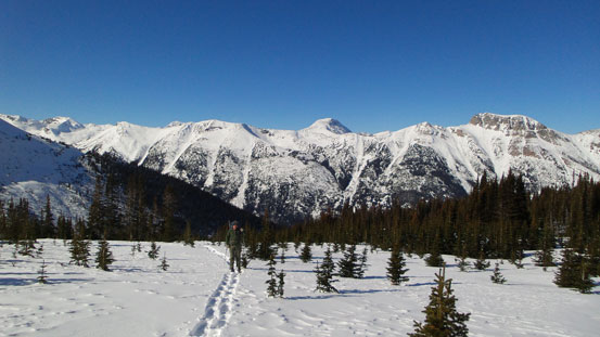
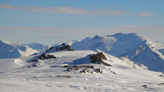
Travelling up this wide meadow
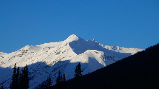
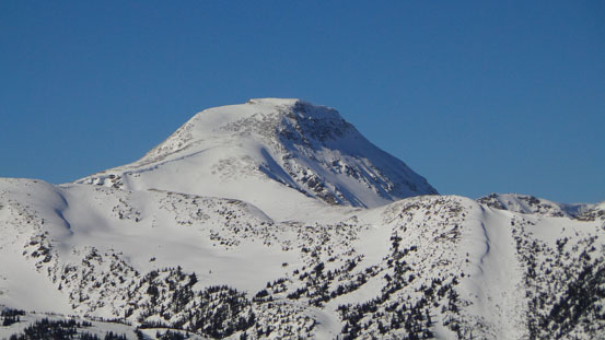
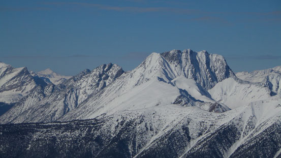
Part of Siberia Peak (unofficial name)
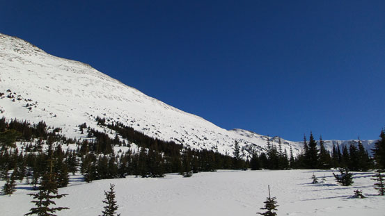
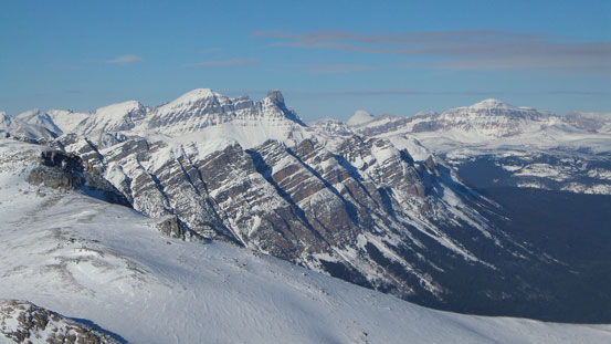
We passed this giant avalanche path
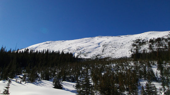
Then we should have just followed the major Ghita Creek to the entrance of this side drainage, but instead we made a big mistake trying to short-cut the route through bush… Steep sugary snow and dense alders punished us. I tried my best to pack a gentler trail down and at the meantime to avoid as much alders as possible so that Eric could follow on his skis. It didn’t work very well and we tried to traverse climber’s right and eventually hit the drainage. It took us a good 2 hours up probably only 200 meters. Without my snowshoes there’s no way we could get through all of this crap. The drainage wasn’t good neither but at least didn’t have as much alders as the forest. It was still very steep and the snow was still very unconsolidated. Mostly knee deep post-holing and on top of that I often got surprised by waist deep weak spots. Higher up the grade started to cease a bit and travelling got better. As simply as putting one foot in front of another, but this drainage was freakin’ long.

Typical bush
And, typical…
Higher up the creek it gets better
Finally got some views.
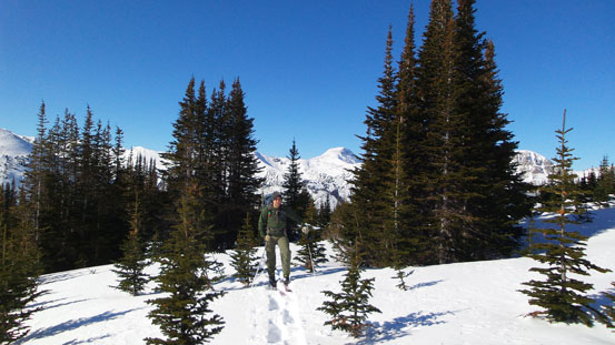
The next critical point was leaving this drainage and following a smaller side creek on climber’s left. I marked it on my GPS but it was still not obvious. We ended up a big too far up but that was okay. We ventured left into the bush and then rejoined this small creek. The section ahead looked to be very narrow and steep so we had no choice but bushwhacking steeply up the north bank. Dense timbers wasn’t fun to negotiate but at least better than alders. After eternity we hit a flatter bank and finally got our eye on Ghita Mountain. There’s apparently one more steep roll to ascent. This one wasn’t as long, but very steep and the trees were pretty sparse. Breaking trail up this roll was even more miserable as I had to punch down the many wind slabs. After this bit we were out of the trees.

Eric skinning up a steep treed slope
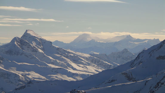
There’re some cool looking peaks at the head of this valley
Sleeper Mountain looks cool
Looking back
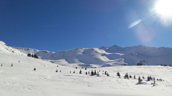
Now we’d go up this flat bench for quite a while
We’ll aim at the treed section at center of this photo. That’s the steepest slope of the ascent
Eric
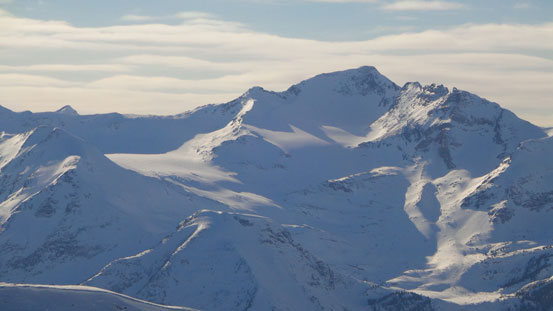
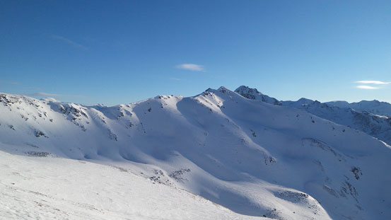
Beautiful alpine environment

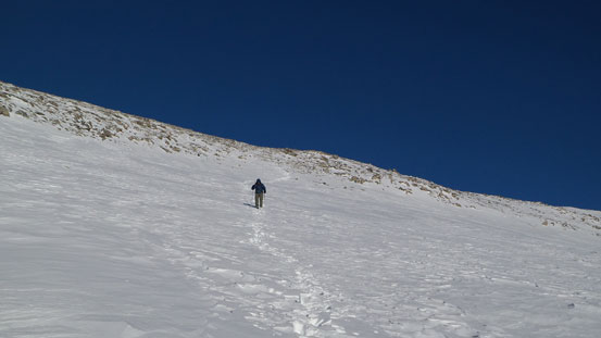
Eric following me up this steep slope
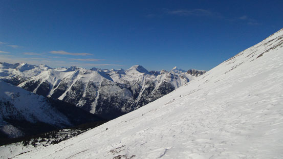
The alpine was pretty much a gigantic wind slab followed by scree for 300 vertical meters… We did hear a couple settlements but thankfully the slopes weren’t very steep. Eric’s skis performed poorly again as he couldn’t get much of a grip on the icy stuffs. Thankfully he brought ski crampons up otherwise he would have to post-hole a long section. Once hitting the summit, the “other side” fully opened up revealing impressive giant peaks on the Ramparts. The views were kicking-ass towards each direction. However, at the meantime the sun was getting lower already and it was super cold and the wind was howling. We were 12 hours into the trip at this point. I didn’t have thermometer but my sunscreen was frozen inside my jacket. My camera would only work for about 10 photos before dying due to the coldness. Then I have to put it back into my jacket and warm up for a while before taking another 10 photos, and then repeat the process to finish my summit panorama and zoomed photos. I descended a bit to make sure Eric was still going up. He was! Then I waited for him to tag the summit. I went back up there again to get a photo of myself.
Slogging up the final slopes

A cool looking unnamed peak towards south
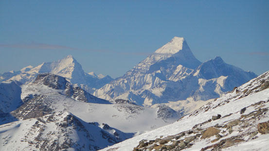
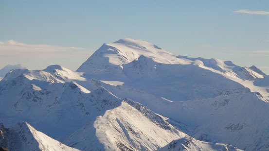
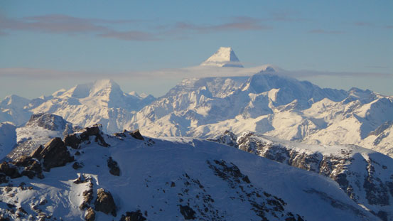
What a view of Whitehorn, Robson and Resplendent!
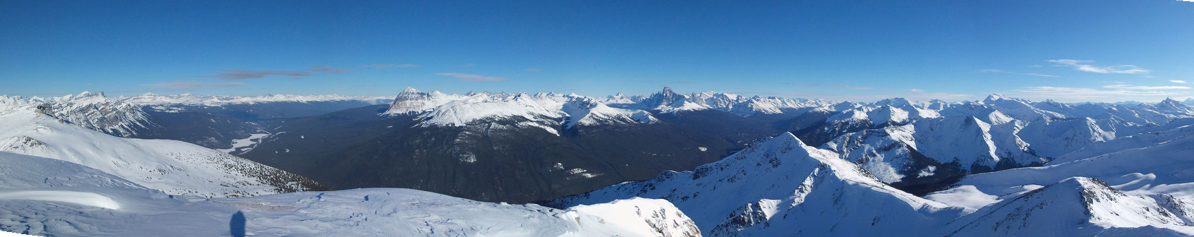
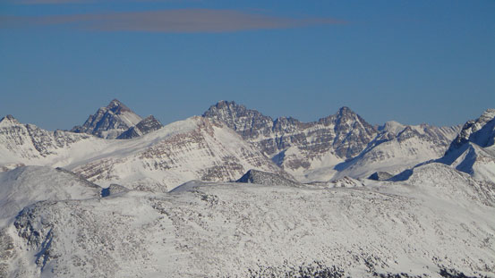
Summit Panorama looking at Fraser River Valley. Click to view large size.
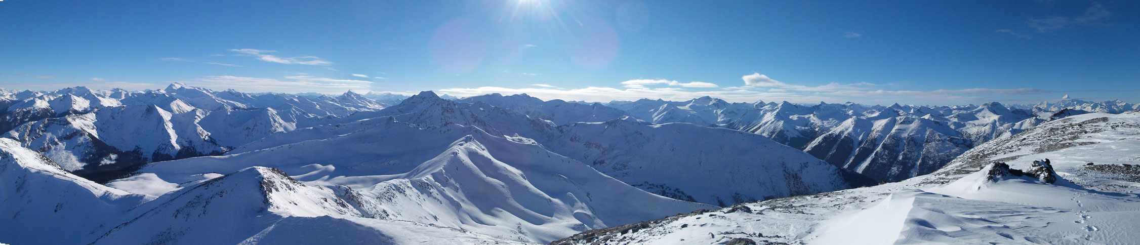
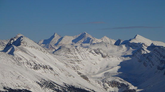
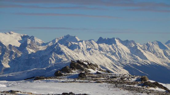
Summit panorama of Selwyn Range. Click to view large size.
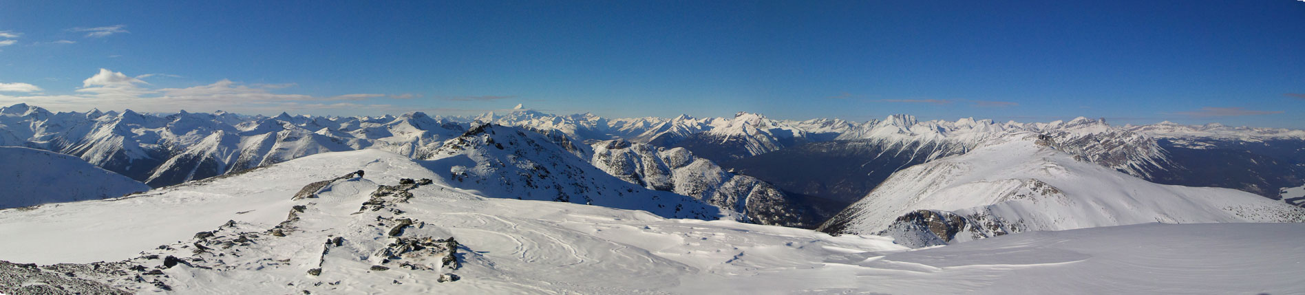
Summit panorama looking towards Robson. Click to view large size.

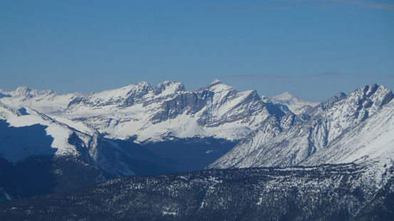
Mount Fitzwilliam
Roche Noire, Basillica and Curia
Trident Range – Majestic Mountain et al.

Mt. Edith Cavell
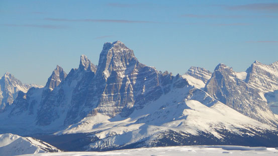
Mt. Geikie

Mt. Fraser
The not-so-familiar peaks south of the Ramparts on the Continental Divide

Even Mount Clemenceau showed up!
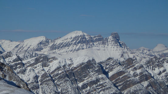
One of the many unnamed peaks in Selwyn Range
Jeanette Peak according to bivouac.com
In the distance is Mount Monashee and Mount Lempriere

This one is Mount Albreda
Siberia Peak
Sleeper Mountain
Mount Robson
Lynx Mountain and Reef Icefield

Mount Mowat
Salient Mountain
Caledonia Mountain
Deer Peak and Mt. Bridgeland

Monarch Mountain

Mount Oliver and peaks on Victoria Cross Range

Another photo of Fitzwilliam
Eric approaching the summit
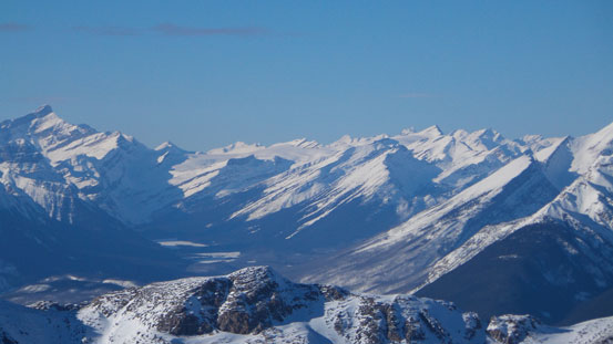
Yellowhead Mountain in the foreground
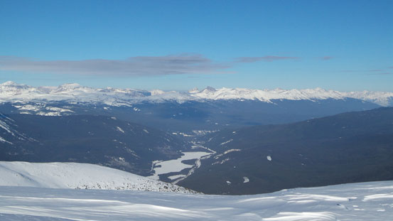
Yellowhead Lake and the valley Highway 16 travels through
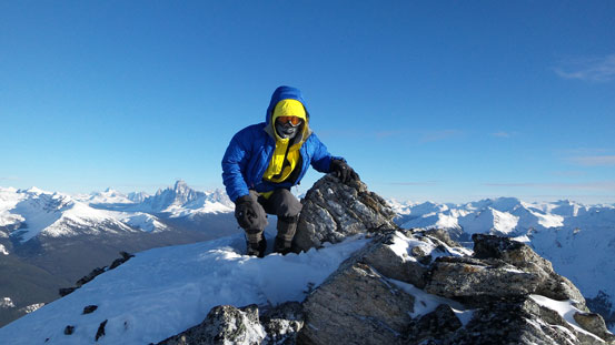
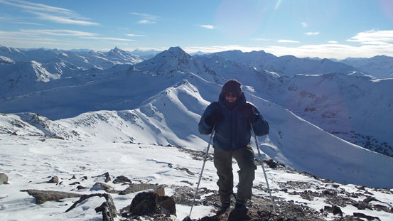
Me on the summit
The descent was far from easy. Skiing down required a lot more strength but Eric was already exhausted. The upper icy wind slabs weren’t very skiable and Eric had to keep the skins and ski crampons on. He somehow managed to maneuver down that part. Then came the steep roll at treeline. Eric decided to put the crampons and skins away but still, skiing down this part had no match to snowshoeing. I plunged down it in no time but Eric was struggling on the steep wind slabs. Now the sun finally got down and we would only have less than 1 hour before darkness. Looking ahead, there was no easy section for skiing and we knew we’d have an epic on this day.
Descending the upper slopes

Not the best place to ski…
One last view
Descending the steepest slope at treeline

Now the sun had gone down..
For me the game was pretty simple actually. I just needed to put one foot in front of another while following our tracks. It’s just a matter of time but my energy level was high and I knew I’d still have energy even in another 10 hours. For Eric it was a different game. Since I was the faster one I stayed behind for most of the time to make sure Eric’s okay. If he fell and couldn’t get up then I could help him to remove the skis. At the lower end of this side drainage we had the choice to follow our tracks into the alders or continue descending the creek. We opted for the alders since we couldn’t see much ahead and we didn’t want to risk backtracking if the drainage came to a dead end. For the alders at least we knew it would go, just painfully slow. At this point my head lamp started to fail probably due to the cold battery. I originally put the battery box in my parka’s pocket and I immediately moved it to my inner pocket hoping it would start working. Eric gave me his spare head lamp which worked fine in short time. Coming down this 200 meters or so also took us 2 hours…
Back to the main Ghita Creek, the bush was done but Eric was also totally exhausted. He also ran out of food/water and I gave him all of mine (a couple energy bars and about 0.5 L of warm water). The spare head-lamp that Eric gave me got too dim at this point but my head-lamp started to function properly so it was still okay. This creek was very flat and Eric put his skins back on and we could manage to maintain a speed at about 1 km per hour. But soon Eric started to have skin problem. One of his skins got iced up and it couldn’t stick. It fell off for every minute or so. He tried a couple strategies but all failed. Obviously on this pace we wouldn’t get anywhere. By constantly stopping I started to get frost bite on my toes. We had to keep moving no matter how exhausted otherwise we couldn’t survive. We thought about hitting the SPOT but we were still responsible for the long night. Another option was me getting out as fast as I could and grabbing food and gears back to Eric, but we figured that’s too risky and we were still more than 5 km from the road and I wasn’t sure if I’d have enough energy for that. I figured I might be able to ski out without skins so we even tried to swap gears but I couldn’t get my feet into Eric’s boots. Then Eric decided to try without skins and see how that would work. It actually worked better! Oh well… There’s not much to describe now except for hours and hours or struggling. Eventually we made back at 5 am on Sunday morning, and our round trip time was 25 hours…
Then the car couldn’t start… We couldn’t catch any cell phone signal neither so we had no choice but waiting in the car hoping someone would stop. It did! A truck stopped and help us getting the car started. A big thank to this guy! Now came the long drive back home. We managed to catch up a couple hours sleep here and there and we took turn driving and eventually made back safely. It was definitely an epic adventure up an unknown objective. I think in the future I’ll stay home in similar condition, or doing easy and well-known mountains. Speaking Ghita Mountain, we couldn’t see any human activity up there and we couldn’t find any reference of a previous ascent, so we made the first recorded ascent. Not sure if we can claim a FA since it’s overall pretty close to the road. But only nutso peak-baggers would even think about something like this that’s for sure.

Dude – sounds a bit risky but glad you guys made it out OK! Another epic for sure! I think my longest day trip is 15 or 16 hours tops! 🙂
Steven, Eric
Vern’s right, risky business, glad no one got too cold or frost bitten. IMHO cold days like this shorter ski trips are the best option. Incredible views though, I love Robson/northern Jasper area.
I have had piles of 24+hours trips, hope to have more too 🙂
Cheers
Agree. I got a minor frost bite on one of my toes, but it’s all fine now. Could manage to warm it up in my booties briefly and then kept post-holing beside our tracks to stay warm.
This is a greaat post thanks