Cypress Peak
October 30, 2017
2083m
Roe Creek / Whistler, BC
Cypress Peak is by most considered as a “local classic” in the Sea-to-Sky Corridor and boasts numerous scramble routes with fairly straightforward accesses. The mere requirement is a 4×4 vehicle as driving on logging roads is still inevitable but that’s the theme for you to climb anything in BC Coastal Ranges. Among the various routes the most popular one is the NW Ridge direct (Class 3) accessed by logging road system in Roe Creek drainage. I was too lazy to come up with anything fancier plus a couple friends of mine had recently broken a set of tracks all the way to the top, so why not. This also serves as a good objective to introduce someone else new to this area. Colin Kaburia recently moved to the coast from Rockies and was keen to explore this new wonderland.
Thank to the recent updates we knew this wouldn’t be a long day but an “early start” is still essential at this time of a year. Another reason was to avoid the rush hour gong show as Colin would be coming from Maple Ridge while me from Surrey. The meetup was then set at 6 am at the church of West Vancouver. Nobody was late so soon enough we were cruising up the Sea-to-Sky Highway. This was my first time turning off the highway at Chance Creek FSR so somehow missed it but thank to the GPS technology we soon corrected this mistake. It’s right by the “cat skiing”. The logging road has quite a few major intersections but again, with a pre-drawn GPS track the navigation was simple. There’s quite a bit of uphill and the road surface was rough at places but not a big deal for my Tacoma.
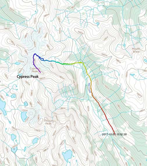
Cypress Peak via NW Ridge. GPX DL
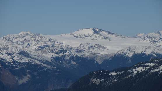
People used to drive further up the Roe Creek FSR but not anymore. There are at least 30 enormous ditches such that without an ATV there’s no way so we parked at the junction with Branch R200 which goes up to Brew Hut. The parking pull-out has limited space though so if you want to secure the spot then make sure you come early enough. The first stage was then to hike up the rest of Roe Creek FSR to its end. Other than crossing numerous cross ditches and wash-outs there’s little worth documenting. At a couple spots there’s good views towards Tricouni Peak. At the road’s end it’s important to pick up a flagged trail but we soon lost it somehow. The punishment was about 10 minutes of horrible bushwhacking in slide alders. We then turned our bearing towards downhill side, got out of the mess and then came across the trail coming from nowhere. And this brought us to the bottom of a long pile of talus.

At the base of the talus slog…
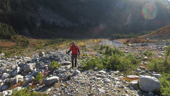
Colin emerging out of the woods after a bit of off-route ‘shwhacking
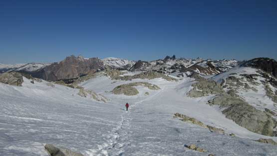
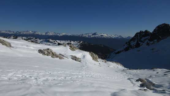
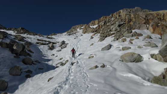
The bulk part of elevation gain would be done on this long stretch of talus slope. This part would have been super enjoyable on snow but such isn’t the case in late October. There’s no snow whatsoever and instead, it’s step-by-step of talus hopping that soon got tedious. Thankfully with the popularity of this peak there has already developed a path marked by cairns. The worst, also the steepest stretch came near a mini waterfall and we also had to hop across the water flow to the climber’s left side. Upwards again the grade eased off a bit and then we were at the mouth of the upper basin. Soon enough there’s snow appearing and the depth increased dramatically in a short time.

Very cool glacial scenery. It shows this area gets enormous snowfall

Roughly here we had to get into the gulch and cross the watercourse

The creek crossing was tricky thank to the layer of verglass

Running into snow now.

Ascending into the upper basin, now looking back. Keg Peak behind

Colin grunting up.
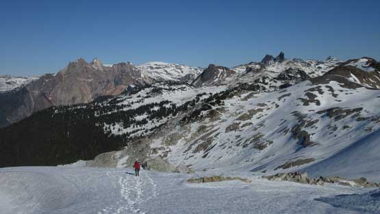
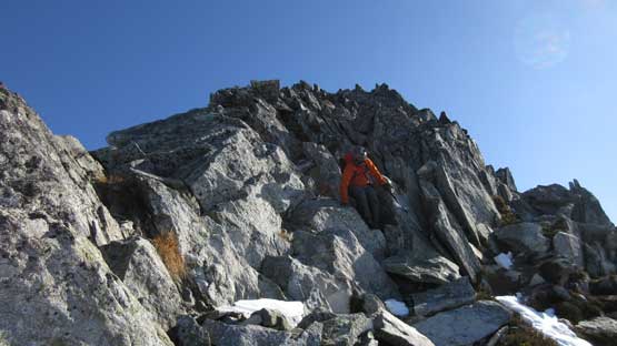
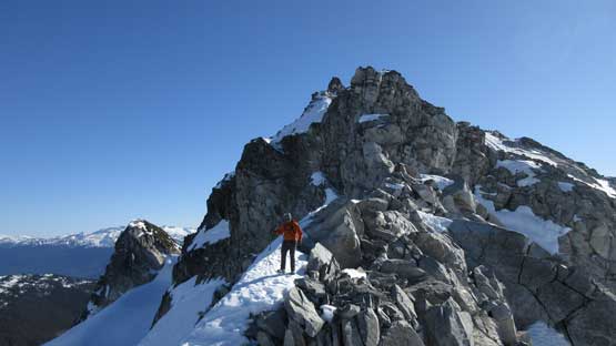
The snow had gone a full depth freeze making some easy travel. There’s no post-holing whatsoever and meanwhile the surface wasn’t icy enough to require crampons. The condition was simply perfect and we cruised across this basin in no time. A long break was taken after cresting the long NW Ridge with views into the Squamish Valley. The crux was scrambling directly over a gendarme. A few moves are solid 3rd class with some pretty good exposure but very fun. There’s an option to detour around but not without substantial amount of elevation drop.

Traversing on the edge of this glacier.

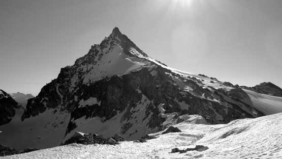
This is a view looking up the glacier towards the summit looming above

Colin traversing the upper bowl

And then slowly ascending onto the NW Ridge proper

On the ridge now.
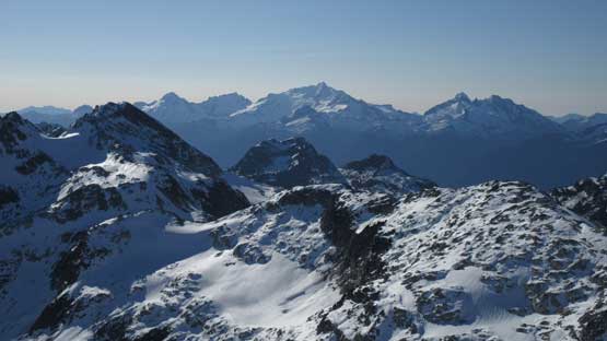
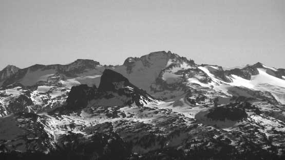
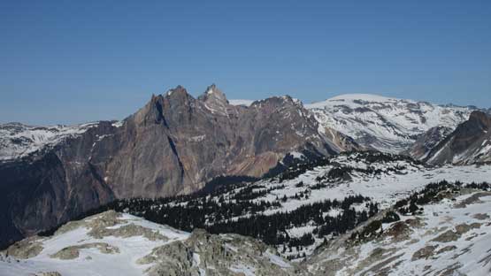
Mt. Cayley and Pyroclastic Peak massif

The twin towers of Mt. Fee is hard to miss
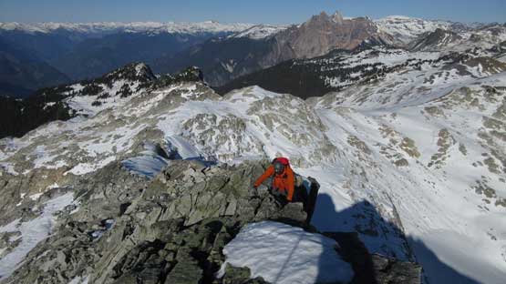
Upwards and onwards with expansive vistas behind
Resuming on..
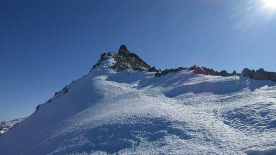
Our route up Cypress Peak is by a direct ridge attack

This is the small pocket glacier on the west slopes. Skiers?

Pykett Peak and Mt. Charlie-Charlie on Ashlu-Elaho Divide
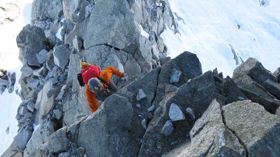
Colin climbing up the crux gendarme
Beyond the short crux gendarme the scrambling was mostly Class 2 on broken boulders. I opted to ascend the strip of snow on climber’s left side as I prefer step-kicking over boulder-hopping on any day, but the exposure to the left (north) side was quite severe. The summit block looked pretty terrifying from afar but actually easy, and the summit offered excellent views. Another party joined us soon and we all had a good time up there.

Ascending on snow beyond the crux. Easy going.

There’s a shear drop down the north side so don’t get too close if you have vertigo
What a day…

The summit block is far easier than appeared
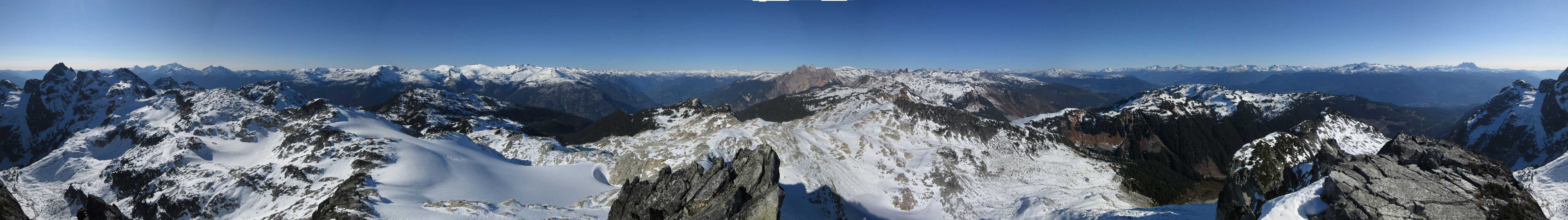
Summit Panorama from Cypress Peak. Click to view large size.
The iconic Tantalus Range rises behind
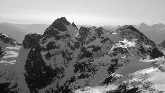
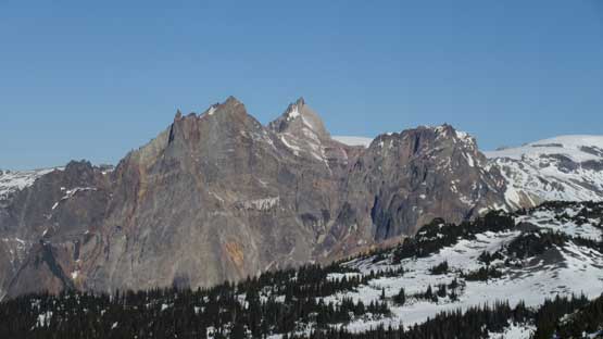
The north face of Tricouni Peak

The full stretch of Ashlu-Elaho Divide

This is looking into Elaho River valley towards Clendinning Provincial Park
Icecap Peak with Amicus Mountain behind.
Exodus Peak on the far western reach of Pemberton Icefield

Another shot of Mt. Fee

Mt. Currie and Hibachi Ridge near Pemberton
Black Tusk with Castle Towers behind

The Sphinx and Sphix Glacier behind Garibaldi Lake

The massif of Mt. Garibaldi

This is a full view looking down our approach valley into Sea-to-Sky Corridor
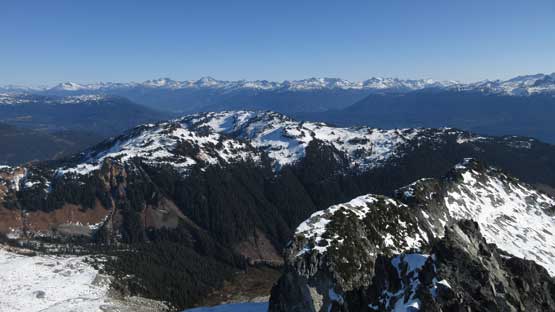
In the foreground are Mt. Brew and peaks by Brew Hut

Colin and myself on the summit of Cypress Peak
After what seemed like a long time Colin and I slowly started the descent with the other party following shortly behind. There’s a talk about using the snow bypass but I said we should down-climb the same way we came. That gendarme was challenging, but very enjoyable and soon enough we were off the NW Ridge. Another long break was taken at the same place since it’s the last spot with fine views. Descending into the basin was very fun plunging down on snow but then descending the long slope of talus wasn’t so much.
Descending the summit block
The upper NW Ridge.
One last look at Mt. Cayley and Powder Mountain

Down-climbing the crux. Needs a full stretch.
Cleaned the crux now.

We would take another long break at the saddle. The peak behind doesn’t have a name.
Time to get going again.

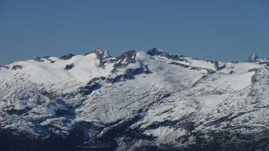
Cypress Peak and its north side glacier
Down.
Into the wood we tried pretty hard to actually stay on that trail and we sure did. We discovered the trick that we missed in the morning so misery was solved. There’s no bushwhacking this time to get back onto Roe Creek FSR. The final 5 km plod down the road was painful but at least not without views.

Creek crossing near the proper trail.
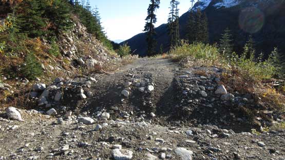
If you can drive across 30 of these then go for it…

We opted to walk.. It’s a painful slog at the end.
Driving down the logging roads required some caution but the rest of the way back home was without event. The timing was right at rush hour but the traffic was surprisingly not too bad. Overall I would highly recommend Cypress Peak as a scramble ascent. It’s more of a Type I fun kind of trip as far as the west coast standard goes.
Make sure to take a look at Colin’s excellent video!
