Whitecap Mountain
August 15, 2020
2918m
Gold Bridge / Seton Portage, BC
Whitecap Mountain is the 3rd highest in the loosely-defined region of “SW British Columbia” and also one of the handful “Ultras” in the region. It’s a big mountain by any measure, and despite the inland location it still boasts several small glaciers on the north side. This peak is highly visible from pretty much any summit in the Pemberton – Lillooet areas. The standard route is however, just a long slog with a somewhat annoying but not bushy approach. The approach comes from McGillivray Pass to the west, which is accessed from Bralorne near Gold Bridge via Kingdom Lakes FSR and a somewhat-maintained trail. Getting to Gold Bridge is a 4+ hour drive from Vancouver.
I had been wanting to do Whitecap Mountain for years and the trigger was almost pulled several times in the past. In the summer of 2017 I almost did it with Adam Walker from Washington but I had to bail the trip at the last minute due to an oppourtunity to climb Mt. Alberta in the Rockies. And in the summer of 2019 I almost did it with Alex but again, the Montana road-trip came up and I had to bail. There then came the summer of 2020 when Alex, Vlad and I finally got a perfect window for it. The weather and condition was almost too good for Whitecap Mountain as I could have easily gone somewhere else for more technical climbs but I was tired and just wanted something relaxing. I was not particularly keen on the long drives but among the three of us I had the most reliable vehicle for the mission so I had no excuse. To make our lives easier I insisted on car-camping. We left Vancouver at around 5 pm on Friday evening and made to the start of Hurley Road at around sunset. The crawling up and over Railroad Pass was a shit show of pot-holes and washboards that I couldn’t drive more than 30 km/h for pretty much the entire 40 ish kilometers on the Hurley. I could have driven faster but I didn’t want to fuck up the suspensions of my truck. Alex had attempted this peak in the past and directed me linking up several logging roads once turning off the main Hurley. The last stretch on Kingdom Lakes FSR seemed like eternity but by 1 am ish we did make to the parking lot. I simply went to bed on the driver’s seat while Alex and Vlad had to set up their tent. For the start we took a slight variation shaving off at least 1 km each way.
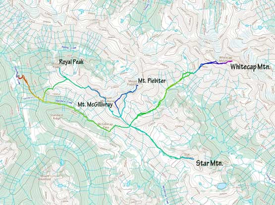
Whitecap Mountain et al. ascent routes. GPX DL
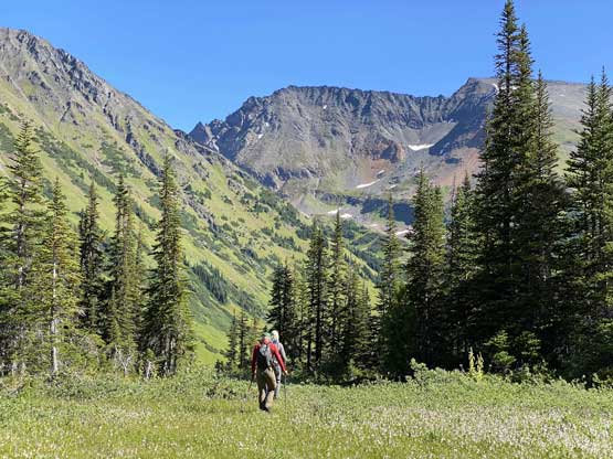
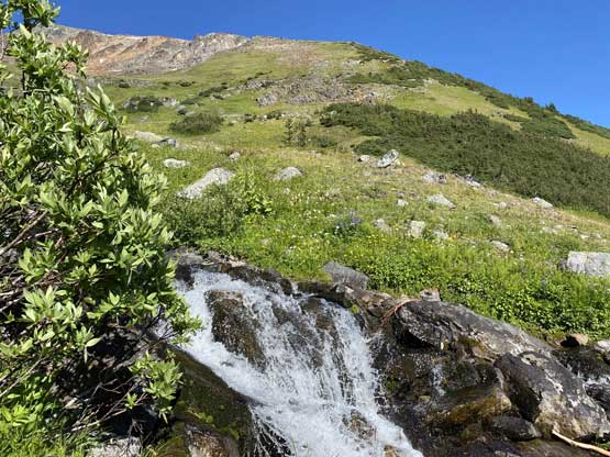
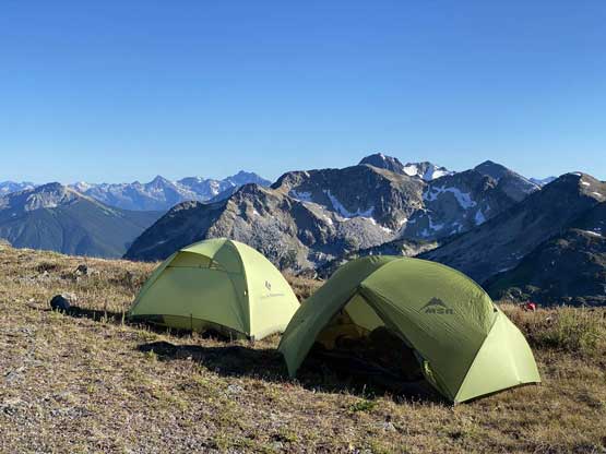
In the next morning we woke up at around the first light and got going in about an hour. The dew made the morning transitions wet but we were expecting that. I was a little skeptical about this short-cut variation but Alex remembered it well and led us through the initial cut-block with minimal bushwhacking. We managed to find the trail and linked it up with the main McGillivray Pass trail. We got off route briefly at the junction with McGillivray Pass trail picking a wrong logging road to walk on, but soon realized and corrected this mistake. For the next short while the going was fairly easy but soon enough we entered the bogs. There’s a horse trail that went up higher including a sign of “McGillivray Pass” pointing towards it, but all of our references including Alex’s previous trip took the traditional route up the valley, so to stick with the known we opted to embrace the wetness. The bogs weren’t too bad, but combining with the morning dew they completely soaked my shoes in under a couple kilometers. My feet were literally swimming by the time we reached the pass. I didn’t really care as I brought my mountaineering boots for the ascents anyway. The hike from McGillivray Pass to a higher pass at Star/McGillivray col had some tedious and annoying side-hilling on grass, as well as one short but dense band of bushwhacking. We probably could have avoided that bushy stretch but side-hilling on steep grass was not really avoidable. We debated about our camping spot but just opted for the broad area at Star/McGillivray col. There was no immediate access to running water but the views were really nice and the bugs weren’t too bad.

Taco parked…

The short bits of off-route travel not far from the start
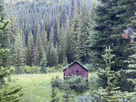
There are quite a few cabins in the Standard Creek valley

Plodding up the Standard Creek valley in the morning shade

Alex near McGillivray Pass

The short band of dense bushwhack above the pass
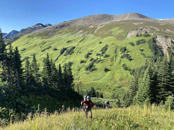
Exiting the bush, we came to the vast grassland

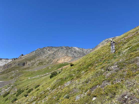
The terrain looked nice but we had to traverse a long ways on steep grass
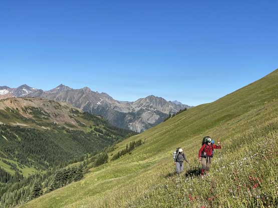
We kept traversing…
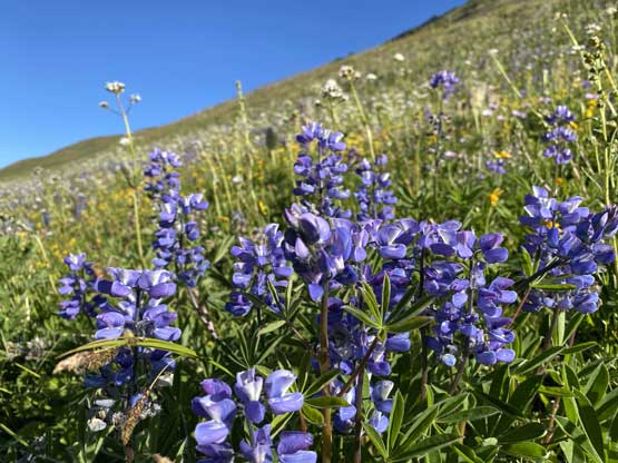
At least the flowers were blooming

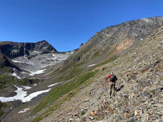
This stretch was strenuous and very steep…
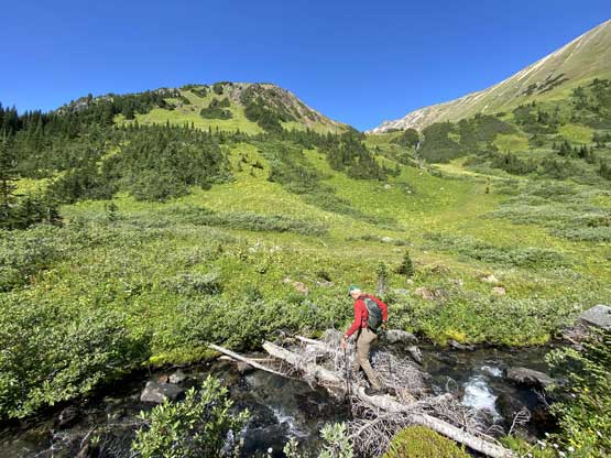
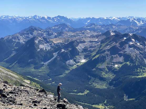
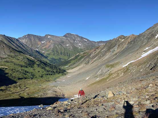
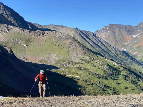
We spent an hour setting up camp and chill and then it’s time to bag Whitecap Mountain. The peak didn’t look too far away, but our GPS units wouldn’t lie and we knew we hadn’t even done half of the work yet. I swapped my soaked shoes for the Trango Ice Cube mountaineering boots and down into the upper Connel Creek valley we went. The terrain was very nice with mostly soft footing on meadows and soon we picked up what seemed like another horse trail running down this valley. We managed to stay on this trail for most of the time, all the way to the base of our objective. At some point we hopped back across Connel Creek to the north side and did a long and unpleasant sidehill plod on grass to access Whitecap Mountain’s lower slopes.

Plodding down into Connel Creek valley now

Alex and Vlad look small with Whitecap Mtn. ahead

We hopped over Connel Creek here

The south-east aspect of Mt. Piebiter, the only scrambly summit here
Plodding across another marsh land
Alex hopping back to the north side of Connel Creek
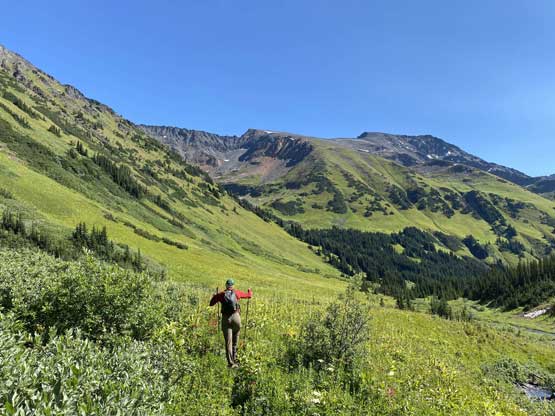
Now, a long side-hill grass traverse to the base of our objective
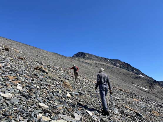
We hopped across another creek, and scrambled on more steep grass with occasional scrambling steps. I found the lower section of Whitecap’s scramble was the worst with the steepest grade and the most slippery terrain. Once the grade eased off all we needed was to put one foot in front of another, for a long ass while to the summit ridge. The sudden view into the north side was a welcoming change, but we still had about 200 m to gain. The terrain was more tedious on the final stretch with nothing but boulders and talus, and very minimal hands-on scrambling. At least the summit views were killer and we even managed to catch some cell services for the social media updates…

Vlad taking a short break from the steep grass ascent

Vlad plodding up with Mt. McGillivray and Mt. Piebiter behind
A while later we were finally in the alpine

Finally hitting the summit ridge
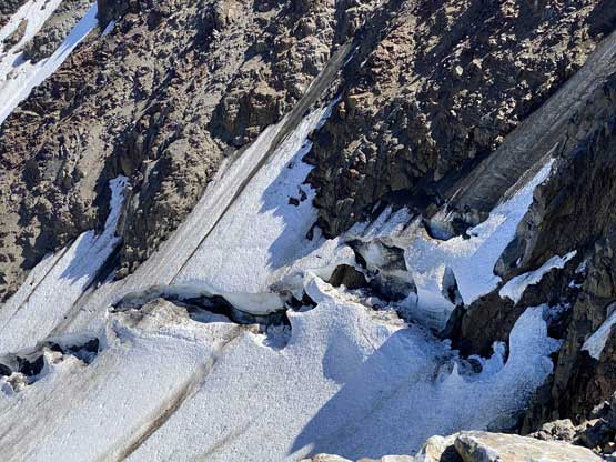
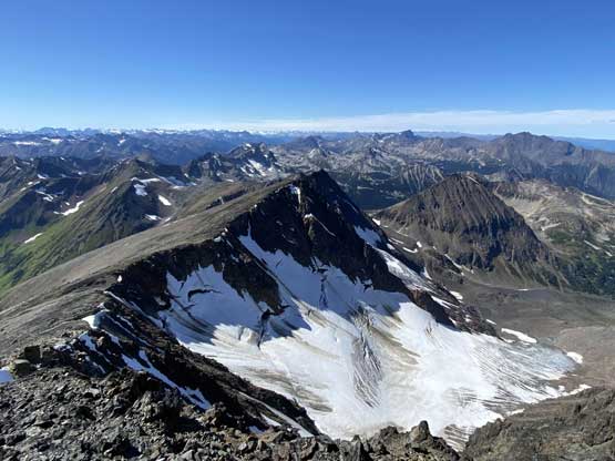
The bergschrunds on the north side of Whitecap were impressive

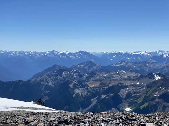
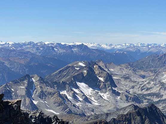
Summit Panorama from Whitecap Mountain. Click to view large size.

Looking north with Shulaps Range on the horizon

Seton Lake and Mission Ridge in the distance
This is looking south towards some familiar Duffey giants in the distance

Mt. Truax the 6th highest in SW BC dominates the skyline

Mt. Bobb is a remote summit in Bendor Range
This is looking towards the edge of Lillooet Icefield

Mt. Brew in the distance, another prominent peak…
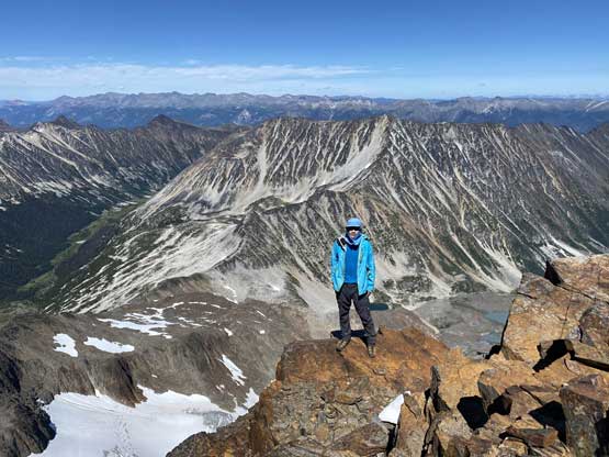
Me on the summit of Whitecap Mountain
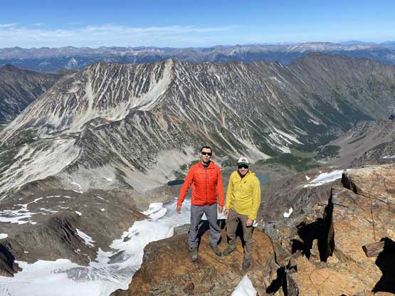
Vlad and Alex on the summit of Whitecap Mountain
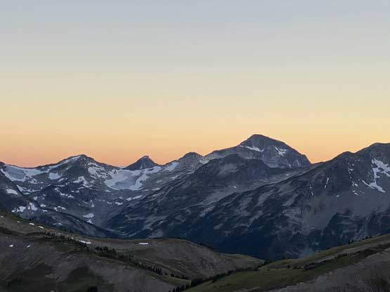
We lingered for almost an hour but eventually we had to face the tedious descent. I didn’t have much to say about the descent as all we needed was patience and perseverance. The terrain, especially on the lower slopes was quite unpleasant and required concentration. We talked about tagging the unofficially-named “Connel Peak” but didn’t generate enough interest in the group, so continued down into the valley. We picked up the horse trail again. The plod back to camp was a long and exhausting one. Near the last water sources we took our time loading up all of our water containers and slogged back to camp. The evening was peaceful and the sunset was nice. We were passed by another group-of-three heading towards some tarns near Star Mountain who later recognized Alex and myself out on Instagram. The next day we would start with Star Mountain, and work towards Mt. McGillivray, Mt. Piebiter and finally, Royal Peak.

Vlad and Alex heading down.
A view of the north side glacier
Vlad was still above most peaks nearby
Alex descending some steep grassy terrain that required caution
More steep grassy slopes

Vlad plodding back down into Connel Creek drainage
We hopped across this creek and loaded some water

Vlad back in Connel Creek valley
Almost back to our camp
Our lovely campsite at Star/McGillivray col
Alex arriving back at camp

A while later, this is Whitecap Mountain catching evening sunlight

Prospector Peaks rise behind Standard Ridge

The evening horizon behind Standard Ridge
Mt. Taillefer that I did in 2015 with Alex and friends

Mt. Marriott to the south
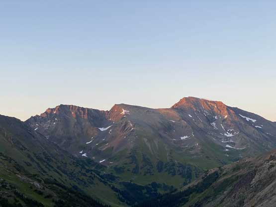
One last photo of Whitecap Mountain catching the evening sun
Speaking the peak we just did I had some mixed feeling about it. It’s a trophy summit and a fairly “classic” one for the SW BC region. Every peak-bagger wants it as it’s iconic, tall, prominent, remote but not technical. The main challenge of Whitecap Mountain comes from the approach and once there, the ascent is technically straightforward but very sloggy “type 2 fun”. This seems like the norm for most “major summits” in the South Coast. To me personally, I don’t mind this type of peaks but my preference has always been the ones that require some degree of mountaineering even by the easiest route, and hence my delayed attempt on the 3rd highest in our region. I could have done it a few years earlier but the trip didn’t happen until 2020. I am very happy to have it finally bagged though…
