Pinecone Peak
May 19, 2019
2027m
Squamish / Mamquam Main FSR, BC
The unofficially named “Pinecone Peak” is the highest summit immediately near the picturesque but hard-to-access Pinecone Lake. This is also the second highest summit on the axis from Mamquam Mtn. all the way to Meslilloet Mtn., towered only marginally by Crawford Peak to the north. There used to have a well-defined trail that runs from Mamquam River to the nearby Knothole Lake but such access has long gone. The most logical access nowadays is still by Knothole Lake but partied had reported “swimming in alders for 3 hours and finally gave up the quest”. The idea to do it with abundant snow coverage (winter or early spring) sounds great on paper but one needs the 21-km logging road access to be free of snow, meaning one has to time the window very precisely. I also thought about a contrived approach by scrambling up and over Seed Peak but such ordeal would be no fun, especially considering I had already bagged Seed Peak a few years ago. It wasn’t until a month ago that the ascent of Pinecone Peak was brought back to my short-term list. Two separate parties from “South Coast Touring” Facebook group reported new logging activities in the area. There beta wasn’t particularly useful for a late-spring ascent, but at least boosted the confidence somehow.
Towards this past Victoria Day long weekend I was struggling to pick a suitable but still-worthy objective. I could only manage Sunday and had to work on the other two days, and weather looked somewhat promising, but not 100% ideal. The forecast improved towards the last minute and eventually Alex and I agreed on Pinecone Peak. I thought Alex could for sure bring a couple friends along with but nobody else showed up at the carpool. I think only the stubborn peak-baggers would dare to face that “3 hours of alder swimming”. After a stop in Squamish for food we drove up the familiar Mamquam Main FSR. Thank to the recent logging the road was almost free of potholes and we could cruise down at a reasonable speed. I remembered in the past few years this road had always been a slow show. Active logging was taken near, and on the spur road we were taking but it’s a Sunday, so we drove it up nonetheless. I had several maps downloaded to the phone and initially went to trace the route drawn on bivouac.com but the recent logging activities had changed the start of it. After finding what’s supposed to be the start a complete tangled mess of alders (couldn’t even make out the road surface) we turned around and drove up to the end of the logging cut at ~780 m elevation. We backtracked and parked at a pull-out just in case the company decided to work on a Sunday…
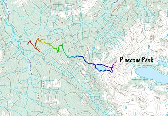
Pinecone Peak via Knothole Lake. GPX DL
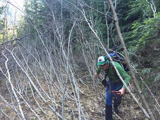
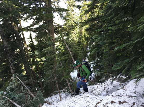
I was hoping that the logging company would completely clear the road to at least where snowline was, but such wasn’t the case. Neither Alex or myself was high on motivation when gearing up, but we were here already so there’s nothing else we could do other than sucking it up. I didn’t even bother with trail-runners because I expected bushwhacking right from the end of the cutblock, and I was right. A short bushwhack straight up from the top of the cutblock brought us to the “road” where we walked/swam for about 1 km up, before giving it up. I consulted with the map multiple times and just as I was thinking about to bail into the forest Alex threw out the same suggestion, so we quickly left the road. The forest was all secondary-growth and didn’t look inviting at all, but still better than the “road”. Uphill/sidehill swimming in alders is the second worst type of bushwhacking topped only by bramble type of plants… We crossed several branches of the roads several times higher up. At one time we started using the road because we saw snow on it, but as soon as the snow ran out we were back into the swimming mode and the progress was painfully slow, much worse than lower down. Back into the forest and this time the bushwhacking was also more awful until hitting continuous snow at ~1100m elevation and joining the road. I’d rate the bushwhack “sustained BW3 with short sections of BW4”.

We parked at pretty much the end of the cut block
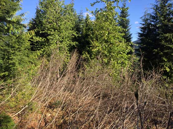
This is pretty much as easy as the road gets. Not recommend.
Alex trying to have some fun swimming in the alders.

We soon bailed the road and went bushwhacking up the forest
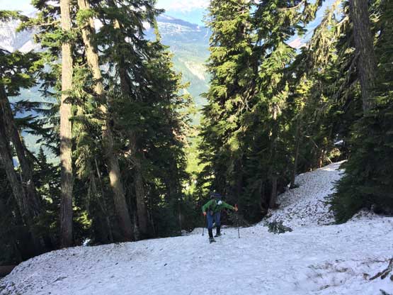
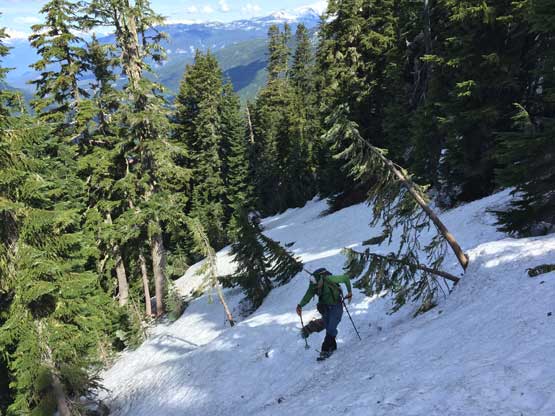
There were still a few dry stretches along the road but those were minor issues. The snow depth increased drastically to the point that bushwhacking was no longer than issue. We followed the road pleasantly all the way to the end, putting snowshoes on partway up for the simple reason of why-not. From the road’s end it was 250 vertical meters of steep forested grunt to the ridge. The forest was 35-40 degree at a few short sections but we managed to keep the snowshoes on the whole time, cutting some tight switchbacks. Without taking a break we continued plodding along the ridge with some increasing views, over the first bump and then onto the second bump overlooking the summit of Pinecone Peak as well as Knothole Lake down below. This was a key decision point on the route selection and we decided to take an energy break. We got here in 3 hours from the truck and I hadn’t eaten anything yet.

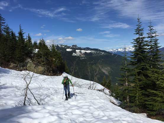
We merged back onto the road once hitting supportive snow

Finally cruise sailing now. This is looking back at Mamquam River valley

Alpen Mountain directly across the river
We finally put the snowshoes on here

Steep grunt from the end of the road
I call this “technical snowshoeing”..
The forest is steep, much steeper than the photo suggests
More steep forest.

Onto the ridge now, and this was our first view of Mamquam Mtn.

Looking back from the ridge.

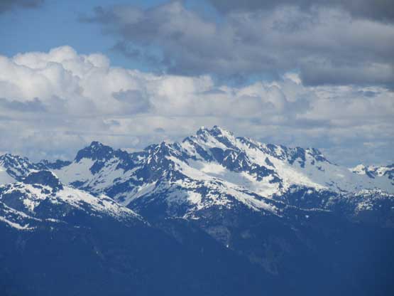
A zoomed-in shot of Mt. Garibaldi massif

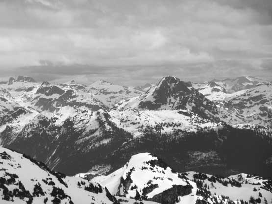
Bucklin Peak is an impressive tower and very difficult to access
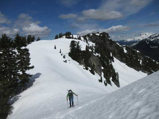
Alex traversing over the bumps. We had two bumps to go up and over

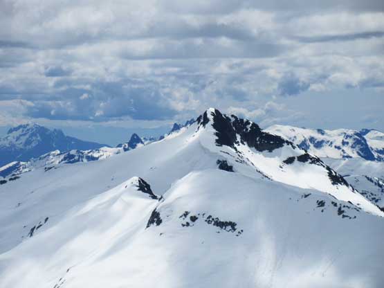
A close-up shot of our objective – Pinecone Peak

Me on the second bump surveying the route. Photo by Alex R.
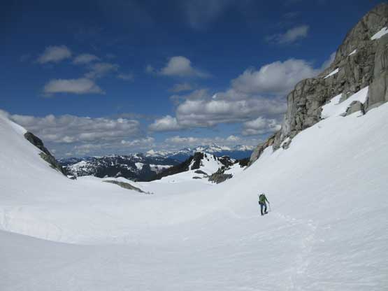
We outlined four different routes – the ridge direct, the SW Face diagonal, or Pinecone/unnamed col by contouring around Knothole Lake (left or right side). After some discussion we agreed on the longest, but the most conservative option, to contour around Knothole Lake on the right (south) side. This way we could also keep the snowshoes on for most of the time, providing the greatest flotation. The lake’s contouring was also quite scenic. The grunt to Pinecone/unnamed col was steep but not very long. Around the corner we could finally see the big Pinecone Lake. The snow had become considerably softer as soon as we hit the south slopes so we decide to keep the snowshoes on for longer. The ascent on the south ridge was not as trivial as appeared on maps. A couple melted-out sections had annoying krummholz and other spots were steep (35-40 degrees) with questionable snow surfaces and not-so-good runout. Nonetheless I led the way keeping the snowshoes on, all the way to near the very top. The last 20 meters or so was a dry scramble. Our ascent time was 4 hours exact.

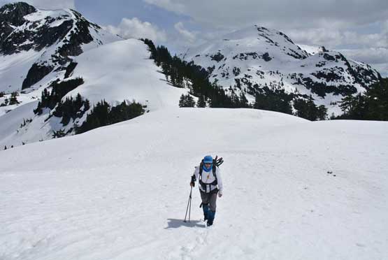
Me snowshoeing around Knothole Lake. Photo by Alex R.

Starting to gain elevation towards the col, looking back at Knothole Lake

Alex snowshoeing up a steep slope towards the south col

The col proper is still a bit of ways away
Neat terrain here.

Looking south we could see the faces of Seed Peak

The still-frozen Pinecone Lake

Me approaching the summit block. Photo by Alex R.

Summit Panorama from Pinecone Peak. Click to view large size.

Mt. Garibaldi – all sub-summits on the massif can be seen here
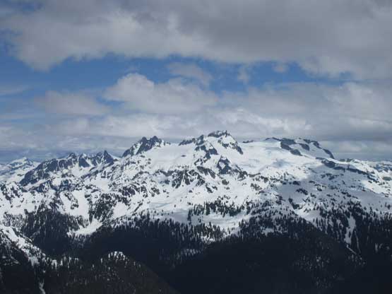
The massif of Mamquam Mountain

The highest peak in the distance is the uber-remote Stave Peak
Pukulkul Peak

Old Pierre Mountain

Mt. Judge Howay

Mt. Robie Reid
This is the north ridge of Mt. Gillespie

The massif of Mt. Bishop in the North Shore Mountains
The familiar view of Mt. Tantalus

The register is about 50 years old, wrapped in a tiny aluminum container
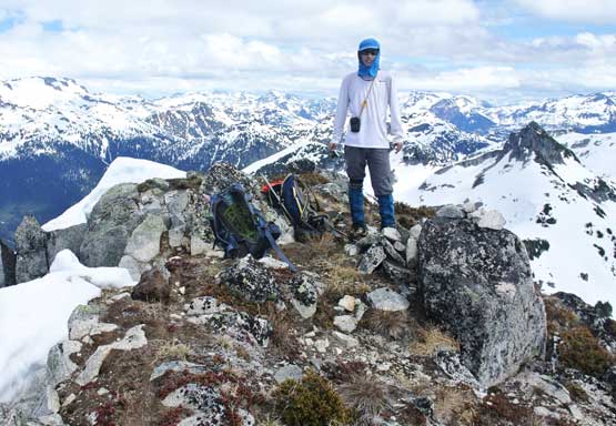
Me on the summit of Pinecone Peak

Alex and I on the summit of Pinecone Peak
About half an hour later it’s time to head home. We snowshoed down the uppermost slope but then opted to take snowshoes off to down-climb a steep spot. It wasn’t the steepness but rather the soft and slippery snow surface that forced us to abandon snowshoes. Earlier in the trip we had decided to descend the “SW Face diagonal” to short-cut our Knothole Lake’s contouring. This short-cut turned out to be steeper than appeared. A stretch of solid 40+ degree section had us taken the ice axe out for some careful down-climbing and traversing. A while later we cleared the steeps, and then traversed up and over those two annoying bumps along the ridge. The snowshoes were no longer needed. The steep forested descent was such a blast in the soft snow and in no time we were back to the road, and another short while later we were back to the bushwhack. I checked the GPS for at least 20 times because we wanted to get the bushwhack part done in one shot. Other than getting briefly cliffed out by a bluff I was confident that we did manage to pick the most efficient line on the descent. Other than that middle part of the (snow covered) road the best was simply ignoring all roads and going straight up/down the W/NW Ridge. The truck was still there when we got back.

Me down-climbing a steep spot on the south ridge.

We decided to descend via the SW Face snow ramp. Tame and easy at the start
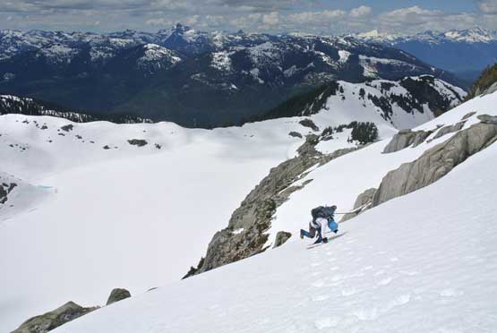
This part was a bit steep with cliffs below. Careful down-climbing. Photo by Alex R.
Me traversing back up and over those bumps. Photo by Alex R.

Fast forward. Back into the snow-free roads now.

Into the forest. As you can see, it’s bad but not show-stopper

Fast forward again. Back to the cut block

Hiking down on the cut logs required caution too.
Our round trip time was 7 hours and considering the amount of bushwhacking we did this was definitely a good time. We were charging pretty hard for most of the day and were efficient on all transitions. I definitely wouldn’t recommend this objective for snow-free season but if you are a west coast bushwhack enthusiast then it’s not as bad as people made it sound, just don’t follow the road. The drive back home was mostly easy except for the stretch in North Vancouver. Apparently there’s an accident on Lions Gate Bridge causing the closure of the bridge, and a huge increase in volume on Highway 1. Other than that it was a fluent flow across the whole Metro Vancouver to White Rock.
