Mount Lougheed
September 2, 2012
3107m
Kananaskis – Smith Dorrien Valley, AB
On Sunday, I woke up in Canmore, and the next thing I saw was the new snow on the mountains… Oops, my original plan, Big Sister, wasn’t doable then due to its slabby nature. My “plan B” was Mt. Nestor so up the bumpy and dusty Smith Dorrien road I went. I saw several cars already by the Big Sister parking lot and two guys were actually preparing for the ascent. I drove to the parking lot, and discussed the conditions with them. We agreed on Mt. Lougheed eventually. It’s an easy scramble so we thought it was okay with snow on.

Mt. Lougheed scramble route
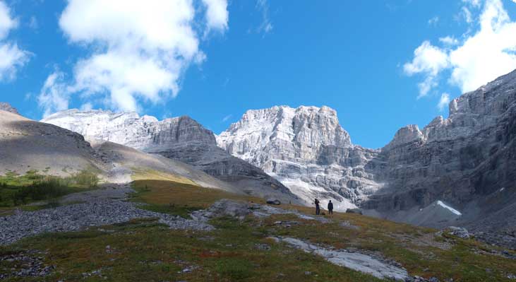
The ascending drainage was easy to locate. It’s the first obvious drainage after passing “Little Lougheed”, and also the last drainage before Sparrowhawk Day Use area. After about 2 min bushwhacking, we managed to gain the trail on the left side of the creek. The weather was overcast and we didn’t get good view on the way in. The trail basically parallels the the creek. Near treeline, it gets faint, but the route is obvious as you still have to follow the drainage up. My partners went uphill too soon and they were forced to side-hill after realizing their mistake. After side-sloping across a large meadow, I dropped to the creek bed and followed it through a “narrow gate”. Further up, I started to gain elevation on grass slope, and we regrouped at the base of the huge scree cone.

Looking back at Old Goat Mountain
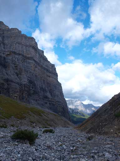
Walking beneath the impressive wall of Sparrowhwak

The scramble route up Lougheed starts with this scree cone.
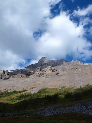
The route up should be obvious, but the scree cone was very foreshortened. You gotta gain a good portion of the entire elevation gain by trudging up this cone. Thankfully the footing wasn’t too loose, or it would be really bad. Looking back, we were amazed by the impressive north face of Mt. Sparrowhawk. You should know that Mt. Lougheed is almost as high as Mt. Sparrowhawk, so don’t be fooled by the foreshortened view. The entire mountain is foreshortened once you start the scree cone. At the end of the cone, we looked carefully for cairns on climber’s right side. It was obvious and we quickly started the traverse. Going up the miner rock band provided some challenge to us, due to the snow and verglass… Verglass and wet rock was the major theme of the rest of the ascent… Oh well… I thought this was the only challenge. Not really as it was just the start.

Looking back at the N. Face of Sparrowhawk

The first challenging part due to verglass

The upper mountain. More verglass
We followed cairns through the rock band. The correct route from here was to traverse horizontally to the ridge on climber’s right side and gain that broad ridge. However, due to the last minute decision, none of us knew this important point. We decided to go straight up. It should be just moderate scramble in dry condition, on down-sloping ledges and slabs… But with verglass and snow on, it felt much harder at places, not because of exposure, but purely due to the lack of reliable holds. We all managed to get through. Just before topping out on the west ridge skyline, we were blocked by another slab step… This one looked really bad with snow on, and we couldn’t find a safe way up. I managed to find a small ledge on the left side. I figured out after this step, I could make to the summit and use the correct route to descent. The holds were solid but this step exposed me to the entire north face drop-off. It only took me 10 second to get through. My partners felt this part over their head and they decided to slowly retrace. I would say this step was only difficult scramble, although deadly exposed. I quickly made to the summit afterwards…
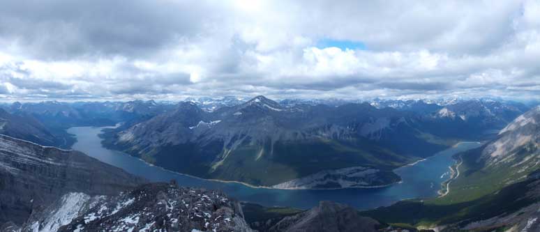
A panorama of Spray Lake from the false summit.
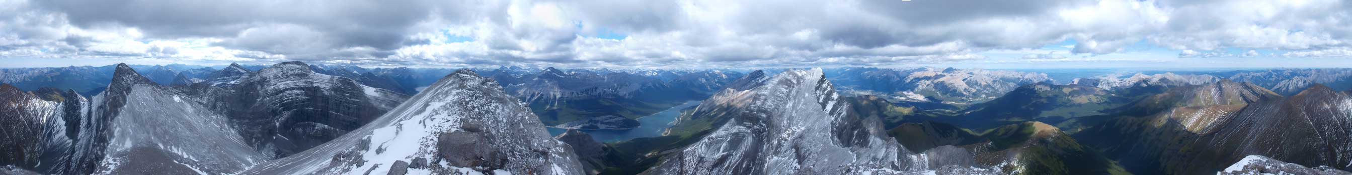
Summit Panorama. Click to view large size.

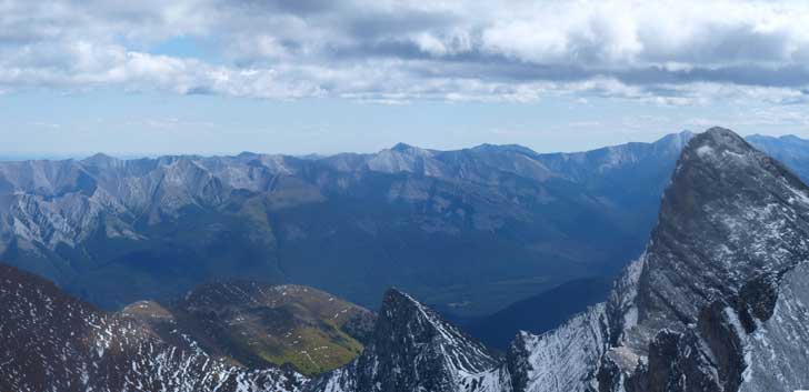
Wind Mountain (Lougheed IV)
Lougheed I
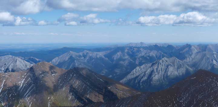
The East part of Kananaskis was still free of clouds
These peaks are all part of Fisher Range. You can see Old Baldy / McDougall / Volcano on left and center.

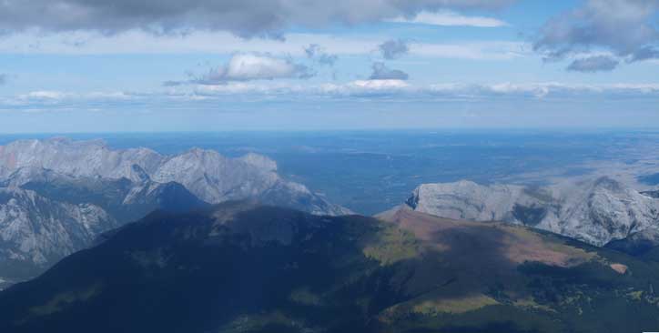
Town of Canmore was also visible.

A bunch of peaks north of Bow Valley.
Looking over Pigeon Mountain. Yamuska left of center. McGillivray on right.
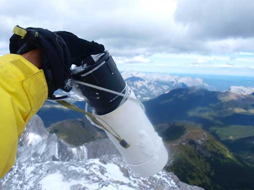
Summit Register
Because I got separated with the other two, I didn’t do Lougheed III instead quickly made my way down the correct line. Oh gosh, that was sooooo easy!! It was mostly a scree run to get down, then a horizontal traverse on a path. We regrouped somewhere on the talus slope. On the way down the lower rock band, the verglass were gone but the rock was still wet… After this last obstacle, we made back to the big slope. We could manage to scree ski here and there and we quickly made back to the valley floor. The strong wind was another theme of the day. It wasn’t too crazy but we did got pushed around though. The sky briefly cleared a bit and I got some good photos of the impressive rock faces surrounding.

Almost down the scree cone.

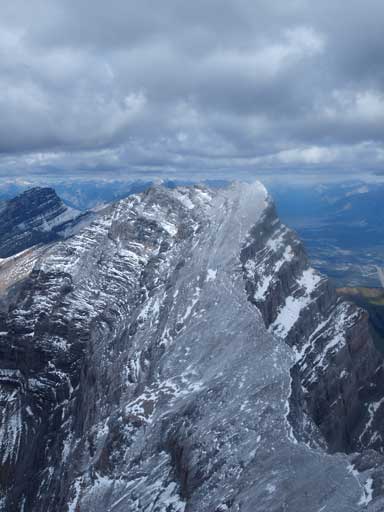
Looking back at the impressive Lougheed. The scree cone on left
Wind Mountain at center.
Another shot of Lougheed, from a different angle

Regain the trail. Weather was getting nicer
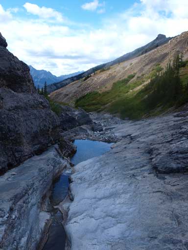
Some interesting pools of water

Mount Lougheed
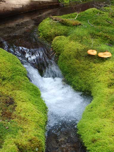
Neat mini waterfall. Almost back to car.
We followed the nice trail back to car. If you are not a scrambler, this alpine bowl is still worth a shot. The trail isn’t shown on any map but is very easy to follow. I guess it’s one of the secrets in the Rockies. If you know the route, this mountain isn’t more difficult than the nearby Sparrowhawk. So for those who don’t like scrambling, you still can get Lougheed and Sparrowhawk, two of the greatest viewpoints in Kananaskis Range.
