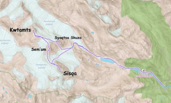
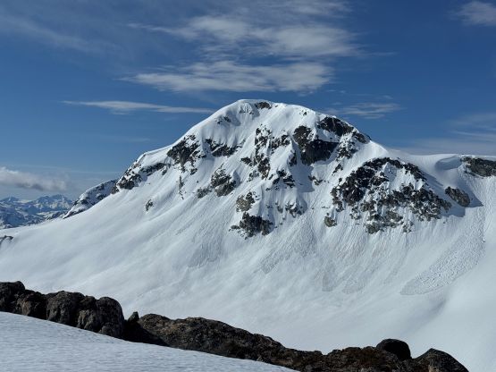
Sisqa Peak, Sem’am Peak, Kwtamts Peak and Syaqtsa Skuza Peak
May 10, 2026
2357m
Pemberton, BC
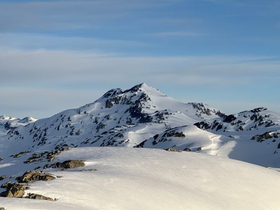
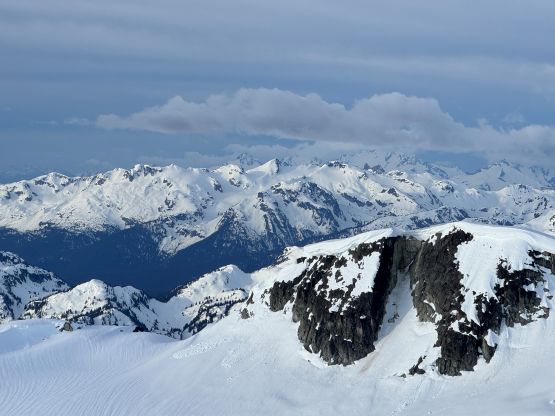
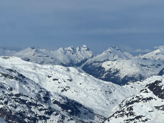
These are officially named peaks on the far eastern reach of Pemby Icecap and also some of the more accessible objectives in the area. They are however, not the tallest nor the most prominent in the vicinity so don’t get much attention. The nearby “Appa Peak” sees far more visitors from the hiking community. A few years ago I had paid two consecutive visits to the area by sitting on the back of Eric Gilbertson’s snowmobile and bagged most of the bigger peaks deeper on the icecap. We didn’t have time to tag these closer ones but they are quite approachable on foot so I knew I could easily come back in another year. Upon further research I realized that accessing this area on foot requires a somewhat strict timing window. One needs the road access to be mostly melted out (to 1100+ m elevation) but at the same time, needs plenty of snow on the 2-km stretch of valley flats (1200-1300 m elevation) to avoid heinous bushwhacking. This basically means the first half of May is the only reasonable time.
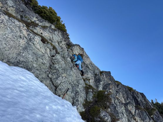
The original plan was “Phelix Peak” further north but Tanja convinced me to try Sisqa Peak instead. I was initially rejecting the idea as I thought the weather was not 100% stable, but then the forecast improved a little bit. We eventually jacked up the ambition to include all 4 of the officially named peaks in the vicinity as they are really close to each other anyway. Syaqtsa Skuza Peak is the smallest but also the technically hardest as it required some steep snow climbing and a short step of 4th class whereas Sem’am Peak and Kwtamts Peak are nothing fancier than “walk-ups”. The main objective, Sisqa Peak is also a fairly straightforward ascent via the NW Ridge. There wasn’t much “beta” on the internet but a few weeks ago I happened to have flown directly over this group of peaks on the way back from Lillooet Icefield so I took some mental notes of the conditions. The forecast suggested mid and low clouds coming in at noon so we made the decision to leave Squamish at 1 AM to take advantage of the morning window. The snow condition would be more favourable in the morning anyway. I had to leave Surrey at 11:40 PM which was basically 2 hours after I finished work in White Rock, so I had zero sleep. Fortunately Tanja had a reliable 4×4 vehicle and volunteered to drive so I caught a bit of sleep riding to the trail-head. We were able to drive past the high point and parked at 1100 m just before descending steeply into Rutherford Creek drainage. Theoretically we could have driven a little bit further but the road condition deteriorated quickly and we would also soon encounter patchy snow.
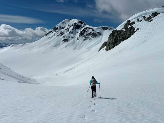
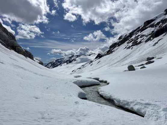
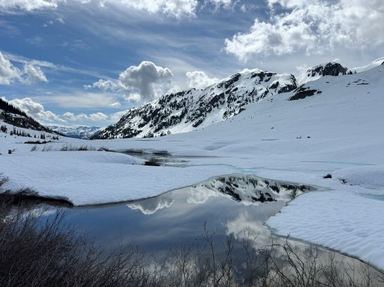
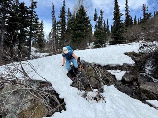
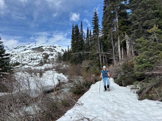
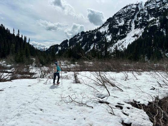
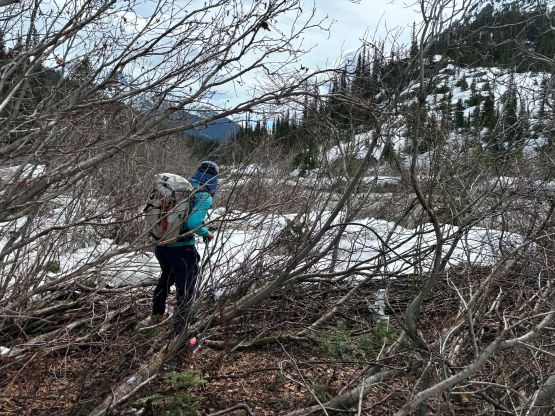
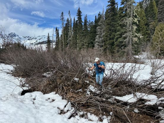
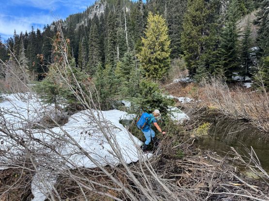
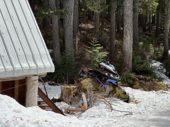
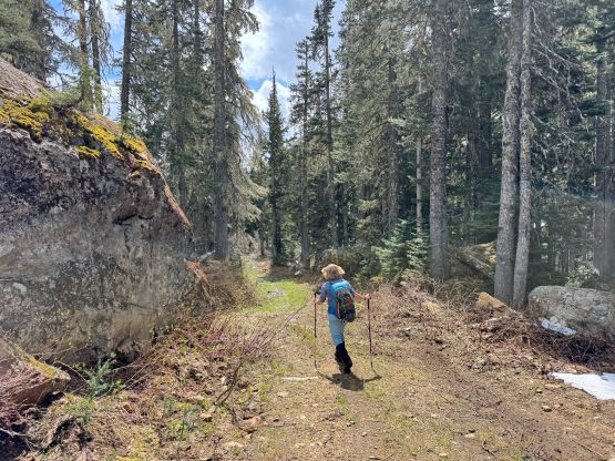
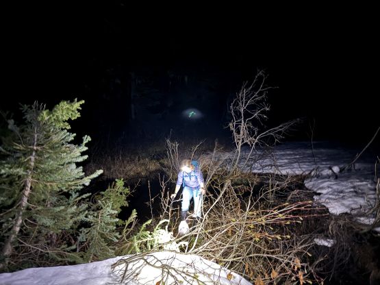
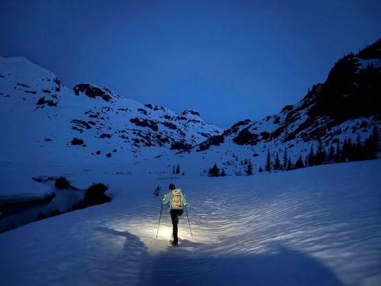
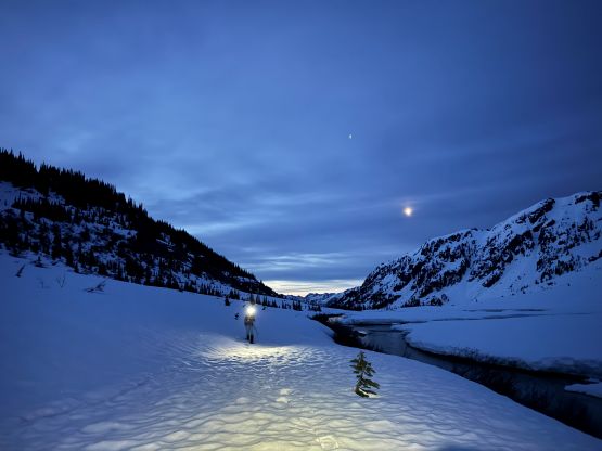
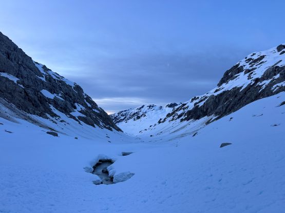
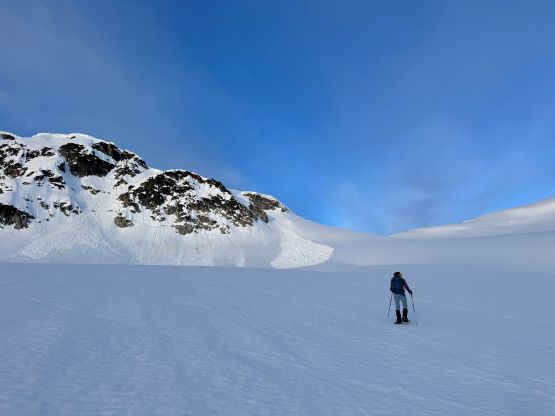
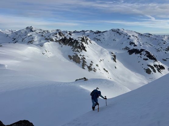
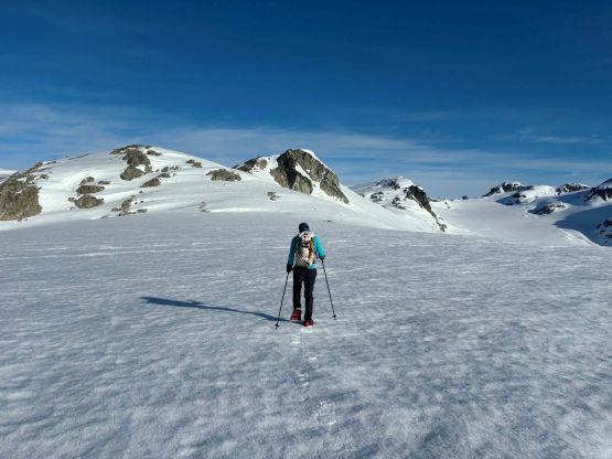
We started the plodding at 3 AM and I opted to wear the trail-runners while carrying the mountaineering boots and snowshoes. In retrospect I should have either worn boots right from the vehicle or pushed the trail runners all the way to the snowmobiler’s cabin. About halfway to the cabin we started to encounter several large patches of snow and the post-holing was ankle deep as there’s no freeze at this elevation especially in the forest. We made the decision to swap footwear and also don snowshoes, but the ‘shoes had to be taken off shortly after. The entire stretch of the steep ascent to the snowmobiler’s cabin afterwards was dry so we carried the snowshoes in our hands for at least 1.5 km distance. Continuous snow did appear at around the cabin but the valley flats didn’t appear to be fully covered at all. Tanja suggested to traverse the forest on the far climber’s right but I thought it would make more sense to at least give the valley flats a shot. I strapped the snowshoes on and plodded across some swamps, and then we tried as hard as we could staying on the strips of snow. The going wasn’t super elegant due to obstacles such as creek crossings and bands of thick brush but the strategy of focusing one step at a time seemed to work. At least it was faster than Tanja’s attempt in the previous year bushwhacking entirely around in the woods. The route-finding wasn’t the most straightforward in the dark but we made steady progress and never encountered anything too overly heinous. When the slope angle picked up we went farther climber’s right away from the main river and a long while later we arrived at that “lake” labelled on the various map layers. We stayed entirely on the climber’s right (north) side of the main creek as there’s no snow bridge to facilitate crossing the creek. The snow condition was softer than expected with lots of breakable crust so the going wasn’t very fast. It was still in the pitch dark but the horizon was starting to become brighter.
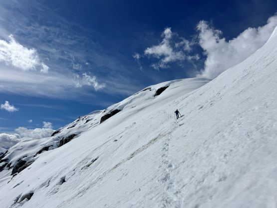
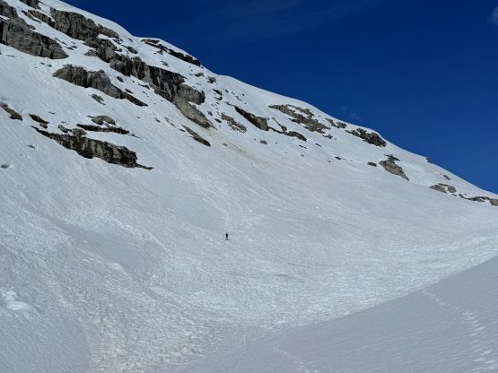
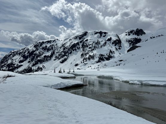
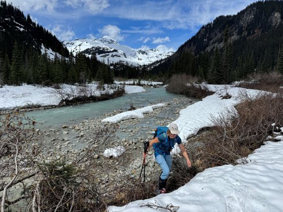
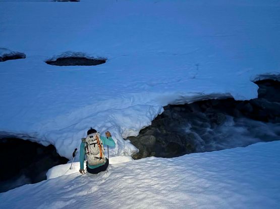
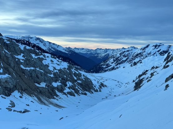
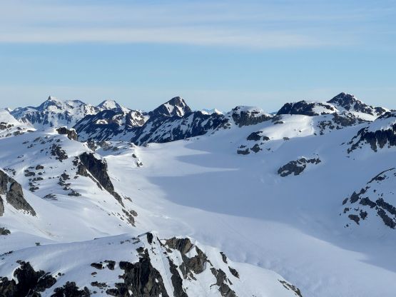
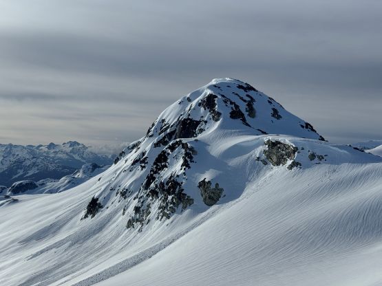
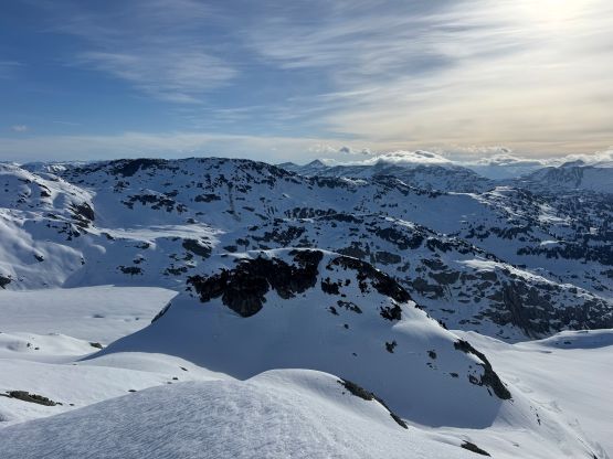
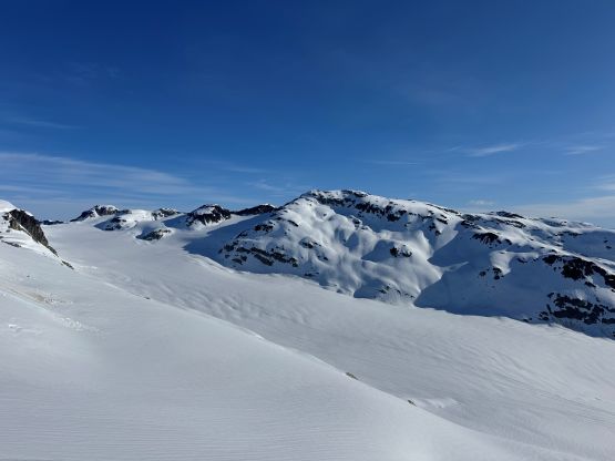
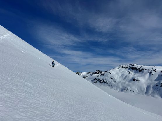
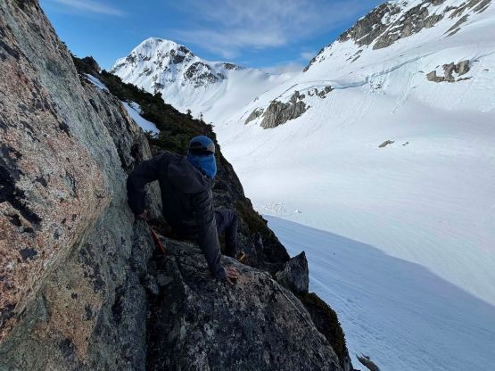
At the far end of this long stretch of flats we had to cross one of the bigger tributary creeks that comes down the valley SE of “Appa Peak” and the creek was quite a raging torrent. Fortunately we found the only piece of snow bridge left and gingerly made our way across, but I noted that had we stayed lower we could have easily avoided this creek crossing all together. Nevertheless the snow bridge crossing provided the much needed variation and a little bit of excitement from the never ending plodding so we opted to take the snow bridge on the way back as well. We then entered the “canyon” that would eventually bring us to the toe of the main Appa Glacier and again, we had to stay entirely on the north side of the main river as the river itself was not crossable. We also crossed several large patches of avalanche debris that had spanned across the entire valley bottom. I had proposed a fairly direct route to gain the hanging glacier north of Sisqa Peak and the route appeared mostly “in” on the far climber’s right side. The middle of that steep section had a few waterfalls running between the rock slabs and the snow slabs so that would be a “no go”. We eventually decided that the far climber’s right variation would be “fine” and it sure turned out to be fine. I even managed to lead us up this stretch entirely by wearing the snowshoes even though the slope angle was defintitely exceeding 35 degrees on various occasions. The condition was either firm or breakable crust so this stretch required some techniques if doing on snowshoes. The alternative option would be going all the way around to the north side of Syaqtsa Skuza and Sem’am Peaks. I had thought about that route as a “back up” in case the Plan A didn’t go, as this should work in any condition but adds a few kilometers of distance with considerable amount of up-and-downs.
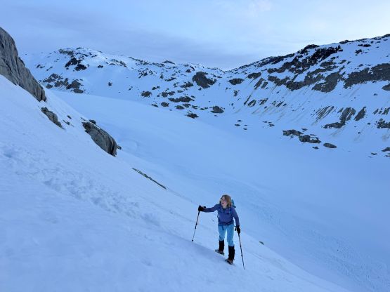
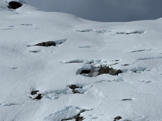
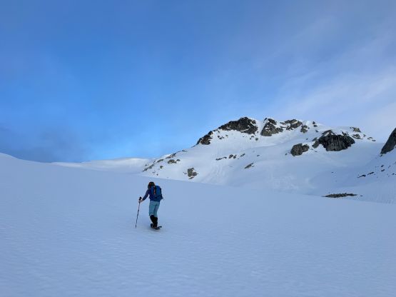
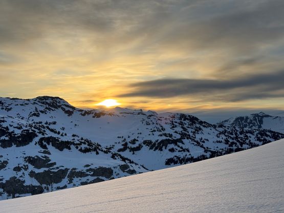
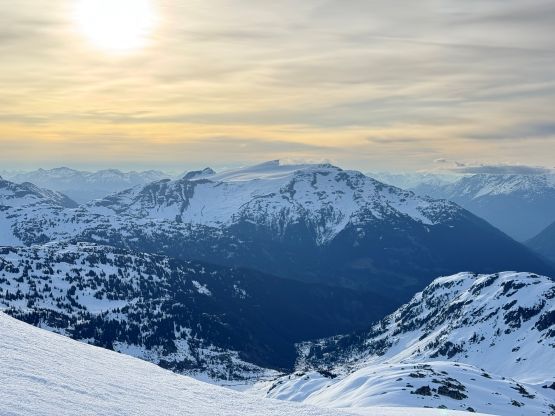
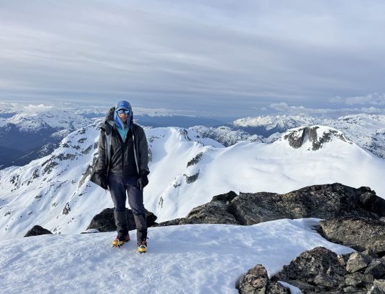
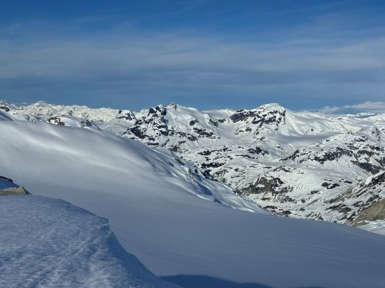
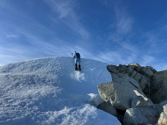
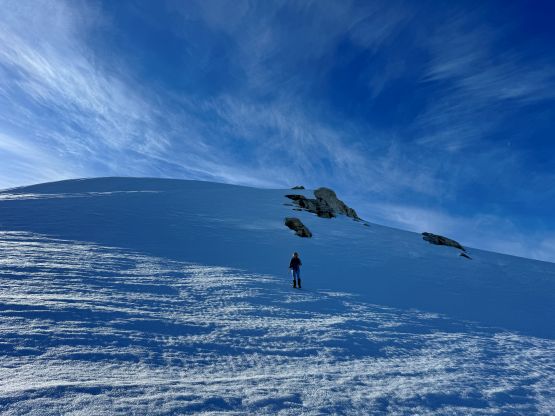
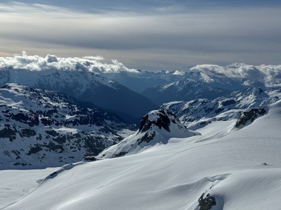
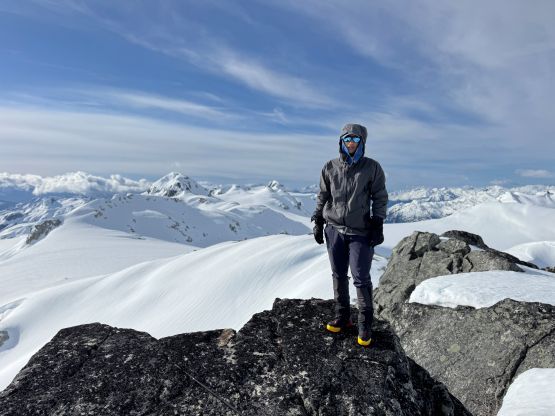
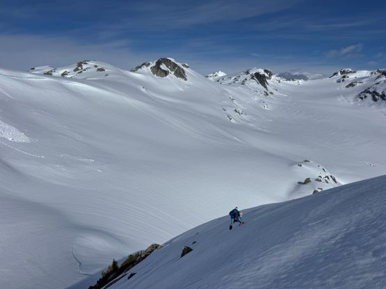
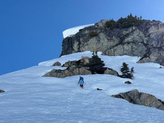
There appeared to have an open crevasse at the bottom of this hanging glacier so we traversed climber’s left and used a gentle ramp feature to gain the glacier. The plodding on the glacier was easy but very foreshortened. There finally seemed to have a solid overnight freeze at this elevation so the going had become considerably quicker, and we also got treated with some incredible sunrise views. With the boost in stoke level we dashed up the glacier to the NW Ridge of Sisqa Peak. The ridge appeared to have several steep steps and the condition was quite icy, so we ditched the snowshoes and swapped for crampons. I had only brought one ice tool (Petzl Gully) and that was enough for the job. There was at least two 45-degree stretches on firm snow but the exposure was minimal. An easy but foreshortened traverse then brought us to the summit where we only stopped briefly due to some bone chilling winds.
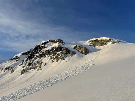
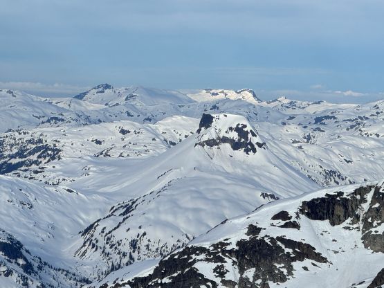
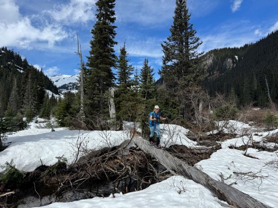
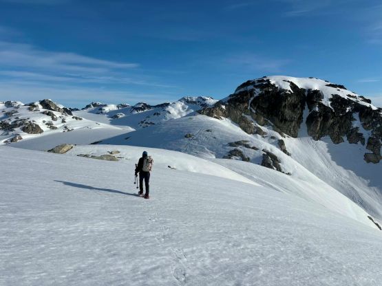
We gingerly retraced our steps back to where we ditched the gears, took a much needed energy break and swapped the footwear back to the snowshoes. The traverse towards Sem’am Peak was the easiest part of this loop and in fact I don’t even know how this bump earned an official name. It doesn’t even have 100 m prominence nor an iconic profile. After easily plodding to the summit we quickly focused on the descent towards the broad saddle between Sem’am and Kwtamts Peaks. Coming off the north side of Sem’am Peak involved a few moves of facing into the slopes while wearing the snowshoes, but otherwise the route was straightforward. Going up towards Kwtamts Peak we had no choice but to plod up and over a subsidiary bump which involved at least 50 m of frustrating elevation loss. The actual ascent of Kwtamts Peak was a scramble on loose rocks followed by some simple snow traverses, which was quite no-brainer.
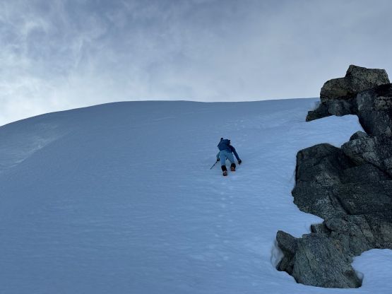
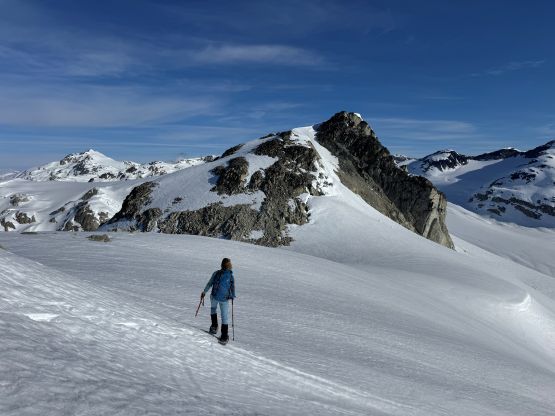
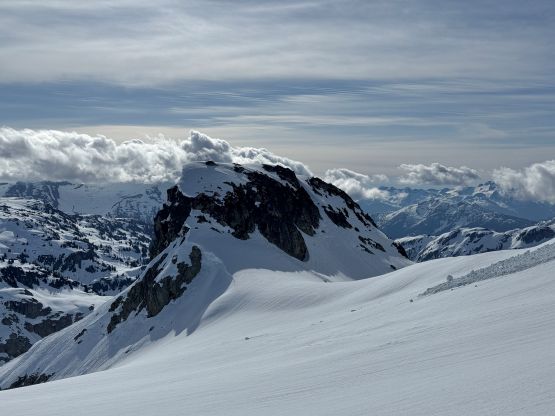
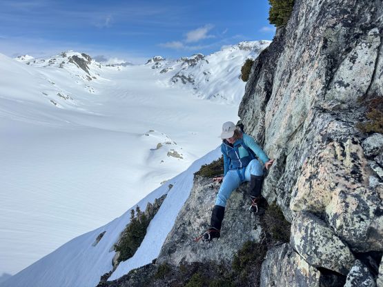
A while later we made our way back down to the glaciers and then worked our way towards Sem’am/Syaqtsa Skuza saddle. I mostly led a line aiming straight towards the saddle but one steep roll forced us to make a short detour. The snow condition on the N and E aspects had already turned mushy but the W aspects were still in the shade and firm. We had outlined at least two routes for this final objective of the trip but eventually opted to try the W. Ridge which seemed to involve a questionable rock step. The step turned out to be exposed 4th class so it went. There was also some unavoidable steep and exposed snow climbing but one ice tool and steel crampons were more than sufficient enough for the job for a competent mountaineer. We didn’t linger up on the summit for long since I was already worrying about the descent, so gingerly made our way back down to the gear cache.
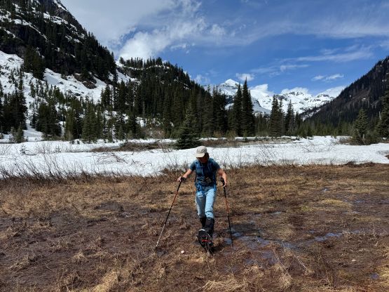
I then led us down the broad gulch feature and eventually joined our snowshoe tracks above the steep descent onto Appa Glacier. The snow condition was as expected, horribly mushy but I wasn’t triggering any wet slide yet so it was still a “go”. We got down as quickly as possible and then followed our tracks back down into the main valley. I was concerning about the forested stretch with many thin sections but we somehow didn’t find 100 holes… The snow was never that supportive in the morning so it didn’t actually get that much worse, and the visible tracks made the route-finding job “non existing”, so I didn’t think the egress sucked that much. We took the last break at the snowmobiler’s shelter removing the snowshoes, and I took one more stop to swap footwear back to the trail runners about 1 km from the finish line. Our round trip time was just over 9 hours on a reasonably fast and steady pace, despite the sub-optimal conditions. Tanja then drove us back to Squamish and I caught at least an hour of valuable sleep. It took me almost 2 hours to drive from Squamish back to Surrey thank to the horrible Vancouver traffics, and I did have to work for 1.5 hours between 9 and 10:30 PM but I did also earn myself a few hours of napping before showing up at work.